Description
Vintage Cartographics
New Mexico Maps
∙
Antique Prints
∙
Bargain Bin
∙
Browse Nearby Sheets
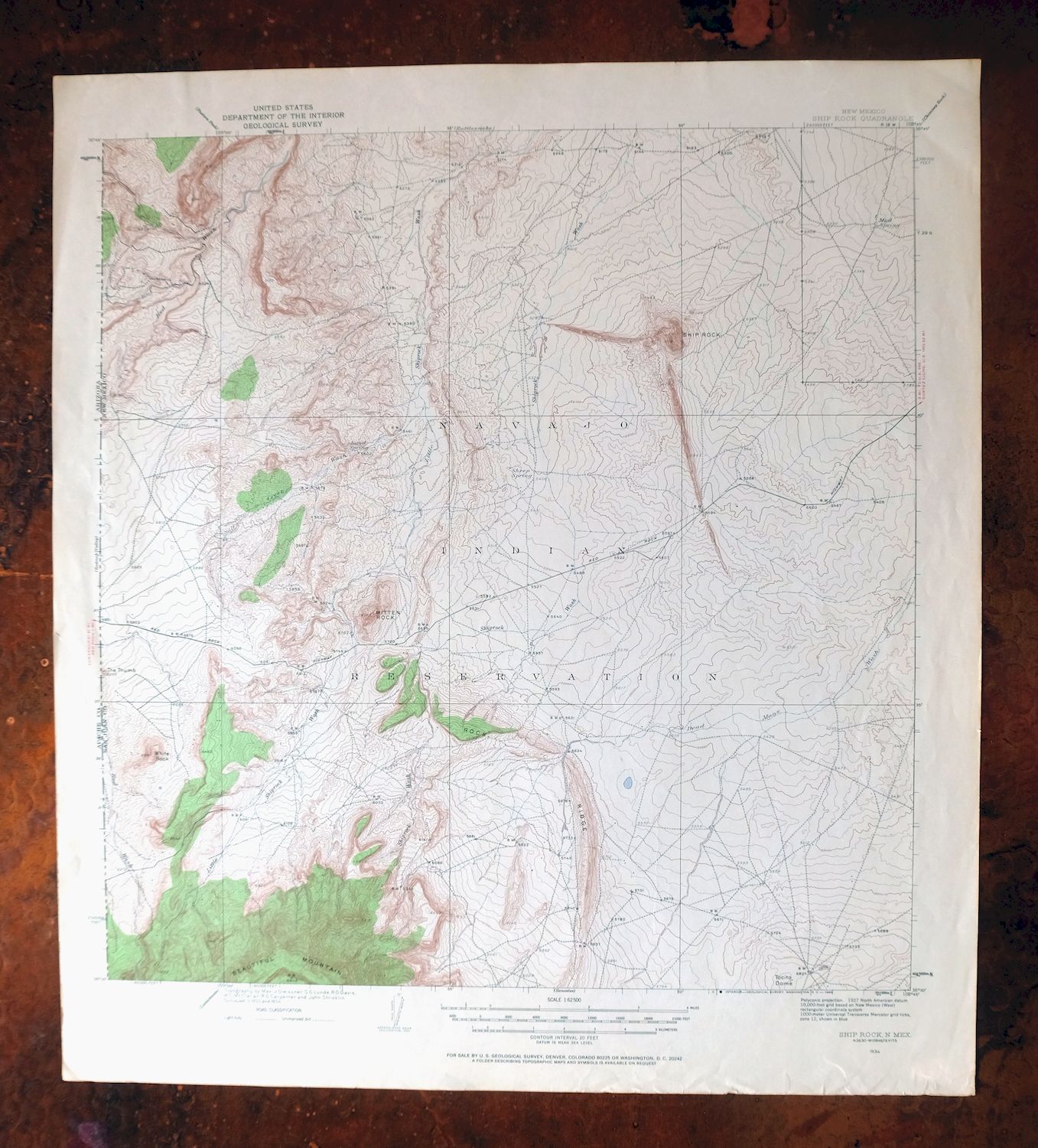
1934
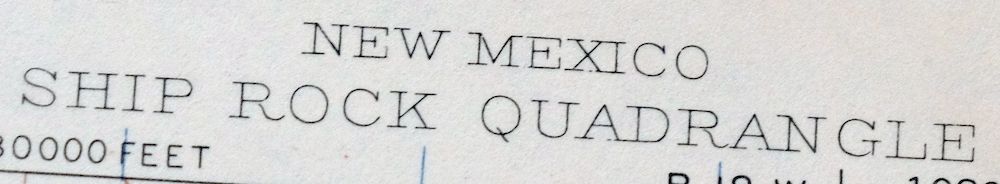
Ship Rock
New Mexico
USGS TOPOGRAPHIC MAP
1968 print in very good condition
For sale is the 1934 edition of the Ship Rock 15-minute map. This map would be ideal for framing or display, historical reference or research, genealogy studies, adding to your collection, treasure hunting, a nice conversation piece, a gift for a history or map enthusiast, or for anyone interested in this area. Maps of this vintage are printed on durable stock and are well-suited for outdoor activities and recreation of all kinds.
This sheet includes the only survey produced by the United States Geological Survey for the Ship Rock 15-minute quadrangle. The map sheet is an original 1968 USGS print in very good condition.
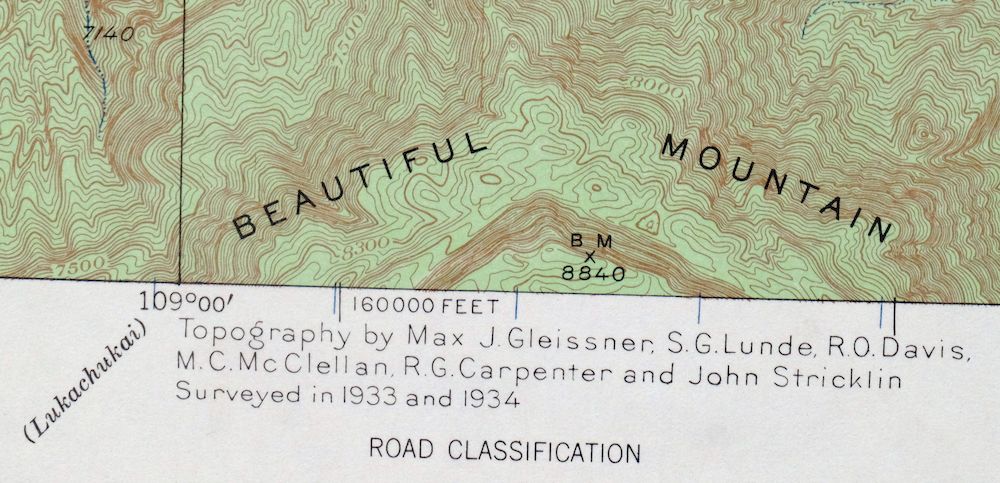
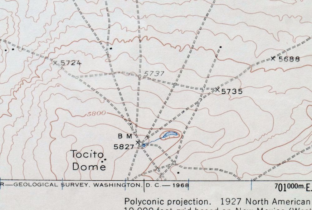
The Ship Rock 15-minute map shows all roads, paths, towns, railroads, rivers, creeks, elevation contour lines, public land survey lines, county, state, and other administrative boundaries as they existed at the time of the survey in 1933 and 1934. All known structures (houses, businesses, churches, schools, barns, cabins, etc) are also shown, with exceptions in some urban areas, where only landmark buildings may be shown.
The Ship Rock map was field surveyed before aerial photography methods were widely used in map data gathering. It was drawn by cartographers based on plane table field survey information as well as information gathered from local residents in the area. It displays the remarkable abilities of early government map makers, who placed a strong emphasis on creating complete, accurate, and cartographically appealing maps.
Maps from the 15-minute series for the continental United States are no longer produced or printed by the USGS and original prints are becoming increasingly difficult to find. They are a valuable historical record for an area, as they contain many placenames and features that have been dropped from more recent maps.
MAP DETAILS
Title
Ship Rock
State
New Mexico
Series
15-minute
Surveyed
1933 and 1934 Field Survey
Geographer
Max J. Gleissner
Edition
1934
Printed
1968, thick paper stock
Woodland Tint
Yes
Scale
1:62500
Contour Interval
20 Foot
Sheet Dimensions
19 x 20 7/8 inches
SHEET CONDITION
Overall Condition
VERY GOOD
Sheet Notes
lightly handled, never folded
Map Area
flawless map area
Collar Area
no markings, very minor blemishes, minor storage wear along bottom collar
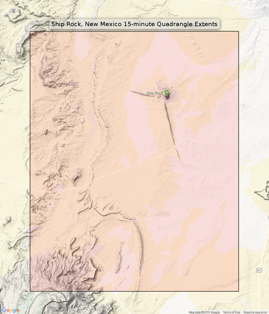
MAP COVERAGE
Quadrangle extent overlaid on current basemap.
PLACENAMES
Depending on map series and survey date, all of the features listed below may not be shown on this map. This list contains features that currently exist or historically existed within the area covered by this map. The list can be used as a reference to determine if this map covers your area of interest. Placenames are listed alphabetically next to each feature type.
Counties Covered
San Juan
Federal Land Units
Navajo Indian Reservation
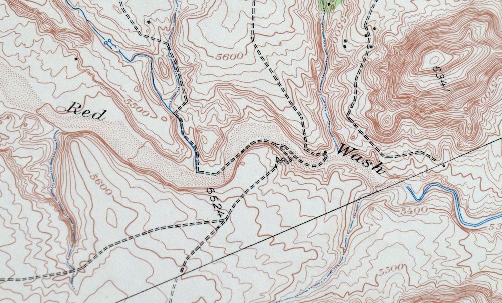
Rivers and Streams
Little Shiprock Wash, Many Devils Wash, Pajarito Creek, Rattlesnake Wash, Red Wash, Salt Wash, and Shiprock Wash
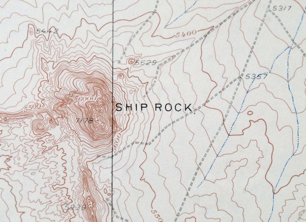
Mountains, Peaks, and Summits: Mitten Rock, Ship Rock, Tocito Dome, and Yellow Hill. Arroyos and Washes: Arroyo Del Pajarito. Parks: Shiprock Historical Marker. Drainages: Pajarito Creek and Salt Wash. Dams: Big Gap Dam and Table Mesa Dam. Ridges: Rock Ridge. Reservoirs and Tanks: Big Gap Reservoir. Wells: 12R-100 Water Well, 12T-343 Water Well, 12T-354 Water Well, 12T-508 Water Well, 12T-646 Water Well, 12T-654 Water Well, North Water Well, SJ-743 Water Well, and T26R19s5 Water Well. Oilfields: Rattlesnake Oil Field and Shiprock Gallup Oil Field. Springs: 12R-57, Sand Spring, and Sand Springs.
SHIPPING AND RETURNS
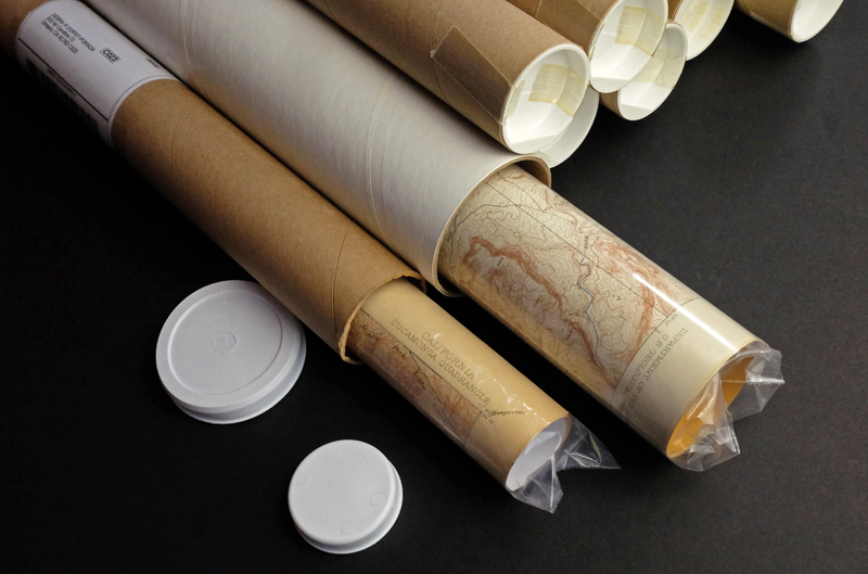
This map sheet will be carefully rolled in a sturdy tube and shipped via the US Postal Service. Shipping and handling costs are included in the purchase price.
If you find that the sheet you receive is not as described in the listing, you may ship it back to us for a refund of the purchase price.
15~9029 15~9030 15~9033 15~9217 15~9218 15~9219 15~9220 15~9403 15~9404 15~9405 15~9590 15~9591 15~9592 15~9777 15~9778 30~2492 60~239 60~257 60~258 60~259 60~276 60~277 60~296 75~35129 75~35130 75~35131 75~35132 75~35496 75~35497 75~35498 75~35499 75~35500 75~35501 75~35866 75~35867 75~35868 75~35869 75~35870 75~35871 75~35872 75~35873 75~36235 75~36236 75~36237 75~36238 75~36239 75~36240 75~36241 75~36242 75~36606 75~36607 75~36608 75~36609 75~36610 75~36611 75~36977 75~36978 75~36979 75~36980
Reviews
There are no reviews yet.