MAP DETAILS | |
|---|---|
| TITLE | Watertown |
| STATE | New York |
| LOCATION | 60 miles north of Syracuse |
| SERIES | 15-minute |
| SURVEYED | 1893 through 1908 Field Survey |
| GEOGRAPHER | R.B. Marshall |
| ENGRAVED | 1909 |
| EDITION | 1909 |
| PRINTED | 1909 |
| SCALE | 1:62500 |
| CONTOUR INTERVAL | 20 feet |
| SHEET DIMENSIONS | 16 1/2 x 20 inches |
| MAP DIMENSIONS | 12 5/8 x 17 1/2 inches |
| COVERAGE AREA | 12 x 17 miles |
| SOURCE | From an uncommonly well-preserved collection |
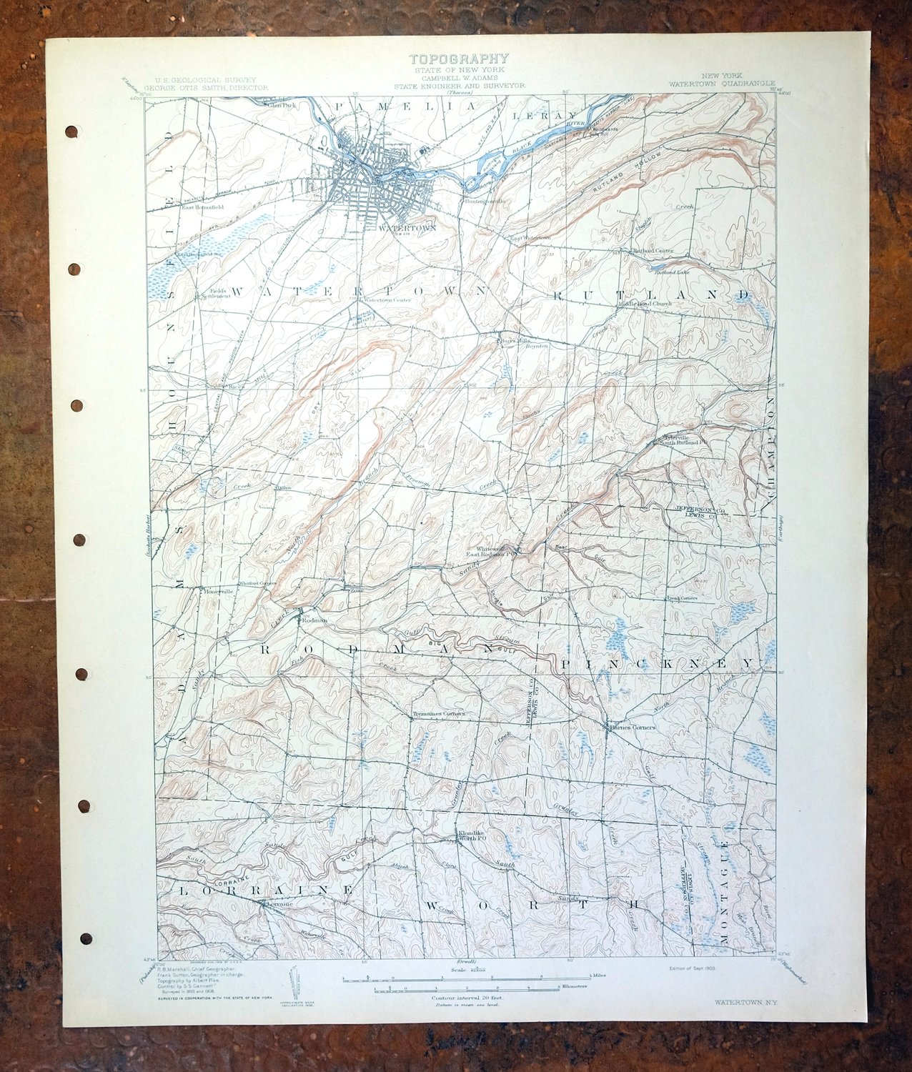
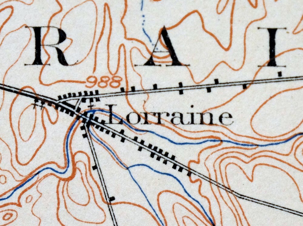
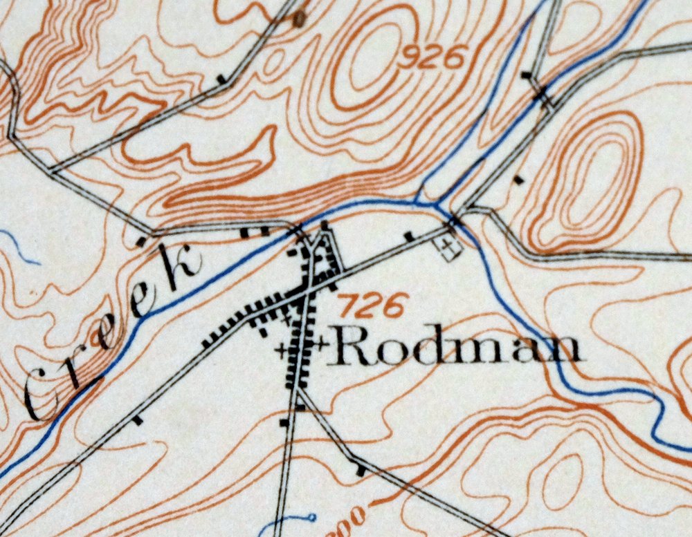
| MAP NOTES | A fascinating historical snapshot of the area from Watertown southward to Lorraine and Sears Pond State Forest, surveyed before the modern highway system, showing historic travel routes and structures. |
| SHEET CONDITION For maps of this vintage, effort is made to note all visible flaws, no matter how minor. | |
| OVERALL CONDITION | Very Good |
| SHEET NOTES | very lightly handled, never folded, smooth and flat, moderate blemishes on backside of sheet |
| MAP AREA | flawless map area |
| COLLARS | no wear or tears, no markings, no blemishes, hole punches along left collar |
| MAP COVERAGE Quadrangle extent overlaid on current basemap. | |
| BACKSIDE LEGEND | |
 A map summary is printed on the back side of the Watertown sheet similar to the one shown in the picture. It outlines the history, purpose, and status of the USGS mapping program at the time of the printing in 1909. It also provides instructions on how to read contour lines and a description of how they are used to depict the terrain. At the bottom of the page is a legend showing all of the symbols used to represent the cultural, relief, and water features found on the map. | |
| PLACENAMES Depending on map series and survey date, all of the features listed below may not be shown on this map. This list contains features that currently exist or historically existed within the area covered by the map. The list can be used as a reference to determine if this map covers your area of interest. Placenames are listed alphabetically next to each feature type. | |
| CITIES AND TOWNS (CURRENT) | Adams Center, Black River, Brownville, Glen Park, and Watertown |
| COUNTIES COVERED | Jefferson and Lewis |
| RIVERS AND STREAMS | Abijah Creek, Bear Creek, Big Brook, Black River, Boynton Creek, Clora Creek, Deep Creek, Deer River, Denning Creek, Fish Creek, Fox Creek, Freeman Creek, Grunley Creek, Gulf Stream, Jacobs Creek, Kelsey Creek, Mill Creek, North Branch Sandy Creek, Pigeon Creek, Raystone Creek, Sandy Creek, South Sandy Creek, Staplin Creek, Stebbins Creek, and Stony Creek |
| Populated Place: Evergreen Mobile Home Park, Floral Estates Mobile Home Park, Garland City Trailer Park, Northland Estates Mobile Home Park, Pine Meadows Mobile Home Park, Barnes Corners, Burrs Mills, Dillen, East Hounsfield, East Rodman, East Watertown, Fields Settlement, Honeyville, Huntingtonville, Lorraine, Paddy Hill, Rices, Rodman, Rutland Center, Tylersville, Watertown, Watertown Center, Worth, and Zoar. Locations: Northland Plaza Shopping Center, Seaway Shopping Center, Watertown Shopping Plaza Shopping Center, Watertown Water Works, Adams Rest Area, City Center Industrial Park, Jefferson County Industrial Park, Jenkins Dairy Farm, Little M Farm, Murrock Farms, Porterdale Farms, Salmon Run Mall Shopping Center, Babbits Corners, Bullock Corners, Cronk Corners, Forks Number Two, Gould Corners, Ives Hill Country Club, Massey Yard, Ross Corners, Seven by Nine Corners, Stears Corners, Talcott Corners, Tremaines Corners, Watertown Golf Club, and Whitford Corners. Administrative Boundaries: City of Watertown, Town of Pinckney, Town of Rodman, Town of Rutland, and Town of Watertown. Mountains, Peaks, and Summits: Dry Hill, Orvis Hill, and Underwood Hill. Valleys and Canyons: Bear Gulf, Inman Gulf, Lorraine Gulf, Rutland Hollow, Shingle Gulf, and Towle Gulf. Parks: Public Square, Adams Recreation Field, Kostyk Field, and Thompson Park. Drainages: Abijah Creek, Big Brook, Boynton Creek, Clora Creek, Denning Creek, Fish Creek, Freeman Creek, Grunley Creek, Gulf Stream, Jacobs Creek, Kelsey Creek, North Branch Sandy Creek, Pigeon Creek, Staplin Creek, Stebbins Creek, and West Branch Deer River. Islands: Beebee's Island, Delano Island, Diamond Island, Huntington Island, and Sewalls Island. Mines: Kings Quarry and Watertown Quarry. Churches: All Souls Universalist Church, Asbury Methodist Church, Bethany Methodist Church, Central Church of Christ, Church of Christ, Concordia Lutheran Church, Congregation Degel Israel Synagogue, Emmanuel Congregational Church, First Baptist Church, First Church of Christ Scientist, First Church of the Nazarene, First Methodist Church, First Presbyterian Church, Free Methodist Church, Holy Family Roman Catholic Church, Hope Presbyterian Church, Kingdom Hall of Jehovahs Witnesses, Lansing Street Free Methodist Church, Our Lady of the Sacred Heart Roman Catholic Church, Parkside Alliance Church, Redeemer Episcopal Church, Saint Anthony's Roman Catholic Church, Saint Josephs Convent, Saint Patricks Roman Catholic Church, Saint Paul's Episcopal Church, Saint Vasilios Greek Orthodox Church, Seventh Day Adventist Church, Stone Street Presbyterian Church, Thomas African Methodist Episcopal Zion Church, Trinity Episcopal Church, Watertown Assembly of God Church, West Side Church of Christ, Burrville Congregational Church, Christian Life Center, Church of the Nazarene, Cornerstone Assembly of God, Faith Fellowship Church, Fellowship Baptist Church, Grace Wesleyan Church, Honeyville Baptist Church, Korean Baptist Church, Maranatha Bible Baptist Church, New Hope Baptist Church, New Testament Fellowship, Parkside Bible Church, Transformed Life Church, United Pentecostal Church, Watertown Church of Christ, Watertown Mennonite Church, Word of Life Church, Cupertino Friary, and Middle Road Church. Post Office: Lorraine Post Office, Rodman Post Office, and Watertown Post Office. Hospitals: Samaritan Medical Center. Lakes and Ponds: Rutland Lake. Buildings: Jefferson County Children's Home, Jefferson County Court House, Jefferson County Historical Society, Jefferson County Home, Jefferson County Home And Infirmary, Jefferson County Jail, Little Theatre of Watertown, Madonna Home For The Aged, Memorial Health Building, New York State Office Complex, Niagara-Mohawk Power Corporation Sewalls Island Hydro-Electric Plant, Roswell P Flower Memorial Library, Saint Patrick's Children's Home, Trinity House, Watertown Fire Department - Station 1 - Emma Flower Taylor Fire Station, Watertown Fire Department - Station 3 - North Side Fire Station, Watertown Fire Department State Street Station 2, Watertown Municipal Building, Watertown Power House, Guilfoyle Ambulance Service, Ives Hill Retirement Community, James McVean Student Center, Jefferson County Sheriff's Office, John Foster Dulles Building, John T. Henderson Childcare Center, Lorraine Volunteer Fire Company, Melvil Dewey Library Building, Northpole Fire Company, Robert E. Lansing Building, Rodman Fire Department, Rodman Public Library, Rutland Fire Department Station 2, Samaritan Keep Nursing Home, Samuel Guthrie Building, Sci - Tech Center of Northern New York, Strand Theatre, The Jules Center, Watertown Ambulance Service, Watertown Correctional Facility, Watertown Police Department, Watertown Volunteer Fire Department Station 2, Watertown Volunteer Fire Department Station 3, and Watertown Volunteer Fire Department Watertown Center Station 1. Waterfalls: Beaver Falls, Burrville Cider Mill Falls, Butternut Falls, Great Falls, Rainbow Falls, and Talcott Falls. Crossings: Harpers Ferry. Bluffs: Woodward Sidehill. Bridges: Worden Road Bridge. Swamps: Beaver Meadows. Census: Lorraine Census Designated Place and Rodman Census Designated Place. Schools: Academy Street School, Arsenal Street Public School, Boon Street Public School, Butterfield School, Case Junior High School, Cooper Public School, Holy Family Parochial School, Immaculate Heart Academy, Massey Street Elementary School, North Junior High School, Sacred Heart Parochial School, Saint Anthony Parochial School, Saint Patricks Parochial School, Sherman School, Sisters of Saint Joseph Conservatory of Music, Watertown High School, Harold T Wiley School, Immaculate Heart Central High School, Knickerbocker School, Meade Street School, Ohio Elementary School, Starbuck School, State Street School, and Thompson School. Military: Watertown Air Force Station. Towers: WATN-AM (Watertown), WCIZ-FM (Watertown), WNCQ-AM (Watertown), WRVJ-FM (Watertown), and WTNY-AM (Watertown). Cemetery: Adams State Road Cemetery, Arsenal Street Cemetery, Brookside Cemetery, Calvary Cemetery, Clark Cemetery, Cotes Cemetery, Degel Israel Cemetery, Fairview Cemetery, Fields Settlement Cemetery, Glenwood Cemetery, Isham Cemetery, Lyman Cemetery, Maple Hill Cemetery, Massey Street Cemetery, Newton Cemetery, North Watertown Cemetery, Randall Cemetery, Rutland Hollow Cemetery, Saints Peter and Paul Cemetery, Thompson Cemetery, Underwood Cemetery, and Zoar Cemetery. | |
| SHIPPING AND RETURNS | |
 This map sheet will be carefully rolled in a sturdy tube and shipped via the US Postal Service. If you find that the sheet you receive is not as described in the listing, you may ship it back to us for a refund of the purchase price. | |
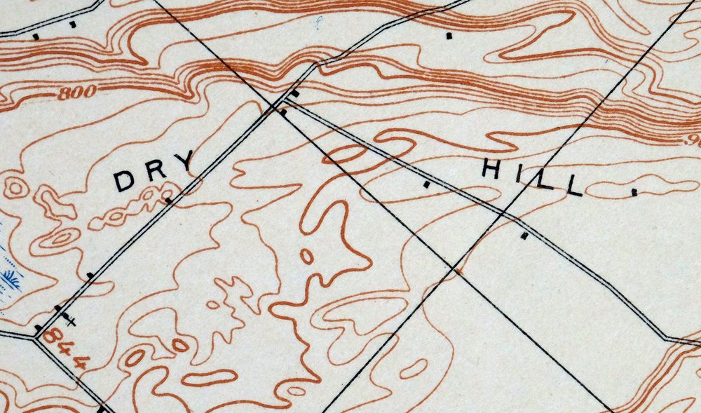
Watertown New York Adams Center Glen Park USGS Topo Map 1909
$75
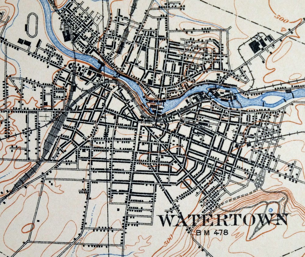
Printed in 1909, its year of first publication, this Watertown sheet is an antique USGS 15-minute topographic map in very good condition, engraved that same year with the survey work of R.B. Marshall. Sitting about 60 miles north of Syracuse in Jefferson and Lewis counties, the quad takes in the city of Watertown along with Black River, Brownville, Glen Park, and Adams Center, extending south toward Lorraine and Sears Pond State Forest. Based on a field survey carried out from 1893 through 1908, before the modern highway system took shape, it records the older travel routes and structures of the day; the sheet was never folded and stays smooth and flat, with a flawless map area, and comes from an uncommonly well-preserved collection.
In stock
This antique sheet is a 1909 edition of the Watertown New York USGS topographic map. It is an authentic 117-year-old United States Geological Survey print in very good condition.
HOW THIS MAP CAN BE USED
In addition to making a fascinating conversation piece, this sheet would look great in a frame or on display, make a unique and prized gift for anyone interested in this area, be perfect as a reference for genealogy studies or general historical research, or fill that missing piece in your collection.
FEATURES SHOWN ON THE MAP
The Watertown 15-minute map shows cities and towns, roads, railroads, rivers, creeks, elevation contour lines, public land survey lines, county, state, and other administrative boundaries as they existed at the time of the survey in 1893 through 1908. All known structures (houses, businesses, churches, schools, barns, cabins, etc) are also shown, with exceptions in some urban areas, where only landmark buildings may be shown.
A VALUABLE HISTORICAL RECORD
Maps from the 15-minute series for the continental United States are no longer produced or printed by the USGS and original prints are becoming increasingly difficult to find. They are a valuable historical record for an area, as they contain many placenames and features that have been dropped from more recent maps.
Nearby maps
-
Carthage New York Lowville West Carthage USGS Topo Map 1904
$40 Add to cart -
Theresa New York Fort Drum Calcium USGS Topographic Map 1909
$85 Add to cart -

Orwell New York Altmar USGS 15-Min Topo Map 1912 Antique
$55 Add to cart -
Antwerp New York Fort Drum Fort Drum USGS Topo Map 1911
$46 Add to cart -
Lowville New York Indian River Croghan USGS Topo Map 1913
$60 Add to cart -

Port Leyden New York Lyons Falls Turin USGS Topo Map 1907
$90 Add to cart -
Kasoag New York Camden Constantia USGS Topographic Map 1912
$74 Add to cart -
Hammond New York Black Lake Oxbow USGS Topo Map 1912 Antique
$52 Add to cart -

Grindstone New York Thousand Island Park USGS Topo Map 1909
$90 Add to cart -

Mexico New York Central Square Brewerton USGS Topo Map 1905
$55 Add to cart -
Taberg New York Rome Camden USGS 15-Min Topographic Map 1912
$55 Add to cart -

Gouverneur New York Edwards Richville USGS Topo Map 1915
$52 Add to cart -

Boonville New York Rome USGS 15-Min Topo Map 1910 Antique
$75 Add to cart -
Fulton New York Oswego Minetto USGS Topo Map 1905 Antique
$42 Add to cart -
Old Forge New York USGS 15-Min Topographic Map 1913 Antique
$90 Add to cart -
Brier Hill New York Ogdensburg Morristown USGS Topo Map 1906
$48 Add to cart -
Oneida New York Rome Canastota USGS Topo Map 1909 Antique
$52 Add to cart -
Ogdensburg New York Heuvelton Lisbon USGS Topo Map 1905
$85 Add to cart -
Oriskany New York Utica Rome USGS Topo Map 1911 Antique
$85 Add to cart -
Sodus Bay New York Port Bay North Wolcott USGS Topo Map 1913
$67 Add to cart -
Wilmurt New York USGS 15-Min Topographic Map 1912 Antique
$48 Add to cart -
Raquette Lake New York Speculator USGS Topo Map 1964 Vintage
$32 Add to cart -

Canton New York Potsdam Norwood USGS Topo Map 1911 Antique
$49 Add to cart -
Utica New York Ilion Herkimer USGS Topo Map 1911 Antique
$89 Add to cart
