
Lewes Delaware Primehook Beach Nassau USGS Topo Map 1972
$30.00
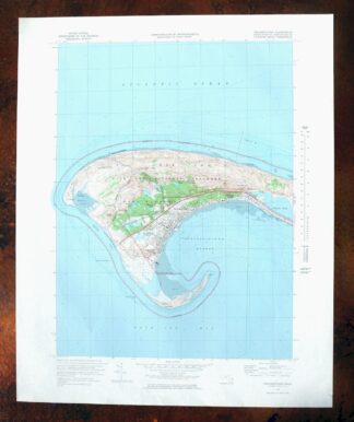
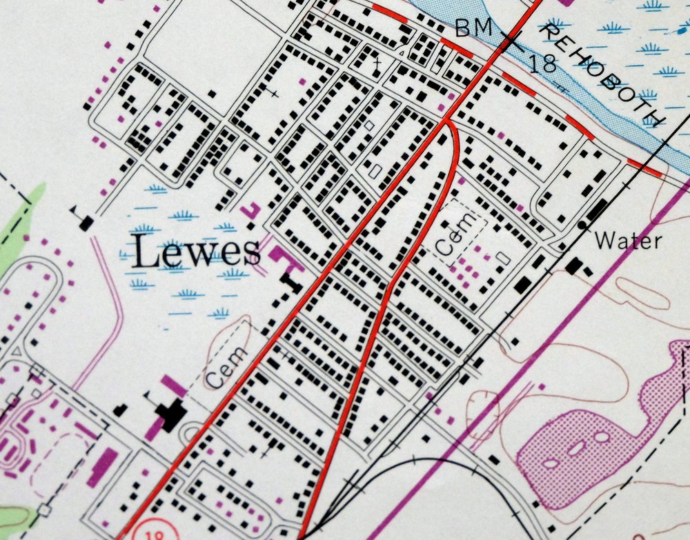
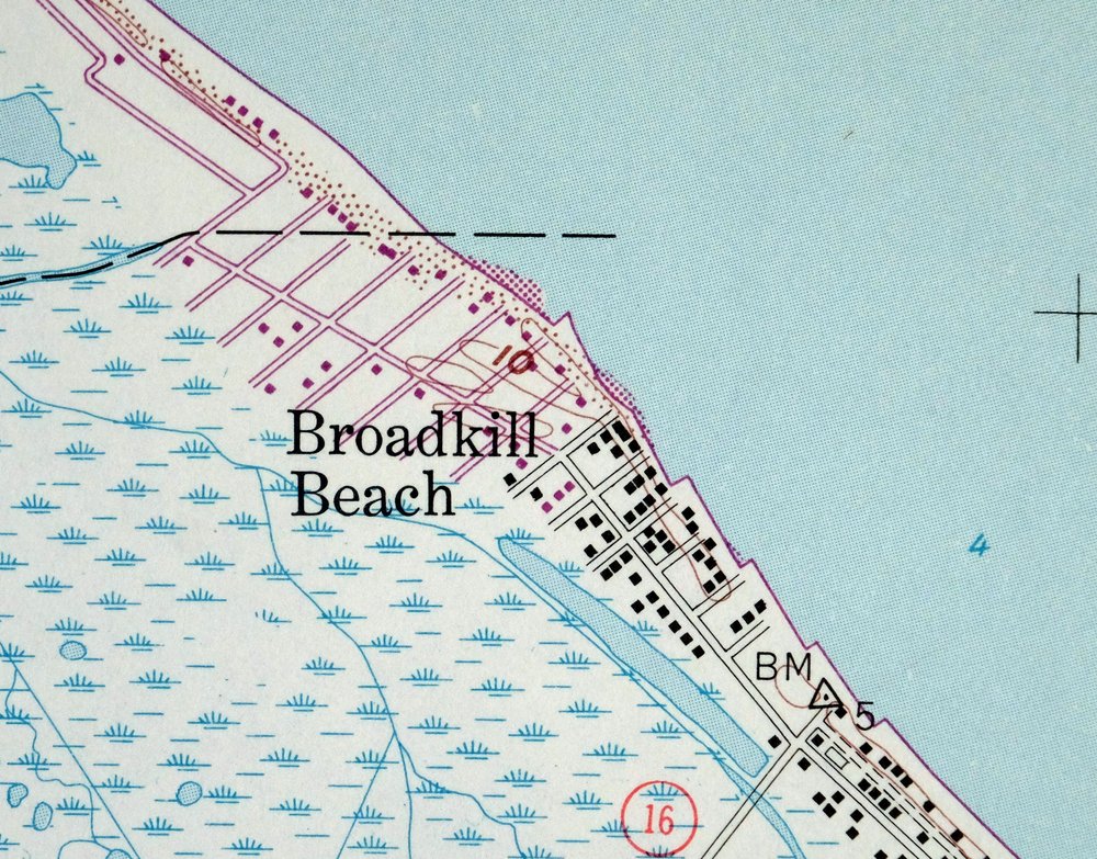
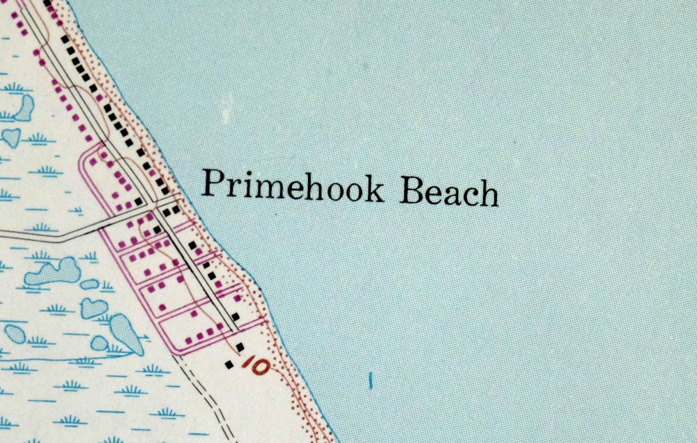
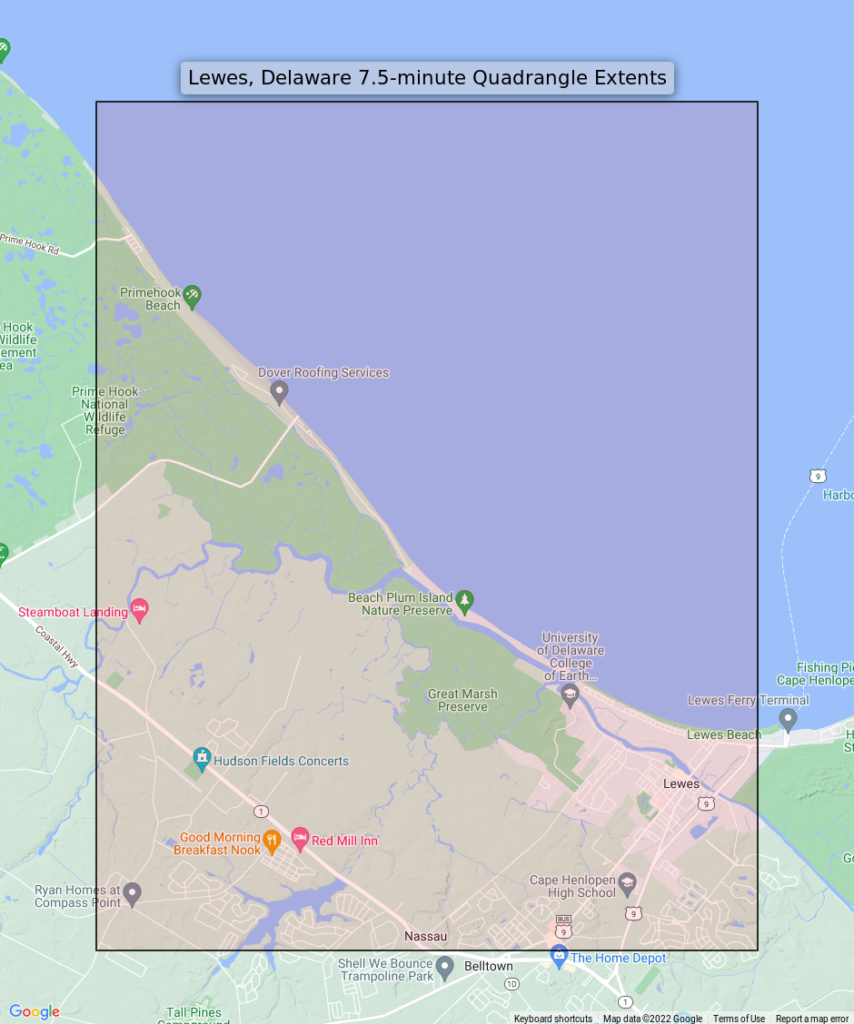
A USGS 7.5-minute quadrangle, first published in 1954 and printed in 1972, the sheet is in good condition on thick stock. It depicts the coastal area around Lewes, Delaware, taking in Lewes town, Primehook Beach, Nassau, and portions of Prime Hook National Wildlife Refuge along the Delaware Bay shoreline of Sussex County. Researchers studying mid-century coastal Delaware or those with ties to this corner of the Delmarva Peninsula will find the 1954 edition’s rendering of the bay margin and surrounding lowlands a reliable reference.
In stock
Additional information
| State | |
|---|---|
| Series | |
| Scale | |
| MapType | |
| MapSubType | |
| Printed |
This vintage sheet is a 1954 edition of the Lewes Delaware USGS topographic map revised in 1970 using aerial photography. It is an original 50-year-old 1972 United States Geological Survey print in good condition.
HOW THIS MAP CAN BE USED
In addition to making a fascinating conversation piece, this sheet would look great in a frame or on display, make a unique and prized gift for anyone interested in this area, be perfect as a reference for genealogy studies or general historical research, or fill that missing piece in your collection. Maps of this vintage are printed on durable stock and are well-suited for outdoor activities and recreation of all kinds, including hiking, backpacking, hunting, rafting and kayaking, backcountry skiing, geocaching, general exploration, treasure hunting, etc.
* Title-> Lewes
* State-> Delaware
* Edition-> 1954
* Printed-> 1972, thick paper stock
FEATURES SHOWN ON THE MAP
The Lewes 7.5-minute map shows cities and towns, roads, railroads, utilities and energy infrastructure, rivers, creeks, elevation contour lines, public land survey lines, county, state, and other administrative boundaries as they existed at the time of the survey. All known structures (houses, businesses, churches, schools, barns, cabins, etc) are also shown.
* Series-> 7.5-minute
* Scale-> 1:24000
* Woodland Tint-> Yes
* Revision-> 1970
A VALUABLE HISTORICAL RECORD
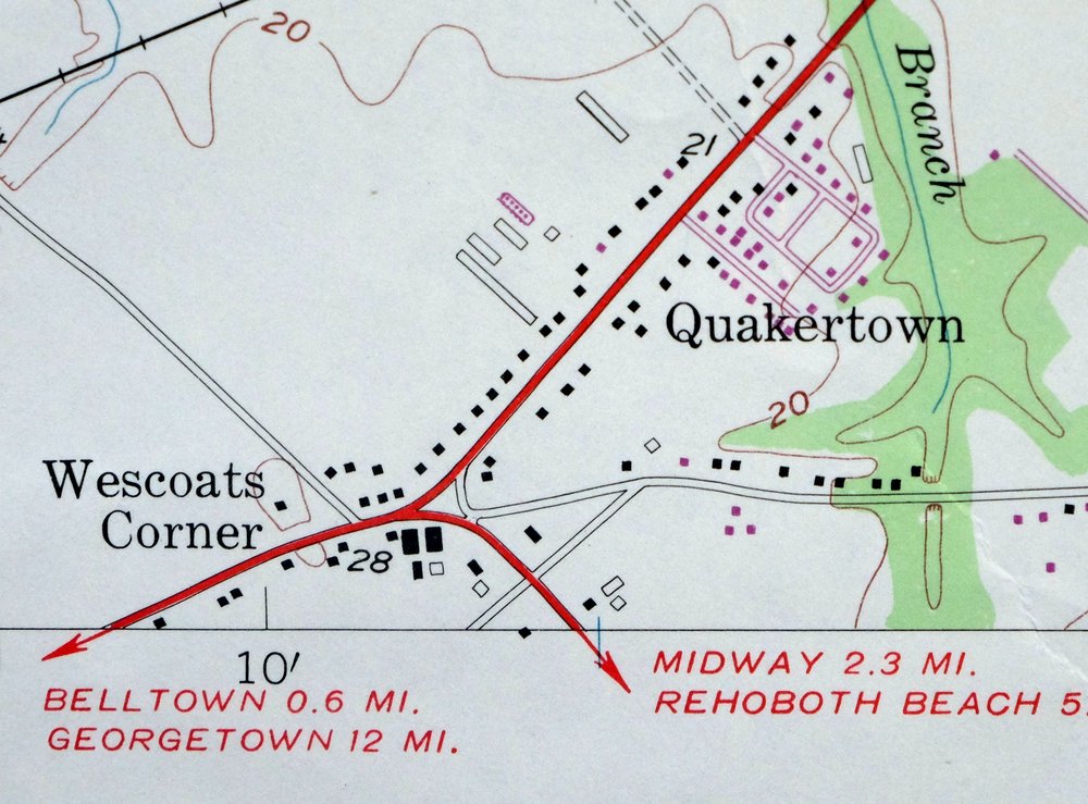
This map is from the 7.5-minute series, the most detailed series that is widely available from the USGS. The 1954 Lewes map is a valuable historical record for the area. It contains some placenames and features that have been dropped from more recent maps.
The map was photorevised in 1970. Any features that changed or were added between the original edition year of 1954 and the photorevision year of 1970 are overlayed in purple. The purple overlay provides an excellent view of the fast-growing and changing areas within the quad boundary.
* Sheet Dimensions-> 22 x 27 inches
* Map Dimensions-> 17 3/4 x 22 3/4 inches
* Map Coverage-> 7 x 9 miles
SHEET CONDITION: Good
* Sheet Notes-> moderately handled, midsheet horizontal foldline, title notation pencilled on backside of sheet
* Map Area-> no markings, no blemishes
* Collar Area-> no markings, no blemishes, no edge tears
PLACENAMES
The following places are found within the boundary of this quadrangle. They may or may not be shown or labeled, depending on the map series and vintage.
* Cities and Towns-> Lewes
* Counties Covered-> Sussex
* Federal Land Units-> Prime Hook National Wildlife Refuge
* Rivers and Streams-> Beaverdam Creek, Broadkill River, Ditch Creek, Doty Glade, Ebenezer Branch, Fisher Creek, Old Mill Creek, and Old Slaughter Creek
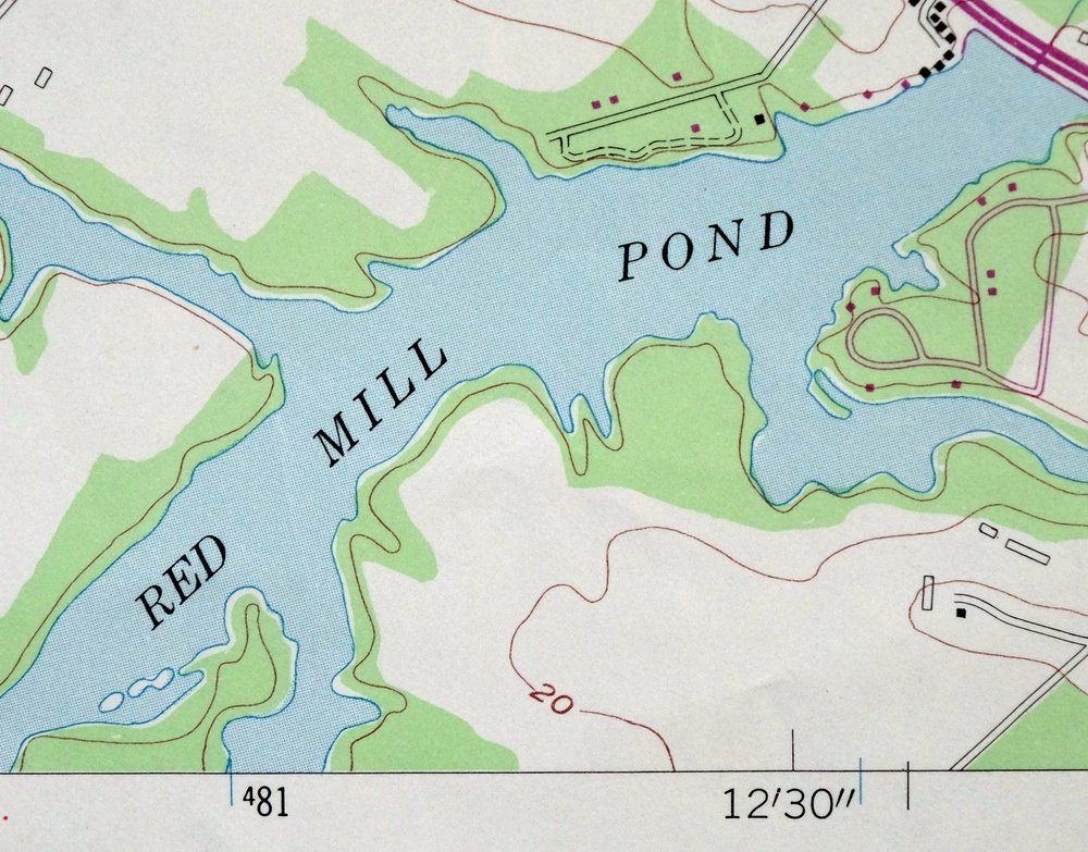
* Water Bodies-> Bookhammers Pond, Gordon Pond, Holland Pond, Red Mill Pond, and Shell Beach Pond