MAP DETAILS | |
|---|---|
| TITLE | Sag Bridge |
| STATE | Illinois |
| LOCATION | Vicinity of Orland Park, 19 miles southwest of Chicago |
| SERIES | 7.5-minute |
| EDITION | 1963 |
| PRINTED | 1964 |
| PRINT NOTES | Thick paper stock, includes woodland tint (green to indicate vegetated areas) |
| SCALE | 1:24000 |
| SHEET DIMENSIONS | 22 x 27 inches (approximate) |
| MAP DIMENSIONS | 17 x 22 3/4 inches |
| COVERAGE AREA | 6 x 9 miles |
| SHEET CONDITION For maps of this vintage, effort is made to note all visible flaws, no matter how minor. | |
| OVERALL CONDITION | Very Good |
| SHEET NOTES | very lightly handled, midsheet horizontal foldline (in half), color-pencilled map title on back of sheet |
| MAP AREA | no wear, no markings, no blemishes |
| COLLARS | no wear or tears, no markings, no blemishes |
| MAP COVERAGE Quadrangle extent overlaid on current basemap. | |
| PLACENAMES Depending on map series and survey date, all of the features listed below may not be shown on this map. This list contains features that currently exist or historically existed within the area covered by the map. The list can be used as a reference to determine if this map covers your area of interest. Placenames are listed alphabetically next to each feature type. | |
| NOTABLE PLACES | Darien, Tampier Lake, and Palisades |
| CITIES AND TOWNS (CURRENT) | Burr Ridge, Downers Grove, Goodings Grove, Hastings, Hodgkins, Lemont, Orland Park, Palos Park, Willow Springs, and Willowbrook |
| COUNTIES COVERED | Cook, DuPage, and Will |
| FEDERAL LAND UNITS | Argonne National Laboratory |
| RIVERS AND STREAMS | Calumet Sag Channel, Chicago Sanitary And Ship Canal, Des Plaines River, Flag Creek, Long Run, and Sawmill Creek |
| WATER BODIES | Bull Frog Lake, Holy Family Villa Lake, Joes Pond, Maple Lake, Orland Lake, Tampier Slough, and Tomahawk Slough |
| Locations: Camp Palos, Carriage Greens Golf Club, Cog Hill Country Club, Gleneagles Country Club, and Mid-Iron Golf Course. Areas: Mount Forest. Administrative Boundaries: Township of Lemont. Reserves: Argonne National Laboratory Reservation and Waterfall Glen County Forest Preserve. Woods: Columbia Woods, Henry DeTonty Woods, Paw Paw Woods, Pulaski Woods, Red Gate Woods, and Wolf Road Woods. Parks: Devon Park, Goreham Park, Lindenwood Park, Pinewood Park, Santa Fe Speedway, Stevens Park, Timberlake Park, and Whittaker Park. Trails: Illinois and Michigan Canal State Trail. Drainages: Crooked Creek, Flag Creek, and Sawmill Creek. Churches: Bethany Lutheran Church, Blessed Jurgis Matulaitis Lithuanian Catholic Mission, First Church of the Nazarene, Franciscan Sisters Convent, Mount Carmel Church, Our Lady of Mount Carmel Church, Saint Alphonsus Catholic Church, Saint James At Sag Bridge Catholic Church, Saint Mathew Evangelical Lutheran Church, Saints Cyril and Methodius Catholic Church, Trinity Lutheran Church, and Welcome Hill Missionary Baptist Church. Lakes and Ponds: Joes Pond and Tomahawk Slough. Buildings: Deandrils Institute and Holy Family Villa. Dams: Bull Frog Lake Dam, Dam Number 1 Dam, Dam Number 2, Dam Number 3, Dam Number 4, Dam Number 5, Dam Number 6, Holy Family Villa Lake Dam, Maple Lake Dam, and Tampier Lake Dam. Crossings: Interchange 273 and Interchange 274. Canals: Chicago Sanitary And Ship Canal and Illinois and Michigan Canal. Bayous and Sloughs: Longjohn Slough, Rainbarrel Slough, and Saganashkee Slough. Airports: Argonne Heliport, Brookridge Airport, and Midwest Heliport. Swamps: Cramer Slough and Horse Collar Slough. Schools: Anne M Jeans Elementary School, Cass Junior High School, Central School, Concord Elementary School, Elizabeth Ide Elementary School, Gooding Grove School, Gower Middle School, Gower West Elementary School, Lemont High School, Lemont Township High School, Mount Assisi Academy, Oakwood School, Palisades School, Palos West Elementary School, Pleasantdale South School, Reed Elementary School, Saint Alphonsus School, Saint Cyrils School, Saint Marys Seminary, Saint Vincent Depaul High School Seminary, and Trinity Lutheran School. Reservoirs and Tanks: Bull Frog Lake, Holy Family Villa Lake, Mallard Pond, Maple Lake, Saganashkee Slough, Tampier Lake, and Tampier Slough. | |
| SHIPPING AND RETURNS | |
 This map sheet will be carefully rolled in a sturdy tube and shipped via the US Postal Service. If you find that the sheet you receive is not as described in the listing, you may ship it back to us for a refund of the purchase price. | |
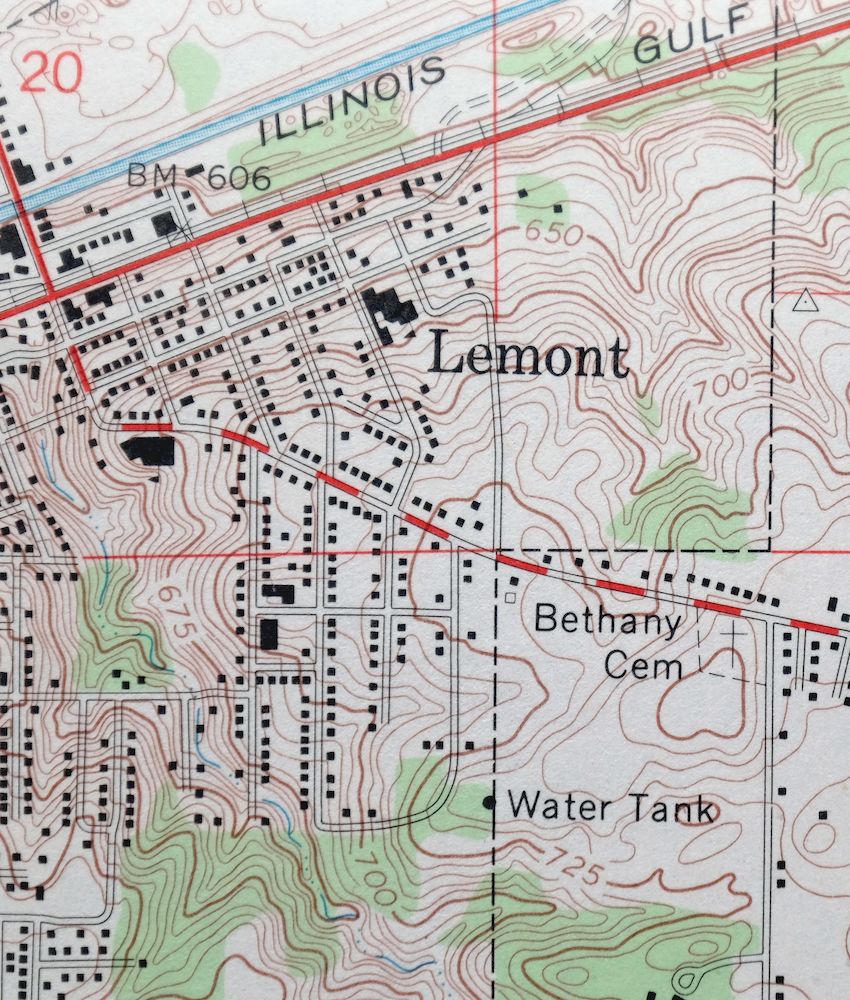
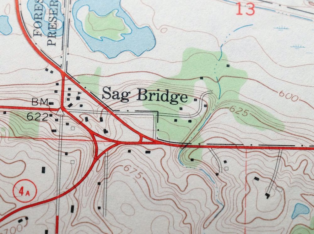
1964 Sag Bridge Illinois USGS Topo Map: Darien
$29
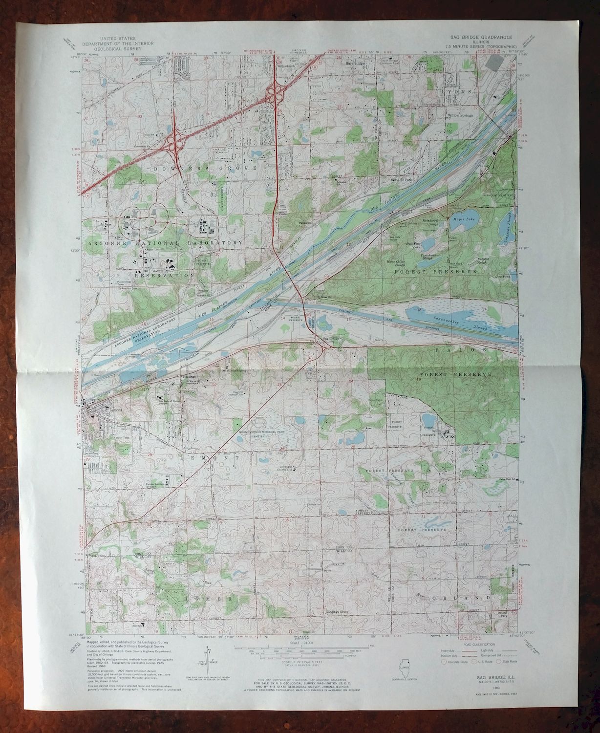
This is the Sag Bridge quadrangle, a 7.5-minute USGS topographic map at 1:24,000 scale, a 1963 edition printed in 1964 on thick paper with a green tint marking wooded ground. It covers a stretch of suburban Cook, DuPage, and Will counties southwest of Chicago, taking in Lemont, Willow Springs, Palos Park, and the edges of Orland Park and Downers Grove, along with Tampier Lake. The sheet maps the Des Plaines valley and the old Illinois and Michigan Canal corridor through Sag Bridge, a route that shaped how industry and rail reached the southwest suburbs.
In stock
This vintage sheet is a 1963 edition of the Sag Bridge Illinois USGS topographic map. It is an original 62-year-old 1964 United States Geological Survey print in very good condition.
HOW THIS MAP CAN BE USED
In addition to making a fascinating conversation piece, this sheet would look great in a frame or on display, make a unique and prized gift for anyone interested in this area, be perfect as a reference for genealogy studies or general historical research, or fill that missing piece in your collection. Maps of this vintage are printed on durable stock and are well-suited for outdoor activities and recreation of all kinds, including hiking, backpacking, hunting, rafting and kayaking, backcountry skiing, geocaching, general exploration, treasure hunting, etc.
FEATURES SHOWN ON THE MAP
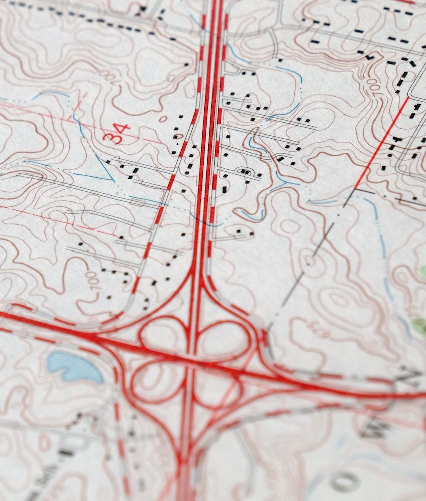
The Sag Bridge 7.5-minute map shows cities and towns, roads, paths, railroads, utilities and energy infrastructure, rivers, creeks, elevation contour lines, public land survey lines, county, state, and other administrative boundaries as they existed at the time of the survey. A reddish tint may be used on this sheet to indicate urban areas where only landmark buildings will be shown. Outside of those areas, all known structures (houses, businesses churches, schools, barns, cabins, etc) are shown.
A VALUABLE HISTORICAL RECORD
This map is from the 7.5-minute series, the most detailed series that is widely available from the USGS. The 1963 Sag Bridge map is a valuable historical record for the area. It contains some placenames and features that have been dropped from more recent maps.
Nearby maps
-
1973 Berwyn Illinois USGS Topo Map: Chicago (Vintage Print)
$32 Add to cart -
Blue Island Illinois Chicago Posen USGS Topographic Map 1965
$28 Add to cart -
Harvey Illinois Chicago Heights Dolton USGS Topo Map 1965
$37 Add to cart -
Lake Calumet Illinois Chicago Hammond USGS Topo Map 1966
$30 Add to cart -
Jackson Park Illinois Chicago USGS Topo Map 1973 Vintage
$36 Add to cart -
1973 West Chicago Illinois USGS Topo Map: Elgin
$26 Add to cart -
1984 Chicago Loop Illinois USGS Topo Map: Lincolnwood
$27 Add to cart -
Calumet City Illinois Harvey USGS Topographic Map 1970
$45 Add to cart -
Evanston Illinois Chicago USGS 7.5-Min Topo Map 1964 Vintage
$12 Add to cart -
1979 La Salle Illinois USGS Topo Map: Peru
$16 Add to cart -
1911 USGS Topo Map: Hennepin, Princeton, Illinois
$75 Add to cart -

Shopiere Wisconsin Janesville Clinton USGS Topo Map 1910
$65 Add to cart -
Forreston Illinois Freeport Shannon USGS Topo Map 1972
$14 Add to cart -

Brodhead Wisconsin Orfordville Albany USGS Topo Map 1910
$67 Add to cart -
Oconomowoc Wisconsin Waukesha Plat USGS Topographic Map 1947
$26 Add to cart -

1961 Waterloo Wisconsin USGS Topo Map: Watertown
$28 Add to cart -
Evansville Wisconsin Madison Fitchburg USGS Topo Map 1925
$43 Add to cart -
South Wayne Wisconsin Argyle Wiota USGS Topographic Map 1923
$49 Add to cart -

Cross Plains Wisconsin Madison Middleton USGS Topo Map 1942
$28 Add to cart -
1971 Cross Plains Wisconsin USGS Topo Map: Madison
$25 Add to cart -

Woodhull Illinois Wataga Windsor USGS Topo Map 1947 Vintage
$20 Add to cart -
Battle Creek Michigan Springfield USGS Topo Map 1918 Antique
$59 Add to cart -

Denzer Wisconsin Baraboo West Baraboo USGS Topo Map 1929
$58 Add to cart -
Springfield East Illinois Sherman USGS Topo Map 1973 Vintage
$32 Add to cart