MAP DETAILS | |
|---|---|
| TITLE | Sacaton |
| STATE | Arizona |
| LOCATION | Vicinity of Gilbert, 35 miles southeast of Phoenix |
| SERIES | 15-minute |
| SURVEYED | 1904 and 1906 Field Survey |
| GEOGRAPHER | E.M. Douglas |
| EDITION | 1907 |
| PRINTED | 1948 |
| PRINT NOTES | Thick paper stock |
| SCALE | 1:62500 |
| CONTOUR INTERVAL | 50 feet |
| SHEET DIMENSIONS | 17 x 21 inches |
| MAP DIMENSIONS | 14 5/8 x 17 1/2 inches |
| COVERAGE AREA | 14 x 17 miles |
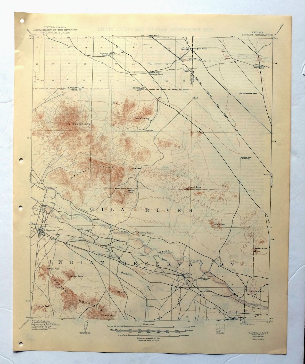
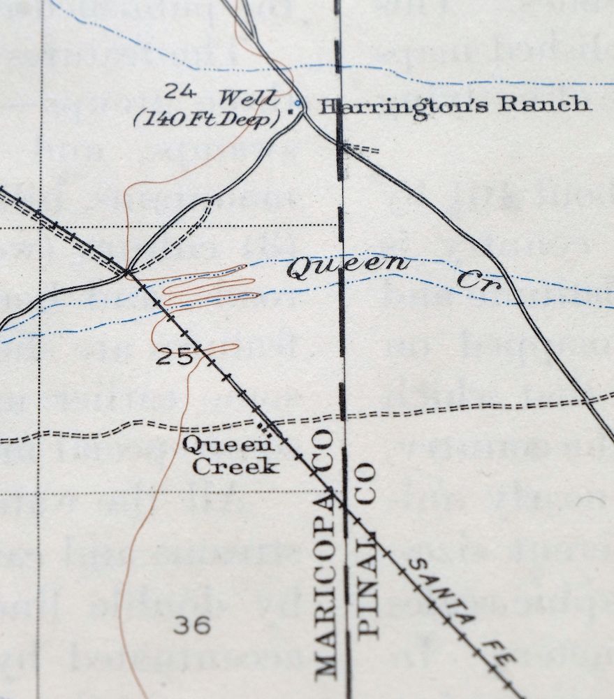
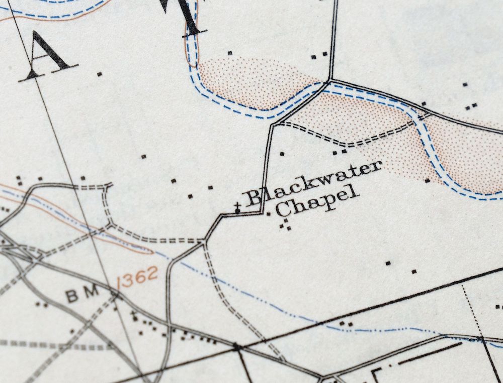
| MAP NOTES | A historical snapshot of the desert between present-day Coolidge and Queen Creek, surveyed when Queen Creek was a three-structure railroad stop, before suburban expansion of San Tan Valley and Chandler Heights and before the modern road system, showing overland routes, rail lines, ranches, and early placenames. |
| SHEET CONDITION For maps of this vintage, effort is made to note all visible flaws, no matter how minor. | |
| OVERALL CONDITION | Excellent |
| SHEET NOTES | very lightly handled, never folded, smooth and flat |
| MAP AREA | flawless map area |
| COLLARS | no wear or tears, no markings, no blemishes, hole punches in left collar |
| MAP COVERAGE Quadrangle extent overlaid on current basemap. | |
| BACKSIDE LEGEND | |
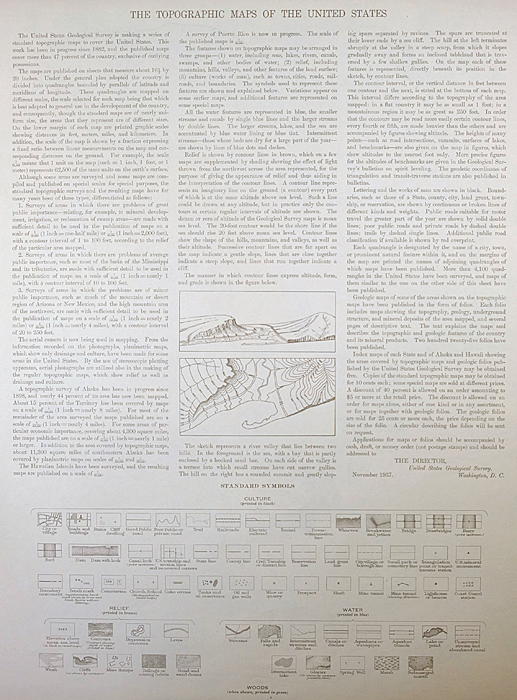 A map summary is printed on the back side of the Sacaton sheet similar to the one shown in the picture. It outlines the history, purpose, and status of the USGS mapping program at the time of the printing in 1948. It also provides instructions on how to read contour lines and a description of how they are used to depict the terrain. At the bottom of the page is a legend showing all of the symbols used to represent the cultural, relief, and water features found on the map. | |
| PLACENAMES Depending on map series and survey date, all of the features listed below may not be shown on this map. This list contains features that currently exist or historically existed within the area covered by the map. The list can be used as a reference to determine if this map covers your area of interest. Placenames are listed alphabetically next to each feature type. | |
| NOTABLE PLACES | Queen Creek, San Tan Valley, and Gila River |
| CITIES AND TOWNS (CURRENT) | Blackwater, Chandler Heights, Coolidge, Gilbert, Magma, Olberg, and Sacaton |
| COUNTIES COVERED | Maricopa and Pinal |
| FEDERAL LAND UNITS | Casa Grande Ruins National Monument and Gila River Indian Reservation |
| RIVERS AND STREAMS | Little Gila River and McClellan Wash |
| Locations: Bellavista Farms, Dock, Poston, Queen Creek Siding, and Rittenhouse Substation. Mountains, Peaks, and Summits: Agency Peak, Cholla Mountain, Fivemile Peak, Goldmine Mountain, Granite Knob, Hayden Peak, Malpais Hills, Mineral Butte, Rock Peak, Round Top, Sacaton Peak, Santan Mountain, Santan Mountains, Thin Mountain, Twin Buttes, Walker Butte, and Yellow Peak. Parks: Sacaton Ball Field Park and Sacaton Fairgrounds. Drainages: Little Gila River and McClellan Wash. Churches: Sacaton Community Church. Buildings: Dock Railroad Station, Olberg Trading Post, Poston Railroad Station, and Sacaton Flats Community Center. Gaps: The Gap. Canals: Blackwater Lateral, Casa Blanca Canal, Little Gila Canal, Santan Canal, and Southside Canal. Airports: Ray Schnepf Ranch Airport. Schools: Blackwater Community Center and School, Chandler Heights School, and Pima Central School. Towers: KCKY-AM (Coolidge) and KQEZ-FM (Coolidge). | |
| SHIPPING AND RETURNS | |
 This map sheet will be carefully rolled in a sturdy tube and shipped via the US Postal Service. If you find that the sheet you receive is not as described in the listing, you may ship it back to us for a refund of the purchase price. | |
Sacaton Arizona Gilbert Coolidge USGS Topographic Map 1948
$42
A historical snapshot of the desert between present-day Coolidge and Queen Creek, surveyed when Queen Creek was a three-structure railroad stop, before suburban expansion of San Tan Valley and Chandler Heights and before the modern road system, showing overland routes, rail lines, ranches, and early placenames. This is a 1907 edition of the Sacaton 15-minute quadrangle, printed in 1948 on thick stock from field surveys of 1904 and 1906 by geographer E.M. Douglas. It covers roughly 14 by 17 miles of the desert southeast of Phoenix in Maricopa and Pinal counties, taking in the Gila River and part of the Gila River Indian Reservation, near Gilbert and Sacaton.
In stock
This vintage sheet is a 1907 edition of the Sacaton Arizona USGS topographic map. It is an original 78-year-old 1948 United States Geological Survey print in excellent condition.
HOW THIS MAP CAN BE USED
In addition to making a fascinating conversation piece, this sheet would look great in a frame or on display, make a unique and prized gift for anyone interested in this area, be perfect as a reference for genealogy studies or general historical research, or fill that missing piece in your collection.
FEATURES SHOWN ON THE MAP
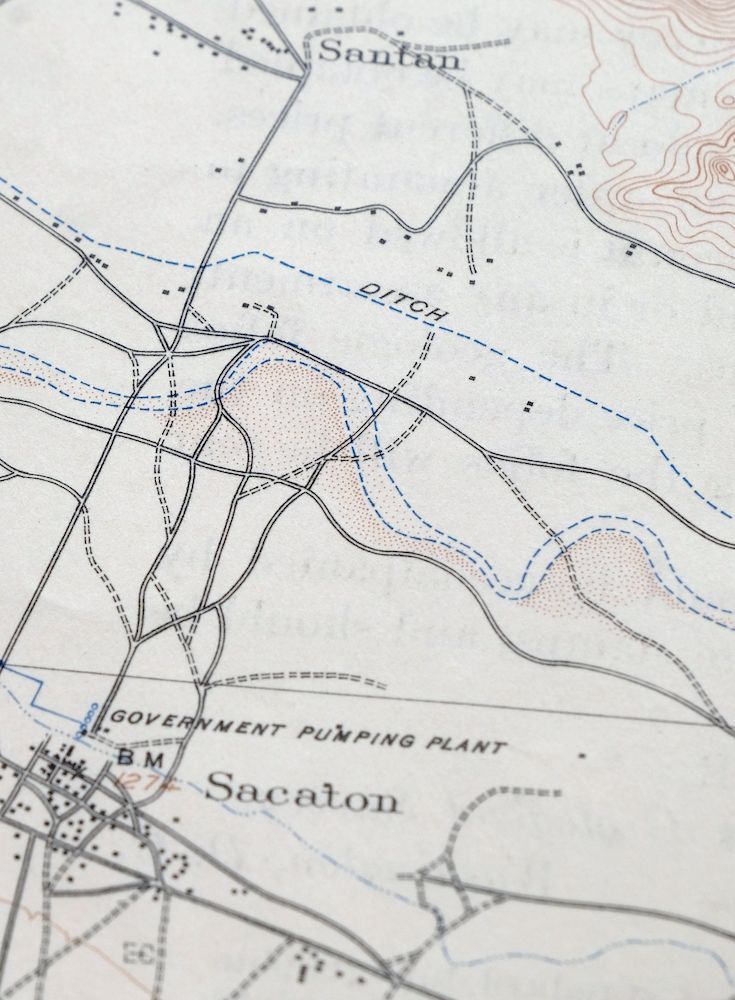
The Sacaton 15-minute map shows cities and towns, roads, railroads, rivers, creeks, elevation contour lines, public land survey lines, county, state, and other administrative boundaries as they existed at the time of the survey in 1904 and 1906. All known structures (houses, businesses, churches, schools, barns, cabins, etc) are also shown, with exceptions in some urban areas, where only landmark buildings may be shown.
A VALUABLE HISTORICAL RECORD
Maps from the 15-minute series for the continental United States are no longer produced or printed by the USGS and original prints are becoming increasingly difficult to find. They are a valuable historical record for an area, as they contain many placenames and features that have been dropped from more recent maps.
Nearby maps
-
Sacaton Arizona Gilbert Coolidge USGS Topographic Map 1907
$80 Add to cart -

Gila Butte Arizona Chandler Santan USGS Topographic Map 1966
$54 Add to cart -
1960 USGS Topo Map: Signal Peak, Casa Grande, Arizona
$46 Add to cart -

Desert Well Arizona Apache Junction Mesa USGS Topo Map 1906
$63 Add to cart -
1958 Desert Well Arizona USGS Topo Map: Apache Junction
$45 Add to cart -

Mesa Arizona Phoenix Scottsdale USGS Topo Map 1960 Vintage
$78 Add to cart -
Casa Grande Arizona Stanfield Bon USGS Topographic Map 1959
$49 Add to cart -
Maricopa Arizona Ak-Chin Village USGS Topo Map 1967 Vintage
$44 Add to cart -

Superior Arizona Top-of-the-World USGS Topo Map 1957 Vintage
$55 Add to cart -
1960 Phoenix Arizona USGS Topo Map: Tolleson
$52 Add to cart -
1968 Phoenix Arizona USGS Topo Map: Tolleson
$49 Add to cart -
1955 USGS Topo Map: Antelope Peak, Arizona
$36 Add to cart -
1968 USGS Topo Map: Antelope Peak, Arizona
$25 Add to cart -

Camelback Arizona Tonto NF Phoenix USGS 15-Min Topo Map 1948
$55 Add to cart -
Red Rock Arizona Picacho Peak Marana USGS Topo Map 1965
$44 Add to cart -

Mobile Arizona Goodyear USGS 15-Min Topo Map 1951 Vintage
$37 Add to cart -

Tortolita Mountains Arizona USGS 15-Min Topographic Map 1964
$38 Add to cart -

Avondale Arizona Phoenix Goodyear USGS Topo Map 1965 Vintage
$54 Add to cart -
Globe Arizona Miami Claypool USGS Topo Map 1955 Vintage
$45 Add to cart -
Globe Arizona Miami Claypool USGS Topo Map 1910 Antique
$78 Add to cart -
Winkelman Arizona Dudleyville Hayden USGS Topo Map 1966
$43 Add to cart -
Vaca Hills Arizona Papago USGS Topographic Map 1965 Vintage
$32 Add to cart -
1961 USGS Topo Map: Vaca Hills, Arizona
$37 Add to cart -
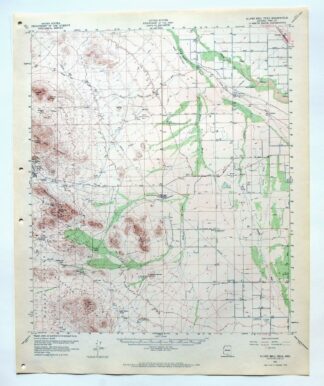
1965 Silver Bell Peak Arizona USGS Topo Map: Marana
$46 Add to cart
