MAP DETAILS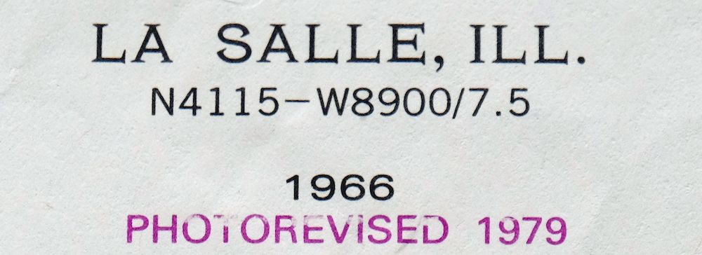 | |
|---|---|
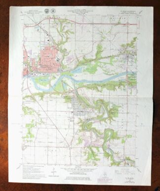
| TITLE | La Salle |
| STATE | Illinois |
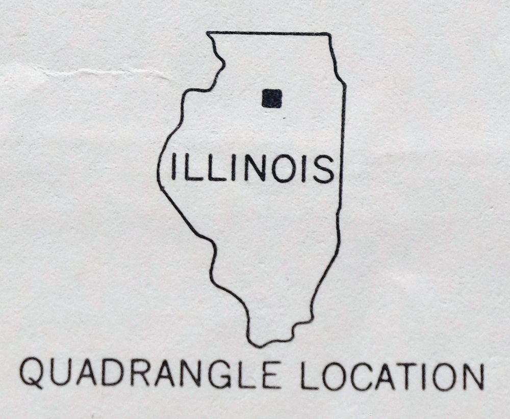
| LOCATION | 82 miles southwest of Chicago |
| SERIES | 7.5-minute |
| EDITION | 1966 |
| REVISIONS | Photo revision in 1979 is shown in purple. |
| PRINTED | 1979 |
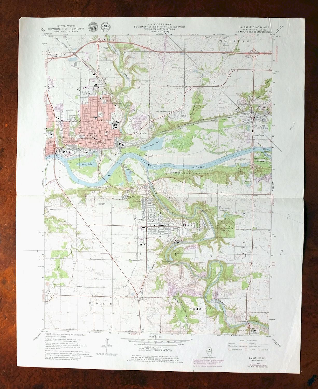
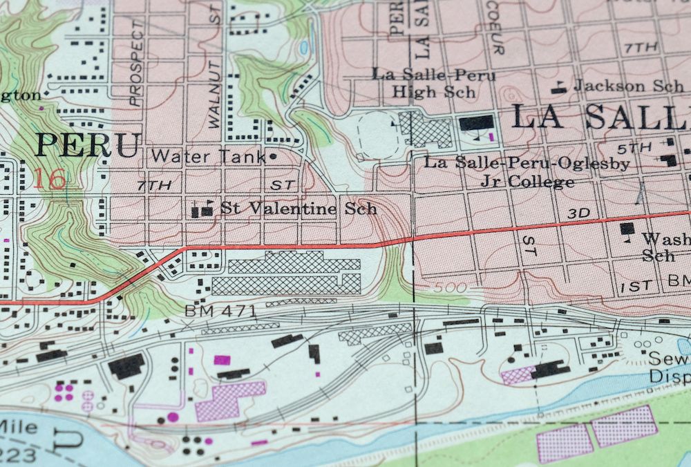
| PRINT NOTES | Thick paper stock, includes woodland tint (green to indicate vegetated areas). A reddish tint is used to indicate urban areas where only landmark buildings are shown. |
| SCALE | 1:24000 |
| SHEET DIMENSIONS | 22 x 27 inches (approximate) |
| MAP DIMENSIONS | 17 1/8 x 22 3/4 inches |
| COVERAGE AREA | 6 x 9 miles |
| SHEET CONDITION For maps of this vintage, effort is made to note all visible flaws, no matter how minor. | |
| OVERALL CONDITION | Good |
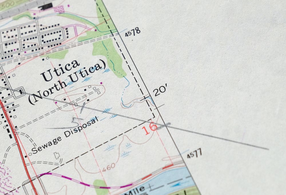
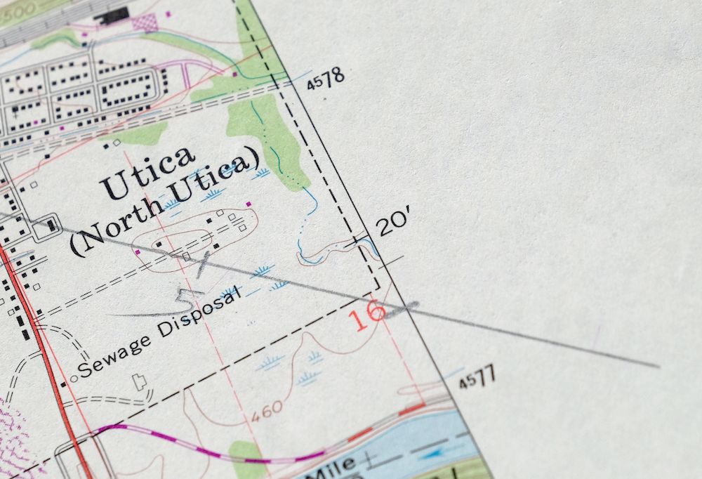
| SHEET NOTES | lightly handled, midsheet horizontal foldline (in half), pencilled map title on back of sheet, communication infrastructure transects pencilled onto sheet |
| MAP AREA | no wear, no blemishes |
| COLLARS | no wear or tears, no blemishes |
 | |
| MAP COVERAGE Quadrangle extent overlaid on current basemap. | |
| PLACENAMES Depending on map series and survey date, all of the features listed below may not be shown on this map. This list contains features that currently exist or historically existed within the area covered by the map. The list can be used as a reference to determine if this map covers your area of interest. Placenames are listed alphabetically next to each feature type. | |
| CITIES AND TOWNS (CURRENT) | Cedar Point, La Salle, North Utica, Oglesby, Peru, and Utica |
| COUNTIES COVERED | La Salle |
| RIVERS AND STREAMS | Bailey Creek, Cedar Creek, Clark Run, Illinois River, Little Vermilion River, and Vermilion River |
| WATER BODIES | Huse Lake and Split Rock Lake |
| Locations: Deer Park Country Club, La Salle Speedway, and South Bluff Country Club. Administrative Boundaries: Township of La Salle. Mountains, Peaks, and Summits: Piety Hill. Valleys and Canyons: Saint Louis Canyon. Parks: Baker Park, Carey Memorial Park, Cerri Memorial Park, Hegeler Park, Lehigh Memorial Park, Mary Hegeler Carus Park, Mattheissen Park, Matthiessen State Park, McKinley Park, Pulaski Park, Saint Marys Park, and Washington Park. Drainages: Bailey Creek, Clayton Run, Little Vermilion River, Pecumsaugan Creek, and Vermilion River. Churches: Christ Family Foursquare Church, Church of God, Church of the Resurrection, Clareknoll Novitiate, First Baptist Church, First Congregational Church, Grace Church, Oglesby Union Church, Queen of the Holy Rosary Roman Catholic Church, Sacred Heart Roman Catholic Church, Saint Hyacinths Roman Catholic Church, Saint Patricks Roman Catholic Church, Saint Pauls Episcopal Church, Saint Valentine Church, Temple B'nai Moshe, and Trinity United Church of Christ. Hospitals: Peoples Hospital and Saint Marys Hospital. Lakes and Ponds: Huse Lake and Split Rock Lake. Buildings: Dickinson House Community Building, La Salle City Building, Oglesby City Hall, and Oglesby Public Library. Dams: Deer Park Lake Dam. Crossings: Interchange 51, Interchange 52, Interchange 54, Interchange 57, Interchange 75, Interchange 77, Interchange 79, and Interchange 81. Airports: Bassett Airport, Illinois Valley Community Hospital Heliport, and Trovero Airport. Schools: Holy Family School, Illinois Valley Community College, Jackson Elementary School, Jefferson School, La Salle-Peru Township High School, Lasalle-Peru-Oglesby Junior College, Lincoln Elementary School, Lincoln Junior High School, Matthiessen School, Northview Elementary School, Northwest Elementary School, Peru Washington School, Saint Hyacinth School, Saint Marys School, Saint Roch School, Saint Valentine School, Utica Elementary School, Washington Elementary School, and Washington School. Reservoirs and Tanks: Deer Park Lake. Towers: WLPO-AM (La Salle) and WLRZ-FM (Peru). | |
| SHIPPING AND RETURNS | |
 This map sheet will be carefully rolled in a sturdy tube and shipped via the US Postal Service. If you find that the sheet you receive is not as described in the listing, you may ship it back to us for a refund of the purchase price. | |
1979 La Salle Illinois USGS Topo Map: Peru
$16
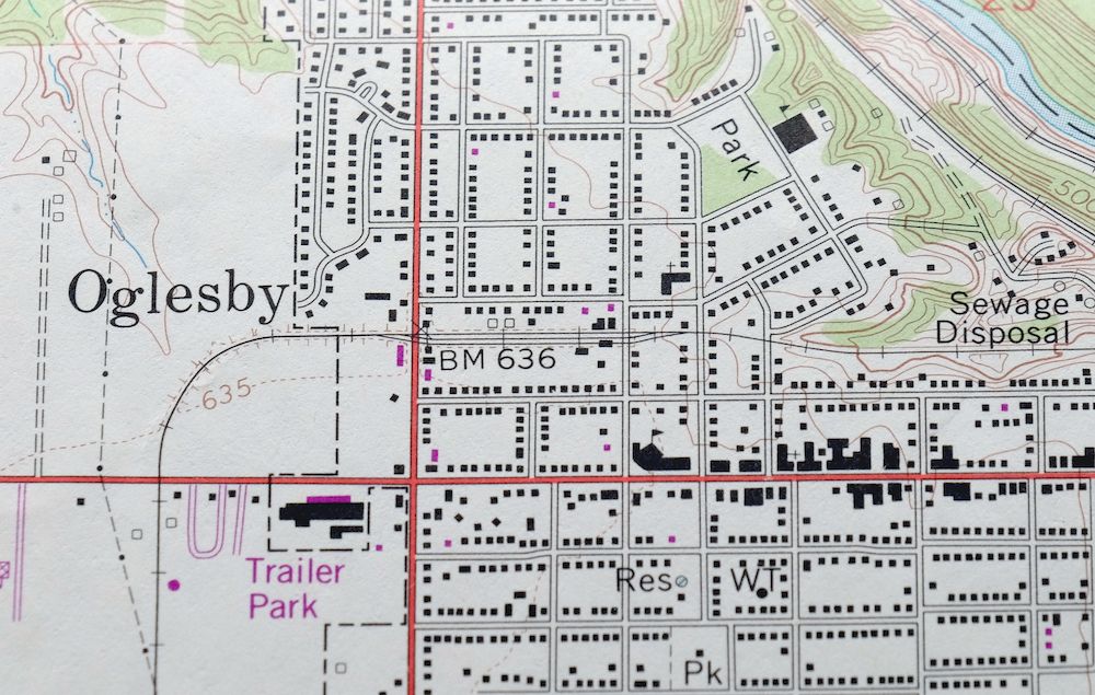
This 7.5-minute topographic map covers the La Salle area of north-central Illinois, about 82 miles southwest of Chicago. First published in 1966 and printed in 1979 with 1979 revisions, it takes in the twin river towns of La Salle and Peru along the Illinois River, plus Oglesby, Utica, North Utica, and Cedar Point. Someone has pencilled communication infrastructure lines across the sheet, the kind of working markup left by a utility or survey hand reading this landscape at 1:24000.
In stock
This vintage sheet is a 1966 edition of the La Salle Illinois USGS topographic map revised in 1979 using aerial photography. It is an original 47-year-old 1979 United States Geological Survey print in good condition.
HOW THIS MAP CAN BE USED
In addition to making a fascinating conversation piece, this sheet would look great in a frame or on display, make a unique and prized gift for anyone interested in this area, be perfect as a reference for genealogy studies or general historical research, or fill that missing piece in your collection. Maps of this vintage are printed on durable stock and are well-suited for outdoor activities and recreation of all kinds, including hiking, backpacking, hunting, rafting and kayaking, backcountry skiing, geocaching, general exploration, treasure hunting, etc.
FEATURES SHOWN ON THE MAP
The La Salle 7.5-minute map shows cities and towns, roads, paths, railroads, utilities and energy infrastructure, rivers, creeks, elevation contour lines, public land survey lines, county, state, and other administrative boundaries as they existed at the time of the survey. A reddish tint is used on this sheet to indicate urban areas where only landmark buildings are depicted. Outside of those areas, all known structures (houses, businesses, churches, schools, barns, cabins, etc) are shown.
A VALUABLE HISTORICAL RECORD
This map is from the 7.5-minute series, the most detailed series that is widely available from the USGS. The 1966 La Salle map is a valuable historical record for the area. It contains some placenames and features that have been dropped from more recent maps.
The map was photorevised in 1979. Any features that changed or were added between the original edition year of 1966 and the photorevision year of 1979 are overlayed in purple. The purple overlay provides an excellent view of the fast-growing and changing areas within the quad boundary.
Nearby maps
-
1911 USGS Topo Map: Hennepin, Princeton, Illinois
$75 Add to cart -
1973 West Chicago Illinois USGS Topo Map: Elgin
$26 Add to cart -
Forreston Illinois Freeport Shannon USGS Topo Map 1972
$14 Add to cart -
1964 Sag Bridge Illinois USGS Topo Map: Darien
$29 Add to cart -

Woodhull Illinois Wataga Windsor USGS Topo Map 1947 Vintage
$20 Add to cart -
Harvey Illinois Chicago Heights Dolton USGS Topo Map 1965
$37 Add to cart -
1973 Berwyn Illinois USGS Topo Map: Chicago (Vintage Print)
$32 Add to cart -
Blue Island Illinois Chicago Posen USGS Topographic Map 1965
$28 Add to cart -
Calumet City Illinois Harvey USGS Topographic Map 1970
$45 Add to cart -
Lake Calumet Illinois Chicago Hammond USGS Topo Map 1966
$30 Add to cart -
1984 Chicago Loop Illinois USGS Topo Map: Lincolnwood
$27 Add to cart -
Jackson Park Illinois Chicago USGS Topo Map 1973 Vintage
$36 Add to cart -
Evanston Illinois Chicago USGS 7.5-Min Topo Map 1964 Vintage
$12 Add to cart -

Shopiere Wisconsin Janesville Clinton USGS Topo Map 1910
$65 Add to cart -

Brodhead Wisconsin Orfordville Albany USGS Topo Map 1910
$67 Add to cart -
South Wayne Wisconsin Argyle Wiota USGS Topographic Map 1923
$49 Add to cart -
La Harpe Illinois Stronghurst Raritan USGS Topo Map 1918
$44 Add to cart -
Springfield East Illinois Sherman USGS Topo Map 1973 Vintage
$32 Add to cart -
Evansville Wisconsin Madison Fitchburg USGS Topo Map 1925
$43 Add to cart -
Colchester Illinois Plymouth Tennessee USGS Topo Map 1913
$46 Add to cart -

1961 Waterloo Wisconsin USGS Topo Map: Watertown
$28 Add to cart -

Cross Plains Wisconsin Madison Middleton USGS Topo Map 1942
$28 Add to cart -
1971 Cross Plains Wisconsin USGS Topo Map: Madison
$25 Add to cart -
Oconomowoc Wisconsin Waukesha Plat USGS Topographic Map 1947
$26 Add to cart