MAP DETAILS | |
|---|---|
| TITLE | Butte South |
| STATE | Montana |
| SERIES | 15-minute |
| SURVEYED | 1956 and 1961 Aerial and Field Survey |
| EDITION | 1961 |
| PRINTED | 1975 |
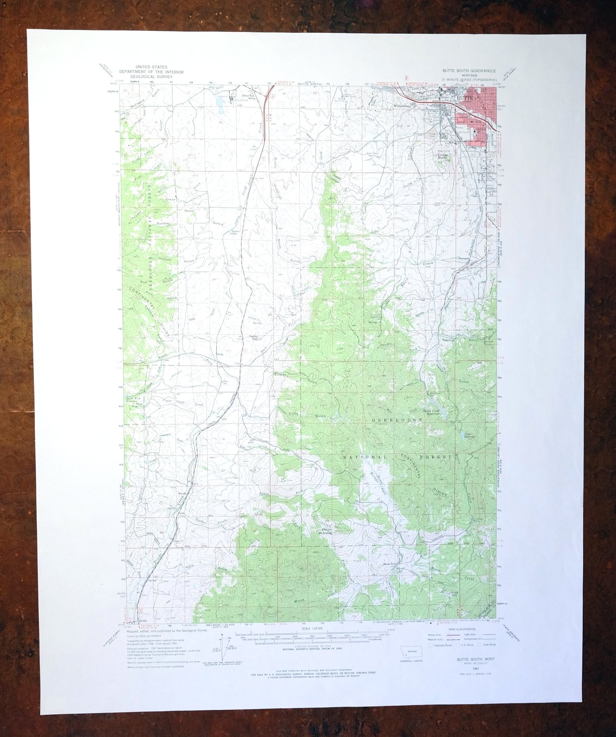
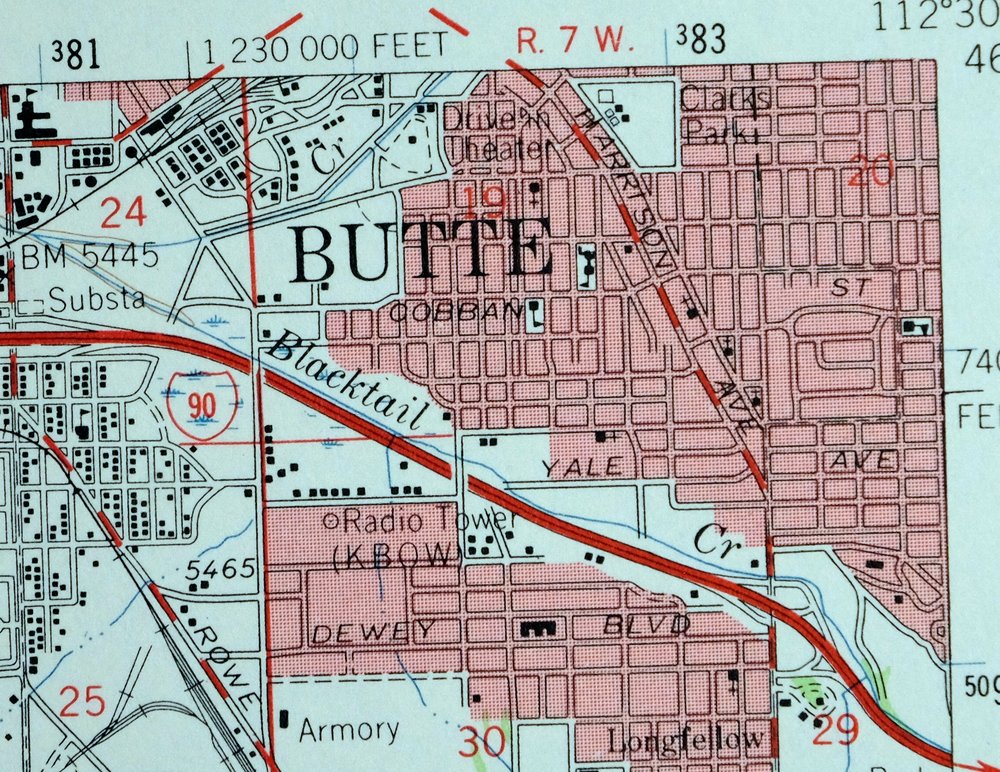
| PRINT NOTES | Thick paper stock, includes woodland tint (green to indicate vegetated areas). A reddish tint is used to indicate urban areas where only landmark buildings are shown. |
| SCALE | 1:62500 |
| CONTOUR INTERVAL | 80 feet |
| SHEET DIMENSIONS | 18 x 22 inches |
| MAP DIMENSIONS | 12 1/8 x 17 1/2 inches |
| COVERAGE AREA | 12 x 17 miles |
| MAP NOTES | Surveyed before the existence of Interstate 15. |
| SHEET CONDITION For maps of this vintage, effort is made to note all visible flaws, no matter how minor. | |
| OVERALL CONDITION | Very Good |
| SHEET NOTES | lightly handled, never folded |
| MAP AREA | flawless map area |
| COLLARS | no wear or tears, no markings, no blemishes |
| MAP COVERAGE Quadrangle extent overlaid on current basemap. | |
| PLACENAMES Depending on map series and survey date, all of the features listed below may not be shown on this map. This list contains features that currently exist or historically existed within the area covered by the map. The list can be used as a reference to determine if this map covers your area of interest. Placenames are listed alphabetically next to each feature type. | |
| NOTABLE PLACES | Divide, Williamsburg, and Deerlodge NF |
| CITIES AND TOWNS (CURRENT) | Butte-Silver Bow and Ramsay |
| COUNTIES COVERED | Madison and Silver Bow |
| FEDERAL LAND UNITS | Deerlodge National Forest and Humbug Spires Wilderness Study Area |
| RIVERS AND STREAMS | Basin Creek, Blacktail Creek, Camp Creek, Crazy Swede Creek, Divide Creek, East Fork Divide Creek, Fish Creek, Fly Creek, Grove Gulch Creek, Horse Creek, Little Basin Creek, Little Camp Creek, Middle Fork Moose Creek, Moose Creek, Moose Park, Muddy Creek, North Fork Divide Creek, North Fork Moose Creek, North Fork Tucker Creek, Sand Creek, Silver Bow Creek, South Fork North Fork Divide Creek, South Fork Tucker Creek, Tucker Creek, and Two-Bit Creek |
| WATER BODIES | South Fork Reservoir |
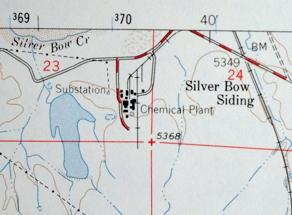
| Populated Place: Butte-Silver Bow (balance), Buxton, Divide, Feely, Johnson, Moose Town, Newcomb, Williamsburg, and Woodin. Locations: Butte, Butte Industrial Park, Butte KOA Kampground, Butte Plaza Mall, Divide Rest Area, Feely, Highland View Golf Course, La Rue Mountain View RV Park, Tamarack Square, Basin Creek Park, BLM Butte District Office, Butte Gun Club, Butte Skeet Club, Butte Ski Club, Buxton Siding, Camp Castlerock, Fleecer Ranger Station, Montana State Highway Department Section House, Rocker Water Supply, Roosevelt Campground, and Silver Bow Siding. Administrative Boundaries: Silver Bow County, Butte-Silver Bow, Butte-Silver Bow South Division, and Butte Division. Mountains, Peaks, and Summits: Feeley Hill, Gold Hill, Mount Humbug, and Timber Butte. Valleys and Canyons: Sawmill Gulch, Bear Gulch, China Gulch, Climax Gulch, Curly Gulch, Cyclone Gulch, Decker Gulch, Dry Gulch, Freezeout Gulch, Grove Gulch, Hanson Gulch, Herman Gulch, Lime Gulch, Little Gulch, Lone Tree Gulch, Orchard Gulch, Park Canyon, Pine Gulch, Pink Gulch, Powder Gulch, Price Gulch, Rose Gulch, Sawmill Canyon, Sheep Gulch, Slab Gulch, Smith Gulch, Sunday Gulch, Water Gulch, Whiskey Gulch, and Willow Gulch. Parks: Father Sheehan Park, Humbug Spires Primitive Area Historical Marker, Clark Park, Fleecer Mountain Wildlife Management Area, and Stodden Park. Drainages: Basin Creek, Blacktail Creek, Crazy Swede Creek, East Fork Divide Creek, Fly Creek, Grove Gulch Creek, Left Fork Little Basin Creek, Little Basin Creek, Middle Fork Moose Creek, Muddy Creek, North Fork Divide Creek, North Fork Moose Creek, North Fork Tucker Creek, Sand Creek, Seven Springs Creek, South Fork North Fork Divide Creek, South Fork Tucker Creek, Standby Creek, Tucker Creek, and Two-Bit Creek. Mines: Butte Ardsley Mine, Canadian Mine, Copper City I Mine, Highland Mine, NE SE Section 4 Mine, NE SW Section 22 Mine, NW NE Section 32 Mine, NW SE Section 21 Mine, SE NE Section 9 Mine, Silver Queen Mine, and W SE Section 9 Mine. Churches: Family Worship Center, Fellowship Baptist Church, Kingdom Hall of Jehovahs Witnesses, Aldersgate United Methodist Church, Butte Assembly of God Church, Church of Christ, First Church of the Nazarene, Floral Park Baptist Church, Gloria Dei Lutheran Church, Highland View Baptist Church, Pentecostal Church, Saint Ann's Catholic Church, and Saint John's Catholic Church. Post Office: Butte Post Office. Hospitals: Acadia Montana, Butte Silver Bow Primary Health Care Clinic, Express Care, Family Planning and Well Child Clinic, Rocky Mountain Childrens Clinic, Rocky Mountain Clinic, Rocky Mountain Eye Center, and Welker Chiropractic Clinic. Buildings: Butte - Silver Bow Fire Department Station 2, A - 1 Ambulance, Bert Mooney Airport Fire Department, Boulevard Volunteer Fire Department, Butte - Silver Bow Fire Department Training Center, Butte Ranger District, Little Basin Creek Volunteer Fire Department, Montana Highway Patrol District III Office, and Race Track Volunteer Fire Department. Dams: Basin Creek Dam Number 1, Basin Creek Dam Number 2, Grove Gulch Dam, South Fork Reservoir Dam, and Stauffer Chemical Number 1 Dam. Gaps: Deer Lodge Pass. Airports: Bert Mooney Airport. Schools: Butte Christian School, Emerson School, Longfellow School, Margaret Leary School, and Montana Tech - College of Technology. Ridges: Sunday Ridge. Reservoirs and Tanks: Basin Creek Reservoir and Upper Reservoir. Flats: Burton Park, Butler Meadow, Decker Flats, and Maloney Park. Towers: KBOW-AM (Butte). Wells: 02N07W06AAB_01 Well, 02N07W06AAC_02 Well, 02N07W06ADC_01 Well, 02N07W06BDD_01 Well, 02N07W06DBA_01 Well, 02N07W06DBA_02 Well, 02N07W06DBA_03 Well, 02N07W08CAB_01 Well, 02N07W08CAB_02 Well, 02N07W08CAC_03 Well, 02N07W17CCB_01 Well, 03N07W30BCB_01 Well, 03N07W30CDD_01 Well, 03N07W31AAA_01 Well, 03N07W31ABB_02 Well, 03N07W31ABC_01 Well, 03N07W31ABD_01 Well, 03N07W31ABD_02 Well, 03N07W31BAC_01 Well, 03N07W31CB__01 Well, 03N07W31DAC_01 Well, 03N07W32BBA_01 Well, 03N07W32BDB_01 Well, 03N07W32CCA_01 Well, 03N08W23BDC_01 Well, and 03N08W24CCC_01 Well. Springs: 02N07W06BBB_01 Spring, 02N07W06CBD_01 Spring, 02N07W30ADA_01 Spring, 03N07W31CCB_01 Spring, and Moose Camp Spring. Cemetery: B'Nai Israel Cemetery, Holy Cross Cemetery, Mount Moriah Cemetery, Mountain View Cemetery, and Saint Patrick Cemetery. | |
| SHIPPING AND RETURNS | |
 This map sheet will be carefully rolled in a sturdy tube and shipped via the US Postal Service. If you find that the sheet you receive is not as described in the listing, you may ship it back to us for a refund of the purchase price. | |
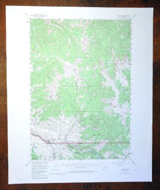
1975 Butte South Montana USGS Topo Map: Divide
$42
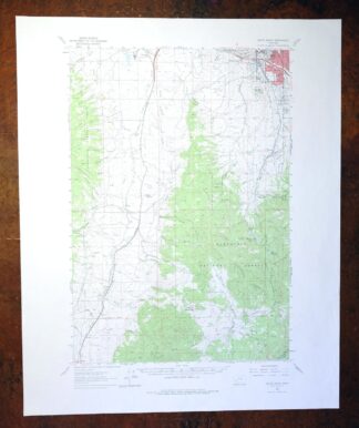
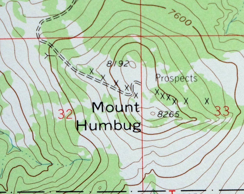
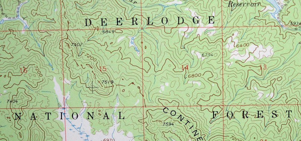
Surveyed before the existence of Interstate 15. This is a 15-minute USGS topographic map of the Butte South quadrangle in southwestern Montana, a 1961 edition printed in 1975 on thick paper stock at a scale of 1:62,500. It takes in roughly twelve by seventeen miles of Madison and Silver Bow counties, including the community of Divide and portions of Deerlodge National Forest and the Humbug Spires Wilderness Study Area, with the town of Ramsay lying to the north.
In stock
This vintage sheet is a 1961 edition of the Butte South Montana USGS topographic map. It is an original 51-year-old 1975 United States Geological Survey print in very good condition.
HOW THIS MAP CAN BE USED
In addition to making a fascinating conversation piece, this sheet would look great in a frame or on display, make a unique and prized gift for anyone interested in this area, be perfect as a reference for genealogy studies or general historical research, or fill that missing piece in your collection. Maps of this vintage are printed on durable stock and are well-suited for outdoor activities and recreation of all kinds, including hiking, backpacking, hunting, rafting and kayaking, backcountry skiing, geocaching, general exploration, treasure hunting, etc.
FEATURES SHOWN ON THE MAP
The Butte South 15-minute map shows cities and towns, roads, railroads, utilities and energy infrastructure, rivers, creeks, elevation contour lines, public land survey lines, county, state, and other administrative boundaries as they existed at the time of the survey in 1956 and 1961. A reddish tint is used on this sheet to indicate urban areas where only landmark buildings are depicted. Outside of those areas, all known structures (houses, businesses, churches, schools, barns, cabins, etc) are shown.
A VALUABLE HISTORICAL RECORD
Maps from the 15-minute series for the continental United States are no longer produced or printed by the USGS and original prints are becoming increasingly difficult to find. They are a valuable historical record for an area, as they contain many placenames and features that have been dropped from more recent maps.
Nearby maps
-

Devils Fence Montana USGS 15-Min Topo Map 1950 Vintage
$36 Add to cart -

Jefferson City Montana Clancy Basin USGS Topo Map 1967
$39 Add to cart -
1969 Clancy Montana USGS Topo Map: Elkhorn Mountains
$40 Add to cart -
1979 Drummond Montana USGS Topo Map: Hall (1958 Edition)
$34 Add to cart -

Ennis Montana McAllister Jeffers USGS Topo Map 1969 Vintage
$38 Add to cart -

East Helena Montana Helena Clancy USGS Topographic Map 1974
$42 Add to cart -

Boulder Montana Butte-Silver Bow Clancy USGS Topo Map 1933
$39 Add to cart -

Spanish Peaks Montana Big Sky USGS Topo Map 1973 Vintage
$37 Add to cart -

Goldstone Mountain Idaho Baker USGS Topo Map 1969 Vintage
$22 Add to cart -

1980 Belgrade Montana USGS Topo Map: Bridger Range
$43 Add to cart -
1969 Bozeman Montana USGS Topo Map: Gallatin Gateway
$44 Add to cart -
Monument Ridge Montana USGS 15-Min Topo Map 1975 Vintage
$38 Add to cart -
1968 USGS Topo Map: Sphinx Mountain, Montana
$43 Add to cart -

Sedan Montana USGS 15-Min Topographic Map 1956 Vintage
$38 Add to cart -
1981 Cliff Lake Montana USGS Topo Map: Madison River
$43 Add to cart -
Bozeman Pass Montana USGS 15-Min Topo Map 1978 Vintage
$43 Add to cart -

Crown Butte Montana Yellowstone NP USGS 15-Min Topo Map 1979
$40 Add to cart -
Fridley Peak Montana USGS 15-Min Topo Map 1972 Vintage
$43 Add to cart -

Missoula Montana Stevensville Lolo USGS Topographic Map 1925
$57 Add to cart -

Miner Montana Gardiner Corwin Springs USGS Topo Map 1983
$36 Add to cart -

Tepee Creek Montana Grayling USGS Topo Map 1963 Vintage
$35 Add to cart -
1975 USGS Topo Map: Emigrant, Yellowstone River, Montana
$42 Add to cart -

Mount Holmes Wyoming USGS 15-Min Topo Map 1979 Vintage
$39 Add to cart -
1983 Gardiner Montana USGS Topo Map: Yellowstone NP
$45 Add to cart