MAP DETAILS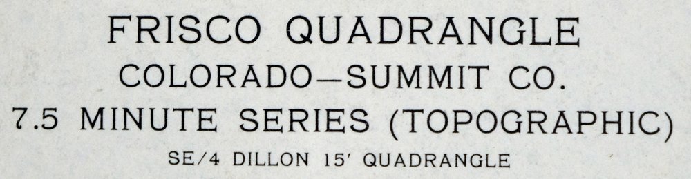 | |
|---|---|
| TITLE | Frisco |
| STATE | Colorado |
| SURVEYED | 1958 through 1970 Aerial and Field Survey |
| PRINT NOTES | Thick paper stock, includes woodland tint (green to indicate vegetated areas) |
| SCALE | 1:24000 |
| CONTOUR INTERVAL | 40 feet |
| SHEET DIMENSIONS | 19 1/2 x 27 inches |
| MAP DIMENSIONS | 17 5/8 x 22 3/4 inches |
| COVERAGE AREA | 7 x 9 miles |
| SOURCE | From the vintage map collection of David R. Wortendyke, Boulder, Colorado |
| SHEET CONDITION For maps of this vintage, effort is made to note all visible flaws, no matter how minor. | |
| SHEET NOTES | lightly handled, has foldlines |
| MAP AREA | no markings, no blemishes |
| COLLARS | no wear or tears, no markings, no blemishes, yellow highlight mark in lower right collar corner, small inventory stamp in collar, left and right collars trimmed to a 1-inch width |
| MAP COVERAGE Quadrangle extent overlaid on current basemap. | |
| PLACENAMES Depending on map series and survey date, all of the features listed below may not be shown on this map. This list contains features that currently exist or historically existed within the area covered by the map. The list can be used as a reference to determine if this map covers your area of interest. Placenames are listed alphabetically next to each feature type. | |
| NOTABLE PLACES | Dillon Reservoir and Tenmile Range |
| CITIES AND TOWNS (CURRENT) | Breckenridge, Dillon, Frisco, Keystone, and Silverthorne |
| COUNTIES COVERED | Summit |
| FEDERAL LAND UNITS | Arapaho National Forest and Eagles Nest Wilderness |
| RIVERS AND STREAMS | Blue River, North Tenmile Creek, Snake River, Soda Creek, Swan River, and Tenmile Creek |
| WATER BODIES | Lily Pad Lake |
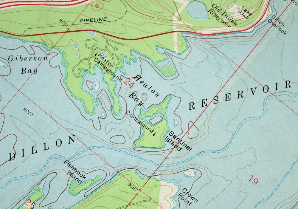
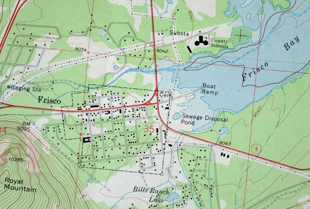
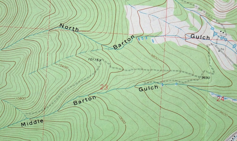
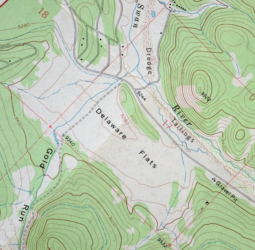
| Populated Place: Frisco, Gold Hill, and Masontown. Locations: Blue River Inlet Fishermans Parking, Dillon Overlook, Frisco Bay Fishermans Parking, Frisco Marina, Giberson Bay Fishermans Parking, Gold Pan Campground, Heaton Campground, Peak One Campground, Peninsula Recreation Area, Pine Cove Campground, Prospector Campground, Sapphire Point Overlook, Sentinel Island Campground, Snake River Fishermans Parking, and Swan Mountain Recreation Area. Administrative Boundaries: Breckenridge Division, Town of Dillon, and Town of Frisco. Mountains, Peaks, and Summits: Lake Hill, Ophir Mountain, Peak Five, Peak Four, Peak One, Peak Three, Royal Mountain, Swan Mountain, and Tenmile Peak. Valleys and Canyons: Gold Run Gulch, Horseshoe Gulch, Middle Barton Gulch, North Barton Gulch, Ryan Gulch, Salt Lick Gulch, Soda Gulch, and South Barton Gulch. Parks: Windy Point Fisherman Park. Trails: Lily Pad Lake Trail and Miners Creek Trail. Drainages: Meadow Creek, Miners Creek, North Tenmile Creek, Snake River, Soda Creek, Squaw Creek, Swan River, and Tenmile Creek. Islands: Fishhook Island, Sentinel Island, and Silver Dollar Island. Capes: Crown Point and Windy Point. Mines: Como Claims, Frisco Mine, Gold Cord Tunnel Mine, Gold Run Gulch Claims Mine, King Solomon Mine, and Naperville Tunnel Mine. Post Office: Frisco Post Office. Hospitals: Saint Anthony Summit Medical Center. Lakes and Ponds: Bills Ranch Lake, Lily Pad Lake, and Rainbow Lake. Buildings: Colorado State Patrol Frisco Post, Flight for Life Colorado 2 Medical Transport, Frisco Police Department, Lake Dillon Fire - Rescue Station 2, Red White and Blue Fire District Station 4, and Summit County Ambulance Service. Dams: Dillon Dam and Old Dillon Dam. Canals: Williams-Hamm Diversion Ditch. Bays: Blue River Arm, Dillon Bay, Frisco Bay, Giberson Bay, Heaton Bay, and Snake River Arm. Airports: Summit Medical Center Heliport. Reservoirs and Tanks: Dillon Reservoir and Old Dillon Reservoir. Flats: Braddock Flats and Delaware Flats. Towers: KYSL-FM (Frisco). Springs: Iron Springs. Cemetery: Dillon Cemetery and Frisco Cemetery. | |
| SHIPPING AND RETURNS | |
 Ships carefully rolled in a sturdy 2" x 24" mailing tube. Shipping and return details are in our terms. | |
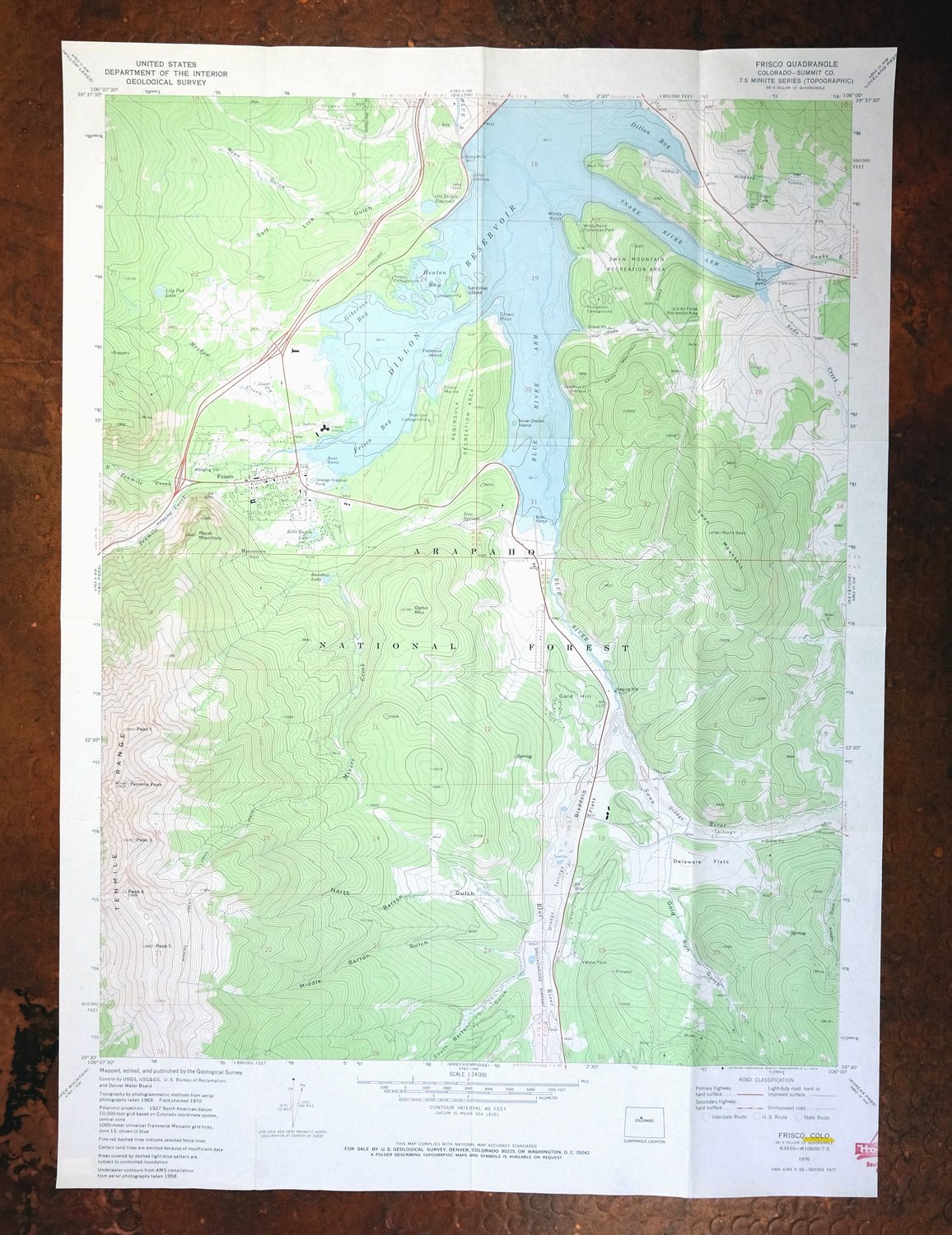
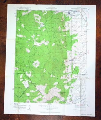
Frisco, Dillon Reservoir, Colorado 1970 USGS Topo Map
$37
- 59 miles west of Denver.
- 7.5-minute series, 1970 edition, printed in 1973.
- Good condition.
In stock
This vintage sheet is a 1970 edition of the Frisco Colorado USGS topographic map. It is an original 53-year-old 1973 United States Geological Survey print in good condition.
HOW THIS MAP CAN BE USED
In addition to making a fascinating conversation piece, this sheet would look great in a frame or on display, make a unique and prized gift for anyone interested in this area, be perfect as a reference for genealogy studies or general historical research, or fill that missing piece in your collection. Maps of this vintage are printed on durable stock and are well-suited for outdoor activities and recreation of all kinds, including hiking, backpacking, hunting, rafting and kayaking, backcountry skiing, geocaching, general exploration, treasure hunting, etc.
FEATURES SHOWN ON THE MAP
The Frisco 7.5-minute map shows cities and towns, roads, paths, railroads, utilities and energy infrastructure, rivers, creeks, elevation contour lines, public land survey lines, county, state, and other administrative boundaries as they existed at the time of the survey in 1958 through 1970. All known structures (houses, businesses, churches, schools, barns, cabins, etc) are also shown.
A VALUABLE HISTORICAL RECORD
This map is from the 7.5-minute series, the most detailed series that is widely available from the USGS. The 1970 Frisco map is a valuable historical record for the area. It contains some placenames and features that have been dropped from more recent maps.
Nearby maps
-

1958 USGS Topo Map: Keystone, Tiger, Colorado
$34 Add to cart -

Red Cliff, Colorado 1970 USGS Topo Map (1988 Print)
$34 Add to cart -
Red Cliff, Colorado 1970 USGS Topo Map: Vail Ski Resort
$49 Add to cart -
Vail East, Colorado 1970 USGS Topo Map: Gore Range
$36 Add to cart -
1957 USGS Topo Map: Georgetown, Silver Plume, Colorado
$32 Add to cart -
Vail West, Colorado 1970 USGS Topo Map: Gore Creek
$34 Add to cart -
Shawnee, Colorado 1945 USGS Topo Map: Singleton (1972 Print)
$29 Add to cart -
Edwards, Avon, Colorado 1962 USGS Topo Map (1988 Print)
$37 Add to cart -
1942 USGS Topo Map: Central City, Colorado (1964 Print)
$31 Add to cart -

Mount Massive, Sawatch Range, Colorado 1967 USGS Topo Map
$35 Add to cart -
Bailey, Colorado 1945 USGS Topo Map (1973 Print)
$32 Add to cart -
1926 USGS Topo Map: Montezuma, Keystone, Colorado
$53 Add to cart -
Montezuma, Keystone, Colorado 1958 USGS Topo Map
$41 Add to cart -
Ute Peak, Colorado 1933 USGS Topo Map (1971 Print)
$36 Add to cart -
Georgetown, Colorado 1957 USGS Topo Map (1980 Print)
$40 Add to cart -

Mount Powell, Colorado 1940 USGS Topo Map: Gore Range
$27 Add to cart -

Mount Powell, Colorado 1933 USGS Topo Map (1974 Print)
$41 Add to cart -
1942 USGS Topo Map: Nederland, Eldora, Colorado (1964 Print)
$34 Add to cart -
Hot Sulphur Springs, Colorado 1957 USGS Topo Map
$33 Add to cart -
1967 USGS Topo Map: Mount Elbert, Sawatch Range, Colorado
$36 Add to cart -
1942 USGS Topo Map: Tungsten, Barker Reservoir, Colorado
$39 Add to cart -
Platte Canyon, Colorado 1945 USGS Topo Map: Foxton
$45 Add to cart -
Aspen, Buttermilk, Colorado 1960 USGS Topo Map
$40 Add to cart -
1942 USGS Topo Map: Eldorado Springs, Colorado (1961 Print)
$36 Add to cart
