MAP DETAILS | |
|---|---|
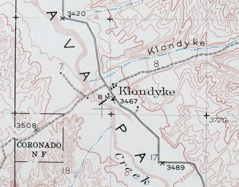
| TITLE | Klondyke |
| STATE | Arizona |
| LOCATION | 55 miles northeast of Tucson |
| SERIES | 15-minute |
| SURVEYED | 1937 and 1938 Field Survey |
| GEOGRAPHER | C.W.H. Nessler |
| EDITION | 1938 |
| PRINTED | 1971 |
| PRINT NOTES | Thick paper stock |
| SCALE | 1:62500 |
| CONTOUR INTERVAL | 50 feet |
| SHEET DIMENSIONS | 17 x 20 7/8 inches |
| MAP DIMENSIONS | 14 3/4 x 17 1/2 inches |
| COVERAGE AREA | 14 x 17 miles |
| SOURCE | From the vintage map collection of Art Christiansen, Tempe, Arizona |
| SHEET CONDITION For maps of this vintage, effort is made to note all visible flaws, no matter how minor. | |
| OVERALL CONDITION | Excellent |
| SHEET NOTES | very lightly handled, never folded, smooth and flat |
| MAP AREA | flawless map area |
| COLLARS | no wear or tears, no markings, no blemishes |
| MAP COVERAGE Quadrangle extent overlaid on current basemap. | |
| PLACENAMES Depending on map series and survey date, all of the features listed below may not be shown on this map. This list contains features that currently exist or historically existed within the area covered by the map. The list can be used as a reference to determine if this map covers your area of interest. Placenames are listed alphabetically next to each feature type. | |
| COUNTIES COVERED | Graham and Pinal |
| FEDERAL LAND UNITS | Aravaipa Canyon Wilderness, Coronado National Forest, San Carlos Indian Reservation, and Santa Teresa Wilderness |
| RIVERS AND STREAMS | Aravaipa Creek, Ash Creek, Black Rock Wash, Copper Creek, Deer Creek, Fourmile Creek, Goodwin Wash, Klondyke Wash, Oak Creek, Rattlesnake Creek, Sand Wash, Squaw Creek, Telegraph Wash, and Turkey Creek |
| WATER BODIES | Woodrows Tank |
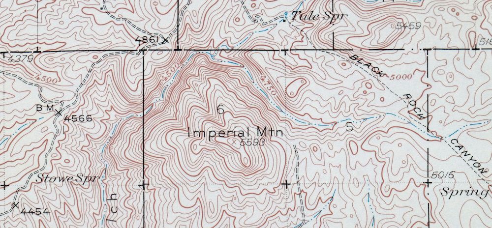
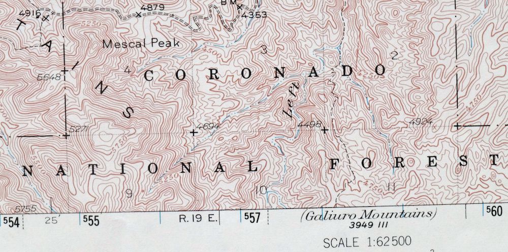
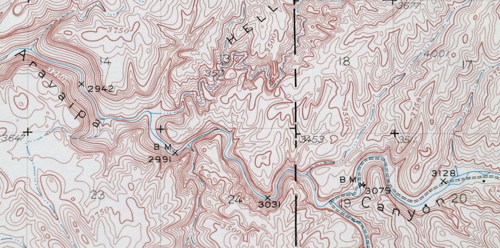
| Locations: Aravaipa Canyon Primitive Area East Entrance, Aravaipa Ranger Station, Davidson Ranch, Don Jose Corral, Fourmile Ranch, Hanks Corral, Lamb Camp, Landsman Camp, Lime Camp, Roten Cabin, and Wire Corral. Areas: Hell Hole. Mountains, Peaks, and Summits: Black Butte, Cobre Grande Mountain, Grand Reef Mountain, Horse Mountain, Imperial Mountain, Little Table Mountain, Lone Cedar Mesa, Lookout Mountain, Mescal Peak, Quartz Hill, Rocky Top, Sixtysix Peak, and Turquoise Peak. Valleys and Canyons: Arizona Gulch, Black Canyon, Booger Canyon, Bear Canyon, Bottle Canyon, Buford Canyon, Copper Canyon, Cottonwood Canyon, Dark Canyon, First Trail Canyon, Fourmile Canyon, Garden Spring Canyon, Goat Canyon, Hell Hole Valley, Horse Canyon, Laurel Canyon, Left Branch Long Hollow, Left Prong Fourmile Canyon, Long Hollow, Marics Canyon, Maroga Canyon, Martinez Canyon, Negro Henry Canyon, Oak Grove Canyon, Paisano Canyon, Parsons Canyon, Pipeline Canyon, Rattlesnake Canyon, Right Branch Long Hollow, Right Prong Fourmile Canyon, Road Canyon, Saddle Canyon, Saloon Canyon, Second Trail Canyon, South Fork Buford Canyon, Spring Canyon, Stone Cabin Canyon, Stowe Gulch, Sycamore Canyon, Tule Canyon, Waterfall Canyon, Williamson Canyon, and Wire Corral Draw. Parks: Aravaipa Canyon Primitive Area. Trails: Holdout Trail Sixty Nine and Reef Basin Sixty Eight Trail. Drainages: Deer Creek, Fourmile Creek, Klondyke Wash, Rattlesnake Creek, Right Prong Fourmile Creek, San Simon Stream, Sand Wash, Squaw Creek, Telegraph Wash, and Turkey Creek. Mines: Bluebird Mine, Childs and Altwilkle Mine, Cobre Grande Mine, Copper Prince Mine, Dog Water Mine, Glory Hole Mine, Grand Reef Mine, Head Center Mine, Princess Pat Mine, Quinn Mine, Reliable Mine, Sin Fin Mine, Table Mountain Mine, Tenstrike Mine, and The Hendrickson. Forests: Crook National Forest. Dams: Ash Creek Dam. Basins: Jerky Basin. Schools: Aravaipa School. Ridges: Horse Ridge. Reservoirs and Tanks: Big Tank, Black Tank, Blue Jay Tank, Cement Tank, Chet Tank, Davidson Tank, Dirt Tank, Double Tank, Dowdle Tank, Jacks Tank, Little Wonder Tank, Manzanita Tank, Mescal Tank, Nl Tank, Poncho Tank, Reef Tank, Salty Tank, Spring Canyon Tank, Squaw Tank, Teresa Tank, and Woodrows Tank. Wells: Deep Well. Pillars: The Chimney. Springs: Anderson Spring, Bitter Spring, Black Canyon Spring, Bleak Spring, Bluebird Spring, Bear Spring, Boundary Spring, Brown Jug Spring, Cement Tank Spring, Cooly Spring, Copper Canyon Spring, Cottonwood Spring, Fourmile Springs, Gable Spring, Garden Spring, Haby Spring, Ison Spring, Jackson Spring, John Spring, Juniper Spring, Landsman Spring, McKinney Spring, Mineshaft Spring, Monkey Spring, Oak Spring, Peach Spring, Quartz Hill Spring, Soda Spring, Soda Water Spring, Spring Trail Spring, Stowe Spring, Tule Spring, Tunnel Spring, Van Dyke Spring, Walnut Spring, Warm Spring, and Willow Spring. | |
| SHIPPING AND RETURNS | |
 This map sheet will be carefully rolled in a sturdy tube and shipped via the US Postal Service. If you find that the sheet you receive is not as described in the listing, you may ship it back to us for a refund of the purchase price. | |
Klondyke Arizona USGS 15-Min Topographic Map 1971 Vintage
$44
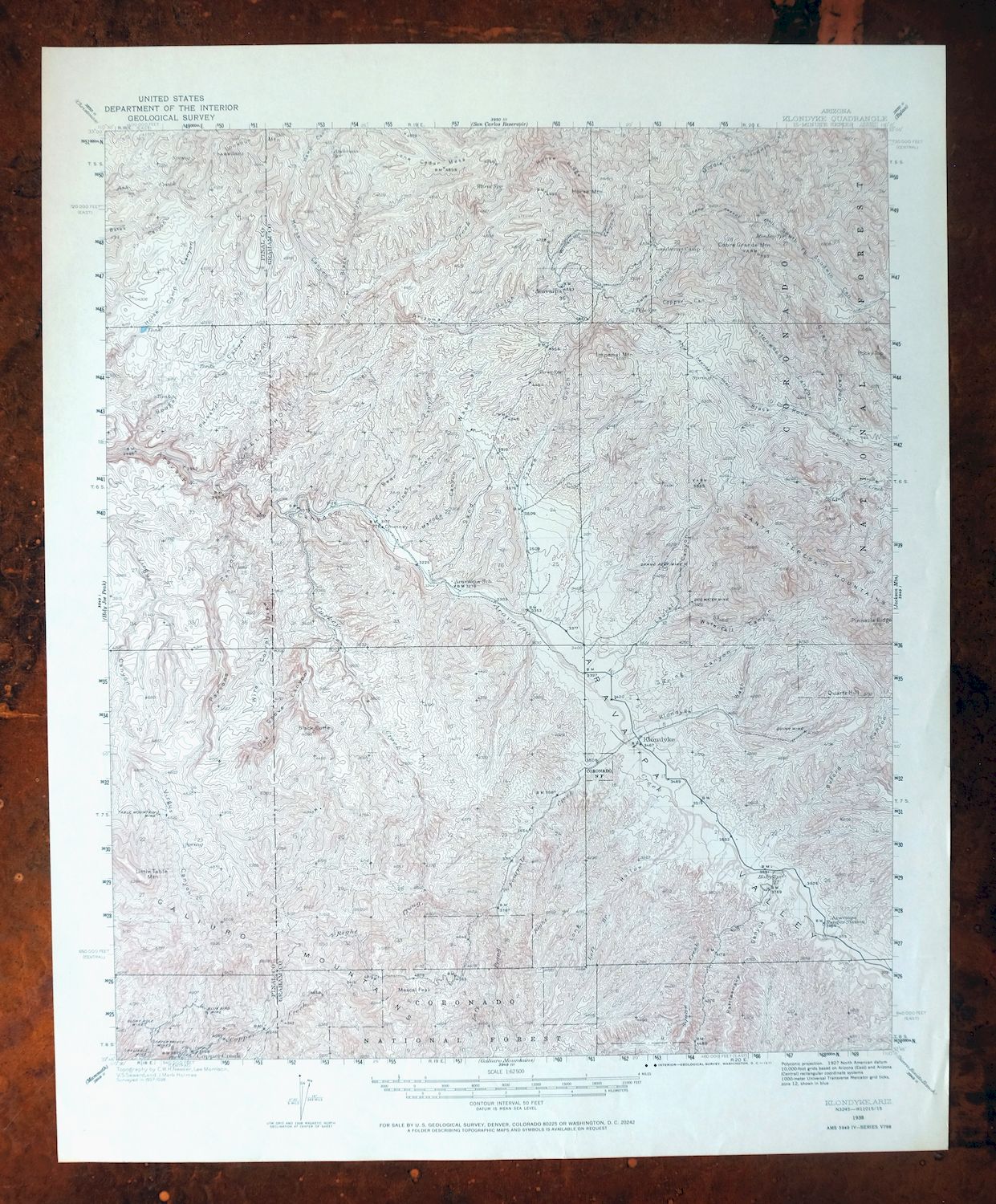
First published in 1938, this USGS 15-minute topographic sheet was printed in 1971 and is in excellent condition – very lightly handled, never folded, smooth and flat, on thick stock. Covering an area about 55 miles northeast of Tucson in Graham and Pinal counties, the quad takes in rugged high desert with portions of the Coronado National Forest, the San Carlos Indian Reservation, and the Santa Teresa and Aravaipa Canyon Wilderness areas. The Aravaipa country here is known for its steep canyons and remote backcountry, mapped at a 50-foot contour interval that brings out the sharp terrain; this sheet comes from the vintage map collection of Art Christiansen of Tempe, Arizona.
In stock
This vintage sheet is a 1938 edition of the Klondyke Arizona USGS topographic map. It is an original 55-year-old 1971 United States Geological Survey print in excellent condition.
HOW THIS MAP CAN BE USED
In addition to making a fascinating conversation piece, this sheet would look great in a frame or on display, make a unique and prized gift for anyone interested in this area, be perfect as a reference for genealogy studies or general historical research, or fill that missing piece in your collection. Maps of this vintage are printed on durable stock and are well-suited for outdoor activities and recreation of all kinds, including hiking, backpacking, hunting, rafting and kayaking, backcountry skiing, geocaching, general exploration, treasure hunting, etc.
FEATURES SHOWN ON THE MAP
The Klondyke 15-minute map shows cities and towns, roads, railroads, utilities and energy infrastructure, rivers, creeks, elevation contour lines, public land survey lines, county, state, and other administrative boundaries as they existed at the time of the survey in 1937 and 1938. All known structures (houses, businesses, churches, schools, barns, cabins, etc) are also shown, with exceptions in some urban areas, where only landmark buildings may be shown.
A VALUABLE HISTORICAL RECORD
Maps from the 15-minute series for the continental United States are no longer produced or printed by the USGS and original prints are becoming increasingly difficult to find. They are a valuable historical record for an area, as they contain many placenames and features that have been dropped from more recent maps.
Nearby maps
-
Christmas Arizona USGS 15-Min Topographic Map 1917 Antique
$57 Add to cart -
Winkelman Arizona Dudleyville Hayden USGS Topo Map 1966
$43 Add to cart -
Oracle Arizona Catalina USGS 15-Min Topo Map 1964 Vintage
$41 Add to cart -

Winchester Mountains Arizona The Mesas USGS Topo Map 1962
$35 Add to cart -

Safford Arizona Thatcher Solomon USGS Topo Map 1980 Vintage
$44 Add to cart -
Globe Arizona Miami Claypool USGS Topo Map 1955 Vintage
$54 Add to cart -

Mount Lemmon Tucson Arizona Vintage USGS Topo Map 1967
$62 Add to cart -

Tortolita Mountains Arizona USGS 15-Min Topographic Map 1964
$38 Add to cart -

Superior Arizona Top-of-the-World USGS Topo Map 1957 Vintage
$45 Add to cart -
Cortaro Arizona Tucson Oro Valley USGS Topographic Map 1947
$58 Add to cart -

Tucson Arizona Davis-Monthan Tanque Verde USGS Topo Map 1963
$58 Add to cart -
Cochise Arizona Willcox USGS 15-Min Topo Map 1963 Vintage
$43 Add to cart -
Red Rock Arizona Picacho Peak Marana USGS Topo Map 1965
$46 Add to cart -
Bowie Arizona USGS 15-Min Topographic Map 1950 Vintage
$36 Add to cart -
San Xavier Mission Arizona Tucson USGS Topo Map 1961 Vintage
$52 Add to cart -
Globe Arizona Miami Claypool USGS Topo Map 1982 Vintage
$28 Add to cart -
Tucson North Arizona Casas Adobes USGS Topo Map 1977 Vintage
$46 Add to cart -

Marana Arizona Picture Rocks Rillito USGS Topo Map 1976
$37 Add to cart -

Florence Arizona Apache Junction Superior USGS Topo Map 1917
$70 Add to cart -

Tucson SE Arizona Rita Ranch Littletown USGS Topo Map 1980
$35 Add to cart -
Tucson SW Arizona Summit Sahuarita USGS Topographic Map 1977
$33 Add to cart -
Benson Arizona Coronado NF St. David USGS Topo Map 1962
$38 Add to cart -

Morenci Arizona Clifton Blue River USGS 30-Min Topo Map 1954
$64 Add to cart -
Empire Mountains Arizona Vail Pantano USGS Topo Map 1961
$47 Add to cart
