MAP DETAILS | |
|---|---|
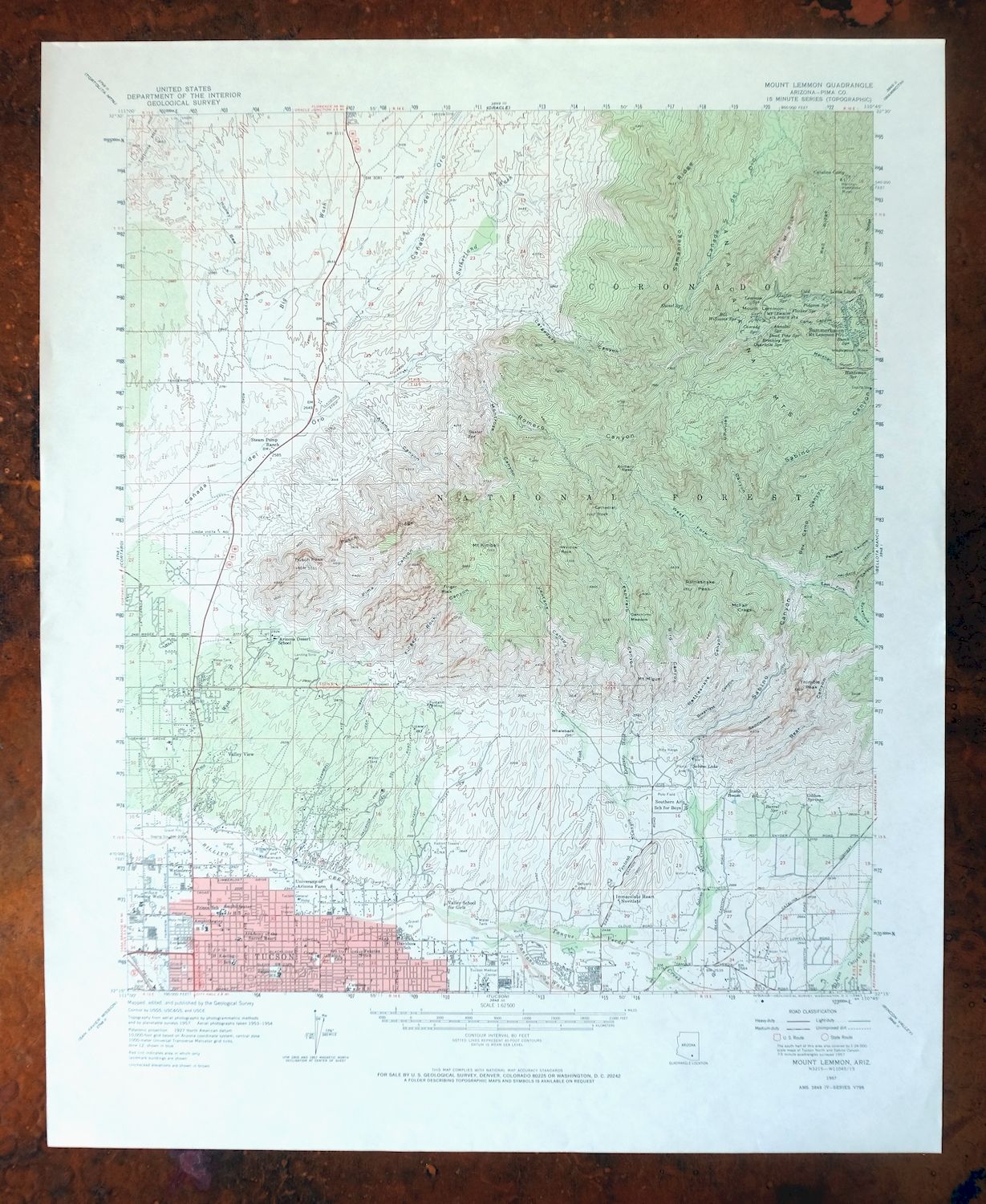
| TITLE | Mount Lemmon |
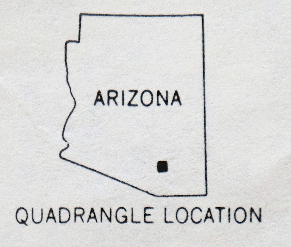
| STATE | Arizona |
| LOCATION | Vicinity of Tucson |
| SERIES | 15-minute |
| SURVEYED | 1953 through 1957 Aerial and Field Survey |
| EDITION | 1957 |
| PRINTED | 1967 |
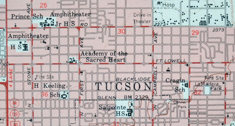
| PRINT NOTES | Thick paper stock, includes woodland tint (green to indicate vegetated areas). A reddish tint is used to indicate urban areas where only landmark buildings are shown. |
| SCALE | 1:62500 |
| CONTOUR INTERVAL | 80 feet |
| SHEET DIMENSIONS | 17 7/8 x 21 7/8 inches |
| MAP DIMENSIONS | 14 3/4 x 17 1/2 inches |
| COVERAGE AREA | 15 x 17 miles |
| SOURCE | From the vintage map collection of Art Christiansen, Tempe, Arizona |
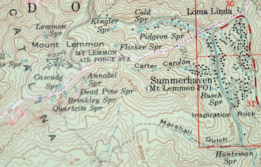
| MAP NOTES | An interesting historical snapshot of the northern Tucson area and the Catalina Mountains, surveyed in the 1950s when the foothills were still primarily dirt roads and ranches and Oro Valley was all open desert. |
| SHEET CONDITION For maps of this vintage, effort is made to note all visible flaws, no matter how minor. | |
| OVERALL CONDITION | Excellent |
| SHEET NOTES | very lightly handled, never folded, smooth and flat |
| MAP AREA | flawless map area |
| COLLARS | no wear or tears, no markings, no blemishes |
| MAP COVERAGE Quadrangle extent overlaid on current basemap. | |
| PLACENAMES Depending on map series and survey date, all of the features listed below may not be shown on this map. This list contains features that currently exist or historically existed within the area covered by the map. The list can be used as a reference to determine if this map covers your area of interest. Placenames are listed alphabetically next to each feature type. | |
| CITIES AND TOWNS (CURRENT) | Casas Adobes, Catalina, Catalina Foothills, Flowing Wells, Oro Valley, Tanque Verde, Tortolita, and Tucson |
| COUNTIES COVERED | Pima |
| FEDERAL LAND UNITS | Coronado National Forest and Pusch Ridge Wilderness |
| RIVERS AND STREAMS | Batamote Wash, Big Wash, Chalk Creek, Esperero Wash, Pantano Wash, Pima Wash, Rillito River, Sabino Creek, Santa Cruz River, Sausaulito Creek, Sutherland Wash, Tanque Verde Wash, and Ventana Canyon Wash |
| WATER BODIES | Twin Lakes |
| Locations: Amphi Plaza, Bel Air Plaza Shopping Center, Campbell Plaza Shopping Center, Casa Adobes Shopping Plaza, Casa Blanca Plaza Shopping Center, Catalina Camp, Christopher City University of Arizona, Cliff Valley Golf Course, Colonia Verde Shopping Center, Decorator Square Shopping Center, Del Norte Shopping Center, El Conquistador Golf Course, Estrada de Aro Shopping Center, Flowing Wells Plaza Shopping Center, Fort Lowell Shopping Center, Gaslight Square Shopping Center, Grant Park Shopping Center, Grantstone Shopping Center, Inspiration Rock Picnic Area, Lemmon Rock Lookout, Mount Lemmon Ski Valley, Northgate Shopping Center, Oracle Ridge Plaza Shopping Center, Oro Valley Country Club Golf Course, Plaza Escondia Shopping Center, Plaza del Oro, Prince Mall, Rams Shopping Center, San Juan Plaza Shopping Center, Skyline Country Club, Steam Pump Ranch, Stone House, Sunnyslope Terrace Plaza Shopping Center, Tanque Verde Shopping Center, Tucson Mall, University of Arizona Farm, and Woodland Plaza Shopping Center. Areas: Wilderness of Rocks. Mountains, Peaks, and Summits: Bighorn Mountain, Buster Mountain, Mount Kimball, Mount Lemmon, Marshall Peak, Mount Miguel, Mule Ears, Pusch Peak, Rattlesnake Peak, Saddleback, Samaniego Peak, Table Mountain, Thimble Peak, and Whaleback. Arroyos and Washes: Sahuarita Wash. Valleys and Canyons: Alamo Canyon, Alamo Canyon Number One, Bird Canyon, Bear Canyon, Box Camp Canyon, Box Canyon, Breakfast Canyon, Cargodera Canyon, Carter Canyon, Catchment canyon, Dead Horse Canyon, East Fork Canada del Oro, East Fork Sabino Canyon, Esperero Canyon, Finger Rock Canyon, Honey Bee Canyon, Lemmon Canyon, Marshall Gulch, Montrose Canyon, Palisade Canyon, Pima Canyon, Pine Canyon, Pontatoc Canyon, Rattlesnake Canyon, Romero Canyon, Sabino Canyon, Ventana Canyon, and West Fork Sabino Canyon. Parks: Cactus Picnic Area, Catalina State Park, Conner Park, Dennis Weaver Park, Fort Lowell Park, Jacinto Park, Jacobs Park, LaMadera Park, Loma Linda Campground, Lower Bear Picnic Area, Marshall Gulch Picnic Area, McCormick Park, McDonald Park, Mitchell Park, Navajo Park, Overlook Picnic Area, Pusch Ridge Wilderness, Rillito Park and Racetrack, Sabino Visitor Center Picnic Area, Santa Catalina Natural Area, and Wetmore Park. Trails: Bear Canyon Trail Twenty-Nine, Canada del Oro Four, Cargodera Canyon Six Trail, Sabino-Palisade Trail Twenty-Three, Samaniego Ridge Seven, and Ventura Esperero Trail Twenty-five. Drainages: Big Wash, Chalk Creek, Esperero Wash, Lemmon Creek, Pantano Wash, Pima Wash, Sabino Creek, Sausaulito Creek, Sutherland Wash, Tanque Verde Wash, Twentyseven Wash, and Ventana Canyon Wash. Mines: Hartman Homestake Mines and Pontatoc Mine. Churches: Immaculate Heart Novitiate. Hospitals: Tucson General Hospital and Tucson Medical Center. Lakes and Ponds: Twin Lakes. Buildings: Arizona Youth Center, Petrie Railroad Station, and Sabino Visitor Center. Crossings: Grant Road Interchange. Bluffs: McFall Crags, Prominent Point, and Rosewood Point. Gaps: Marshall Saddle, Pima Saddle, and Romero Pass. Natural Arches: Elephant Trunk. Airports: Brave Bull Ranch Resort Airport, Fenster School Airport, Horizon Heliport, La Paloma Heliport, Medical Center Heliport, Tankersley Residence Heliport, and Tucson Medical Center Heliport. Schools: Academy of the Sacred Heart, Amphitheater High School, Amphitheater Junior High School, Arizona Desert School, Canyon del Oro High School, Catalina Foothills School, Catalina Junior High School, Collier School, Coronado School, Cragin School, Cross Junior High School, Davidson School, Emily Gray Junior High School, Fenster School, Flowing Wells High School, H Keeling School, Holaway School, Iola Frans School, Jacob C Fruchthendler Elementary School, Nash School, Orange Grove Junior High School, Prince School, Sabino High School, Sabino Junior High, Salponite High School, Southern Arizona School for Boys, Suffolk Hills School, Sunrise Drive School, Tucson Community School, Valley School for Girls, Walter Douglas School, Wetmore School, Whitmore School, and Winifred Harelson Elementary School. Ridges: Baby Jesus Ridge, Pontatoc Ridge, Pusch Ridge, Radio Ridge, Red Ridge, Reef of Rock, Samaniego Ridge, and Sutherland Ridge. Reservoirs and Tanks: Cement Dam Tank, Cottonwood Tank, Flying V Tank, Paja Verde Tank, and Sabino Lake. Flats: Geronimo Meadow and Lemmon Park. Towers: KCNA, KCUB-AM (Tucson), KCUB-FM (Tuscon), KHYT-AM (South Tucson), KIKX-AM (Tucson), KSAZ-AM (Tucson), KVOI-AM (Tucson), and KWFM-FM (Tucson). Pillars: Cathedral Rock, Finger Rock, Inspiration Rock, and Window Rock. Springs: Annabel Spring, Apache Spring, Barrel Spring, Bill Williams Spring, Box Spring, Brinkley Spring, Busch Spring, Buster Spring, Cargodera Spring, Cascade Spring, Cold Spring, Dead Pine Spring, Finger Rock Spring, Flicker Spring, Gibbon Springs, Huntsman Spring, Iron Spring, Kinglet Spring, Lemmon Spring, Mormon Spring, Pidgeon Spring, Pima Spring, Quartzite Spring, Samaniego Spring, Shovel Spring, Walnut Spring, Wild Cow Spring, and Wooden Trough Spring. | |
| SHIPPING AND RETURNS | |
 This map sheet will be carefully rolled in a sturdy tube and shipped via the US Postal Service. If you find that the sheet you receive is not as described in the listing, you may ship it back to us for a refund of the purchase price. | |
Mount Lemmon Arizona Tucson Casas Adobes USGS Topo Map 1967
$62
This USGS 15-minute topographic map is a 1957 edition, printed in 1967, and the sheet is in excellent condition: very lightly handled, never folded, smooth and flat on thick stock. Covering a stretch of Pima County in the vicinity of Tucson, its boundaries take in the Santa Catalina foothills and parts of the Coronado National Forest and Pusch Ridge Wilderness, with the quad area reaching from the northern edge of Tucson toward Catalina and Oro Valley. Surveyed in the 1950s, it records the northern Tucson area when the foothills were still mostly dirt roads and ranches and Oro Valley was open desert. It comes from the vintage map collection of Art Christiansen of Tempe, Arizona.
In stock
This vintage sheet is a 1957 edition of the Mount Lemmon Arizona USGS topographic map. It is an original 59-year-old 1967 United States Geological Survey print in excellent condition.
HOW THIS MAP CAN BE USED
In addition to making a fascinating conversation piece, this sheet would look great in a frame or on display, make a unique and prized gift for anyone interested in this area, be perfect as a reference for genealogy studies or general historical research, or fill that missing piece in your collection. Maps of this vintage are printed on durable stock and are well-suited for outdoor activities and recreation of all kinds, including hiking, backpacking, hunting, rafting and kayaking, backcountry skiing, geocaching, general exploration, treasure hunting, etc.
FEATURES SHOWN ON THE MAP
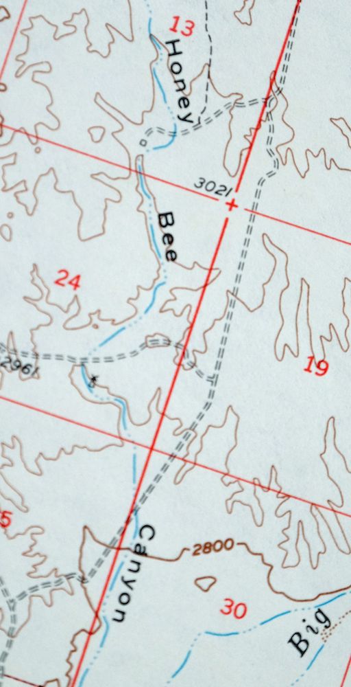
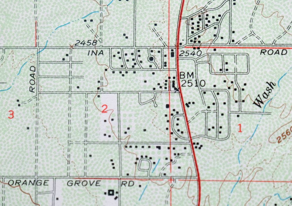
The Mount Lemmon 15-minute map shows cities and towns, roads, railroads, utilities and energy infrastructure, rivers, creeks, elevation contour lines, public land survey lines, county, state, and other administrative boundaries as they existed at the time of the survey in 1953 through 1957. A reddish tint is used on this sheet to indicate urban areas where only landmark buildings are depicted. Outside of those areas, all known structures (houses, businesses, churches, schools, barns, cabins, etc) are shown.
A VALUABLE HISTORICAL RECORD
Maps from the 15-minute series for the continental United States are no longer produced or printed by the USGS and original prints are becoming increasingly difficult to find. They are a valuable historical record for an area, as they contain many placenames and features that have been dropped from more recent maps.
Nearby maps
-
Cortaro Arizona Tucson Oro Valley USGS Topographic Map 1947
$58 Add to cart -

Tucson Arizona Davis-Monthan Tanque Verde USGS Topo Map 1963
$58 Add to cart -
Oracle Arizona Catalina USGS 15-Min Topo Map 1964 Vintage
$41 Add to cart -

Tortolita Mountains Arizona USGS 15-Min Topographic Map 1964
$38 Add to cart -
San Xavier Mission Arizona Tucson USGS Topo Map 1961 Vintage
$52 Add to cart -
Red Rock Arizona Picacho Peak Marana USGS Topo Map 1965
$46 Add to cart -
Winkelman Arizona Dudleyville Hayden USGS Topo Map 1966
$43 Add to cart -
Empire Mountains Arizona Vail Pantano USGS Topo Map 1961
$47 Add to cart -

Winchester Mountains Arizona The Mesas USGS Topo Map 1962
$35 Add to cart -
Vaca Hills Arizona Papago USGS Topographic Map 1965 Vintage
$32 Add to cart -

Klondyke Arizona USGS 15-Min Topographic Map 1971 Vintage
$44 Add to cart -
Benson Arizona Coronado NF St. David USGS Topo Map 1962
$38 Add to cart -
Christmas Arizona USGS 15-Min Topographic Map 1917 Antique
$57 Add to cart -

Elgin Arizona Patagonia Sonoita USGS Topo Map 1971 Vintage
$52 Add to cart -
Signal Peak Arizona Casa Grande Eloy USGS Topo Map 1960
$45 Add to cart -
Baboquivari Peak Arizona USGS 15-Min Topo Map 1967 Vintage
$48 Add to cart -
Cochise Arizona Willcox USGS 15-Min Topo Map 1963 Vintage
$43 Add to cart -
Casa Grande Arizona Stanfield Bon USGS Topographic Map 1959
$44 Add to cart -

Sacaton Arizona Gilbert Coolidge USGS Topographic Map 1948
$45 Add to cart -
Tombstone Arizona Sierra Vista USGS Topo Map 1959 Vintage
$56 Add to cart -
Presumido Peak Arizona USGS 15-Min Topo Map 1960 Vintage
$48 Add to cart -
Sells Arizona Topawa Cowlic USGS 15-Min Topographic Map 1948
$45 Add to cart -
Tucson North Arizona Casas Adobes USGS Topo Map 1977 Vintage
$46 Add to cart -

Marana Arizona Picture Rocks Rillito USGS Topo Map 1976
$37 Add to cart
