MAP DETAILS | |
|---|---|
| TITLE | Olean |
| STATE | New York |
| SURVEYED | 1896 Field Survey |
| GEOGRAPHER | H.M. Wilson |
| ENGRAVED | 1898 |
| PRINT NOTES | Thick paper stock |
| SCALE | 1:62500 |
| CONTOUR INTERVAL | 20 feet |
| SHEET DIMENSIONS | 16 1/2 x 20 inches |
| MAP DIMENSIONS | 13 x 17 1/2 inches |
| COVERAGE AREA | 13 x 17 miles |
| SOURCE | From an uncommonly well-preserved collection |
| SHEET CONDITION For maps of this vintage, effort is made to note all visible flaws, no matter how minor. | |
| SHEET NOTES | very lightly handled, never folded, smooth and flat |
| MAP AREA | flawless map area |
| COLLARS | no wear or tears, no markings, hole punches along left collar |
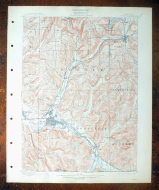
| MAP COVERAGE Quadrangle extent overlaid on current basemap. | |
| BACKSIDE LEGEND | |
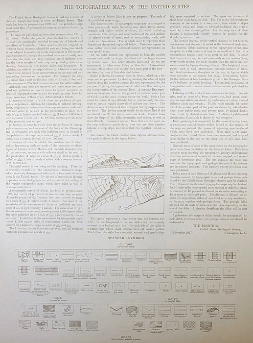 A map summary is printed on the back side of the Olean sheet similar to the one shown in the picture. It outlines the history, purpose, and status of the USGS mapping program at the time of the printing in 1909. It also provides instructions on how to read contour lines and a description of how they are used to depict the terrain. At the bottom of the page is a legend showing all of the symbols used to represent the cultural, relief, and water features found on the map. | |
| PLACENAMES Depending on map series and survey date, all of the features listed below may not be shown on this map. This list contains features that currently exist or historically existed within the area covered by the map. The list can be used as a reference to determine if this map covers your area of interest. Placenames are listed alphabetically next to each feature type. | |
| NOTABLE PLACES | Cuba, Portville, and Allegany River |
| CITIES AND TOWNS (CURRENT) | Allegany, Olean, Saint Bonaventure, St. Bonaventure, and Weston Mills |
| COUNTIES COVERED | Allegany and Cattaraugus |
| FEDERAL LAND UNITS | Oil Springs Indian Reservation |
| RIVERS AND STREAMS | Allegheny River, Butternut Brook, Coon Branch, Cuba Lake Outlet, Deer Creek, Dodge Creek, Fivemile Creek, Fourmile Creek, Griffin Creek, Gull Brook, Haskell Creek, Indian Creek, Johnson Creek, Johnsons Creek, Kings Brook, Lillibridge Creek, North Branch Indian Creek, Olean Creek, Oswayo Creek, Scott Branch, Tannery Creek, Twomile Creek, Wayman Branch, West Branch Creek, Wolf Creek, Wolf Run, and Wrights Creek |
| WATER BODIES | Cuba Lake, Stephens Lake, Van Der Linden Pond, and Vee Pond |
| Locations: Barlett Country Club, North Olean Yards, Olean Raceway, Olean Rod and Gun Club, South Olean Yards, and Wolf Creek Camp. Administrative Boundaries: Town of Cuba, Town of Hinsdale, Town of Ischua, Oil Springs Reservation, City of Olean, Town of Olean, and Town of Portville. Reserves: Oil Spring Indian Reservation. Mountains, Peaks, and Summits: Burt Hill, Camel Back, Bozard Hill, Cuba Hill, Mount Herman, Dutch Hill, Flatiron Rock, Hartzfelt Mountain, Homer Hill, Keller Hill, Maple Hill, Old Baldy, Paul Wise Hill, Reservation Hill, Typnahda Mountain, and Union Hill. Valleys and Canyons: Bear Valley, Blakesly Hollow, Bucher Hollow, Cherry Valley, Coon Hollow, Doget Hollow, Farwell Hollow, Fay Hollow, Geiger Hollow, Gleason Hollow, Godfrey Hollow, Hannigan Hollow, Johnson Hollow, Keim Hollow, Lippert Hollow, Mc Cann Hollow, McClure Hollow, Narvoo Hollow, Savage Hollow, Smith Hollow, and Union Valley. Parks: Bradher Ball Park, Forness Park, Franchot Field, Gargoyle Park, Oak Hill Park, Rock City Park, and War Veterans Park. Drainages: Butternut Brook, Bells Brook, Coon Branch, Cuba Lake Outlet, Deer Creek, Dodge Creek, Fourmile Creek, Griffin Creek, Gull Brook, Haskell Creek, Honey Brook, Ischua Creek, Johnsons Creek, Kings Brook, Lillibridge Creek, Oil Creek, Olean Creek, Oswayo Creek, Scott Branch, Tannery Creek, Twomile Creek, Wayman Branch, West Branch Creek, West Branch Fourmile Creek, Wolf Creek, and Wolf Run. Churches: Union Valley Church. Hospitals: Cuba Memorial Hospital and Saint Francis Hospital. Lakes and Ponds: Egstrom Pond, Millers Pond, Stephens Lake, Van Der Linden Pond, and Vee Pond. Buildings: Cuba Circulating Library. Bends: Horseshoe Bend. Airports: Cattaraugus County-Olean Airport, Cuba Memorial Hospital Heliport, Giermek Executive Airport, and Reiss Game Farm Airport. Schools: Bishop Walsh High School, Central High School, Cuba Elementary School, Cuba-Rushford Central School, Saint Bonaventure University, Saint Johns School, Saint Josephs School, Saint Marys Academy, School Number 1, School Number 10, School Number 11, School Number 2, School Number 4, School Number 5, School Number 7, and School Number 9. Ridges: Moore Ridge and Portville Ridge. Reservoirs and Tanks: Cuba Lake. Towers: WHDL-AM (Olean), WMNS-AM (Olean), WMXO-FM (Olean), WPIG-FM (Olean), and WSBU-FM (Saint Bonaventure). Springs: Seneca Oil Spring. | |
| SHIPPING AND RETURNS | |
 Ships carefully rolled in a sturdy 3" x 18" mailing tube. Shipping and return details are in our terms. | |
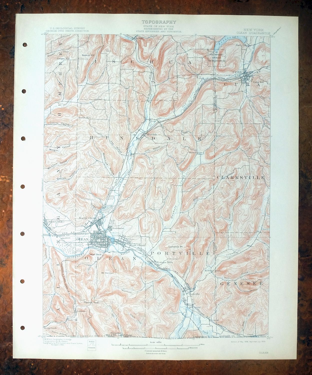
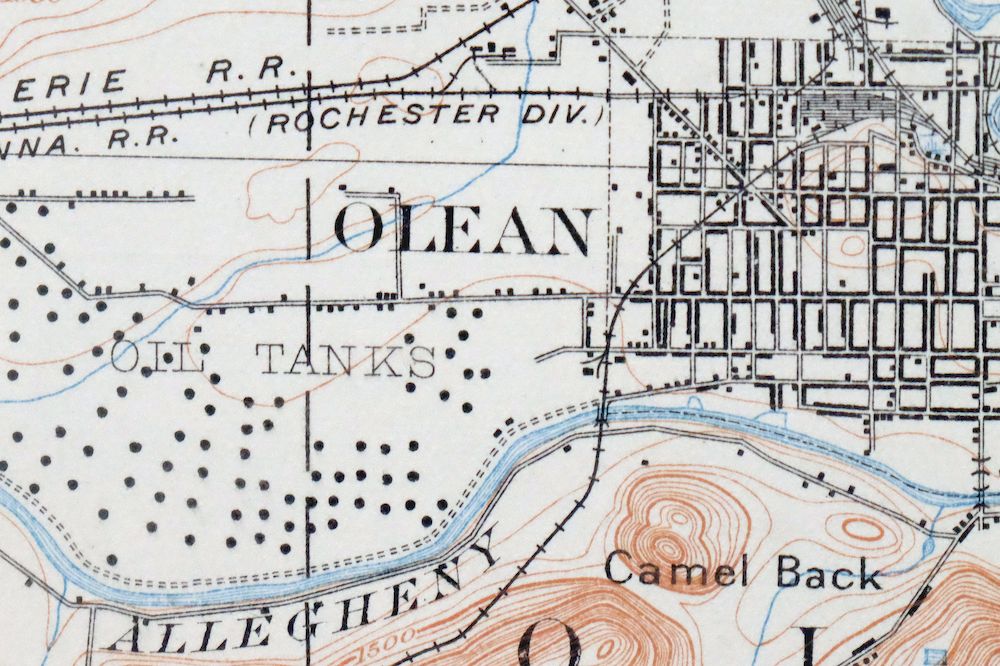
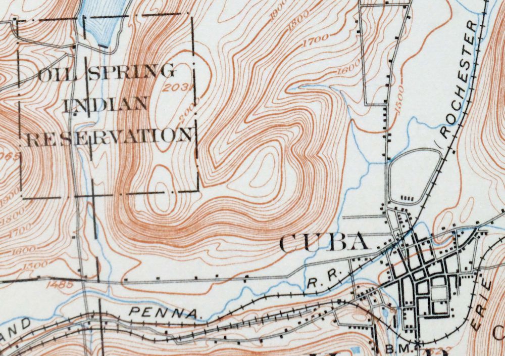
Olean, New York 1898 USGS Topo Map: Cuba (15-minute Series)
$66
A fascinating historical snapshot surveyed before the modern highway system, showing historic travel routes, rail lines, placenames, and all structures known at the time.
- 60 miles southeast of Buffalo.
- 15-minute series, 1898 edition, printed in 1909.
- Excellent condition, never folded.
In stock
This antique sheet is an 1898 edition of the Olean New York USGS topographic map. It is an authentic 117-year-old 1909 United States Geological Survey print in excellent condition.
HOW THIS MAP CAN BE USED
In addition to making a fascinating conversation piece, this sheet would look great in a frame or on display, make a unique and prized gift for anyone interested in this area, be perfect as a reference for genealogy studies or general historical research, or fill that missing piece in your collection.
FEATURES SHOWN ON THE MAP
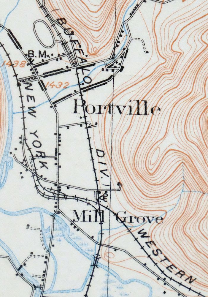
The Olean 15-minute map shows cities and towns, roads, railroads, rivers, creeks, elevation contour lines, public land survey lines, county, state, and other administrative boundaries as they existed at the time of the survey in 1896. All known structures (houses, businesses, churches, schools, barns, cabins, etc) are also shown, with exceptions in some urban areas, where only landmark buildings may be shown.
A VALUABLE HISTORICAL RECORD
Maps from the 15-minute series for the continental United States are no longer produced or printed by the USGS and original prints are becoming increasingly difficult to find. They are a valuable historical record for an area, as they contain many placenames and features that have been dropped from more recent maps.
Nearby maps
-
Smethport, PA/NY 1933 USGS Topo Map (1960 Print)
$37 Add to cart -

Coudersport, PA/NY 1934 USGS Topo Map (1966 Print)
$27 Add to cart -
Canaseraga, Alfred, New York 1916 USGS Topo Map
$67 Add to cart -
Kinzua, PA/NY 1949 USGS Topo Map (1967 Print)
$38 Add to cart -

Crosby, Norwich, Pennsylvania 1948 USGS Topo Map
$30 Add to cart -
Portage, Warsaw, New York 1905 USGS Topo Map (Rare Print)
$87 Add to cart -
Mount Jewett, Pennsylvania 1935 USGS Topo Map (1965 Print)
$35 Add to cart -
Jamestown, Falconer, New York 1905 USGS Topo Map
$71 Add to cart -
Nunda, New York 1905 USGS Topo Map: Mount Morris
$77 Add to cart -

Conrad, Pennsylvania 1947 USGS Topo Map
$29 Add to cart -
Wayland, Hemlock Lake, New York 1904 USGS Topo Map
$77 Add to cart -
1905 USGS Topo Map: Attica, Alden, New York
$70 Add to cart -
Batavia, Le Roy, New York 1904 USGS Topo Map (Antique Print)
$67 Add to cart -
Depew, Cheektowaga, New York 1905 USGS Topo Map (Rare Print)
$61 Add to cart -

Driftwood, Sinnamahoning, Pennsylvania 1945 USGS Topo Map
$27 Add to cart -

Bath, Avoca, New York 1910 USGS Topo Map (Antique Print)
$62 Add to cart -

Elkland, Wellsboro, Pennsylvania/New York 1903 USGS Topo Map
$65 Add to cart -
Elkland, PA/NY 1900 USGS Topo Map (1944 Print)
$42 Add to cart -
Caledonia, Geneseo, New York 1904 USGS Topo Map
$63 Add to cart -
Renovo West, Pennsylvania 1946 USGS Topo Map (1965 Print)
$33 Add to cart -
Naples, New York 1903 USGS Topo Map
$77 Add to cart -
Clymer, Mayville, New York 1905 USGS Topo Map
$70 Add to cart -
Westfield, New York 1899 USGS Topo Map: Mayville
$60 Add to cart -

Tioga, Pennsylvania/New York 1903 USGS Topo Map: Mansfield
$64 Add to cart