MAP DETAILS | |
|---|---|
| TITLE | Elkland |
| STATE | Pennsylvania, New York |
| LOCATION | 35 miles southwest of Elmira, NY |
| SERIES | 15-minute |
| SURVEYED | 1899 Field Survey |
| GEOGRAPHER | H.M. Wilson |
| EDITION | 1900 |
| PRINTED | 1944 |
| PRINT NOTES | Thick paper stock |
| SCALE | 1:62500 |
| CONTOUR INTERVAL | 20 feet |
| SHEET DIMENSIONS | 17 x 21 inches |
| MAP DIMENSIONS | 13 x 17 1/2 inches |
| COVERAGE AREA | 13 x 17 miles |
| SHEET CONDITION For maps of this vintage, effort is made to note all visible flaws, no matter how minor. | |
| OVERALL CONDITION | Very Good |
| SHEET NOTES | lightly handled, never folded |
| MAP AREA | flawless map area |
| COLLARS | no markings, very minor blemishes, edge protectors applied, no edge tears, library stamp in center right collar |
| MAP COVERAGE Quadrangle extent overlaid on current basemap. | |
| BACKSIDE LEGEND | |
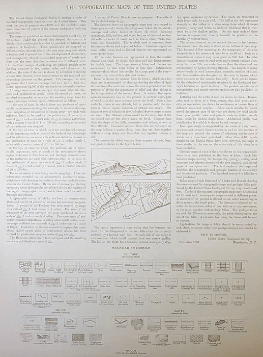 A map summary is printed on the back side of the Elkland sheet similar to the one shown in the picture. It outlines the history, purpose, and status of the USGS mapping program at the time of the printing in 1944. It also provides instructions on how to read contour lines and a description of how they are used to depict the terrain. At the bottom of the page is a legend showing all of the symbols used to represent the cultural, relief, and water features found on the map. | |
| PLACENAMES Depending on map series and survey date, all of the features listed below may not be shown on this map. This list contains features that currently exist or historically existed within the area covered by the map. The list can be used as a reference to determine if this map covers your area of interest. Placenames are listed alphabetically next to each feature type. | |
| NOTABLE PLACES | Wellsboro, Knoxville, and Middlebury Center |
| CITIES AND TOWNS (CURRENT) | Elkland and Keeneyville |
| COUNTIES COVERED | Steuben and Tioga |
| RIVERS AND STREAMS | Baker Branch, Baldwin Run, Bill Hess Creek, Boatman Brook, Bulkley Brook, Bulkley Creek, Camp Brook, Canada Run, Carpenter Run, Charleston Creek, Cowanesque River, Crooked Creek, Crotch Run, Cummings Creek, Dantz Run, East Branch Canada Run, Elkhorn Creek, Heise Run, Holden Creek, Horse Run, Jemison Creek, Left Asaph Run, Left Straight Run, Losey Creek, Marsh Creek, Mill Run, Morris Branch, Norris Brook, North Run, Redhouse Run, Right Asaph Run, Right Straight Run, Smith Run, South Brook Troups Creek, Straight Run, Thornbottom Creek, Troups Creek, Windfall Brook, Wolf Run, and Yarnell Brook |
| WATER BODIES | Black Ash Swamp |
| Pennsylvania Locations: Academy Corners, Ansonia Station, East Chatham, Karls Corners, and Odle Corners. Areas: Black Ash Swamp Natural Area. Administrative Boundaries: Township of Charleston, Township of Chatham, Township of Deerfield, Borough of Elkland, Township of Elkland, Borough of Knoxville, Township of Middlebury, Township of Osceola, and Township of Oswceola. Mountains, Peaks, and Summits: Barlow Hill, Barney Hill, Big Rocks, Briar Hill, Cobble Knoll, Fork Hill, Mutton Hill, Mount Nesmuk, Oak Point, Roundtop, South Hill, and Windfall Hill. Valleys and Canyons: Carpenter Hollow, Abbott Hollow, Big Tree Hollow, Biscuit Hollow, Button Hollow, Catlin Hollow, Compound Hollow, Confer Sag, Croft Hollow, Daggett Hollow, Daly Hollow, Frying Pan Hollow, Fuller Hollow, Gee Hollow, Goodall Hollow, Gray Hollow, Hibard Hollow, Hoadley Hollow, Hornby Hollow, Keck Hollow, Keeney Hollow, Kinney Hollow, Moffit Hollow, Monks Hollow, Niles Hollow, Oil Well Hollow, Osgood Hollow, Parker Hollow, Rattlesnake Hollow, Roe Hollow, Root Hollow, Rose Valley, Schanbacher Hollow, Schoolhouse Hollow, Scotch Pine Hollow, Skinner Hollow, Spike Buck Hollow, Spoor Hollow, Sweet Hollow, Walker Hollow, Wedge Hollow, Wheaton Hollow, Whitehouse Hollow, Wildcat Hollow, Wood Hollow, and Woodruff Hollow. Parks: Asaph Run Picnic Area. Trails: Carpenter Trail, Bark Slide Trail, Bee Trail, Broad Ridge Trail, Broken Axe Trail, Cass Trail, Cross Trail, Darling Road Trail, Deer Trail, Dry Hollow Trail, Forks Trail, Harrigton Trail, Hemlock Flats Trail, Horse Lane Trail, Jim Close Trail, Kinney Hollow Trail, Kinney Trail, Left Frying Pan Trail, Left Strait Run Trail, Log Slide Trail, Lost Trail, Mathers Run Trail, Matson Trail, Middle Ridge Trail, Niles Trail, Oak Ridge Trail, Old Supply Trail, Reese Trail, Roe Trail, Root Trail, Schanbacher Trail, School House Trail, Scotch Pine Hollow Trail, Smith Run Trail, Stone Road Trail, Water Trough Trail, and Woodruff Trail. Drainages: Carpenter Run, Asaph Run, Baker Branch, Baldwin Run, Bear Wallow Branch, Blair Creek, Boatman Brook, Bulkley Brook, Bulkley Creek, Camp Brook, Canada Run, Charleston Creek, Christie Run, Crotch Run, Dantz Run, Deer Lick Run, East Branch Canada Run, Gulf Run, Heise Run, Hemlock Flats Run, Holden Creek, Horse Run, Horse Thief Run, Jemison Creek, Kelsey Creek, Left Asaph Run, Left Straight Run, Losey Creek, Morris Branch, Norris Brook, Redhouse Run, Rice Branch, Right Asaph Run, Right Straight Run, Roberts Branch, Sand Run, Sanders Creek, Smith Run, South Brook Troups Creek, Straight Run, Thornbottom Creek, Troups Creek, Windfall Brook, Wolf Run, and Yarnell Brook. Churches: Butler Hill Church, Catlin Hollow Church, Farmington Church, and Jemison Valley Church. Lakes and Ponds: Lake Lard. Basins: Bear Wallow. Airports: Baker Airport and Sharretts Airport. Swamps: Black Ash Swamp and Cranberry Swamp. Schools: Marsh Creek School. Ridges: Broad Ridge, Middle Ridge, and Oak Ridge. Reservoirs and Tanks: Knoxville Reservoir. Towers: Goodall Fire Tower. Springs: Log Cabin Spring. | |
| New York Valleys and Canyons: Biscuit Hollow, Cook Hollow, and Red House Hollow. Drainages: Bulkley Brook, Camp Brook, Holden Creek, and Troups Creek. | |
| SHIPPING AND RETURNS | |
 This map sheet will be carefully rolled in a sturdy tube and shipped via the US Postal Service. If you find that the sheet you receive is not as described in the listing, you may ship it back to us for a refund of the purchase price. | |
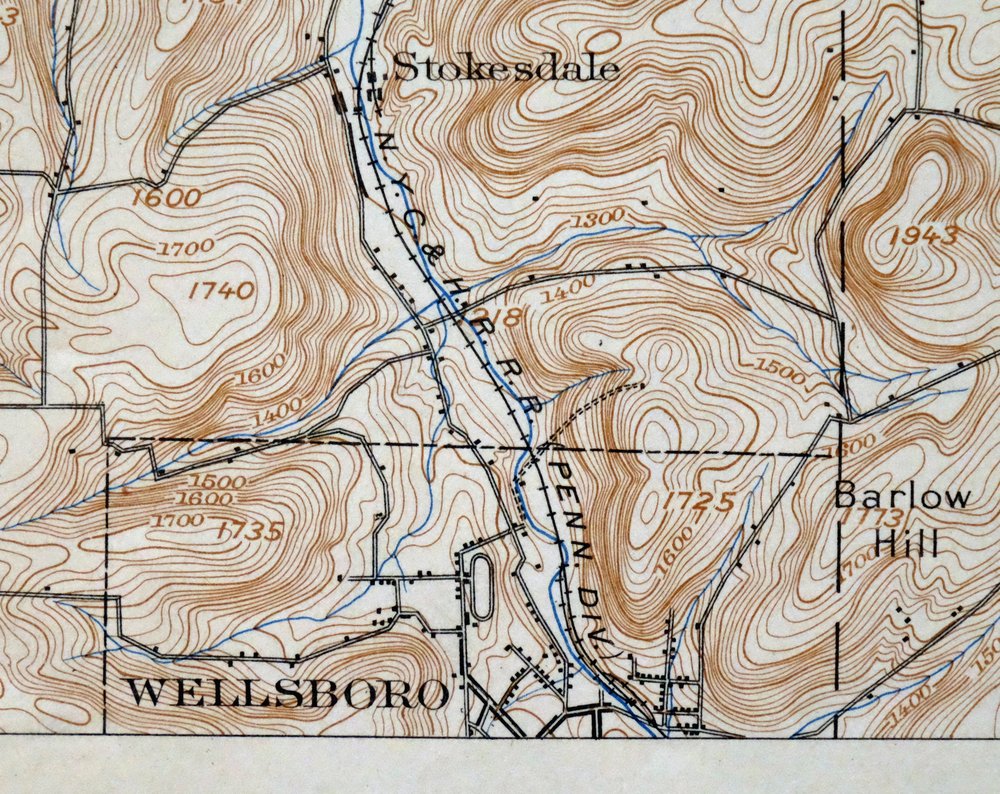
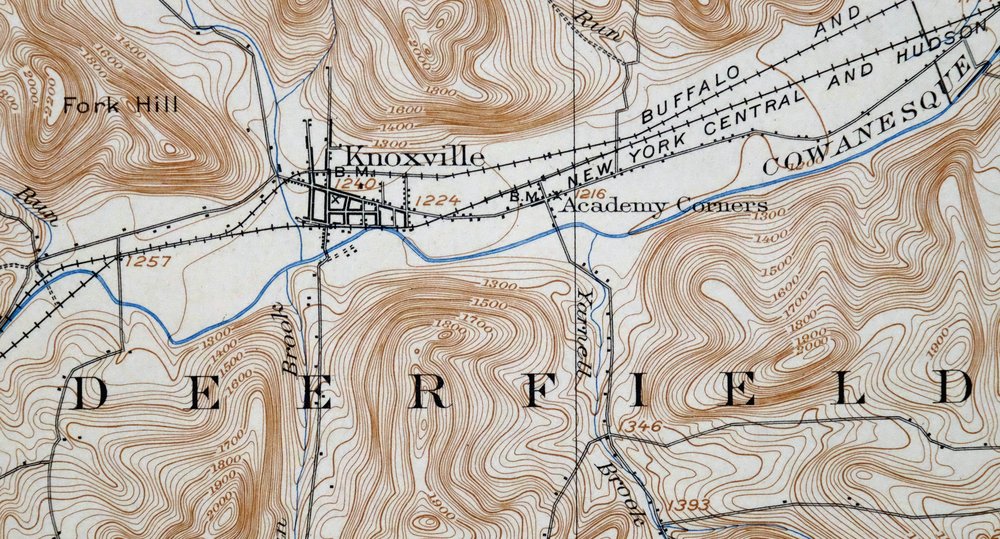
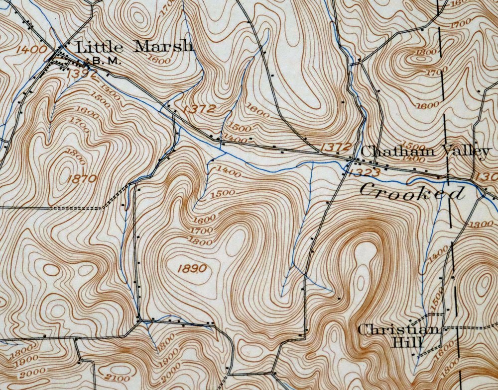
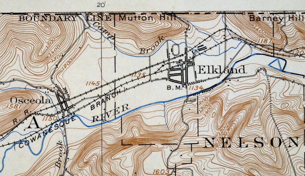
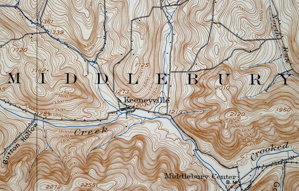
1944 Elkland Pennsylvania/New York USGS Topo Map: Wellsboro
$44
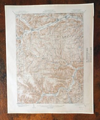
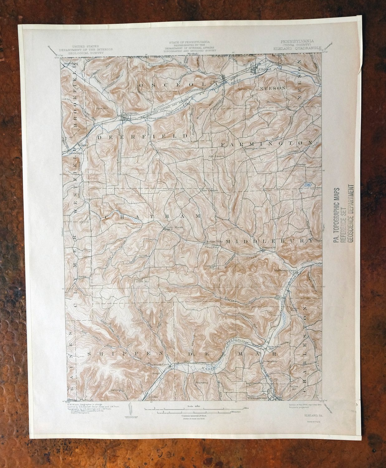
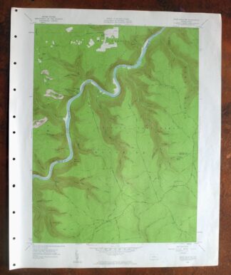
This is a 1900 edition of the Elkland quadrangle, a 15-minute USGS topographic map printed in 1944 on thick paper stock, based on an 1899 field survey by geographer H.M. Wilson. The sheet straddles the Pennsylvania–New York line in the hills of Tioga and Steuben counties, taking in the borough of Elkland along with Knoxville, Keeneyville, and the area around Middlebury Center, roughly 35 miles southwest of Elmira. The 20-foot contours trace the deep valleys of the Cowanesque River country, farmland and ridges drawn from a survey made at the close of the nineteenth century.
In stock
This vintage sheet is a 1900 edition of the Elkland Pennsylvania USGS topographic map. It is an original 82-year-old 1944 United States Geological Survey print in very good condition.
HOW THIS MAP CAN BE USED
In addition to making a fascinating conversation piece, this sheet would look great in a frame or on display, make a unique and prized gift for anyone interested in this area, be perfect as a reference for genealogy studies or general historical research, or fill that missing piece in your collection.
FEATURES SHOWN ON THE MAP
The Elkland 15-minute map shows cities and towns, roads, railroads, rivers, creeks, elevation contour lines, public land survey lines, county, state, and other administrative boundaries as they existed at the time of the survey in 1899. All known structures (houses, businesses, churches, schools, barns, cabins, etc) are also shown, with exceptions in some urban areas, where only landmark buildings may be shown.
A VALUABLE HISTORICAL RECORD
Maps from the 15-minute series for the continental United States are no longer produced or printed by the USGS and original prints are becoming increasingly difficult to find. They are a valuable historical record for an area, as they contain many placenames and features that have been dropped from more recent maps.
Nearby maps
-

Elkland Pennsylvania Wellsboro Knoxville USGS Topo Map 1903
$52 Add to cart -

Tioga Pennsylvania Mansfield USGS Topo Map 1903 Antique
$68 Add to cart -

Conrad Pennsylvania Hammersley Wild Area USGS Topo Map 1958
$34 Add to cart -
1965 Canton Pennsylvania USGS Topo Map: Granville Summit
$48 Add to cart -

Bath New York Avoca Cohocton USGS Topo Map 1910 Antique
$52 Add to cart -

Coudersport Pennsylvania Oswayo USGS Topographic Map 1966
$42 Add to cart -
Canaseraga New York Alfred USGS 15-Min Topo Map 1916 Antique
$85 Add to cart -
Warrensville Pennsylvania Barbours USGS Topographic Map 1962
$42 Add to cart -
Renovo West Pennsylvania Westport USGS Topographic Map 1965
$38 Add to cart -
Smethport Pennsylvania Eldred USGS Topographic Map 1960
$43 Add to cart -
Towanda Pennsylvania Rome USGS 15-Min Topo Map 1960 Vintage
$43 Add to cart -
Naples New York Cohocton Middlesex USGS Topographic Map 1908
$90 Add to cart -
Eagles Mere Pennsylvania Laporte USGS Topographic Map 1961
$36 Add to cart -

Driftwood Pennsylvania Sterling Run USGS Topo Map 1956
$39 Add to cart -
Wayland New York Dansville Cohocton USGS Topo Map 1907
$100 Add to cart -
Olean New York Saint Bonaventure Allegany USGS Topo Map 1909
$58 Add to cart -

Crosby Pennsylvania Norwich Rich Valley USGS Topo Map 1957
$35 Add to cart -
Ovid New York Seneca Lake Dundee USGS Topo Map 1909 Antique
$105 Add to cart -
Nunda New York Perry Mount Morris USGS Topo Map 1912 Antique
$98 Add to cart -
Le Raysville Pennsylvania Little Meadows USGS Topo Map 1965
$41 Add to cart -
Portage New York Perry Warsaw USGS Topo Map 1912 Antique
$105 Add to cart -

Hughesville Pennsylvania Millville Iola USGS Topo Map 1962
$42 Add to cart -
Mount Jewett Pennsylvania Wilcox USGS Topographic Map 1965
$40 Add to cart -
Snow Shoe NW Pennsylvania Sproul SF USGS Topo Map 1962
$32 Add to cart