MAP DETAILS | |
|---|---|
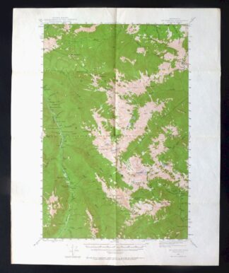
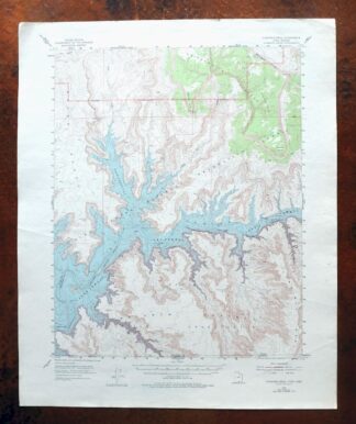
| TITLE | Panther Spring |
| STATE | California |
| LOCATION | 40 miles southeast of Redding |
| SERIES | 15-minute |
| SURVEYED | 1951 and 1953 Aerial and Field Survey |
| EDITION | 1953 |
| PRINTED | 1970 |
| SCALE | 1:62500 |
| CONTOUR INTERVAL | 80 feet |
| SHEET DIMENSIONS | 18 x 22 inches |
| MAP DIMENSIONS | 13 3/8 x 17 1/2 inches |
| COVERAGE AREA | 13 x 17 miles |
| SHEET CONDITION For maps of this vintage, effort is made to note all visible flaws, no matter how minor. | |
| OVERALL CONDITION | Very Good |
| SHEET NOTES | lightly handled, never folded |
| MAP AREA | no markings, no blemishes |
| COLLARS | no markings, no blemishes, no edge tears, minor storage wear at center left collar edge |
| MAP COVERAGE Quadrangle extent overlaid on current basemap. | |
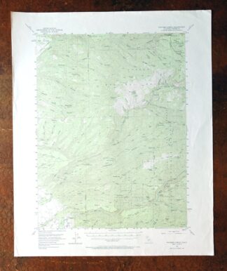
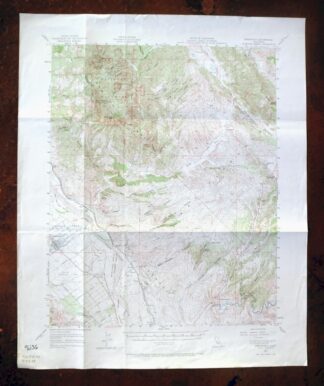
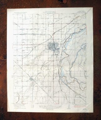
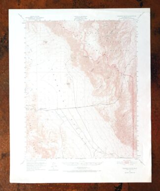
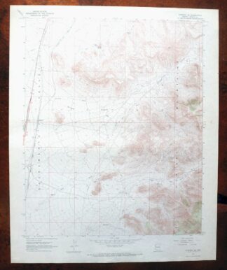
Panther Spring California USGS 15-Min Topo Map 1970 Vintage
$39
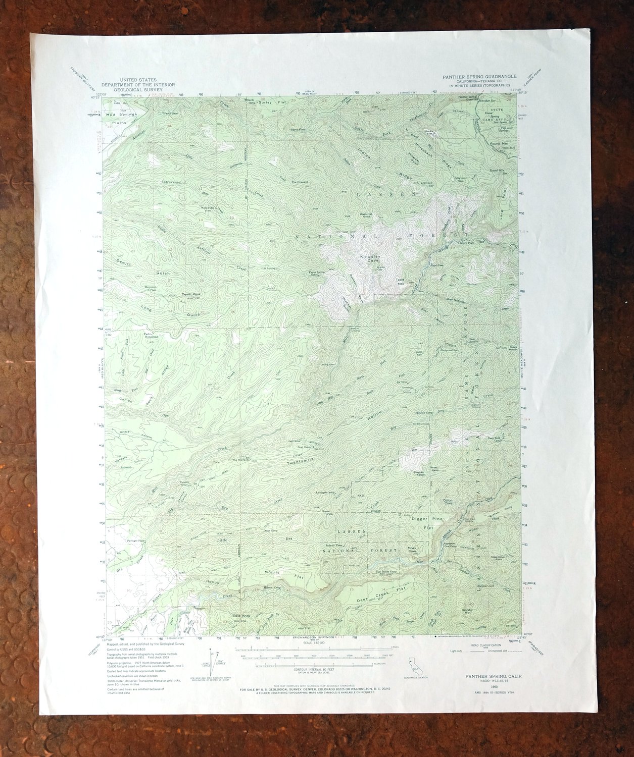
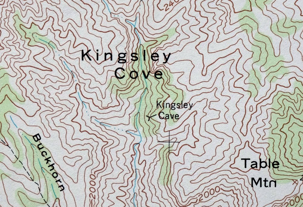
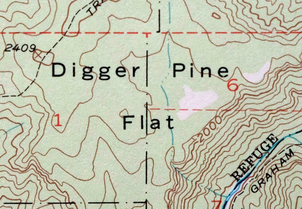
This USGS 15-minute topographic map is a 1953 edition printed in 1970, in very good condition on thick stock, lightly handled and never folded. Spanning terrain about 40 miles southeast of Redding in Tehama County, the quad takes in part of Lassen National Forest and the Ishi Wilderness, rugged backcountry with 80-foot contours marking the steep relief. This is undeveloped, roadless country in California’s southern Cascade foothills, the kind of high, broken terrain that gives the Ishi Wilderness its remote character. The collar shows only minor storage wear at the center left edge.
In stock
This vintage sheet is a 1953 edition of the Panther Spring California USGS topographic map. It is an original 56-year-old 1970 United States Geological Survey print in very good condition.
HOW THIS MAP CAN BE USED
In addition to making a fascinating conversation piece, this sheet would look great in a frame or on display, make a unique and prized gift for anyone interested in this area, be perfect as a reference for genealogy studies or general historical research, or fill that missing piece in your collection. Maps of this vintage are printed on durable stock and are well-suited for outdoor activities and recreation of all kinds, including hiking, backpacking, hunting, rafting and kayaking, backcountry skiing, geocaching, general exploration, treasure hunting, etc.
FEATURES SHOWN ON THE MAP
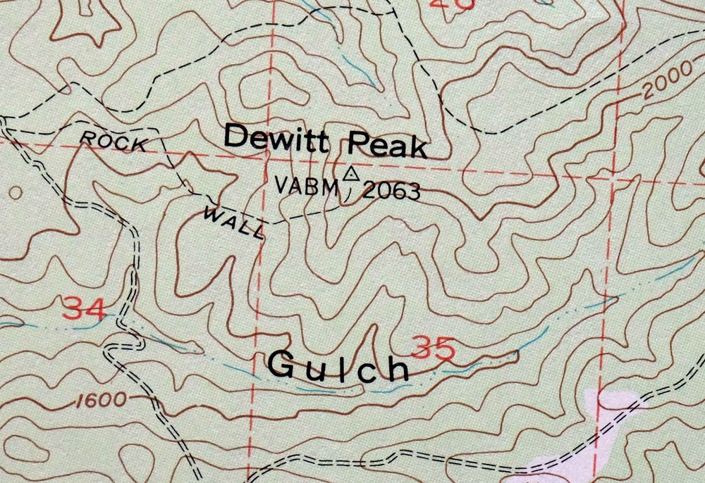
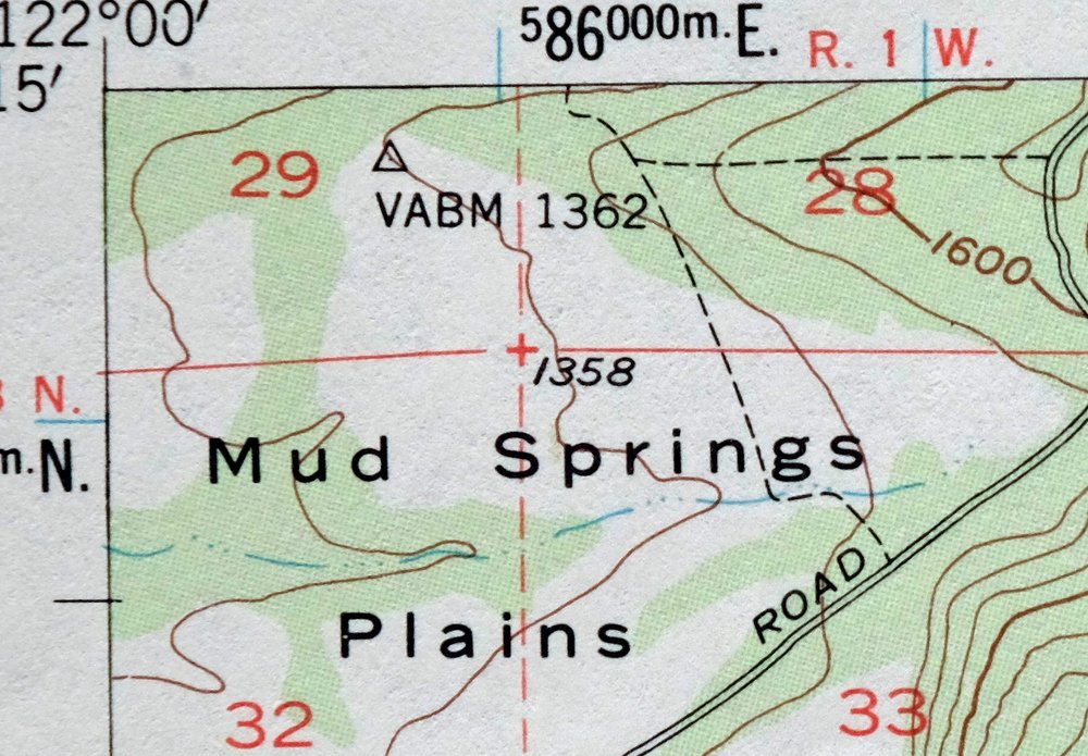
The Panther Spring 15-minute map shows cities and towns, roads, railroads, utilities and energy infrastructure, rivers, creeks, elevation contour lines, public land survey lines, county, state, and other administrative boundaries as they existed at the time of the survey in 1951 and 1953. All known structures (houses, businesses, churches, schools, barns, cabins, etc) are also shown.
A VALUABLE HISTORICAL RECORD
Maps from the 15-minute series for the continental United States are no longer produced or printed by the USGS and original prints are becoming increasingly difficult to find. They are a valuable historical record for an area, as they contain many placenames and features that have been dropped from more recent maps.
PLACENAMES
The following places are found within the boundary of this quadrangle. They may or may not be shown or labeled, depending on the map series and vintage.
* Counties Covered-> Tehama
* Federal Land Units-> Ishi Wilderness and Lassen National Forest
* Rivers and Streams-> Antelope Creek, Avery Creek, Big Dry Creek, Boat Gunwale Creek, Brush Creek, Cameron Creek, Campbell Creek, Deer Creek, Dry CreekDye Creek, and others
Nearby maps
-
San Francisco South California USGS 7.5-Min Topo Map 1975
$58 Add to cart -
Greenfield California Salinas River USGS Topo Map 1973
$30 Add to cart -
Sanger Del Ray Clotho California USGS 7.5-Min Topo Map 1923
$66 Add to cart -
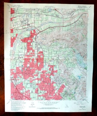
Panamint Butte California USGS 15-Min Topo Map 1967 Vintage
$39 Add to cart -
Yakima East Washington Moxee Parker USGS Topo Map 1985
$38 Add to cart -
Yakima East Washington Union Gap USGS Topographic Map 1968
$45 Add to cart -
Orange Anaheim California Vintage USGS Topographic Map 1970
$36 Add to cart -
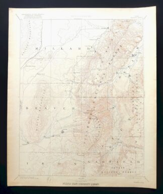
Beaver Utah Dixie NF Fishlake NF USGS Topo Map 1921 Antique
$105 Add to cart -
Kingman NW Arizona Golden Valley USGS Topo Map 1968 Vintage
$38 Add to cart -
Mount Angeles Washington Olympic NF USGS Topo Map 1964
$32 Add to cart -
Kingman SE Arizona Griffith USGS Topographic Map 1968
$40 Add to cart -
Notom Capitol Reef NP Utah USGS 15-Min Topo Map 1958 Vintage
$47 Add to cart -
Bright Angel Arizona Grand Canyon Tusayan USGS Topo Map 1912
$30 Add to cart -
Mount Shuksan Washington USGS 15-Min Topo Map 1957 Vintage
$37 Add to cart -
Cummings Mesa Utah USGS 15-Min Topographic Map 1978 Vintage
$48 Add to cart -

1922 Lake Wyoming Antique USGS Topographic Map
$78 Add to cart -
Bozeman Pass Montana USGS 15-Min Topo Map 1978 Vintage
$44 Add to cart -
Casa Grande East Arizona USGS 7.5-Min Topo Map 1975 Vintage
$42 Add to cart -

La Plata Hesperus Colorado USGS 15-Min Topo Map 1956 Vintage
$75 Add to cart -

La Plata Colorado Mayday Hesperus USGS Topo Map 1897 Antique
$150 Add to cart -

Silverton Colorado Camp Bird USGS Topo Map 1962 Vintage
$34 Add to cart -

Durango East Colorado USGS 7.5-Min Topo Map 1965 Vintage
$30 Add to cart -

Leon White River NF Colorado USGS 7.5-Min Topo Map 1988
$42 Add to cart -

Vail West Colorado Avon USGS 7.5-Min Topo Map 1973 Vintage
$42 Add to cart