MAP DETAILS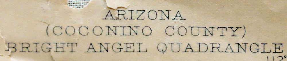 | |
|---|---|
| TITLE | Bright Angel |
| STATE | Arizona |
| LOCATION | Grand Canyon National Park, vicinity of Grand Canyon Village, 70 miles north of Flagstaff, AZ |
| SERIES | 15-minute |
| SURVEYED | 1902 and 1903 Field Survey |
| GEOGRAPHER | E.M. Douglas |
| ENGRAVED | 1905 |
| EDITION | 1906 |
| PRINTED | 1912 |
| SCALE | 1:48000 |
| CONTOUR INTERVAL | 50 feet |
| SHEET DIMENSIONS | 21 x 26 inches |
| MAP DIMENSIONS | 18 3/8 x 22 3/4 inches |
| COVERAGE AREA | 14 x 17 miles |
| SOURCE | From the vintage map collection of Art Christiansen, Tempe, Arizona |
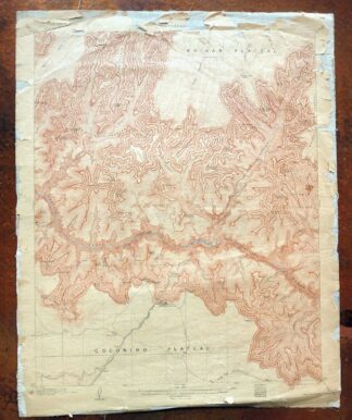
| MAP NOTES | A fascinating historical snapshot of a central section of the Grand Canyon from Grapevine Creek to Crystal Creek, surveyed before the establishment of the National Park and before the modern road system reached either rim; geologic history is detailed on the backside of this sheet. |
| SHEET CONDITION For maps of this vintage, effort is made to note all visible flaws, no matter how minor. | |
| OVERALL CONDITION | Fair |
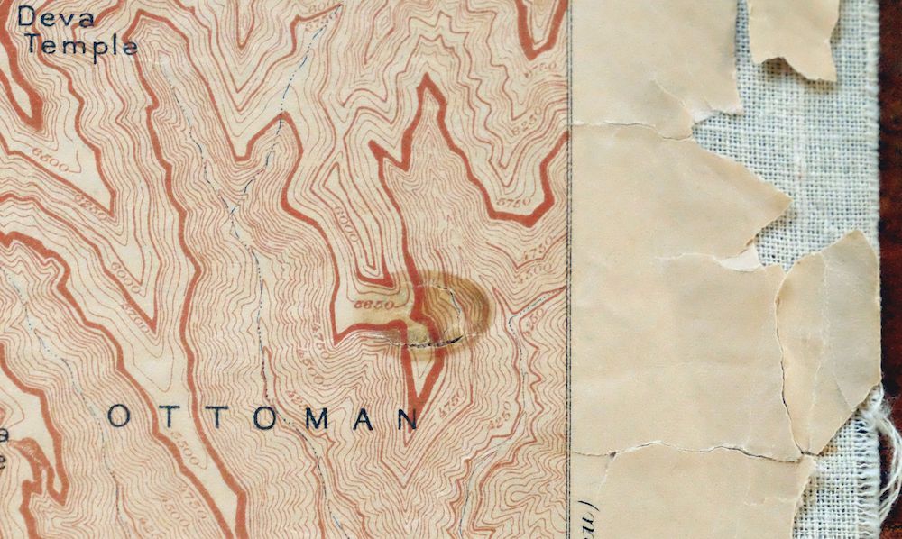
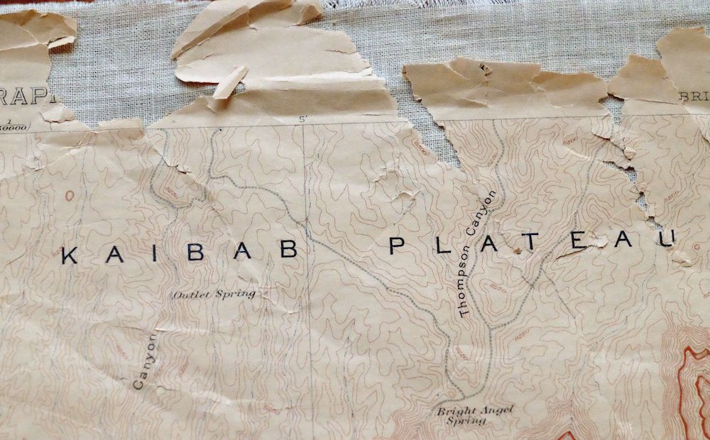
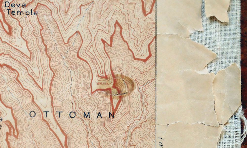
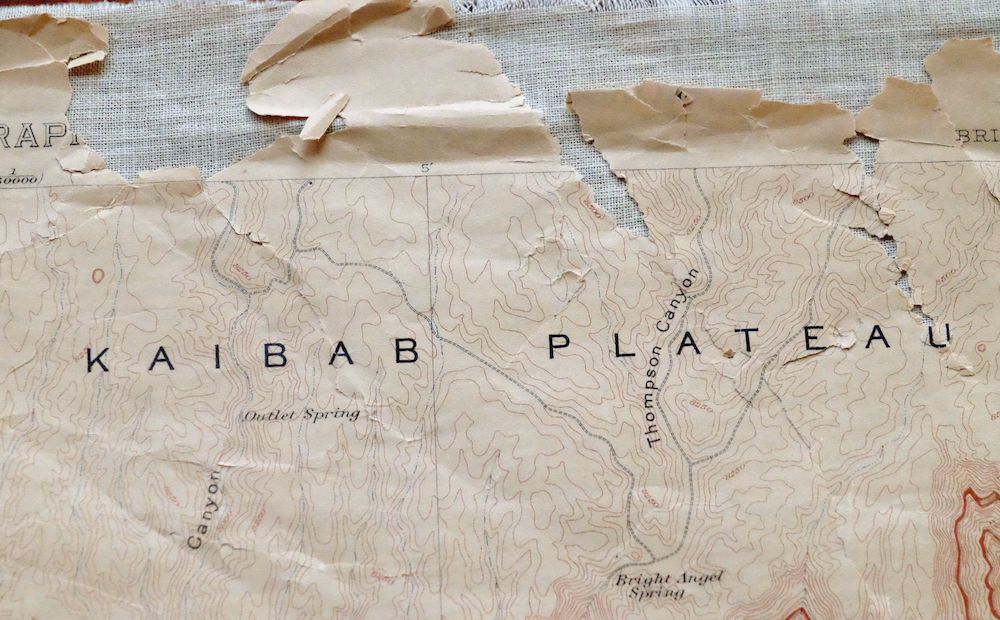
| SHEET NOTES | handled considerably, never folded, has original canvas-backing, age-toned paper, sheet has detached from canvas backing in the collars and along map edges |
| MAP AREA | considerable wear, very minor markings, minor blemishes |
| COLLARS | considerable wear or tears, no markings, minor blemishes |
  | |
| MAP COVERAGE Quadrangle extent overlaid on current basemap. | |
| PLACENAMES Depending on map series and survey date, all of the features listed below may not be shown on this map. This list contains features that currently exist or historically existed within the area covered by the map. The list can be used as a reference to determine if this map covers your area of interest. Placenames are listed alphabetically next to each feature type. | |
| CITIES AND TOWNS (CURRENT) | Grand Canyon, Grand Canyon Village, North Rim, and Tusayan |
| COUNTIES COVERED | Coconino |
| FEDERAL LAND UNITS | Grand Canyon National Park, Grand Canyon National Park Wilderness Study Area, and Kaibab National Forest |
| RIVERS AND STREAMS | Boucher Creek, Boulder Creek, Bright Angel Creek, Bright Angel Wash, Clear Creek, Coconino Wash, Colorado River, Cremation Creek, Crystal Creek, Dragon Creek, Garden Creek, Grapevine Creek, Hermit Creek, Horn Creek, Manzanita Creek, Milk Creek, Monument Creek, Ninetyfour Mile Creek, Ninetyone Mile Creek, Phantom Creek, Pipe Creek, Salt Creek, Slate Creek, Trinity Creek, Tuna Creek, and Wall Creek |
| Locations: Coconino Siding, Cottonwood Camp, Hermits Rest, North Rim Inn, Phantom Ranch, Phantom Ranger Station, and South Entrance Station. Mountains, Peaks, and Summits: The Battleship, Berry Butte, Brahma Temple, Buddha Cloister, Buddha Temple, Cheops Pyramid, Clement Powell Butte, The Colonnade, Confucius Temple, Cope Butte, Dana Butte, Deva Temple, Dragon Head, Eremita Mesa, Grandeur Point, Hattan Butte, Hawkins Butte, Hillers Butte, Horus Temple, The Howlands Butte, Isis Temple, Lyell Butte, Manu Temple, Marsh Butte, Mencius Temple, Newton Butte, O'Neill Butte, Osiris Temple, Oza Butte, Pattie Butte, Schellbach Butte, Tower Of Set, Shiva Temple, Sumner Butte, Sumner Point, The Tipoff, Twin Buttes, Whites Butte, and Zoroaster Temple. Valleys and Canyons: The Box, Bright Angel Canyon, Fuller Canyon, Haunted Canyon, Lonetree Canyon, Obi Canyon, Outlet Canyon, Phantom Canyon, Roaring Springs Canyon, Thompson Canyon, Topaz Canyon, The Transept, Travertine Canyon, Walla Valley, and Zoroaster Canyon. Parks: Grand Canyon National Park, Roaring Springs Campground, Rowe Well Picnic Area, Suspension Bridge Campground, Transept Trail Campgrounds, and Visitor Center Campground. Trails: Boucher Trail, Bright Angel Trail, Clear Creek Trail, Dripping Springs Trail, Hermit Trail, North Kaibab Trail, Old Kaibab Trail, River Trail, South Kaibab Trail, Tiyo Point Trail, Tonto Trail, and Transept Trail. Drainages: Boucher Creek, Boulder Creek, Bright Angel Creek, Bright Angel Wash, Clear Creek, Cremation Creek, Crystal Creek, Dragon Creek, Garden Creek, Grapevine Creek, Hermit Creek, Horn Creek, Manzanita Creek, Milk Creek, Monument Creek, Ninetyfour Mile Creek, Ninetyone Mile Creek, Phantom Creek, Pipe Creek, Salt Creek, Slate Creek, Trinity Creek, and Wall Creek. Mines: Lost Orphan Mine. Hospitals: Grand Canyon Hospital. Buildings: El Tovar Hotel, Grand Canyon Lodge, Grand Canyon National Park Visitor Center, and Grand Canyon Railroad Station. Waterfalls: Ribbon Falls. Bluffs: The Abyss, The Alligator, Ariel Point, Bradley Point, Breezy Point, Bright Angel Point, Cathedral Stairs, Claude Birdseye Point, Cocopa Point, Columbus Point, Demaray Point, Grama Point, Great Mohave Wall, Hopi Point, Hopi Wall, The Inferno, Johnson Point, Jones Point, Komo Point, Lookout Point, Manzanita Point, Maricopa Point, Mather Point, Mohave Point, Obi Point, Pima Point, Plateau Point, Powell Point, Shoshone Point, Sturdevant Point, Tiyo Point, Uncle Jim Point, Widforss Point, Yaki Point, Yavapai Point, and Yuma Point. Basins: Hermit Basin, Hindu Amphitheater, and Ottoman Amphitheater. Schools: Grand Canyon Elementary School, Grand Canyon High School, and National Park Service Training Center. Ridges: Cedar Ridge, The Dragon, and Little Dragon. Reservoirs and Tanks: Brush Tank, Holloway Tank, Horsethief Tank, O'Connell Tank, Road Tank, Rowes Tank, Sewer Number One Tank, Sewer Number Two Tank, and Trap Tank. Rapids: Boucher Rapids, Crystal Rapids, Eightyfive Mile Rapids, Eightythree Mile Rapids, Granite Rapids, Grapevine Rapids, Hermit Rapids, Horn Creek Rapids, and Salt Creek Rapids. Flats: Harvey Meadow, Indian Garden, and Marble Flats. Wells: Rowes Well. Pillars: Tower Of Ra. Springs: Bright Angel Spring, Burro Spring, Cedar Spring, Cliff Dweller Spring, Dripping Spring, Fourmile Spring, Greenland Spring, Lower Thompson Spring, Outlet Spring, Pipe Spring, Roaring Springs, and Santa Maria Spring. | |
| SHIPPING AND RETURNS | |
 This map sheet will be carefully rolled in a sturdy tube and shipped via the US Postal Service. If you find that the sheet you receive is not as described in the listing, you may ship it back to us for a refund of the purchase price. | |
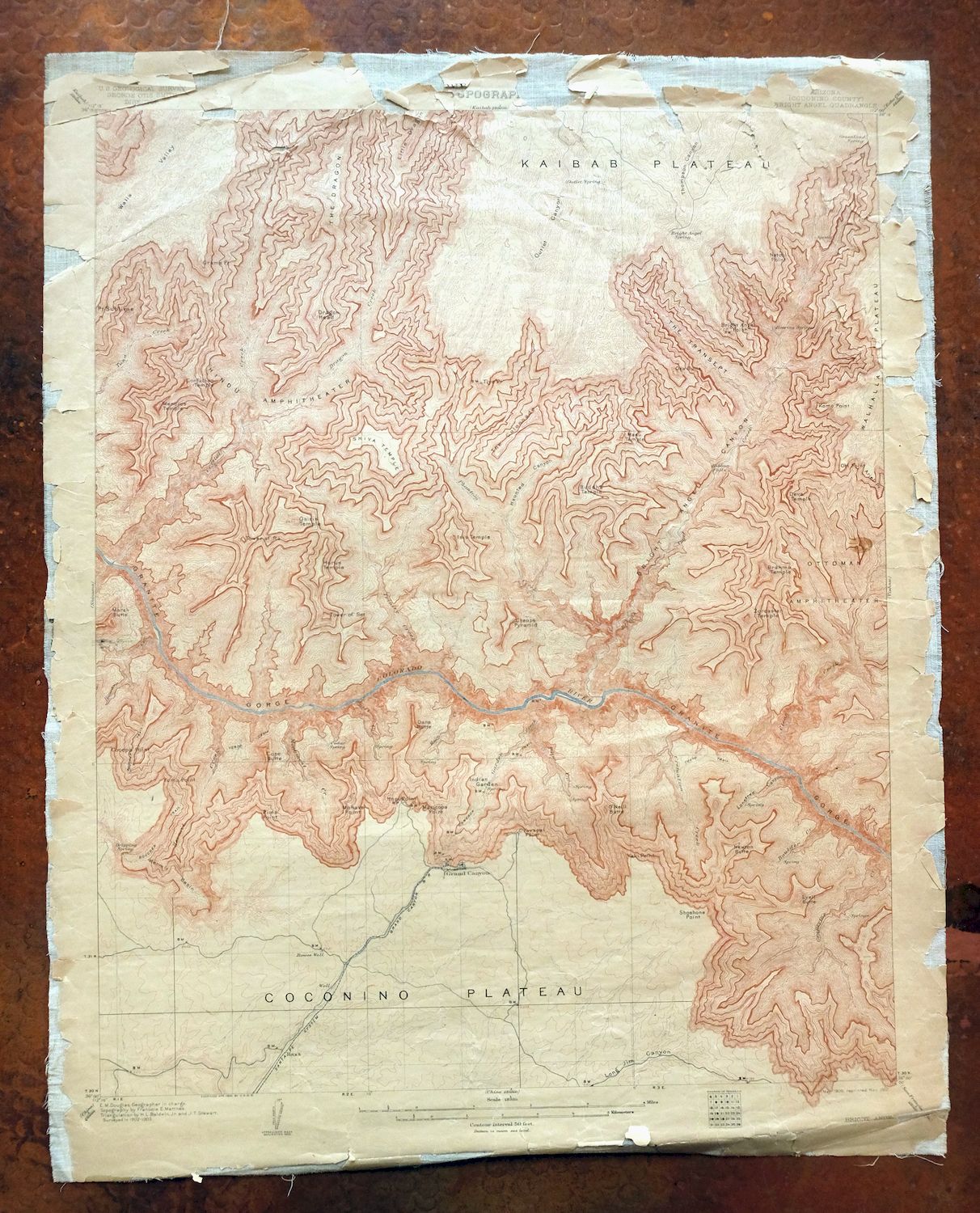
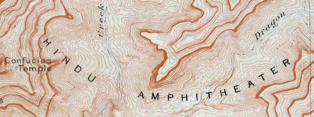
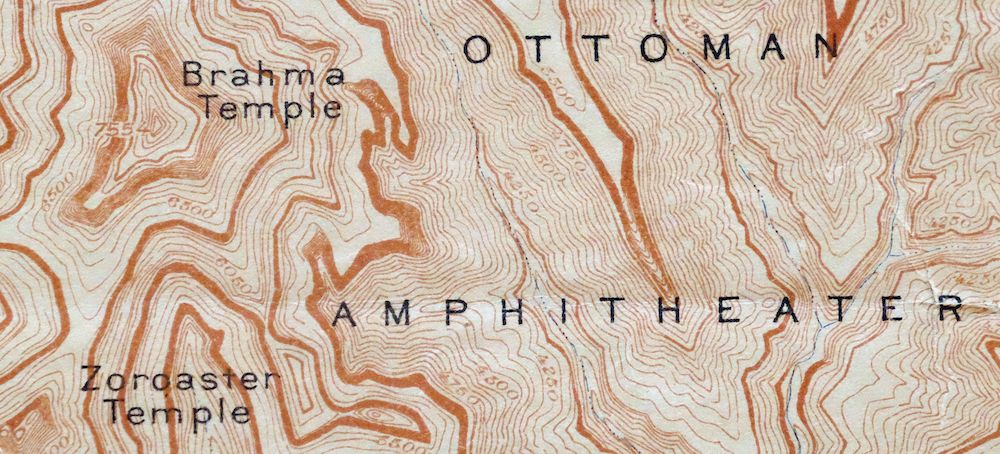
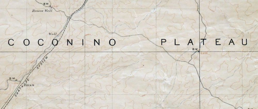
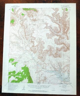
Bright Angel Arizona Grand Canyon Tusayan USGS Topo Map 1912
$30
This USGS 15-minute topographic map is a 1906 edition printed in 1912, a canvas-backed sheet in fair condition that survives with age-toned paper and considerable handling wear, having detached from its backing in the collars and along the map edges. The quad takes in a central stretch of the Grand Canyon from Grapevine Creek to Crystal Creek, including the North Rim, Grand Canyon Village, and portions of Grand Canyon National Park and the Kaibab National Forest in Coconino County. Surveyed in 1902 and 1903 under geographer E.M. Douglas and engraved in 1905, it records the canyon before the National Park was established and before modern roads reached either rim, with geologic history printed on the reverse. From the vintage map collection of Art Christiansen of Tempe, Arizona.
In stock
This antique sheet is a 1906 edition of the Bright Angel Arizona USGS topographic map. It is an authentic 114-year-old 1912 United States Geological Survey print in fair condition.
HOW THIS MAP CAN BE USED
In addition to making a fascinating conversation piece, this sheet would make a unique and prized gift for anyone interested in this area, be perfect as a reference for genealogy studies or general historical research, or fill that missing piece in your collection.
FEATURES SHOWN ON THE MAP
The Bright Angel 15-minute map shows cities and towns, roads, railroads, rivers, creeks, elevation contour lines, public land survey lines, county, state, and other administrative boundaries as they existed at the time of the survey in 1902 and 1903. All known structures (houses, businesses, churches, schools, barns, cabins, etc) are also shown, with exceptions in some urban areas, where only landmark buildings may be shown.
A VALUABLE HISTORICAL RECORD
Maps from the 15-minute series for the continental United States are no longer produced or printed by the USGS and original prints are becoming increasingly difficult to find. They are a valuable historical record for an area, as they contain many placenames and features that have been dropped from more recent maps.
Nearby maps
-
De Motte Park Arizona USGS 15-Min Topo Map 1964 Vintage
$37 Add to cart -
Powell Plateau Arizona USGS 15-Min Topo Map 1964 Vintage
$37 Add to cart -
Nankoweap Arizona Grand Canyon USGS Topo Map 1970 Vintage
$32 Add to cart -
Supai Arizona USGS 15-Min Topographic Map 1970 Vintage
$41 Add to cart -
Blue Spring Arizona USGS 15-Min Topographic Map 1978 Vintage
$44 Add to cart -
Kanab Point Arizona USGS 15-Min Topographic Map 1972 Vintage
$44 Add to cart -

Jacob Lake Arizona Kaibab Plateau USGS Topo Map 1965 Vintage
$38 Add to cart -
Valle Arizona Kaibab Quivero USGS Topo Map 1964 Vintage
$28 Add to cart -
Big Springs Arizona Kaibab Nail Canyon USGS Topo Map 1984
$40 Add to cart -
Ebert Mountain Arizona Red Mountain USGS Topo Map 1969
$36 Add to cart -

National Canyon Arizona Grand Canyon USGS Topo Map 1964
$37 Add to cart -
S P Mountain Arizona USGS 15-Min Topo Map 1975 Vintage
$34 Add to cart -
Tuckup Canyon Arizona Grand Canyon USGS 15-Min Topo Map 1974
$35 Add to cart -
House Rock Spring Arizona USGS 15-Min Topo Map 1972 Vintage
$40 Add to cart -

Paria Plateau Arizona Vermillion Cliffs USGS Topo Map 1978
$42 Add to cart -
Shinarump Arizona Kaibab USGS 15-Min Topo Map 1964 Vintage
$35 Add to cart -
Heaton Knolls Arizona USGS 15-Min Topo Map 1963 Vintage
$36 Add to cart -

Lees Ferry Arizona Page Marble Canyon USGS Topo Map 1971
$58 Add to cart -
Colorado City Arizona Moccasin Kaibab USGS Topo Map 1975
$37 Add to cart -
Echo Cliffs Arizona Tuba City Page USGS 60-Min Topo Map 1913
$48 Add to cart -

Bill Williams Mountain Arizona Williams USGS Topo Map 1983
$40 Add to cart -
Ash Fork Arizona Kaibab NF Prescott NF USGS Topo Map 1978
$44 Add to cart -
Kanab Utah Fredonia Orderville USGS Topo Map 1960 Vintage
$37 Add to cart -
Nipple Butte Utah Wahweap WSA Big Water USGS Topo Map 1962
$36 Add to cart