MAP DETAILS | |
|---|---|
| TITLE | Taconic |
| STATE | Vermont, Massachusetts, New York |
| LOCATION | Vicinity of Pittsfield, 55 miles northwest of Springfield, MA |
| SERIES | 30-minute |
| SURVEYED | 1885 through 1896 Field Survey |
| GEOGRAPHER | H.M. Wilson |
| ENGRAVED | 1900 |
| EDITION | 1900 |
| PRINTED | 1912 |
| PRINT NOTES | Thick paper stock |
| SCALE | 1:125000 |
| CONTOUR INTERVAL | 40 feet |
| SHEET DIMENSIONS | 16 1/2 x 20 inches |
| MAP DIMENSIONS | 12 7/8 x 17 1/2 inches |
| COVERAGE AREA | 25 x 35 miles |
| SOURCE | From an uncommonly well-preserved collection |
| MAP NOTES | A fascinating historical snapshot surveyed before the modern highway system, showing historic overland travel routes, rail lines, structures, and early placenames. |
| SHEET CONDITION For maps of this vintage, effort is made to note all visible flaws, no matter how minor. | |
| OVERALL CONDITION | Very Good |
| SHEET NOTES | very lightly handled, never folded, smooth and flat, lightly age-toned paper |
| MAP AREA | no wear, no markings, no blemishes |
| COLLARS | no wear or tears, no markings, hole punches along left collar, a few light blemishes |
| MAP COVERAGE Quadrangle extent overlaid on current basemap. | |
| BACKSIDE LEGEND | |
 A map summary is printed on the back side of the Taconic sheet similar to the one shown in the picture. It outlines the history, purpose, and status of the USGS mapping program at the time of the printing in 1912. It also provides instructions on how to read contour lines and a description of how they are used to depict the terrain. At the bottom of the page is a legend showing all of the symbols used to represent the cultural, relief, and water features found on the map. | |
| PLACENAMES Depending on map series and survey date, all of the features listed below may not be shown on this map. This list contains features that currently exist or historically existed within the area covered by the map. The list can be used as a reference to determine if this map covers your area of interest. Placenames are listed alphabetically next to each feature type. | |
| CITIES AND TOWNS (CURRENT) | Adams, Bennington, Cherryplain, East Nassau, Hoosick Falls, North Adams, North Bennington, Old Bennington, Petersburg, Pittsfield, Pownal, South Shaftsbury, Stamford, and Williamstown |
| COUNTIES COVERED | Bennington, Berkshire, Columbia, Franklin, Rensselaer, Washington, and Windham |
| FEDERAL LAND UNITS | George D. Aiken Wilderness and Green Mountain National Forest |
| RIVERS AND STREAMS | Anthony Brook, Barney Brook, Basin Brook, Bear Swamp Brook, Bickford Hollow Brook, Birch Brook, Black River, Bog Brook, Bolles Brook, Bonesteel Creek, Broad Brook, Browns Brook, Case Brook, Center Brook, Center White Creek, Chickley River, City Stream, Cold River, Cold Spring Brook, Cowan Brook, Cranberry Vly Creek, Daniels Brook, Deer Cabin Brook, Deer Lick Brook, Dill Creek, Drowned Land Brook, Dry Brook, Dunbar Brook, East Branch Green River, East Brook, Fayville Branch, Furnace Brook, Glastenbury River, Gore Brook, Green River, Gulf Brook, Hemlock Brook, Hoosic River, Hopper Brook, Hoxie Brook, Hudson Brook, Huff Brook, Hume Brook, Jewett Brook, Kinderhook Creek, Kitchen Brook, Kronk Brook, Ladd Brook, Little Hoosic River, Little Pond Brook, Little White Creek, McDonald Brook, Miller Brook, Nipmoose Brook, North Branch Hoosic River, Notch Brook, Otter Creek, Owl Kill, Paran Creek, Paull Brook, Pecks Brook, Pencil Brook, Pettibone Brook, Poesten Kill, Quacken Kill, Rake Branch, Red Pond Brook, Reservoir Brook, Roaring Branch, Roaring Branch Walloomsac Brook, Roaring Brook, Savoy Hollow Brook, Secum Brook, South Brook, South Stream, Stamford Stream, Sunkauissia Creek, Sweet Brook, Tackawasick Creek, Tower Brook, Town Brook, Walloomsac River, Wampecack Creek, West Branch Deerfield River, West Branch Green River, Westfield River, Weston Brook, Whipple Brook, Whitman Brook, Windsor Brook, Woods Brook, Wyomanock Creek, and Yaw Pond Brook |
| WATER BODIES | Adams Reservoir, Berkshire Pond, Big Pond, Billings Pond, Black River Pond, Bog Pond, Bonesteel Pond, Burnett Pond, Dunham Reservoir, Hicks Pond, Kendall Pond, Little Pond, Long Pond, Lake Lorraine, Mill Pond, Mud Pond, Newcomb Pond, North Pond, Lake Paran, Red Pond, Second Pond, South Pond, Stamford Pond, Taplin Pond, Thompsons Pond, and Wing Pond |
| Vermont Locations: Shadowbrook Farm, Shady Acres Campground, Bennington Hatchery, Bennington Plaza Shopping Center, Bennington Square Shopping Center, Camp Casino, Col Seth Warner Camp, Congdon Camp, Dutch Hill Winter Sports Area, Fay Fuller Camp, Glastenbury Camp, Glastenbury Mountain Lookout, Greenwood Lodge and Tent Sites, Holden-Leonard Mill Complex, Mellville Nanheim Shelter, Monument Plaza Shopping Center, Mount Anthony Country Club, North Street Shopping Center, Peters Four Corners, Pine Hollow Campground, Prospect Mountain Ski Center, Prospect Mountain Winter Sports Area, Red Mill Brook Campground, Red Mill Brook Camping Area, The Elbow, Thendara Camp, White Creek Station, and Yaw Brook Cabin. Administrative Boundaries: Town of Shaftsbury, Town of Stamford, Town of Bennington, Town of Glastenbury, Town of Pownal, and Town of Woodford. Mountains, Peaks, and Summits: Spruce Hill, Scrub Hill, Sheep Hill, Stamford and Woodford Plateau, Allen Hill, Mount Anthony, Bald Mountain, Bare Hill, Bingham Hill, Bucks Cobble, Carpenter Hill, The Dome, Dutch Hill, Glastenbury Mountain, Hagar Hill, Hale Mountain, Harmon Hill, Harrington Cobble, Houghton Mountain, Mann Hill, Maple Hill, Mason Hill, Prospect Mountain, Trumbull Mountain, and Whipstock Hill. Valleys and Canyons: Shaftsbury Hollow, Dunville Hollow, Ellis Mine Hollow, Frost Hollow, Halifax Hollow, Lincoln Hollow, Potter Hollow, and Reservoir Hollow. Woods: McCullough Woods. Parks: South Stream Waterfowl Area, Stamford Meadows Wildlife Management Area, Center Shaftsbury Historic District, Downtown Bennington Historic District, George D Aiken Wilderness, George D Aiken Wilderness Area, Memorial Park, Monument Square, North Bennington Historic District, Old Bennington Historic District, Willow Park, and Woodford State Park. Trails: Atwood Trail, Bald Mountain Trail, Kelly Camp Trail, Molly Stark Trail, Old Stage Trail, Taconic Crest Trail, and West Ridge Trail. Drainages: South Pond Brook, South Stream, Stamford Stream, Stratton Brook, Sumner Brook, Barney Brook, Basin Brook, Bickford Hollow Brook, Blind Brook, Bolles Brook, Broad Brook, Brown Brook, Browns Brook, Cardinal Brook, City Stream, Cold Spring Brook, Cowan Branch, Crazy John Stream, Deer Cabin Brook, Deer Lick Brook, Fuller Brook, Furnace Brook, Goodrich Brook, Harris Brook, Hell Hollow Brook, Jewett Brook, Ladd Brook, Little Pond Brook, Little White Creek, Mill Pond Brook, North Branch Hoosic River, Nunge Brook, Paran Creek, Red Mill Pond Brook, Redfield Brook, Reservoir Brook, Roaring Branch, Roaring Branch Walloomsac Brook, Roaring Brook, Walloomsac River, and Yaw Pond Brook. Churches: Sacred Heart-Saint Francis Church, Saint Peters Episcopal Church, Christian and Missionary Alliance Church, First Baptist Church, First Church of Christ, First United Methodist Church, Holy Cross Novitiate, Old First Church, Union Church, White Chapel, and Woodford Hollow Church. Forests: Stamford Town Forest, Bennington Municipal Forest, and North Bennington Memorial Forest. Hospitals: Southwestern Medical Center. Lakes and Ponds: Stamford Pond, Big Pond, Billings Pond, Lake Hancock, Little Pond, Lost Pond, Mill Pond, Mud Pond, Lake Paran, Red Mill Pond, and Yaw Pond. Buildings: Samuel H Blackmer Memorial Library, Solomon Wright Library, Southern Vermont College Library, Southwestern Vermont Medical Center Medical Library, Stamford Community Library, Shaftsbury Historical Society Building, Shaftsbury Historical Society Museum, Stamford Town Hall, Bennington Area Chamber of Commerce, Bennington County Courthouse, Bennington Free Library, Bennington Historical Museum, Bennington Museum Genealogical Library, Bennington Town Hall, Jedediah Dewey House, John G McCullough Free Library, North Bennington Depot, Park McCullough House Museum, Pownal Center Town Hall, Vermont Veterans Home Library, and Woodford Town Hall. Dams: South Stream Dam, Adams Reservoir Dam, Barber Pond Dam, Bugbee Pond Dam, Cider Mill Dam, Lake Paran Dam, Ricker Dam, and Thompsons Pond Upper Dam. Crossings: Exit 1 and Exit 2. Bridges: Silk Road Covered Bridge, Henry Covered Bridge, and Paper Mill Village Bridge. Basins: Bear Wallow. Airports: Bennington Airport, Bennington State Airport, and William H Morse State Airport. Swamps: Stamford Meadows, Beaver Meadows, Camp Meadows, and Castle Meadow. Schools: Saint Joseph College, Snow School, Shaftsbury Elementary School, Stamford Elementary School, Barber School, Beech Street School, Bennington College, Bennington Elementary School, Brooklyn School, Bushnell School, Catamount Elementary School, Chapel School, Cobblestone School, Harwood Hill School, Maple Grove School, Molly Stark School, Monument Elementary School, Mount Anthony High School, Mount Anthony Middle School, Niles School, North Bennington Graded School, Oak Hill School, Pleasant Valley School, Pownall Elementary School, Riverside School, Varney School, and Woodford Hollow School. Reservoirs and Tanks: South Stream Pond, Adams Reservoir, Barber Pond, Bugbee Mill Pond, Bugbee Pond, Lake Paran, North Bennington Reservoir, and Thompsons Pond. Towers: WBTN Radio Tower, WBTN-AM (Bennington), and WHGC-FM (Bennington). | |
| Massachusetts Locations: Bacons Farm, Brodie Mountain Ski Area, Camp Mohawk, Camp Muriel Flagg, Colonial Shopping Center, Forest Park Country Club, Grand Union Shopping Center, Hairpin Turn, Hardman Industrial Park, Haskin Farm, Jiminy Peak Ski Area, Mount Greylock Ski Club, Mount Hope Farm, North Adams Country Club, Phillips Woolen Mill, Pine Valley Mobile Home Park, Renfrew Mill Number 2, Skyline Country Club, Susan B Anthony Birthplace, Susan B Anthony Homestead, Taconic Golf Course, Thiel Farm, Waubeeka Springs Golf Course, and Williams College Ski Area. Administrative Boundaries: Town of Adams, Town of Cheshire, Town of Clarksburg, Town of Florida, Town of Hancock, Town of Lanesborough, Town of New Ashford, Town of North Adams, Town of Savoy, Town of Williamstown, and Town of Windsor. Mountain Ranges: Greylock Range and Taconic Range. Reserves: Chalet Wildlife Management Area, Eugene D Moran Wildlife Management Area, Notchview Reservation, and Savoy Wildlife Management Area. Mountains, Peaks, and Summits: Mount Amos, Appletree Hill, Bee Hill, Bakke Mountain, Bald Mountain, Beoadic Mountain, Berlin Mountain, Berry Hill, Berry Mountain, Birch Hill, Blackpoll Mountain, Borden Mountain, Chadbournes Knoll, Briggs Cobble, Brodie Mountain, Buxton Hill, Cheshire Harbor Hill, The Cobble, The Cobble, The Cobbles, Cole Mountain, Constitution Hill, Crum Hill, E Parmalee Prentice Mountain, East Mountain, Farnams Hill, Mount Fitch, Flat Rock Hill, Fobes Hill, Mount Greylock, Hales Hill, Honwee Mountain, Jiminy Peak, Judges Hill, Laurel Hill, Lewis Hill, Mason Hill, Misery Mountain, The Noppet, North Mountain, Northwest Hill, Phelps Knoll, Pine Cobble, The Pinnacle, The Pinnacle, Potter Mountain, Pratt Hill, Mount Prospect, Rounds Mountain, Rounds Rock, Saddle Ball Mountain, Savage Hill, Sheeps Heaven Mountain, Spruce Hill, Spruce Mountain, Stafford Hill, Stone Hill, Stony Ledge, Sugarloaf, Weston Mountain, Whitcomb Hill, Widow Whites Peak, Mount Williams, Windsor Hill, and Woodchuck Hill. Valleys and Canyons: Bentley Hollow, Doty Hollow, Flora Glen, Ford Glen, Gardner Hollow, Goodell Hollow, Goodrich Hollow, Mills Hollow, and The Notch. Parks: Balance Rock State Park, Blackington Historic District, Blair Hiking Area, Bowe Memorial Playground, Cascade Park, Buxton Gardens, Field Park, Mill Village Historic District, Church Street Historic District, Church Street-Cady Hill Historic District, Clarksburg State Park, Cole Field, Denison Park, Forbush Wildlife Sanctuary, Freeman Grove Historic District, Greylock Park, Heritage Park, Historic Valley Park, Kemp Park, Lindley Park, Linear Park, Mount Greylock State Reservation, Mount Hope Park, Natural Bridge State Park, Noel Field, Normal School Historic District, North Adams State College Athletic Field, Pioneer Monument, Renfrew Athletic Field, Rusek Whipple Square, Soldiers Memorial Field, Stafford Hill Wildlife Management Area, Summer Street Historic District, Taconic Trail State Park, Weston Field, and Windsor James State Park. Trails: Busby Trail, Cheshire Harbor Trail, Circle Trail, Deer Hill Trail, Hopper Trail, Overlook Trail, Stony Ledge Ski Trail, Thunderbolt Ski Trail, and Williams Trail. Drainages: Bassett Brook, Bear Swamp Brook, Beaver Creek, Azimuth Brook, Baker Brook, Bentley Brook, Berry Pond Creek, Birch Brook, Birch Hill Brook, Bog Brook, Bowerman Creek, Center Brook, Cheesbro Brook, Broad Brook, Buxton Brook, Canyon Brook, Miller Brook, Collins Brook, Cowan Brook, Drowned Land Brook, Dry Brook, East Branch Green River, Flora Glen Brook, Ford Glen Brook, Goodell Brook, Gore Brook, Granger Brook, Green River, Hemlock Brook, Hollow Brook, Hopper Brook, Hoxie Brook, Hudson Brook, Hunterfield Brook, Jones Brook, Kitchen Brook, McDonald Brook, Mitchell Brook, Money Brook, Muddy Brook, North Branch Hemlock Brook, North Branch Hoosic River, Notch Brook, Parker Brook, Patton Brook, Paull Brook, Pecks Brook, Penniman Brook, Pettibone Brook, Phillips Creek, Phoebes Brook, Rathburn Brook, Red Oak Brook, Reed Brook, Roaring Brook, Ross Brook, Savoy Hollow Brook, Secum Brook, Sherman Brook, South Branch Hemlock Brook, South Brook, Southwick Brook, Staples Brook, Steep Bank Brook, Sweet Brook, Thompson Brook, Thunder Brook, Tophet Brook, Tower Brook, Town Brook, Tunnel Brook, Tyler Brook, West Branch Green River, Wheeler Brook, White Brook, and Whitman Brook. Islands: Cheshire Cemetery. Capes: Westlawn Cemetery. Churches: Bethel Pentecostal Church, First Baptist Church, First Baptist Church of Cheshire, First Congregational Church, Community Bible Church, Congregational Church, First United Methodist Church, Harvard Christian Ministries, Interfaith Church of Cosmogony, Jesus Saves Tabernacle, Notre Dame Church of Adams, Old Quaker Meeting House, Our Lady of the Incarnation Church, Quaker Meetinghouse, Saint Johns Episcopal Church, Saint Lukes Church, Saint Lukes Episcopal Church, Saint Marks Episcopal Church, Saint Patricks Roman Catholic Church, Saint Raphaels Roman Catholic Church, Saint Stanislaus Kostka Roman Catholic Church, Saint Thomas Aquinas Roman Catholic Church, Second Congregational Church, Thompson Memorial Chapel, and Warren Brown Zion Church. Forests: Clarksburg State Forest, Florida State Forest, Hopkins Memorial Forest, Savoy Mountain State Forest, and Windsor State Forest. Hospitals: North Adams Regional Hospital, Plunkett Medical Center, and South Adams Regional Hospital. Lakes and Ponds: Anthony Pond, Berkshire Pond, Berry Pond, Chilson Pond, Choquettes Pond, Eph Pond, Gore Pond, North Pond, South Pond, Tannery Pond, and Witts Pond. Buildings: Adams Community Center, Adams Memorial Theatre, Adams Nursing HOme, Adams Townhall, Artist Center and Gallery, Bascom Lodge, Briggsville Town Hall, Cheshire Public Library, Cheshire Town Hall, Clark Art Museum, Elizabeth S Botsford Memorial Library, Eugene L Freel Library, Farm Museum, Florida Town Hall, Hancock Town Hall, Harper Center Senior Citizens Center, Hoosac Tunnel Museum, Houghton Memorial Building, Lanesborough Town Hall, Massachusetts Museum of Contemporary Art, New Ashford Town Hall, North Adams Center, North Adams City Hall, North Adams Public Library, Sterling and Francine Clark Art Institute, Susan B Anthony, Sweet Brook Nursing Home, Vietnam Veterans Memorial Skating Rink, Williams College Museum of Art, Williamstown Fire Station, Williamstown House of Local History, Williamstown Municipal Building, Windsor Town Hall, and YMCA. Waterfalls: Money Brook Falls, Tannery Falls, and Twin Cascade. Dams: Bassett Reservoir Dam, Bog Pond Dam, Burnett Pond, Cheshire Reservoir Dam, Eclipse Dam, Mauserts Pond North Dam, Mauserts Pond South Dam, Mount Williams Reservoir Dam, Notch Reservoir Dam, Renfrew Dam, Upper Reservoir Dam, Williamstown Reservoir Dam, and Windsor Lake Dam. Bluffs: Hoosac Range, Jones Nose, and Raven Rocks. Gaps: The Bellows Pipe and Moores Summit. Bridges: Moody Bridge and Walley Bridge. Basins: The Hopper. Natural Arches: Natural Bridge of New England. Airports: Air Hill Farms Landing Strip, Harriman and West Airport, Kendalls Landing Area, North Adams Airport, Sprague Number 1 Heliport, and Sprague Number 2 Heliport. Swamps: Bear Swamp and Tyler Pond. Schools: Abbott Memorial School, Adams Junior High School, Adams Middle School, Charles McCann Vocational Technical School, Broad Brook School, Buxton School, Cheshire Elementary School, Clarksburg Elementary School, Crane School, Drury High School, Greylock School, Hancock Central School, Hoosac Street School, Hoosac Valley High School, Hopkins School, Howland Avenue School, J S Sullivan School, Johnson School, Lanesborough Elementary School, Mount Greylock Christian School, Mount Greylook Regional High School, North Adams State College, Notre Dame School, Pine Cobble School, Plunkett Elementary School, Saint Stanislaus School, Starrat Memorial School, The Highcroft School, Williams College, and Williamstown Elementary School. Ridges: Deer Ridge, Pease Ridge, Ragged Mountain, and Sheep Hill. Reservoirs and Tanks: Bassett Reservoir, Bog Pond, Bridges Pond, Burnett Pond, Cheshire Reservoir, Harmon Pond, Lower Reservoir, Mauserts Pond, Mount Williams Reservoir, North Branch Hoosic River Reservoir, Notch Reservoir, Renfrew Pond, Upper Reservoir, Williamstown Reservoir, and Windsor Lake. Rapids: The Cascade. Towers: WCDC-TV (Adams), WCFM-FM (Williamstown), WJJW-FM (North Adams), WMNB-FM (North Adams), WNAW-AM (North Adams), Walker Lookout Tower, and War Memorial Beacon. Springs: Indian Spring, Sand Spring, and Waubeeka Spring. | |
| New York Locations: Camp Kiwanis, Camp Yowochas, Hoosick Falls Country Club, Post Corners, Seven Hill Firetower, Taconic Trails Ski Area, and White Creek Station. Administrative Boundaries: Town of Cambridge, Town of Berlin, Town of Grafton, Town of Hoosick, Town of Petersburgh, and Town of Stephentown. Mountains, Peaks, and Summits: Bald Hill, Bald Mountain, Butternut Hill, Berlin Mountain, Buck Rock, Buckwheat Hill, Dickinson Hill, The Gipfel, Indian Hill, Johnson Hill, Misery Mountain, Moon Hill, Moore Hill, Nipmoose Hill, Odell Hill, Perigo Hill, Pomeroy Hill, Poplar Hill, Mount Raimer, Roberts Hill, Rocky Hill, Rounds Mountain, Smith Hill, The Snow Hole, Sugarloaf Hill, Turner Mountain, White Rock, and White Rocks. Valleys and Canyons: Allen Hollow, Breese Hollow, Browns Hollow, Church Hollow, Comstock Hollow, Couch Hollow, Cowdry Hollow, Doty Hollow, East Hollow, Fox Hollow, Goodrich Hollow, Green Brook Hollow, Greene Hollow, Hills Hollow, Jones Hollow, Lewis Hollow, Mattison Hollow, Pine Valley, Prosser Hollow, Reservoir Hollow, Robinson Hollow, Satterlee Hollow, Shaftsbury Hollow, Shingle Hollow, Southeast Hollow, and Ward Hollow. Parks: Bennington Battlefield Park. Trails: Southeast Hollow Trail. Drainages: Berry Pond Creek, Black River, Browns Brook, Case Brook, Center White Creek, Cranberry Vly Creek, Dayfoot Brook, Dill Creek, East Brook, Huff Brook, Kronk Brook, Little Hoosic River, Little White Creek, Nipmoose Brook, Owl Kill, Pencil Brook, Red Pond Brook, Roaring Brook, Rocky Brook, Taplin Bourn, Walloomsac River, West Brook, Whipple Brook, and Woods Brook. Churches: Dutch Church, Fifty Six Church, and Saint Georges Church. Forests: Capital District Forest And Game Refuge and State Forest Rensselaer Number 3. Lakes and Ponds: Banker Pond, Big Bowman Pond, Black Pond, Black River Pond, Bonesteel Pond, Cranberry Pond, Hicks Pond, Douglas Pond, Dyken Pond, Lake Elizabeth, Forest Lake, Golden Pond, Gravel Pond, Griswold Pond, Hosford Pond, Kendall Pond, Little Bowman Pond, Long Pond, Lake Lorraine, Newcomb Pond, Peckham Pond, Red Pond, Second Pond, South Long Pond, Spring Lake, Stone Bridge Pond, Stump Pond, Taconic Pond, Taplin Pond, Thurber Pond, White Lily Pond, and Wing Pond. Gaps: Berlin Pass and Petersburg Pass. Airports: Moseleys Airport. Swamps: Sabarney Gile Swamp and Squaw Swamp. Schools: Central School, Cherryplain School, Cobb School, Groveside School, Hoosac School, School Number 11, School Number 13, School Number 14, School Number 16, School Number 2, School Number 3, School Number 4, School Number 5, School Number 6, School Number 7, Snyder School, South District School, and Toad Point School. Reservoirs and Tanks: Dunham Reservoir, Echo Lake, Mill Pond, Round Pond, Shaver Pond, and Wager Pond. Towers: WNGN-FM (Hoosick Falls). Pillars: Eagle Rock. | |
| SHIPPING AND RETURNS | |
 This map sheet will be carefully rolled in a sturdy tube and shipped via the US Postal Service. If you find that the sheet you receive is not as described in the listing, you may ship it back to us for a refund of the purchase price. | |
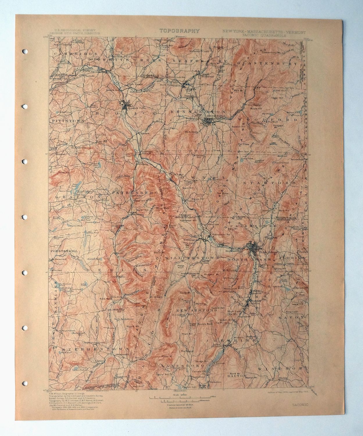
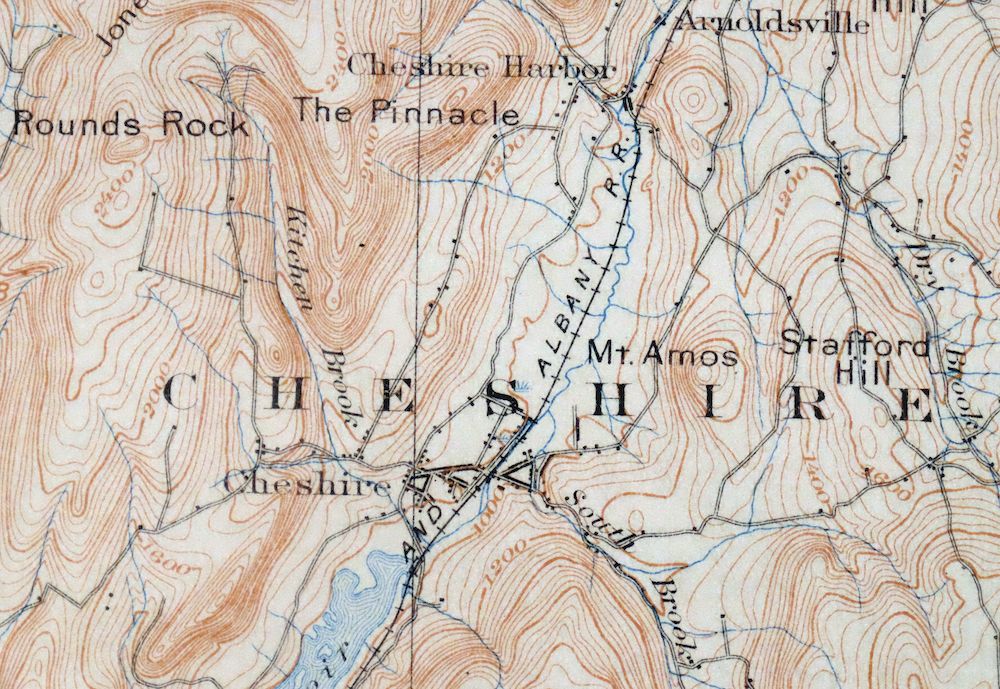
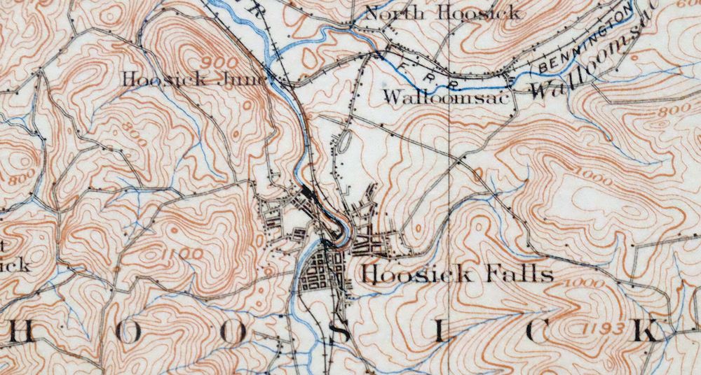
Taconic Vermont Pittsfield Adams USGS Topographic Map 1912
$95
This USGS 30-minute topographic sheet is a 1900 edition printed in 1912, engraved by H.M. Wilson from an 1885 through 1896 field survey, and in very good condition on thick stock – never folded, smooth and flat, with lightly age-toned paper. Spanning the point where Vermont, Massachusetts, and New York meet, the quad area takes in Pittsfield and North Adams in the Berkshires along with Bennington, Williamstown, Hoosick Falls, and portions of Green Mountain National Forest and the George D. Aiken Wilderness. Surveyed before the modern highway system, this antique sheet records the overland travel routes, rail lines, structures, and early placenames of the era, and it comes from an uncommonly well-preserved collection; the reverse carries printed reference material.
In stock
This antique sheet is a 1900 edition of the Taconic Vermont USGS topographic map. It is an authentic 114-year-old 1912 United States Geological Survey print in very good condition.
HOW THIS MAP CAN BE USED
In addition to making a fascinating conversation piece, this sheet would look great in a frame or on display, make a unique and prized gift for anyone interested in this area, be perfect as a reference for genealogy studies or general historical research, or fill that missing piece in your collection.
FEATURES SHOWN ON THE MAP
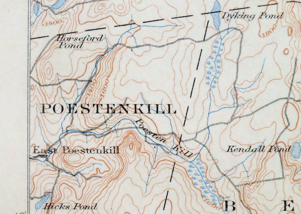
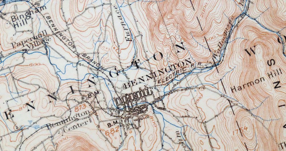
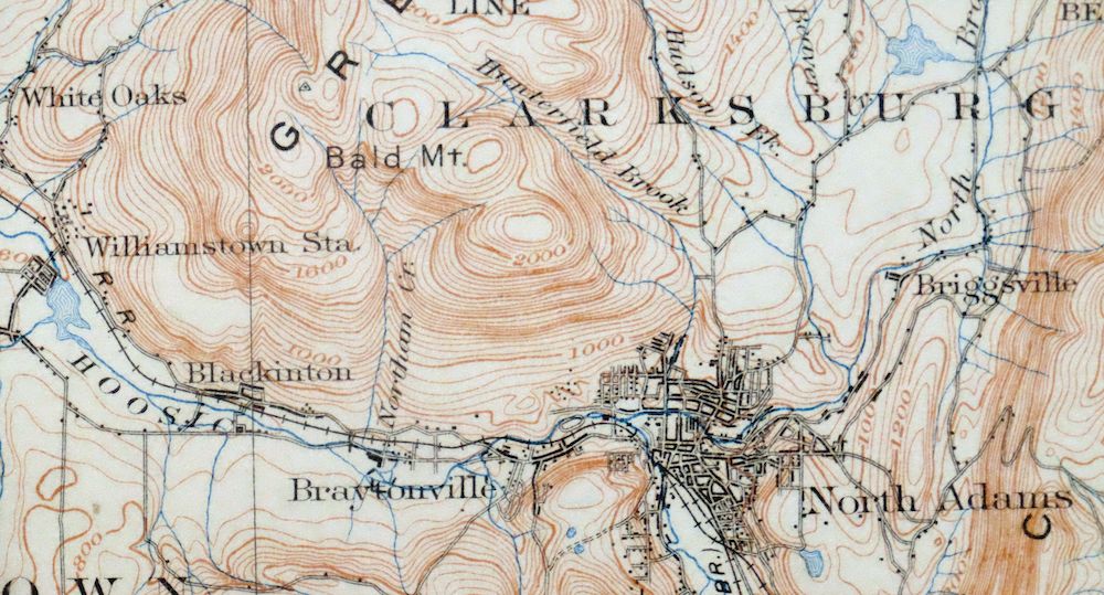
The Taconic 30-minute map shows cities and towns, roads, railroads, rivers, creeks, elevation contour lines, public land survey lines, county, state, and other administrative boundaries as they existed at the time of the survey in 1885 through 1896.
A VALUABLE HISTORICAL RECORD
Maps from the USGS 30-minute series have been out of print for many years. They have never been common and original prints are increasingly difficult to find. For areas where the 30-minute map was produced, it is usually the first large-scale survey done by the USGS for that area. These are a valuable historical record, as they contain many placenames and features that have been dropped from more recent series’ and editions.
Nearby maps
-

Holyoke Massachusetts Springfield USGS Topo Map 1897 Antique
$85 Add to cart -
Litchfield Connecticut Waterbury Oakville USGS Topo Map 1910
$100 Add to cart -

Quinsigamond Massachusetts Milford USGS Topographic Map 1910
$125 Add to cart -

Troy New York Albany Watervliet USGS Topo Map 1907 Antique
$110 Add to cart -
Amsterdam New York Rotterdam Hagaman USGS Topo Map 1912
$45 Add to cart -
Fonda New York Esperance Johnstown USGS 15-Min Topo Map 1909
$52 Add to cart -
Canajoharie New York Fort Plain Ames USGS Topo Map 1909
$64 Add to cart -
Richmondville New York Cobleskill USGS Topo Map 1911 Antique
$68 Add to cart -

Brandon Vermont Green Mountain NF USGS Topo Map 1911 Antique
$52 Add to cart -
Richfield Springs New York Cherry Valley USGS Topo Map 1911
$85 Add to cart -
Little Falls New York Salisbury Herkimer USGS Topo Map 1911
$52 Add to cart -
Delhi New York Davenport USGS 15-Min Topo Map 1911 Antique
$52 Add to cart -

Moodus Connecticut Lake Pocotopaug USGS Topographic Map 1946
$32 Add to cart -
Wilmurt New York USGS 15-Min Topographic Map 1912 Antique
$48 Add to cart -

Middlebury Vermont Bristol Starksboro USGS Topo Map 1905
$67 Add to cart -
Port Henry Vermont Lake Champlain USGS Topo Map 1913 Antique
$115 Add to cart -

Danbury Connecticut Trumbull Bethel USGS Topo Map 1899
$70 Add to cart -
Winfield New York Ilion Clayville USGS Topographic Map 1913
$65 Add to cart -
Utica New York Ilion Herkimer USGS Topo Map 1911 Antique
$110 Add to cart -

Blackstone Massachusetts Milford Hopedale USGS Topo Map 1944
$22 Add to cart -

West Point New York Newburgh Peekskill USGS Topo Map 1912
$105 Add to cart -
Old Forge New York USGS 15-Min Topographic Map 1913 Antique
$90 Add to cart -
Raquette Lake New York Speculator USGS Topo Map 1964 Vintage
$32 Add to cart -

Schunemunk New York Newburgh Kiryas Joel USGS Topo Map 1915
$65 Add to cart
