MAP DETAILS | |
|---|---|
| TITLE | West Point |
| STATE | New York |
| LOCATION | Vicinity of Newburgh, 45 miles north of New York |
| SERIES | 15-minute |
| SURVEYED | 1890 and 1891 Field Survey |
| GEOGRAPHER | Henry Gannett |
| EDITION | 1901 |
| PRINTED | 1912 |
| PRINT NOTES | Thick paper stock |
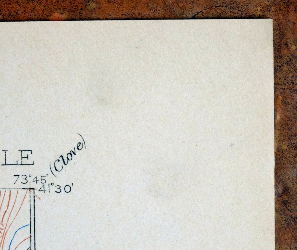
| SCALE | 1:62500 |
| CONTOUR INTERVAL | 20 feet |
| SHEET DIMENSIONS | 16 1/2 x 20 inches |
| MAP DIMENSIONS | 13 1/8 x 17 1/2 inches |
| COVERAGE AREA | 13 x 17 miles |
| SOURCE | From an uncommonly well-preserved collection |
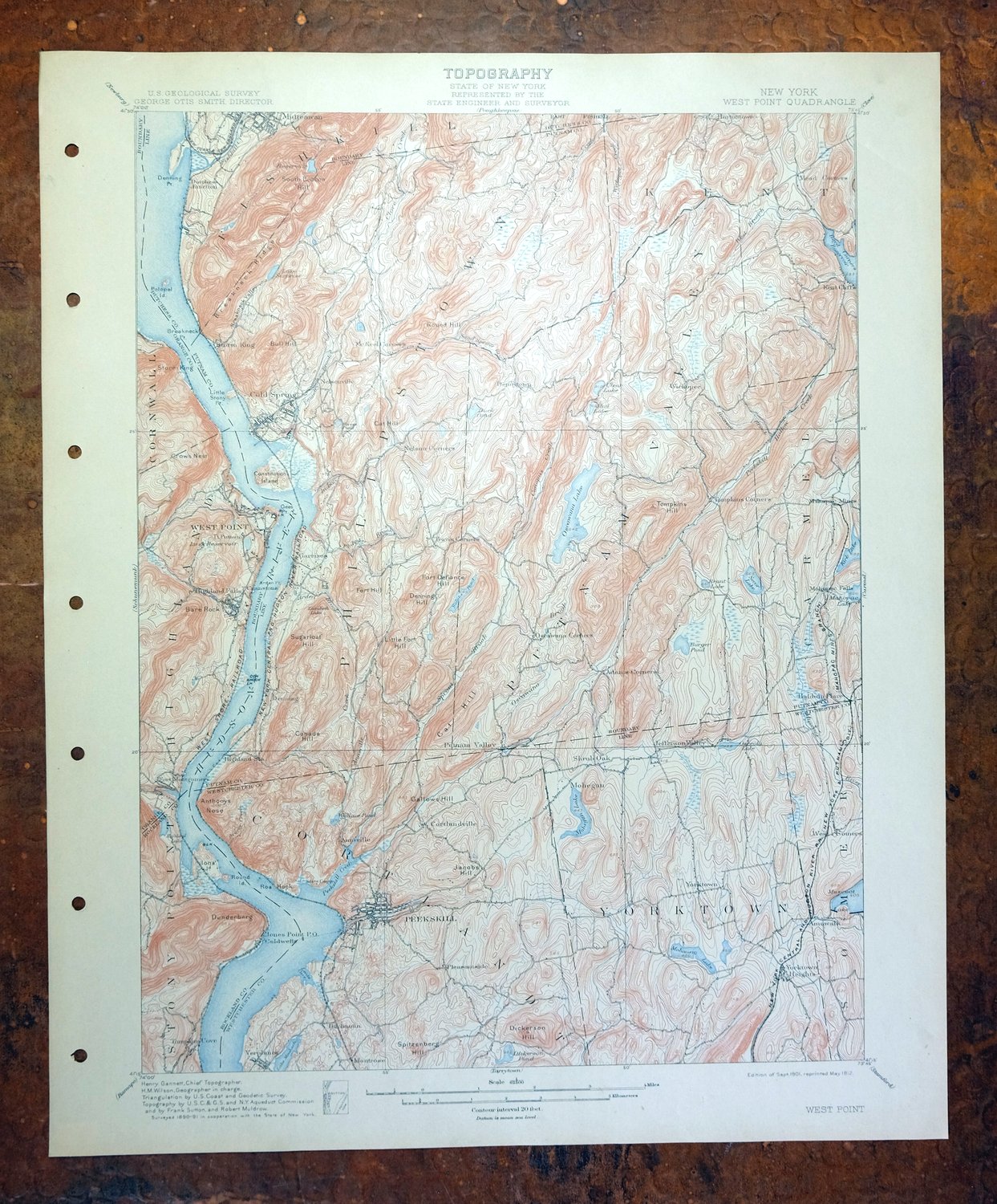
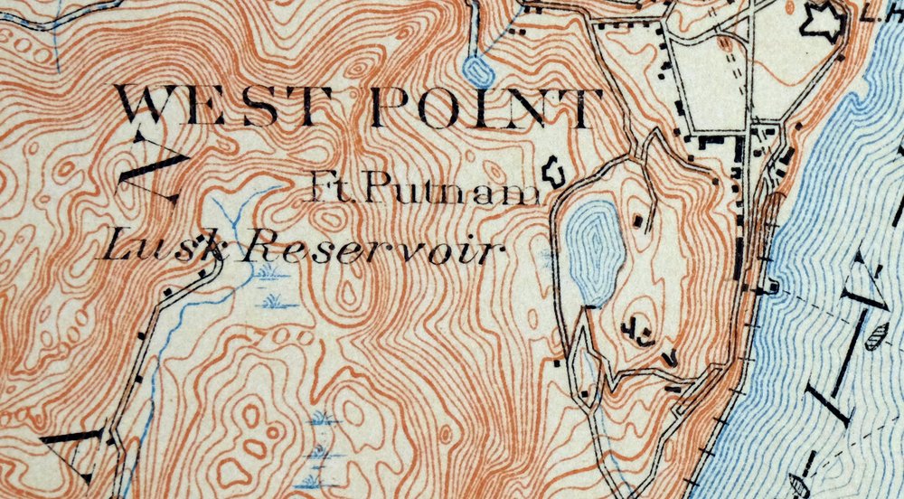
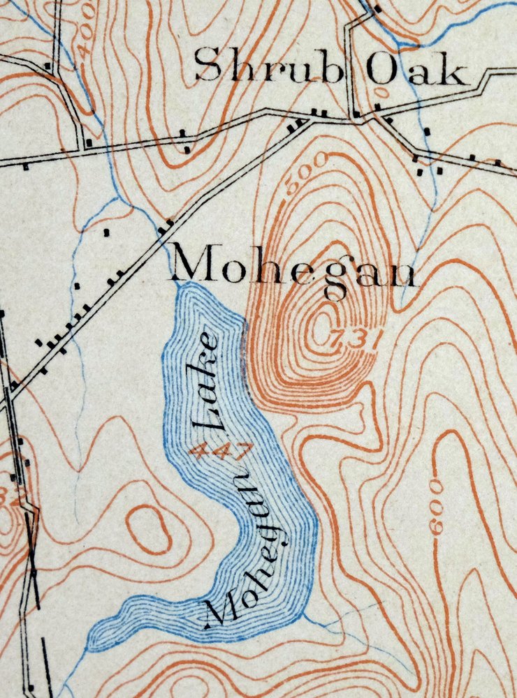
| MAP NOTES | A fascinating historical snapshot of the area from south of Beacon to Peekskill and Yorktown Heights, surveyed before the modern highway system, showing historic travel routes, rail lines, river crossings, structures, and placenames. |
| SHEET CONDITION For maps of this vintage, effort is made to note all visible flaws, no matter how minor. | |
| OVERALL CONDITION | Very Good |
| SHEET NOTES | very lightly handled, never folded, smooth and flat |
| MAP AREA | flawless map area |
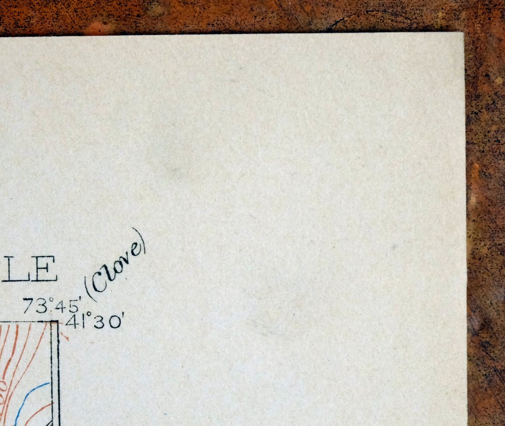
| COLLARS | no wear or tears, no markings, minor blemishes, hole punches along left collar |
 | |
| MAP COVERAGE Quadrangle extent overlaid on current basemap. | |
| BACKSIDE LEGEND | |
 A map summary is printed on the back side of the West Point sheet similar to the one shown in the picture. It outlines the history, purpose, and status of the USGS mapping program at the time of the printing in 1912. It also provides instructions on how to read contour lines and a description of how they are used to depict the terrain. At the bottom of the page is a legend showing all of the symbols used to represent the cultural, relief, and water features found on the map. | |
| PLACENAMES Depending on map series and survey date, all of the features listed below may not be shown on this map. This list contains features that currently exist or historically existed within the area covered by the map. The list can be used as a reference to determine if this map covers your area of interest. Placenames are listed alphabetically next to each feature type. | |
| CITIES AND TOWNS (CURRENT) | Amawalk, Annsville, Beacon, Buchanan, Cold Spring, Cornwall on Hudson, Crompond, Fort Montgomery, Furnace Woods, Granite Springs, Highland Falls, Jefferson Valley, Jefferson Valley-Yorktown, Jones Point, Lake Mohegan, Mahopac, Montrose, Nelsonville, Newburgh, Peekskill, Roe Park, Shenorock, Shrub Oak, Toddville, Tomkins Cove, Van Cortlandtville, Verplanck, West Point, Yorktown, and Yorktown Heights |
| COUNTIES COVERED | Dutchess, Orange, Putnam, Rockland, and Westchester |
| FEDERAL LAND UNITS | West Point U.S. Military Academy |
| RIVERS AND STREAMS | Annsville Creek, Arden Brook, Barger Brook, Black Pond Brook, Breakneck Brook, Broccy Creek, Canopus Creek, Copper Mine Brook, Crows Nest Brook, Dickey Brook, Doodletown Brook, Dry Brook, Fishkill Creek, Foundry Brook, Furnace Brook, Gordons Brook, Hallocks Mill Brook, Highland Brook, Hudson River, Hunter Brook, Indian Brook, McGregory Brook, Oscawana Brook, Peekskill Hollow Creek, Philips Brook, Plum Brook, Quassaic Creek, Roaring Brook, Sand Spring Brook, Secor Brook, Shrub Oak Brook, Squirrel Hollow Brook, Stony Lonesome Brook, The Timp Brook, Trout Creek, Wades Brook, West Branch Canopus Creek, West Branch Croton River, Wiccopee Brook, and Wiccopee Creek |
| WATER BODIES | Lake Alice, Amawalk Reservoir, Barrett Pond, Beacon Reservoir, Broccy Creek Reservoir, Brooks Lake, Bryant Pond, Camp Field Reservoir, Canopus Lake, Lake Celeste, Clear Lake, Cortlandt Lake, Cragston Lakes, Crom Pond, Crystal Lake, Dales Pond, Dickerson Pond, Dickiebusch Lake, Garrison Pond, Gregory Pond, Jacox Pond, Jordan Pond, Kirk Lake, Lake Surprise, Loretta Lake, Loch Lyall, Lake Mahopac, Melzingah Reservoir, Mill Pond, New Croton Reservoir, Oceola Lake, Oscawana Lake, Lake Peekskill, Pelton Pond, Petersons Pond, Roaring Brook Lake, Roe Pond, Seven Hills Lake, Sparkle Lake, Stillwater Pond, Lake Tibet, Lake Valhalla, and Wiccopee Reservoir |
| Locations: Bear Mountain, CYO Camp, Beverly Dock, Camp Smith, Camp Wiccopee, Christian Corners, Fahnestock Corners, Fahnestock Ski Slope, Garrison Four Corners, Highlands Country Club, Houseman Corners, McKeel Corners, Michie Stadium, Nokomis Camp, Putnam Country Club, Saint Francis Camp, South Dock, Storm King, Third Order Villa, Travis Corners, Valeria Home, and YCW Camp. Administrative Boundaries: Town of Cortlandt, City of Peekskill, Town of Philipstown, Town of Putnam Valley, and Town of Yorktown. Mountains, Peaks, and Summits: Bald Mountain, Bare Rock Mountain, Bull Hill, Blue Mountain, California Hill, Bryant Hill, Canada Hill, Candlewood Hill, Canopus Hill, Castle Rock, Cat Hill, Cat Rock, Crows Nest, Denning Hill, Dickerson Mountain, Dunderberg Mountain, East Mountain, Fort Defiance Hill, Fort Hill, French Hill, Granite Mountain, Indian Hill, Jacobs Hill, Jones Hill, Kiah Hill, Lambs Hill, Little Fort Hill, Manitou Mountain, Mine Mountain, Moneyhole Mountain, Moose Hill, North Beacon Mountain, Piano Mountain, Prospect Hill, Round Hill, Snake Hill, South Beacon Mountain, Spitzenberg Mountain, Spruce Hill, Storm King Mountain, Strawberry Hill, Sugarloaf Hill, Sugarloaf Mountain, The Timp, Tinker Hill, and White Rock. Valleys and Canyons: The Clove. Parks: Bear Mountain State Park, Beecher Park, Blue Mountain Reservation, Clarence Fahnestock Memorial State Park, Depew Park, Fort Hill Park, Hudson Highlands State Park, Mohansic State Park, Monument Park, Pugsley Park, and The Parade. Trails: Appalachian National Scenic Trail, Goethals Trail, Patrick Trail, Pipe Line Trail, and Redoubt Trail. Drainages: Annsville Creek, Arden Brook, Barger Brook, Black Pond Brook, Breakneck Brook, Broccy Creek, Canopus Creek, Copper Mine Brook, Crows Nest Brook, Dickey Brook, Doodletown Brook, Fishkill Creek, Foundry Brook, Gordons Brook, Hallocks Mill Brook, Highland Brook, Hunter Brook, Indian Brook, McGregory Brook, Mohegan Outlet, Oscawana Brook, Peekskill Hollow Creek, Philips Brook, Popolopen Creek, Roaring Brook, Sand Spring Brook, Secor Brook, Shrub Oak Brook, Snake Hole Creek, Sprout Brook, Squirrel Hollow Brook, Stony Lonesome Brook, The Timp Brook, Trout Creek, Wades Brook, West Branch Canopus Creek, and Wiccopee Brook. Islands: Constitution Island, Duck Island, Fish Island, Iona Island, Pollepel Island, and Round Island. Capes: Arden Point, Breakneck Point, Charles Point, Con Hook, Denning Point, East Gable, Gees Point, Indian Point, Jones Point, Little Stony Point, Magazine Point, Mystery Point, Roa Hook, Target Point, and Travis Point. Churches: Calvary Memorial Church, Canopus Church, Church of the Hill, Holy Trinity Chapel, House of Prayer Church, Indian Lake Chapel, Leila Leeds Memorial Chapel, Manitou Chapel, Monastery of Mary Immaculate, Mount Saint Francis Church, Mount of Atonement Monastery, Red Mills Church, Saint Andrews Church, Saint Georges Church, Saint Johns Church, Saint Josephs Church, Saint Lawrence Seminary, Saint Lukes Church, Saint Marys Church, Saint Patricks Church, Saint Philips Church, Tomahawk Chapel, Trinity Chapel, and Union Church. Hospitals: Saint Elizabeths Hospice. Lakes and Ponds: Adolphs Pond, Lake Alice, Barger Pond, Barrett Pond, Brooks Lake, Bryant Pond, Canopus Lake, Cat Pond, Catfish Pond, Lake Celeste, Clear Lake, Crom Pond, Crystal Lake, Curry Pond, Dales Pond, Dassori Pond, Hessian Lake, Dickiebusch Lake, Duck Pond, Lake Elizabeth, Garrison Pond, Gregory Pond, Indian Lake, Jacox Pond, John Pond, Jordan Pond, Kirk Lake, Laths Pond, Loretta Lake, Lounsbury Pond, Lake Meahagh, Mill Pond, Lake Mitchell, Mohansic Lake, Mud Lake, Oceola Lake, Oscawana Lake, Lake Ossi, Lake Peekskill, Pells Pond, Pelton Pond, Penelope Pond, Reeves Pond, Secor Lake, Sparkle Lake, Spy Pond, Stillwater Pond, Lake Tibet, Tomkins Lake, Twin Lakes, Upper Cranberry Pond, Lake Valhalla, and Weise Pond. Buildings: Thayer Hall and Village Hall. Bluffs: Anthonys Nose. Gaps: South Mountain Pass and Wiccopee Pass. Canals: Catskill Aqueduct. Bridges: Bear Mountain Bridge and Popolopen Bridge. Bays: Doodletown Bight, Foundry Cove, Lents Cove, and Peekskill Bay. Airports: Mahopac Airport and Westchester Resco Heliport. Schools: Brookside School, Central School, Cold Spring Institute, Drum Hill School, Franklin School, Garrison School, Gordon School, Hillcrest School, Hudson School, Ladycliff College, Lakeland High School, Lindsey School, Locust Avenue School, Loyola Seminary, Manitou School, Marianist School, McKinley School, Montville School, Mount Saint Florence School, Oakside School, Park Street School, Peekskill Military Academy, Post School, Saint Basils Academy, Saint Columbanus School, Saint Josephs Novitiate, Saint Josephs School, Saint Marys School, Saint Peters School, Saints Patrick and George School, Uriah Hill School, Villa Loretto School, and Woodside School. Ridges: Agor Ridge, Bushy Ridge, Breakneck Ridge, The Crown Ridge, and Scofield Ridge. Reservoirs and Tanks: Amawalk Reservoir, Beacon Reservoir, Broccy Creek Reservoir, Camp Field Reservoir, Cold Spring Reservoir, Cortlandt Lake, Cragston Lakes, Delafield Pond, Dickerson Pond, Lake Mohegan, Lake Surprise, Lusk Reservoir, Loch Lyall, Melzingah Reservoir, Petersons Pond, Roaring Brook Lake, Roe Pond, Sagamore Lake, Wallace Pond, and Wiccopee Reservoir. Flats: Ring Meadow and Salisbury Meadow. Towers: WBNR-AM (Beacon), WHUD-FM (Peekskill), WLNA-AM (Peekskill), and WSPK-FM (Poughkeepsie). | |
| SHIPPING AND RETURNS | |
 This map sheet will be carefully rolled in a sturdy tube and shipped via the US Postal Service. If you find that the sheet you receive is not as described in the listing, you may ship it back to us for a refund of the purchase price. | |
West Point New York Newburgh Peekskill USGS Topo Map 1912
$105
This USGS topographic sheet is a 1901 edition of the West Point quad, printed in 1912, and it remains in very good condition – lightly handled, never folded, and smooth and flat on thick stock, with only minor collar blemishes and hole punches along the left edge. Drawn from an 1890 and 1891 field survey under geographer Henry Gannett, the map takes in the Hudson Highlands from south of Beacon down to Peekskill and Yorktown Heights, with West Point itself giving the quad its name and Newburgh among the places within its boundaries. Surveyed before the modern highway system, it records the historic travel routes, rail lines, river crossings, structures, and placenames of the region as they stood at the turn of the century, and it comes from an uncommonly well-preserved collection.
In stock
This antique sheet is a 1901 edition of the West Point New York USGS topographic map. It is an authentic 114-year-old 1912 United States Geological Survey print in very good condition.
HOW THIS MAP CAN BE USED
In addition to making a fascinating conversation piece, this sheet would look great in a frame or on display, make a unique and prized gift for anyone interested in this area, be perfect as a reference for genealogy studies or general historical research, or fill that missing piece in your collection.
FEATURES SHOWN ON THE MAP
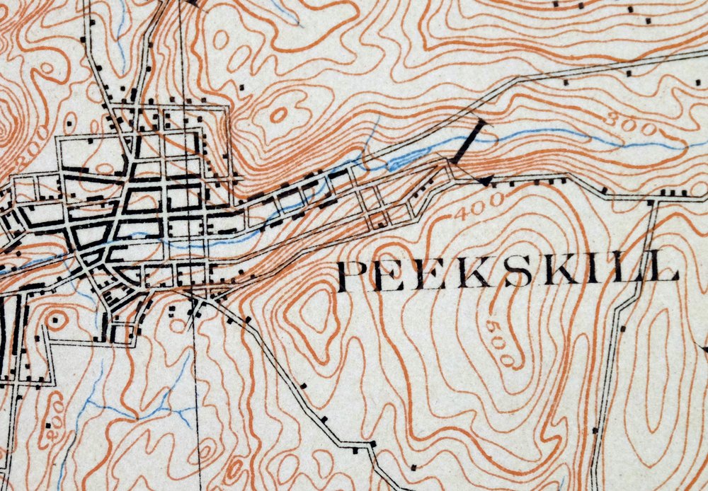
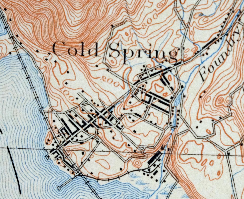
The West Point 15-minute map shows cities and towns, roads, railroads, rivers, creeks, elevation contour lines, public land survey lines, county, state, and other administrative boundaries as they existed at the time of the survey in 1890 and 1891. All known structures (houses, businesses, churches, schools, barns, cabins, etc) are also shown, with exceptions in some urban areas, where only landmark buildings may be shown.
A VALUABLE HISTORICAL RECORD
Maps from the 15-minute series for the continental United States are no longer produced or printed by the USGS and original prints are becoming increasingly difficult to find. They are a valuable historical record for an area, as they contain many placenames and features that have been dropped from more recent maps.
Nearby maps
-

Schunemunk New York Newburgh Kiryas Joel USGS Topo Map 1915
$65 Add to cart -

Goshen New York Middletown Warwick USGS Topographic Map 1913
$55 Add to cart -

Danbury Connecticut Trumbull Bethel USGS Topo Map 1899
$70 Add to cart -

Harlem New York New York Yonkers USGS Topo Map 1913 Antique
$250 Add to cart -

Milford Pennsylvania Lackawaxen Pond Eddy USGS Topo Map 1915
$58 Add to cart -
Hawley Pennsylvania Tafton USGS 15-Min Topo Map 1964 Vintage
$44 Add to cart -

Damascus Pennsylvania Honesdale USGS Topo Map 1964 Vintage
$35 Add to cart -

Park Ridge New Jersey New City Ridgewood USGS Topo Map 1963
$45 Add to cart -
Norwalk South Connecticut Stamford Darien USGS Topo Map 1963
$40 Add to cart -
Westport Connecticut Fairfield USGS Topographic Map 1973
$42 Add to cart -
Litchfield Connecticut Waterbury Oakville USGS Topo Map 1910
$100 Add to cart -

Plainfield New Jersey Edison Somerset USGS Topo Map 1965
$42 Add to cart -

New Brunswick New Jersey Spotswood Edison USGS Topo Map 1965
$32 Add to cart -

Riverhead New York Manorville Calverton USGS Topo Map 1915
$175 Add to cart -

Moodus Connecticut Lake Pocotopaug USGS Topographic Map 1946
$32 Add to cart -
Honesdale Pennsylvania Carbondale Waymart USGS Topo Map 1945
$49 Add to cart -

Holyoke Massachusetts Springfield USGS Topo Map 1897 Antique
$85 Add to cart -
Starrucca Pennsylvania Hancock Lakewood USGS Topo Map 1964
$40 Add to cart -
Sag Harbor New York Hampton Bays USGS Topo Map 1913 Antique
$145 Add to cart -
Delhi New York Davenport USGS 15-Min Topo Map 1911 Antique
$52 Add to cart -
Olyphant Pennsylvania Scranton Dunmore USGS Topo Map 1960
$37 Add to cart -

Troy New York Albany Watervliet USGS Topo Map 1907 Antique
$110 Add to cart -

Trenton New Jersey Philadelphia Levittown USGS Topo Map 1907
$150 Add to cart -
Uncasville Connecticut Ledyard Norwich USGS Topo Map 1984
$34 Add to cart
