MAP DETAILS | |
|---|---|
| TITLE | Moodus |
| STATE | Connecticut |
| LOCATION | Vicinity of Lake Pocotopaug, 19 miles southeast of Hartford |
| SERIES | 7.5-minute |
| SURVEYED | 1942 and 1943 Field Survey |
| EDITION | 1946 |
| PRINTED | 1946 |
| PRINT NOTES | Thick paper stock |
| SCALE | 1:31680 |
| CONTOUR INTERVAL | 10 feet |
| SHEET DIMENSIONS | 17 x 21 inches (approximate) |
| MAP DIMENSIONS | 12 7/8 x 17 1/4 inches |
| COVERAGE AREA | 6 x 9 miles |
| SHEET CONDITION For maps of this vintage, effort is made to note all visible flaws, no matter how minor. | |
| OVERALL CONDITION | Very Good |
| SHEET NOTES | lightly handled, never folded |
| MAP AREA | flawless map area |
| COLLARS | no wear or tears, no markings, minor age toning along collar edge |
| MAP COVERAGE Quadrangle extent overlaid on current basemap. | |
| BACKSIDE LEGEND | |
 A map summary is printed on the back side of the Moodus sheet similar to the one shown in the picture. It outlines the history, purpose, and status of the USGS mapping program at the time of the printing in 1946. It also provides instructions on how to read contour lines and a description of how they are used to depict the terrain. At the bottom of the page is a legend showing all of the symbols used to represent the cultural, relief, and water features found on the map. | |
| PLACENAMES Depending on map series and survey date, all of the features listed below may not be shown on this map. This list contains features that currently exist or historically existed within the area covered by the map. The list can be used as a reference to determine if this map covers your area of interest. Placenames are listed alphabetically next to each feature type. | |
| CITIES AND TOWNS (CURRENT) | East Hampton, Lake Pocotopaug, Moodus, and Terramuggus |
| COUNTIES COVERED | Hartford, Middlesex, New London, and Tolland |
| RIVERS AND STREAMS | Blackledge River, Cattle Lot Brook, Dickinson Creek, Elbow Brook, Fawn Brook, Fawn Hill Brook, Flat Brook, Jeremy River, Lyman Brook, Moodus River, Pine Brook, Safstrom Brook, and Salmon River |
| WATER BODIES | Babcock Pond, Bevins Pond, Cone Pond, Day Pond, Jones Street Pond, Moodus Reservoir, Number One Pond, Number Two Pond, Pickerel Lake, Pine Meadows Park Pond, Pocotopaug Lake, Post Pond, Standish Pond, Strong Pond, and Thousand Acre Pond |
| Locations: Banner Golf Course, Camp Halburn, Hartford County 4-H Camp, Nathan Hale Place, Nathan Hale Plaza Shopping Center, and Tri-Town Shopping Center. Mountains, Peaks, and Summits: Baker Hill, Bull Hill, Cave Hill, Chalker Hill, Jeremiahs Back, and Prospect Hill. Parks: Day Pond State Park and Westchester Green. Drainages: Blackledge River, Cattle Lot Brook, Day Meadow Brook, Day Pond Brook, Dickinson Creek, Elbow Brook, Fawn Brook, Fawn Hill Brook, Flat Brook, Senate Brook, Shady Brook, Jeremy River, Lyman Brook, Meadow Brook, Molley Brook, Pickerel Lake Brook, Pine Brook, Safstrom Brook, Standish Brook, and Wolf Brook. Capes: Arrow Point and Markham Point. Churches: Marlborough Congregational Church, Saint Bridget of Kildare Church, and Westchester Congregational Church. Lakes and Ponds: Babcock Pond, Cone Pond, Day Pond, Jones Street Pond, Number One Pond, Number Two Pond, Pickerel Lake, Standish Pond, Strong Pond, and Thousand Acre Pond. Buildings: Amasa Day House and East Haddam Free Public Library. Dams: Babcock Pond Dam, Jones Street Pond Dam, Leesville Dam, Moodus Reservoir Dam, Pickerel Lake Dam, and Pine Meadows Park Pond Dam. Crossings: Interchange 16. Bridges: Old Comstock Bridge. Bays: Markham Bay. Airports: Somers Field and Rankl Field. Swamps: Babcock Swamp, Bear Swamp, and Cranberry Meadow. Schools: East Haddam School and Memorial School. Reservoirs and Tanks: Leesville Pond, Moodus Reservoir, North Westchester Pond, Pine Meadows Park Pond, and Post Pond. | |
| SHIPPING AND RETURNS | |
 This map sheet will be carefully rolled in a sturdy tube and shipped via the US Postal Service. If you find that the sheet you receive is not as described in the listing, you may ship it back to us for a refund of the purchase price. | |
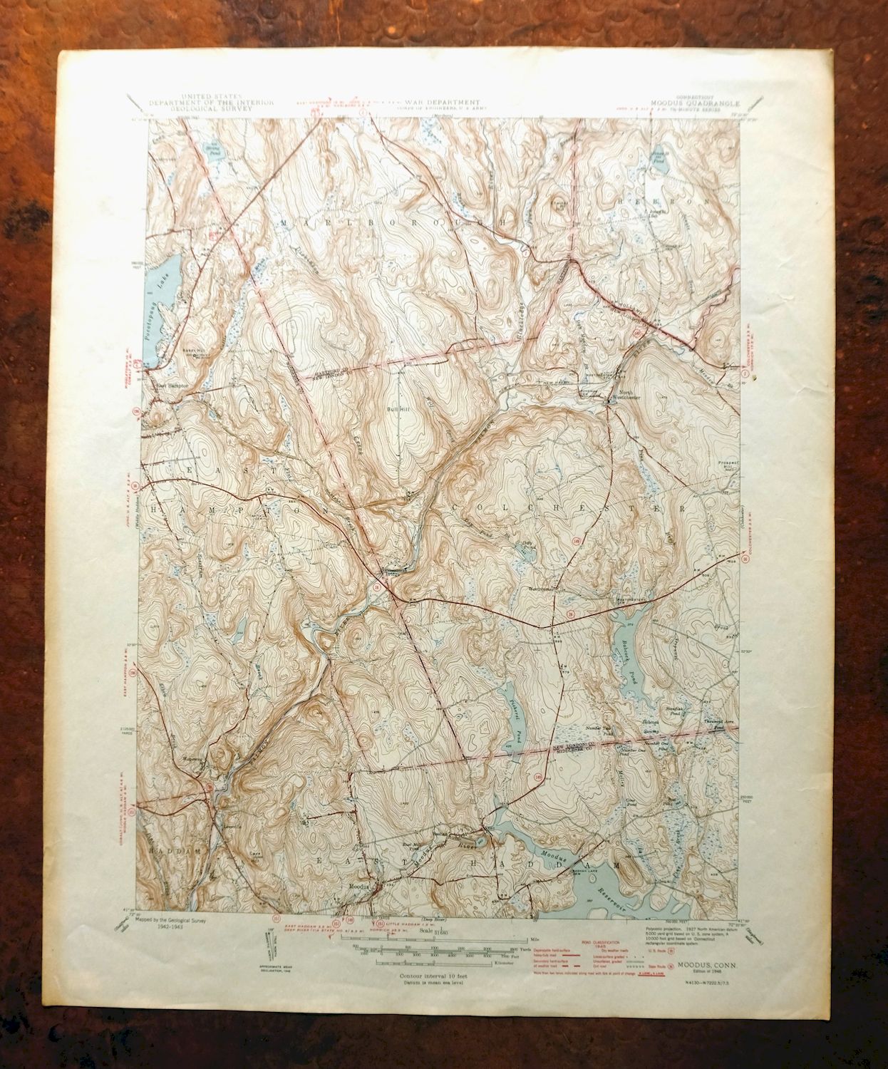
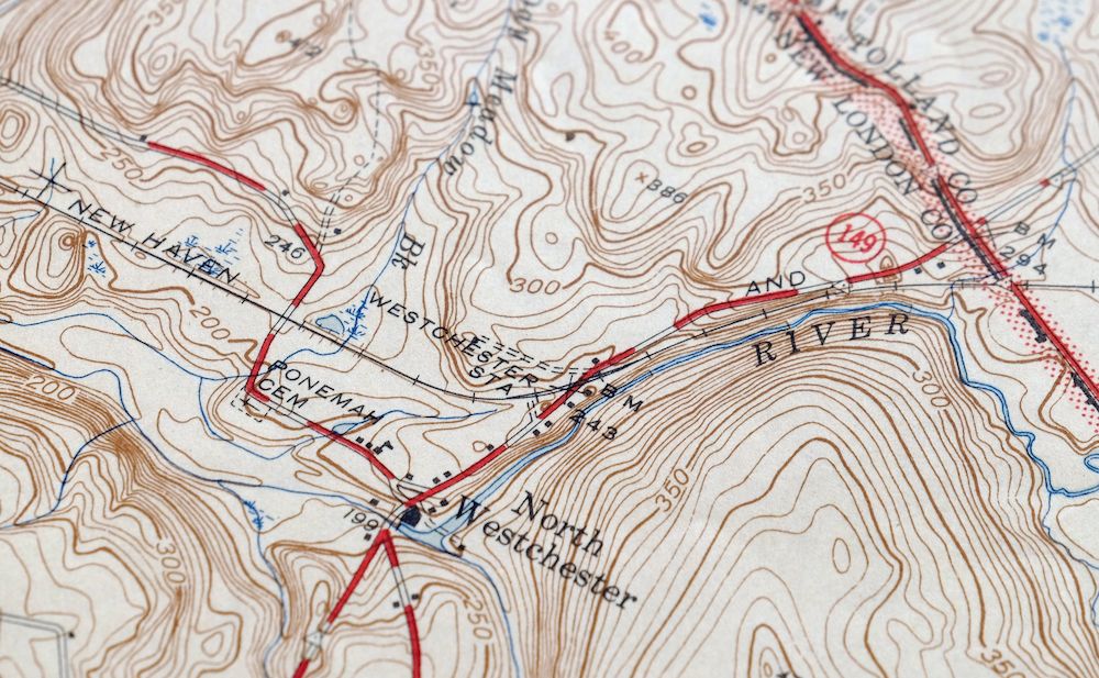
Moodus Connecticut Lake Pocotopaug USGS Topographic Map 1946
$32
Printed in its year of first publication, 1946, this USGS 7.5-minute topographic sheet is a first-year print in very good condition—lightly handled and never folded, on thick stock, with a flawless map area and only minor age toning along the collar edge. The quad sits about 19 miles southeast of Hartford, taking in Lake Pocotopaug and the towns of East Hampton and Moodus along the boundaries of Hartford, Middlesex, New London, and Tolland counties. Drawn from a 1942 and 1943 field survey, it records this stretch of central Connecticut as it stood in the mid-1940s, with Lake Pocotopaug a defining feature of the sheet. The reverse carries printed USGS reference material. Because the sheet was never folded and lies flat on heavy stock, it is a good candidate for framing.
In stock
This vintage sheet is a 1946 edition of the Moodus Connecticut USGS topographic map. It is an original 80-year-old United States Geological Survey print in very good condition.
HOW THIS MAP CAN BE USED
In addition to making a fascinating conversation piece, this sheet would look great in a frame or on display, make a unique and prized gift for anyone interested in this area, be perfect as a reference for genealogy studies or general historical research, or fill that missing piece in your collection.
FEATURES SHOWN ON THE MAP
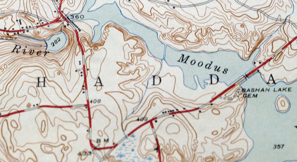
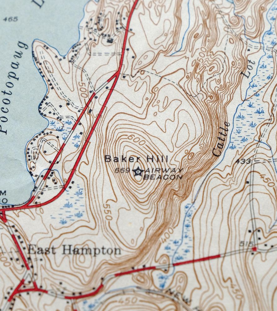
The Moodus 7.5-minute map shows cities and towns, roads, paths, railroads, rivers, creeks, elevation contour lines, public land survey lines, county, state, and other administrative boundaries as they existed at the time of the survey in 1942 and 1943. All known structures (houses, businesses, churches, schools, barns, cabins, etc) are also shown.
A VALUABLE HISTORICAL RECORD
This map is from the 7.5-minute series, the most detailed series that is widely available from the USGS. The 1946 Moodus map is a valuable historical record for the area. It contains some placenames and features that have been dropped from more recent maps.
Nearby maps
-
Uncasville Connecticut Ledyard Norwich USGS Topo Map 1984
$34 Add to cart -
Litchfield Connecticut Waterbury Oakville USGS Topo Map 1910
$100 Add to cart -
Sag Harbor New York Hampton Bays USGS Topo Map 1913 Antique
$145 Add to cart -

Riverhead New York Manorville Calverton USGS Topo Map 1915
$175 Add to cart -

Holyoke Massachusetts Springfield USGS Topo Map 1897 Antique
$85 Add to cart -

Danbury Connecticut Trumbull Bethel USGS Topo Map 1899
$70 Add to cart -
Westport Connecticut Fairfield USGS Topographic Map 1973
$42 Add to cart -

Blackstone Massachusetts Milford Hopedale USGS Topo Map 1944
$22 Add to cart -

Quinsigamond Massachusetts Milford USGS Topographic Map 1910
$125 Add to cart -
Norwalk South Connecticut Stamford Darien USGS Topo Map 1963
$40 Add to cart -
Mansfield Massachusetts Sharon Walpole USGS Topo Map 1961
$18 Add to cart -

West Point New York Newburgh Peekskill USGS Topo Map 1912
$105 Add to cart -
Norwood Massachusetts Boston Dover USGS Topographic Map 1960
$18 Add to cart -

Schunemunk New York Newburgh Kiryas Joel USGS Topo Map 1915
$65 Add to cart -

Harlem New York New York Yonkers USGS Topo Map 1913 Antique
$250 Add to cart -

Park Ridge New Jersey New City Ridgewood USGS Topo Map 1963
$45 Add to cart -

Taconic Vermont Pittsfield Adams USGS Topographic Map 1912
$95 Add to cart -

Troy New York Albany Watervliet USGS Topo Map 1907 Antique
$110 Add to cart -

Goshen New York Middletown Warwick USGS Topographic Map 1913
$55 Add to cart -
Provincetown Massachusetts USGS Topographic Map 1978 Vintage
$58 Add to cart -

Plainfield New Jersey Edison Somerset USGS Topo Map 1965
$42 Add to cart -
Amsterdam New York Rotterdam Hagaman USGS Topo Map 1912
$45 Add to cart -

Milford Pennsylvania Lackawaxen Pond Eddy USGS Topo Map 1915
$58 Add to cart -

New Brunswick New Jersey Spotswood Edison USGS Topo Map 1965
$32 Add to cart
