MAP DETAILS | |
|---|---|
| TITLE | Lake Frances |
| STATE | Montana |
| LOCATION | 20 miles south of Cut Bank |
| SERIES | 15-minute |
| SURVEYED | 1934 Aerial and Field Survey |
| GEOGRAPHER | S.C. Kain |
| EDITION | 1937 |
| PRINTED | 1949 |
| SCALE | 1:62500 |
| CONTOUR INTERVAL | 25 feet |
| SHEET DIMENSIONS | 17 x 21 inches |
| MAP DIMENSIONS | 11 5/8 x 17 1/2 inches |
| COVERAGE AREA | 11 x 17 miles |
| SHEET CONDITION For maps of this vintage, effort is made to note all visible flaws, no matter how minor. | |
| OVERALL CONDITION | Flawless |
| SHEET NOTES | very lightly handled, never folded, smooth and flat |
| MAP AREA | no wear, no markings, no blemishes |
| COLLARS | no wear or tears, no markings, no blemishes |
| MAP COVERAGE Quadrangle extent overlaid on current basemap. | |
| BACKSIDE LEGEND | |
 A map summary is printed on the back side of the Lake Frances sheet similar to the one shown in the picture. It outlines the history, purpose, and status of the USGS mapping program at the time of the printing in 1949. It also provides instructions on how to read contour lines and a description of how they are used to depict the terrain. At the bottom of the page is a legend showing all of the symbols used to represent the cultural, relief, and water features found on the map. | |
| PLACENAMES Depending on map series and survey date, all of the features listed below may not be shown on this map. This list contains features that currently exist or historically existed within the area covered by the map. The list can be used as a reference to determine if this map covers your area of interest. Placenames are listed alphabetically next to each feature type. | |
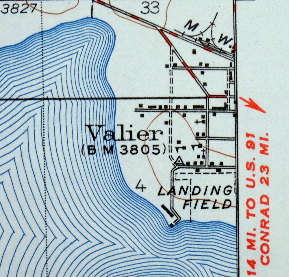
| CITIES AND TOWNS (CURRENT) | Valier |
| COUNTIES COVERED | Glacier and Pondera |
| FEDERAL LAND UNITS | Blackfeet Indian Reservation |
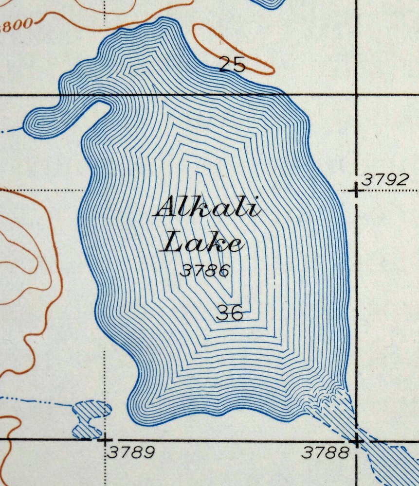
| RIVERS AND STREAMS | Alkali Lake, Birch Creek, Cut Bank Creek, Dupuyer Creek, and Two Medicine River |
| WATER BODIES | Alkali Lake, Lake Frances, and Lake Francis |
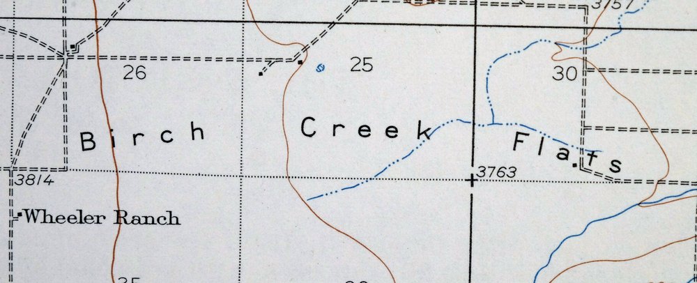
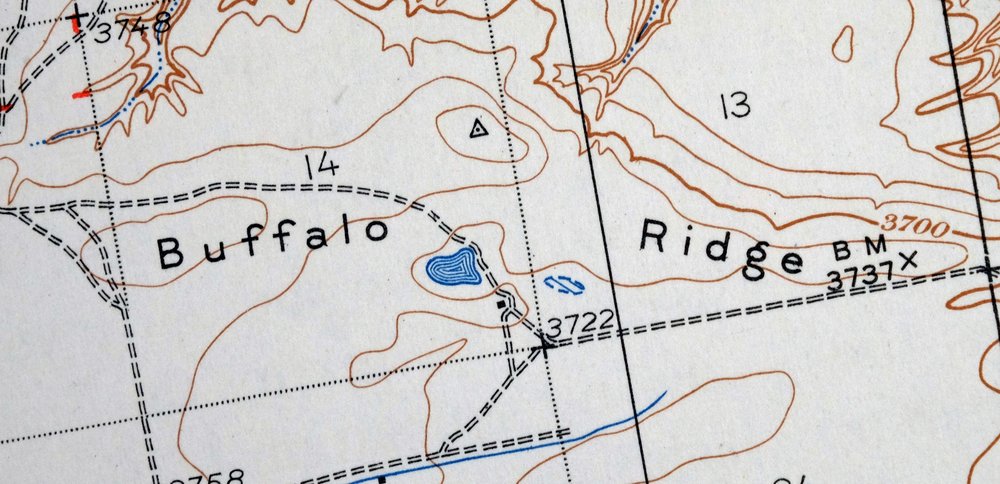
| Populated Place: Pondera Colony, Aubrey Crossing, Blair Crossing, Edwards Crossing, Kingsbury Colony, Kuka Crossing, Pierce Crossing, and Shields Crossing. Locations: Valier, Bartley Ranch, Bird Ranch, Collins Ranch, Goolin Ranch, Home Ranch, Hubbard Ranch, Kilian Ranch, Kuka Ranch, Lauffer Ranch, Lenoir Ranch, Moser Ranch, Parker Ranch, Pierce Ranch, Pioneer Farm, Rock City, Ryan Ranch, Wagner Ranch, Wayman Ranch, Wheeler Ranch, and Wolstad Ranch. Administrative Boundaries: Blackfeet Reservation East Division and Town of Valier. Mountains, Peaks, and Summits: Flag Butte and Lookout Butte. Valleys and Canyons: Cartwright Coulee, Laughlin Coulee, Miller Coulee, Rocky Ridge Coulee, and Sober Up Coulee. Parks: Miller Park. Drainages: Birch Creek and Dupuyer Creek. Mines: Blair Mine, Kennedy Mine, Kimball Mine, Kingston Mine, and Slezak Mine. Churches: First Baptist Church, Saint Francis Catholic Church, Valier Lutheran Church, and Valier United Methodist Church. Hospitals: Valier Clinic. Lakes and Ponds: Alkali Lake. Buildings: Valier Public Library and Valier Volunteer Fire Department. Dams: Lake Frances North Dam. Canals: A 4 Canal, A Canal, AN Six Canal, AN Two Canal, B Four Ditch, Badger Fisher Main Canal, C 3 Canal, C Canal, K Canal, Lateral K, M Canal, N Canal, Nineteen K Canal, Twentytwo K Canal, and Two M Canal. Bridges: Birch Creek Bridge. Census: Kingsbury Colony Census Designated Place. Schools: Kingsbury Colony School, Pondera Colony School, Valier Elementary School, and Valier High School. Ridges: Buffalo Ridge. Reservoirs and Tanks: Lake Frances. Flats: Birch Creek Flats. Wells: 29N06W24DABA01 Well, 30N05W33DDB_01 Well, and 31N05W34CCCC01 Well. Cemetery: Lakeview Cemetery. | |
| SHIPPING AND RETURNS | |
 This map sheet will be carefully rolled in a sturdy tube and shipped via the US Postal Service. If you find that the sheet you receive is not as described in the listing, you may ship it back to us for a refund of the purchase price. | |
Lake Frances Montana Valier USGS 15-Min Topographic Map 1949
$42
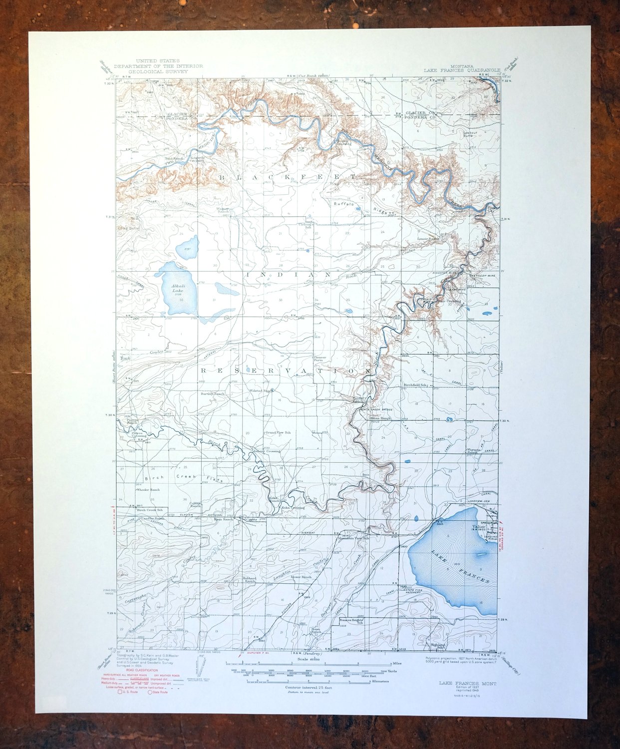
This USGS 15-minute topographic map is a 1937 edition printed in 1949, and the sheet is in flawless condition — very lightly handled, never folded, and smooth and flat. Based on a 1934 aerial and field survey with S.C. Kain as geographer, it takes in Lake Frances and the town of Valier in north-central Montana, roughly 20 miles south of Cut Bank, spanning parts of Glacier and Pondera counties and reaching into the Blackfeet Indian Reservation. The lake gives the quad its name and remains its defining feature, set in the open country along the Rocky Mountain Front’s eastern edge. Because this print was never folded and lies flat, it would frame well for anyone with ties to the Valier area or the reservation lands nearby.
In stock
This vintage sheet is a 1937 edition of the Lake Frances Montana USGS topographic map. It is an original 77-year-old 1949 United States Geological Survey print in flawless condition.
HOW THIS MAP CAN BE USED
In addition to making a fascinating conversation piece, this sheet would look great in a frame or on display, make a unique and prized gift for anyone interested in this area, be perfect as a reference for genealogy studies or general historical research, or fill that missing piece in your collection.
FEATURES SHOWN ON THE MAP
The Lake Frances 15-minute map shows cities and towns, roads, railroads, rivers, creeks, elevation contour lines, public land survey lines, county, state, and other administrative boundaries as they existed at the time of the survey in 1934. All known structures (houses, businesses, churches, schools, barns, cabins, etc) are also shown, with exceptions in some urban areas, where only landmark buildings may be shown.
A VALUABLE HISTORICAL RECORD
Maps from the 15-minute series for the continental United States are no longer produced or printed by the USGS and original prints are becoming increasingly difficult to find. They are a valuable historical record for an area, as they contain many placenames and features that have been dropped from more recent maps.
Nearby maps
-
Fairfield Montana Simms Fort Shaw USGS Topo Map 1952 Vintage
$45 Add to cart -
Laredo Montana Box Elder Agency USGS Topographic Map 1975
$37 Add to cart -

East Helena Montana Helena Clancy USGS Topographic Map 1974
$42 Add to cart -

Jefferson City Montana Clancy Basin USGS Topo Map 1967
$39 Add to cart -

Missoula Montana Stevensville Lolo USGS Topographic Map 1925
$57 Add to cart -

Saint Regis Montana St. Regis USGS Topo Map 1968 Vintage
$40 Add to cart -

Boulder Montana Butte-Silver Bow Clancy USGS Topo Map 1933
$39 Add to cart -

Devils Fence Montana USGS 15-Min Topo Map 1950 Vintage
$36 Add to cart -
Lewistown Montana Judith Mountains USGS 15-Min Topo Map 1975
$40 Add to cart -
Judith Peak Montana Black Butte USGS Topo Map 1978 Vintage
$38 Add to cart -

Cataldo Idaho Lakeview Osburn USGS Topo Map 1954 Vintage
$45 Add to cart -

Sedan Montana USGS 15-Min Topographic Map 1956 Vintage
$38 Add to cart -
Bozeman Pass Montana USGS 15-Min Topo Map 1978 Vintage
$42 Add to cart -

Ennis Montana McAllister Jeffers USGS Topo Map 1969 Vintage
$38 Add to cart -

Spanish Peaks Montana Big Sky USGS Topo Map 1973 Vintage
$37 Add to cart -

Big Timber Montana Reed Point Reed Point USGS Topo Map 1910
$48 Add to cart -
Fridley Peak Montana USGS 15-Min Topo Map 1972 Vintage
$50 Add to cart -

Mount Cowen Montana Absaroka Range USGS 15-Min Topo Map 1963
$43 Add to cart -
Sphinx Mountain Montana Big Sky USGS Topo Map 1968 Vintage
$40 Add to cart -

Goldstone Mountain Idaho Baker USGS Topo Map 1969 Vintage
$22 Add to cart -

Crown Butte Montana Yellowstone NP USGS 15-Min Topo Map 1979
$40 Add to cart -
Stillwater Montana Hailstone NWR Columbus USGS Topo Map 1932
$47 Add to cart -

Deer Park Washington Spokane Fairwood USGS Topo Map 1951
$40 Add to cart -

Miner Montana Gardiner Corwin Springs USGS Topo Map 1983
$36 Add to cart