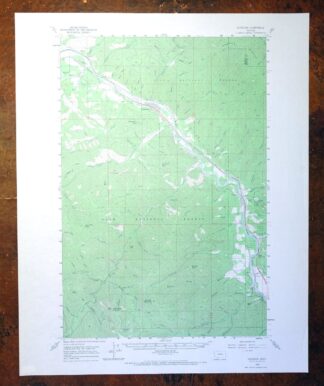
MAP DETAILS | |
|---|---|
| TITLE | Superior |
| STATE | Montana |
| LOCATION | 45 miles northwest of Missoula |
| SERIES | 15-minute |
| SURVEYED | 1954 and 1960 Aerial and Field Survey |
| EDITION | 1960 |
| PRINTED | 1971 |
| PRINT NOTES | Thick paper stock, includes woodland tint (green to indicate vegetated areas) |
| SCALE | 1:62500 |
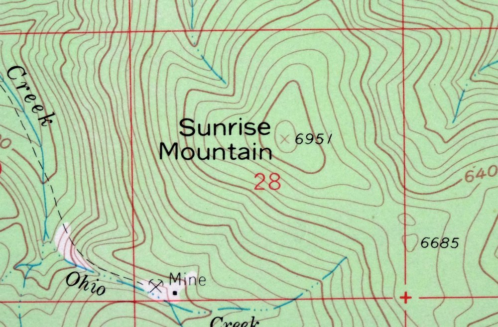
| CONTOUR INTERVAL | 25 feet |
| SHEET DIMENSIONS | 17 x 21 inches |
| MAP DIMENSIONS | 11 7/8 x 17 1/2 inches |
| COVERAGE AREA | 12 x 17 miles |
| MAP NOTES | Surveyed before the existence of Interstate 90. |
| SHEET CONDITION For maps of this vintage, effort is made to note all visible flaws, no matter how minor. | |
| OVERALL CONDITION | Excellent |
| SHEET NOTES | very lightly handled, never folded, smooth and flat |
| MAP AREA | flawless map area |
| COLLARS | no wear or tears, no markings, no blemishes |
| MAP COVERAGE Quadrangle extent overlaid on current basemap. | |
| PLACENAMES Depending on map series and survey date, all of the features listed below may not be shown on this map. This list contains features that currently exist or historically existed within the area covered by the map. The list can be used as a reference to determine if this map covers your area of interest. Placenames are listed alphabetically next to each feature type. | |
| NOTABLE PLACES | Clark Fork, Westfall, and Lolo NF |
| CITIES AND TOWNS (CURRENT) | Lozeau, Riverbend, and Superior |
| COUNTIES COVERED | Mineral and Missoula |
| FEDERAL LAND UNITS | Lolo National Forest |
| RIVERS AND STREAMS | Blacktail Creek, Cayuse Creek, Cedar Creek, Cement Creek, Cougar Creek, Deep Creek, Deer Lick Creek, Devils Creek, Dry Creek, Dunn Creek, Eagle Rock Creek, East Fork Johnson Creek, Eddy Creek, First Creek, Flat Creek, Johnson Creek, Keystone Creek, Lime Creek, Lozo Creek, McFarland Creek, Meadow Creek, Murphy Creek, Nellie Creek, Nemote Creek, North Fork Trout Creek, Oliver Creek, Pardee Creek, Quartz Creek, Second Creek, South Fork Trout Creek, Sunrise Creek, Thompson Creek, Tin Cup Creek, Trout Creek, Twin Creek, Upham Creek, Van Ness Creek, Verde Creek, Westfall Creek, and Winofall Creek |
| WATER BODIES | Bouchard Lake and Windfall Lake |
| Populated Place: Riverbend, Riverview Trailer Park, Lozeau, Oliverville, Quartz, Spring Gulch, Superior, and Westfall. Locations: Cedar Creek Golf Course, Cedars, Dry Creek Fishing Access Site, Forest Grove Fishing Access Site, Mineral County Fairgrounds, Quartz Fishing Access Site, Quartz Flat Campground, Quartz Flats Rest Area, Superior, Superior Fishing Access Site, Diamond Match Company, Quartz Guard Station, and Trout Creek Campground. Administrative Boundaries: Mineral County, Superior Division, and Town of Superior. Mountains, Peaks, and Summits: Magone Mountain, Chimney Rock, Eagle Rock, Landowner Mountain, Quartz Peak, Sunrise Mountain, Sunrise Point, Thompson Peak, and Van Ness Point. Valleys and Canyons: Berry Gulch, East Fork Berry Gulch, Bear Gulch, Brushy Gulch, Camp Four Gulch, Charette Gulch, Chute Gulch, Club Gulch, Curran Gulch, Gray Gulch, Hall Gulch, Hungary Gulch, Idaho Gulch, Jim Gulch, Kelly Gulch, Lime Gulch, Louisiana Gulch, McIntyre Gulch, Micayune Gulch, Oregon Gulch, Prospect Gulch, Sand Gulch, Shaw Gulch, Shyrock Gulch, Siekrest Gulch, Slowey Gulch, Smith Gulch, Tucker Gulch, Water Gulch, Weaver Gulch, Welch Gulch, Whiskey Gulch, Whitemarsh Gulch, and Wood Gulch. Parks: Eva Horning Park, Frank James Park, Iron Mountain Mine Historical Marker, Timberman Park, and Westside Field. Trails: Trout Creek Stock Driveway. Drainages: Nellie Creek, Blacktail Creek, Cayuse Creek, Cedar Creek, Cement Creek, Cougar Creek, Deep Creek, Deer Lick Creek, Dry Creek, Dunn Creek, Eagle Rock Creek, East Fork Johnson Creek, Eddy Creek, First Creek, Flat Creek, Fortysix Creek, Hoodoo Creek, Johnson Creek, Keystone Creek, Landowner Creek, Lime Creek, Lozo Creek, McFarland Creek, Meadow Creek, Murphy Creek, Nemote Creek, North Fork Trout Creek, Ohio Creek, Pardee Creek, Quartz Creek, Russian Bill Creek, Saint Patrick Creek, Second Creek, South Fork Trout Creek, Sunrise Creek, Thompson Creek, Tin Cup Creek, Trout Creek, Twin Creek, Upham Creek, Van Ness Creek, Verde Creek, Westfall Creek, and Winofall Creek. Mines: Deep Creek Mine, Gold Mountain Mine, Gold Mountain Mines, Iron Mountain Mill Mine, Iron Mountain Mine, Joe Doris Mine, Lucky 7 Mine, North Fork Second Creek Mine, Quartz Creek Mine, Triangle Mine, Wingo Mine, and X-Ray Vision Mine. Churches: Jehovah's Witness Kingdom Hall, Mary Queen of Heaven Catholic Church, Mineral County Parish of United Methodist Church, Seventh Day Adventist Church, Superior Assembly of God Church, Superior Baptist Church, Superior Church of Christ, Superior Community Church, The Church of Jesus Christ of Latter Day Saints, and Trinity Lutheran Church. Post Office: Superior Post Office. Hospitals: Mineral Community Hospital, Mineral Community Nursing Home, Riverside Medical Clinic, and Tamarack Medical Clinic. Lakes and Ponds: Windfall Lake. Buildings: Mineral County Courthouse, Mineral County Museum, Mineral County Public Library, Mineral County Sheriff's Office, Superior Volunteer Fire Department, Superior EMS, and Superior Volunteer Fire Company. Gaps: Eagle Rock Saddle and Verde Saddle. Airports: Mineral County Airport and Mineral County Hospital Heliport. Census: Riverbend Census Designated Place. Schools: Superior Elementary School and Superior High School. Flats: Quartz Flat. Wells: 16N19W10DBAC01 Well. Cemetery: Quartz Cemetery and Superior Cemetery. | |
| SHIPPING AND RETURNS | |
 This map sheet will be carefully rolled in a sturdy tube and shipped via the US Postal Service. If you find that the sheet you receive is not as described in the listing, you may ship it back to us for a refund of the purchase price. | |
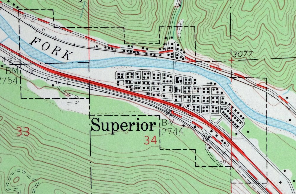
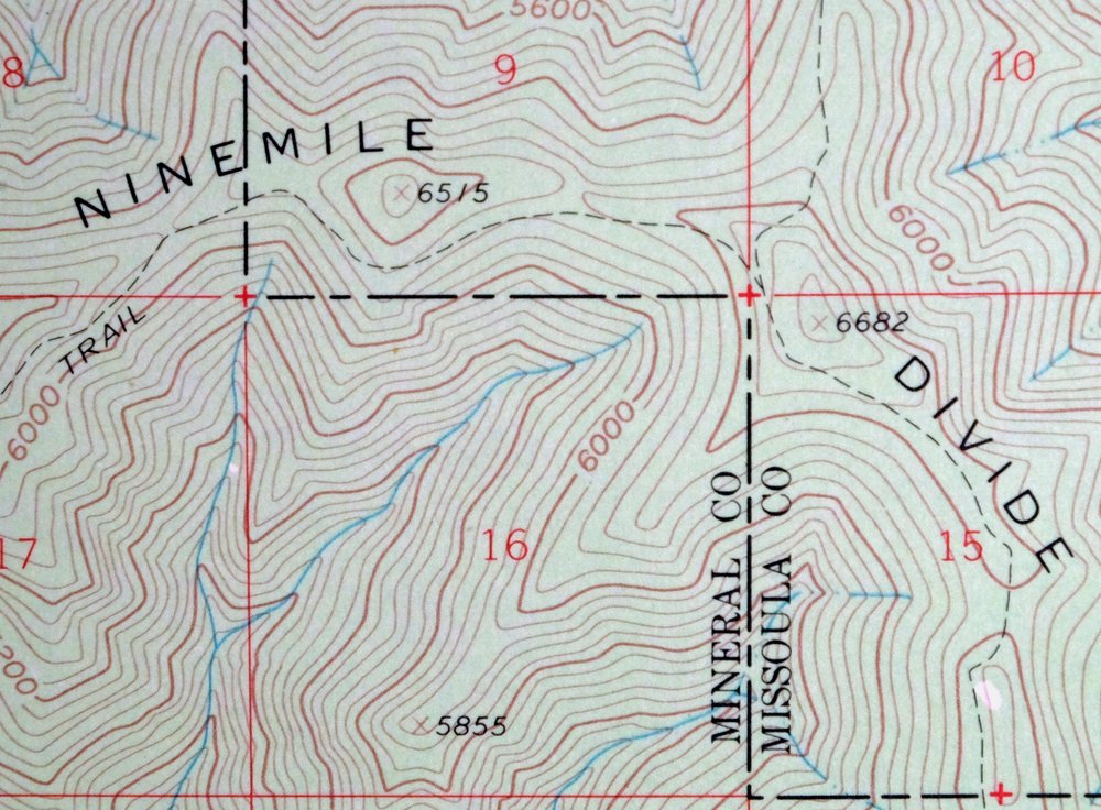
1971 Superior Montana USGS Topo Map: Clark Fork
$44
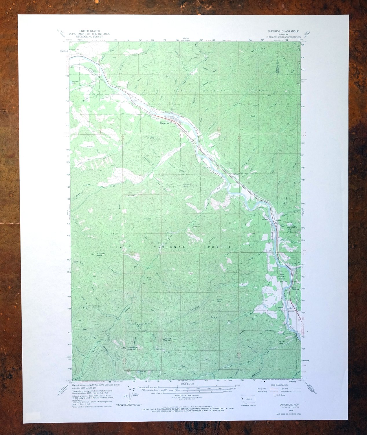
Surveyed before the existence of Interstate 90. This 15-minute topographic sheet, a 1960 edition printed in 1971, maps the mountain country of western Montana along the Clark Fork River about 45 miles northwest of Missoula. The quad area takes in the town of Superior, the community of Lozeau, and part of the Lolo National Forest, spanning roughly 12 by 17 miles across Mineral and Missoula counties, with green woodland tint marking the forested slopes.
In stock
This vintage sheet is a 1960 edition of the Superior Montana USGS topographic map. It is an original 55-year-old 1971 United States Geological Survey print in excellent condition.
HOW THIS MAP CAN BE USED
In addition to making a fascinating conversation piece, this sheet would look great in a frame or on display, make a unique and prized gift for anyone interested in this area, be perfect as a reference for genealogy studies or general historical research, or fill that missing piece in your collection. Maps of this vintage are printed on durable stock and are well-suited for outdoor activities and recreation of all kinds, including hiking, backpacking, hunting, rafting and kayaking, backcountry skiing, geocaching, general exploration, treasure hunting, etc.
FEATURES SHOWN ON THE MAP
The Superior 15-minute map shows cities and towns, roads, railroads, utilities and energy infrastructure, rivers, creeks, elevation contour lines, public land survey lines, county, state, and other administrative boundaries as they existed at the time of the survey in 1954 and 1960. All known structures (houses, businesses, churches, schools, barns, cabins, etc) are also shown.
A VALUABLE HISTORICAL RECORD
Maps from the 15-minute series for the continental United States are no longer produced or printed by the USGS and original prints are becoming increasingly difficult to find. They are a valuable historical record for an area, as they contain many placenames and features that have been dropped from more recent maps.
Nearby maps
-

Saint Regis Montana St. Regis USGS Topo Map 1968 Vintage
$40 Add to cart -

Missoula Montana Stevensville Lolo USGS Topographic Map 1925
$57 Add to cart -

Cataldo Idaho Lakeview Osburn USGS Topo Map 1954 Vintage
$48 Add to cart -

Oakesdale Washington Saint Joe NF Tekoa USGS Topo Map 1938
$29 Add to cart -
Limekiln Rapids Idaho USGS 15-Min Topo Map 1946 Vintage
$32 Add to cart -

Deer Park Washington Spokane Fairwood USGS Topo Map 1951
$40 Add to cart -

Boulder Montana Butte-Silver Bow Clancy USGS Topo Map 1933
$39 Add to cart -

Clayton Washington Spokane USGS 15-Min Topo Map 1951 Vintage
$42 Add to cart -

Jefferson City Montana Clancy Basin USGS Topo Map 1967
$39 Add to cart -

La Crosse Washington Winona Palouse River USGS Topo Map 1952
$42 Add to cart -
Fairfield Montana Simms Fort Shaw USGS Topo Map 1952 Vintage
$45 Add to cart -
Lake Frances Montana Valier USGS 15-Min Topographic Map 1949
$42 Add to cart -

East Helena Montana Helena Clancy USGS Topographic Map 1974
$42 Add to cart -
Wellpinit Washington Long Lake Ford USGS Topo Map 1944
$42 Add to cart -

Goldstone Mountain Idaho Baker USGS Topo Map 1969 Vintage
$22 Add to cart -

Benge Washington Hooper Palouse River USGS Topo Map 1952
$35 Add to cart -

Devils Fence Montana USGS 15-Min Topo Map 1950 Vintage
$36 Add to cart -
Cuprum Idaho USGS 15-Min Topographic Map 1958 Vintage
$31 Add to cart -

Walla Walla Washington Langdon Mill Creek USGS Topo Map 1978
$43 Add to cart -
Wilbur Washington Creston USGS 15-Min Topo Map 1950 Vintage
$42 Add to cart -

Connell Washington Lind Mesa USGS Topo Map 1918 Antique
$34 Add to cart -
Orient Washington Colville NF Laurier USGS Topo Map 1951
$37 Add to cart -
Wallula Washington Finley Burbank USGS Topo Map 1918 Antique
$34 Add to cart -
1955 USGS Army COE Topo Map: Grand Coulee Dam, Washington
$36 Add to cart