MAP DETAILS | |
|---|---|
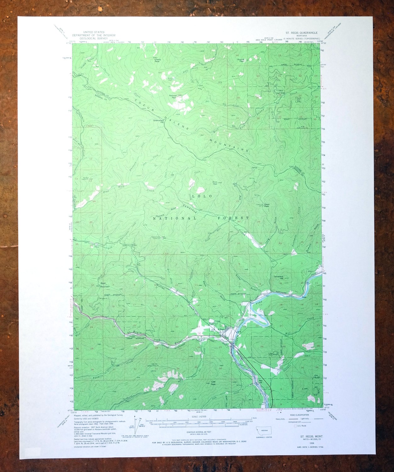
| TITLE | Saint Regis |
| STATE | Montana |
| LOCATION | 65 miles northwest of Missoula, MT |
| SERIES | 15-minute |
| SURVEYED | 1952 and 1956 Aerial and Field Survey |
| EDITION | 1956 |
| PRINTED | 1968 |
| PRINT NOTES | Includes woodland tint (green to indicate vegetated areas) |
| SCALE | 1:62500 |
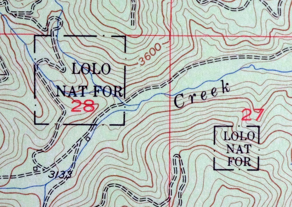
| CONTOUR INTERVAL | 80 feet |
| SHEET DIMENSIONS | 17 x 21 inches |
| MAP DIMENSIONS | 11 7/8 x 17 1/2 inches |
| COVERAGE AREA | 12 x 17 miles |
| SHEET CONDITION For maps of this vintage, effort is made to note all visible flaws, no matter how minor. | |
| OVERALL CONDITION | Excellent |
| SHEET NOTES | very lightly handled, never folded, smooth and flat |
| MAP AREA | flawless map area |
| COLLARS | no wear or tears, no markings, no blemishes |
| MAP COVERAGE Quadrangle extent overlaid on current basemap. | |
| PLACENAMES Depending on map series and survey date, all of the features listed below may not be shown on this map. This list contains features that currently exist or historically existed within the area covered by the map. The list can be used as a reference to determine if this map covers your area of interest. Placenames are listed alphabetically next to each feature type. | |
| CITIES AND TOWNS (CURRENT) | Saint Regis and St. Regis |
| COUNTIES COVERED | Mineral and Sanders |
| FEDERAL LAND UNITS | Lolo National Forest |
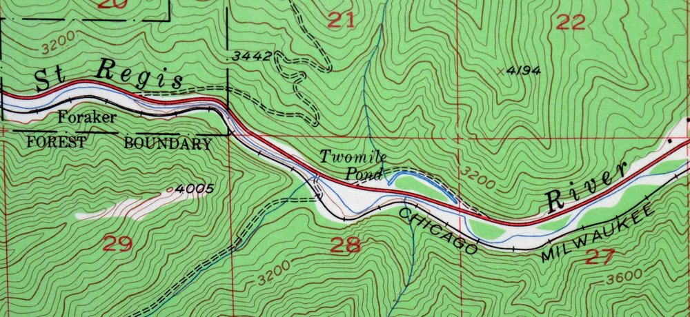
| RIVERS AND STREAMS | Bemish Creek, Blackburn Creek, Breen Creek, Burnt Flats Creek, Cherry Creek, Clark Fork, Cold Creek, Dee Creek, Dry Fork, East Fork Cherry Creek, East Fork Swamp Creek, East Fork Twelvemile Creek, Eddy Creek, Flat Rock Creek, Fourmile Creek, Keith Creek, Little Joe Creek, Mill Creek, Mineral Mountain Creek, Moon Creek, North Fork Little Joe Creek, Northup Creek, Saint Regis River, Sevenmile Creek, Short Creek, Slow Creek, South Fork Little Joe Creek, South Fork Tamarack Creek, Tamarack Creek, Twelvemile Creek, Twomile Creek, Ward Creek, West Fork Swamp Creek, and Wolf Creek |
| WATER BODIES | Acorn Lake |
| Populated Place: Foraker, Saint Regis, and Toole. Locations: Campground Saint Regis, Saint Regis, Saint Regis Fishing Access Site, Saint Regis KOA Kampgrounds, Saint Regis Riding Stables Campground, Trestle Creek Golf Club, Arvilla Lookout Station, Camels Hump Lookout Station, Flat Rock Lookout Station, Little Joe Lookout Station, and Saint Regis Beacon. Mountain Ranges: Coeur d'Alene Mountains. Mountains, Peaks, and Summits: Boyd Mountain, Cherry Peak, Cold Peak, Drury Peak, Greenwood Hill, Olson Peak, Penrose Peak, Red Hill, Sacajawea Peak, Sunset Peak, and Tamarack Hill. Valleys and Canyons: Brown Gulch, Butler Gulch, Buzzard Gulch, Graham Gulch, Long Gulch, Mayo Gulch, and Mullan Gulch. Parks: John Mullan Statue. Drainages: Bemish Creek, Blackburn Creek, Breen Creek, Burnt Flats Creek, Cold Creek, Dee Creek, Dry Fork, Flat Rock Creek, Fourmile Creek, Keith Creek, Little Joe Creek, Mill Creek, Mineral Mountain Creek, Moon Creek, North Fork Little Joe Creek, Northup Creek, Saint Regis River, Short Creek, Slow Creek, South Fork Little Joe Creek, South Fork Tamarack Creek, Tamarack Creek, Twomile Creek, Ward Creek, and Wolf Creek. Mines: Annie Lorie Number 1 Mine, Dee Creek Mine, Eddy Creek Mine, Keith Creek Mine, Miller Mine, Spitfire Mine, Upper Dee Creek Mine, Upper Eddy Creek Mine, and Wolf Creek Mine. Churches: Saint Regis Methodist Church. Post Office: Saint Regis Post Office. Lakes and Ponds: Acorn Lake and Twomile Pond. Buildings: Saint Regis Branch Library, Saint Regis Rural Fire Department, and Saint Regis Visitor Information Center. Gaps: Burr Saddle. Census: Saint Regis Census Designated Place. Schools: Saint Regis Public Schools. Ridges: C C Divide. Cemetery: Saint Regis Cemetery. | |
| SHIPPING AND RETURNS | |
 This map sheet will be carefully rolled in a sturdy tube and shipped via the US Postal Service. If you find that the sheet you receive is not as described in the listing, you may ship it back to us for a refund of the purchase price. | |
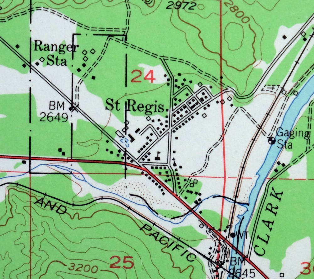
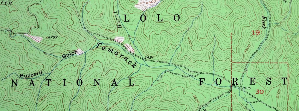
Saint Regis Montana St. Regis USGS Topo Map 1968 Vintage
$40
This USGS 15-minute topographic map is a 1956 edition printed in 1968, and the sheet is in excellent condition: never folded, smooth and flat, with a flawless map area and a clean collar showing no wear, tears, or markings. Covering a stretch of Mineral and Sanders counties in northwestern Montana about 65 miles northwest of Missoula, it takes in the community of Saint Regis and part of the Lolo National Forest. The 80-foot contour interval traces the steep, forested terrain of this corner of the northern Rockies, where the mountains rise sharply along the St. Regis drainage.
In stock
This vintage sheet is a 1956 edition of the Saint Regis Montana USGS topographic map. It is an original 58-year-old 1968 United States Geological Survey print in excellent condition.
HOW THIS MAP CAN BE USED
In addition to making a fascinating conversation piece, this sheet would look great in a frame or on display, make a unique and prized gift for anyone interested in this area, be perfect as a reference for genealogy studies or general historical research, or fill that missing piece in your collection. Maps of this vintage are printed on durable stock and are well-suited for outdoor activities and recreation of all kinds, including hiking, backpacking, hunting, rafting and kayaking, backcountry skiing, geocaching, general exploration, treasure hunting, etc.
FEATURES SHOWN ON THE MAP
The Saint Regis 15-minute map shows cities and towns, roads, railroads, utilities and energy infrastructure, rivers, creeks, elevation contour lines, public land survey lines, county, state, and other administrative boundaries as they existed at the time of the survey in 1952 and 1956. All known structures (houses, businesses, churches, schools, barns, cabins, etc) are also shown.
A VALUABLE HISTORICAL RECORD
Maps from the 15-minute series for the continental United States are no longer produced or printed by the USGS and original prints are becoming increasingly difficult to find. They are a valuable historical record for an area, as they contain many placenames and features that have been dropped from more recent maps.
Nearby maps
-

Cataldo Idaho Lakeview Osburn USGS Topo Map 1954 Vintage
$45 Add to cart -

Missoula Montana Stevensville Lolo USGS Topographic Map 1925
$57 Add to cart -

Oakesdale Washington Saint Joe NF Tekoa USGS Topo Map 1938
$29 Add to cart -

Deer Park Washington Spokane Fairwood USGS Topo Map 1951
$40 Add to cart -
Limekiln Rapids Idaho USGS 15-Min Topo Map 1946 Vintage
$32 Add to cart -

Clayton Washington Spokane USGS 15-Min Topo Map 1951 Vintage
$42 Add to cart -
Wellpinit Washington Long Lake Ford USGS Topo Map 1944
$42 Add to cart -

La Crosse Washington Winona Palouse River USGS Topo Map 1952
$42 Add to cart -
Lake Frances Montana Valier USGS 15-Min Topographic Map 1949
$42 Add to cart -

Benge Washington Hooper Palouse River USGS Topo Map 1952
$35 Add to cart -
Fairfield Montana Simms Fort Shaw USGS Topo Map 1952 Vintage
$45 Add to cart -

Boulder Montana Butte-Silver Bow Clancy USGS Topo Map 1933
$39 Add to cart -

Jefferson City Montana Clancy Basin USGS Topo Map 1967
$39 Add to cart -

East Helena Montana Helena Clancy USGS Topographic Map 1974
$42 Add to cart -
Wilbur Washington Creston USGS 15-Min Topo Map 1950 Vintage
$42 Add to cart -

Goldstone Mountain Idaho Baker USGS Topo Map 1969 Vintage
$22 Add to cart -
Cuprum Idaho USGS 15-Min Topographic Map 1958 Vintage
$31 Add to cart -
Orient Washington Colville NF Laurier USGS Topo Map 1951
$37 Add to cart -

Connell Washington Lind Mesa USGS Topo Map 1918 Antique
$34 Add to cart -

Walla Walla Washington Langdon Mill Creek USGS Topo Map 1978
$43 Add to cart -

Devils Fence Montana USGS 15-Min Topo Map 1950 Vintage
$36 Add to cart -
Wallula Washington Finley Burbank USGS Topo Map 1918 Antique
$34 Add to cart -
Republic Washington Malo Danville USGS Topo Map 1944 Vintage
$38 Add to cart -
Barker Canyon Washington USGS 7.5-Min Topo Map 1971 Vintage
$36 Add to cart
