MAP DETAILS | |
|---|---|
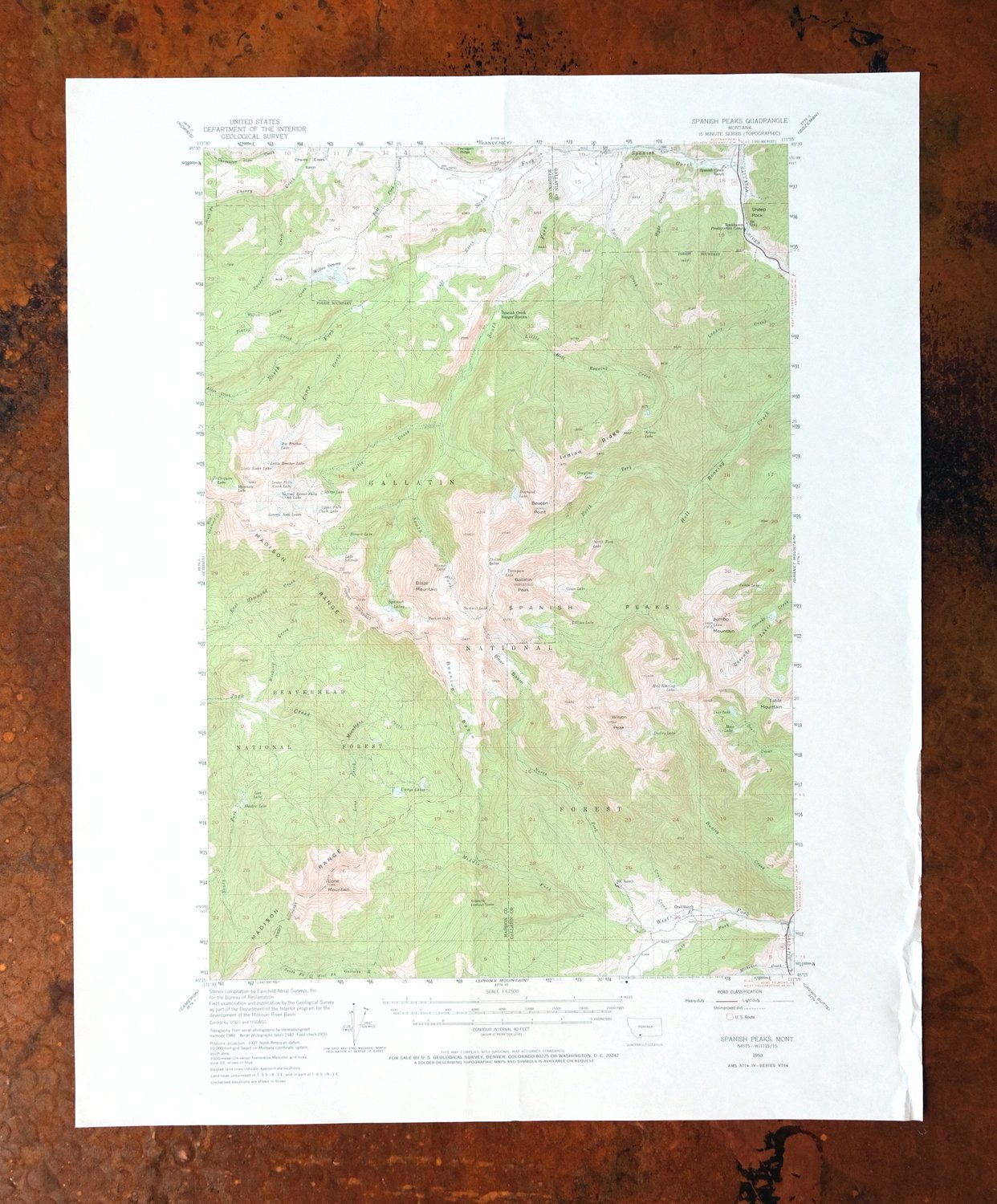
| TITLE | Spanish Peaks |
| STATE | Montana |
| LOCATION | Vicinity of Big Sky, 25 miles southwest of Bozeman |
| SERIES | 15-minute |
| SURVEYED | 1947 through 1950 Aerial and Field Survey |
| EDITION | 1950 |
| PRINTED | 1973 |
| PRINT NOTES | Thick paper stock, includes woodland tint (green to indicate vegetated areas) |
| SCALE | 1:62500 |
| CONTOUR INTERVAL | 40 feet |
| SHEET DIMENSIONS | 18 x 22 inches |
| MAP DIMENSIONS | 12 1/4 x 17 1/2 inches |
| COVERAGE AREA | 12 x 17 miles |
| MAP NOTES | A fascinating historical snapshot surveyed before the existence of Big Sky Ski Resort. |
| SHEET CONDITION For maps of this vintage, effort is made to note all visible flaws, no matter how minor. | |
| OVERALL CONDITION | Very Good |
| SHEET NOTES | lightly handled, random foldline(s), light vertical crease |
| MAP AREA | no markings, no blemishes |
| COLLARS | no markings, no blemishes, minor storage damage along lower right collar edge |
 | |
| MAP COVERAGE Quadrangle extent overlaid on current basemap. | |
| PLACENAMES Depending on map series and survey date, all of the features listed below may not be shown on this map. This list contains features that currently exist or historically existed within the area covered by the map. The list can be used as a reference to determine if this map covers your area of interest. Placenames are listed alphabetically next to each feature type. | |
| CITIES AND TOWNS (CURRENT) | Big Sky |
| COUNTIES COVERED | Gallatin and Madison |
| FEDERAL LAND UNITS | Gallatin National Forest, Lee Metcalf Wilderness (Spanish Peaks Unit), and Lee Metcalf Wilderness (Taylor-Hilgard Unit) |
| RIVERS AND STREAMS | Alder Creek, Camp Creek, Carpenter Creek, Cascade Creek, Cave Creek, Cherry Creek, Crail Creek, Cuff Creek, Deer Creek, Dudley Creek, East Fork Cherry Creek, East Hammond Creek, Falls Creek, Gallatin River, Hell Roaring Creek, Hyde Creek, Jack Creek, Little Hell Roaring Creek, Logger Creek, Lone Creek, Michener Creek, Middle Fork West Fork Gallatin River, Moonlight Creek, North Fork Hell Roaring Creek, North Fork Spanish Creek, North Fork West Fork Gallating River, Placer Creek, South Fork Cherry Creek, South Fork Hell Roaring Creek, South Fork Jack Creek, South Fork Spanish Creek, South Fork West Fork Gallatin River, Spanish Creek, Sweden Creek, Twin Creek, West Fork Gallatin River, West Hammond Creek, Wickiup Creek, and Willow Swamp Creek |
| WATER BODIES | Beehive Lake, Big Brother Lake, Chiquita Lake, Deer Lake, Diamond Lake, Dudley Lake, Grace Lake, Grayling Lake, Hell Roaring Lake, Jerome Rock Lakes, Jumbo Lake, Lost Lake, Lower Falls Creek Lake, Marcheta Lake, Margo Lake, Mirror Lake, Moon Lake, North Fork Lake, Shadow Lake, Lake Solitude, Spanish Lakes, Thompson Lake, Ulerys Lakes, Upper Falls Creek Lake, and Willow Swamp |
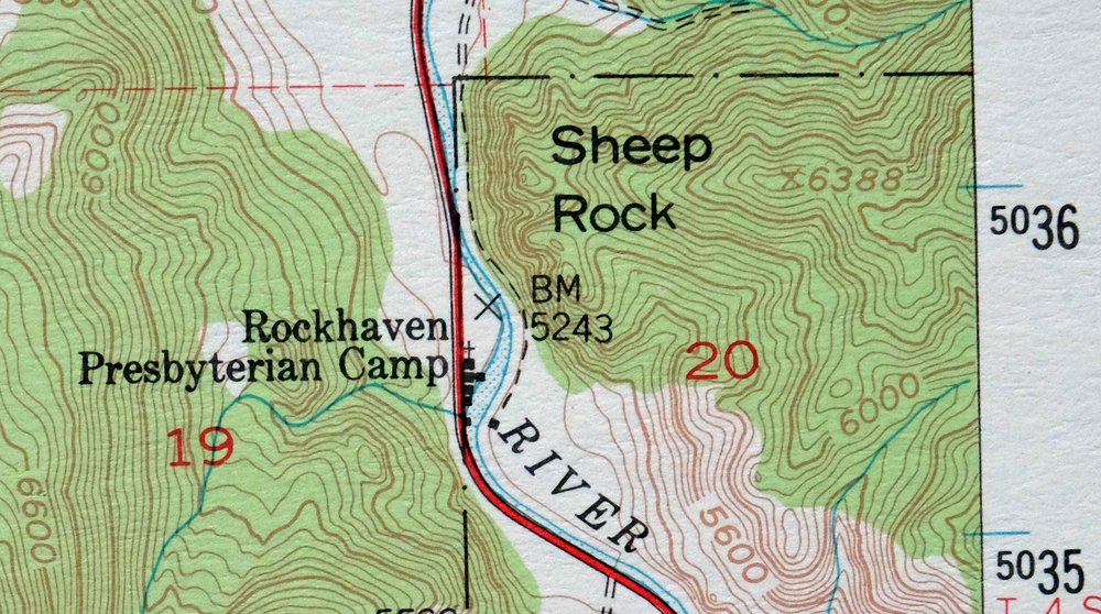
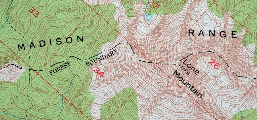
| Locations: B K Ranch, Big Sky Golf Course, Big Sky Ski Area, Crail Ranch, Rockhaven Presbyterian Camp, Spanish Creek Forest Service Station, Spanish Creek Ranch, and Spanish Creek Recreation Site. Mountain Ranges: Spanish Peaks. Mountains, Peaks, and Summits: Blaze Mountain, Mount Chipperfield, Gallatin Peak, Jumbo Mountain, Lone Mountain, Table Mountain, and Wilson Peak. Trails: A-Z Chutes Ski Trail, Africa Ski Trail, Ambush Meadows Ski Trail, Ambush Ski Trail, Arch Rock Ski Trail, Bacon Rind Ski Trail, Bad Dog Ski Trail, Bavarian Forest Ski Trail, Bert Road Ski Trail, Big Couloir Ski Trail, Big Horn Ski Trail, Big Rock Tongue Ski Trail, Black Rock Gully Ski Trail, Black and Blue Ski Trail, Blue Moon Ski Trail, Bone Crusher Ski Trail, Bozeman Trail Ski Trail, Broken Arrow Ski Trail, Buffalo Jump Ski Trail, Cache Trees Ski Trail, Calamity Jane Ski Trail, Chucks Run Ski Trail, Country Club Ski Trail, Cow Flats Ski Trail, Crazy Horse Ski Trail, Crazy Raven Ski Trail, Crons Pocket Ski Trail, Cue Ball Ski Trail, Dakota Territory Ski Trail, Dead Top Ski Trail, Deep South Ski Trail, Dictator Chutes Ski Trail, Dirt Bag Wall Ski Trail, Duck Walk Ski Trail, Dude Park Ski Trail, El Dorado Ski Trail, Elk Park Meadows Ski Trail, Elk Park Ridge Ski Trail, Exit Chute Ski Trail, Fast Lane Ski Trail, Fifth Gully Ski Trail, First Gully Ski Trail, Fourth Gully Ski Trail, Gun Mount Ski Trail, Hangmans Ski Trail, High Clearing Ski Trail, Highway Ski Trail, Huntley Hollow Ski Trail, Kurts Glades Ski Trail, Larkspur Ski Trail, Liberty Bowl Ski Trail, Lightning Ski Trail, Little Ewe Ski Trail, Little Gullies Ski Trail, Little Rock Tongue Ski Trail, Little Tree Ski Trail, Lobo Ski Trail, Lone Wolf Ski Trail, Low Bench Ski Trail, Low Clearing Ski Trail, Lower Bone Crusher Ski Trail, Lower Calamity Jane Ski Trail, Lower Mister K Ski Trail, Lower Morningstar Ski Trail, Mad Wolf Ski Trail, Madison Avenue Ski Trail, Marmot Meadows Ski Trail, Midnight Basin Ski Trail, Mister K Ski Trail, Moonlight Basin Ski Trail, Nashville Bowl Ski Trail, Never Sweat Ski Trail, Old Faithful Glades Ski Trail, Onslows Ski Trail, Pacifer Ski Trail, Pack Saddle Ski Trail, Ponderosa Ski Trail, Powder River Ski Trail, Rice Bowl Ski Trail, Sacajawea Ski Trail, Screaming Left Ski Trail, Second Gully Ski Trail, Seventeenth Green Ski Trail, Short Shot Ski Trail, Silverknife Ski Trail, Sixth Gully Ski Trail, Snake Bite Ski Trail, Snake Pit Ski Trail, Stump Farm Ski Trail, Stutzmans Rock Ski Trail, Sunlight Ski Trail, The Bowl Ski Trail, The Pinnacles Ski Trail, The Wave Ski Trail, Third Gully Ski Trail, Thunder Ski Trail, Tippys Tumble Ski Trail, Tohelluride Ski Trail, Turkey Traverse Ski Trail, Upper Morningstar Ski Trail, Upper Sunlight Ski Trail, Vertical Reality Ski Trail, War Dance Ski Trail, White Wing Ski Trail, Yellow Mule Ski Trail, and Zucchini Patch Ski Trail. Drainages: Alder Creek, Camp Creek, Crail Creek, Cuff Creek, Falls Creek, Hyde Creek, Little Hell Roaring Creek, Lone Creek, Michener Creek, Middle Fork West Fork Gallatin River, Moonlight Creek, North Fork Hell Roaring Creek, North Fork Spanish Creek, North Fork West Fork Gallating River, Placer Creek, South Fork Cherry Creek, South Fork Hell Roaring Creek, South Fork Jack Creek, South Fork Spanish Creek, South Fork West Fork Gallatin River, Spanish Creek, Sweden Creek, Twin Creek, West Fork Gallatin River, Wickiup Creek, and Willow Swamp Creek. Mines: Placer Creek Mine and Table Mountain Mine. Churches: Soldiers Chapel. Lakes and Ponds: Arrow Lake, Beehive Lake, Big Brother Lake, Cascade Lakes, Chilled Lakes, Chiquita Lake, Deer Lake, Diamond Lake, Dudley Lake, Grace Lake, Grayling Lake, Hell Roaring Lake, Hermit Lake, Jerome Rock Lakes, Jumbo Lake, Lake Levinsky, Lillian Lake, Little Brother Lake, Little Sister Lake, Lost Lake, Lower Falls Creek Lake, Marcheta Lake, Margo Lake, Mirror Lake, Moon Lake, North Fork Lake, Second Lower Falls Creek Lake, Shadow Lake, Lake Solitude, Spanish Lakes, Summit Lake, Thompson Lake, Ulerys Lakes, and Upper Falls Creek Lake. Waterfalls: Pioneer Falls. Dams: Big Sky Dam. Bridges: Benham Bridge. Basins: Bear Basin, Beehive Basin, and Newell Basin. Swamps: Willow Swamp. Schools: Spanish Creek School. Ridges: Indian Ridge. Towers: Andesite Lookout Tower. Wells: 01S04E17DCDD01 Well and 04S04E18ACAA01 Well. Pillars: Sheep Rock. Springs: Spanish Peaks. | |
| SHIPPING AND RETURNS | |
 This map sheet will be carefully rolled in a sturdy tube and shipped via the US Postal Service. If you find that the sheet you receive is not as described in the listing, you may ship it back to us for a refund of the purchase price. | |
Spanish Peaks Montana Big Sky USGS Topo Map 1973 Vintage
$37
First published in 1950, this USGS 15-minute topographic sheet was printed in 1973 on thick stock and is in very good condition, with light handling and a random foldline. The quad takes in the Spanish Peaks of southwestern Montana, spanning parts of Gallatin and Madison counties and including portions of Gallatin National Forest and both the Spanish Peaks and Taylor-Hilgard units of the Lee Metcalf Wilderness. Its 1947 through 1950 survey predates the Big Sky Ski Resort, so the rugged country around Big Sky appears here as it was before the resort was built.
In stock
This vintage sheet is a 1950 edition of the Spanish Peaks Montana USGS topographic map. It is an original 53-year-old 1973 United States Geological Survey print in very good condition.
HOW THIS MAP CAN BE USED
In addition to making a fascinating conversation piece, this sheet would look great in a frame or on display, make a unique and prized gift for anyone interested in this area, be perfect as a reference for genealogy studies or general historical research, or fill that missing piece in your collection. Maps of this vintage are printed on durable stock and are well-suited for outdoor activities and recreation of all kinds, including hiking, backpacking, hunting, rafting and kayaking, backcountry skiing, geocaching, general exploration, treasure hunting, etc.
FEATURES SHOWN ON THE MAP
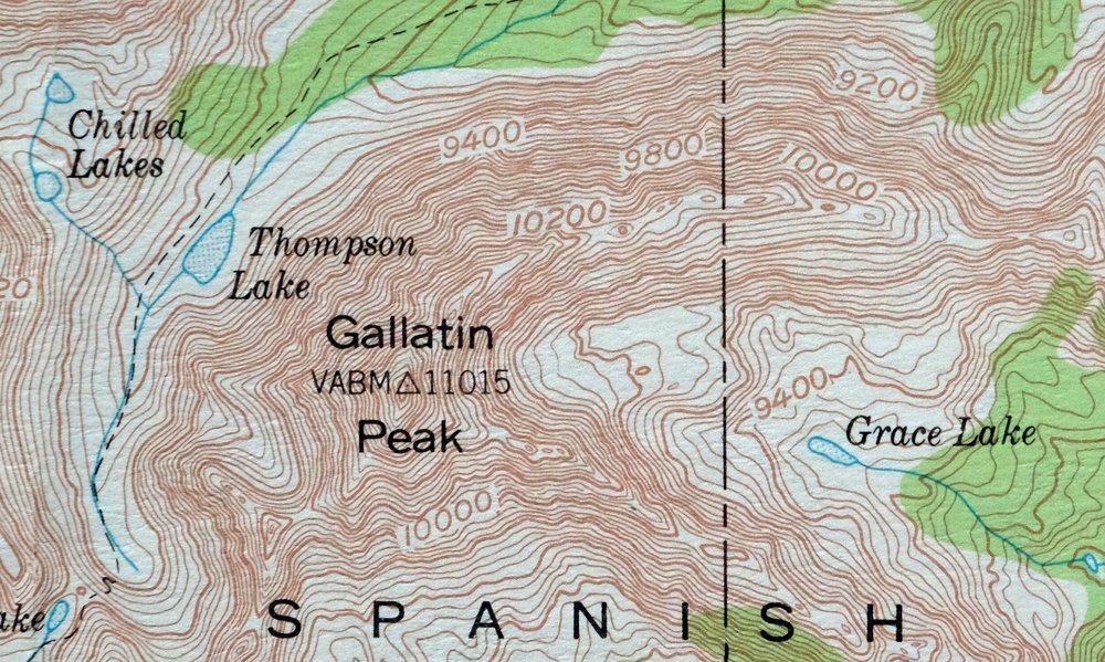
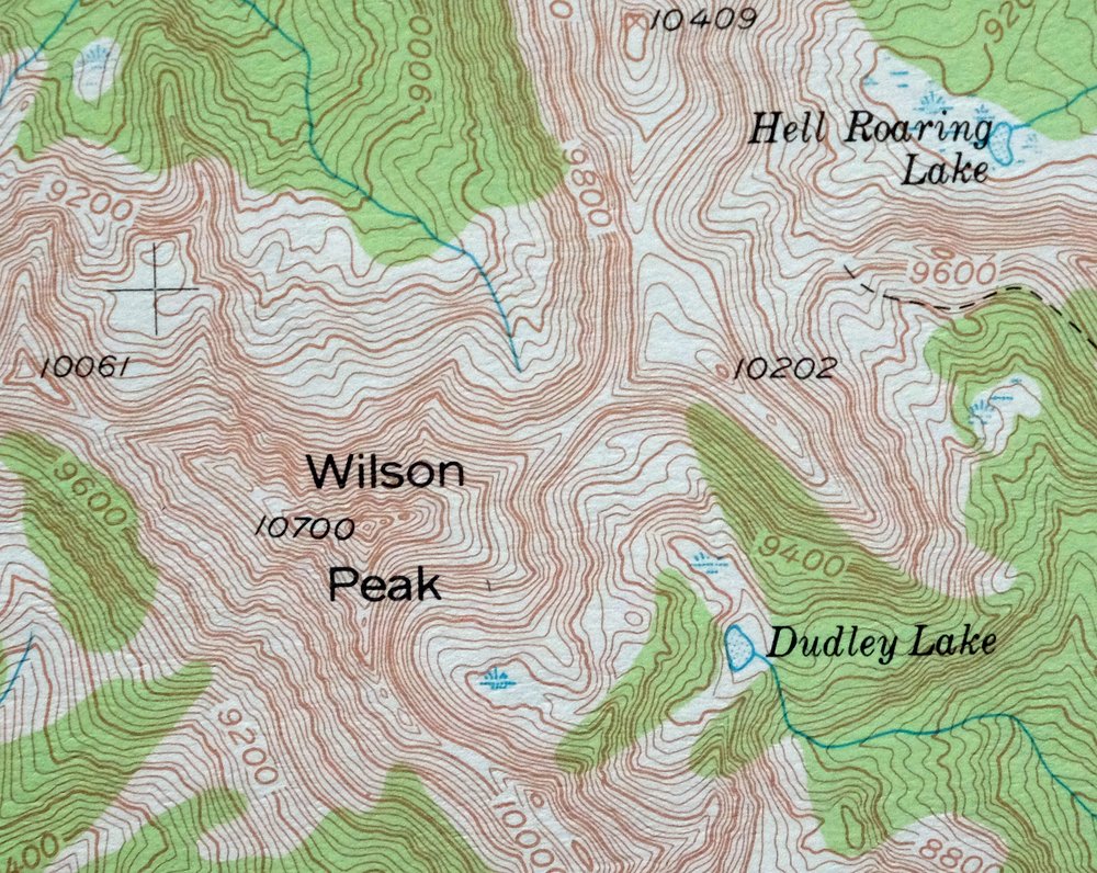
The Spanish Peaks 15-minute map shows cities and towns, roads, railroads, utilities and energy infrastructure, rivers, creeks, elevation contour lines, public land survey lines, county, state, and other administrative boundaries as they existed at the time of the survey in 1947 through 1950. All known structures (houses, businesses, churches, schools, barns, cabins, etc) are also shown.
A VALUABLE HISTORICAL RECORD
Maps from the 15-minute series for the continental United States are no longer produced or printed by the USGS and original prints are becoming increasingly difficult to find. They are a valuable historical record for an area, as they contain many placenames and features that have been dropped from more recent maps.
Nearby maps
-

Ennis Montana McAllister Jeffers USGS Topo Map 1969 Vintage
$38 Add to cart -
Sphinx Mountain Montana Big Sky USGS Topo Map 1968 Vintage
$40 Add to cart -

Crown Butte Montana Yellowstone NP USGS 15-Min Topo Map 1979
$40 Add to cart -
Fridley Peak Montana USGS 15-Min Topo Map 1972 Vintage
$50 Add to cart -
Bozeman Pass Montana USGS 15-Min Topo Map 1978 Vintage
$42 Add to cart -

Miner Montana Gardiner Corwin Springs USGS Topo Map 1983
$36 Add to cart -

Tepee Creek Montana Grayling USGS Topo Map 1963 Vintage
$35 Add to cart -

Sedan Montana USGS 15-Min Topographic Map 1956 Vintage
$38 Add to cart -

Mount Holmes Wyoming USGS 15-Min Topo Map 1979 Vintage
$39 Add to cart -
Monument Ridge Montana USGS 15-Min Topo Map 1975 Vintage
$38 Add to cart -

Mount Cowen Montana Absaroka Range USGS 15-Min Topo Map 1963
$43 Add to cart -

Devils Fence Montana USGS 15-Min Topo Map 1950 Vintage
$36 Add to cart -

Tower Junction Wyoming USGS 15-Min Topo Map 1984 Vintage
$40 Add to cart -

Boulder Montana Butte-Silver Bow Clancy USGS Topo Map 1933
$39 Add to cart -

Jefferson City Montana Clancy Basin USGS Topo Map 1967
$39 Add to cart -

Big Timber Montana Reed Point Reed Point USGS Topo Map 1910
$48 Add to cart -

East Helena Montana Helena Clancy USGS Topographic Map 1974
$42 Add to cart -

Sunlight Peak Wyoming Pahaska Tepee USGS Topo Map 1980
$36 Add to cart -
Lake Wyoming Antique USGS Topographic Map 1922
$78 Add to cart -
Stillwater Montana Hailstone NWR Columbus USGS Topo Map 1932
$47 Add to cart -

Goldstone Mountain Idaho Baker USGS Topo Map 1969 Vintage
$22 Add to cart -
Cody Wyoming USGS 15-Min Topographic Map 1969 Vintage
$38 Add to cart -
Lewistown Montana Judith Mountains USGS 15-Min Topo Map 1975
$40 Add to cart -
Fairfield Montana Simms Fort Shaw USGS Topo Map 1952 Vintage
$45 Add to cart
