MAP DETAILS | |
|---|---|
| TITLE | Mount Wallace |
| STATE | Montana, Wyoming |
| LOCATION | Yellowstone National Park, 50 miles southeast of Bozeman |
| SERIES | 15-minute |
| SURVEYED | 1937 through 1940 Field Survey |
| EDITION | 1940 |
| PRINTED | 1966 |
| PRINT NOTES | Thick paper stock, includes woodland tint (green to indicate vegetated areas) |
| SCALE | 1:62500 |
| CONTOUR INTERVAL | 50 feet |
| SHEET DIMENSIONS | 18 x 22 inches |
| MAP DIMENSIONS | 12 3/8 x 17 1/2 inches |
| COVERAGE AREA | 12 x 17 miles |
| SHEET CONDITION For maps of this vintage, effort is made to note all visible flaws, no matter how minor. | |
| OVERALL CONDITION | Very Good |
| SHEET NOTES | lightly handled, never folded |
| MAP AREA | flawless map area |
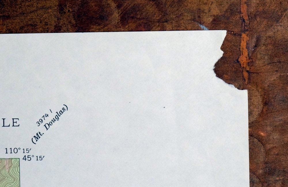
| COLLARS | no markings, no blemishes, extreme upper right collar corner torn away, slight edgewear in lower left collar |
 | |
| MAP COVERAGE Quadrangle extent overlaid on current basemap. | |
| PLACENAMES Depending on map series and survey date, all of the features listed below may not be shown on this map. This list contains features that currently exist or historically existed within the area covered by the map. The list can be used as a reference to determine if this map covers your area of interest. Placenames are listed alphabetically next to each feature type. | |
| NOTABLE PLACES | Yellowstone NP and Buffalo Plateau |
| COUNTIES COVERED | Park |
| FEDERAL LAND UNITS | Absaroka-Beartooth Wilderness, Gallatin National Forest, and Yellowstone National Park |
| RIVERS AND STREAMS | Basin Creek, Beaver Creek, Boulder River, Brundage Creek, Buffalo Creek, Cat Creek, Clover Creek, Colley Creek, Copper Creek, East Branch Hellroaring Creek, East Fork Buffalo Fork, East Fork Hellroaring Creek, East Fork Wallace Creek, Elk Creek, Grassy Creek, Grizzly Creek, Hellroaring Creek, Horse Creek, Hyman Creek, Knife Creek, Lambert Creek, Little Cottonwood Creek, Middle Fork Hellroaring Creek, North Fork Clover Creek, Passage Creek, Second Fork West Fork Buffalo Fork, Sheep Creek, Silver Creek, South Fork Bridge Creek, South Fork Sheep Creek, Specimen Creek, Wallace Creek, West Fork Buffalo Creek, and West Fork Horse Creek |
| WATER BODIES | Carpenter Lake, Elk Lake, and Hidden Lake |
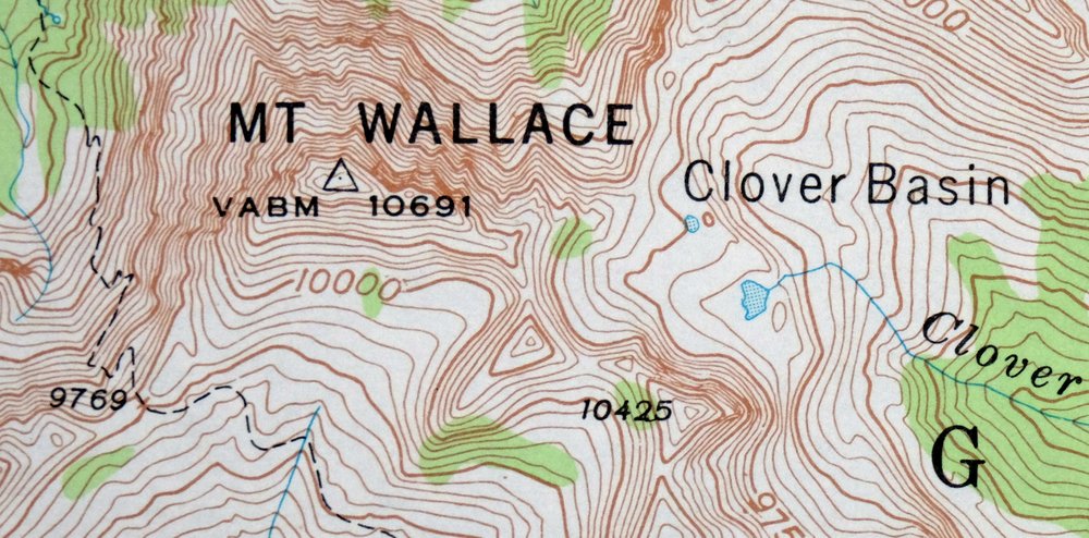
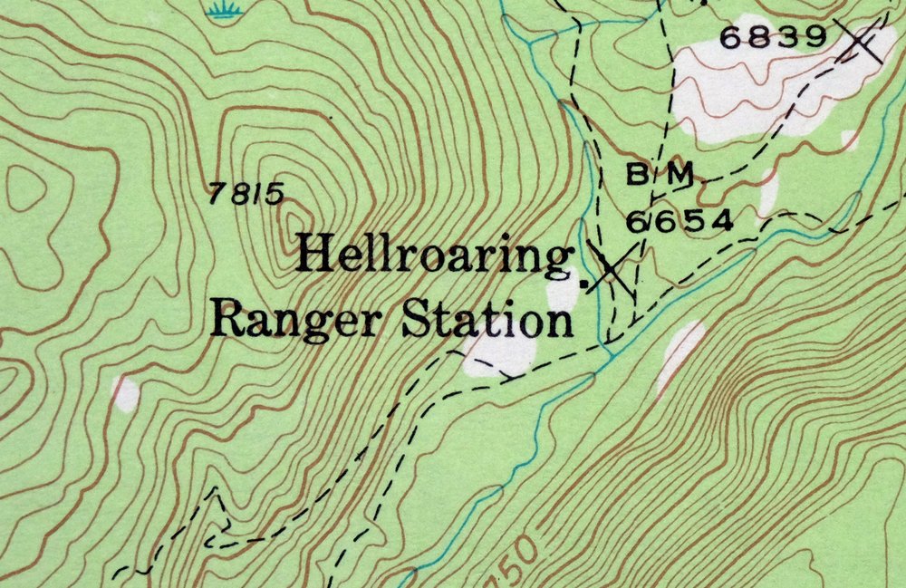
| Montana Locations: Buffalo Fork Ranger Station, Buffalo Plateau Patrol Cabin, Bull Moose Cabin, and Hellroaring Ranger Station. Administrative Boundaries: Gardiner-Cooke City Division. Mountains, Peaks, and Summits: Buffalo Butte, Bull Mountain, Hellroaring Mountain, Horse Mountain, Hummingbird Peak, Iron Mountain, and Mount Wallace. Trails: Coyote Creek Trail and Poacher Trail. Drainages: Basin Creek, Beaver Creek, Brundage Creek, Cat Creek, Clover Creek, Copper Creek, East Branch Hellroaring Creek, East Fork Buffalo Fork, East Fork Hellroaring Creek, East Fork Wallace Creek, Elk Creek, Grassy Creek, Grizzly Creek, Horse Creek, Hyman Creek, Knife Creek, Middle Fork Hellroaring Creek, North Fork Clover Creek, North Fork Hellroaring Creek, Second Fork West Fork Buffalo Fork, Sheep Creek, Silver Creek, South Fork Sheep Creek, Specimen Creek, Wallace Creek, West Fork Buffalo Creek, and West Fork Horse Creek. Post Office: Maxwell Post Office. Lakes and Ponds: Carpenter Lake, Colley Lake, Elk Lake, and Hidden Lake. Waterfalls: Passage Falls and Specimen Falls. Basins: Clover Basin, East Fork Basin, Elk Creek Basin, Hummingbird Basin, North Fork Basin, Silver Basin, Telephone Basin, and The Hole. Ridges: Middle Ridge. Plains and Plateaus: Buffalo Plateau and Red Rock Plateau. | |
| Wyoming | |
| Wyoming None | |
| SHIPPING AND RETURNS | |
 This map sheet will be carefully rolled in a sturdy tube and shipped via the US Postal Service. If you find that the sheet you receive is not as described in the listing, you may ship it back to us for a refund of the purchase price. | |
1966 Mount Wallace Montana/Wyoming USGS Topo Map
$45
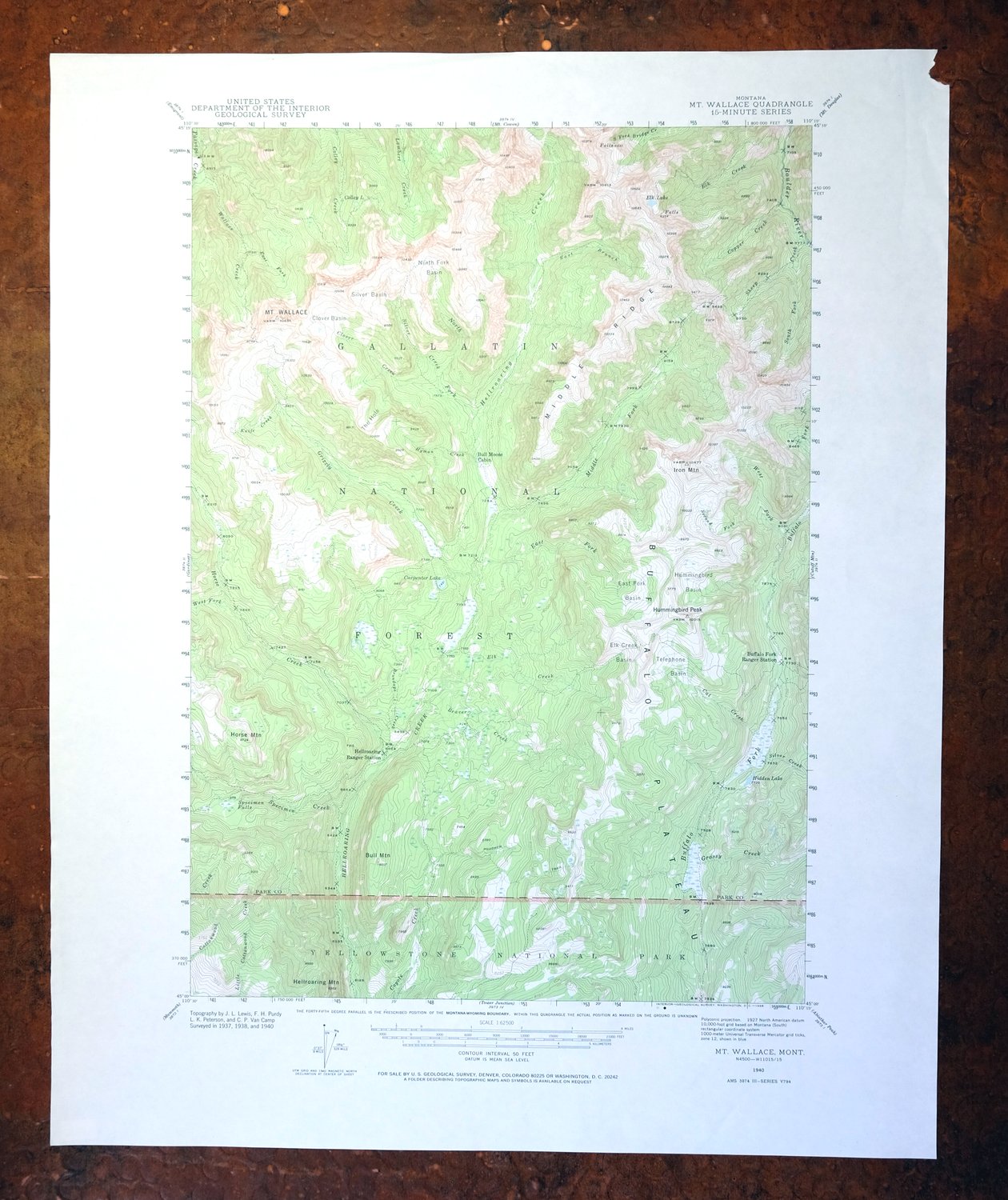
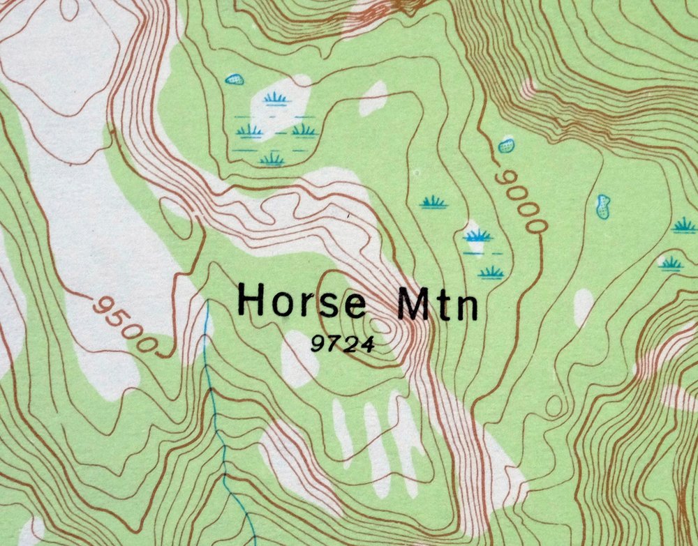
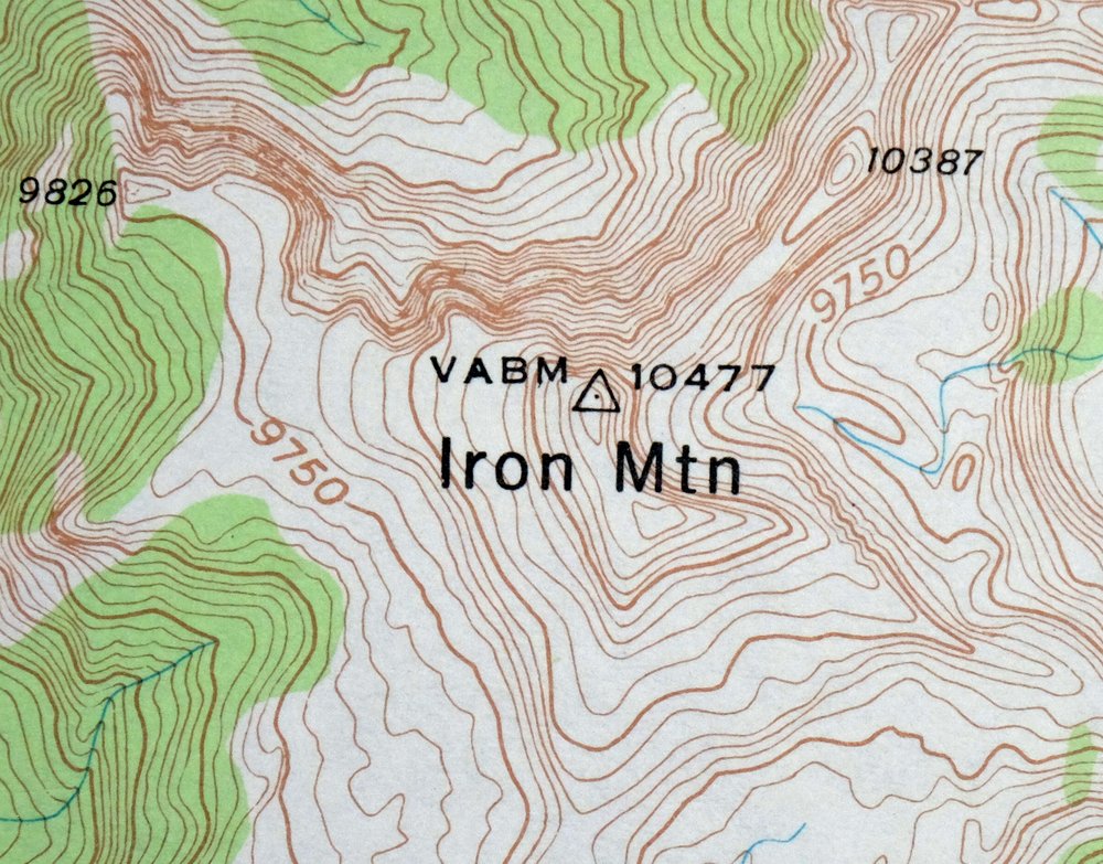
This 15-minute topographic map covers the Mount Wallace quadrangle, a 1940 edition printed in 1966 at a scale of 1:62,500 with 50-foot contours and a green woodland tint marking vegetated terrain. The area straddles the Montana-Wyoming line in the northern reaches of Yellowstone National Park, taking in the Buffalo Plateau and portions of Gallatin National Forest and the Absaroka-Beartooth Wilderness. Built from field survey work done between 1937 and 1940, it shows this rugged backcountry as the Civilian Conservation Corps era closed. Never folded, with a flawless map area.
In stock
This vintage sheet is a 1940 edition of the Mount Wallace Montana USGS topographic map. It is an original 60-year-old 1966 United States Geological Survey print in very good condition.
HOW THIS MAP CAN BE USED
In addition to making a fascinating conversation piece, this sheet would look great in a frame or on display, make a unique and prized gift for anyone interested in this area, be perfect as a reference for genealogy studies or general historical research, or fill that missing piece in your collection. Maps of this vintage are printed on durable stock and are well-suited for outdoor activities and recreation of all kinds, including hiking, backpacking, hunting, rafting and kayaking, backcountry skiing, geocaching, general exploration, treasure hunting, etc.
FEATURES SHOWN ON THE MAP
The Mount Wallace 15-minute map shows cities and towns, roads, railroads, utilities and energy infrastructure, rivers, creeks, elevation contour lines, public land survey lines, county, state, and other administrative boundaries as they existed at the time of the survey in 1937 through 1940. All known structures (houses, businesses, churches, schools, barns, cabins, etc) are also shown.
A VALUABLE HISTORICAL RECORD
Maps from the 15-minute series for the continental United States are no longer produced or printed by the USGS and original prints are becoming increasingly difficult to find. They are a valuable historical record for an area, as they contain many placenames and features that have been dropped from more recent maps.
Nearby maps
-
1983 Gardiner Montana USGS Topo Map: Yellowstone NP
$45 Add to cart -

Mount Cowen Montana Absaroka Range USGS 15-Min Topo Map 1963
$44 Add to cart -

Tower Junction Wyoming USGS 15-Min Topo Map 1984 Vintage
$40 Add to cart -
1975 USGS Topo Map: Emigrant, Yellowstone River, Montana
$42 Add to cart -

Miner Montana Gardiner Corwin Springs USGS Topo Map 1983
$36 Add to cart -
Fridley Peak Montana USGS 15-Min Topo Map 1972 Vintage
$43 Add to cart -

Mount Holmes Wyoming USGS 15-Min Topo Map 1979 Vintage
$39 Add to cart -

Crown Butte Montana Yellowstone NP USGS 15-Min Topo Map 1979
$40 Add to cart -

Tepee Creek Montana Grayling USGS Topo Map 1963 Vintage
$35 Add to cart -
Bozeman Pass Montana USGS 15-Min Topo Map 1978 Vintage
$43 Add to cart -

Sunlight Peak Wyoming Pahaska Tepee USGS Topo Map 1980
$36 Add to cart -
Sphinx Mountain Montana Big Sky USGS Topo Map 1968 Vintage
$40 Add to cart -
1969 Bozeman Montana USGS Topo Map: Gallatin Gateway
$44 Add to cart -

Spanish Peaks Montana Big Sky USGS Topo Map 1973 Vintage
$37 Add to cart -

Sedan Montana USGS 15-Min Topographic Map 1956 Vintage
$38 Add to cart -

Ennis Montana McAllister Jeffers USGS Topo Map 1969 Vintage
$38 Add to cart -

1980 Belgrade Montana USGS Topo Map: Bridger Range
$43 Add to cart -
1981 Cliff Lake Montana USGS Topo Map: Madison River
$43 Add to cart -

Big Timber Montana Reed Point Reed Point USGS Topo Map 1910
$36 Add to cart -
Lake Wyoming Antique USGS Topographic Map 1922
$78 Add to cart -
Stillwater Montana Hailstone NWR Columbus USGS Topo Map 1932
$45 Add to cart -
Cody Wyoming USGS 15-Min Topographic Map 1969 Vintage
$38 Add to cart -
Monument Ridge Montana USGS 15-Min Topo Map 1975 Vintage
$38 Add to cart -

Devils Fence Montana USGS 15-Min Topo Map 1950 Vintage
$36 Add to cart