MAP DETAILS | |
|---|---|
| TITLE | Mount Morrison |
| STATE | California |
| LOCATION | Vicinity of Mammoth Lakes, 80 miles northeast of Fresno |
| SERIES | 15-minute |
| SURVEYED | 1951 and 1953 Aerial and Field Survey |
| EDITION | 1953 |
| PRINTED | 1974 |
| PRINT NOTES | Thick paper stock, includes woodland tint (green to indicate vegetated areas) |
| SCALE | 1:62500 |
| CONTOUR INTERVAL | 80 feet |
| SHEET DIMENSIONS | 18 x 22 inches |
| MAP DIMENSIONS | 13 7/8 x 17 1/2 inches |
| COVERAGE AREA | 14 x 17 miles |
| SHEET CONDITION For maps of this vintage, effort is made to note all visible flaws, no matter how minor. | |
| OVERALL CONDITION | Excellent |
| SHEET NOTES | very lightly handled, never folded, smooth and flat |
| MAP AREA | flawless map area |
| COLLARS | no wear or tears, no markings, no blemishes |
| MAP COVERAGE Quadrangle extent overlaid on current basemap. | |
| PLACENAMES Depending on map series and survey date, all of the features listed below may not be shown on this map. This list contains features that currently exist or historically existed within the area covered by the map. The list can be used as a reference to determine if this map covers your area of interest. Placenames are listed alphabetically next to each feature type. | |
| CITIES AND TOWNS (CURRENT) | Mammoth Lakes |
| COUNTIES COVERED | Fresno and Mono |
| FEDERAL LAND UNITS | Inyo National Forest, John Muir Wilderness, and Sierra National Forest |
| RIVERS AND STREAMS | Cold Water Creek, Convict Creek, Deadman Creek, Deer Creek, Dry Creek, Fish Creek, Glass Creek, Hilton Creek, Hot Creek, Laurel Creek, Little Hot Creek, Mammoth Creek, McGee Creek, McLaughlin Creek, Minnow Creek, O'arrel Canyon Creek, O'Harrel Canyon Creek, Owens River, Sherwin Creek, and Whisky Creek |
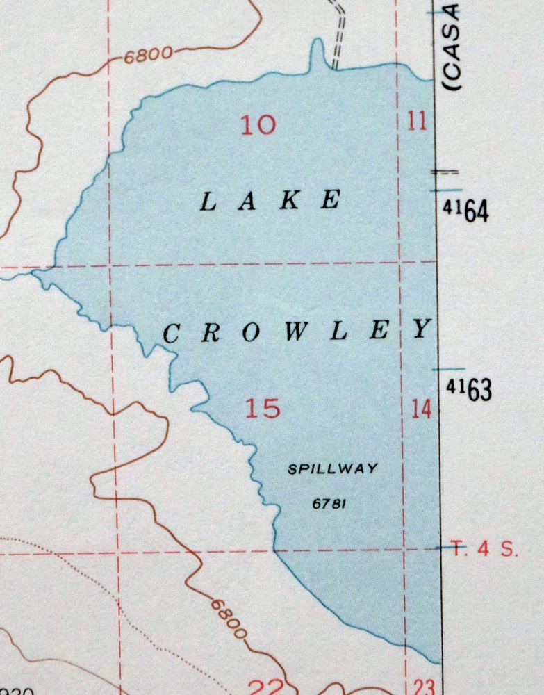
| WATER BODIES | Arrowhead Lake, Big Alkali Lake, Bighorn Lake, Bloody Lake, Bright Dot Lake, Cecil Lake, Cloverleaf Lake, Constance Lake, Convict Lake, Davis Lake, Deer Lakes, Lake Dorothy, Duck Lake, Edith Lake, Franklin Lake, Lake Genevieve, Glen Lake, Glennette Lake, Hammil Lake, Lake Crowley, Laurel Lakes, Lee Lake, Little Alkali Lake, Marsh Lake, Lake Mary, Mildred Lake, Pika Lake, Purple Lake, Ram Lake, Skelton Lake, Steelhead Lake, Valentine Lake, Lake Virginia, and Lake Wit-So-Nah-Pah |
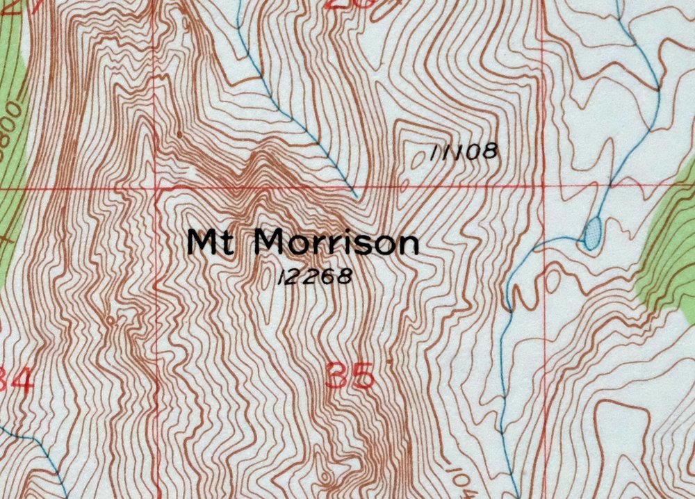
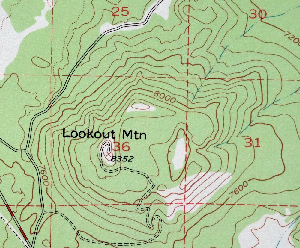
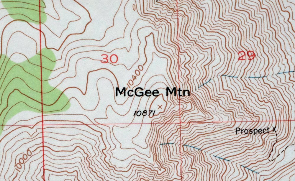
| Locations: Arcularius Ranch, Big Spring Campground, Camp High Sierra, Casa Diablo Hot Springs, Cashbaugh Ranch, Cold Water Campground, Convict Lake Campground, Convict Lake Picnic Area, Crestview Roadside Rest, Fish and Game Experimental Station, Ford Ranch, Hot Creek Ranch, Hot Creek State Fish Hatchery, Lake Crowley Campground, Los Angeles Y M C A Camp, Main Street Plaza Shopping Center, Mammoth Business Park, Mammoth Factory Store Shopping Center, Mammoth Gateway Center Shopping Center, Mammoth Mall Shopping Center, Mammoth Motorcross Track, Mammoth Mountain Recreation Vehicle Park, Mammoth Ranger Station, McGee Creek Campground, Minaret Village Mall Shopping Center, Mono County Youth Camp, Old Shady Rest Campground, Pine Glen Group Campground, Red Rooster Mall Shopping Center, Shady Rest Campground, Shell Center Shopping Center, Sherwin Creek Campground, Sherwin Plaza Shopping Center, Sherwin Professional Plaza, Sierra Center Mall Shopping Center, Sierra Meadows Ranch, Sierra Nevada Aquatic Research Laboratory, Snowcreek Athletic Club, Snowcreek Driving Range, Snowcreek Golf Course, South Lake Crowley Pack Station, Upper McGee Creek Campground, and White Wing Camp. Areas: Gentian Meadow. Mountains, Peaks, and Summits: Mount Aggie, Mount Baldwin, Bloody Mountain, Dry Creek Knoll, Earthquake Dome, Gilbert Peak, Laurel Mountain, Lookout Mountain, Mammoth Knolls, McGee Mountain, Mono Jim Peak, Mount Morgan, Mount Morrison, Panorama Dome, and Red Slate Mountain. Valleys and Canyons: Cascade Valley, Esha Canyon, Little Antelope Valley, and Long Canyon. Parks: Community Center Park, Mammoth Creek Park, Shady Rest Park, and Valentine Reserve Ecological Study Area. Trails: Mammoth Rock Trail and Sherwin Lakes Trail. Drainages: Cold Water Creek, Convict Creek, Dry Creek, Glass Creek, Hot Creek, Laurel Creek, Little Hot Creek, Mammoth Creek, McGee Creek, Minnow Creek, O'Harrel Canyon Creek, Purple Creek, and Sherwin Creek. Mines: Clay Pit Mine, Hilton Creek Mine, Mammoth Consolidated Mine, Monte Cristo Mine, Old Mammoth Mine, Scheeldre Mine, and Tiptop Prospect. Churches: Saint Joseph Church. Hospitals: Mammoth Hospital. Lakes and Ponds: Arrowhead Lake, Barney Lake, Big Alkali Lake, Bighorn Lake, Bloody Lake, Bright Dot Lake, Bunny Lake, Cecil Lake, Cloverleaf Lake, Constance Lake, Convict Lake, Davis Lake, Deer Lakes, Lake Dorothy, Duck Lake, Edith Lake, Emerald Lake, Franklin Lake, Lake Genevieve, Glen Lake, Glennette Lake, Grass Lake, Hammil Lake, Heart Lake, Laurel Lakes, Lee Lake, Little Alkali Lake, Lost Lake, Marsh Lake, Mildred Lake, Pika Lake, Purple Lake, Ram Lake, Red Lake, Scoop Lake, Sherwin Lakes, Skelton Lake, Valentine Lake, Lake Virginia, Way Lake, Lake Wit-So-Nah-Pah, and Woods Lakes. Buildings: Mammoth Museum, Mammoth Public Library, and Mammoth Visitor Center. Waterfalls: Horsetail Falls. Bluffs: Sevehah Cliff. Gaps: McGee Pass. Craters: Long Valley Caldera. Basins: Long Valley, Tully Hole, and Whitmore Tub. Airports: Mammoth Lakes Airport and Mammoth-June Lake Airport. Schools: Mammoth High School, Mammoth School, and Sierra High School. Ridges: Mammoth Crest and Nevahbe Ridge. Flats: Sky Meadows, Smokey Bear Flat, and Tobacco Flat. Pillars: Mammoth Rock. Springs: Antelope Spring and Buzztail Spring. | |
| SHIPPING AND RETURNS | |
 This map sheet will be carefully rolled in a sturdy tube and shipped via the US Postal Service. If you find that the sheet you receive is not as described in the listing, you may ship it back to us for a refund of the purchase price. | |
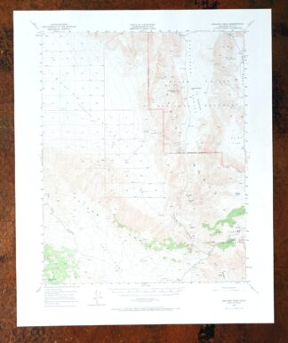
Mount Morrison California Mammoth Lakes USGS Topo Map 1974
$52
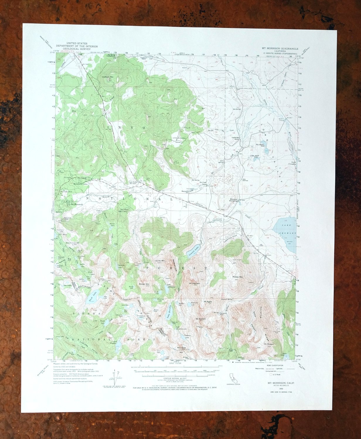
This USGS 15-minute topographic map is a 1953 edition printed in 1974, in excellent condition on thick stock, never folded and kept smooth and flat with a flawless map area and a clean collar. The quad sits in the eastern Sierra near Mammoth Lakes, taking in high country within the John Muir Wilderness and parts of the Inyo and Sierra National Forests, with Mono and Fresno county lands falling inside its boundaries. With an 80-foot contour interval charting the steep relief around Mount Morrison, the sheet captures the rugged terrain of the range just south of the Mammoth Lakes basin.
In stock
This vintage sheet is a 1953 edition of the Mount Morrison California USGS topographic map. It is an original 52-year-old 1974 United States Geological Survey print in excellent condition.
HOW THIS MAP CAN BE USED
In addition to making a fascinating conversation piece, this sheet would look great in a frame or on display, make a unique and prized gift for anyone interested in this area, be perfect as a reference for genealogy studies or general historical research, or fill that missing piece in your collection. Maps of this vintage are printed on durable stock and are well-suited for outdoor activities and recreation of all kinds, including hiking, backpacking, hunting, rafting and kayaking, backcountry skiing, geocaching, general exploration, treasure hunting, etc.
FEATURES SHOWN ON THE MAP
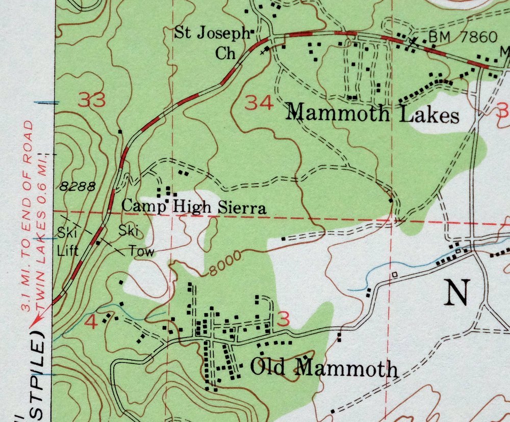
The Mount Morrison 15-minute map shows cities and towns, roads, railroads, utilities and energy infrastructure, rivers, creeks, elevation contour lines, public land survey lines, county, state, and other administrative boundaries as they existed at the time of the survey in 1951 and 1953. All known structures (houses, businesses, churches, schools, barns, cabins, etc) are also shown.
A VALUABLE HISTORICAL RECORD
Maps from the 15-minute series for the continental United States are no longer produced or printed by the USGS and original prints are becoming increasingly difficult to find. They are a valuable historical record for an area, as they contain many placenames and features that have been dropped from more recent maps.
Nearby maps
-
Bishop California West Bishop Laws USGS Topographic Map 1969
$40 Add to cart -
Blackcap Mountain California USGS Topo Map 1972 Vintage
$40 Add to cart -
Huntington Lake California Shaver Lake USGS Topo Map 1968
$43 Add to cart -
Hetch Hetchy Reservoir California USGS Topo Map 1973 Vintage
$39 Add to cart -
Tower Peak California USGS 15-Min Topo Map 1972 Vintage
$40 Add to cart -

Mount Pinchot California USGS 15-Min Topo Map 1969 Vintage
$26 Add to cart -
Fales Hot Springs California USGS Topo Map 1971 Vintage
$20 Add to cart -

Kinsley California USGS 7.5-Min Topographic Map 1949 Vintage
$32 Add to cart -

Jawbone Ridge California Buck Meadows USGS Topo Map 1949
$27 Add to cart -

Raynor Creek California Chowchilla River USGS Topo Map 1947
$30 Add to cart -
Mount Whitney California USGS 15-Min Topo Map 1972 Vintage
$42 Add to cart -
Sanger Del Ray Clotho California USGS 7.5-Min Topo Map 1923
$66 Add to cart -
Kismet California Madera USGS 7.5-Min Topo Map 1948 Vintage
$32 Add to cart -

Le Grand California Madera Chowchilla USGS Topo Map 1963
$14 Add to cart -
Selma California Fresno Sanger USGS Topo Map 1954 Vintage
$35 Add to cart -
Ivanhoe California Woodlake USGS Topo Map 1946 Vintage
$34 Add to cart -

Merced California Planada USGS 15-Min Topo Map 1963 Vintage
$18 Add to cart -

Chowchilla California Le Grand El Nido USGS Topo Map 1962
$20 Add to cart -
Ubehebe Crater California USGS 15-Min Topo Map 1972 Vintage
$37 Add to cart -
Kerman California Madera Avenue USGS Topographic Map 1947
$25 Add to cart -
Kentucky Well California USGS 7.5-Min Topo Map 1948 Vintage
$32 Add to cart -
Exeter California Visalia Ivanhoe USGS Topographic Map 1944
$37 Add to cart -
Jamesan California Tranquillity USGS Topo Map 1924 Antique
$16 Add to cart -
Ubehebe Peak California USGS 15-Min Topo Map 1966 Vintage
$47 Add to cart