MAP DETAILS | |
|---|---|
| TITLE | Mount Tom |
| STATE | California |
| LOCATION | Vicinity of West Bishop, 75 miles northeast of Fresno |
| SERIES | 15-minute |
| SURVEYED | 1947 and 1949 Aerial and Field Survey |
| EDITION | 1949 |
| PRINTED | 1968 |
| PRINT NOTES | Thick paper stock, includes woodland tint (green to indicate vegetated areas) |
| SCALE | 1:62500 |
| CONTOUR INTERVAL | 80 feet |
| SHEET DIMENSIONS | 18 x 22 inches |
| MAP DIMENSIONS | 13 7/8 x 17 1/2 inches |
| COVERAGE AREA | 14 x 17 miles |
| SHEET CONDITION For maps of this vintage, effort is made to note all visible flaws, no matter how minor. | |
| OVERALL CONDITION | Excellent |
| SHEET NOTES | very lightly handled, never folded, smooth and flat |
| MAP AREA | flawless map area |
| COLLARS | no wear or tears, no markings, no blemishes |
| MAP COVERAGE Quadrangle extent overlaid on current basemap. | |
| PLACENAMES Depending on map series and survey date, all of the features listed below may not be shown on this map. This list contains features that currently exist or historically existed within the area covered by the map. The list can be used as a reference to determine if this map covers your area of interest. Placenames are listed alphabetically next to each feature type. | |
| NOTABLE PLACES | Paradise, Round Valley, Sierra National Forest, and Mount Emerson |
| CITIES AND TOWNS (CURRENT) | Mesa and West Bishop |
| COUNTIES COVERED | Fresno, Inyo, and Mono |
| FEDERAL LAND UNITS | Inyo National Forest, John Muir Wilderness, Volcanic Tablelands Wilderness Study Area, and Wheeler Ridge Wilderness Study Area |
| RIVERS AND STREAMS | Birch Creek, Bishop Creek, Coyote Creek, East Fork Rock Creek, Egypt Creek, Gable Creek, Horton Creek, Lower Rock Creek, McGee Creek, Middle Fork Bishop Creek, Morgan Creek, North Fork Bishop Creek, Owens River, Owens River Canal, Pine Creek, Piute Creek, Rock Creek, and South Fork Bishop Creek |
| WATER BODIES | Bear Lake, Desolation Lake, Dorothy Lake, Eastern Brook Lakes, French Lake, Gable Lakes, Honeymoon Lake, Horton Lake, Humphreys Lakes, Knob Lake, Little Lake, Longley Lake, Lower Desolation Lake, Lower Morgan Lake, Marmot Lake, Mesa Lake, Moon Lake, Pine Lake, Puppet Lake, Rock Creek Lake, Spire Lake, Split Lake, Square Lake, Steelhead Lake, Tomahawk Lake, Upper Horton Lakes, Upper Morgan Lake, Upper Pine Lake, and Wedge Lake |
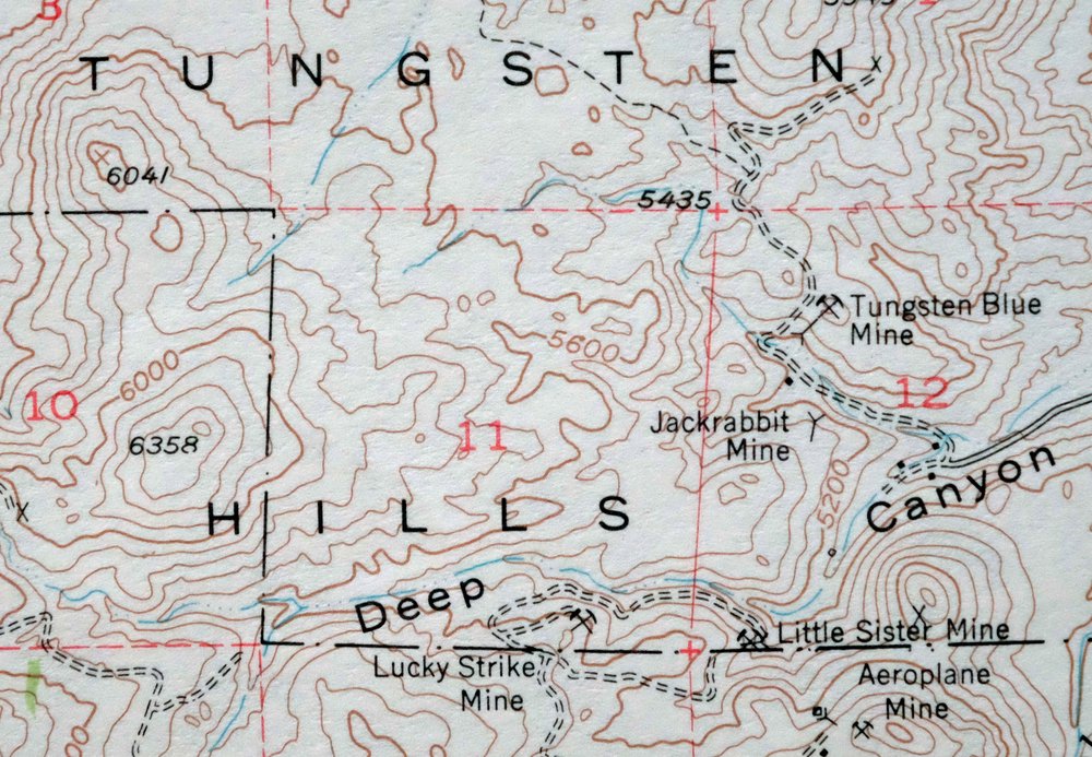
| Locations: Big Trees Campground, East Fork Campground, Forks Campground, Four Jeffrey Campground, Horton Creek Campground, Inyo-Mono Ecology Center, Lake Inlet Campground, Lake Outlet Campground, Mosquito Flat Campground, Palisade Campground, Paradise Camp, Pine Creek Tungsten Mill, Pine Grove Campground, Pleasant Valley Campground, Rock Creek Lake Campground, Starlight Estates, and Vanadium Ranch. Areas: Buttermilk Country. Mountains, Peaks, and Summits: Basin Mountain, Broken Finger Peak, Four Gables, Grouse Mountain, Mount Humphreys, Mount Morgan, Round Valley Peak, and Mount Tom. Valleys and Canyons: Birchim Canyon, Deep Canyon, Elderberry Canyon, Little Lakes Valley, Mayfield Canyon, Owens River Gorge, and Sand Canyon. Drainages: Coyote Creek, East Fork Rock Creek, Egypt Creek, Gable Creek, Lower Rock Creek, Middle Fork Bishop Creek, Morgan Creek, Pine Creek, and South Fork Bishop Creek. Mines: Adamson Mine, Aeroplane Mine, Blue Grouse Prospect, Brownstone Mine, Hanging Valley Mine, Hilltop Prospect, Jackrabbit Mine, Lakeview Mine, Lambert Mine, Little Egypt Prospect, Little Shot Mine, Little Sister Mine, Lucky Strike Mine, Mountain Basin Prospect, Pine Creek Mine, Pine Creek Mine-Zero Adit, Raindrop Prospect, Rattlesnake Prospect, Round Valley Mine, Round Valley Peak Prospect, Round Valley Quarry, Sunny Boy Prospect, Tungstar Mine, Tungsten Blue Mine, Tungsten Peak Prospect, Van Loon Prospect, Western Mine, and White Caps Mine. Lakes and Ponds: Alsace Lake, Bear Lake, Birchim Lake, Blanc Lake, Buck Lake, Cony Lake, Desolation Lake, Dorothy Lake, Eastern Brook Lakes, Elba Lake, Finch Lake, Forsaken Lake, Francis Lake, French Lake, Gable Lakes, Golden Lake, Hidden Lakes, Honeymoon Lake, Horton Lake, Humphreys Lakes, Kenneth Lake, Knob Lake, Little French Lake, Little Lake, Lorraine Lake, Lower Desolation Lake, Lower Morgan Lake, Lower Petite Lake, Mack Lake, Marmot Lake, Mesa Lake, Moon Lake, Paris Lake, Patricia Lake, Pine Lake, Puppet Lake, Rock Creek Lake, Roget Lake, Rust Lake, Serene Lake, Split Lake, Square Lake, Star Lake, Steelhead Lake, Tamarack Lakes, La Tete Lake, Tomahawk Lake, Upper Horton Lakes, Upper Morgan Lake, Upper Petite Lake, Upper Pine Lake, and Wedge Lake. Dams: Longley 104-031 Dam and Pleasant Valley 6-045 Dam. Gaps: Carol Col and Pine Creek Pass. Basins: Humphreys Basin and Round Valley. Schools: Round Valley Elementary School. Ridges: Wheeler Ridge. Reservoirs and Tanks: Longley Lake and Pleasant Valley Reservoir. Flats: Ainslee Meadow, Dutch Johns Meadow, Longley Meadow, McGee Meadow, Mosquito Flat, Sharps Meadow, Tungsten Hills, Upper Meadow, and Wells Meadow. Slopes: Sherwin Grade. | |
| SHIPPING AND RETURNS | |
 This map sheet will be carefully rolled in a sturdy tube and shipped via the US Postal Service. If you find that the sheet you receive is not as described in the listing, you may ship it back to us for a refund of the purchase price. | |
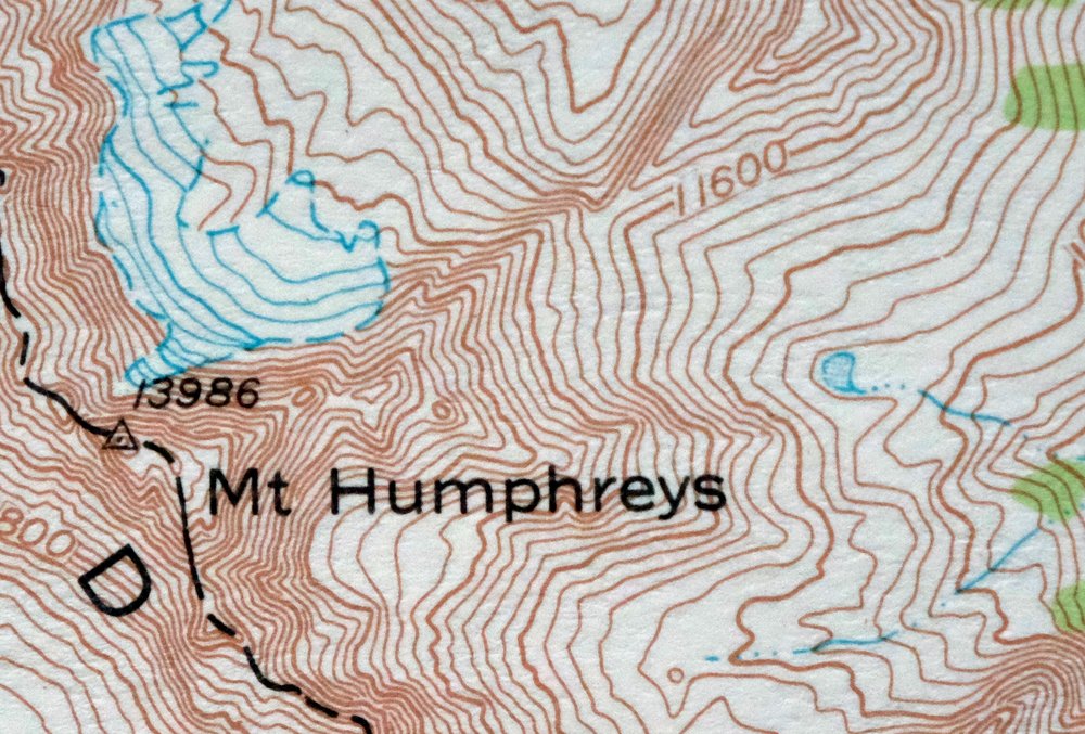
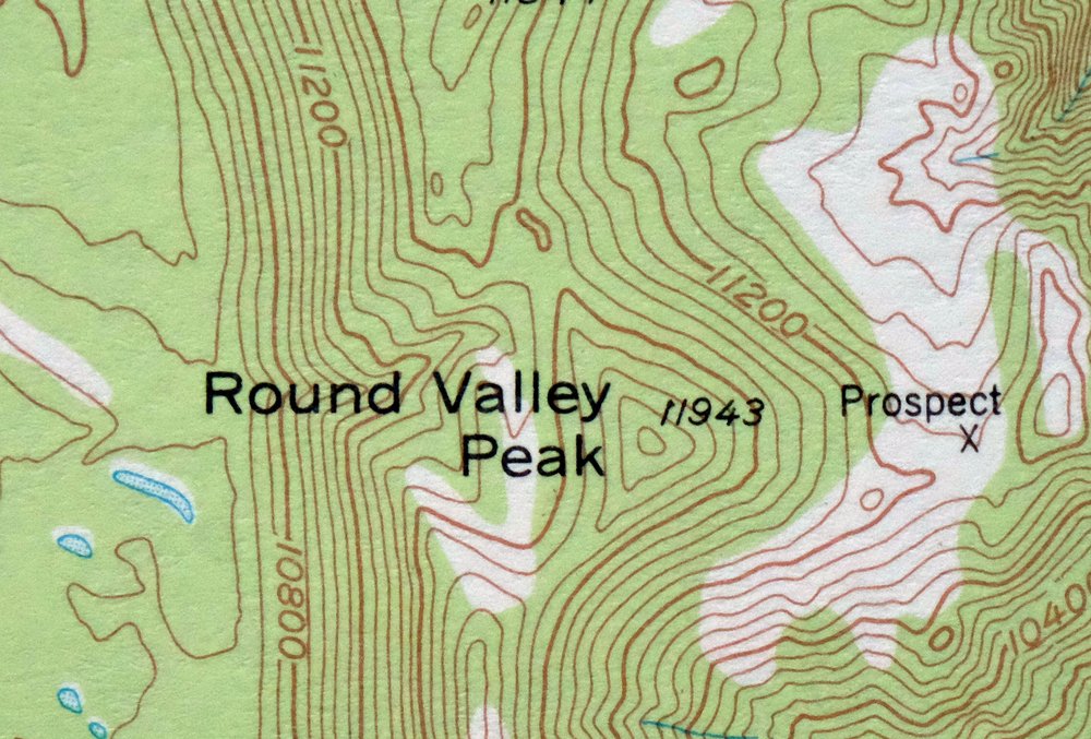
1968 USGS Topo Map: Mount Tom, Paradise, California
$45
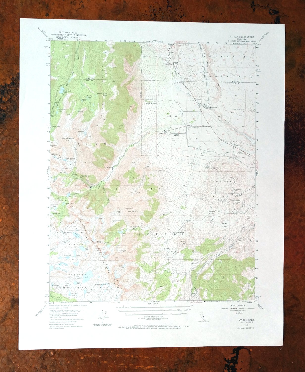
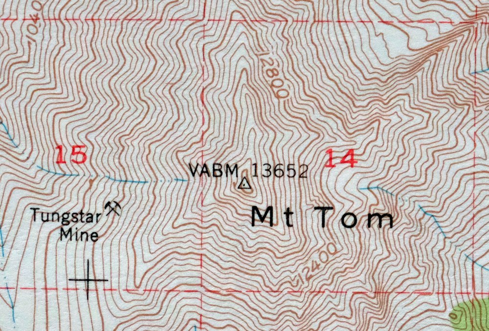
This is a 1949 edition of the Mount Tom quadrangle in eastern California, printed in 1968 at a scale of 1:62,500, with a green woodland tint marking the vegetated areas. The map covers a stretch of the eastern Sierra Nevada around West Bishop and Round Valley, taking in portions of the John Muir Wilderness and Inyo National Forest where Fresno, Inyo, and Mono counties meet. Mount Tom itself rises above 13,000 feet on the Sierra crest here, a landmark for anyone who has hiked or climbed the range above Bishop. Never folded, it would frame well.
In stock
This vintage sheet is a 1949 edition of the Mount Tom California USGS topographic map. It is an original 58-year-old 1968 United States Geological Survey print in excellent condition.
HOW THIS MAP CAN BE USED
In addition to making a fascinating conversation piece, this sheet would look great in a frame or on display, make a unique and prized gift for anyone interested in this area, be perfect as a reference for genealogy studies or general historical research, or fill that missing piece in your collection. Maps of this vintage are printed on durable stock and are well-suited for outdoor activities and recreation of all kinds, including hiking, backpacking, hunting, rafting and kayaking, backcountry skiing, geocaching, general exploration, treasure hunting, etc.
FEATURES SHOWN ON THE MAP
The Mount Tom 15-minute map shows cities and towns, roads, railroads, utilities and energy infrastructure, rivers, creeks, elevation contour lines, public land survey lines, county, state, and other administrative boundaries as they existed at the time of the survey in 1947 and 1949. All known structures (houses, businesses, churches, schools, barns, cabins, etc) are also shown.
A VALUABLE HISTORICAL RECORD
Maps from the 15-minute series for the continental United States are no longer produced or printed by the USGS and original prints are becoming increasingly difficult to find. They are a valuable historical record for an area, as they contain many placenames and features that have been dropped from more recent maps.
Nearby maps
-
Bishop California West Bishop Laws USGS Topographic Map 1969
$40 Add to cart -
1973 USGS Topo Map: Mount Abbot, Sierra Nevada, California
$43 Add to cart -
1975 USGS Topo Map: Casa Diablo Mountain, California
$40 Add to cart -
Mount Morrison California Mammoth Lakes USGS Topo Map 1974
$52 Add to cart -
Blackcap Mountain California USGS Topo Map 1972 Vintage
$40 Add to cart -
1952 USGS Topo Map: Big Pine, California
$44 Add to cart -
Huntington Lake California Shaver Lake USGS Topo Map 1968
$43 Add to cart -

Mount Pinchot California USGS 15-Min Topo Map 1969 Vintage
$18 Add to cart -
1964 Cowtrack Mountain California USGS Topo Map: Mono Lake
$45 Add to cart -
1973 USGS Topo Map: Shaver Lake, Meadow Lakes, California
$42 Add to cart -
1965 Triple Divide Peak California USGS Topo Map
$33 Add to cart -
Mount Whitney California USGS 15-Min Topo Map 1972 Vintage
$42 Add to cart -
1973 USGS Topo Map: Tuolumne Meadows, California
$48 Add to cart -
1976 Last Chance Range California/Nevada USGS Topo Map
$38 Add to cart -
Hetch Hetchy Reservoir California USGS Topo Map 1973 Vintage
$39 Add to cart -
1971 USGS Topo Map: Matterhorn Peak, California
$46 Add to cart -
1973 Kern Peak California USGS Topo Map
$42 Add to cart -
Sanger Del Ray Clotho California USGS 7.5-Min Topo Map 1923
$30 Add to cart -
Ubehebe Crater California USGS 15-Min Topo Map 1972 Vintage
$37 Add to cart -
Ivanhoe California Woodlake USGS Topo Map 1946 Vintage
$34 Add to cart -
Selma California Fresno Sanger USGS Topo Map 1954 Vintage
$35 Add to cart -
Ubehebe Peak California USGS 15-Min Topo Map 1966 Vintage
$44 Add to cart -
Tower Peak California USGS 15-Min Topo Map 1972 Vintage
$40 Add to cart -

Kinsley California USGS 7.5-Min Topographic Map 1949 Vintage
$32 Add to cart
