MAP DETAILS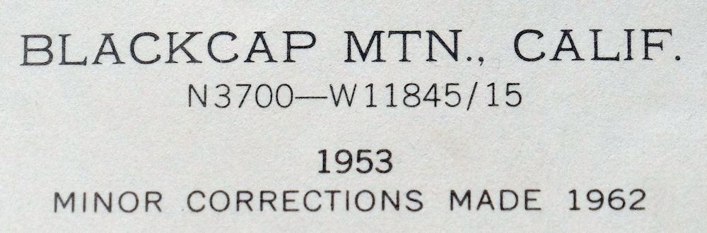 | |
|---|---|
| TITLE | Blackcap Mountain |
| STATE | California |
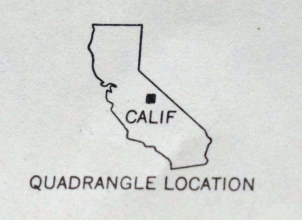
| LOCATION | Kings Canyon National Park, 55 miles northeast of Fresno |
| SERIES | 15-minute |
| SURVEYED | 1948 and 1953 Aerial and Field Survey |
| EDITION | 1953 |
| REVISIONS | 1962 |
| PRINTED | 1972 |
| PRINT NOTES | Thick paper stock, includes woodland tint (green to indicate vegetated areas) |
| SCALE | 1:62500 |
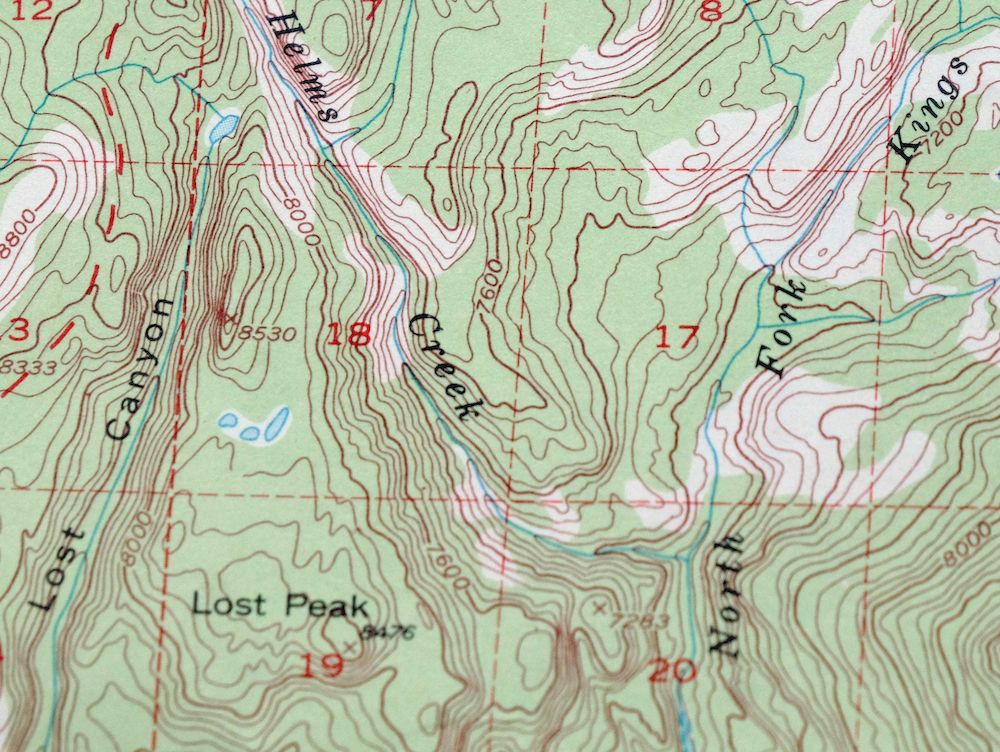
| CONTOUR INTERVAL | 80 feet |
| SHEET DIMENSIONS | 17 x 21 inches |
| MAP DIMENSIONS | 14 x 17 1/2 inches |
| COVERAGE AREA | 14 x 17 miles |
| SHEET CONDITION For maps of this vintage, effort is made to note all visible flaws, no matter how minor. | |
| OVERALL CONDITION | Excellent |
| SHEET NOTES | lightly handled, never folded |
| MAP AREA | flawless map area |
| COLLARS | no wear or tears, no markings, no blemishes |
| MAP COVERAGE Quadrangle extent overlaid on current basemap. | |
| PLACENAMES Depending on map series and survey date, all of the features listed below may not be shown on this map. This list contains features that currently exist or historically existed within the area covered by the map. The list can be used as a reference to determine if this map covers your area of interest. Placenames are listed alphabetically next to each feature type. | |
| COUNTIES COVERED | Fresno |
| FEDERAL LAND UNITS | Dinkey Lakes Wilderness, John Muir Wilderness, Kings Canyon National Park, Sequoia-Kings Canyon Wilderness, and Sierra National Forest |
| RIVERS AND STREAMS | Boulder Creek, Burnt Corral Creek, Crown Creek, Dusy Creek, Evolution Creek, Fall Creek, Fleming Creek, Helms Creek, Meadow Brook, North Fork Kings River, Piute Creek, Post Corral Creek, Scepter Creek, South Fork San Joaquin River, Turret Creek, West Pinnacles Creek, and Woodchuck Creek |
| WATER BODIES | Ambition Lake, Arctic Lake, Bighorn Lake, Blackrock Lake, Bullet Lake, Chimney Lake, Colt Lake, Courtright Reservoir, Crabtree Lake, Crown Lake, Dale Lake, Davis Lake, Devils Punchbowl, Diamond-X Lake, Disappointment Lake, Division Lake, Filly Lake, Fleming Lake, Florence Lake, Guest Lake, Halfmoon Lake, Hell for Sure Lake, Hidden Lake, Hobler Lake, Holster Lake, Horseshoe Lake, Little Jo Lake, Lobe Lakes, Lost Lake, Lower Indian Lake, Marsh Lake, Maxson Lake, McGuire Lakes, Midway Lake, Mount Shinn Lake, Old Pipe Lake, Pearl Lake, Portal Lake, Rae Lake, Rainbow Lake, Ramona Lake, Scepter Lake, Schoolmarm Lake, Summit Lake, Thompson Lake, Turf Lakes, Twin Buck Lakes, Upper Honeymoon Lake, Upper Indian Lake, Ward Mountain Lake, Wishon Reservoir, and Woodchuck Lake |
| Locations: Blizzard Camp, Boulder Creek Campground, Chamberlains Camp, Lacy Camp, Lily Pad Campground, Lower Blayney Campground, Marmot Rock Campground, Moore Boys Camp, Muir Trail Ranch, Trapper Springs Campground, and Voyager Rock Campground. Areas: China Camp, Potholes, and Woodchuck Country. Mountains, Peaks, and Summits: Blackcap Mountain, Cape Horn, Corral Mountain, Emerald Peak, Fleming Mountain, Mount Henry, Mount Hutton, Long Top, Loper Peak, Lost Peak, Maxson Dome, Pavilion Dome, Red Mountain, Mount Shinn, Ward Mountain, and Zingheim Heights. Valleys and Canyons: Bench Valley, Evolution Valley, Goddard Canyon, Lost Canyon, Nichols Canyon, Pig Chute, and Piute Canyon. Parks: Courtright Intrusive Contact Zone Geological Area. Drainages: Boulder Creek, Burnt Corral Creek, Dusy Creek, Evolution Creek, Fall Creek, Fleming Creek, Helms Creek, Meadow Brook, North Goddard Creek, Piute Creek, Post Corral Creek, Sallie Keyes Creek, Senger Creek, Sharp Creek, Short Hair Creek, Turret Creek, West Pinnacles Creek, and Woodchuck Creek. Lakes and Ponds: Arctic Lake, Big Shot Lake, Bighorn Lake, Blackrock Lake, Bonita Lake, Bullet Lake, Chimney Lake, Clear Lake, Colt Lake, Lake Confusion, Crabtree Lake, Crown Lake, Dale Lake, Davis Lake, Devils Punchbowl, Diamond-X Lake, Disappointment Lake, Division Lake, Filly Lake, Fleming Lake, Guest Lake, Halfmoon Lake, Heather Lake, Hell for Sure Lake, Hidden Lake, Hobler Lake, Hockey Lakes, Holster Lake, Horseshoe Lake, Hummingbird Lake, Jigger Lakes, Little Jo Lake, Little Shot Lake, Lobe Lakes, Lone Doe Lake, Lost Lake, Lower Indian Lake, Marsh Lake, Maxson Lake, McGuire Lakes, Mount Shinn Lake, Old Pipe Lake, Portal Lake, Rae Lake, Rainbow Lake, Ramona Lake, Roman Four Lake, Scepter Lake, Schoolmarm Lake, Six Shooter Lake, Summit Lake, Thompson Lake, Turf Lakes, Twin Buck Lakes, Upper Honeymoon Lake, Upper Indian Lake, Wah Hoo Lake, Ward Mountain Lake, and Woodchuck Lake. Buildings: John Muir Trail Cabin and Meadow Brook Cabin. Dams: Courtright Dam, Courtwright 97-119 Dam, Wishon 97-118 Dam, and Wishon Dam. Gaps: Chuck Pass, Crown Pass, Hell for Sure Pass, Hot Springs Pass, Mosquito Pass, Scepter Pass, and Thompson Pass. Basins: Blackcap Basin, Crown Basin, Lower Box, Maxson Basin, Red Mountain Basin, Red Rock Basin, Reddys Hole, and Upper Box. Swamps: Tule Lake. Ridges: Castle Ridge and Le Conte Divide. Reservoirs and Tanks: Courtright Reservoir and Wishon Reservoir. Flats: Aspen Meadow, Big Maxson Meadow, Blayney Meadows, Burnt Corral Meadow, Coolidge Meadow, Double Meadow, Dusy Meadow, Dutch Oven Meadow, Evolution Meadow, Franklin Meadow, Lightning Corral Meadow, Long Meadow, Maxson Meadows, Mountain Meadow, Post Corral Meadows, and Shooting Star Meadow. Pillars: John Muir Rock. Springs: Cold Springs, Hot Springs, and Indian Springs. | |
| SHIPPING AND RETURNS | |
 This map sheet will be carefully rolled in a sturdy tube and shipped via the US Postal Service. If you find that the sheet you receive is not as described in the listing, you may ship it back to us for a refund of the purchase price. | |
Blackcap Mountain California USGS Topo Map 1972 Vintage
$40
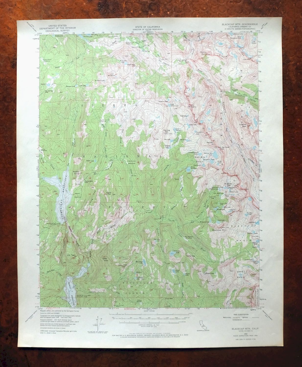
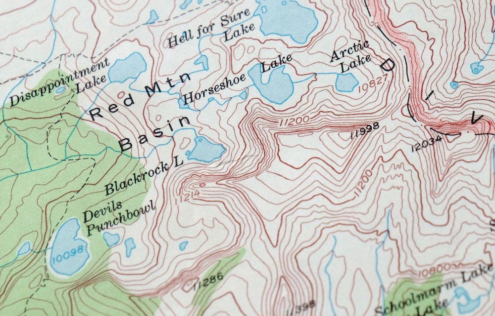
This USGS 15-minute topographic map is a 1953 edition with 1962 revisions, printed in 1972 on thick stock and in excellent condition, lightly handled and never folded. It takes in high country in Fresno County about 55 miles northeast of Fresno, spanning parts of Kings Canyon National Park and Sierra National Forest along with portions of the John Muir, Dinkey Lakes, and Sequoia-Kings Canyon Wilderness areas. This is rugged Sierra Nevada backcountry, with 80-foot contours tracing the peaks and drainages of a stretch of the range with no roads or towns, and the never-folded sheet on heavy stock lies flat for framing.
In stock
This vintage sheet is a 1953 edition of the Blackcap Mountain California USGS topographic map. It is an original 54-year-old 1972 United States Geological Survey print in excellent condition.
HOW THIS MAP CAN BE USED
In addition to making a fascinating conversation piece, this sheet would look great in a frame or on display, make a unique and prized gift for anyone interested in this area, be perfect as a reference for genealogy studies or general historical research, or fill that missing piece in your collection. Maps of this vintage are printed on durable stock and are well-suited for outdoor activities and recreation of all kinds, including hiking, backpacking, hunting, rafting and kayaking, backcountry skiing, geocaching, general exploration, treasure hunting, etc.
FEATURES SHOWN ON THE MAP
The Blackcap Mountain 15-minute map shows cities and towns, roads, railroads, utilities and energy infrastructure, rivers, creeks, elevation contour lines, public land survey lines, county, state, and other administrative boundaries as they existed at the time of the survey in 1948 and 1953. All known structures (houses, businesses, churches, schools, barns, cabins, etc) are also shown.
A VALUABLE HISTORICAL RECORD
Maps from the 15-minute series for the continental United States are no longer produced or printed by the USGS and original prints are becoming increasingly difficult to find. They are a valuable historical record for an area, as they contain many placenames and features that have been dropped from more recent maps.
Nearby maps
-
Huntington Lake California Shaver Lake USGS Topo Map 1968
$43 Add to cart -

Mount Pinchot California USGS 15-Min Topo Map 1969 Vintage
$26 Add to cart -
Bishop California West Bishop Laws USGS Topographic Map 1969
$40 Add to cart -
Mount Morrison California Mammoth Lakes USGS Topo Map 1974
$52 Add to cart -
Mount Whitney California USGS 15-Min Topo Map 1972 Vintage
$42 Add to cart -
Selma California Fresno Sanger USGS Topo Map 1954 Vintage
$35 Add to cart -
Hetch Hetchy Reservoir California USGS Topo Map 1973 Vintage
$39 Add to cart -

Le Grand California Madera Chowchilla USGS Topo Map 1963
$14 Add to cart -
Sanger Del Ray Clotho California USGS 7.5-Min Topo Map 1923
$30 Add to cart -
Ivanhoe California Woodlake USGS Topo Map 1946 Vintage
$34 Add to cart -
Exeter California Visalia Ivanhoe USGS Topographic Map 1944
$37 Add to cart -

Raynor Creek California Chowchilla River USGS Topo Map 1947
$30 Add to cart -
Kismet California Madera USGS 7.5-Min Topo Map 1948 Vintage
$32 Add to cart -

Remnoy California Hamblin Hanford USGS Topo Map 1927 Antique
$30 Add to cart -
Camp Nelson California USGS 15-Min Topo Map 1977 Vintage
$40 Add to cart -

Kinsley California USGS 7.5-Min Topographic Map 1949 Vintage
$32 Add to cart -
Kerman California Madera Avenue USGS Topographic Map 1947
$25 Add to cart -
Helm California Fresno Slough Fish Slough USGS Topo Map 1947
$22 Add to cart -
Ubehebe Peak California USGS 15-Min Topo Map 1966 Vintage
$47 Add to cart -
Jamesan California Tranquillity USGS Topo Map 1924 Antique
$16 Add to cart -
Tower Peak California USGS 15-Min Topo Map 1972 Vintage
$40 Add to cart -
Kentucky Well California USGS 7.5-Min Topo Map 1948 Vintage
$32 Add to cart -

Jawbone Ridge California Buck Meadows USGS Topo Map 1949
$27 Add to cart -

Chowchilla California Le Grand El Nido USGS Topo Map 1962
$20 Add to cart