MAP DETAILS | |
|---|---|
| TITLE | Clancy |
| STATE | Montana |
| LOCATION | 15 miles southeast of Helena |
| SERIES | 15-minute |
| SURVEYED | 1947 and 1950 Aerial and Field Survey |
| EDITION | 1950 |
| PRINTED | 1969 |
| PRINT NOTES | Thick paper stock, includes woodland tint (green to indicate vegetated areas) |
| SCALE | 1:62500 |
| CONTOUR INTERVAL | 40 feet |
| SHEET DIMENSIONS | 18 x 22 inches |
| MAP DIMENSIONS | 12 1/8 x 17 1/2 inches |
| COVERAGE AREA | 12 x 17 miles |
| SHEET CONDITION For maps of this vintage, effort is made to note all visible flaws, no matter how minor. | |
| OVERALL CONDITION | Very Good |
| SHEET NOTES | never folded |
| MAP AREA | no markings, no blemishes |
| COLLARS | no markings, no blemishes, no edge tears, light handling in bottom collar |
| MAP COVERAGE Quadrangle extent overlaid on current basemap. | |
| PLACENAMES Depending on map series and survey date, all of the features listed below may not be shown on this map. This list contains features that currently exist or historically existed within the area covered by the map. The list can be used as a reference to determine if this map covers your area of interest. Placenames are listed alphabetically next to each feature type. | |
| NOTABLE PLACES | Elkhorn Mountains and Helena NF |
| CITIES AND TOWNS (CURRENT) | Clancy, Jefferson City, and Montana City |
| COUNTIES COVERED | Broadwater and Jefferson |
| FEDERAL LAND UNITS | Deerlodge National Forest, Elkhorn Wilderness Study Area, and Helena National Forest |
| RIVERS AND STREAMS | Antelope Creek, Badger Creek, Bear Creek, Beaver Creek, Big Tizer Creek, Blacker Creek, Clancy Creek, Clear Creek, Crazy Creek, Crow Creek, Crystal Creek, Dewey Creek, Dutchman Creek, Eagle Creek, East Fork Dry Creek, East Fork McClellan Creek, Elkhorn Creek, Eureka Creek, Falls Creek, Golconda Creek, Hall Creek, Haystack Creek, Hogan Creek, Jackson Creek, Jenkins Gulch Creek, Little Tizer Creek, Longfellow Creek, Maupin Creek, McCarty Creek, McClellan Creek, Middle Fork Warm Springs Creek, Mill Creek, Moose Creek, Muddy Lake Creek, Muskrat Creek, North Fork Warm Springs Creek, North Pole Creek, Prickly Pear Creek, Rattlesnake Creek, Sand Creek, Sawmill Creek, Shingle Creek, Sourdough Creek, South Fork Beaver Creek, South Fork Crow Creek, South Fork Warm Springs Creek, Spokane Creek, Spring Creek, Staubach Creek, Strawberry Creek, Swamp Creek, Teakettle Creek, Tepee Creek, Turman Creek, Turnley Creek, Warm Springs Creek, Warner Creek, Weimer Creek, West Fork Dry Creek, Willard Creek, and Wilson Creek |
| WATER BODIES | Glenwood Lake, Hidden Lake, and Tizer Lakes |
| Populated Place: Alhambra, Clancy, Elkhorn, and Queen. Locations: Alhambra RV Park, Tizer Lakes Fishing Access Site, Elkhorn Picnic Area, McClellan Ranger Station, and Tizer Ranger Station. Mountain Ranges: Elkhorn Mountains. Mountains, Peaks, and Summits: Bullock Hill, Burnt Mountain, Casey Peak, Corral Mountain, Crow Peak, Elkhorn Peak, High Peak, Lava Mountain, Shingle Butte, Strawberry Butte, and Windy Point. Valleys and Canyons: Anderson Gulch, Black Canyon, Browns Gulch, DuBois Gulch, Greyback Gulch, Hobo Gulch, Hog Hollow, Lump Gulch, Ninety Cent Gulch, Queen Gulch, Rabbit Gulch, Seven-Up Gulch, Slaughterhouse Gulch, South Fork Queen Gulch, and Westover Gulch. Parks: Elkhorn State Park. Drainages: Badger Creek, Bear Gulch, Big Tizer Creek, Blacker Creek, Clancy Creek, Clear Creek, Crazy Creek, Crystal Creek, Dewey Creek, Dutchman Creek, Eagle Creek, East Fork McClellan Creek, Eureka Creek, Falls Creek, Hall Creek, Haystack Creek, Hogan Creek, Jackson Creek, Little Tizer Creek, Longfellow Creek, Maupin Creek, Middle Fork Warm Springs Creek, Mill Creek, Moose Creek, North Fork Warm Springs Creek, Rattlesnake Creek, Shingle Creek, Sourdough Creek, South Fork Warm Springs Creek, Spring Creek, Strawberry Creek, Swamp Creek, Teakettle Creek, Tepee Creek, Turnley Creek, Warm Springs Creek, Warner Creek, Weimer Creek, Willard Creek, and Wilson Creek. Mines: Alhambra Hot Springs Mine, Argonaut Mine, B and G Mine, Ballard Mine, Big Tizer Wildcat Mine, Bonanza Mine, Boulaway Mine, C and D Mine, Calahan Mine, Calahan/Pataloma Mine, Carmody Mine, Champion Mine, Crystal Creek Mine, Dunstone/Klondyke Mine, Eagles Nest Mine, East Butte Mine, Elkhorn Skyline Mine, Forest Park Mine, Golden Age Mine, Golden Moss Mine, Hardcash Mine, Heggen Mine, Hog Hollow Mine, Iron Mine, James R Keene Mine, King of Sweden Mine, Little Tizer Wildcat Mine, Louise Mine, Luxanburgh Mine, Mid Fork Warm Springs Mine, Moreau Mine, NE NE Section 18 Mine, NE NE Section 3 Mine, NW SE Section 9 Mine, NW SW Section 24 Mine, Pataloma Mine, SE NE Section 2 Mine, SE SW Section 1 Mine, Seven-Up Gulch Mine, Skyline Mine, Sourdough Mine, Union Mine, and Wall 2 Mine. Churches: Clancy United Methodist Church and Saint John Mission. Post Office: Clancy Post Office. Hospitals: Hillbrook Nursing Home. Lakes and Ponds: Glenwood Lake, Hidden Lake, Leslie Lake, South Fork Lakes, and Tizer Lakes. Buildings: Clancy Volunteer Fire Company Station 1 and Elkhorn Search and Rescue. Waterfalls: Crow Creek Falls. Gaps: Radersburg Pass. Basins: Slim Sam Basin. Census: Elkhorn Census Designated Place. Schools: Clancy Elementary School. Ridges: Bonanza Ridge and Mike Murray Ridge. Reservoirs and Tanks: Scott Reservoir. Flats: Airplane Park, Boulder Park, Casey Meadows, Elk Park, Horsethief Park, Longfellow Park, Manley Park, Montgomery Park, Poe Park, Sheep Park, Spring Park, Turnley Meadows, and Woods Park. Wells: 08N03W16AAB_01 Well, 08N03W16AAC_01 Well, 08N03W16ABB_01 Well, 08N03W16ACBC01 Well, 08N03W16ADB_01 Well, 08N03W16ADD_01 Well, 08N03W16BDA_01 Well, and 08N03W22ACA_01 Well. Springs: 08N03W16ACA_01 Spring, 08N03W16ACAA01 Spring, 08N03W16ACD_01 Spring, Bomar Spring, Bonanza Spring, Church Spring, Hog Hollow Spring, Lupien Spring, Mud Springs, Rube Sobey Spring, Swamp Creek Spring, and Two Sam Spring. | |
| SHIPPING AND RETURNS | |
 This map sheet will be carefully rolled in a sturdy tube and shipped via the US Postal Service. If you find that the sheet you receive is not as described in the listing, you may ship it back to us for a refund of the purchase price. | |
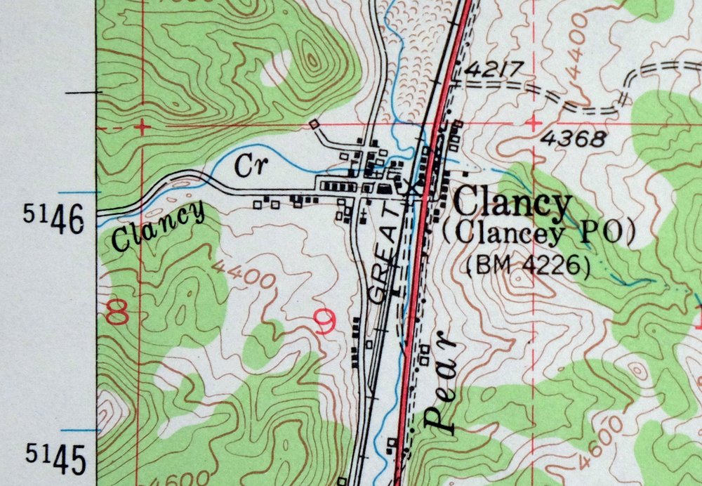
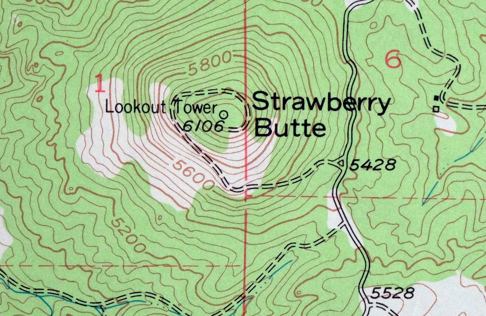
1969 Clancy Montana USGS Topo Map: Elkhorn Mountains
$40
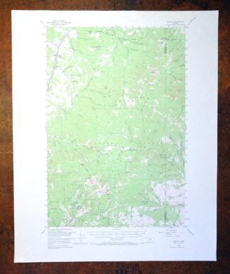
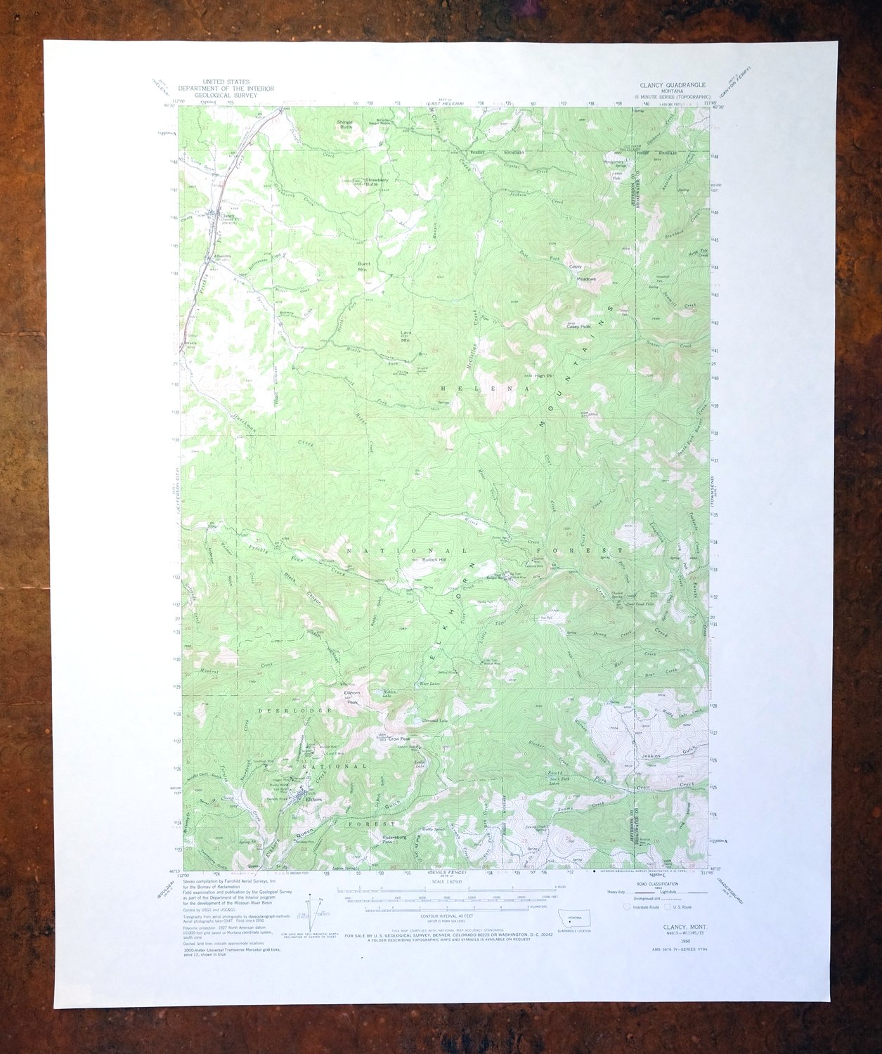
This USGS topographic map of the Clancy quadrangle in Montana was first published as a 1950 edition and printed in 1969, showing the landscape from aerial and field surveys of 1947 and 1950. Covering about 12 by 17 miles in Broadwater and Jefferson counties, roughly 15 miles southeast of Helena, it reaches into the Elkhorn Mountains and takes in portions of the Helena and Deerlodge national forests. The green woodland tint traces the forested slopes at a 1:62,500 scale, and the sheet has never been folded.
In stock
This vintage sheet is a 1950 edition of the Clancy Montana USGS topographic map. It is an original 57-year-old 1969 United States Geological Survey print in very good condition.
HOW THIS MAP CAN BE USED
In addition to making a fascinating conversation piece, this sheet would look great in a frame or on display, make a unique and prized gift for anyone interested in this area, be perfect as a reference for genealogy studies or general historical research, or fill that missing piece in your collection. Maps of this vintage are printed on durable stock and are well-suited for outdoor activities and recreation of all kinds, including hiking, backpacking, hunting, rafting and kayaking, backcountry skiing, geocaching, general exploration, treasure hunting, etc.
FEATURES SHOWN ON THE MAP
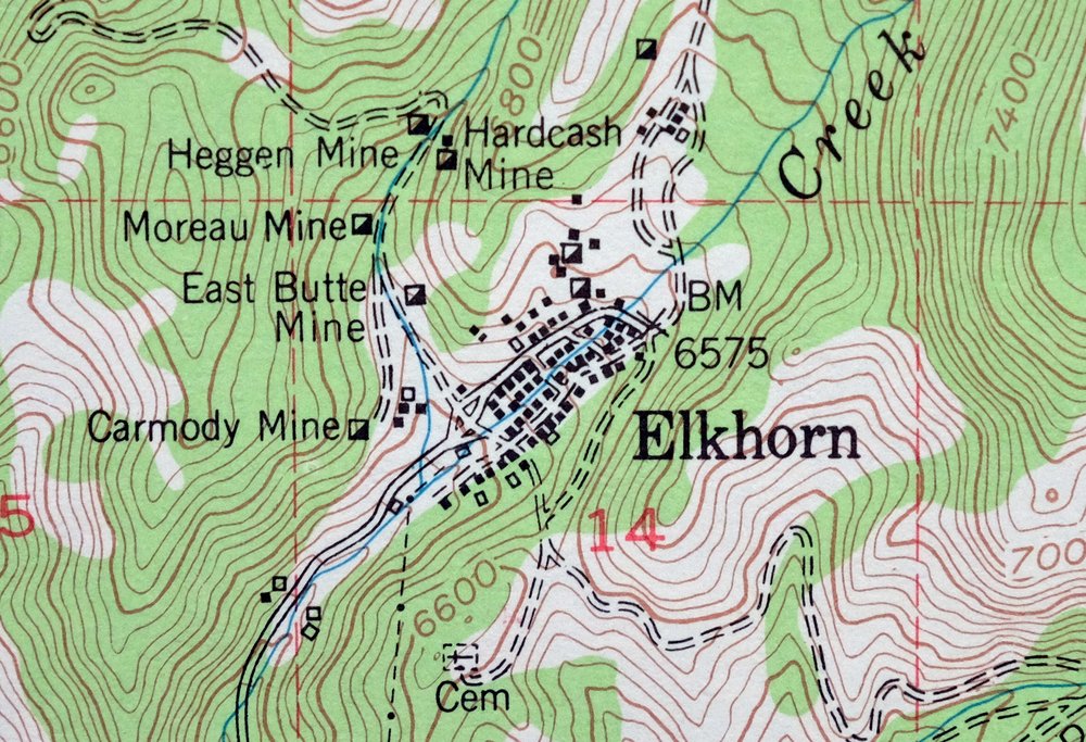
The Clancy 15-minute map shows cities and towns, roads, railroads, utilities and energy infrastructure, rivers, creeks, elevation contour lines, public land survey lines, county, state, and other administrative boundaries as they existed at the time of the survey in 1947 and 1950. All known structures (houses, businesses, churches, schools, barns, cabins, etc) are also shown.
A VALUABLE HISTORICAL RECORD
Maps from the 15-minute series for the continental United States are no longer produced or printed by the USGS and original prints are becoming increasingly difficult to find. They are a valuable historical record for an area, as they contain many placenames and features that have been dropped from more recent maps.
Nearby maps
-

Jefferson City Montana Clancy Basin USGS Topo Map 1967
$39 Add to cart -

Devils Fence Montana USGS 15-Min Topo Map 1950 Vintage
$36 Add to cart -

East Helena Montana Helena Clancy USGS Topographic Map 1974
$42 Add to cart -

1980 Belgrade Montana USGS Topo Map: Bridger Range
$43 Add to cart -
1975 Butte South Montana USGS Topo Map: Divide
$42 Add to cart -

Sedan Montana USGS 15-Min Topographic Map 1956 Vintage
$38 Add to cart -
1979 Drummond Montana USGS Topo Map: Hall (1958 Edition)
$34 Add to cart -
1969 Bozeman Montana USGS Topo Map: Gallatin Gateway
$44 Add to cart -

Boulder Montana Butte-Silver Bow Clancy USGS Topo Map 1933
$39 Add to cart -

Ennis Montana McAllister Jeffers USGS Topo Map 1969 Vintage
$38 Add to cart -
Bozeman Pass Montana USGS 15-Min Topo Map 1978 Vintage
$43 Add to cart -

Spanish Peaks Montana Big Sky USGS Topo Map 1973 Vintage
$37 Add to cart -
Fridley Peak Montana USGS 15-Min Topo Map 1972 Vintage
$43 Add to cart -
Fairfield Montana Simms Fort Shaw USGS Topo Map 1952 Vintage
$40 Add to cart -
1968 USGS Topo Map: Sphinx Mountain, Montana
$43 Add to cart -
1975 USGS Topo Map: Emigrant, Yellowstone River, Montana
$42 Add to cart -

Crown Butte Montana Yellowstone NP USGS 15-Min Topo Map 1979
$40 Add to cart -

Miner Montana Gardiner Corwin Springs USGS Topo Map 1983
$36 Add to cart -

Mount Cowen Montana Absaroka Range USGS 15-Min Topo Map 1963
$44 Add to cart -
Monument Ridge Montana USGS 15-Min Topo Map 1975 Vintage
$38 Add to cart -
1975 Choteau Montana USGS Topo Map: Arod Lakes
$40 Add to cart -
1981 Cliff Lake Montana USGS Topo Map: Madison River
$43 Add to cart -
1983 Gardiner Montana USGS Topo Map: Yellowstone NP
$45 Add to cart -

Tepee Creek Montana Grayling USGS Topo Map 1963 Vintage
$35 Add to cart