MAP DETAILS | |
|---|---|
| TITLE | Drummond |
| STATE | Montana |
| LOCATION | 45 miles southeast of Missoula |
| SERIES | 15-minute |
| SURVEYED | 1954 through 1958 Aerial and Field Survey |
| EDITION | 1958 |
| PRINTED | 1979 |
| PRINT NOTES | Includes woodland tint (green to indicate vegetated areas) |
| SCALE | 1:62500 |
| CONTOUR INTERVAL | 40 feet |
| SHEET DIMENSIONS | 18 x 22 inches |
| MAP DIMENSIONS | 12 x 17 1/2 inches |
| COVERAGE AREA | 12 x 17 miles |
| SHEET CONDITION For maps of this vintage, effort is made to note all visible flaws, no matter how minor. | |
| OVERALL CONDITION | Very Good |
| SHEET NOTES | lightly handled, never folded |
| MAP AREA | no markings, no blemishes |
| COLLARS | no wear or tears, no markings, no blemishes |
| MAP COVERAGE Quadrangle extent overlaid on current basemap. | |
| PLACENAMES Depending on map series and survey date, all of the features listed below may not be shown on this map. This list contains features that currently exist or historically existed within the area covered by the map. The list can be used as a reference to determine if this map covers your area of interest. Placenames are listed alphabetically next to each feature type. | |
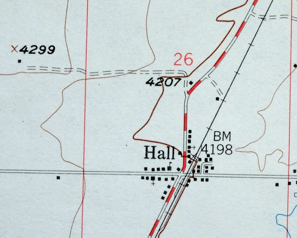
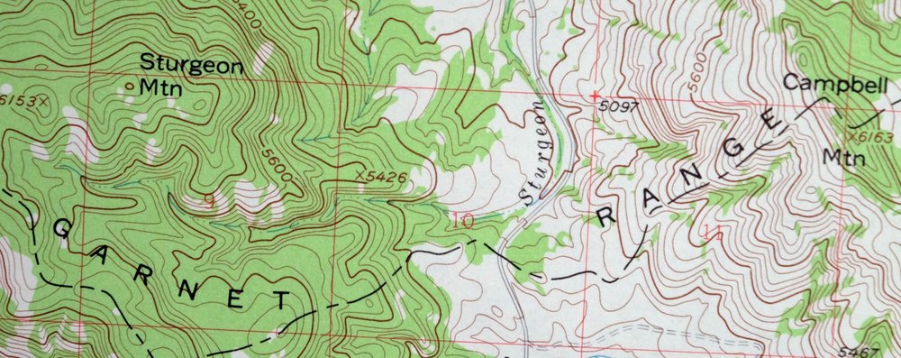
| NOTABLE PLACES | Hall, Clark Fork, and Garnet Range |
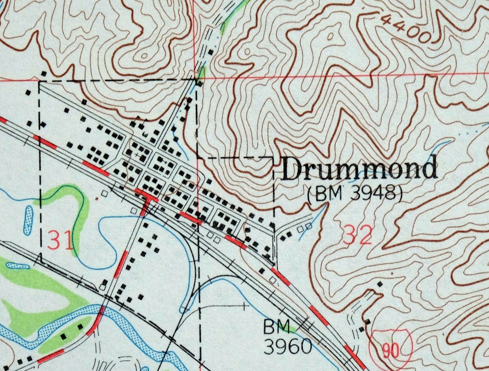
| CITIES AND TOWNS (CURRENT) | Drummond |
| COUNTIES COVERED | Granite and Powell |
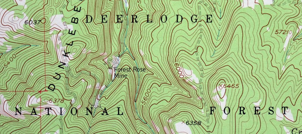
| FEDERAL LAND UNITS | Deerlodge National Forest |
| RIVERS AND STREAMS | Barnes Creek, Bear Creek, Bert Creek, Blum Creek, Byrne Creek, Chimney Creek, Cow Creek, Crevice Creek, Douglas Creek, Dunkleberg Creek, Flint Creek, Gird Creek, Gold Creek, Griffin Creek, Hoover Creek, Lower Willow Creek, Morris Creek, North Fork Douglas Creek, Sheep Creek, Smart Creek, Sturgeon Creek, and Tigh Creek |
| Populated Place: Bradman, Drummond, Hall, Jens, New Chicago, Ozan, Sherryl, and Stone. Locations: Drummond, Hall, Jens, and Douglas Creek Cabin. Administrative Boundaries: Town of Drummond. Mountains, Peaks, and Summits: Campbell Mountain, King Mountain, Lone Tree Hill, Saddle Mountain, and Sturgeon Mountain. Valleys and Canyons: Coberly Gulch, Edwards Gulch, Lyon Gulch, Rattler Gulch, Sheep Gulch, and Spring Gulch. Parks: Southern Flint Creek Valley Historical Marker and Jackson Park. Drainages: Barnes Creek, Bert Creek, Byrne Creek, Cow Creek, Douglas Creek, Dunkleberg Creek, Flint Creek, Gaskill Creek, Gird Creek, Henderson Creek, Hoover Creek, Lower Willow Creek, Morris Creek, Perkins Creek, Smart Creek, and Tigh Creek. Mines: Forest Rose Mine, Jackson Park Mine, Placer Mine, SE Section 14 Mine, SE Section 15 Mine, and SW Section 14 Mine. Churches: Drummond Community Church, Saint Michael Parish, and The Church of Jesus Christ of Latter Day Saints. Post Office: Drummond Post Office and Hall Post Office. Hospitals: Community Health Nurse. Buildings: Drummond Museum, Drummond Public Library, Valley Rural Fire Department, and Drummond Volunteer Ambulance. Dams: Goldberg East Dam, Goldberg West Dam, and Wolling Wighter Dam. Canals: Allendale Ditch. Bridges: Drummond Bridge. Airports: Drummond Airport. Census: Hall Census Designated Place. Schools: Drummond Public Schools and Hall Elementary School. Ridges: Dunkleberg Ridge and Limestone Ridge. Reservoirs and Tanks: Goldberg Reservoir. Wells: 09N12W04BABB01 Well, 09N13W02CBBC01 Well, 09N13W10DCCC01 Well, 09N13W22BCDA01 Well, 09N13W27BCDD01 Well, 09N13W28CBAA01 Well, 10N11W19ACAC01 Well, 10N11W19BBBA01 Well, 10N11W20CACA01 Well, 10N11W20CADA01 Well, 10N12W04AAAB01 Well, 10N12W04CACD01 Well, 10N12W06BAAA01 Well, 10N12W06BBAA01 Well, 10N12W06CBBC01 Well, 10N12W09CADA01 Well, 10N12W09CCCD01 Well, 10N12W14BADC01 Well, 10N12W17BABB01 Well, 10N12W17BBDB01 Well, 10N12W30BABD01 Well, 10N12W31ACDA01 Well, 10N13W12BDDA01 Well, 10N13W22AAAA01 Well, 10N13W22BDDA01 Well, 10N13W25CCCC01 Well, 10N13W26ABAA01 Well, 10N13W26DCCB01 Well, 10N13W29DDAA01 Well, 10N13W33CCBC01 Well, 10N13W34BBBB01 Well, 10N13W34DAAC01 Well, 10N13W36BABA01 Well, 11N12W29BDAA01 Well, 11N12W29CCCC01 Well, 11N12W30CDDD01 Well, 11N12W31AAAA01 Well, 11N12W31AAAD01 Well, 11N12W31AACA01 Well, 11N12W31AACB01 Well, 11N12W31AACB02 Well, 11N12W31AACC01 Well, 11N12W31AACC02 Well, 11N12W31AACD01 Well, 11N12W31AACD02 Well, 11N12W31AACD03 Well, 11N12W31AACD04 Well, 11N12W31AACD05 Well, 11N12W31AADD01 Well, 11N12W31ABAC01 Well, 11N12W31ABAD01 Well, 11N12W31ABCD01 Well, 11N12W31ABDA01 Well, 11N12W31ABDA02 Well, 11N12W31ABDA03 Well, 11N12W31ADAA01 Well, 11N12W31ADAA02 Well, 11N12W31ADAB01 Well, 11N12W31ADAB02 Well, 11N12W31ADAD01 Well, 11N12W31ADAD02 Well, 11N12W31ADAD03 Well, 11N12W31ADBA01 Well, 11N12W31ADBB01 Well, 11N12W31ADBD01 Well, 11N12W31ADBD02 Well, 11N12W31ADDA01 Well, 11N12W31CCAC01 Well, 11N12W31CCAD01 Well, 11N12W31CCDA01 Well, 11N12W31CDAB01 Well, 11N12W31CDAD01 Well, 11N12W31CDBA01 Well, 11N12W31CDBC01 Well, 11N12W31CDBC02 Well, 11N12W31CDBC03 Well, 11N12W31CDCB01 Well, 11N12W31CDDA01 Well, 11N12W31DABA01 Well, 11N12W31DABA02 Well, 11N12W31DABC01 Well, 11N12W31DABC02 Well, 11N12W31DBDA01 Well, 11N12W31DCAD01 Well, 11N12W32BCBC01 Well, 11N12W32BCBC02 Well, 11N12W32BCCD01 Well, 11N12W32CBAA01 Well, 11N12W34BBCD01 Well, 11N13W16ABCC01 Well, 11N13W22AAAC01 Well, 11N13W23CDBA01 Well, 11N13W23CDDA01 Well, 11N13W26AACC01 Well, 11N13W36DDBA01 Well, and 11N13W36DDBA02 Well. Springs: 10N12W32BBDC01 Spring and 11N12W29BDAB01 Spring. Cemetery: Valley Cemetery. | |
| SHIPPING AND RETURNS | |
 This map sheet will be carefully rolled in a sturdy tube and shipped via the US Postal Service. If you find that the sheet you receive is not as described in the listing, you may ship it back to us for a refund of the purchase price. | |
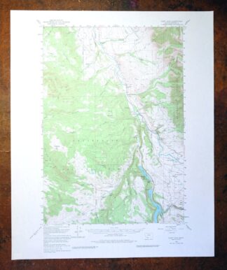
1979 Drummond Montana USGS Topo Map: Hall (1958 Edition)
$34
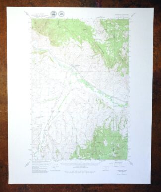
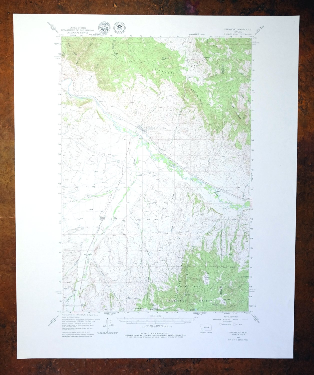
This is a USGS topographic map of the Drummond area in western Montana, a 1958 edition printed in 1979 at a scale of 1:62,500 with 40-foot contours and a green woodland tint marking the forested country. The quad sits in Granite and Powell counties, about 45 miles southeast of Missoula, where the Clark Fork runs below the Garnet Range and takes in part of the Deerlodge National Forest, with the small community of Hall within its bounds. The Garnet Range here holds the remains of old gold-mining camps, and the sheet’s detailed contours trace the rugged terrain that drew those prospectors. Never folded and in very good condition, it would frame well.
In stock
This vintage sheet is a 1958 edition of the Drummond Montana USGS topographic map. It is an original 47-year-old 1979 United States Geological Survey print in very good condition.
HOW THIS MAP CAN BE USED
In addition to making a fascinating conversation piece, this sheet would look great in a frame or on display, make a unique and prized gift for anyone interested in this area, be perfect as a reference for genealogy studies or general historical research, or fill that missing piece in your collection. Maps of this vintage are printed on durable stock and are well-suited for outdoor activities and recreation of all kinds, including hiking, backpacking, hunting, rafting and kayaking, backcountry skiing, geocaching, general exploration, treasure hunting, etc.
FEATURES SHOWN ON THE MAP
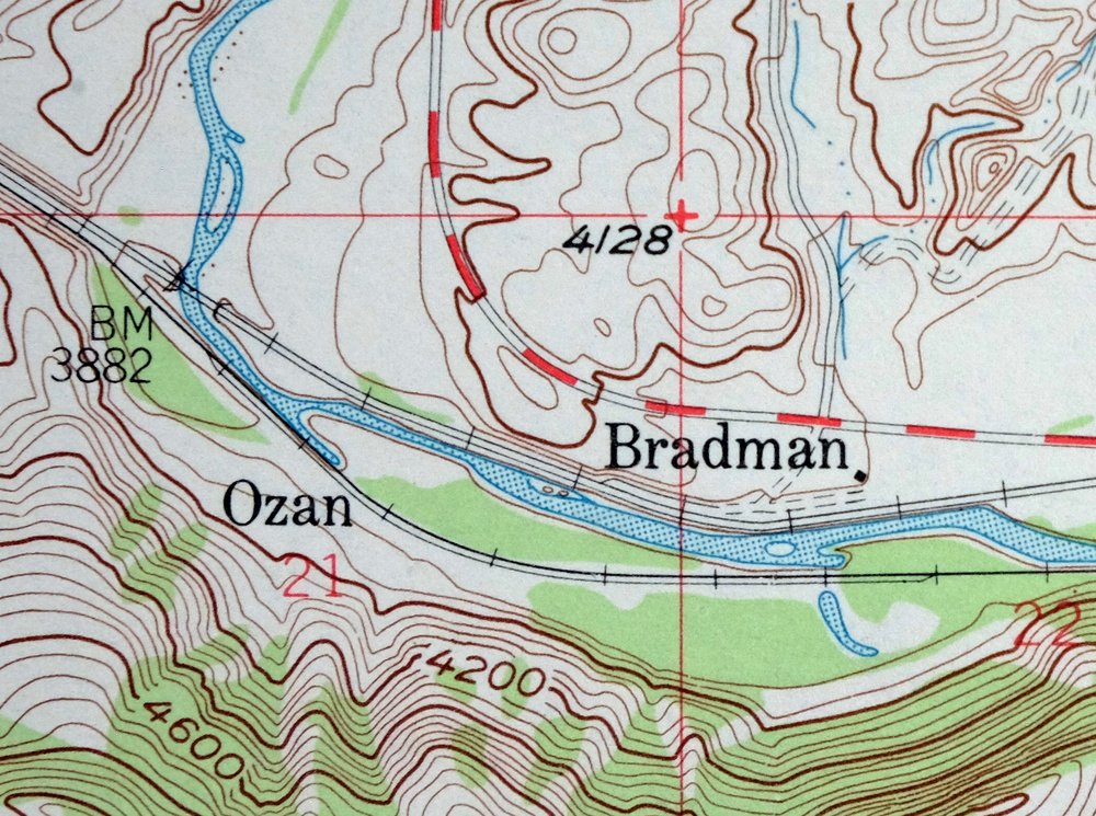
The Drummond 15-minute map shows cities and towns, roads, railroads, utilities and energy infrastructure, rivers, creeks, elevation contour lines, public land survey lines, county, state, and other administrative boundaries as they existed at the time of the survey in 1954 through 1958. All known structures (houses, businesses, churches, schools, barns, cabins, etc) are also shown.
A VALUABLE HISTORICAL RECORD
Maps from the 15-minute series for the continental United States are no longer produced or printed by the USGS and original prints are becoming increasingly difficult to find. They are a valuable historical record for an area, as they contain many placenames and features that have been dropped from more recent maps.
Nearby maps
-

Jefferson City Montana Clancy Basin USGS Topo Map 1967
$39 Add to cart -
1975 Butte South Montana USGS Topo Map: Divide
$42 Add to cart -

East Helena Montana Helena Clancy USGS Topographic Map 1974
$42 Add to cart -
1969 Clancy Montana USGS Topo Map: Elkhorn Mountains
$40 Add to cart -

Devils Fence Montana USGS 15-Min Topo Map 1950 Vintage
$36 Add to cart -

Boulder Montana Butte-Silver Bow Clancy USGS Topo Map 1933
$39 Add to cart -

Missoula Montana Stevensville Lolo USGS Topographic Map 1925
$57 Add to cart -
1971 Superior Montana USGS Topo Map: Clark Fork
$40 Add to cart -
Fairfield Montana Simms Fort Shaw USGS Topo Map 1952 Vintage
$40 Add to cart -
1975 Choteau Montana USGS Topo Map: Arod Lakes
$40 Add to cart -

Goldstone Mountain Idaho Baker USGS Topo Map 1969 Vintage
$22 Add to cart -

Saint Regis Montana St. Regis USGS Topo Map 1968 Vintage
$38 Add to cart -

1980 Belgrade Montana USGS Topo Map: Bridger Range
$43 Add to cart -

Ennis Montana McAllister Jeffers USGS Topo Map 1969 Vintage
$38 Add to cart -
1976 Gallup City Montana USGS Topo Map: Agawam
$37 Add to cart -
1969 Bozeman Montana USGS Topo Map: Gallatin Gateway
$44 Add to cart -

Sedan Montana USGS 15-Min Topographic Map 1956 Vintage
$38 Add to cart -

Spanish Peaks Montana Big Sky USGS Topo Map 1973 Vintage
$37 Add to cart -
Lake Frances Montana Valier USGS 15-Min Topographic Map 1949
$40 Add to cart -
Bozeman Pass Montana USGS 15-Min Topo Map 1978 Vintage
$43 Add to cart -
1968 USGS Topo Map: Sphinx Mountain, Montana
$43 Add to cart -
Monument Ridge Montana USGS 15-Min Topo Map 1975 Vintage
$38 Add to cart -
Fridley Peak Montana USGS 15-Min Topo Map 1972 Vintage
$43 Add to cart -
1981 Cliff Lake Montana USGS Topo Map: Madison River
$43 Add to cart