MAP DETAILS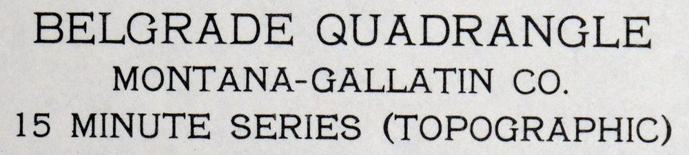 | |
|---|---|
| TITLE | Belgrade |
| STATE | Montana |
| LOCATION | 15 miles north of Bozeman |
| SERIES | 15-minute |
| SURVEYED | 1947 through 1950 Aerial and Field Survey |
| EDITION | 1950 |
| PRINTED | 1980 |
| PRINT NOTES | Includes woodland tint (green to indicate vegetated areas) |
| SCALE | 1:62500 |
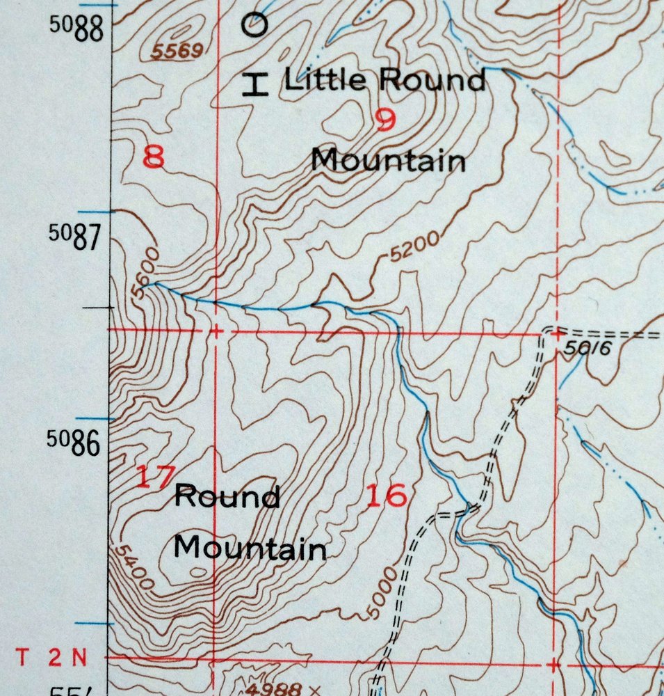
| CONTOUR INTERVAL | 40 feet |
| SHEET DIMENSIONS | 18 x 22 inches |
| MAP DIMENSIONS | 12 1/8 x 17 1/2 inches |
| COVERAGE AREA | 12 x 17 miles |
| SHEET CONDITION For maps of this vintage, effort is made to note all visible flaws, no matter how minor. | |
| OVERALL CONDITION | Very Good |
| SHEET NOTES | lightly handled, never folded |
| MAP AREA | no markings, no blemishes |
| COLLARS | no markings, no blemishes, no edge tears, minor handling in bottom collar |
| MAP COVERAGE Quadrangle extent overlaid on current basemap. | |
| PLACENAMES Depending on map series and survey date, all of the features listed below may not be shown on this map. This list contains features that currently exist or historically existed within the area covered by the map. The list can be used as a reference to determine if this map covers your area of interest. Placenames are listed alphabetically next to each feature type. | |
| NOTABLE PLACES | Bridger Range, Edilou, and Gallatin River |
| CITIES AND TOWNS (CURRENT) | Belgrade |
| COUNTIES COVERED | Gallatin |
| FEDERAL LAND UNITS | Gallatin National Forest |
| RIVERS AND STREAMS | Aajker Creek, Baker Creek, Baxter Creek, Bear Creek, Ben Hart Creek, Bill Smith Creek, Bostwick Creek, Bullrun Creek, Dry Creek, East Gallatin River, Evan Reese Creek, Foster Creek, Gallop Creek, Gibson Creek, Horseshoe Creek, Hyalite Creek, Limestone Creek, Little Horseshoe Creek, Menard Creek, Middle Cottonwood Creek, Mill Creek, Miser Creek, North Cottonwood Creek, Pass Creek, Quagle Creek, Reese Creek, Reynolds Creek, Ross Creek, Schafer Creek, Smith Creek, South Fork Ross Creek, Spring Branch, Story Creek, Sypes Creek, Thompson Creek, Tom Reese Creek, Trout Creek, Walton Creek, and White Ditch |
| Locations: Agribasics Company Elevator, Belgrade, Erwin Bridge Fishing Access Site, Lexley Acres Campground, McCrea Ranch, Missouri River Grain Elevator, Springhill, and Valley Center Mall. Mountains, Peaks, and Summits: Little Round Mountain and Round Mountain. Valleys and Canyons: Bostwick Canyon, Chipmunk Gulch, Corbly Gulch, Felix Canyon, Grouse Canyon, Johnson Canyon, Limestone Canyon, Mill Creek Canyon, Miser Canyon, Morrison Canyon, and Watts Canyon. Parks: Childrens Park, Clarkin Park, Lewis and Clark Park, Lions Park, Memorial Park, Mountain View Park, Prescott Park, Quinella Park, Sunnyside Park, and Triangle Park. Trails: Stock Drive Trail. Drainages: Aajker Creek, Baxter Creek, Bear Creek, Ben Hart Creek, Bill Smith Creek, Bostwick Creek, Cowan Creek, Dry Creek, Evan Reese Creek, Foster Creek, Gallop Creek, Gibson Creek, Horseshoe Creek, Hyalite Creek, Limestone Creek, Little Horseshoe Creek, Menard Creek, Middle Cottonwood Creek, Mill Creek, Miser Creek, North Cottonwood Creek, Pass Creek, Quagle Creek, Reese Creek, Reynolds Creek, Ross Creek, Schafer Creek, Smith Creek, South Fork Ross Creek, Spring Branch, Story Creek, Thompson Creek, Tom Reese Creek, Trout Creek, and Walton Creek. Mines: Pass Creek Mine and Sept Morn Mine. Churches: Belgrade Alliance Church, Belgrade Baptist Church, Belgrade Christian Assembly, Belgrade Community Church, Church of Christ, Dry Creek Church, Jehovahs Witnesses, Peace Lutheran Church, Springhill Church, The Church of Jesus Christ of Latter Day Saints, and Valley of the Flowers Catholic Church. Hospitals: Gallatin Valley Family Clinic. Buildings: Belgrade Community Library, Belgrade Fire Department, and Belgrade Police Department. Crossings: Interchange 298. Gaps: Flathead Pass. Channels: Gallatin Overflow Channel. Canals: Durham Ditch, J S Hoffman Ditch, Lutz McGuire Ditch, Moreland Ditch, Spain Ferris Fork Ditch, and Weaver Ditch. Bridges: Flannery Bridge, Irwin Bridge, Nelson Bridge, Penwell Bridge, Spain Bridge, and Spaulding Bridge. Basins: Little Horseshoe Basin. Airports: Gallatin Field. Schools: Belgrade High School, Belgrade Intermediate School, Belgrade Middle School, Gallatin-Madison Cooperative School, Marth Fox Heck School, Pass Creek School, Springhill School, and Thomas B Quaw Elementary School. Towers: KGVW-AM (Belgrade). Wells: 01N03E10BB__01 Well, 01N04E01CB__01 Well, 01N04E01DBAB01 Well, 01N04E02AD__01 Well, 01N04E03AB__01 Well, 01N04E03AC__01 Well, 01N04E03BBAA01 Well, 01N04E03BC__01 Well, 01N04E04AC__01 Well, 01N04E05AD__01 Well, 01N04E05DA__01 Well, 01N04E05DDDD01 Well, 01N04E05DD__01 Well, 01N04E08AD__01 Well, 01N04E09AB__01 Well, 01N04E10AADD01 Well, 01N04E10AA__01 Well, 01N04E12CDCC01 Well, 01N04E13AD__01 Well, 01N04E14BBB_01 Well, 01N04E14BBC_01 Well, 01N04E14CC__01 Well, 01N04E15BA__01 Well, 01N04E15DADD01 Well, 01N04E15DA__01 Well, 01N04E16BB__01 Well, 01N04E21DC__01 Well, 01N04E22CC__01 Well, 01N04E22DC__01 Well, 01N04E22DC__02 Well, 01N04E22DC__03 Well, 01N04E22DC__04 Well, 01N04E22DD__01 Well, 01N04E23BB__01 Well, 01N04E23BB__02 Well, 01N04E24CD__01 Well, 01N04E24DC__01 Well, 01N04E25BD__01 Well, 01N04E25DCDD01 Well, 01N04E25DC__01 Well, 01N04E26CCCC01 Well, 01N04E28ABBB01 Well, 01N04E28ABBD01 Well, 01N04E28DA__01 Well, 01N04E28DA__02 Well, 01N04E28DA__03 Well, 01N04E33AA__01 Well, 01N04E33CC__01 Well, 01N04E33CDCC01 Well, 01N04E33CD__01 Well, 01N04E36DC__01 Well, 01N05E02AAAC01 Well, 01N05E02BAAD01 Well, 01N05E03DA__01 Well, 01N05E04DDAD01 Well, 01N05E04DDAD02 Well, 01N05E04DD__01 Well, 01N05E04DD__02 Well, 01N05E05DA__01 Well, 01N05E06BD__01 Well, 01N05E06CC__01 Well, 01N05E08AD__01 Well, 01N05E09BB__01 Well, 01N05E10BA__01 Well, 01N05E11CB__01 Well, 01N05E11CB__02 Well, 01N05E13AD__01 Well, 01N05E14AB__01 Well, 01N05E14ACDD01 Well, 01N05E15CB__01 Well, 01N05E15CB__02 Well, 01N05E16BC__01 Well, 01N05E16DAAA01 Well, 01N05E19BC__01 Well, 01N05E20CB__01 Well, 01N05E20DBAA01 Well, 01N05E20DB__01 Well, 01N05E21BC__01 Well, 01N05E21BC__02 Well, 01N05E21BC__03 Well, 01N05E21BC__04 Well, 01N05E21CA__01 Well, 01N05E22AD__01 Well, 01N05E22CC__01 Well, 01N05E23CC__01 Well, 01N05E24AC__01 Well, 01N05E26CD__01 Well, 01N05E27CC__01 Well, 01N05E28DB__01 Well, 01N05E28DB__02 Well, 01N05E28DCAD01 Well, 01N05E29AB__01 Well, 01N05E29CA__01 Well, 01N05E29CA__02 Well, 01N05E29CC__01 Well, 01N05E29DB__01 Well, 01N05E30CC__01 Well, 01N05E30CC__02 Well, 01N05E30DC__01 Well, 01N05E30DDAA01 Well, 01N05E32CCA_01 Well, 01N05E32CCD_01 Well, 01N05E32CCD_02 Well, 01N05E32DD__01 Well, 01N05E34BD__01 Well, 01N05E34BD__02 Well, 01N05E34DB__01 Well, 01N05E34DDDC01 Well, 01N05E35AA__01 Well, 01N05E35ADBB01 Well, 01N05E35AD__01 Well, 01N05E35CA__01 Well, 01N05E36CD__01 Well, 01N06E17CDCB01 Well, 01N06E18CB__01 Well, 01N06E18CB__02 Well, 01N06E30BCBB01 Well, 01S04E01ACCA01 Well, 01S04E01BC__01 Well, 01S04E01CB__01 Well, 01S04E01CDCB01 Well, 01S04E01DCBD01 Well, 01S04E01DC__01 Well, 01S04E01DDCC01 Well, 01S04E02AB__01 Well, 01S04E02BB__01 Well, 01S04E02DD__01 Well, 01S04E04AA__01 Well, 01S04E04CC__01 Well, 01S04E04CC__02 Well, 01S04E08DA__01 Well, 01S04E08DA__02 Well, 01S04E09AB__01 Well, 01S04E09BAAA01 Well, 01S04E09BA__02 Well, 01S04E09BC__01 Well, 01S04E09CB__01 Well, 01S04E10BA__01 Well, 01S04E10DB__01 Well, 01S04E10DDDD01 Well, 01S04E10DD__01 Well, 01S04E11BB__01 Well, 01S04E12BB__01 Well, 01S04E12CAAB01 Well, 01S04E12CB__01 Well, 01S04E12DA__01 Well, 01S04E13AD__01 Well, 01S04E13BB__01 Well, 01S04E14AA__01 Well, 01S04E14BB__01 Well, 01S04E15AB__01 Well, 01S04E15AD__01 Well, 01S04E16BB__01 Well, 01S04E17AD__01 Well, 01S05E01CB__01 Well, 01S05E02DC__01 Well, 01S05E03CB__01 Well, 01S05E03CD__01 Well, 01S05E04BD__01 Well, 01S05E04DB__01 Well, 01S05E04DC__01 Well, 01S05E04DC__02 Well, 01S05E05AD__01 Well, 01S05E05CCBB01 Well, 01S05E05CD__01 Well, 01S05E06CD__01 Well, 01S05E06DC__01 Well, 01S05E08AB__01 Well, 01S05E09ACCC01 Well, 01S05E09AC__01 Well, 01S05E09BB__01 Well, 01S05E09DCCC01 Well, 01S05E10AC__01 Well, 01S05E10CC__01 Well, 01S05E11BC__01 Well, 01S05E11CB__01 Well, 01S05E12AD__01 Well, 01S05E12BCCC01 Well, 01S05E12BCCC02 Well, 01S05E12DB__01 Well, 01S05E13AA__01 Well, 01S05E14BD__01 Well, 01S05E15BA__01 Well, 01S05E15BCBA01 Well, 01S05E17AC__01 Well, 01S05E17BA__01 Well, 01S05E18BB__01 Well, 01S06E06ABCB01 Well, 01S06E18BBBB01 Well, 02N04E02DDDB01 Well, 02N04E12CC__01 Well, 02N04E23DA__01 Well, 02N04E23DBDD01 Well, 02N04E23DB__01 Well, 02N04E24BB__01 Well, 02N04E24DD__01 Well, 02N04E26BA__01 Well, 02N04E26BA__02 Well, 02N04E28CC__01 Well, 02N04E29DD__01 Well, 02N04E33BC__01 Well, 02N04E33CA__01 Well, 02N04E35BDCC01 Well, 02N04E36CC__01 Well, 02N05E04DADD01 Well, 02N05E06AC__01 Well, 02N05E06AC__02 Well, 02N05E06ADDA01 Well, 02N05E08BC__01 Well, 02N05E10BDBD01 Well, 02N05E18ABBB01 Well, 02N05E18BA__01 Well, 02N05E18BC__01 Well, 02N05E21BBCC01 Well, 02N05E22DDAD01 Well, 02N05E28CD__01 Well, 02N05E30BB__01 Well, 02N05E31DAAA01 Well, 02N05E31DAAA02 Well, 02N05E33BD__01 Well, 02N05E33CA__01 Well, 02N05E34DA__01 Well, 02N05E34DDBB01 Well, 02N05E34DDC_01 Well, 02N05E34DDD_01 Well, 02N05E35BA__01 Well, 03N04E36BB__01 Well, and 03N05E28DD__01 Well. Springs: 01N06E07CC__01 Spring, 01N06E30AB__01 Spring, 02N05E15AC__01 Spring, 02N05E23CD__01 Spring, 02N05E27DD__01 Spring, and 02N05E34AD__01 Spring. | |
| SHIPPING AND RETURNS | |
 This map sheet will be carefully rolled in a sturdy tube and shipped via the US Postal Service. If you find that the sheet you receive is not as described in the listing, you may ship it back to us for a refund of the purchase price. | |
1980 Belgrade Montana USGS Topo Map: Bridger Range
$43
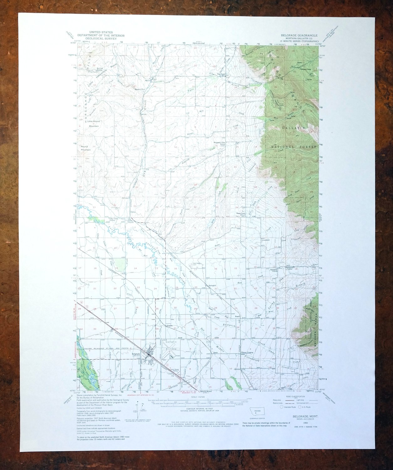
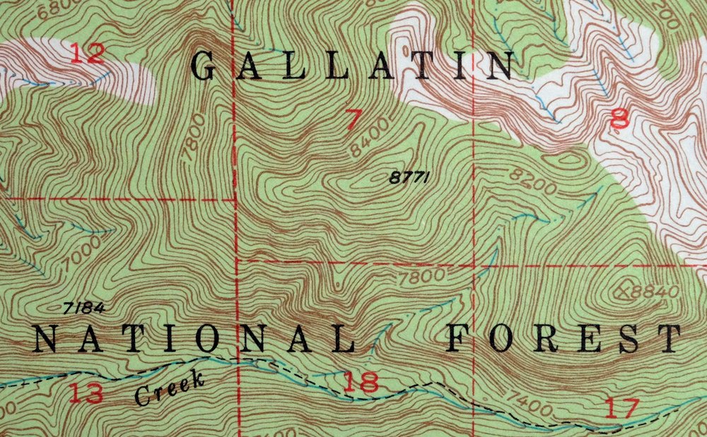
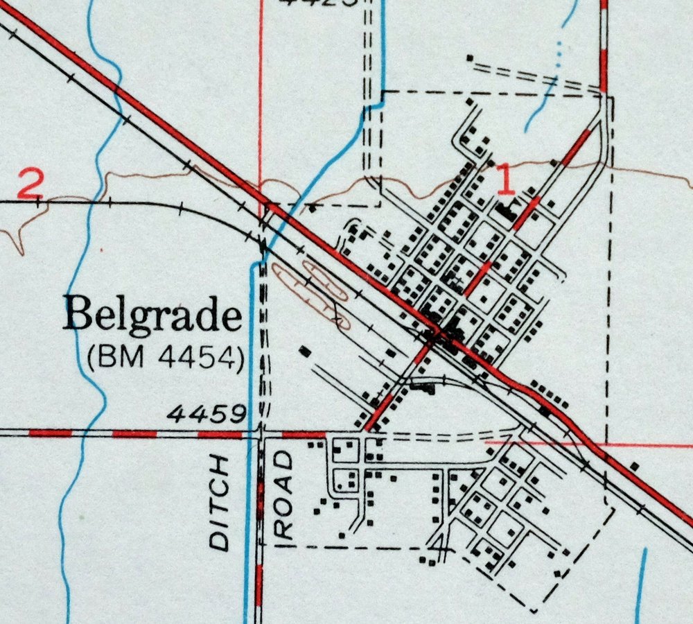
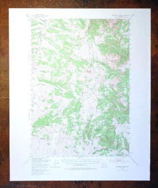
This USGS topographic map of the Belgrade quadrangle in Montana is a 1950 edition printed in 1980, at 1:62,500 scale with 40-foot contours. The quad sits in Gallatin County about 15 miles north of Bozeman, taking in the Gallatin River valley and the Bridger Range to the east, with part of Gallatin National Forest. Drawn from aerial and field survey work of 1947 through 1950, it records the farmland and ranch country of the Gallatin before Bozeman’s later growth reached north. Never folded and in very good condition, it would frame well.
In stock
This vintage sheet is a 1950 edition of the Belgrade Montana USGS topographic map. It is an original 46-year-old 1980 United States Geological Survey print in very good condition.
HOW THIS MAP CAN BE USED
In addition to making a fascinating conversation piece, this sheet would look great in a frame or on display, make a unique and prized gift for anyone interested in this area, be perfect as a reference for genealogy studies or general historical research, or fill that missing piece in your collection. Maps of this vintage are printed on durable stock and are well-suited for outdoor activities and recreation of all kinds, including hiking, backpacking, hunting, rafting and kayaking, backcountry skiing, geocaching, general exploration, treasure hunting, etc.
FEATURES SHOWN ON THE MAP
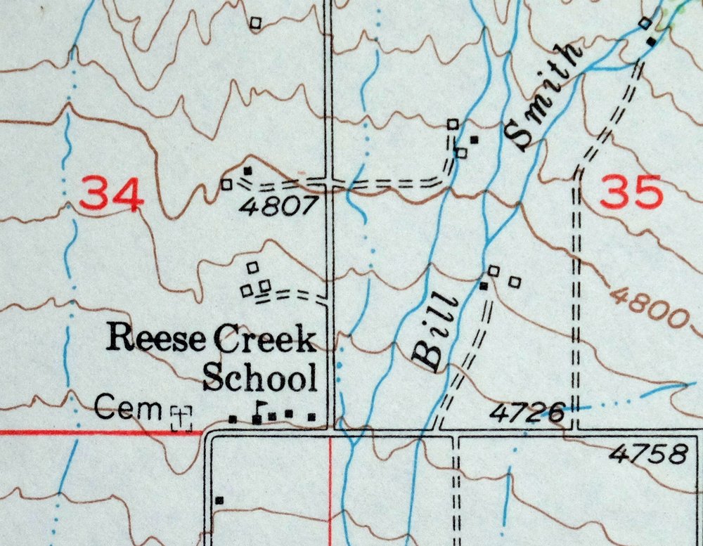
The Belgrade 15-minute map shows cities and towns, roads, railroads, utilities and energy infrastructure, rivers, creeks, elevation contour lines, public land survey lines, county, state, and other administrative boundaries as they existed at the time of the survey in 1947 through 1950. All known structures (houses, businesses, churches, schools, barns, cabins, etc) are also shown.
A VALUABLE HISTORICAL RECORD
Maps from the 15-minute series for the continental United States are no longer produced or printed by the USGS and original prints are becoming increasingly difficult to find. They are a valuable historical record for an area, as they contain many placenames and features that have been dropped from more recent maps.
Nearby maps
-

Sedan Montana USGS 15-Min Topographic Map 1956 Vintage
$38 Add to cart -
1969 Bozeman Montana USGS Topo Map: Gallatin Gateway
$44 Add to cart -
Bozeman Pass Montana USGS 15-Min Topo Map 1978 Vintage
$43 Add to cart -
Fridley Peak Montana USGS 15-Min Topo Map 1972 Vintage
$43 Add to cart -

Spanish Peaks Montana Big Sky USGS Topo Map 1973 Vintage
$37 Add to cart -

Devils Fence Montana USGS 15-Min Topo Map 1950 Vintage
$36 Add to cart -

Ennis Montana McAllister Jeffers USGS Topo Map 1969 Vintage
$38 Add to cart -
1975 USGS Topo Map: Emigrant, Yellowstone River, Montana
$42 Add to cart -
1969 Clancy Montana USGS Topo Map: Elkhorn Mountains
$40 Add to cart -

Mount Cowen Montana Absaroka Range USGS 15-Min Topo Map 1963
$44 Add to cart -

Crown Butte Montana Yellowstone NP USGS 15-Min Topo Map 1979
$40 Add to cart -
1968 USGS Topo Map: Sphinx Mountain, Montana
$43 Add to cart -

Miner Montana Gardiner Corwin Springs USGS Topo Map 1983
$36 Add to cart -
1983 Gardiner Montana USGS Topo Map: Yellowstone NP
$45 Add to cart -

Jefferson City Montana Clancy Basin USGS Topo Map 1967
$39 Add to cart -

East Helena Montana Helena Clancy USGS Topographic Map 1974
$42 Add to cart -
1966 Mount Wallace Montana/Wyoming USGS Topo Map
$45 Add to cart -

Boulder Montana Butte-Silver Bow Clancy USGS Topo Map 1933
$39 Add to cart -

Big Timber Montana Reed Point Reed Point USGS Topo Map 1910
$36 Add to cart -

Tepee Creek Montana Grayling USGS Topo Map 1963 Vintage
$35 Add to cart -

Mount Holmes Wyoming USGS 15-Min Topo Map 1979 Vintage
$39 Add to cart -
1975 Butte South Montana USGS Topo Map: Divide
$42 Add to cart -
1981 Cliff Lake Montana USGS Topo Map: Madison River
$43 Add to cart -
Monument Ridge Montana USGS 15-Min Topo Map 1975 Vintage
$38 Add to cart
