MAP DETAILS | |
|---|---|
| TITLE | Stillwater |
| STATE | Montana |
| LOCATION | Vicinity of Columbus, 35 miles west of Billings |
| SERIES | 30-minute |
| SURVEYED | 1889 Field Survey |
| GEOGRAPHER | A.H. Thompson |
| EDITION | 1892 |
| PRINTED | 1932 |
| PRINT NOTES | Thick paper stock |
| SCALE | 1:125000 |
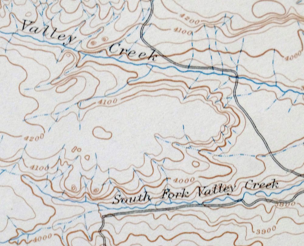
| CONTOUR INTERVAL | 50 feet |
| SHEET DIMENSIONS | 16 1/2 x 20 inches |
| MAP DIMENSIONS | 12 1/4 x 17 1/2 inches |
| COVERAGE AREA | 24 x 35 miles |
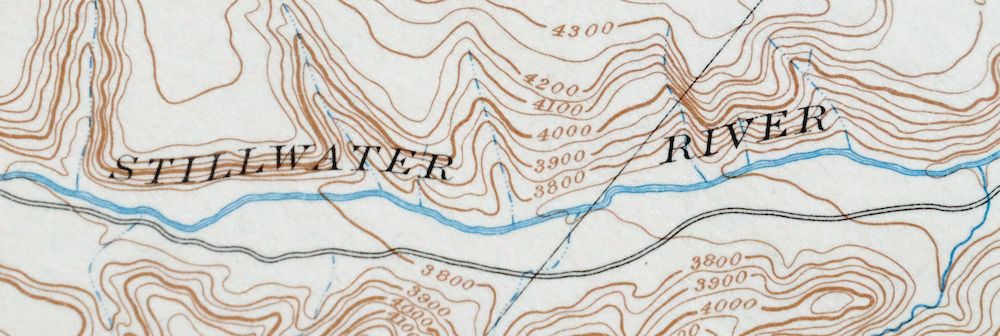
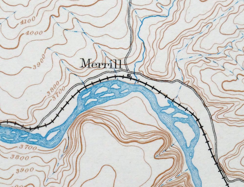
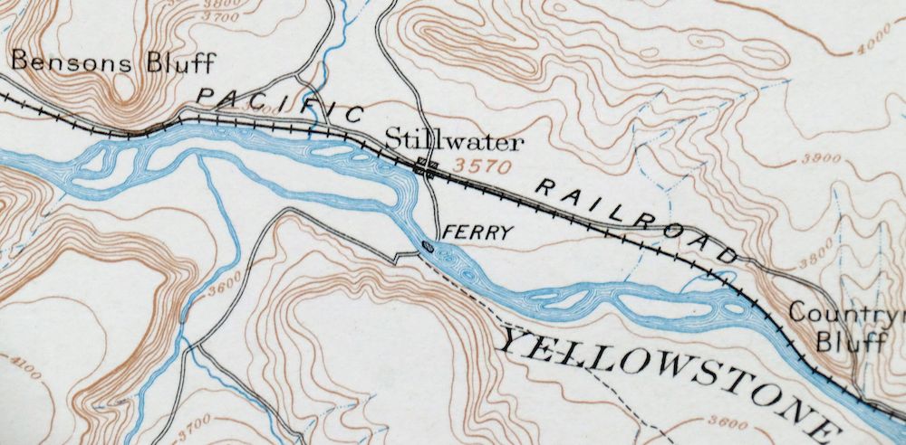
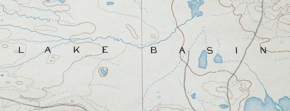
| MAP NOTES | Surveyed before the modern highway system, showing historic travel corridors, rail lines, river ferries, and placenames. |
| SHEET CONDITION For maps of this vintage, effort is made to note all visible flaws, no matter how minor. | |
| OVERALL CONDITION | Good |
| SHEET NOTES | lightly handled, never folded |
| MAP AREA | no wear, no markings, no blemishes |
| COLLARS | very minor wear or tears, no markings, very minor blemishes, handling wear along bottom collar |
| MAP COVERAGE Quadrangle extent overlaid on current basemap. | |
| BACKSIDE LEGEND | |
 A map summary is printed on the back side of the Stillwater sheet similar to the one shown in the picture. It outlines the history, purpose, and status of the USGS mapping program at the time of the printing in 1932. It also provides instructions on how to read contour lines and a description of how they are used to depict the terrain. At the bottom of the page is a legend showing all of the symbols used to represent the cultural, relief, and water features found on the map. | |
| PLACENAMES Depending on map series and survey date, all of the features listed below may not be shown on this map. This list contains features that currently exist or historically existed within the area covered by the map. The list can be used as a reference to determine if this map covers your area of interest. Placenames are listed alphabetically next to each feature type. | |
| CITIES AND TOWNS (CURRENT) | Absarokee, Columbus, and Rapelje |
| COUNTIES COVERED | Carbon, Stillwater, and Sweet Grass |
| FEDERAL LAND UNITS | Hailstone National Wildlife Refuge, Halfbreed Lake National Wildlife Refuge, and Stillwater County Waterfowl Production Area |
| RIVERS AND STREAMS | Allen Creek, Bearpaw Creek, Beaver Creek, Berry Creek, Brown Creek, Buck Creek, Camp Creek, Cedar Creek, Coal Mine Coulee, Cole Creek, Cottonwood Creek, Countryman Creek, Cow Creek, Cummin Creek, Deer Creek, Dry Creek, East Fork Shane Creek, East Keyser Creek, East White Beaver Creek, Greenwood Creek, Grove Creek, Hensley Creek, Huntley Creek, Joe Hill Creek, Keyser Creek, McNally Creek, Mexican Joe Creek, Middle Creek, Mills Creek, North Fork Cedar Creek, North Fork Cottonwood Creek, North Fork Valley Creek, Norve Coulee, Porter Coulee, Rosebud Creek, Rye Grass Creek, Sectionhouse Creek, Shane Creek, Sheep Creek, Sixshooter Creek, South Fork Cedar Creek, South Fork Cottonwood Creek, South Fork Valley Creek, Spring Creek, Stillwater River, Swamp Creek, Tilden Creek, Toll Creek, Toms Creek, Tucker Creek, Tutt Creek, Valley Creek, West Fork Shane Creek, West White Beaver Creek, Whistle Creek, White Beaver Creek, Whitebird Creek, Whitney Creek, and Yellowstone River |
| WATER BODIES | Big Lake, Dallmann Lake, Dry Lake, Halfbreed Lake, and Hunter Lake |
| Locations: Absaroka Fishing Access Site, Columbus, Columbus Rest Area, Firemans Point Fishing Access Site, Harvest State Cooperatives Elevator, Itch-Kep-Pe Park Campground, Rapelje Grain Company Elevator, Rapids, Riverside Inn, Stillwater County Fairgrounds, Stillwater Golf Course, Swinging Bridge Fishing Access Site, Wheat Basin, Whitebird Fishing Access Site, and Youngs Point. Mountains, Peaks, and Summits: Antelope Point, Battle Butte, Busteed Hill, Horse Butte, Hugh Henry Hill, Huntley Butte, Jones Hill, Lindemulder Hill, Love Hill, Pershing Hill, Warner Hill, and Wash Bowl Butte. Valleys and Canyons: Baney Coulee, Bridge Coulee, Carlton Coulee, Gurney Gulch, Hayrack Gulch, Haystack Coulee, Hoppy Gulch, Kennedy Coulee, Quinn Coulee, Russell Gulch, Smith Coulee, Stump Gulch, Wildcat Coulee, and Wolf Canyon. Parks: Columbus Historical Marker, Eastlake Pond/Big Lake Waterfowl Management Area, Granite Peak Park, Halfbreed Lake National Wildlife Refuge, Itch-Kep-Pe Park, Park Avenue Park, and Park City Historical Marker. Drainages: Allen Creek, Bearpaw Creek, Beaver Creek, Berry Creek, Brown Creek, Buck Creek, Camp Creek, Cedar Creek, Coal Mine Coulee, Cottonwood Creek, Coulee Creek, Countryman Creek, Cow Creek, Cummin Creek, Deer Creek, Dry Creek, East Fork Shane Creek, East Keyser Creek, East White Beaver Creek, Greenwood Creek, Grove Creek, Gurney Creek, Hensley Creek, Horse Creek, Huntley Creek, Joe Hill Creek, Kenyon Creek, Keyser Creek, Lost Creek, McNally Creek, Mexican Joe Creek, Middle Creek, Mills Creek, North Fork Cedar Creek, North Fork Cottonwood Creek, North Fork Valley Creek, Norve Coulee, Orson Coulee, Porter Coulee, Rosebud Creek, Rye Grass Creek, Sectionhouse Creek, Shane Creek, Sheep Creek, South Fork Cedar Creek, South Fork Cottonwood Creek, South Fork Valley Creek, Spring Creek, Stillwater River, Struck Creek, Tilden Creek, Toll Creek, Toms Creek, Tucker Creek, Tutt Creek, West Fork Shane Creek, West White Beaver Creek, Whistle Creek, Whitebird Creek, and Whitney Creek. Islands: Westover Island. Capes: Wimsett Point. Churches: Absarokee Evangelical Church, Assembly of God Church, Christ Covenant Church, Columbus Baptist Church, Columbus Evangelical Church, Community Congregational Church, Community Congregational United Church of Christ, Immanual Lutheran Church, Jehovahs Witnesses, New Life Victory Center, Rapelje Evangelical Church, Saint James Lutheran Church, Saint Marys Catholic Church, Saint Michaels Catholic Church, Stillwater Bible Church, and The Church of Jesus Christ of Latter Day Saints. Hospitals: Absarokee Medical Clinic, Columbus Clinic, Stillwater Community Hospital, Stillwater Community Hospital Extended Care Unit, and Stillwater Convalescent Center. Lakes and Ponds: Big Lake, Dallmann Lake, Dry Lake, Halfbreed Lake, and Hunter Lake. Buildings: Absarokee Fire Department, Columbus Fire Department, Columbus Police Department, Museum of the Beartooths, Stillwater County Courthouse, Stillwater County Library, and Stillwater County Sheriff Department. Dams: Bokma Dam, Handy Dam, Kovanda Number 1 Dam, Robbie Dam, Rummel Dam, and Springtime Number 1 Dam. Crossings: Interchange 400 and Interchange 408. Bluffs: Bensons Bluff, Countrymans Bluff, and Firemans Point. Canals: Columbus Water Users Association Ditch, Garrigus Ditch, J Kern Ditch, Mendenhall Ditch, Merrill Columbus Ditch, Nichols Ditch, Roadhouse Ditch, Scott Ditch, Shane Ditch, Town Ditch, White Ditch, and Whitebird Ditch. Bridges: Albert Johnson Bridge. Basins: Lake Basin. Airports: Columbus Airport. Schools: Absarokee Public Schools, Columbus Elementary School, Columbus High School, and Rapelje Public Schools. Ridges: The Divide, Rattlesnake Ridge, and Shane Ridge. Rapids: Trout Rapids. Flats: Flaherty Flat. Wells: 01N18E22DCCA01 Well, 01N21E02BCCC01 Well, 01N21E03DABA01 Well, 01N21E14ABBC01 Well, 01N21E22AAAA01 Well, 01N22E07DADA01 Well, 01N22E29AAAC01 Well, 01S19E03DDDA01 Well, 01S20E01CDDC01 Well, 01S20E05AAAB01 Well, 01S20E32BCBB01 Well, 01S21E02CADC01 Well, 01S21E07CCCB01 Well, 01S21E34BDDD01 Well, 02N20E08DAAA01 Well, 02N20E15BAAD01 Well, 02N20E16BBBB01 Well, 02N20E29BB__01 Well, 02N21E34CBDD01 Well, 02S19E23DBDA01 Well, 02S20E16CCCA01 Well, 02S20E28CAAC01 Well, 02S20E28CABB01 Well, 02S20E28CACD01 Well, 02S20E28DBCD01 Well, 02S20E28DCBA01 Well, 02S20E28DDBC01 Well, 02S20E29AADC01 Well, 02S20E32ABAA01 Well, 02S20E32ADDC01 Well, 02S20E32DDBB01 Well, 03N19E35CAAB01 Well, 03N20E32AADC01 Well, 03S18E36DCDD01 Well, 03S19E05BBBB01 Well, 03S19E13CACB01 Well, 03S19E13CBAC01 Well, 03S19E13CCAA01 Well, 03S19E13CCAA02 Well, 03S19E13CCAB01 Well, 03S19E13CCAD01 Well, 03S19E23ABCD01 Well, 03S19E23BABD01 Well, 03S19E29CCCB01 Well, 03S19E31CADB01 Well, 03S20E01BCAD01 Well, 03S20E05ABBB01 Well, 03S20E05ABBB02 Well, 03S20E05BAAA01 Well, 03S20E05BAAB01 Well, 03S20E07AADB01 Well, 03S20E27ABDD01 Well, 03S21E31CDDD01 Well, 03S21E35BACA01 Well, 03S22E06CBDB01 Well, 03S22E06CCAA01 Well, 03S22E21BADD01 Well, 04S18E01ACCD01 Well, 04S18E03BBAB01 Well, 04S19E03BCDA01 Well, and Federal Well. Springs: Poison Spring, Shearing Pen Spring, Twin Buttes, and Wiig Spring. | |
| SHIPPING AND RETURNS | |
 This map sheet will be carefully rolled in a sturdy tube and shipped via the US Postal Service. If you find that the sheet you receive is not as described in the listing, you may ship it back to us for a refund of the purchase price. | |
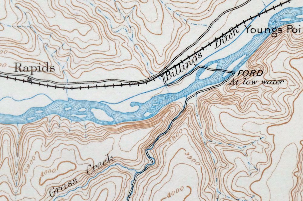
Stillwater Montana Hailstone NWR Columbus USGS Topo Map 1932
$47
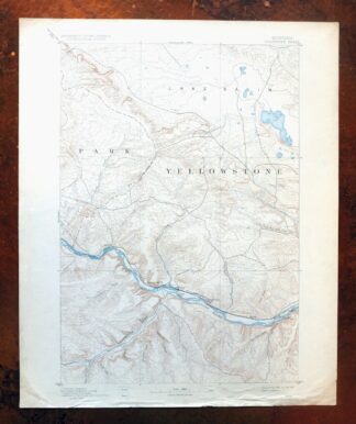
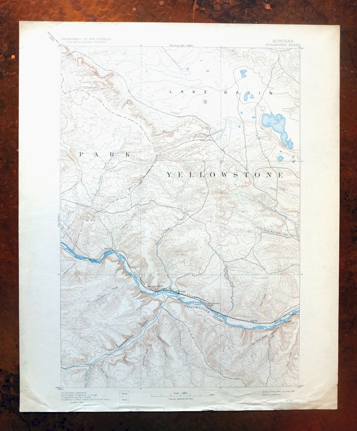
First published in 1892, this Stillwater sheet was printed in 1932 and survives in good condition, lightly handled and never folded on thick stock. The 30-minute quad takes in country west of Billings around Columbus, with Absarokee and Rapelje within its boundaries, and includes parts of the Hailstone and Halfbreed Lake National Wildlife Refuges. Based on an 1889 field survey under geographer A.H. Thompson, it predates the modern highway system and records the older travel corridors, rail lines, river ferries, and placenames of south-central Montana.
In stock
This antique sheet is an 1892 edition of the Stillwater Montana USGS topographic map. It is an authentic 94-year-old 1932 United States Geological Survey print in good condition.
HOW THIS MAP CAN BE USED
In addition to making a fascinating conversation piece, this sheet would look great in a frame or on display, make a unique and prized gift for anyone interested in this area, be perfect as a reference for genealogy studies or general historical research, or fill that missing piece in your collection.
FEATURES SHOWN ON THE MAP
The Stillwater 30-minute map shows cities and towns, roads, railroads, rivers, creeks, elevation contour lines, public land survey lines, county, state, and other administrative boundaries as they existed at the time of the survey in 1889.
A VALUABLE HISTORICAL RECORD
Maps from the USGS 30-minute series have been out of print for many years. They have never been common and original prints are increasingly difficult to find. For areas where the 30-minute map was produced, it is usually the first large-scale survey done by the USGS for that area. These are a valuable historical record, as they contain many placenames and features that have been dropped from more recent series’ and editions.
Nearby maps
-

Big Timber Montana Reed Point Reed Point USGS Topo Map 1910
$48 Add to cart -
Lake Wyoming Antique USGS Topographic Map 1922
$78 Add to cart -

Mount Cowen Montana Absaroka Range USGS 15-Min Topo Map 1963
$43 Add to cart -
Cody Wyoming USGS 15-Min Topographic Map 1969 Vintage
$38 Add to cart -

Sedan Montana USGS 15-Min Topographic Map 1956 Vintage
$38 Add to cart -
Bozeman Pass Montana USGS 15-Min Topo Map 1978 Vintage
$42 Add to cart -

Tower Junction Wyoming USGS 15-Min Topo Map 1984 Vintage
$40 Add to cart -
Fridley Peak Montana USGS 15-Min Topo Map 1972 Vintage
$50 Add to cart -

Sunlight Peak Wyoming Pahaska Tepee USGS Topo Map 1980
$36 Add to cart -

Miner Montana Gardiner Corwin Springs USGS Topo Map 1983
$36 Add to cart -
Lewistown Montana Judith Mountains USGS 15-Min Topo Map 1975
$40 Add to cart -
Judith Peak Montana Black Butte USGS Topo Map 1978 Vintage
$38 Add to cart -

Mount Holmes Wyoming USGS 15-Min Topo Map 1979 Vintage
$39 Add to cart -

Crown Butte Montana Yellowstone NP USGS 15-Min Topo Map 1979
$40 Add to cart -

Spanish Peaks Montana Big Sky USGS Topo Map 1973 Vintage
$37 Add to cart -

Tepee Creek Montana Grayling USGS Topo Map 1963 Vintage
$35 Add to cart -
Sphinx Mountain Montana Big Sky USGS Topo Map 1968 Vintage
$40 Add to cart -

Ennis Montana McAllister Jeffers USGS Topo Map 1969 Vintage
$38 Add to cart -

Devils Fence Montana USGS 15-Min Topo Map 1950 Vintage
$36 Add to cart -

East Helena Montana Helena Clancy USGS Topographic Map 1974
$42 Add to cart -
Monument Ridge Montana USGS 15-Min Topo Map 1975 Vintage
$38 Add to cart -

Jefferson City Montana Clancy Basin USGS Topo Map 1967
$39 Add to cart -

Boulder Montana Butte-Silver Bow Clancy USGS Topo Map 1933
$39 Add to cart -
Fairfield Montana Simms Fort Shaw USGS Topo Map 1952 Vintage
$45 Add to cart