MAP DETAILS | |
|---|---|
| TITLE | Kern Peak |
| STATE | California |
| LOCATION | 80 miles east of Fresno |
| SERIES | 15-minute |
| SURVEYED | 1955 and 1956 Aerial and Field Survey |
| EDITION | 1956 |
| PRINTED | 1973 |
| PRINT NOTES | Thick paper stock, includes woodland tint (green to indicate vegetated areas) |
| SCALE | 1:62500 |
| CONTOUR INTERVAL | 80 feet |
| SHEET DIMENSIONS | 18 x 22 inches |
| MAP DIMENSIONS | 14 1/8 x 17 1/2 inches |
| COVERAGE AREA | 14 x 17 miles |
| SHEET CONDITION For maps of this vintage, effort is made to note all visible flaws, no matter how minor. | |
| OVERALL CONDITION | Very Good |
| SHEET NOTES | never folded |
| MAP AREA | no wear, no markings, no blemishes |
| COLLARS | no markings, no edge tears, minor handling |
| MAP COVERAGE Quadrangle extent overlaid on current basemap. | |
| PLACENAMES Depending on map series and survey date, all of the features listed below may not be shown on this map. This list contains features that currently exist or historically existed within the area covered by the map. The list can be used as a reference to determine if this map covers your area of interest. Placenames are listed alphabetically next to each feature type. | |
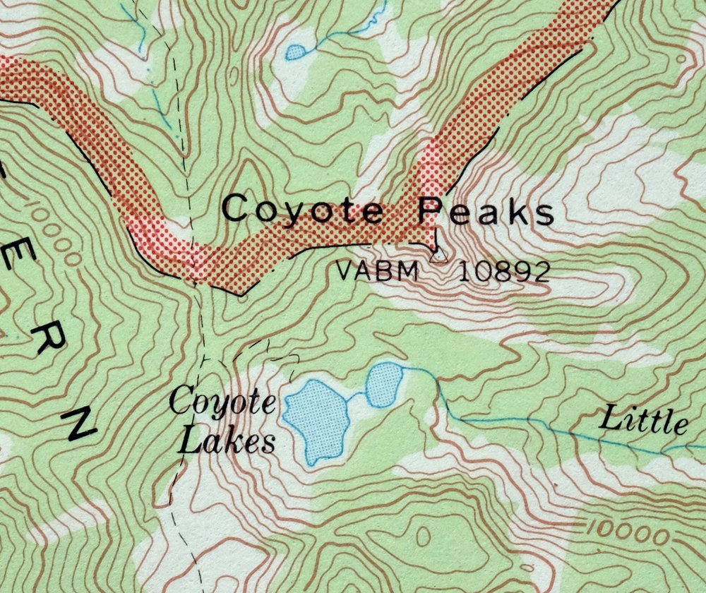
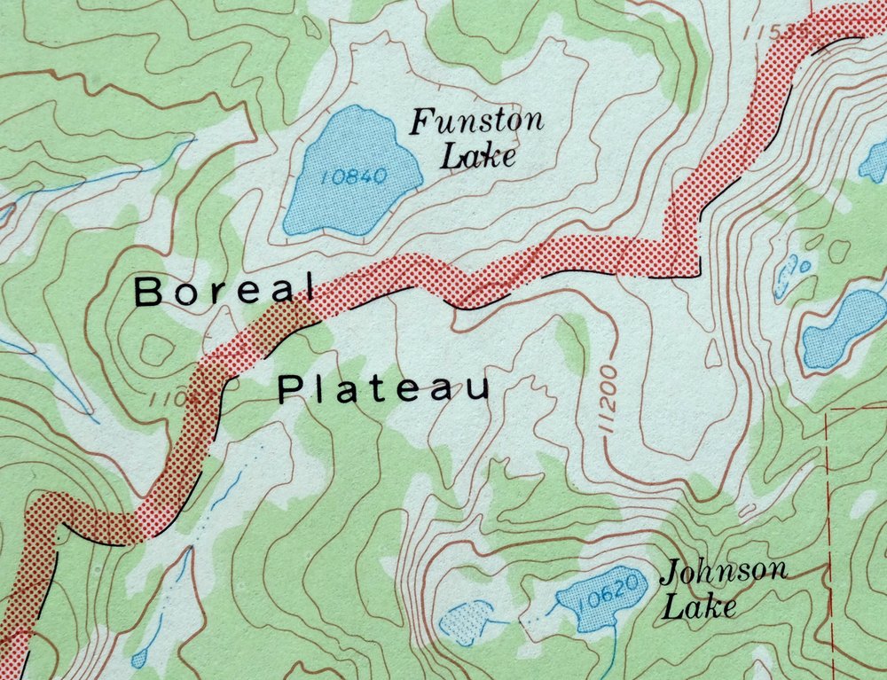
| NOTABLE PLACES | Sequoia National Park, Boreal Plateau, and Great Western Divide |
| COUNTIES COVERED | Inyo and Tulare |
| FEDERAL LAND UNITS | Golden Trout Wilderness, Inyo National Forest, John Muir Wilderness, Sequoia National Forest, and Sequoia-Kings Canyon Wilderness |
| RIVERS AND STREAMS | Angora Creek, Barigan Stringer, Big Arroyo, Chagoopa Creek, Cold Creek, Coyote Creek, Deep Creek, Funston Creek, Golden Trout Creek, Grasshopper Creek, Guyot Creek, Johnson Creek, Kern Peak Stringer, Kern River, Laurel Creek, Left Stringer, Leggett Creek, Lewis Stringer, Lion Creek, Little Kern Lake Creek, Movie Stringer, No Name Creek, Perrin Creek, Rattlesnake Creek, Red Spur Creek, Redrock Creek, Rock Creek, Siberian Pass Creek, Soda Creek, South Fork Kern River, Stokes Stringer, Table Meadow Creek, Tamarack Creek, West Stringer, and Willow Creek |
| WATER BODIES | Coyote Lakes, Funston Lake, Johnson Lake, Kern Lake, Little Kern Lake, Moraine Lake, and Rocky Basin Lakes |
| Locations: Chagoopa Falls District Ranger Office, Kern Canyon Ranger Station, Kern Peak Lookout, Little Whitney Cow Camp, Rattlesnake Point, Rock Creek Patrol Cabin, Tunnel Air Camp, and Tunnel Forest Service Station. Mountains, Peaks, and Summits: Angora Mountain, Mount Anna Mills, Coyote Peaks, Indian Head, Johnson Peak, Kern Peak, Overlook Mountain, Red Hill, Three Rocks, Tower Rock, and White Mountain. Valleys and Canyons: Forgotten Canyon, Kern Canyon, and Lost Canyon. Parks: Hansen Dam Park. Drainages: Angora Creek, BIg Kern Lake Creek, Barigan Stringer, Big Arroyo, Chagoopa Creek, Coyote Creek, Funston Creek, Golden Trout Creek, Grasshopper Creek, Guyot Creek, Hell for Sure Creek, Johnson Creek, Kern Peak Stringer, Laurel Creek, Left Stringer, Leggett Creek, Little Kern Lake Creek, Lost Canyon Creek, Malpais Creek, Perrin Creek, Rattlesnake Creek, Red Spur Creek, Right Stringer, Rock Creek, Rough Creek, Siberian Pass Creek, Soda Creek, Stokes Stringer, Volcanic Creek, West Stringer, and Willow Creek. Lakes and Ponds: Coyote Lakes, Funston Lake, Johnson Lake, Kern Lake, Little Kern Lake, Moraine Lake, and Rocky Basin Lakes. Waterfalls: Chagoopa Falls and Volcano Falls. Bluffs: Window Cliffs. Gaps: Coyote Pass, Right Stringer Pass, Saddle Camp Pass, Siberian Pass, and West Stringer Saddle. Basins: Chinaquapin Basin, Chinquapin Basin, and Siberian Outpost. Natural Arches: Natural Bridge. Ridges: Hell for Sure, Kern Ridge, and Toowa Range. Flats: Bear Meadow, Cold Meadows, Funston Meadow, Grasshopper Flat, Groundhog Meadow, Lion Meadows, Little Whitney Meadow, Ramshaw Meadows, Redrocks Meadows, Salt Lick Meadow, Sidehill Meadow, Sky Parlor Meadow, Tunnel Meadow, Upper Funston Meadow, Volcano Meadow, and Whitney Meadow. Plains and Plateaus: Boreal Plateau and Chagoopa Plateau. Springs: Kern Hot Spring, River Spring, and Soda Spring. | |
| SHIPPING AND RETURNS | |
 This map sheet will be carefully rolled in a sturdy tube and shipped via the US Postal Service. If you find that the sheet you receive is not as described in the listing, you may ship it back to us for a refund of the purchase price. | |
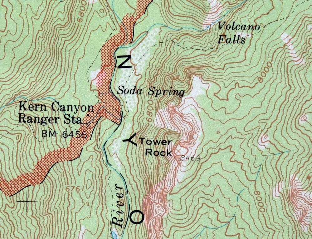
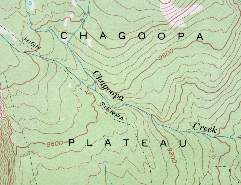
1973 Kern Peak California USGS Topo Map
$42
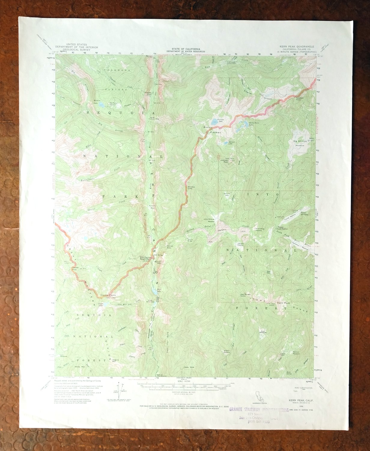
This is a USGS topographic map of the Kern Peak quad in California’s southern Sierra Nevada, a 15-minute sheet at 1:62,500 scale. First published in 1956 from aerial and field survey, this sheet was printed in 1973 on thick stock with a green woodland tint marking the vegetated areas. The quad spans the Inyo-Tulare county line roughly 80 miles east of Fresno, taking in the Boreal Plateau and portions of Sequoia National Forest and the Golden Trout Wilderness. This is high backcountry well above 10,000 feet, reachable only on foot or horseback. Never folded, it suits framing.
In stock
This vintage sheet is a 1956 edition of the Kern Peak California USGS topographic map. It is an original 53-year-old 1973 United States Geological Survey print in very good condition.
HOW THIS MAP CAN BE USED
In addition to making a fascinating conversation piece, this sheet would look great in a frame or on display, make a unique and prized gift for anyone interested in this area, be perfect as a reference for genealogy studies or general historical research, or fill that missing piece in your collection. Maps of this vintage are printed on durable stock and are well-suited for outdoor activities and recreation of all kinds, including hiking, backpacking, hunting, rafting and kayaking, backcountry skiing, geocaching, general exploration, treasure hunting, etc.
FEATURES SHOWN ON THE MAP
The Kern Peak 15-minute map shows cities and towns, roads, railroads, utilities and energy infrastructure, rivers, creeks, elevation contour lines, public land survey lines, county, state, and other administrative boundaries as they existed at the time of the survey in 1955 and 1956. All known structures (houses, businesses, churches, schools, barns, cabins, etc) are also shown.
A VALUABLE HISTORICAL RECORD
Maps from the 15-minute series for the continental United States are no longer produced or printed by the USGS and original prints are becoming increasingly difficult to find. They are a valuable historical record for an area, as they contain many placenames and features that have been dropped from more recent maps.
Nearby maps
-
Mount Whitney California USGS 15-Min Topo Map 1972 Vintage
$42 Add to cart -
1965 Triple Divide Peak California USGS Topo Map
$33 Add to cart -
Camp Nelson California USGS 15-Min Topo Map 1977 Vintage
$40 Add to cart -

Mount Pinchot California USGS 15-Min Topo Map 1969 Vintage
$18 Add to cart -
California Hot Springs California USGS Topo Map 1974 Vintage
$46 Add to cart -
Ubehebe Peak California USGS 15-Min Topo Map 1966 Vintage
$44 Add to cart -
1952 USGS Topo Map: Big Pine, California
$44 Add to cart -
Panamint Butte California USGS 15-Min Topo Map 1967 Vintage
$39 Add to cart -
1954 USGS Topo Map: Visalia, Goshen, California
$44 Add to cart -
Blackcap Mountain California USGS Topo Map 1972 Vintage
$40 Add to cart -
1972 USGS Topo Map: Marble Canyon, Death Valley, California
$43 Add to cart -
Huntington Lake California Shaver Lake USGS Topo Map 1968
$43 Add to cart -
1976 Last Chance Range California/Nevada USGS Topo Map
$38 Add to cart -
Slater California Delano Shafter USGS Topo Map 1942 Antique
$38 Add to cart -
Bishop California West Bishop Laws USGS Topographic Map 1969
$40 Add to cart -
Ivanhoe California Woodlake USGS Topo Map 1946 Vintage
$34 Add to cart -
Exeter California Visalia Ivanhoe USGS Topographic Map 1944
$37 Add to cart -

Quincy School California White River USGS Topo Map 1929
$30 Add to cart -

Sausalito School California USGS Topo Map 1929 Antique
$25 Add to cart -
Richgrove California USGS 7.5-Min Topo Map 1942 Antique
$37 Add to cart -

Remnoy California Hamblin Hanford USGS Topo Map 1927 Antique
$30 Add to cart -

Emerald Mountain California USGS 15-Min Topographic Map 1943
$37 Add to cart -
Sanger Del Ray Clotho California USGS 7.5-Min Topo Map 1923
$30 Add to cart -

1968 USGS Topo Map: Mount Tom, Paradise, California
$45 Add to cart