MAP DETAILS | |
|---|---|
| TITLE | Chopaka |
| STATE | Washington |
| LOCATION | 30 miles north of Okanogan |
| SERIES | 30-minute |
| SURVEYED | 1902 and 1903 Field Survey |
| GEOGRAPHER | R.U. Goode |
| EDITION | 1906 |
| PRINTED | 1917 |
| PRINT NOTES | Thick paper stock |
| SCALE | 1:125000 |
| CONTOUR INTERVAL | 100 feet |
| SHEET DIMENSIONS | 16 x 20 inches (approximate) |
| MAP DIMENSIONS | 11 1/2 x 17 1/2 inches |
| COVERAGE AREA | 23 x 35 miles |
| SHEET CONDITION For maps of this vintage, effort is made to note all visible flaws, no matter how minor. | |
| OVERALL CONDITION | Excellent |
| SHEET NOTES | very lightly handled, never folded, lightly age-toned sheet |
| MAP AREA | flawless map area |
| COLLARS | no wear or tears, no markings, no blemishes, inventory notation in upper right collar corner |
| MAP COVERAGE Quadrangle extent overlaid on current basemap. | |
| BACKSIDE LEGEND | |
 A map summary is printed on the back side of the Chopaka sheet similar to the one shown in the picture. It outlines the history, purpose, and status of the USGS mapping program at the time of the printing in 1917. It also provides instructions on how to read contour lines and a description of how they are used to depict the terrain. At the bottom of the page is a legend showing all of the symbols used to represent the cultural, relief, and water features found on the map. | |
| PLACENAMES Depending on map series and survey date, all of the features listed below may not be shown on this map. This list contains features that currently exist or historically existed within the area covered by the map. The list can be used as a reference to determine if this map covers your area of interest. Placenames are listed alphabetically next to each feature type. | |
| CITIES AND TOWNS (CURRENT) | Conconully, Loomis, Nighthawk, and Riverside |
| COUNTIES COVERED | Okanogan |
| FEDERAL LAND UNITS | Conconully Lake, Conconully Reservoir, Okanogan National Forest, and Pasayten Wilderness |
| RIVERS AND STREAMS | Aeneas Creek, Anderson Creek, Baldy Creek, Basin Creek, Beaver Creek, Bernhardt Creek, Big Canyon Creek, Big Horn Creek, Blue Buck Creek, Blue Goat Creek, Branch Creek, Brown Meadows Creek, Buckhorn Creek, Cecil Creek, Cedar Creek, Center Creek, Champneys Slough Stream, Chickadee Creek, Chilson Creek, Chopaka Creek, Chute Creek, Clark Creek, Cold Creek, Conger Creek, Corduroy Creek, Cougar Creek, Coulee Creek, Coxit Creek, Crazy Cow Creek, Crosby Creek, Daisy Creek, Deer Creek, Deer Park Creek, Dill Creek, Disappointment Creek, Dog Creek, Dunn Creek, Elevenmile Creek, First Creek, Fly Creek, Gibson Creek, Granite Creek, Hilltop Creek, Horseshoe Creek, Huckleberry Creek, Hurley Creek, Jewett Creek, Jim Creek, Johnson Creek, Katasa Creek, Kinchelo Creek, Lightning Creek, Little Granite Creek, Little Horseshoe Creek, Lone Frank Creek, McCay Creek, Meadow Creek, Middle Fork Boulder Creek, Middle Fork Toats Coulee Creek, Middle Fork Twentymile Creek, Milk Creek, Mill Creek, Muckamuck Creek, Mutton Creek, Ninemile Creek, North Fork Boulder Creek, North Fork Chickadee Creek, North Fork Coxit Creek, North Fork Pine Creek, North Fork Toats Coulee Creek, North Granite Creek, Okanogan River, Olallie Creek, Olie Creek, Palmer Creek, Parks Creek, Peak Creek, Pelican Creek, Pine Creek, Queer Creek, Rabbit Creek, Ray Creek, Redman Creek, Rusty Creek, Salmon Creek, Sarsapkin Creek, Scheiner Creek, Scotch Creek, Sheep Creek, Shrew Creek, Similkameen River, Sinlahekin Creek, Smarty Creek, Snehumption Creek, Snowshoe Creek, South Fork Boulder Creek, South Fork Coxit Creek, South Fork Pine Creek, South Fork Salmon Creek, South Fork Toats Coulee Creek, South Fork Twentymile Creek, Spikeman Creek, Spring Creek, Spur Creek, Stub Creek, Sunny Creek, Swamp Creek, Tenmile Creek, Thirtymile Creek, Three Forks, Timber Creek, Timothy Creek, Toats Coulee Creek, Twelvemile Creek, Twentymile Creek, West Fork Salmon Creek, West Fork Twentymile Creek, Wickiup Creek, Wilder Creek, Wildhorse Creek, Windy Creek, and Woodpile Creek |
| WATER BODIES | Aeneas Lake, Alkali Lake, Andrew Lake, Blue Lake, Booher Lake, Castor Lake, Catlin Lake, Cayuse Lake, Coconully Reservoir, Conconully Lake, Conconully Reservoir, Conners Lake, Cow Lake, Crow Lake, Crumbacker Lake, Dead Lake, Dick Price Lake, Evans Lake, Ferguson Lake, Fish Lake, Frye Lake, Heather Lake, Hess Lake, Honey Lake, Horseshoe Lake, Hot Lake, Lemanasky Lake, Little Tiffany Lake, Medicine Lake, Mud Lake, Palmer Lake, Pentland Lake, Rainbow Lake, Ramon Lakes, Reilys Lake, Roberts Lake, Roger Lake, Scanlon Lake, Sheep Lake, Shellberg Lake, Silver Lake, Spectacle Lake, Stevens Lake, Sutton Lake, Tiffany Lake, Turtle Lake, Wannacut Lake, and Washburn Lake |
| Locations: Albert Camp, Alder Campground, Beef Pasture Cabin, Border Camp, Cecil Creek Loading Corral, Chopaka Lake Campground, Cold Creek Camp, Conconully Information Station, Cottonwood Campground, Cougar Camp, Coyote Camp, Crosby Camp, Daisy Campground, Duncan James Cabin, Four Point Corral, Fourteen Mile Trailhead, Golden, Highland Fire Camp, Inlow Camp, Irenes Camp, Iron Gate Campground, Johnny Bell Cabin, Kerr Campground, Kootenai Camp, Lightning Camp, Lone Wolf Camp, Long Swamp Campground, Long Swamp Trailhead, Lost Spoon Camp, Meyer Ranch, Midway Camp, North Fork Ninemile Campground, Oriole Campground, Palmer Lake Campground, Peacock Meadows, Reed Ranch, Salmon Meadows Campground, Skull Camp, Skull and Crossbones Cabin, South Fork Junction Campground, Spectacle Lake Campground, Sugarloaf Campgrounds, Sunny Camp, Thunder Camp, Tiffany Spring Campground, Twentymile Camp, Wagon Camp, Wildhorse Camp, and Woodpile Cabin. Mountain Ranges: Kruger Mountain, Sophys Meadows, South Twentymile Meadows, and Tiffany Meadows. Mountains, Peaks, and Summits: Aeneas Lookout, Aeneas Mountain, American Butte, Arnold Peak, Bald Butte, Blue Goat Mountain, Bullfrog Mountain, Carter Mountain, Cave Mountain, Cayuse Mountain, Chilson Mountain, Chopaka Mountain, Clark Peak, Corral Butte, Cougar Mountain, Coxit Mountain, Disappointment, Douglas Mountain, Dunn Mountain, Ellemeham Mountain, Flatiron, Funk Mountain, Gold Hill, Goodenough Peak, Grandview Mountain, Happy Hill, Hickey Hump, Horseshoe Mountain, Hurley Peak, Joe Mills Mountain, Jones Hill, Juniper Point, Lemanasky Mountain, Little Chopaka Mountain, Little Granite Mountain, Little Peacock Mountain, Mount McCay, Middle Mountain, Middle Tiffany Mountain, Mineral Hill, Muckamuck Hill, Muckamuck Mountain, Mulcahy Mountain, Old Baldy, Palmer Mountain, Peacock Mountain, Pick Peak, Quartz Mountain, Rattlesnake Mountain, Rock Mountain, Schalow Mountain, Short Mountain, Silver Hill, Snowshoe Mountain, Starvation Mountain, Three Buttes, Thunder Mountain, Tiffany Mountain, Tillman Mountain, Topaz Mountain, Twin Peaks, White Rock, and Windy Peak. Arroyos and Washes: Burden Draw. Valleys and Canyons: Chopaka Valley, Ellemeham Draw, Hicks Canyon, Horse Springs Coulee, Long Draw, Longacre Draw, Rattlesnake Draw, Security Draw, Sinlahekin Valley, and Wagonroad Coulee. Parks: Conconully National Wildlife Refuge, Conconully State Park, Deer Park, Fourteen Mile Recreation Site, Goodenough Park, Sinlahekin State Wildlife Recreation Area, and Sinlahekin Wildlife Recreation Area. Trails: Albert Camp Trail, Angel Pass Trail, Bernhardt Trail, Blue Buck Trail, Cathedral Driveway, Chopaka Mountain Trail, Clark Ridge Trail, Clutch Trail, Deer Park Trail, Four Point Trail, Freezeout Trail, Golden Stairway Trail, Granite Trail, Long Draw Trail, Long Swamp Trail, McCay Trail, Muckamuck Trail, North Fork Toats Creek Trail, North Summit Trail, North Twentymile Peak Trail, North Twentymile Trail, Pearrygin Trail, Shrew Creek Trail, Smarty Creek Trail, South Fork Trail, Thirtymile Trail, Tiffany Lake Trail, Tunnel Trail, and Windy Trail. Drainages: Anderson Creek, Bernhardt Creek, Big Canyon Creek, Blue Goat Creek, Branch Creek, Brown Meadows Creek, Buckhorn Creek, Cecil Creek, Cedar Creek, Center Creek, Champneys Slough Stream, Chickadee Creek, Chilson Creek, Chopaka Creek, Chow Creek, Chute Creek, Clark Creek, Clutch Creek, Cold Creek, Conger Creek, Corduroy Creek, Cougar Creek, Coulee Creek, Coxit Creek, Crazy Cow Creek, Crosby Creek, Daisy Creek, Deer Creek, Deer Park Creek, Dill Creek, Disappointment Creek, Dunn Creek, Edwards Slough, Elevenmile Creek, First Creek, Gibson Creek, Granite Creek, Hilltop Creek, Horse Creek, Huckleberry Creek, Hurley Creek, Isabel Creek, Jewett Creek, Jim Creek, Johnson Creek, Katasa Creek, Kinchelo Creek, Little Granite Creek, Little Horseshoe Creek, Lone Frank Creek, Lone Pine Creek, McCay Creek, Meadow Creek, Middle Fork Toats Coulee Creek, Middle Fork Twentymile Creek, Milk Creek, Muckamuck Creek, Mutton Creek, Ninemile Creek, North Fork Chickadee Creek, North Fork Coxit Creek, North Fork Pine Creek, North Fork Salmon Creek, North Fork Toats Coulee Creek, North Granite Creek, Olallie Creek, Olie Creek, Palmer Creek, Parks Creek, Peak Creek, Pelican Creek, Pine Creek, Queer Creek, Rabbit Creek, Ray Creek, Redman Creek, Rusty Creek, Sarsapkin Creek, Scheiner Creek, Scotch Creek, Sheep Creek, Shrew Creek, Sinlahekin Creek, Smarty Creek, Snehumption Creek, Snowshoe Creek, South Fork Coxit Creek, South Fork Pine Creek, South Fork Salmon Creek, South Fork Toats Coulee Creek, South Fork Twentymile Creek, Spikeman Creek, Spring Creek, Spur Creek, Stub Creek, Sunday Creek, Sunny Creek, Swamp Creek, Tenmile Creek, Three Forks, Timothy Creek, Toats Coulee Creek, Twelvemile Creek, West Fork Salmon Creek, West Fork Twentymile Creek, Wickiup Creek, Wilder Creek, Wildhorse Creek, and Woodpile Creek. Capes: Juniper Point. Mines: Alice Mine, Bernhardt Mine, Black Bear Mine, Bullfrog Mine, Chicago Mine, Copper World Mine, Favorite Mine, Four Metals Mine, Golden Zone Mine, Gubser Mine, Horn Silver Mine, Ivanhoe Mine, Ivanhoe Tunnel, John Judge Mine, Johnny Boy Mine, Kabba Texas Mine, King Solomon Mine, Mountain Sheep Mine, Nighthawk Mine, Peacock Mine, Pinnacle Mine, Prize Mine, Rainbow Mine, Ruby Mine, Security Mine, Silver Mountain Mine, Spokane Mine, Submarine Mine, Sunny Peak Mine, Tenderfoot Mine, Triune Mine, War Eagle Mine, Wheeler Mine, and Wyandotte Mine. Lakes and Ponds: Aeneas Lake, Albright Lake, Alkali Lake, Amy Lake, Andrew Lake, Blue Lake, Booher Lake, Bowers Lake, Burden Lake, Castor Lake, Catlin Lake, Cave Lake, Cayuse Lake, Chopaka Lake, Conners Lake, Cow Lake, Crowder Pond, Crumbacker Lake, Dick Price Lake, Doheney Lake, Duckett Lake, Evans Lake, Forde Lake, Frye Lake, Hess Lake, Honey Lake, Horseshoe Lake, Hunter Lake, Jim Black Lake, Lattig Lake, Lenton Lake, Little Tiffany Lake, Long Lake, Louden Lake, Medicine Lake, Mud Lake, Palmer Lake, Poison Lake, Rainbow Lake, Reflection Pond, Reilys Lake, Renn Lake, Roberts Lake, Roger Lake, Round Lake, The Salt Lakes, Sasse Pond, Scanlon Lake, Schalow Pond, Shellberg Lake, Short Mountain Lake, Smith Lake, Spring Lake, Stadium Lake, Stevens Lake, Stewart Lake, Sugarloaf Lake, Sutton Lake, Tiffany Lake, Tule Bill Lake, Turtle Lake, Twin Lakes, Wannacut Lake, and Washburn Lake. Buildings: Nighthawk Customs and Scotch Creek Grange Hall. Waterfalls: Salmon Falls. Dams: Blue Lake Dam, Conconully Dam, Enloe Dam, Fish Lake Dam, Horse Spring Coulee Dam, Lemansky Lake Dam, Roylance Dam, Salmon Lake Dam, Sasse Reservoir Dam, Schallow Lake Dam, Sinlahekin Dam Number One, Sinlahekin Dam Number Three, Sinlahekin Dam Number Two, and Spectacle Lake Dike Dam. Gaps: Angel Pass, Baldy Pass, Honeymoon Pass, Horseshoe Pass, Lone Frank Pass, Muckamuck Pass, Olie Pass, Pelican Pass, and Whistler Pass. Canals: Whitestone Ditch. Bends: Shankers Bend. Basins: Doney Basin, Hells Hole, Horsehoe Basin, Pick Pocket, Scotch Creek Basin, and Whistler Basin. Swamps: Long Swamp. Schools: Beeman School. Ridges: Blue Buck Ridge, Chickadee Ridge, Clark Ridge, Deer Ridge, Duncan Ridge, Freezeout Ridge, Rabbit Ridge, Reed Ridge, Skull and Crossbones Ridge, Timothy Ridge, and Woodpile Ridge. Reservoirs and Tanks: Blue Lake, Conconully Lake, Conconully Reservoir, Fish Lake, Lemanasky Lake, Lower Sinlahekin Impoundment, Sasse Reservoir, Schallow Lake, Sinlahekin Impoundment Number Two, and Spectacle Lake. Flats: Alkali flat, Brown Meadows, Beaver Meadow, Finney Flat, Graveyard Flat, Hercules Flat, Hodges Horse Pasture, Hunter Meadows, Lenton Flat, North Twentymile Meadows, Parachute Meadow, Round Meadow, Salmon Meadows, Snowshoe Meadow, Thirtymile Meadows, and Tunnel Flat. Tunnels: Palmer Mountain Tunnel. Springs: Brown Spring, Big Spring, Bottle Spring, Burbery Spring, Garret Spring, Hariman Spring, and Stump Springs. | |
| SHIPPING AND RETURNS | |
 This map sheet will be carefully rolled in a sturdy tube and shipped via the US Postal Service. If you find that the sheet you receive is not as described in the listing, you may ship it back to us for a refund of the purchase price. | |
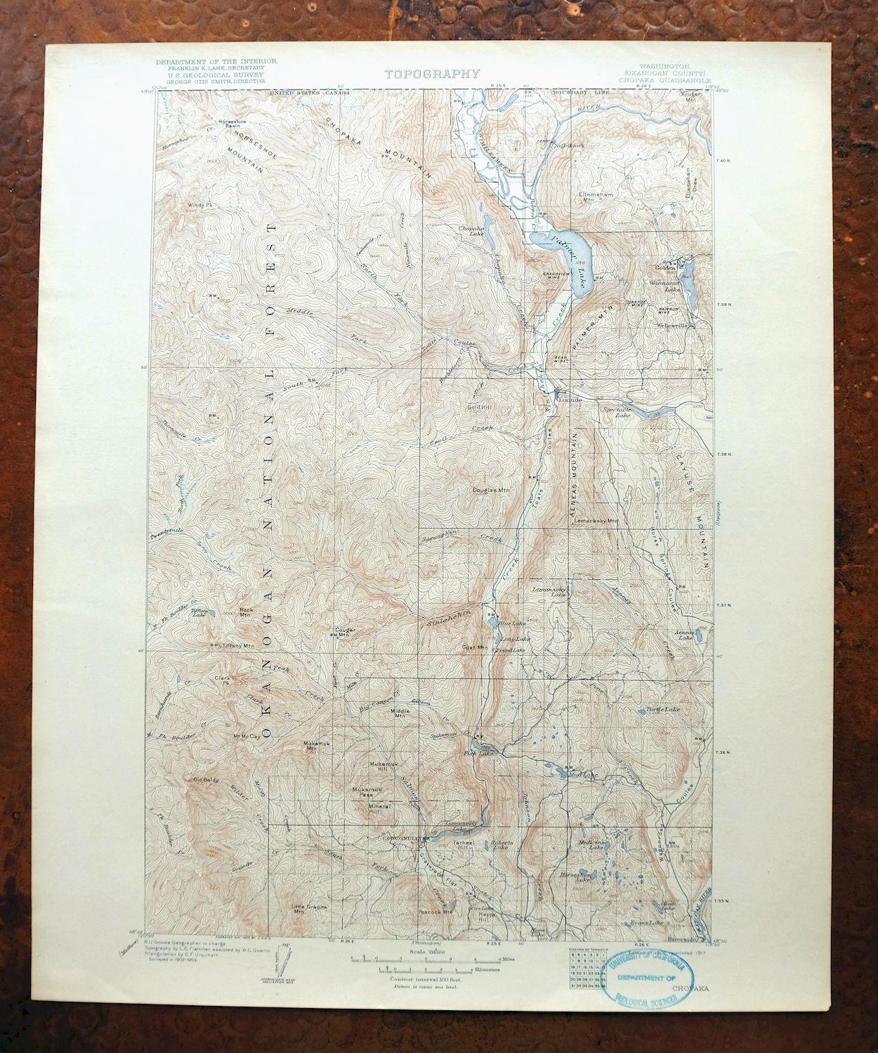
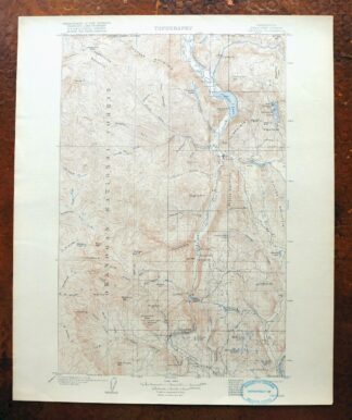
Chopaka Washington Okanogan NF USGS Topographic Map 1917
$42
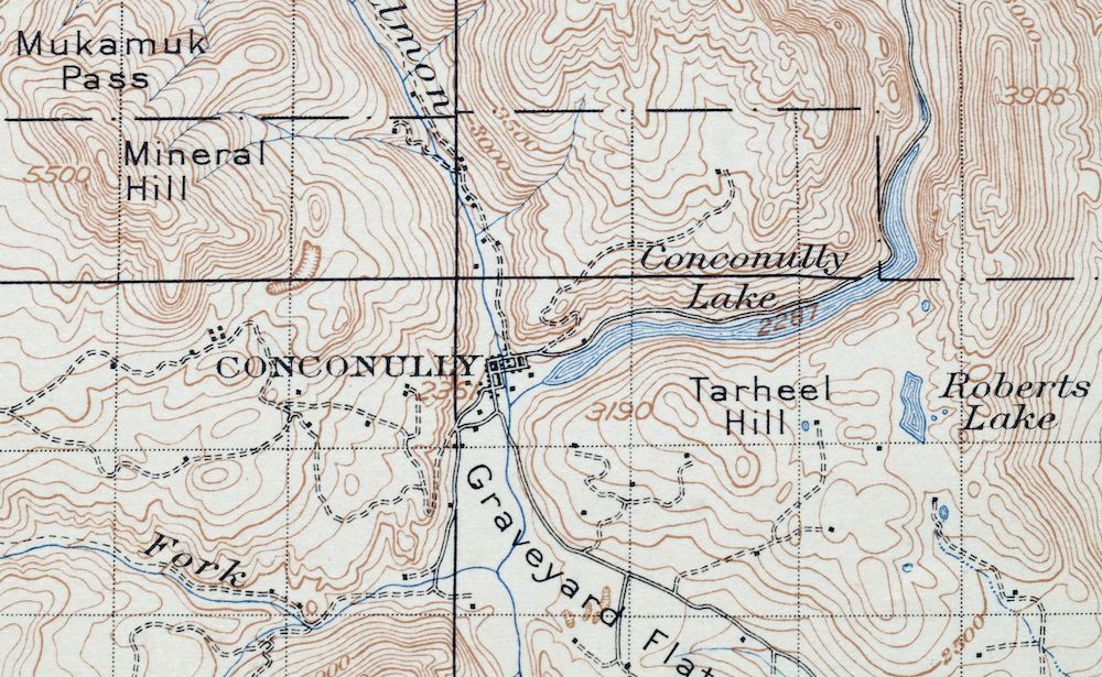
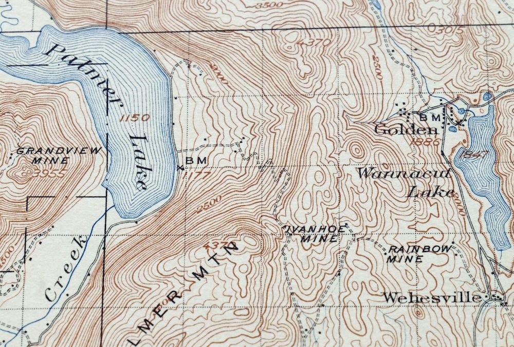
This USGS 30-minute topographic map is a 1906 edition printed in 1917, and the antique sheet survives in excellent condition – very lightly handled, never folded, on thick stock, with a flawless map area and only light age-toning. Reaching to the Canadian border about 30 miles north of Okanogan, the Chopaka quad takes in rugged Okanogan County country that includes portions of the Pasayten Wilderness and Okanogan National Forest, along with Conconully, Nighthawk, Loomis, and Riverside, and the Conconully lake and reservoir. Surveyed in a 1902 and 1903 field survey under geographer R.U. Goode, it records the high border ranges near Chopaka in the early years of the region’s mining and homesteading era. The reverse carries printed USGS reference material describing the mapping program and its symbols.
In stock
This antique sheet is a 1906 edition of the Chopaka Washington USGS topographic map. It is an authentic 109-year-old 1917 United States Geological Survey print in excellent condition.
HOW THIS MAP CAN BE USED
In addition to making a fascinating conversation piece, this sheet would look great in a frame or on display, make a unique and prized gift for anyone interested in this area, be perfect as a reference for genealogy studies or general historical research, or fill that missing piece in your collection.
FEATURES SHOWN ON THE MAP
The Chopaka 30-minute map shows cities and towns, roads, railroads, rivers, creeks, elevation contour lines, public land survey lines, county, state, and other administrative boundaries as they existed at the time of the survey in 1902 and 1903.
A VALUABLE HISTORICAL RECORD
Maps from the USGS 30-minute series have been out of print for many years. They have never been common and original prints are increasingly difficult to find. For areas where the 30-minute map was produced, it is usually the first large-scale survey done by the USGS for that area. These are a valuable historical record, as they contain many placenames and features that have been dropped from more recent series’ and editions.
Nearby maps
-
Osoyoos Washington Okanogan NF Oroville USGS Topo Map 1937
$36 Add to cart -
Republic Washington Malo Danville USGS Topo Map 1944 Vintage
$38 Add to cart -
Glacier Peak Washington Suiattle River USGS Topo Map 1946
$36 Add to cart -
Colockum Pass Washington Wenatchee USGS 30-Min Topo Map 1922
$36 Add to cart -
Mount Bonaparte Washington Molson Chesaw USGS Topo Map 1966
$38 Add to cart -

Lucerne Washington USGS 15-Min Topographic Map 1949 Vintage
$42 Add to cart -
Barker Canyon Washington USGS 7.5-Min Topo Map 1971 Vintage
$36 Add to cart -
Orient Washington Colville NF Laurier USGS Topo Map 1951
$37 Add to cart -
Wilbur Washington Creston USGS 15-Min Topo Map 1950 Vintage
$42 Add to cart -
Mount Shuksan Washington USGS 15-Min Topo Map 1957 Vintage
$37 Add to cart -
Blanca Lake Washington USGS 7.5-Min Topo Map 1982 Vintage
$40 Add to cart -
Rock Island Washington South Wenatchee USGS Topo Map 1967
$41 Add to cart -
Silverton Washington Darrington Verlot USGS Topo Map 1975
$36 Add to cart -
Oso Washington Lake Cavanaugh USGS Topo Map 1977 Vintage
$40 Add to cart -
Wellpinit Washington Long Lake Ford USGS Topo Map 1944
$42 Add to cart -
Wickersham Washington Lyman Acme USGS Topographic Map 1974
$43 Add to cart -

Clayton Washington Spokane USGS 15-Min Topo Map 1951 Vintage
$42 Add to cart -
Sumas Washington Bellingham Lynden USGS 15-Min Topo Map 1931
$59 Add to cart -

Monroe Washington Duvall High Rock USGS Topographic Map 1976
$46 Add to cart -
Snoqualmie Pass Washington Hyak USGS Topographic Map 1965
$21 Add to cart -

Deer Park Washington Spokane Fairwood USGS Topo Map 1951
$40 Add to cart -
Red Rock Washington Royal City Smyrna USGS Topo Map 1911
$20 Add to cart -
Boylston Washington Vantage Doris USGS Topographic Map 1943
$44 Add to cart -

Lummi Bay Washington Ferndale Birch Bay USGS Topo Map 1974
$47 Add to cart