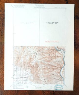
MAP DETAILS | |
|---|---|
| TITLE | Colockum Pass |
| STATE | Washington |
| LOCATION | Vicinity of Wenatchee |
| SERIES | 30-minute |
| SURVEYED | 1919 and 1920 Field Survey |
| GEOGRAPHER | C.H. Birdseye |
| ENGRAVED | 1922 |
| EDITION | 1922 |
| PRINTED | 1922 |
| PRINT NOTES | Thick paper stock |
| SCALE | 1:125000 |
| CONTOUR INTERVAL | 50 feet |
| SHEET DIMENSIONS | 16 1/4 x 20 inches |
| MAP DIMENSIONS | 11 7/8 x 17 1/2 inches |
| COVERAGE AREA | 23 x 35 miles |
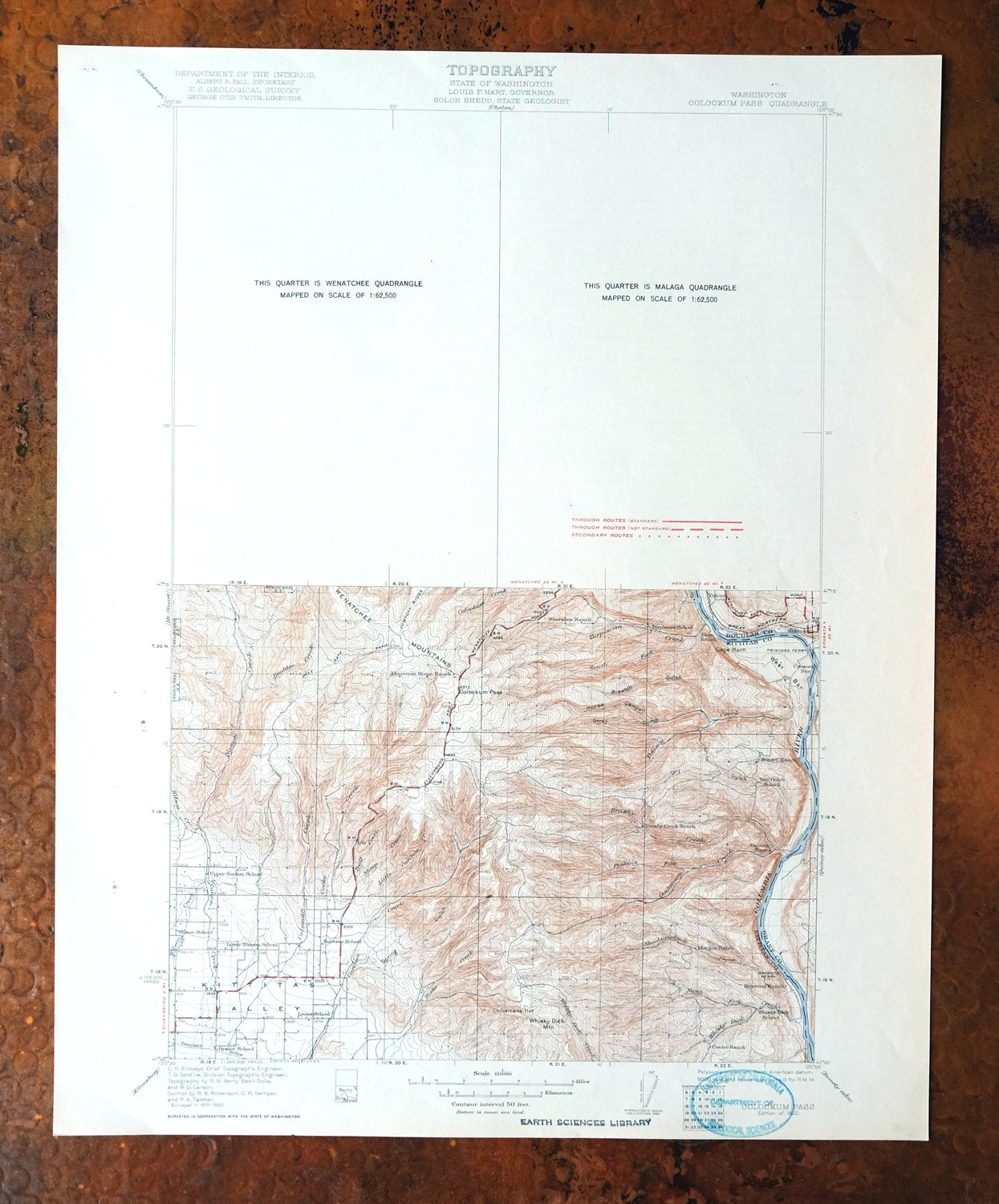
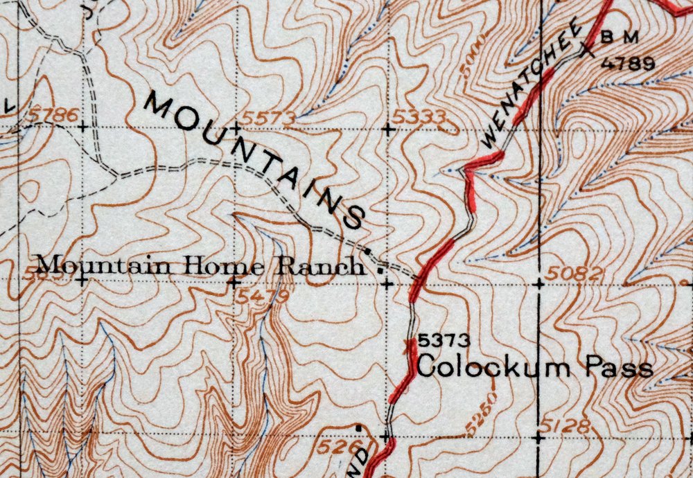
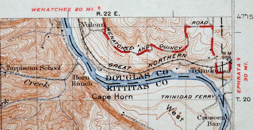
| MAP NOTES | The top half of this quadrangle is unsurveyed; the mapped portion is a fascinating historical snapshot showing old travel routes, rail lines, and water crossings. |
| SHEET CONDITION For maps of this vintage, effort is made to note all visible flaws, no matter how minor. | |
| OVERALL CONDITION | Very Good |
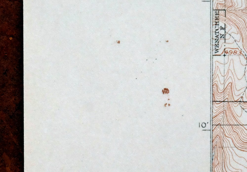
| SHEET NOTES | very lightly handled, never folded, smooth and flat |
| MAP AREA | flawless map area |
| COLLARS | no wear or tears, no markings, library stamp in lower right collar corner, very minor blemishes in left collar |
 | |
| MAP COVERAGE Quadrangle extent overlaid on current basemap. | |
| BACKSIDE LEGEND | |
 A map summary is printed on the back side of the Colockum Pass sheet similar to the one shown in the picture. It outlines the history, purpose, and status of the USGS mapping program at the time of the printing in 1922. It also provides instructions on how to read contour lines and a description of how they are used to depict the terrain. At the bottom of the page is a legend showing all of the symbols used to represent the cultural, relief, and water features found on the map. | |
| PLACENAMES Depending on map series and survey date, all of the features listed below may not be shown on this map. This list contains features that currently exist or historically existed within the area covered by the map. The list can be used as a reference to determine if this map covers your area of interest. Placenames are listed alphabetically next to each feature type. | |
| CITIES AND TOWNS (CURRENT) | East Wenatchee, East Wenatchee Bench, Monitor, Rock Island, South Wenatchee, Sunnyslope, Wenatchee, and West Wenatchee |
| COUNTIES COVERED | Chelan, Douglas, Grant, and Kittitas |
| FEDERAL LAND UNITS | Desert Survival Training Site and Wenatchee National Forest |
| RIVERS AND STREAMS | Bear Creek, Bear Gulch, Beaver Creek, Big Stemilt Creek, Boulder Creek, Brushy Creek, Bryant Creek, Caribou Creek, Coleman Creek, Colockum Creek, Columbia River, Cooke Creek, Dot Creek, Duffy Creek, East Fork Mission Creek, Hartman Creek, High Creek, Hunt Creek, Jackknife Creek, Little Bohinkleman Creek, Little Brushy Creek, Little Caribou Creek, Little Stemilt Creek, Middle Creek, Miners Run Creek, Mission Creek, Naneum Creek, Nealey Creek, North Fork Brushy Creek, North Fork Colockum Creek, North Fork Hunt Creek, North Fork Perkins Fork, North Fork Skookumchuck Creek, North Fork Whiskey Dick Creek, Orr Creek, Park Creek, Pearson Creek, Perkins Fork, Quilomene Creek, Rock Island Creek, Rollinger Creek, Schnebly Creek, Sheep Creek, Skookumchuck Creek, South Fork Brushy Creek, South Fork Colockum Creek, South Fork Hunt Creek, South Fork Tarpiscan Creek, Spring Cayuse Creek, Squilchuck Creek, Stemilt Creek, Swift Creek, Tarpiscan Creek, Tekison Creek, Trail Creek, Upper North Fork Skookumchuck Creek, Wenatchee River, Whiskey Dick Creek, Whiskey Jim Creek, Wide Hollow Creek, and Wilson Creek |
| WATER BODIES | Clara Lake, Clear Lake, Greenwood Reservoir Number One, HH Reservoir Number 1, Horse Lake, Lake Cortez, Lily Lake, Mathison Reservoir, Meadow Lake, Milo Wood Pond, Rose Lake, Spring Hill Reservoir, Steffen Brothers Reservoir, Stemilt Project Reservoir, Upper Wheeler Reservoir, Wenatchee Heights Reservoir Number One, Wenatchee Heights Reservoir Number Two, Wood Reservoir, and Zimmerman Pond |
| Locations: Alphine Campground, Beehive Spring Campground, Bonspur, Colockum Game Range Headquarters, Columbia River, Columbia Substation, Fairview Hall, Four Corners, Keokuk Substation, Meadow Campground, Mission Ridge Winter Sports Area, Mountain Home, Naneum Lookout, Scout-a- Vista, Spring Campground, The Pines, Valhala Substation, Valley North Mall, Vulcan, Washington State University Tree Fruit Experiment Station, Wenatchee Golf and Country Club, Wenatchee Speedway, and Zitting Shopping Center. Mountains, Peaks, and Summits: Badger Mountain, Beehive Mountain, Cape Horn, Chinamans Hat, Horse Lake Mountain, Laurel Hill, Mission Peak, Moses Stool, Old Butte, Rooster Comb, Sheep Rock, Stemilt Hill, Wenatchee Mountain, Wheeler Hill, and Whiskey Dick Mountain. Valleys and Canyons: Bevington Canyon, Black Rock Canyon, Box Canyon, Brewton Gulch, Burnt Canyon, Cave Canyon, Charlton Canyon, Coleman Canyon, Cooke Canyon, Crow Canyon, Davies Canyon, Dawson Canyon, Dry Gulch, Fairview Canyon, Francis Canyon, Hinkleman Canyon, Horse Canyon, Ivy Walker Canyon, King Canyon, Kingsbury Canyon, Lone Pine Canyon, Moses Coulee, Naneum Canyon, Nickles Canyon, Number One Canyon, Number Two Canyon, Patte Canyon, Peavine Canyon, Pendleton Canyon, Pitcher Canyon, Rag Canyon, Robinson Canyon, Sand Canyon, Schnebly Canyon, Scroggie Canyon, Sherman Canyon, Slawson Canyon, Spring Gulch, Sties Canyon, Stray Gulch, Trail Gulch, Tripp Canyon, Walling Canyon, Warm Springs Canyon, Whitson Canyon, Woodring Canyon, and Yaksum Canyon. Parks: Chase Park, Colockum State Wildlife Area, Kenroy Park, Lewis and Clark Park, Lincoln Park, Methow Street Park, Mission Street Park, Pangborn Memorial Park, Pennsylvania Park, Pioneer Park, Quilomene Wildlife Recreation Area, Riverfront Park, Rock Island State Park, Schaake State Wildlife Recreation Area, Squilchuck State Park, Triangle Park, Washington Park, and Wenatchee River County Park. Trails: Devils Gulch Trail, Mission Ridge Trail, and Squilchuck Trail. Drainages: Bear Gulch, Beaver Creek, Big Stemilt Creek, Boulder Creek, Brushy Creek, Bryant Creek, Colockum Creek, Dot Creek, Douglas Creek, East Fork Mission Creek, Hartman Creek, High Creek, Hunt Creek, Jackknife Creek, Lake Creek, Little Bohinkleman Creek, Little Brushy Creek, Little Caribou Creek, Little Stemilt Creek, Middle Creek, Miners Run Creek, Nealey Creek, North Fork Brushy Creek, North Fork Colockum Creek, North Fork Hunt Creek, North Fork Perkins Fork, North Fork Skookumchuck Creek, North Fork Whiskey Dick Creek, Orr Creek, Pearson Creek, Perkins Fork, Quilomene Creek, Rock Island Creek, Rollinger Creek, Schnebly Creek, Sheep Creek, Skookumchuck Creek, South Fork Brushy Creek, South Fork Colockum Creek, South Fork Hunt Creek, South Fork Tarpiscan Creek, Spring Cayuse Creek, Squilchuck Creek, Stemilt Creek, Swift Creek, Tarpiscan Creek, Tekison Creek, Trail Creek, Upper North Fork Skookumchuck Creek, Wenatchee River, Whiskey Dick Creek, Whiskey Jim Creek, and Wide Hollow Creek. Islands: Rock Island. Capes: Naneum Point. Mines: Cannon Mine and Golden King Mine. Hospitals: Deaconess Hospital and Saint Anthony Hospital. Lakes and Ponds: Blue Heron Lake, Clara Lake, Hammond Lake, Hideaway Lake, Horse Lake, Marion Lake, and Putters Lake. Buildings: Parkside Manor Nursing Home, Scout-A-Vista Lodge, and Wenatchee National Forest Supervisors Office. Dams: Beehive Dam, Cammack Dam, Clear Lake Dam, Greenwood Reservoir Number One Dam, Greenwood Reservoir Number Two Dam, H And H Reservoir Number Two Dam, H and H Reservoir Number One Dam, Lily Lake Dam, Lovitt Tailing Pond Dam, Mathison Reservoir Dam, McLaughlin Dam, Meadow Lake Dam, Milo Wood Pond Dam, Quilomene Creek Dam, Rock Island Dam, Rose Lake Dam, Spring Hill Dam, Spring Hill Saddle Dam, Steffen Brothers Reservoir Dam, Stemilt Main Dam, Stemilt Saddle Dam, Three Lakes Reservoir Dam, Upper Wheeler Dam, Wenatchee Heights Reservoir Number One Dam, Wenatchee Heights Reservoir Number Two Dam, Wood Reservoir Dam, and Zimmerman Pond Dam. Crossings: Thirtyseventh Street Interchange. Bluffs: Rocky Point. Gaps: Colockum Pass and Squaw Saddle. Canals: Cascade Canal, Columbia Lateral, Gunn Ditch, High Line Ditch, Lanham Lateral, North Branch Canal, Olive Ditch, Shotwell Ditch, and Wenatchee Reclamation Ditch. Basins: Naneum Basin and Stemilt Basin. Bars: West Bar. Airports: Fancher Field, Hansen Heliport, Hoverhawk Ranch Airport, and Pangborn Field. Schools: Cascade Christian Academy, Cascade Elementary School, Colockum Research Unit Washington State University, Columbia Elementary School, Eastmont Junior High School, Eastmont Senior High School, Eastmount High School, Grant Elementary School, Kenroy Elementary School, Lewis and Clark Elementary School, Lincoln Elementary School, Mission View Elementary School, Orchard Middle School, Pioneer Middle School, Pitcher School, R E Lee Elementary School, Rock Island Elementary School, Saint Josephs School, Saint Pauls Lutheran School, School Number 60, Sterling Middle School, Stevens School, Sunnyslope Elementary School, Washington Elementary School, Wenatchee Christian Academy, Wenatchee High School, Wenatchee Valley Alternative High School, Wenatchee Valley Junior College, and Whitman School. Ridges: Jumpoff Ridge, Mission Ridge, and Naneum Ridge. Reservoirs and Tanks: Beehive Reservoir, Clear Lake, Greenwood Reservoir Number One, Greenwood Reservoir Number Two, H and H Reservoir Number One, H and H Reservoir Number Two, HH Reservoir Number 1, HH Reservoir Number 2, Lake Cortez, Lily Lake, Lovitt Tailings Pond, Mathison Reservoir, Meadow Lake, Milo Wood Pond, Rock Island Lake, Rock Island Pool, Rose Lake, Spring Hill Reservoir, Steffen Brothers Reservoir, Stemilt Project Reservoir, Upper Wheeler Reservoir, Wenatchee Heights Reservoir Number One, Wenatchee Heights Reservoir Number Two, Wood Reservoir, and Zimmerman Pond. Rapids: Cabinet Rapids and Nixon Rapids. Flats: Baker Flats, Birch Flat, Croker Flat, Pole Flat, and Walter Flat. Towers: KCWT-TV (Wenatchee), KKRT-AM (Wenatchee), KPQ-AM (Wenatchee), KPQ-FM (Wenatchee), KSSY-FM (Wenatchee), KWWW-AM (Wenatchee), KXAA-FM (Rock Island), and KYSN-FM (East Wenatchee). Pillars: Castle Rock and Lone Rock. Springs: Basalt Spring, Beehive Spring, Bohinkleman Spring, Bryant Spring, Collins Spring, Dorse Spring, Government Springs, Grouse Spring, Gustafson Spring, Hinkleman Spring, Judkins Spring, Kohler Spring, Leonard Spring, Luehm Spring, Mission Spring, Pine Spring, Rainey Spring, Reynolds Spring, Robinson Spring, Seabrock Spring, Sheridan Spring, Skookumchuck Heights Spring, Spike Spring, Sumac Spring, Thorn Spring, Whitson Spring, Wild Horse Spring, and Windy Spring. | |
| SHIPPING AND RETURNS | |
 This map sheet will be carefully rolled in a sturdy tube and shipped via the US Postal Service. If you find that the sheet you receive is not as described in the listing, you may ship it back to us for a refund of the purchase price. | |
Colockum Pass Washington Wenatchee USGS 30-Min Topo Map 1922
$36
Printed in 1922, its year of first publication, this USGS 30-minute topographic sheet is an antique on thick stock, very good overall and never folded, smooth and flat with a flawless map area. Covering the Colockum Pass quad in the vicinity of Wenatchee, it takes in that city along with East Wenatchee, Sunnyslope, Rock Island, and Monitor across Chelan, Douglas, Grant, and Kittitas counties, and includes part of the Wenatchee National Forest. The top half of the quadrangle is unsurveyed, while the mapped portion below records the old travel routes, rail lines, and water crossings of the area as it stood around 1920, drawn from a 1919 and 1920 field survey and engraved in 1922. A library stamp sits in the lower right collar corner, and the reverse carries printed reference material from the USGS mapping program of the day.
In stock
This antique sheet is a 1922 edition of the Colockum Pass Washington USGS topographic map. It is an authentic 104-year-old United States Geological Survey print in very good condition.
HOW THIS MAP CAN BE USED
In addition to making a fascinating conversation piece, this sheet would look great in a frame or on display, make a unique and prized gift for anyone interested in this area, be perfect as a reference for genealogy studies or general historical research, or fill that missing piece in your collection.
FEATURES SHOWN ON THE MAP
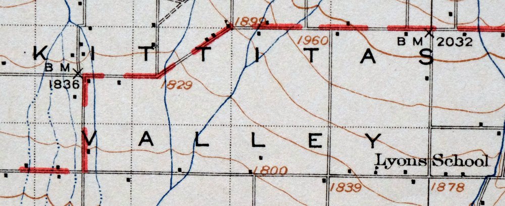
The Colockum Pass 30-minute map shows cities and towns, roads, railroads, rivers, creeks, elevation contour lines, public land survey lines, county, state, and other administrative boundaries as they existed at the time of the survey in 1919 and 1920.
A VALUABLE HISTORICAL RECORD
Maps from the USGS 30-minute series have been out of print for many years. They have never been common and original prints are increasingly difficult to find. For areas where the 30-minute map was produced, it is usually the first large-scale survey done by the USGS for that area. These are a valuable historical record, as they contain many placenames and features that have been dropped from more recent series’ and editions.
Nearby maps
-

Connell Washington Lind Mesa USGS Topo Map 1918 Antique
$34 Add to cart -
Glacier Peak Washington Suiattle River USGS Topo Map 1946
$36 Add to cart -
Wallula Washington Finley Burbank USGS Topo Map 1918 Antique
$34 Add to cart -
Chopaka Washington Okanogan NF USGS Topographic Map 1917
$42 Add to cart -
Osoyoos Washington Okanogan NF Oroville USGS Topo Map 1937
$36 Add to cart -
Chehalis Washington Lacey Tumwater USGS Topographic Map 1916
$75 Add to cart -
Republic Washington Malo Danville USGS Topo Map 1944 Vintage
$38 Add to cart -
Rock Island Washington South Wenatchee USGS Topo Map 1967
$41 Add to cart -
Boylston Washington Vantage Doris USGS Topographic Map 1943
$44 Add to cart -
Red Rock Washington Royal City Smyrna USGS Topo Map 1911
$20 Add to cart -
Yakima East Washington Union Gap USGS Topographic Map 1968
$25 Add to cart -
Black Rock Spring Washington Yakima Ridge USGS Topo Map 1941
$32 Add to cart -
Yakima East Washington Moxee Parker USGS Topo Map 1985
$37 Add to cart -
Coyote Rapids Washington USGS 15-Min Topo Map 1916 Antique
$45 Add to cart -
Snoqualmie Pass Washington Hyak USGS Topographic Map 1965
$21 Add to cart -

Lucerne Washington USGS 15-Min Topographic Map 1949 Vintage
$42 Add to cart -
Grandview Washington Sunnyside USGS Topo Map 1951 Vintage
$42 Add to cart -
Blanca Lake Washington USGS 7.5-Min Topo Map 1982 Vintage
$40 Add to cart -
Barker Canyon Washington USGS 7.5-Min Topo Map 1971 Vintage
$36 Add to cart -
Enumclaw Washington Buckley Upper Mill USGS Topo Map 1976
$45 Add to cart -

Badger Mountain Washington South Richland USGS Topo Map 1978
$43 Add to cart -

Maple Valley Washington Covington USGS Topographic Map 1976
$43 Add to cart -
Wilbur Washington Creston USGS 15-Min Topo Map 1950 Vintage
$42 Add to cart -
Silverton Washington Darrington Verlot USGS Topo Map 1975
$36 Add to cart