MAP DETAILS | |
|---|---|
| TITLE | Osoyoos |
| STATE | Washington |
| LOCATION | Vicinity of Oroville, 25 miles northeast of Omak |
| SERIES | 30-minute |
| SURVEYED | 1902 Field Survey |
| GEOGRAPHER | R.U. Goode |
| ENGRAVED | 1904 |
| EDITION | 1904 |
| PRINTED | 1937 |
| PRINT NOTES | Thick paper stock |
| SCALE | 1:125000 |
| CONTOUR INTERVAL | 100 feet |
| SHEET DIMENSIONS | 16 x 20 inches (approximate) |
| MAP DIMENSIONS | 11 1/2 x 17 1/2 inches |
| COVERAGE AREA | 23 x 35 miles |
| SHEET CONDITION For maps of this vintage, effort is made to note all visible flaws, no matter how minor. | |
| OVERALL CONDITION | Excellent |
| SHEET NOTES | very lightly handled, never folded, smooth and flat |
| MAP AREA | flawless map area |
| COLLARS | no wear or tears, no markings, no blemishes, inventory stamp on lower collar |
| MAP COVERAGE Quadrangle extent overlaid on current basemap. | |
| BACKSIDE LEGEND | |
 A map summary is printed on the back side of the Osoyoos sheet similar to the one shown in the picture. It outlines the history, purpose, and status of the USGS mapping program at the time of the printing in 1937. It also provides instructions on how to read contour lines and a description of how they are used to depict the terrain. At the bottom of the page is a legend showing all of the symbols used to represent the cultural, relief, and water features found on the map. | |
| PLACENAMES Depending on map series and survey date, all of the features listed below may not be shown on this map. This list contains features that currently exist or historically existed within the area covered by the map. The list can be used as a reference to determine if this map covers your area of interest. Placenames are listed alphabetically next to each feature type. | |
| CITIES AND TOWNS (CURRENT) | Chesaw, Cordell, Ellisforde, Molson, Oroville, Riverside, Synarep, and Tonasket |
| COUNTIES COVERED | Okanogan |
| FEDERAL LAND UNITS | Okanogan National Forest |
| RIVERS AND STREAMS | Aeneas Creek, Antoine Creek, Bailey Creek, Baker Creek, Bannon Creek, Barnell Creek, Bench Creek, Bolster Creek, Bonaparte Creek, Cape Labelle Creek, Chewiliken Creek, Cole Creek, Dry Creek, East Fork Myers Creek, Edwards Creek, Ethel Creek, Frosty Creek, Gafvery Creek, Gold Creek, Henderson Creek, Lightning Creek, Lime Creek, Little Bonaparte Creek, Lost Creek, Lyman Creek, Mary Ann Creek, Middle Fork Siwash Creek, Mill Creek, Mosquito Creek, Myers Creek, Ninemile Creek, North Fork Beaver Creek, North Fork Gold Creek, North Fork Mary Ann Creek, North Fork Siwash Creek, North Ninemile Creek, Okanogan River, Patterson Creek, Peony Creek, Pettijohn Creek, Sherer Creek, Similkameen River, Siwash Creek, Sourdough Creek, South Fork Beaver Creek, South Fork Siwash Creek, Squaw Creek, Thorp Creek, Tonasket Creek, Tunk Creek, Walker Creek, West Fork Sanpoil River, and Whisky Cache Creek |
| WATER BODIES | Ads Lake, Alden Lake, Lake Andrews, Baker Lake, Blue Diamond Lake, Blue Lake, Bonaparte Lake, Corral Lake, Crater Lakes, Davis Lake, Ell Lake, Fields Lake, Harbor Lake, Horseshoe Lake, Johnny Johnson Lake, Kerwin Lake, Laura Lake, Lindberg Lake, Long Lake, Lost Lake, Lounsbury Lake, Lyman Lake, Meadow Lake, Molson Lake, Mud Lake, Muskrat Lake, Osoyoos Lake, Pentland Lake, Perry Lake, Poison Lake, Razor Lake, Rock Lake, Round Lake, Sanger Lake, Sidley Lake, Silver Nail Lake, Strawberry Lake, Summit Lake, Talkire Lake, Teal Lake, Turner Lake, Walker Lake, and Whitestone Lake |
| Locations: Aeneas Guard Station, Camp Ortoha, Camp Tokiwanee, Big Tree Botanical Area, Bolster, Bonaparte Campground, Crawfish, Fritz Ranch, Highlands, Kipling, Knobhill Grange, Leese, Lost Lake Campground, and Mount Bonaparte Lookout. Areas: Suttens Meadow. Mountains, Peaks, and Summits: Aeneas Mountain, Mount Annie, Bailey Mountain, Baker Mountain, Bannon Mountain, Barker Mountain, Block Hill, Beehive Mountain, Bimetalic Mountain, Mount Bonaparte, Burge Mountain, Buster Mountain, Cayuse Mountain, Duffys Mountain, Haley Mountain, Hee Hee Mountain, Horse Mountain, Mount Hull, Island Mountain, Knob Hill, Kruger Mountain, Little Bonaparte Mountain, Little Whisky Mountain, McDonald Mountain, Meader Mountain, Molson Hill, Mount Phoebe, Pickens Mountain, Porphyry Peak, Powers Butte, Sneed Mountain, Spur Mountain, Stowe Mountain, Strawberry Mountain, Tunk Mountain, Whisky Mountain, Whitestone Mountain, and Wilcox Mountain. Valleys and Canyons: Aeneas Valley, Antoine Valley, Chewiliken Valley, Devils Canyon, Eden Valley, Haley Canyon, Hungry Hollow, Kilgore Canyon, McLoughlin Canyon, Mud Lake Valley, Tunk Valley, Whister Canyon, and Whitestone Coulee. Parks: Lake Osoyoos State Park and Shady Park. Trails: Antoine Trail, Beaver Ridge Trail, Bonaparte Trail, Mill Creek Trail, North Fork Trail, and South Side Trail. Drainages: Aeneas Creek, Antoine Creek, Bailey Creek, Bannon Creek, Bench Creek, Bolster Creek, Bonaparte Creek, Cape Labelle Creek, Chewiliken Creek, Cole Creek, Dry Creek, East Fork Myers Creek, Edwards Creek, Ethel Creek, Frosty Creek, Gafvery Creek, Gold Creek, Henderson Creek, Lightning Creek, Lime Creek, Little Bonaparte Creek, Lyman Creek, Mary Ann Creek, Middle Fork Siwash Creek, Mill Creek, Mosquito Creek, Ninemile Creek, North Fork Mary Ann Creek, North Fork Siwash Creek, North Ninemile Creek, Patterson Creek, Peony Creek, Pettijohn Creek, Sherer Creek, Similkameen River, Siwash Creek, Sourdough Creek, South Fork Siwash Creek, Squaw Creek, Thorp Creek, Tomasket Creek, Tonasket Creek, Toroda Creek, Tunk Creek, Whisky Cache Creek, and Whitestone Creek. Islands: Driscoll Island, Eyhott Island, and Williams Island. Capes: Boundary Point and Smith Point. Mines: Lucky Knock Mine, OK Copper Mine, and Poland China Mine. Hospitals: North Valley Hospital. Lakes and Ponds: Ads Lake, Alden Lake, Lake Andrews, Baker Lake, Blue Diamond Lake, Blue Lake, Big Finney Lake, Big Mack Lake, Bob Neal Lake, Borst Lake, Cathrene Cecile Lake, Corral Lake, Crater Lakes, Davis Lake, Ell Lake, Fertilizer Lake, Fields Lake, Finley Lake, Green Lake, Harbor Lake, Horseshoe Lake, Hot Lake, Irwins Pond, Johnny Johnson Lake, Kerwin Lake, Laura Lake, Lehrman Pond, Lindberg Lake, Little Finney Lake, Long Lake, Lost Lake, Lounsbury Lake, Lyman Lake, Mary Ann Lake, Meadow Lake, Molson Lake, Mud Lake, Muskrat Lake, Oberg Lake, Osoyoos Lake, Pentland Lake, Perry Lake, Poison Lake, Razor Lake, Rock Lake, Round Lake, Sanger Lake, Sidley Lake, Silver Nail Lake, Stern Lake, Strawberry Lake, Summit Lake, Talkire Lake, Teal Lake, Turner Lake, Twin Lakes, and Walker Lake. Buildings: Molson Museum and Sunny Slope Grange Hall. Waterfalls: McLoughlin Falls. Dams: Bonaparta Lake Dam, Fanchers Dam, Whitestone Lake Dam, and Zosels Mill Pond Dam. Gaps: Lockman Pass. Bridges: Janis Bridge. Bays: Deep Bay and Grubbs Cove. Airports: Dorothy Scott Airport, Hart Ranch Airport, and Scott Seaplane Anchorage. Schools: Chewiliken School, Ellisforde Seventh Day Adventist School, Howe School, Oroville Elementary School, Oroville High School, Tonasket Elementary School, Tonasket High School, and Tonasket Middle School. Ridges: Fourth of July Ridge, Lockman Ridge, and Pontiac Ridge. Reservoirs and Tanks: Bonaparte Lake, Fanchers Dam Reservoir, Whitestone Lake, and Zosels Mill Pond. Rapids: Janis Rapids and McAllister Rapids. Flats: Bigham Flat, Meader Flat, and Whitestone Flats. Pillars: Hee Hee Stone. Springs: Aeneas Spring, Bailey Spring, Box Springs, Camp Spring, Bob Neal Spring, Cockle Spring, Corral Spring, Cutts Spring, Division Spring, Duff Spring, Ethel Spring, Figlenski Spring, Granite Spring, Green Spring, Hardy Spring, Lightning Spring, Nine Spring, Nydeck Spring, Owl Spring, Saddle Spring, Smugglers Spring, Squirrel Spring, Tamarack Spring, Twin Springs, and Wildhorse Spring. | |
| SHIPPING AND RETURNS | |
 This map sheet will be carefully rolled in a sturdy tube and shipped via the US Postal Service. If you find that the sheet you receive is not as described in the listing, you may ship it back to us for a refund of the purchase price. | |
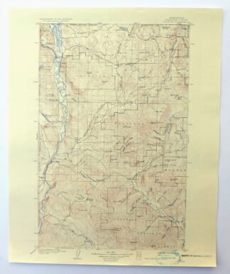
Osoyoos Washington Okanogan NF Oroville USGS Topo Map 1937
$36
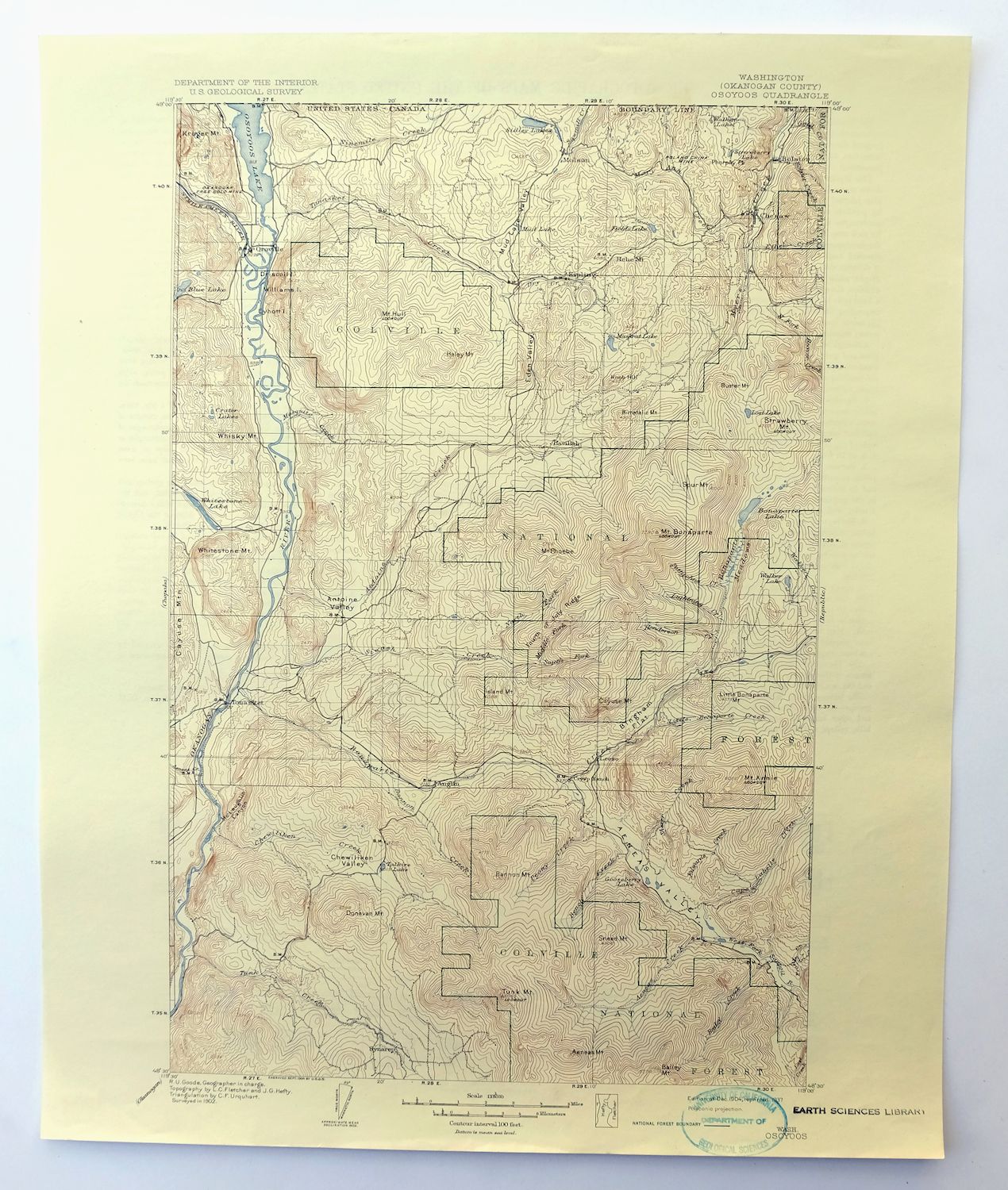
This USGS 30-minute topographic sheet is a 1904 edition, printed in 1937, and survives in excellent condition: never folded, very lightly handled, and smooth and flat on thick stock. The quad spans the Okanogan River country of Okanogan County near the Canadian border, taking in Oroville and Tonasket along with smaller communities such as Riverside, Molson, and Ellisforde, and reaches into part of the Okanogan National Forest. Surveyed in the field in 1902 with engraving by 1904 credited to geographer R.U. Goode, it shows the border valley and forested uplands as they were mapped at the turn of the century, and the reverse carries printed reference material. The flawless map area and clean collar – marked only by an inventory stamp on the lower edge – make it a good candidate for framing.
In stock
This antique sheet is a 1904 edition of the Osoyoos Washington USGS topographic map. It is an authentic 89-year-old 1937 United States Geological Survey print in excellent condition.
HOW THIS MAP CAN BE USED
In addition to making a fascinating conversation piece, this sheet would look great in a frame or on display, make a unique and prized gift for anyone interested in this area, be perfect as a reference for genealogy studies or general historical research, or fill that missing piece in your collection.
FEATURES SHOWN ON THE MAP
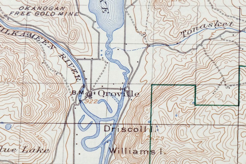
The Osoyoos 30-minute map shows cities and towns, roads, railroads, rivers, creeks, elevation contour lines, public land survey lines, county, state, and other administrative boundaries as they existed at the time of the survey in 1902.
A VALUABLE HISTORICAL RECORD
Maps from the USGS 30-minute series have been out of print for many years. They have never been common and original prints are increasingly difficult to find. For areas where the 30-minute map was produced, it is usually the first large-scale survey done by the USGS for that area. These are a valuable historical record, as they contain many placenames and features that have been dropped from more recent series’ and editions.
Nearby maps
-
Chopaka Washington Okanogan NF USGS Topographic Map 1917
$42 Add to cart -
Republic Washington Malo Danville USGS Topo Map 1944 Vintage
$38 Add to cart -
Glacier Peak Washington Suiattle River USGS Topo Map 1946
$36 Add to cart -
Colockum Pass Washington Wenatchee USGS 30-Min Topo Map 1922
$36 Add to cart -
Mount Bonaparte Washington Molson Chesaw USGS Topo Map 1966
$38 Add to cart -
Orient Washington Colville NF Laurier USGS Topo Map 1951
$37 Add to cart -
Barker Canyon Washington USGS 7.5-Min Topo Map 1971 Vintage
$36 Add to cart -
Wilbur Washington Creston USGS 15-Min Topo Map 1950 Vintage
$42 Add to cart -

Lucerne Washington USGS 15-Min Topographic Map 1949 Vintage
$42 Add to cart -
Wellpinit Washington Long Lake Ford USGS Topo Map 1944
$42 Add to cart -

Clayton Washington Spokane USGS 15-Min Topo Map 1951 Vintage
$42 Add to cart -
Rock Island Washington South Wenatchee USGS Topo Map 1967
$41 Add to cart -

Deer Park Washington Spokane Fairwood USGS Topo Map 1951
$40 Add to cart -
Mount Shuksan Washington USGS 15-Min Topo Map 1957 Vintage
$37 Add to cart -
Blanca Lake Washington USGS 7.5-Min Topo Map 1982 Vintage
$40 Add to cart -
Silverton Washington Darrington Verlot USGS Topo Map 1975
$36 Add to cart -
Oso Washington Lake Cavanaugh USGS Topo Map 1977 Vintage
$40 Add to cart -
Red Rock Washington Royal City Smyrna USGS Topo Map 1911
$20 Add to cart -
Wickersham Washington Lyman Acme USGS Topographic Map 1974
$43 Add to cart -
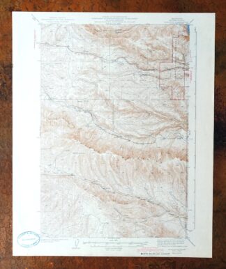
Boylston Washington Vantage Doris USGS Topographic Map 1943
$44 Add to cart -
Snoqualmie Pass Washington Hyak USGS Topographic Map 1965
$21 Add to cart -

Oakesdale Washington Saint Joe NF Tekoa USGS Topo Map 1938
$29 Add to cart -

Monroe Washington Duvall High Rock USGS Topographic Map 1976
$46 Add to cart -

Benge Washington Hooper Palouse River USGS Topo Map 1952
$35 Add to cart