MAP DETAILS | |
|---|---|
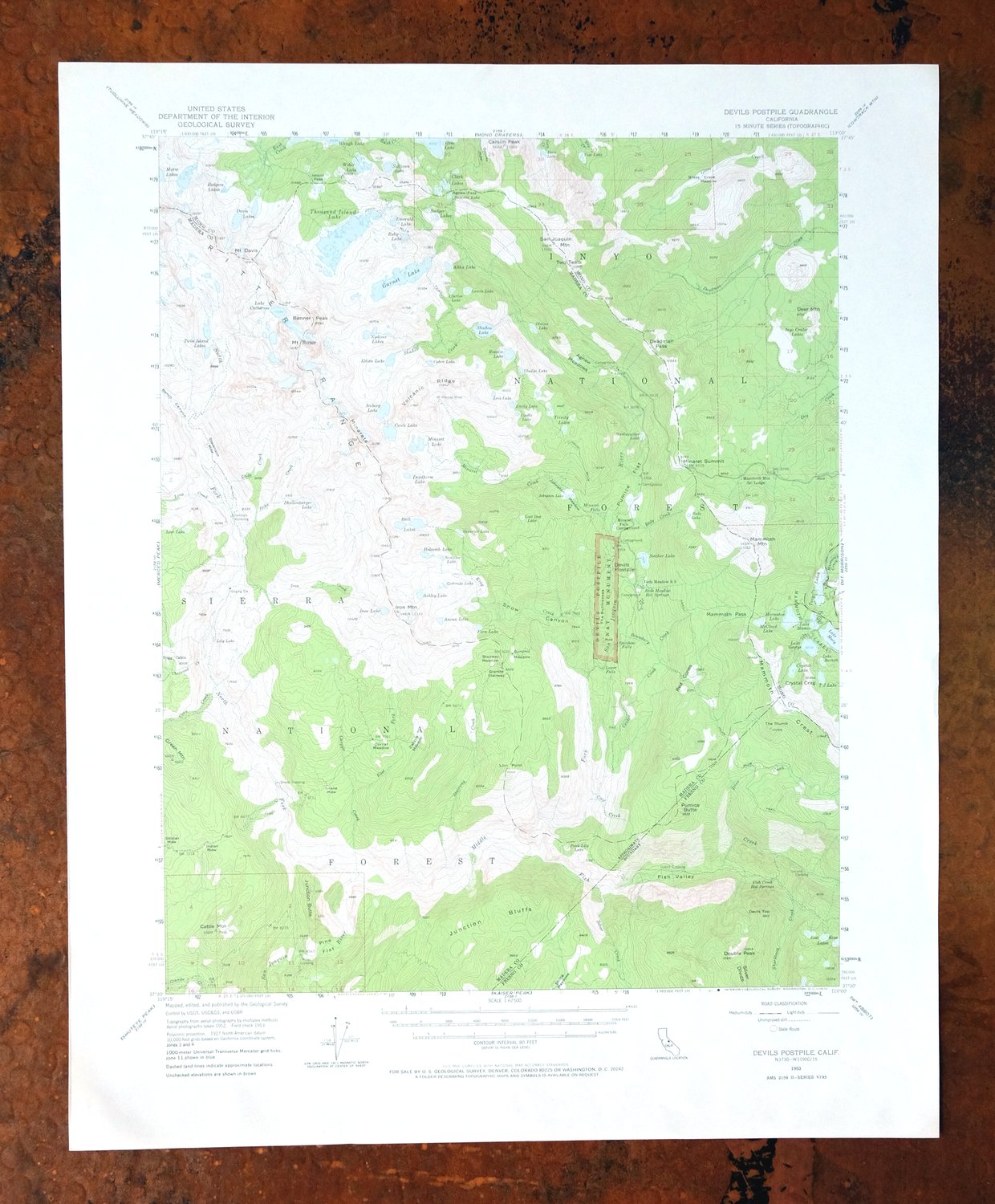
| TITLE | Devils Postpile |
| STATE | California |
| LOCATION | Vicinity of Mammoth Lakes, 70 miles northeast of Fresno |
| SERIES | 15-minute |
| SURVEYED | 1952 and 1953 Aerial and Field Survey |
| EDITION | 1953 |
| PRINTED | 1970 |
| PRINT NOTES | Thick paper stock, includes woodland tint (green to indicate vegetated areas) |
| SCALE | 1:62500 |
| CONTOUR INTERVAL | 80 feet |
| SHEET DIMENSIONS | 18 x 22 inches |
| MAP DIMENSIONS | 13 7/8 x 17 1/2 inches |
| COVERAGE AREA | 14 x 17 miles |
| SHEET CONDITION For maps of this vintage, effort is made to note all visible flaws, no matter how minor. | |
| OVERALL CONDITION | Excellent |
| SHEET NOTES | lightly handled, never folded |
| MAP AREA | flawless map area |
| COLLARS | no wear or tears, no markings, no blemishes |
| MAP COVERAGE Quadrangle extent overlaid on current basemap. | |
| PLACENAMES Depending on map series and survey date, all of the features listed below may not be shown on this map. This list contains features that currently exist or historically existed within the area covered by the map. The list can be used as a reference to determine if this map covers your area of interest. Placenames are listed alphabetically next to each feature type. | |
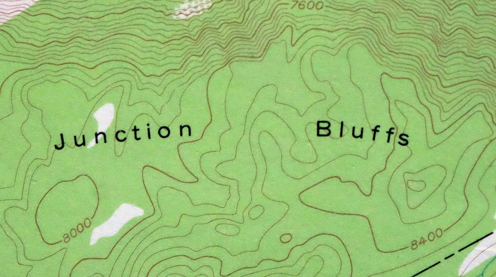
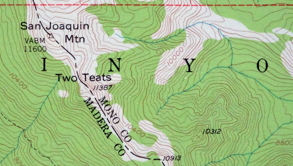
| NOTABLE PLACES | Ritter Range, Mammoth Mountain Ski, and Mammoth Lakes |
| COUNTIES COVERED | Fresno, Madera, and Mono |
| FEDERAL LAND UNITS | Ansel Adams Wilderness, Devil's Postpile National Monument, Inyo National Forest, John Muir Wilderness, and Sierra National Forest |
| RIVERS AND STREAMS | Boundary Creek, Cargyle Creek, Chetwood Creek, Cold Creek, Cora Creek, Crater Creek, Deadman Creek, Deer Creek, Dike Creek, Dry Creek, East Fork Cargyle Creek, Fern Creek, Fish Creek, Glass Creek, Granite Creek, Iron Creek, King Creek, Long Creek, Mammoth Creek, Middle Fork San Joaquin River, Minaret Creek, North Fork San Joaquin River, Reds Creek, Rush Creek, San Joaquin River, Shadow Creek, Sharktooth Creek, Silver Creek, Slide Creek, and Stairway Creek |
| WATER BODIES | Altha Lake, Anona Lake, Ashley Lake, Beck Lakes, Cabin Lake, Lake Catherine, Cecile Lake, Crystal Lake, Davis Lakes, Deadhorse Lake, Ediza Lake, Emerald Lake, Emily Lake, Fern Lake, Garnet Lake, Gem Lake, Lake George, Gladys Lake, Holcomb Lake, Horseshoe Lake, Iceberg Lake, Iron Lake, Laura Lake, Lost Keys Lakes, Lost Lake, Lake Mamie, Marie Lakes, Lake Mary, Minaret Lake, Nydiver Lakes, Olaine Lake, Rosalie Lake, Ruby Lake, Shadow Lake, Sotcher Lake, Sullivan Lake, T J Lake, Thousand Island Lake, Twin Island Lakes, Twin Lakes, Waugh Lake, Weber Lake, and Yost Lake |
| Locations: Agnew Meadows Campground, Agnew Meadows Group Campground, Bugg Cabin, Devils Postpile Recreation Site, Inyo Craters Campground, Lower Deadman Campground, Mammoth Mountain Main Lodge, Minaret Falls Campground, Minaret Vista Picnic Area, Pumice Flat Campground, Pumice Flat Forest Service Station, Pumice Flat Group Campground, Reds Meadow Campground, Reds Meadow Ranger Station, Seventyseven Corral, Soda Springs Campground, Sotcher Lake Picnic Area, Tamarack Cross Country Ski Center, and Upper Deadman Group Campground. Mountain Ranges: Ritter Range. Mountains, Peaks, and Summits: Banner Peak, Carson Peak, Cattle Mountain, Crystal Crag, Mount Davis, Deer Mountain, Devils Top, Double Peak, Granite Stairway, Green Mountain, Iron Mountain, Junction Butte, June Mountain, Lion Point, Mammoth Mountain, Minaret Summit, Minarets, Pumice Butte, Red Cones, Red Top Mountain, Mount Ritter, San Joaquin Mountain, Two Teats, and White Wing Mountain. Valleys and Canyons: Bench Canyon, Fish Valley, and Snow Canyon. Parks: Ansel Adams Wilderness and Devils Postpile National Monument. Drainages: Boundary Creek, Cargyle Creek, Chetwood Creek, Cold Creek, Cora Creek, Crater Creek, Deer Creek, Dike Creek, East Fork Cargyle Creek, Fish Creek, Iron Creek, King Creek, Long Creek, Middle Fork San Joaquin River, Minaret Creek, North Fork San Joaquin River, Reds Creek, Shadow Creek, Sharktooth Creek, Silver Creek, Slide Creek, and Stairway Creek. Mines: Minaret Mine. Lakes and Ponds: Alstot Lake, Altha Lake, Anona Lake, Ashley Lake, Badger Lakes, Lake Barrett, Beck Lakes, Bench Lakes, Cabin Lake, Castle Lake, Lake Catherine, Cecile Lake, Clarice Lake, Clark Lakes, Crystal Lake, Davis Lakes, Deadhorse Lake, Ediza Lake, Emerald Lake, Emily Lake, Fern Lake, Garnet Lake, Lake George, Gertrude Lake, Gladys Lake, Holcomb Lake, Horseshoe Lake, Iceberg Lake, Inyo Crater Lakes, Iron Lake, Johnston Lake, Laura Lake, Lily Lake, Lost Dog Lake, Lost Keys Lakes, Lost Lake, Lake Mamie, Mammoth Lakes, Marie Lakes, Lake Mary, McCloud Lake, McLeod Lake, Minaret Lake, Noname Lake, Nydiver Lakes, Olaine Lake, Pond Lily Lake, Reds Lake, Rodgers Lakes, Rosalie Lake, Ruby Lake, Shadow Lake, Shellenbarger Lake, Sotcher Lake, Starkweather Lake, Straube Lake, Sullivan Lake, Summit Lake, Superior Lake, T J Lake, Thousand Island Lake, Trinity Lakes, Twin Island Lakes, Twin Lakes, Vivian lake, Weber Lake, and Yost Lake. Buildings: Canyon Lodge. Waterfalls: Lower Rainbow Falls, Minaret Falls, Rainbow Falls, and Twin Falls. Crossings: Hemlock Crossing, Island Crossing, Miller Crossing, and Second Crossing. Bluffs: The Buttresses, Devils Postpile, and Junction Bluffs. Gaps: Agnew Pass, Deadman Pass, Island Pass, and Mammoth Pass. Basins: Bottomless Pit. Ridges: Dragons Back and Volcanic Ridge. Flats: Agnew Meadows, Buckhorn Meadow, Bugg Meadow, Cargyle Meadow, Corral Meadow, Crater Flat, Earthquake Meadow, Fox Meadow, Glass Creek Meadow, Headquarters Meadow, Indian Meadow, Johnston Meadow, Naked Lady Meadow, Pine Flat, Pumice Flat, Reds Meadow, Snake Meadow, Spano Meadow, Spooky Meadow, Stairway Meadow, Stevenson Meadow, Summit Meadow, and Yost Meadow. Towers: KMMT-FM (Mammoth Lakes). Pillars: The Thumb. Springs: Iva Bell Hot Springs, Reds Meadow Hot Springs, and Soda Springs. | |
| SHIPPING AND RETURNS | |
 This map sheet will be carefully rolled in a sturdy tube and shipped via the US Postal Service. If you find that the sheet you receive is not as described in the listing, you may ship it back to us for a refund of the purchase price. | |
1970 Devils Postpile California USGS Topo Map: Ritter Range
$36
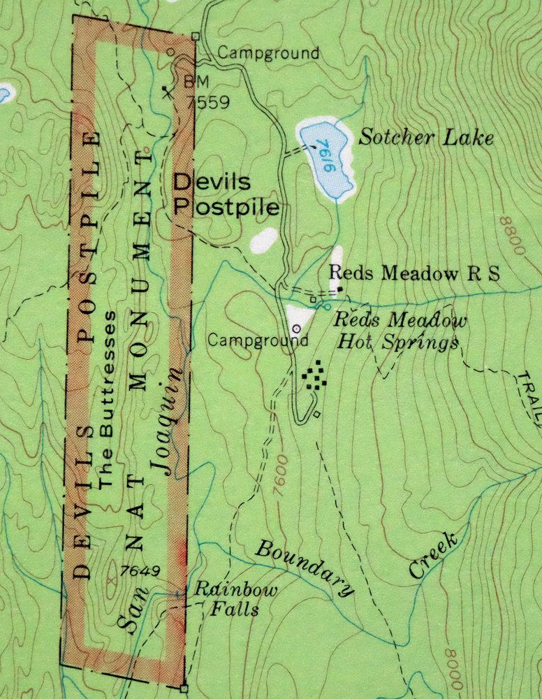
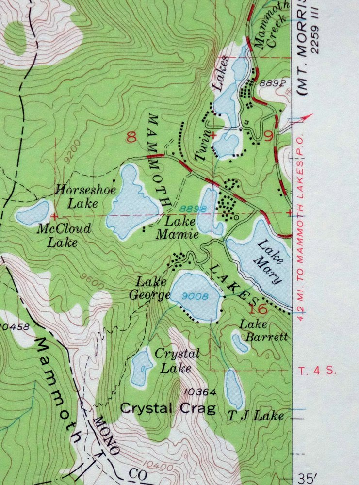
This is a 1953 edition of the Devils Postpile quadrangle in California’s eastern Sierra Nevada, printed in 1970 at 1:62,500 and mapped from 1952 and 1953 aerial and field surveys. The quad covers rugged high country near Mammoth Lakes, including the Ritter Range, Mammoth Mountain, and portions of the Sierra and Inyo national forests, with parts of the John Muir and Ansel Adams wilderness areas and Devils Postpile National Monument. The monument’s columnar basalt formation draws visitors each summer, and this sheet, never folded and in excellent condition, would frame well for anyone drawn to that landscape.
In stock
This vintage sheet is a 1953 edition of the Devils Postpile California USGS topographic map. It is an original 56-year-old 1970 United States Geological Survey print in excellent condition.
HOW THIS MAP CAN BE USED
In addition to making a fascinating conversation piece, this sheet would look great in a frame or on display, make a unique and prized gift for anyone interested in this area, be perfect as a reference for genealogy studies or general historical research, or fill that missing piece in your collection. Maps of this vintage are printed on durable stock and are well-suited for outdoor activities and recreation of all kinds, including hiking, backpacking, hunting, rafting and kayaking, backcountry skiing, geocaching, general exploration, treasure hunting, etc.
FEATURES SHOWN ON THE MAP
The Devils Postpile 15-minute map shows cities and towns, roads, railroads, utilities and energy infrastructure, rivers, creeks, elevation contour lines, public land survey lines, county, state, and other administrative boundaries as they existed at the time of the survey in 1952 and 1953. All known structures (houses, businesses, churches, schools, barns, cabins, etc) are also shown.
A VALUABLE HISTORICAL RECORD
Maps from the 15-minute series for the continental United States are no longer produced or printed by the USGS and original prints are becoming increasingly difficult to find. They are a valuable historical record for an area, as they contain many placenames and features that have been dropped from more recent maps.
Nearby maps
-
Mount Morrison California Mammoth Lakes USGS Topo Map 1974
$52 Add to cart -
1978 USGS Topo Map: Merced Peak, Yosemite, California
$38 Add to cart -
1973 USGS Topo Map: Tuolumne Meadows, California
$48 Add to cart -
1964 Cowtrack Mountain California USGS Topo Map: Mono Lake
$45 Add to cart -
1973 USGS Topo Map: Mount Abbot, Sierra Nevada, California
$43 Add to cart -
1975 USGS Topo Map: Casa Diablo Mountain, California
$40 Add to cart -
Hetch Hetchy Reservoir California USGS Topo Map 1973 Vintage
$39 Add to cart -

1968 USGS Topo Map: Mount Tom, Paradise, California
$45 Add to cart -
Huntington Lake California Shaver Lake USGS Topo Map 1968
$40 Add to cart -
1971 USGS Topo Map: Matterhorn Peak, California
$46 Add to cart -
Blackcap Mountain California USGS Topo Map 1972 Vintage
$40 Add to cart -
1973 USGS Topo Map: Shaver Lake, Meadow Lakes, California
$42 Add to cart -
Tower Peak California USGS 15-Min Topo Map 1972 Vintage
$40 Add to cart -
Bishop California West Bishop Laws USGS Topographic Map 1969
$40 Add to cart -
Fales Hot Springs California USGS Topo Map 1971 Vintage
$20 Add to cart -
1952 USGS Topo Map: Big Pine, California
$44 Add to cart -

Le Grand California Madera Chowchilla USGS Topo Map 1963
$14 Add to cart -
1965 USGS Topo Map: Waucoba Mountain, California
$38 Add to cart -

Mount Pinchot California USGS 15-Min Topo Map 1969 Vintage
$18 Add to cart -
1966 Dardanelles Cone California USGS Topo Map
$40 Add to cart -

Kinsley California USGS 7.5-Min Topographic Map 1949 Vintage
$32 Add to cart -

Jawbone Ridge California Buck Meadows USGS Topo Map 1949
$27 Add to cart -

Raynor Creek California Chowchilla River USGS Topo Map 1947
$30 Add to cart -
Kismet California Madera USGS 7.5-Min Topo Map 1948 Vintage
$32 Add to cart