MAP DETAILS | |
|---|---|
| TITLE | Gould |
| STATE | Colorado |
| SURVEYED | 1955 and 1956 Aerial and Field Survey |
| PRINT NOTES | Thick paper stock, includes woodland tint (green to indicate vegetated areas) |
| SCALE | 1:62500 |
| CONTOUR INTERVAL | 40 feet |
| SHEET DIMENSIONS | 18 x 22 inches |
| MAP DIMENSIONS | 13 1/4 x 17 1/2 inches |
| COVERAGE AREA | 13 x 17 miles |
| SHEET CONDITION For maps of this vintage, effort is made to note all visible flaws, no matter how minor. | |
| SHEET NOTES | very lightly handled, never folded |
| MAP AREA | flawless map area |
| COLLARS | no wear or tears, no markings, no blemishes |
| MAP COVERAGE Quadrangle extent overlaid on current basemap. | |
| PLACENAMES Depending on map series and survey date, all of the features listed below may not be shown on this map. This list contains features that currently exist or historically existed within the area covered by the map. The list can be used as a reference to determine if this map covers your area of interest. Placenames are listed alphabetically next to each feature type. | |
| NOTABLE PLACES | North Park |
| COUNTIES COVERED | Jackson and Larimer |
| FEDERAL LAND UNITS | Arapaho National Wildlife Refuge, Rawah Wilderness, Roosevelt National Forest, and Routt National Forest |
| RIVERS AND STREAMS | Allen Creek, Canadian River, Clear Creek, Deer Creek, Dry Fork Owl Creek, Illinois River, Kelly Creek, Mc Nally Creek, Michigan River, Mill Creek, Muddy Creek, North Fork Canadian River, Owl Creek, Sage Hen Creek, Sales Creek, Soap Creek, South Fork Michigan River, Spring Creek, and Willow Creek |
| WATER BODIES | Jackson Reservoir and Shawver Reservoir |
| Locations: Aspen Campground, Burr Ranch, Cameron Pass 4-H Club Camp, Colter Ranch, Dickens Ranch, Dodge Ranch, Gould Ranch, Hoover Roundup, Illinois Ranch, Howard Ranch, Johnson Ranch, Lobau Ranch, Mace Ranch, Michigan River Ranger Station, Overton Ranch, Ray Ranch, Riley Ranch, Rogerson Ranch, Smith Ranch, Stelbars Connor Ranch, Stelbars Michigan River Ranch, Three Rivers Ranch, and Vils Ranch. Mountains, Peaks, and Summits: Bull Mountain, Custer Mountain, Elk Mountain, Johnny Moore Mountain, and Michigan Hill. Valleys and Canyons: Alderdice Draw, Ballinger Draw, Bottom Draw, Bush Draw, Cat Canyon, Custer Draw, and Kimmons Draw. Trails: Jack Dickens Trail. Drainages: Allen Creek, Clear Creek, Deer Creek, Dry Creek, Dry Fork Michigan River, Dry Fork Owl Creek, Indian Creek, Kelly Creek, McKenzie Creek, McNally Creek, Meadow Creek, Mill Creek, Muddy Creek, No Name Creek, North Fork Canadian River, Owl Creek, Peterson Creek, Sage Hen Creek, Sales Creek, South Fork Canadian River, South Fork Michigan River, Spring Creek, and Willow Creek. Mines: Canadian Strip Mine, Capron Mine, Conrad Coal Mine, Kerr Mine, Lang Prospect, Manning Coal Mines, Marr Mine, Marr Mines, Monolith Mine, Sudduth Coal Mine, and Winscom Mine. Dams: North Michigan Creek Dam and Shawver Dam. Canals: Bonafide Ditch, Bonafide Ditch Number 2, Bostwick Ditch, Bradfield Ditch, Fernando Ditch, First Extension Owl Ditch, Carden Dagle Ditch, Carpenter Ditch Number 1, Cleveland Ditch, Curtin Ditch, Dale Ditch, Deer Ditch, Domestic Supply Ditch, Edith Ditch, Endomile Ditch, Fox Ditch, Georgia Ditch, Gibbs Ditch, Gillette Ditch Number 1, Gillette Ditch Number 2, Gillette Ditch Number 3, Gould Ditch, Hill and Crouter Ditch, Howard Ditch, Ish Baldwin Ditch, Jakey Ditch, Kelley Ditch, Kelley Highline and Kermode Ditch Number 2, Kenney Ditch, Kermode Ditch, Last Treasure and Georgia Ditch, Longhorn Ditch, Lost Treasure Ditch, Lower Walden Ditch, Lowland Ditch, Lynch Ditch, Mac Farlane Ditch, Mason Ditch, Mathews Eastern Ditch, Michigan Association Ditch, Midland Supply Ditch, Nellie E Ditch, Old S C Ditch, Orb Ditch, Overland Ditch, Owl Ditch, Owl Mountain Ditch, Owl Mountain and Domestic Supply and Mason Ditch, Pioneer Ditch, Pomroy Ditch, Pomroy Ditch Number 2, Poverty Flat Ditch Number 1, Poverty Flat Ditch Number 2, Ravine Ditch, Riley Extension Ditch, Sales Ditch Number 2, Smith Ditch, Soldiers Home Ditch, Spear Ditch, Spear and Michigan Highline Ditch, Squibob Ditch, Stemmer Ditch, Sudduth Ditch Number 1, Toledo Ditch, Troublesome Ditch, Vita Ditch, Wagon Wheel Ditch, Walden Ditch, and Wales Ditch. Schools: Haworth School. Ridges: Owl Ridge. Reservoirs and Tanks: North Michigan Creek Reservoir, Rand Reservoir, Shawver Reservoir, and Thirty One Reservoir. Flats: Brown Park and Muddy Park. Springs: Road Spring. | |
| SHIPPING AND RETURNS | |
 Ships carefully rolled in a sturdy 2" x 24" mailing tube. Shipping and return details are in our terms. | |
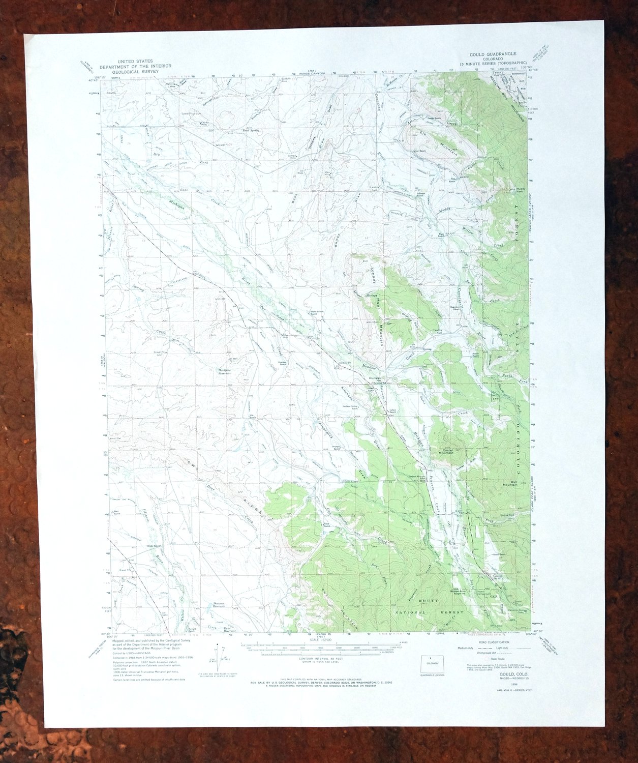
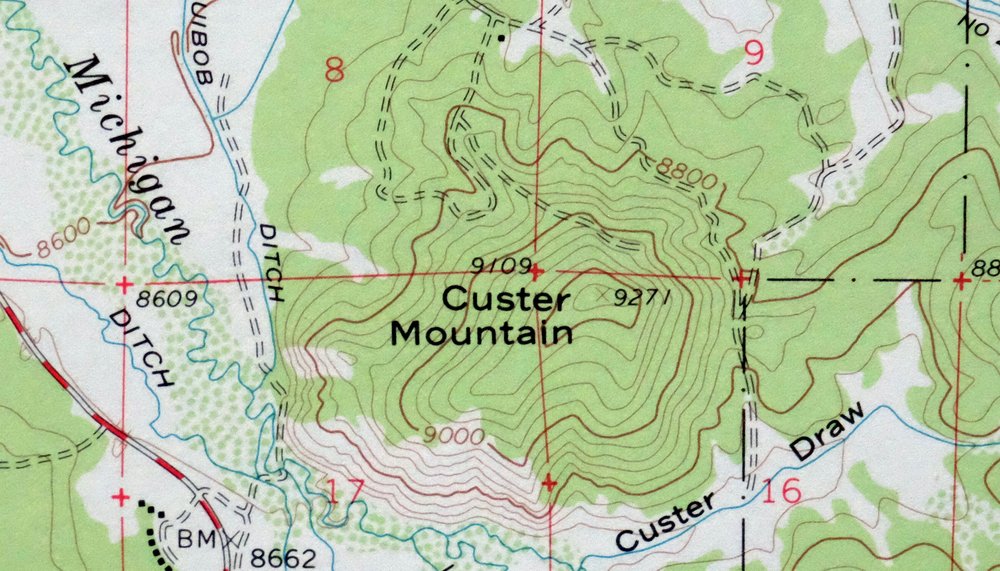
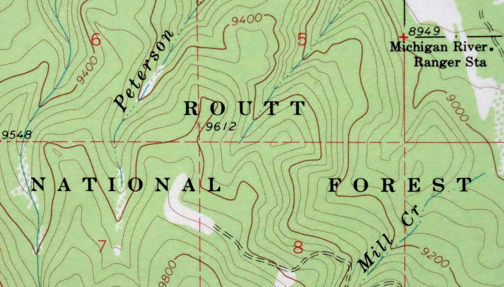
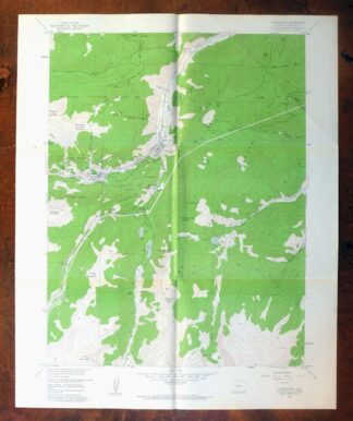
Gould, Colorado 1956 USGS Topo Map: North Park
$37
- 10 miles southeast of Walden.
- 15-minute series, 1956 edition, printed in 1969.
- Excellent condition, never folded.
In stock
This vintage sheet is a 1956 edition of the Gould Colorado USGS topographic map. It is an original 57-year-old 1969 United States Geological Survey print in excellent condition.
HOW THIS MAP CAN BE USED
In addition to making a fascinating conversation piece, this sheet would look great in a frame or on display, make a unique and prized gift for anyone interested in this area, be perfect as a reference for genealogy studies or general historical research, or fill that missing piece in your collection. Maps of this vintage are printed on durable stock and are well-suited for outdoor activities and recreation of all kinds, including hiking, backpacking, hunting, rafting and kayaking, backcountry skiing, geocaching, general exploration, treasure hunting, etc.
FEATURES SHOWN ON THE MAP
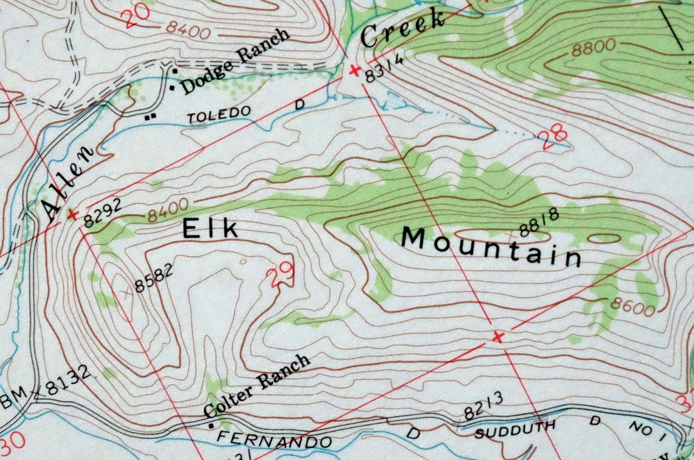
The Gould 15-minute map shows cities and towns, roads, railroads, utilities and energy infrastructure, rivers, creeks, elevation contour lines, public land survey lines, county, state, and other administrative boundaries as they existed at the time of the survey in 1955 and 1956. All known structures (houses, businesses, churches, schools, barns, cabins, etc) are also shown.
A VALUABLE HISTORICAL RECORD
Maps from the 15-minute series for the continental United States are no longer produced or printed by the USGS and original prints are becoming increasingly difficult to find. They are a valuable historical record for an area, as they contain many placenames and features that have been dropped from more recent maps.
Nearby maps
-
Kings Canyon, Colorado/Wyoming 1955 USGS Topo Map
$29 Add to cart -
Rand, Colorado 1956 USGS Topo Map (1974 Print)
$34 Add to cart -
Hyannis Peak, Colorado 1956 USGS Topo Map: Rabbit Ears Range
$37 Add to cart -
Mount Ethel, Colorado 1955 USGS Topo Map (1974 Print)
$40 Add to cart -

Pearl, Colorado 1956 USGS Topo Map: Park Range
$35 Add to cart -
Hot Sulphur Springs, Colorado 1957 USGS Topo Map
$33 Add to cart -
Gore Pass, Colorado 1956 USGS Topo Map: Red Dirt Reservoir
$40 Add to cart -
Ute Peak, Colorado 1933 USGS Topo Map (1971 Print)
$36 Add to cart -
1923 USGS Topo Map: Pilot Knob, Colorado (1963 Print)
$32 Add to cart -

Mount Powell, Colorado 1940 USGS Topo Map: Gore Range
$27 Add to cart -

Mount Powell, Colorado 1933 USGS Topo Map (1974 Print)
$41 Add to cart -

Daton Peak, Colorado 1916 USGS Topo Map (1965 Print)
$23 Add to cart -
Trail Ridge, Colorado 1957 USGS Topo Map
$23 Add to cart -
Mchenrys Peak, Colorado 1957 USGS Topo Map
$33 Add to cart -

Estes Park, Colorado 1961 USGS Topo Map
$31 Add to cart -
Lyons, Altona, Colorado 1957 USGS Topo Map
$33 Add to cart -
1942 USGS Topo Map: Nederland, Eldora, Colorado (1964 Print)
$34 Add to cart -
Boulder, Glendale, Colorado 1957 USGS Topo Map
$38 Add to cart -
1942 USGS Topo Map: Tungsten, Barker Reservoir, Colorado
$39 Add to cart -
1942 USGS Topo Map: Central City, Colorado (1964 Print)
$31 Add to cart -
1942 USGS Topo Map: Eldorado Springs, Colorado (1961 Print)
$36 Add to cart -
Vail East, Colorado 1970 USGS Topo Map: Gore Range
$36 Add to cart -
Vail West, Colorado 1970 USGS Topo Map: Gore Creek
$34 Add to cart -
1957 USGS Topo Map: Georgetown, Silver Plume, Colorado
$32 Add to cart