MAP DETAILS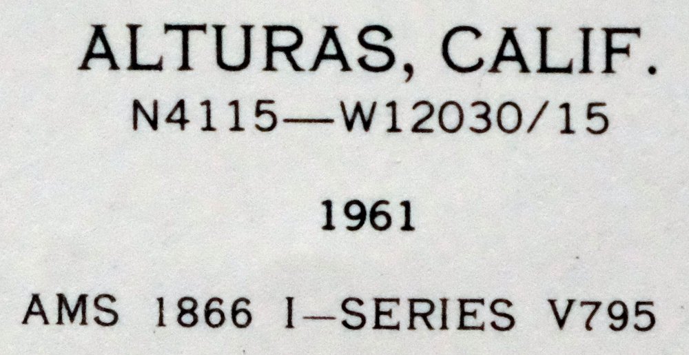 | |
|---|---|
| TITLE | Alturas |
| STATE | California |
| SURVEYED | 1958 and 1961 Aerial and Field Survey |
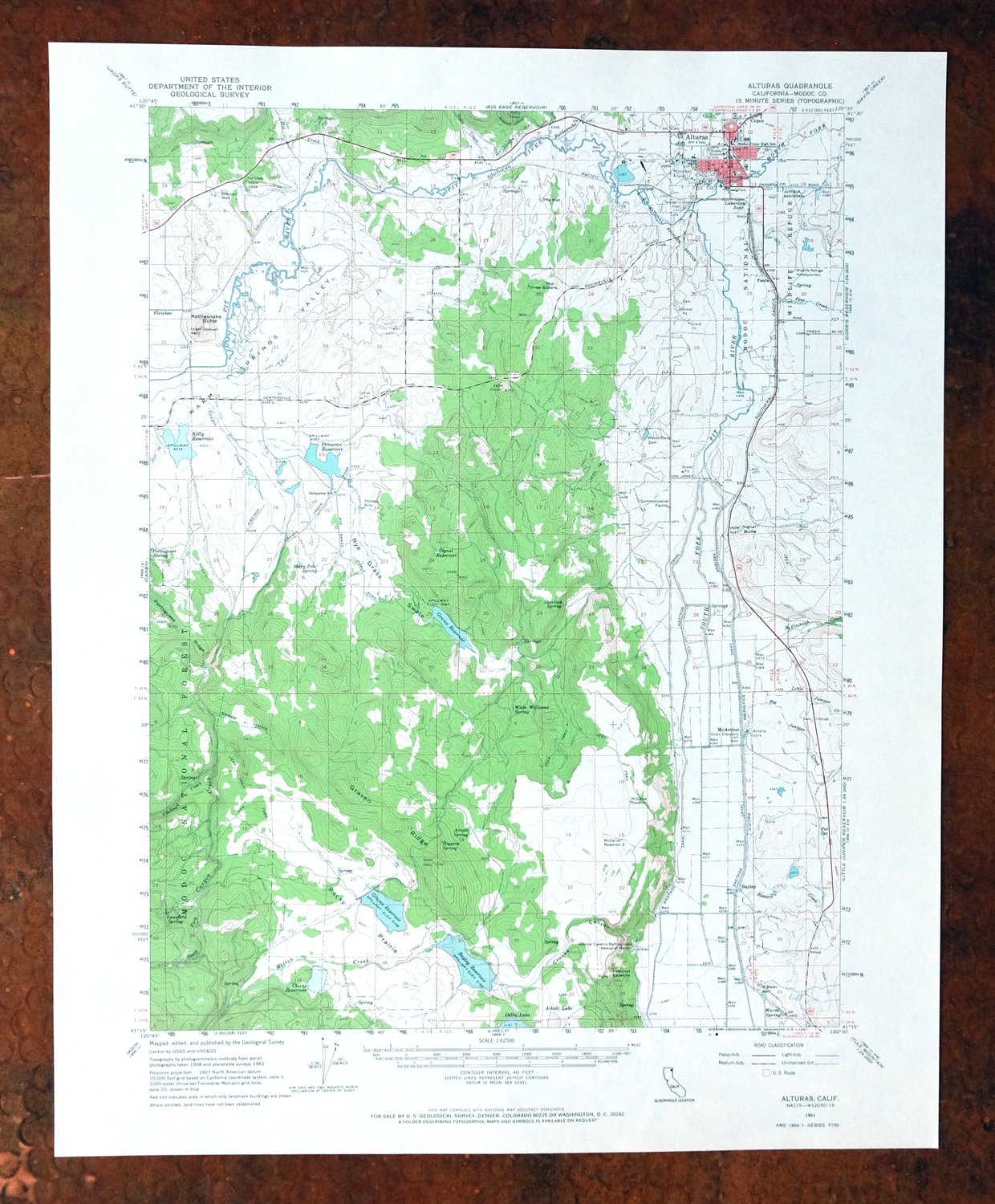
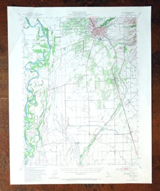
| PRINT NOTES | Thick paper stock, includes woodland tint (green to indicate vegetated areas). A reddish tint is used to indicate urban areas where only landmark buildings are shown. |
| SCALE | 1:62500 |
| CONTOUR INTERVAL | 40 feet |
| SHEET DIMENSIONS | 17 x 21 inches |
| MAP DIMENSIONS | 13 1/8 x 17 1/2 inches |
| COVERAGE AREA | 13 x 17 miles |
| SHEET CONDITION For maps of this vintage, effort is made to note all visible flaws, no matter how minor. | |
| SHEET NOTES | very lightly handled, never folded, smooth and flat |
| MAP AREA | flawless map area |
| COLLARS | no wear or tears, no markings, no blemishes |
| MAP COVERAGE Quadrangle extent overlaid on current basemap. | |
| PLACENAMES Depending on map series and survey date, all of the features listed below may not be shown on this map. This list contains features that currently exist or historically existed within the area covered by the map. The list can be used as a reference to determine if this map covers your area of interest. Placenames are listed alphabetically next to each feature type. | |
| NOTABLE PLACES | McArthur, Donavan Reservoir, Modoc National Forest, and Warm Springs Valley |
| CITIES AND TOWNS (CURRENT) | Alturas |
| COUNTIES COVERED | Modoc |
| FEDERAL LAND UNITS | Alturas Rancheria and Modoc National Wildlife Refuge |
| RIVERS AND STREAMS | Big Juniper Creek, Canyon Creek, Fitzhugh Creek, Horse Creek, Hot Creek, Noble Creek, North Fork Pit River, Pine Creek, Pit River, Rattlesnake Creek, and South Fork Pit River |
| WATER BODIES | Bayley Reservoir, Clarks Reservoir, Delta Lake, Donovan Reservoir, Graven Reservoir, Graves Reservoir, and Kelly Reservoir |
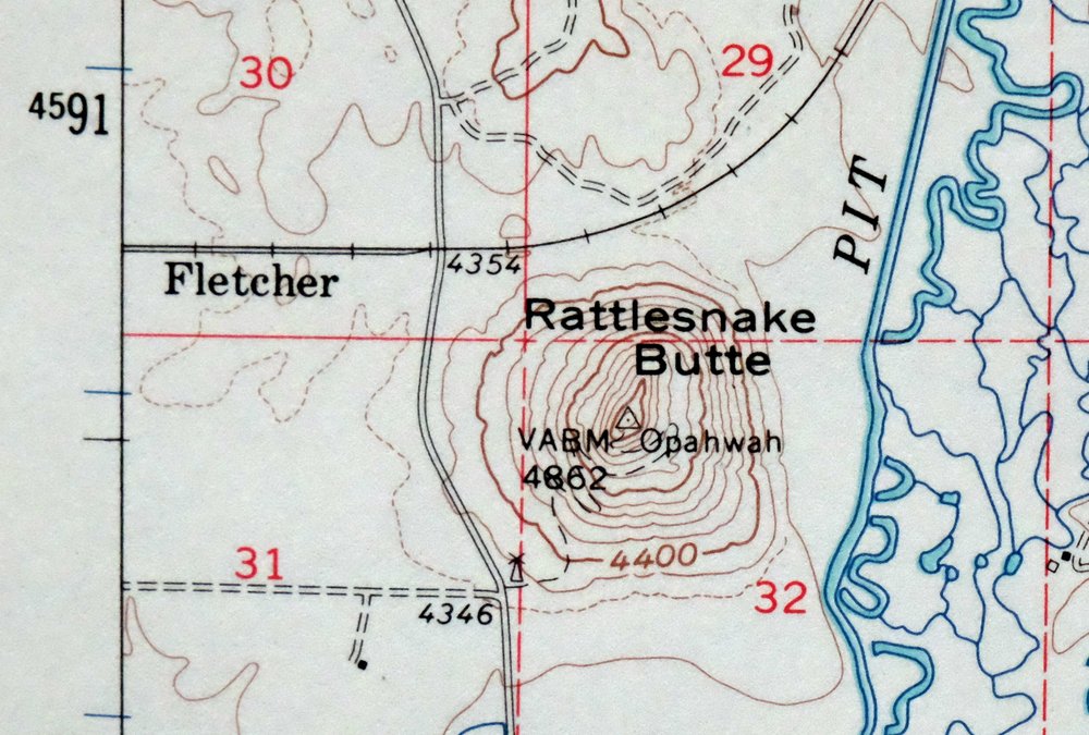
| Locations: Alturas Rancheria, Alturas Yard, Beet Camp, Coop, Corporation Ranch, and Fitzhigh Creek Ranch. Mountains, Peaks, and Summits: The Hat, Rattlesnake Butte, Signal Butte, and The Three Sisters. Valleys and Canyons: Crooks Canyon, Daggert Canyon, Rye Grass Swale, and Sheep Gulch. Parks: Infernal Caverns Battleground Memorial Monument and Modoc National Wildlife Refuge. Drainages: Big Juniper Creek, Canyon Creek, Fitzhugh Creek, Hilton Creek, Hot Creek, Jim Creek, Little Juniper Creek, Noble Creek, North Fork Pit River, Pine Creek, Rattlesnake Creek, Rock Creek, Romero Creek, South Fork Canyon Creek, and South Fork Pit River. Churches: Alturas Baptist Church, Alturas Gospel Mission, Alturas Seventh Day Adventist Church, Bahai Faith Church, Christian Life Assembly Church, Church of Christ, Church of the Nazarene, Faith Baptist Church, Kingdom Hall of Jehovahs Witnesses, Sacred Heart Catholic Church, and Saint Michaels Episcopal Church. Hospitals: Modoc Medical Center. Lakes and Ponds: Alkali Lake, Duck Pond, and Goose Pond. Buildings: Modoc County Courthouse. Dams: Bayley Reservoir 1118 Dam, Donovan 179 Dam, Graven 136-002 Dam, Lindauer Concrete 1110 Dam, McBrien 110 Dam, Pickering Lumber 111 Dam, Rye Grass Swale 150 Dam, and Woods Place Dam. Canals: Eastside Canal and Westside Canal. Airports: Alturas Municipal Airport, California Pines Airport, and Winema Airstrip. Schools: Alturas Elementary School, Delmorma School, Modoc High School, Modoc Middle School, and Warner High School. Ridges: Graven Ridge. Reservoirs and Tanks: Bayley Reservoir, Clarks Reservoir, Donovan Reservoir, Graven Reservoir, Graves Reservoir, Kelly Reservoir, McBrien Reservoir, McGarva Reservoir, McGarva Reservoir Two, Signal Reservoir, and Teal Pond. Flats: Rocky Prairie. Towers: KCNO-AM (Alturas). Springs: Arnett Spring, Higgins Spring, Lunsford Spring, Mary Pete Spring, Pat Spring, Portuguese Spring, Sherlock Spring, Wade Williams Spring, and Warm Spring. Slopes: Barnes Grade. | |
| SHIPPING AND RETURNS | |
 Ships carefully rolled in a sturdy 2" x 18" mailing tube. Shipping and return details are in our terms. | |
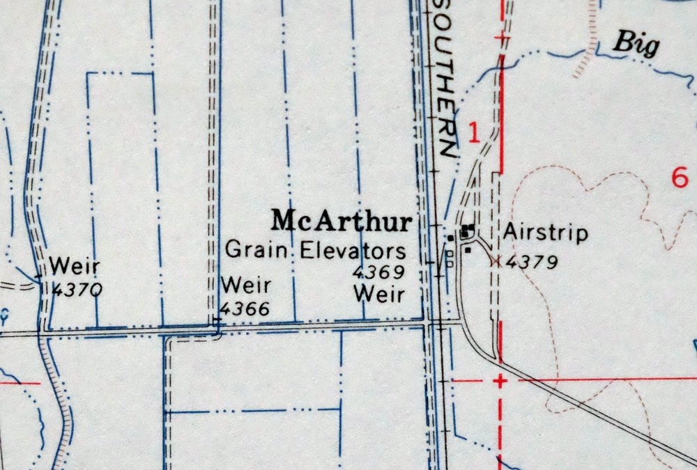
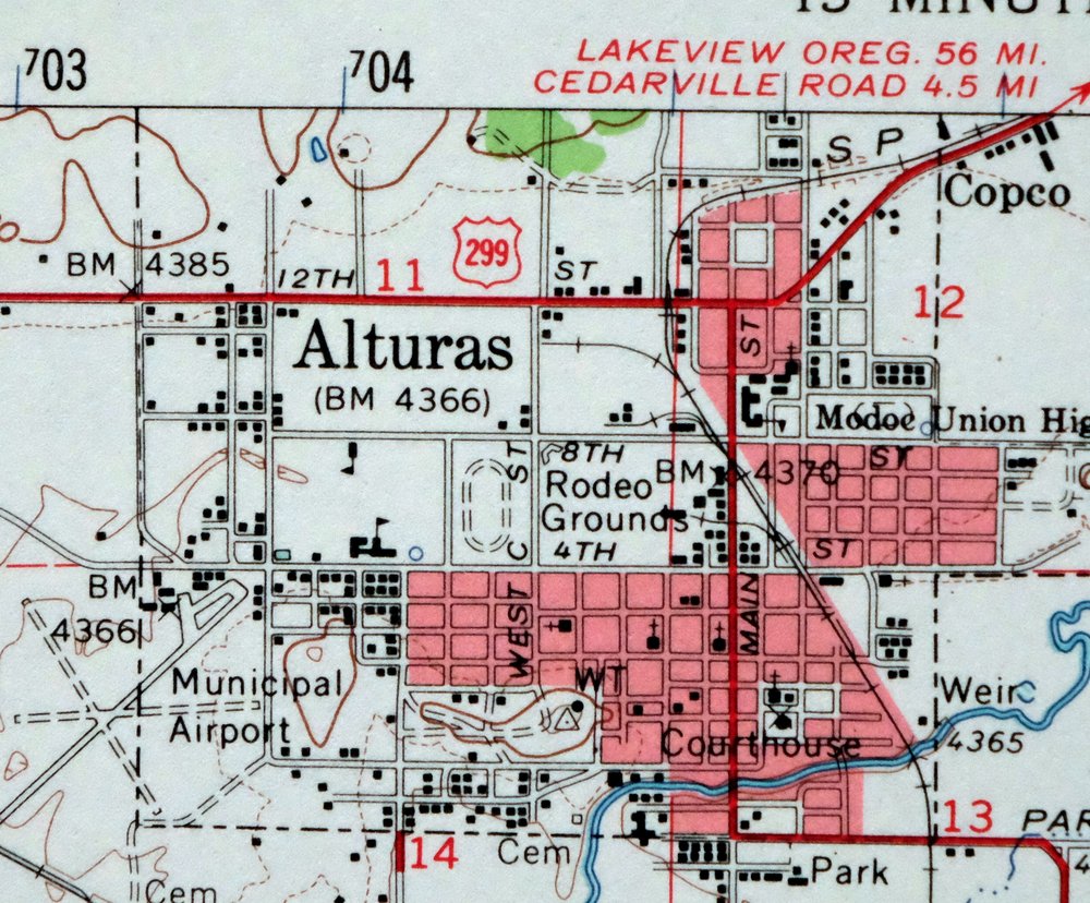
Alturas, California 1961 USGS Topo Map: McArthur
$39
- 65 miles north of Susanville, CA.
- 15-minute series, 1961 edition, printed in 1967.
- Excellent condition, never folded.
In stock
This vintage sheet is a 1961 edition of the Alturas California USGS topographic map. It is an original 59-year-old 1967 United States Geological Survey print in excellent condition.
HOW THIS MAP CAN BE USED
In addition to making a fascinating conversation piece, this sheet would look great in a frame or on display, make a unique and prized gift for anyone interested in this area, be perfect as a reference for genealogy studies or general historical research, or fill that missing piece in your collection. Maps of this vintage are printed on durable stock and are well-suited for outdoor activities and recreation of all kinds, including hiking, backpacking, hunting, rafting and kayaking, backcountry skiing, geocaching, general exploration, treasure hunting, etc.
FEATURES SHOWN ON THE MAP
The Alturas 15-minute map shows cities and towns, roads, railroads, utilities and energy infrastructure, rivers, creeks, elevation contour lines, public land survey lines, county, state, and other administrative boundaries as they existed at the time of the survey in 1958 and 1961. A reddish tint is used on this sheet to indicate urban areas where only landmark buildings are depicted. Outside of those areas, all known structures (houses, businesses, churches, schools, barns, cabins, etc) are shown.
A VALUABLE HISTORICAL RECORD
Maps from the 15-minute series for the continental United States are no longer produced or printed by the USGS and original prints are becoming increasingly difficult to find. They are a valuable historical record for an area, as they contain many placenames and features that have been dropped from more recent maps.
Nearby maps
-
Big Sage Reservoir, California 1962 USGS Topo Map
$35 Add to cart -
Cedarville, California 1962 USGS Topo Map: Lake City
$35 Add to cart -
Fredonyer Peak, California 1954 USGS Topo Map (1972 Print)
$27 Add to cart -
Tulelake, California/Oregon 1951 USGS Topo Map (1970 Print)
$32 Add to cart -
Susanville, California 1954 USGS Topo Map: Lake leavitt
$35 Add to cart -
Litchfield, California 1954 USGS Topo Map (1972 Print)
$39 Add to cart -
Westwood, California 1955 USGS Topo Map: Coppervale
$37 Add to cart -
Dorris, Somerset, California 1950 USGS Topo Map
$39 Add to cart -
Manzanita Lake, California 1956 USGS Topo Map (1974 Print)
$38 Add to cart -
Shasta, California 1954 USGS Topo Map: McCloud
$35 Add to cart -
Mount Harkness, California 1956 USGS Topo Map (1978 Print)
$35 Add to cart -
Milford, California 1950 USGS Topo Map: Honey Lake
$39 Add to cart -
1954 USGS Topo Map: Copco, Agar, California (Original Print)
$39 Add to cart -
Lamoine, Shasta Lake, California 1957 USGS Topo Map
$41 Add to cart -
1950 USGS Topo Map: Chilcoot, California/Nevada (1983 Print)
$39 Add to cart -
Panther Spring, Lassen NF, California 1953 USGS Topo Map
$35 Add to cart -
1893 USGS Topo Map: Disaster, Adler Creek, Nevada
$69 Add to cart -
Sierraville, California 1955 USGS Topo Map: Calpine
$41 Add to cart -

Richardson Springs, California 1952 USGS Topo Map: Chico
$30 Add to cart -
Loyalton, California/Nevada 1955 USGS Topo Map (1980 Print)
$41 Add to cart -
Reno, Nevada 1950 USGS Topo Map: Toiyabe NF (1972 Print)
$18 Add to cart -
1955 USGS Topo Map: Cecilville, California (1974 Print)
$33 Add to cart -
1951 USGS Topo Map: Helena, California
$29 Add to cart -
Chico, California 1949 USGS Topo Map (1968 Print)
$36 Add to cart