MAP DETAILS | |
|---|---|
| TITLE | Lamoine |
| STATE | California |
| LOCATION | Vicinity of Lakehead-Lakeshore, 20 miles north of Redding |
| SERIES | 15-minute |
| SURVEYED | 1943 and 1957 Aerial and Field Survey |
| EDITION | 1957 |
| REVISIONS | Photo revision in 1969 is shown in purple. |
| PRINTED | 1974 |
| PRINT NOTES | Thick paper stock, includes woodland tint (green to indicate vegetated areas) |
| SCALE | 1:62500 |
| CONTOUR INTERVAL | 50 feet |
| SHEET DIMENSIONS | 18 x 22 inches |
| MAP DIMENSIONS | 13 1/4 x 17 1/2 inches |
| COVERAGE AREA | 13 x 17 miles |
| SHEET CONDITION For maps of this vintage, effort is made to note all visible flaws, no matter how minor. | |
| OVERALL CONDITION | Very Good |
| SHEET NOTES | lightly handled, never folded |
| MAP AREA | flawless map area |
| COLLARS | no markings, no blemishes, no edge tears, minor edgewear |
 | |
| MAP COVERAGE Quadrangle extent overlaid on current basemap. | |
| PLACENAMES Depending on map series and survey date, all of the features listed below may not be shown on this map. This list contains features that currently exist or historically existed within the area covered by the map. The list can be used as a reference to determine if this map covers your area of interest. Placenames are listed alphabetically next to each feature type. | |
| CITIES AND TOWNS (CURRENT) | Lakehead-Lakeshore and Lamoine |
| COUNTIES COVERED | Shasta |
| FEDERAL LAND UNITS | Shasta Lake and Shasta National Forest |
| RIVERS AND STREAMS | Albert Creek, Backbone Creek, Campbell Creek, Coal Creek, Dead Horse Creek, Dog Creek, Ellery Creek, Fall Creek, Fannie Creek, Gibson Creek, Johnny Sisk Creek, Kabyai Creek, Little Backbone Creek, Little Slate Creek, Long Tom Creek, Mary Fork, McCloud River, Middle Salt Creek, Mosquito Creek, Nawtawaket Creek, Nelson Creek, North Fork Backbone Creek, North Fork Little Backbone Creek, North Fork North Salt Creek, North Fork Salt Creek, North Fork Slate Creek, North Salt Creek, Pit River, Puppy Creek, Sacramento River, Shoemaker Gulch, South Fork Slate Creek, Tom Head Creek, Tuna Creek, and Whitlow Creek |
| WATER BODIES | Shasta Lake |
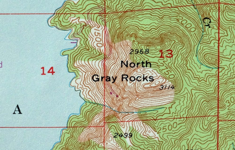
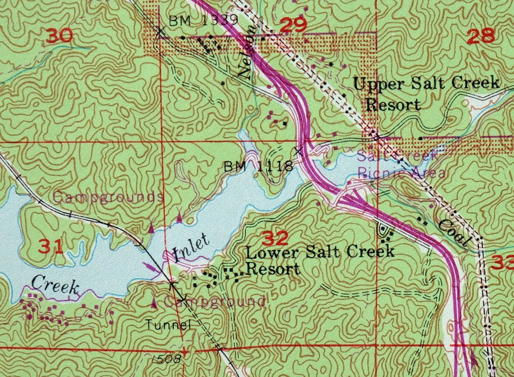
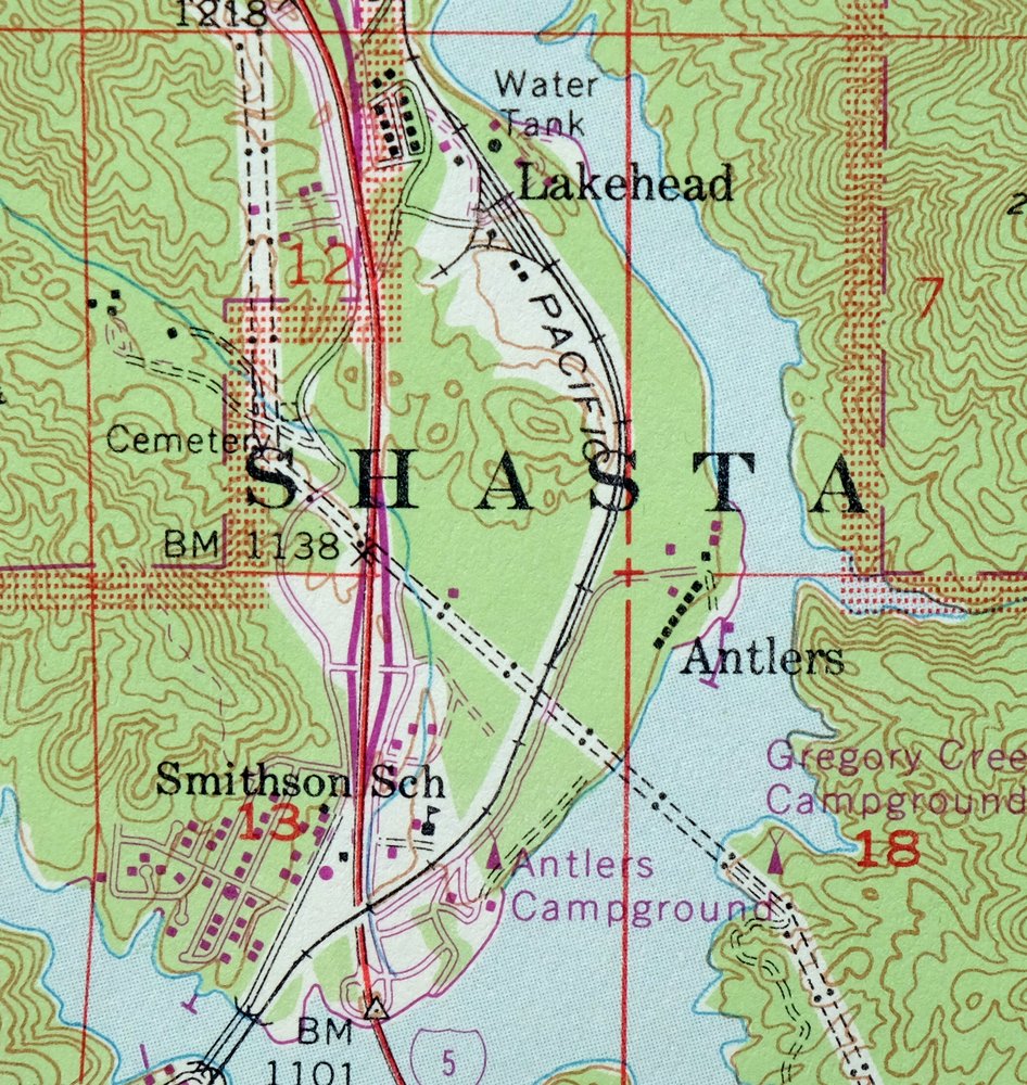
| Locations: Allie Cove Campground, American Trails Recreation Site, Antlers Campground, Bailey Cove Campground, Beehive Campground, Bridge Bay Resort, Cascade Cove Resort, Gooseneck Cove Campground, Greens Creek Campground, Gregory Beach Campground, Gregory Creek Campground, Hirz Bay Campgrounds, Lakeshore Campground, Lakeshore East Campground, Lakeshore Fire Control Station, Lakeshore Resort, Lower Salt Creek Campground, Lower Salt Creek Resort, Mariners Point Campground, Nelson Point Campground, Oak Grove Campground, Old Man Campground, Packers Bay Marina, Pollard Flat Campground, Salt Creek Group Campgrounds, Salt Creek Point Campground, Shasta Marina, Ski Island Campground, Slaughterhouse Island Campground, Tasadi Resort, Turntable Forest Service Facility, Upper Salt Creek Campground, Upper Salt Creek Resort, and Wintoon Campground. Mountains, Peaks, and Summits: Bohemotash Mountain, Bucks Peak, Crane Mountain, Elmore Mountain, Green Mountain, Hanland Peak, Haycock Peak, High Mountain, Jackass Mountain, Mammoth Butte, North Gray Rocks, O'Brien Mountain, Sacramento Mountain, and Sugarloaf. Valleys and Canyons: Barber Gulch, Bastard Canyon, Box Canyon, Buck Gulch, Cavanaugh Canyon, Chase Gulch, Clarks Gulch, Coal Pit Gulch, Dam Gulch, Dark Canyon, Doe Gulch, French Gulch, Lightning Canyon, Limerock Gulch, McCall Gulch, McCardle Gulch, Packers Gulch, Pollard Gulch, Sawmill Gulch, Saylor Gulch, Shake Tree Gulch, Waters Gulch, and Wood Gulch. Parks: Salt Creek Picnic Area. Drainages: Adler Creek, Albert Creek, Alder Creek, Azelle Creek, Backbone Creek, Beartrap Creek, Big Backbone Creek Inlet, Big Creek, Bull Creek, Campbell Creek, Charlie Creek, Coal Creek, Cunningham Creek, Curl Creek, Dead Horse Creek, Dog Creek, Doney Creek, Elmore Creek, Eye Creek, Fall Creek, Fannie Creek, Gibson Creek, Goat Creek, Greens Creek, Gregory Creek, Hirz Creek, Indian Creek, Jackass Creek, Johnny Sisk Creek, Keluche Creek, Lick Creek, Little Backbone Creek, Little Dog Creek, Little Slate Creek, Little South Fork Dog Creek, Little Sugarloaf Creek, Lockhart Creek, Long Tom Creek, Lower Limestone Valley Creek, Marble Creek, McCloud River, Middle Salt Creek, Mosquito Creek, Moss Creek, Nelson Creek, North Fork Backbone Creek, North Fork Little Backbone Creek, North Fork North Salt Creek, North Fork Salt Creek, North Fork Slate Creek, Oak Opening Creek, Pit River, Polly Creek, Potter Creek, Puppy Creek, Ringeye Creek, Salt Creek, Shoemaker Gulch, Slate Creek, South Fork Slate Creek, Sugarloaf Creek, Tom Head Creek, Upper Limestone Valley Creek, West Fork Salt Creek, Whitlow Creek, and Ycotto Creek. Islands: Beaver Island, Ski Island, and Slaughterhouse Island. Capes: Delta Point. Mines: Clipper Mine, Friday-Louden Mine, Golinsky Mine, Mammoth Mine, Shasta Iron Mine, and Sutro Mine. Bridges: Pit River Bridge. Bays: Allie Cove, Bailey Cove, Elmore Bay, Halfway Cove, Hirz Bay, McCloud River Arm, O'Brien Creek Inlet, Packers Bay, Pit River Arm, Sacramento River Arm, Salt Creek Inlet, and Turntable Bay. Airports: Bridge Bay Resort Seaplane Base. Schools: Slate Creek School and Smithson School. Ridges: Backbone Ridge and Mosquito Creek Ridge. Flats: Matquaw Flat and Rabbit Flat. Springs: Indian Spring, Maple Spring, and Shoemaker Spring. | |
| SHIPPING AND RETURNS | |
 This map sheet will be carefully rolled in a sturdy tube and shipped via the US Postal Service. If you find that the sheet you receive is not as described in the listing, you may ship it back to us for a refund of the purchase price. | |

Lamoine California Shasta Lake USGS Topo Map 1974 Vintage
$40
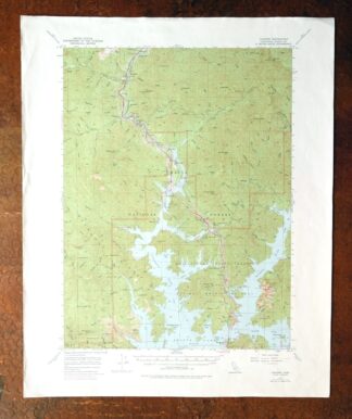
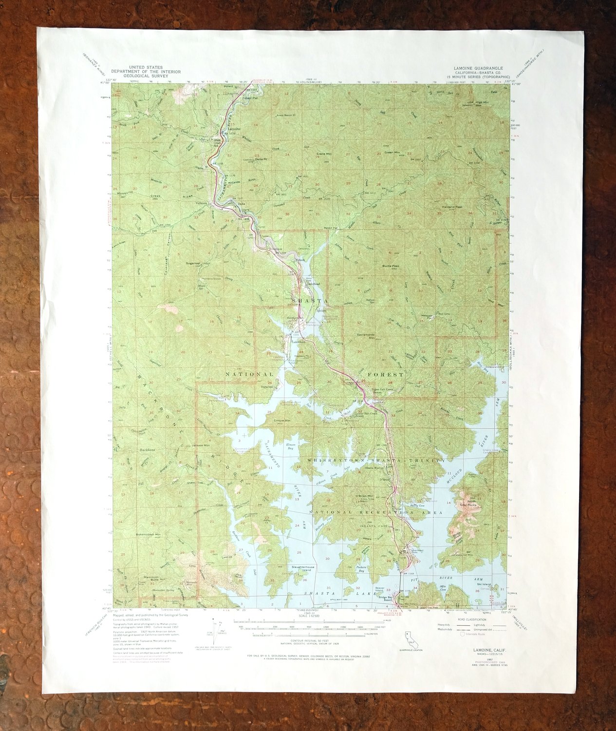
This USGS topographic map is a 1957 edition printed in 1974, with photorevisions through 1969, and the sheet is in very good condition on thick stock—lightly handled and never folded, with a flawless map area. Covering a 13-by-17-mile stretch of Shasta County about 20 miles north of Redding, the quad takes in the northern reaches of Shasta Lake along with Lakehead-Lakeshore, Lamoine, and Pollard Flat, and part of the surrounding Shasta National Forest. The 50-foot contours trace the steep, forested terrain where the upper arms of Shasta Lake reach into the Trinity divide, country familiar to anyone who has driven this stretch of the I-5 corridor. Having never been folded, the sheet lies flat and would frame well.
In stock
This vintage sheet is a 1957 edition of the Lamoine California USGS topographic map revised in 1969 using aerial photography. It is an original 52-year-old 1974 United States Geological Survey print in very good condition.
HOW THIS MAP CAN BE USED
In addition to making a fascinating conversation piece, this sheet would look great in a frame or on display, make a unique and prized gift for anyone interested in this area, be perfect as a reference for genealogy studies or general historical research, or fill that missing piece in your collection. Maps of this vintage are printed on durable stock and are well-suited for outdoor activities and recreation of all kinds, including hiking, backpacking, hunting, rafting and kayaking, backcountry skiing, geocaching, general exploration, treasure hunting, etc.
FEATURES SHOWN ON THE MAP
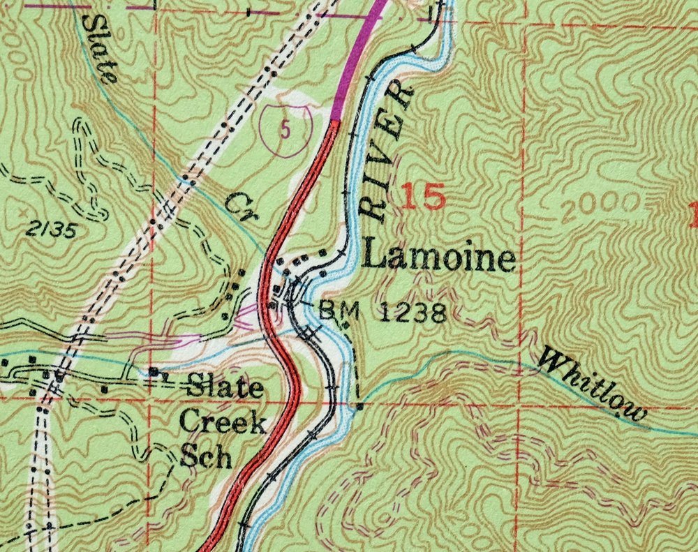
The Lamoine 15-minute map shows cities and towns, roads, railroads, utilities and energy infrastructure, rivers, creeks, elevation contour lines, public land survey lines, county, state, and other administrative boundaries as they existed at the time of the survey in 1943 and 1957. All known structures (houses, businesses, churches, schools, barns, cabins, etc) are also shown.
A VALUABLE HISTORICAL RECORD
Maps from the 15-minute series for the continental United States are no longer produced or printed by the USGS and original prints are becoming increasingly difficult to find. They are a valuable historical record for an area, as they contain many placenames and features that have been dropped from more recent maps.
The map was photorevised in 1969. Any features that changed or were added between the original edition year of 1957 and the photorevision year of 1969 are overlayed in purple. The purple overlay provides an excellent view of the fast-growing and changing areas within the quad boundary.
Nearby maps
-
Shasta California McCloud USGS 15-Min Topo Map 1968 Vintage
$40 Add to cart -
Manzanita Lake California Viola USGS Topo Map 1974 Vintage
$39 Add to cart -
Panther Spring California USGS 15-Min Topo Map 1970 Vintage
$36 Add to cart -
Dorris California Mount Hebron USGS Topo Map 1965 Vintage
$19 Add to cart -

Richardson Springs California Chico Nord USGS Topo Map 1966
$35 Add to cart -
Westwood California USGS 15-Min Topographic Map 1961 Vintage
$38 Add to cart -
Fruto California Stony Creek Nye Creek USGS Topo Map 1944
$30 Add to cart -
Tulelake California USGS 15-Min Topographic Map 1970 Vintage
$33 Add to cart -
Fredonyer Peak California USGS 15-Min Topo Map 1972 Vintage
$40 Add to cart -

Preston Peak California Klamath NF USGS 15-Min Topo Map 1962
$28 Add to cart -
Susanville California Janesville USGS Topo Map 1966 Vintage
$39 Add to cart -
Stonyford California USGS 15-Min Topo Map 1967 Vintage
$39 Add to cart -
Big Sage Reservoir California Alturas USGS Topo Map 1972
$40 Add to cart -
Piercy California USGS 15-Min Topographic Map 1971 Vintage
$33 Add to cart -
Litchfield California Susanville USGS Topo Map 1972 Vintage
$40 Add to cart -
Gridley California Oroville Live Oak USGS Topo Map 1959
$37 Add to cart -
Milford California USGS 15-Min Topographic Map 1966 Vintage
$40 Add to cart -
Lakeport California Lucerne Nice USGS Topo Map 1977 Vintage
$44 Add to cart -
Sierraville California Calpine Loyalton USGS Topo Map 1969
$40 Add to cart -
Mount Vaca California Fairfield Vacaville USGS Topo Map 1967
$40 Add to cart -
Pittsburg California Concord Fairfield USGS Topo Map 1965
$38 Add to cart -
Petaluma Point California Novato USGS Topographic Map 1951
$30 Add to cart -
Port Chicago California Concord Martinez USGS Topo Map 1956
$38 Add to cart -
San Quentin California Richmond Tiburon USGS Topo Map 1980
$46 Add to cart