MAP DETAILS | |
|---|---|
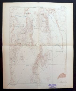
| TITLE | Disaster |
| STATE | Nevada |
| LOCATION | 50 miles northwest of Winnemucca |
| SERIES | 60-minute |
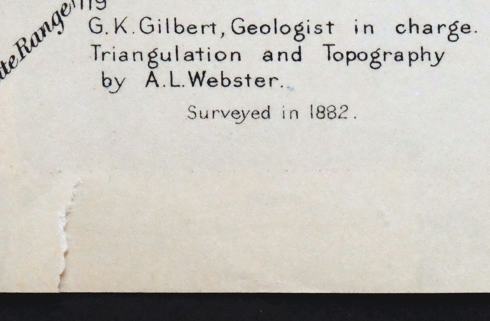
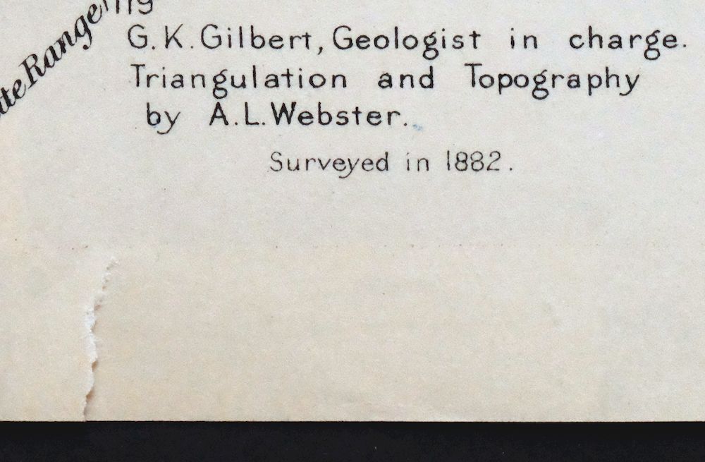
| SURVEYED | 1882 Field Survey |
| GEOGRAPHER | G.K. Gilbert |
| EDITION | 1893 |
| PRINTED | 1909 |
| SCALE | 1:250000 |
| CONTOUR INTERVAL | 200 feet |
| SHEET DIMENSIONS | 16 x 20 inches (approximate) |
| MAP DIMENSIONS | 13 1/8 x 17 1/2 inches |
| COVERAGE AREA | 52 x 69 miles |
| SHEET CONDITION For maps of this vintage, effort is made to note all visible flaws, no matter how minor. | |
| OVERALL CONDITION | Very Good |
| SHEET NOTES | lightly handled, midsheet horizontal and vertical foldlines (1/4) |
| MAP AREA | no markings, no blemishes |
| COLLARS | minor wear or tears, no blemishes, small inventory notation in upper right collar corner, inventory stamp on lower collar |
 | |
| MAP COVERAGE Quadrangle extent overlaid on current basemap. | |
| BACKSIDE LEGEND | |
 A map summary is printed on the back side of the Disaster sheet similar to the one shown in the picture. It outlines the history, purpose, and status of the USGS mapping program at the time of the printing in 1909. It also provides instructions on how to read contour lines and a description of how they are used to depict the terrain. At the bottom of the page is a legend showing all of the symbols used to represent the cultural, relief, and water features found on the map. | |
| PLACENAMES Depending on map series and survey date, all of the features listed below may not be shown on this map. This list contains features that currently exist or historically existed within the area covered by the map. The list can be used as a reference to determine if this map covers your area of interest. Placenames are listed alphabetically next to each feature type. | |
| CITIES AND TOWNS (CURRENT) | Denio |
| COUNTIES COVERED | Harney, Humboldt, and Malheur |
| FEDERAL LAND UNITS | Adler Creek Wilderness Study Area, Black Rock Desert Wilderness, Blue Lakes Wilderness Study Area, Disaster Peak Wilderness Study Area, Fort McDermitt Indian Reservation, Hawk Mountain Wilderness Study Area, North Black Rock Range Wilderness, North Jackson Mountains Wilderness, Pahute Peak Wilderness, Pueblo Mountains Wilderness Study Area, Sheldon National Wildlife Refuge, and South Jackson Mountains Wilderness |
| RIVERS AND STREAMS | Alder Creek, Alta Creek, Antelope Creek, Bartlett Creek, Battle Creek, Big Cedar Creek, Big Creek, Bilk Creek, Butte Creek, Cherry Creek, Chicken Creek, Clover Creek, Cold Creek, Cold Springs Creek, Colman Creek, Corral Creek, Cottonwood Creek, Craine Creek, Crow Creek, Crowley Creek, Deep Creek, Deer Creek, Denio Creek, Dry Creek, East Fork Granite Creek, Flat Creek, Frances Creek, Garden Creek, Granite Creek, Happy Creek, Indian Creek, Jackson Creek, Jordan Meadow Creek, Kings River, Leonard Creek, Little Alder Creek, Little Cedar Creek, Little Riser Creek, Little Sage Hen Creek, Little South Fork Bottle Creek, Little Washburn Creek, Little Wildcat Creek, Little Wilder Creek, Louse Creek, Maggie Creek, Mary Sloan Creek, McDermitt Creek, Mud Creek, North Branch Maggie Creek, North Fork Battle Creek, North Fork Flat Creek, North Fork Jackson Creek, North Fork Leonard Creek, North Fork Willow Creek, North Shyster Creek, Paiute Creek, Pass Creek, Pidgeon Spring, Pole Creek, Pueblo Slough, Quinn River, Raster Creek, Rattlesnake Creek, Rincon Creek, Riser Creek, Rock Creek, Rodeo Creek, Sage Hen Creek, Sagebrush Creek, Sentinel Creek, Shawnee Creek, Sheep Creek, Short Creek, Shyster Creek, Snow Creek, South Branch Maggie Creek, South Fork Battle Creek, South Fork Cottonwood Creek, South Fork Flat Creek, South Fork Granite Creek, South Shyster Creek, Tepee Creek, Thacker Creek, Thousand Creek, Trail Creek, Virgin Creek, Washburn Creek, Wildcat Creek, Wilder Creek, and Willow Creek |
| WATER BODIES | Bilk Creek Reservoir, Blue Lake, Bog Hot Reservoir, Continental Lake, Deer Creek Reservoir, Gridley Lake, Knott Creek Reservoir, Leonard Creek Lake, Little Onion Reservoir, and Onion Valley Reservoir |
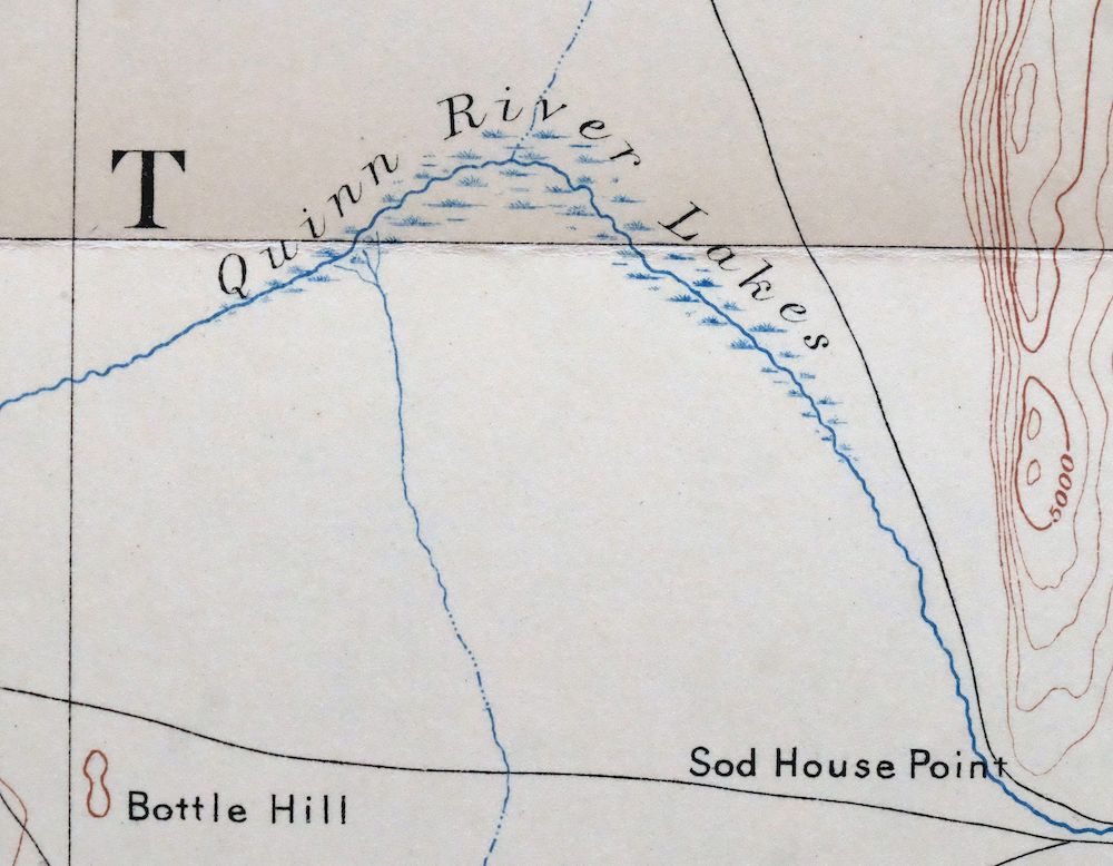
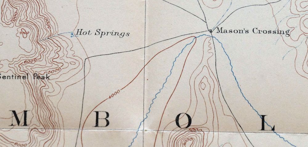
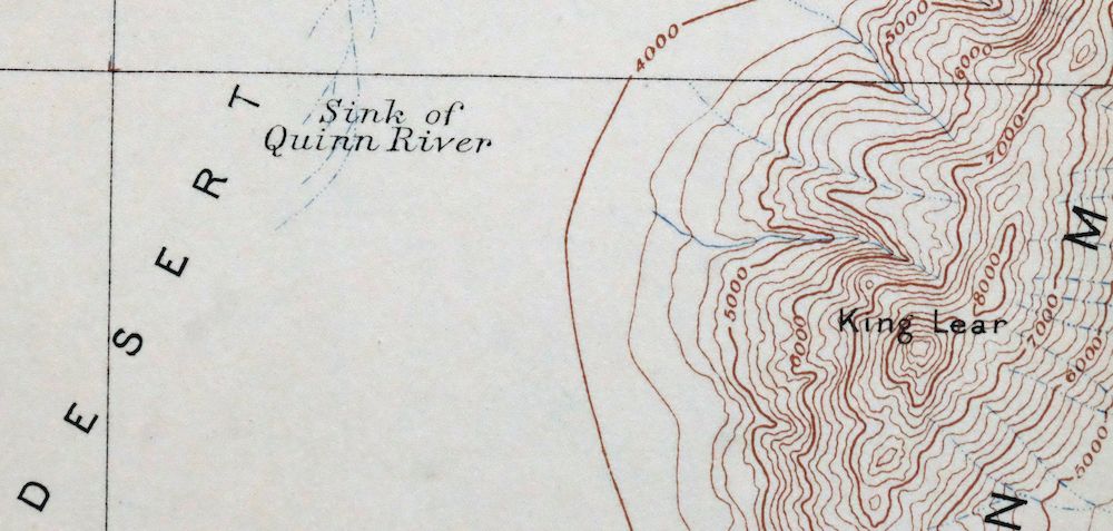
| Locations: Albertson Ranch, Alder Creek Ranch, Alexander Ranch, Ayers Cabin Ruins, Banks Windmill, Basin Cabin, Battle Creek Ranch, Bottle Creek Ranch, Bramlett Stage Station, Big Creek Ranch, Bog Hot Ranch, Cappallo Camp, Clarkfield Ranch, Cove Camp, De Long Windmill, Deer Creek Ranch, Delong Ranch, Happy Creek Ranch, Howard Ranch, Jack Spade Cabin, Jackson Creek Ranch, Jeff Howard Ranch, Kings River Ranch, Knott Creek Ranch, Largasa Ranch, Lay Ranch, Lee Windmill, Leonard Creek Ranch, Lewis Ranch, Log Cabin, McClosky Ranch, McCully Cabin, Miller Corral, Nine Mile Ranch, Paiute Meadows Ranch, Pearl Camp, Perry Boyd Ranch, Pueblo Mill, Quinn River Camp, Quinn River Ranch, Rio King Ranch, Rodon Ranch, Sisson Cabin, Slatterly Cabin, Sod House, Stanley Camp, Summer Camp, Thousand Creek Ranch, Tregaskia Ranch, Trout Creek Ranch, Virgin Station, Wilder Creek Ranch, Willow Creek Ranch, Wood Camp, Woodward Cabin, and Woodward Ranch. Administrative Boundaries: Bottle Creek Mining District, Cove Meadow Mining District, Disaster Mining District, Jackson Creek Mining District, Leonard Creek Mining District, Pine Forest Mining District, Red Butte Mining District, Varyville Mining District, and Warm Springs Mining District. Mountain Ranges: Bilk Creek Mountains, Double H Mountains, The Granites, Idaho Canyon Range, Jackson Mountains, Montana Mountains, and Pine Forest Range. Mountains, Peaks, and Summits: Fisher Peak, Agate Point, Mount Baldy, Bartlett Peak, Bishop Peak, Black Butte, Black Diamond Peak, Black Mountain, Bottle Hill, Burnt Rock Peak, Big Mountain, Buff Peak, Corbeal Butte, Coyote Hills, Crescent Dunes, Deer Creek Peak, Disaster Peak, Donna Schee Peak, Dry Hills, Duffer Peak, Elephant Mountain, Gabica Butte, Granite Mountain, Halburg Mountain, Holloway Mountain, House Creek Butte, Jordan Meadow Mountain, Jungo Hills, King Lear Peak, Krug Hill, Little Peak, Lone Mountain, Mahogany Mountain, McGhee Mountain, The Mesa, Mormon Dan Butte, Navajo Peak, New York Peak, Parrot Peak, Pinto Mountain, Red Butte, Round Mountain, Sand Hills, Schoolhouse Butte, Sentinel Peak, Shyster Butte, Sod House Point, Sombrero Peak, Split Mountain Cairn, Split Peak, Strawberry Butte, Summit Lake Mountain, Table Mountain, Trident Peak, Twin Peak, White Peaks, and Windy Point. Valleys and Canyons: Alaska Canyon, Alta Canyon, Basco Canyon, Bishop Canyon, Black Canyon, Burro Bills Canyon, Blind Canyon, Bliss Canyon, Blue Mountain Canyon, Bobcat Canyon, Buckaroo Canyon, Calavera Canyon, Cherry Gulch, Christiorsson Canyon, Corral Canyon, Cowden Canyon, Desert Valley, Dry Canyon, Dry Gulch, Dyke Canyon, Halburg Canyon, Hobo Canyon, Idaho Canyon, Ikes Canyon, Kings River Valley, Little Idaho Canyon, Long Draw, Lovely Valley, McGill Canyon, Mike O'Brian Canyon, Murray Canyon, New Years Canyon, New York Canyon, Oregon Canyon, Peak Canyon, Pearl Canyon, Oakley Canyon, Rattlesnake Canyon, Red Butte Canyon, Road Canyon, Rough Canyon, Sand Canyon, Spring Canyon, Summer Camp Canyon, Thacker Canyon, Thousand Creek Gorge, Trail Canyon, Vicksburg Canyon, Water Canyon, and Wood Canyon. Parks: Lahontan Cutthroat Trout Natural Area. Trails: McGee Grade. Drainages: Fivemile Creek, Flat Creek, Frances Creek, Alder Creek, Alta Creek, Antelope Creek, Bartlett Creek, Battle Creek, Bilk Creek, Bottle Creek, Bottle Creek Slough, Boulder Creek, Boyd Creek, Burro Bills Creek, Big Cedar Creek, Big Creek, Big South Fork Bottle Creek, Bull Creek, Butte Creek, Center Creek, Cherry Creek, Chicken Creek, China Creek, Clover Creek, Cold Springs Creek, Corral Creek, Cove Creek, Cow Creek, Craine Creek, Deep Creek, Deer Creek, Deer Creek Slough, Dry Creek, East Fork Granite Creek, East Fork Happy Creek, Garden Creek, Gold Hill Creek, Granite Creek, Happy Creek, Horse Creek, House Creek, Indian Creek, Jackson Creek, Johnny Creek, Kings River, Knott Creek, Leonard Creek, Leonard Creek Slough, Little Alder Creek, Little Cedar Creek, Little Creek, Little Riser Creek, Little Sage Hen Creek, Little South Fork Bottle Creek, Little Wilder Creek, Log Cabin Creek, Louse Creek, Maggie Creek, Mary Sloan Creek, Mineral Creek, Mud Creek, New York Canyon Creek, North Branch Maggie Creek, Paiute Creek, Pass Creek, North Fork Battle Creek, North Fork Big Creek, North Fork Flat Creek, North Fork Jackson Creek, North Fork Leonard Creek, North Fork Snow Creek, North Fork Willow Creek, North Shyster Creek, O'Brien Creek, Pole Creek, Post Creek, Raster Creek, Rattlesnake Creek, Rincon Creek, Rodeo Creek, Sage Hen Creek, Sentinel Creek, Shawnee Creek, Sheep Creek, Short Creek, Shyster Creek, Snow Creek, South Branch Maggie Creek, South Fork Battle Creek, South Fork Big Creek, South Fork Flat Creek, South Fork Granite Creek, South Fork Mahogany Creek, South Shyster Creek, Tepee Creek, Thacker Creek, Thousand Creek, Trail Creek, Trout Creek, Virgin Creek, West Branch Battle Creek, West Creek, West Fork Granite Creek, West Fork Happy Creek, and Willow Creek. Capes: Coyote Point. Mines: Adams Mine, Ashdown Mine, Baldwin Mine, Bartlett Mine, Battle Chief Mine, Birthday Mine, Black Jack Mine, Blue Can Mine, Catlow Mine, Cherry Gulch Mine, Columbia Mine, Cove Meadow Mine, Cowden Mine, Defense Mine, Green Elephant Mine, Hall Mine, Harrison Grove Mine, Homer Verne Mine, Humboldt Mine, Iron King Mine, Jensen Mine, Juanita Mine, Krug Mine, Leonard Creek Placer Mines, Lucky Strike Mine, McAdoo Mine, Moonlight Mine, Nelson Mine, Niebuhr Mine, Painted Hills Mine, Pickhandle Mine, Red Ball Mines, Red Boy Mine, Red Butte Mine, Red Ore 1 Mine, Redbird Mine, Reno Copper Mine, Slater Mine, Stroud Mine, Tipperary Mine, and White Peaks Mine. Lakes and Ponds: Blue Lake, Continental Lake, Dry Lake, Gridley Lake, Hot Lake, Leonard Creek Lake, and Quinn River Lakes. Dams: Bilk Creek Reservoir Dam, Bog Hot Reservoir Dam, Knott Creek Reservoir Dam, Little Onion Dam, Onion Valley Dam, and Thousand Creek Dam. Gaps: Bare Pass, Denio Summit, Emigrant Pass, Ninemile Summit, Sand Pass, and Thacker Pass. Canals: Big Cedar Creek Ditch, Bull Creek Ditch, Knott Creek Channel, and Little Cedar Creek Ditch. Bends: Horseshoe Bend. Basins: Florence Basin, Alberson Basin, Alta Creek Basin, Antelope, Boyd Basin, Brush Basin, Bull Basin, Leonard Creek Basin, Seven Springs Basin, Theodore Basin, and Washburn Basin. Airports: Paiute Meadows Ranch Airport. Schools: Denio Elementary School, Jackson Mountain Elementary School, Kings River Elementary School, and Leonard Creek Elementary School. Ridges: Holloway Ridge, Long Ridge, Railroad Point, and Trout Creek Spur. Reservoirs and Tanks: Bilk Creek Reservoir, Bog Hot Reservoir, Deer Creek Reservoir, Knott Creek Reservoir, Little Onion Reservoir, Lone Tree Reservoir, Miller Trough, Montero Reservoir, Onion Valley Reservoir, Plateau Reservoir, and Sentinel Peak Reservoir. Flats: Alkali Flat, Basque Basin, Bog Hot Valley, Buck Pasture, Chicken Creek Meadow, Corral Meadow, Cove Meadows, Harden Lake, Hardpans, Hidden Meadow, Hollywood Meadow, Jackass Flat, Leonard Creek Meadows, Outlaw Meadow, Paiute Meadows, Rodeo Flat, and Spring Meadow. Wells: Fivemile Well, Alta Well Number 1, Austin Well, Barbara Worth Well, Bill Delong Well, Bramlett Well, Bog Hot Well, Cleto Well, Corbeal Well, Crescent Well, Franklin Well, Gabica Well, Giliotti Well, Gone With the Wind Well, Hay Quinn River Well, Hidden Playa Well, Hot Springs Well, Jackson Well, Leonard Creek Well, Leuder Well, McNinch Well, Mormon Dan Well, NERA Well, Paine Well, Presnel Well, Radar Well, Sand Dunes Well, Sod House - Quinn River Well, Wilder Ranch Well, and Windy Point Well. Springs: Crow Creek Spring, Crowbar Spring, Dacite Spring, Fish Pond Spring, Fivemile Spring, Flat Creek Spring, Four Springs, Agate Spring, Alberson Basin Spring, Antelope Spring, Arristu Spring, Baltazor Hot Spring, Barbara Worth Spring, Basque Spring, Boyd Basin Spring, Burnt Springs, Burro Bills Spring, Burro Spring, Big Bend Spring, Bog Hot Springs, Bonita Spring, Buckbrush Spring, Buckbrush Springs, Buster Springs, Butts Spring, Cane Springs, Center Spring, Cherry Hill Spring, Cherry Patch Spring, Cherry Springs, Cheuetto Spring, Chokecherry Spring, Cold Spring, Cold Springs, Corral Spring, Cowden Mine Spring, Craine Spring, Cricket Spring, DeLong Spring, Diamond Spring, Donna Schee Spring, Donnell Spring, Dry Lake Springs, Dyke Hot Springs, East Road Spring, Erquiaga Spring, Erquiaga Spring Number Two, Etchart Springs, Garden Spring, Gartiez Spring, Gold Hill Spring, Gridley Springs, Hardens Spring, Hillside Spring, Holloway Spring, Horse Creek Spring, Hot Spring, Houghland Spring, House Spring, Howard Hot Spring, Howison Spring, Idaho Canyon Spring, Ikes Spring, Indian Spring, Indian Springs, Johnstone Springs, Josie Pearl Spring, Lay Waterhole, Little Creek Spring, Little Sage Hen Spring, Lone Meadow Spring, Lone Willow Spring, Lovely Valley Spring, Lyles Spring, Maggie Creek Spring, McCully Spring, McGhee Mountain Spring, Middle Spring, Mine Spring, Mosquito Spring, Mud Spring, Mustang Spring, Ninemile Springs, Ninemile Summit Spring, Noble Spring, Onemile Spring, Parman Spring, Pidgeon Spring, Pinto Hot Springs, Oakley Canyon Spring, Old Corral Spring, Old Man Spring, Poorman Spring, Quaking Aspen Spring, Rattlesnake Spring, Reese Spring, Road Spring, Rock Spring, Round Hill Spring, Salt Water Spring, Santa Claus Spring, Seep Spring, Sheep Creek Spring, Sheep Head Spring, Sheep Ranch Springs, Shyster Spring, South Fork Spring, South Spring, Summit Spring, Texas Springs, Three Springs, Tin Trough Spring, Top Spring, Trough Spring, Upper Crow Creek Spring, Upper Riser Spring, Warm Spring, Warm Springs, West Pinto Hot Spring, West Spring, Wheeler Springs, Whiskey Springs, Willow Spring, Willow Springs, Willows Spring, Woodcamp Spring, Woodcamp Springs, and Yellow Rose Springs. Slopes: Dufurrena Grade. | |
| SHIPPING AND RETURNS | |
| This map sheet ships via the US Postal Service. Choose your preferred packaging at eBay checkout: rolled in a sturdy tube, or folded in a padded mailer. If you find that the sheet you receive is not as described in the listing, you may ship it back to us for a refund of the purchase price. | |
Disaster Nevada Adler Creek WSA Denio USGS Topo Map 1909
$65
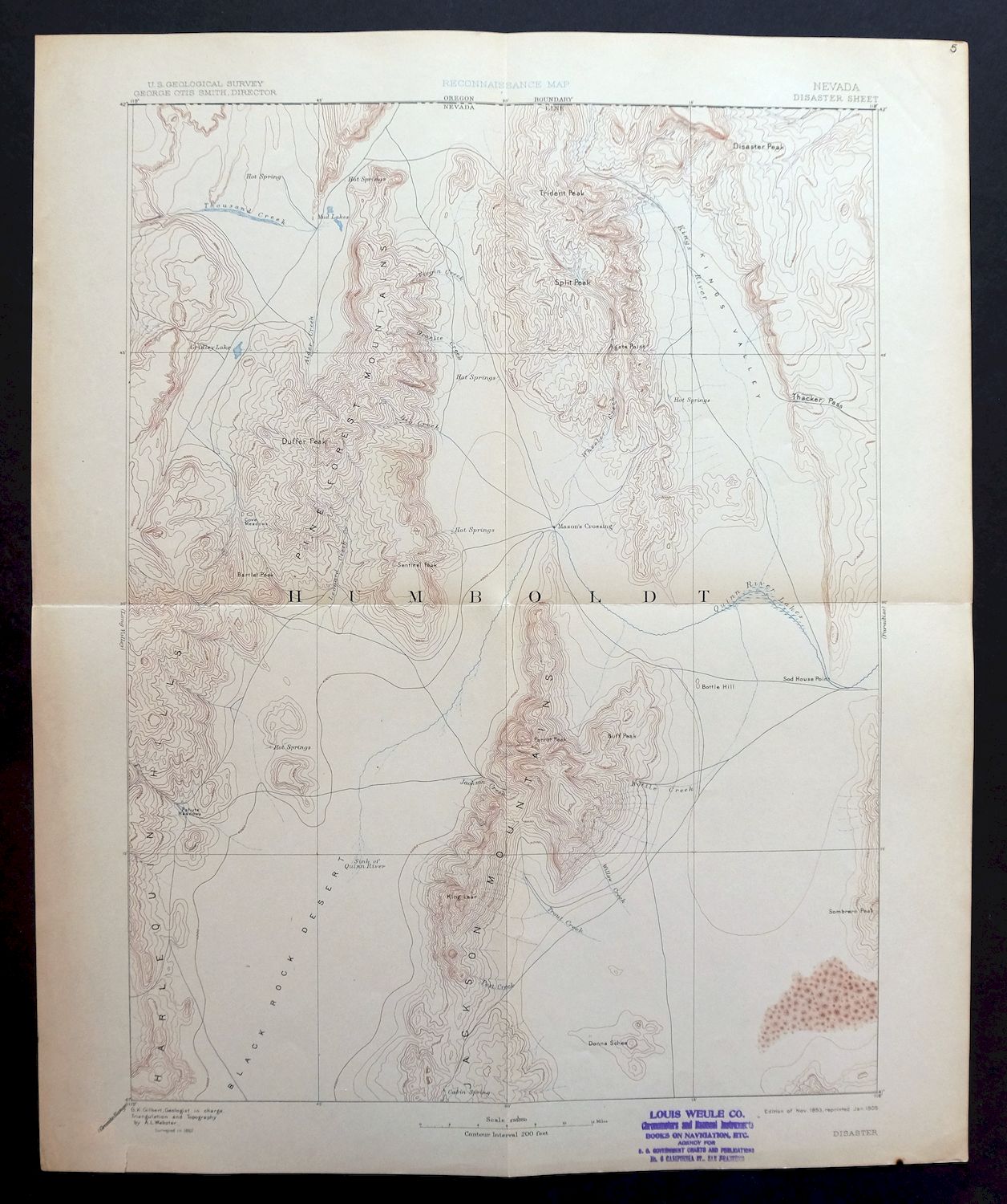
This USGS reconnaissance topographic sheet is a 1893 edition printed in 1909, a very good example that has been lightly handled with midsheet horizontal and vertical foldlines. Covering high desert country about 50 miles northwest of Winnemucca where Nevada meets Oregon, the quad takes in parts of the Black Rock Desert, the Pueblo Mountains, and the community of Denio, along with portions of the Sheldon National Wildlife Refuge and several wilderness areas. Drawn from an 1882 field survey credited to geographer G.K. Gilbert, the sheet reflects the early reconnaissance mapping of a remote stretch of Great Basin backcountry, and its reverse carries printed reference material on reading the map.
In stock
This antique sheet is an 1893 edition of the Disaster Nevada USGS topographic map. It is an authentic 117-year-old 1909 United States Geological Survey print in very good condition.
HOW THIS MAP CAN BE USED
In addition to making a fascinating conversation piece, this sheet would look great in a frame or on display, make a unique and prized gift for anyone interested in this area, be perfect as a reference for genealogy studies or general historical research, or fill that missing piece in your collection.
FEATURES SHOWN ON THE MAP
The Disaster 60-minute map shows cities and towns, roads, railroads, rivers, creeks, elevation contour lines, public land survey lines, county, state, and other administrative boundaries as they existed at the time of the survey in 1882.
A VALUABLE HISTORICAL RECORD
Maps from the 60-minute series have been out of print for many years. They have never been common and original prints are increasingly difficult to find. Only about 85 quadrangles (covering about 10% of the continental US) were mapped in this series, all in western states. For the limited areas where the 60-minute map was produced, it was generally a product of the very first USGS survey done for that area. These quadrangles are a valuable historical record, as they contain many placenames and features that have been dropped from more recent series’ and editions.
Nearby maps
-
Big Sage Reservoir California Alturas USGS Topo Map 1972
$40 Add to cart -
Litchfield California Susanville USGS Topo Map 1972 Vintage
$40 Add to cart -
Owyhee Nevada Duck Valley USGS 15-Min Topo Map 1965 Vintage
$40 Add to cart -
Fredonyer Peak California USGS 15-Min Topo Map 1972 Vintage
$40 Add to cart -
Susanville California Janesville USGS Topo Map 1966 Vintage
$39 Add to cart -
Milford California USGS 15-Min Topographic Map 1966 Vintage
$40 Add to cart -

Mountain City Nevada Owyhee River Owyhee USGS Topo Map 1956
$40 Add to cart -
Carlin Nevada Humboldt River Bunker Hill USGS Topo Map 1961
$24 Add to cart -
Westwood California USGS 15-Min Topographic Map 1961 Vintage
$38 Add to cart -
Tulelake California USGS 15-Min Topographic Map 1970 Vintage
$33 Add to cart -
Sierraville California Calpine Loyalton USGS Topo Map 1969
$40 Add to cart -
Manzanita Lake California Viola USGS Topo Map 1974 Vintage
$39 Add to cart -
Dorris California Mount Hebron USGS Topo Map 1965 Vintage
$19 Add to cart -

Nampa Idaho Caldwell Emmett USGS 30-Min Topographic Map 1948
$37 Add to cart -

Mountain Home Idaho Cleft Mayfield USGS 30-Min Topo Map 1916
$37 Add to cart -
Wildcat Peak Nevada Toiyabe NF USGS Topo Map 1962 Vintage
$14 Add to cart -
Shasta California McCloud USGS 15-Min Topo Map 1968 Vintage
$40 Add to cart -
Panther Spring California USGS 15-Min Topo Map 1970 Vintage
$36 Add to cart -
Lamoine California Shasta Lake USGS Topo Map 1974 Vintage
$40 Add to cart -

Richardson Springs California Chico Nord USGS Topo Map 1966
$35 Add to cart -
Gridley California Oroville Live Oak USGS Topo Map 1959
$37 Add to cart -
Fales Hot Springs California USGS Topo Map 1971 Vintage
$20 Add to cart -
Squaw Creek Idaho Alpha Cascade USGS Topo Map 1948 Vintage
$38 Add to cart -
Tower Peak California USGS 15-Min Topo Map 1972 Vintage
$40 Add to cart