MAP DETAILS | |
|---|---|
| TITLE | Sierraville |
| STATE | California |
| LOCATION | Vicinity of Loyalton |
| SERIES | 15-minute |
| SURVEYED | 1953 and 1955 Aerial and Field Survey |
| EDITION | 1955 |
| PRINTED | 1969 |
| PRINT NOTES | Thick paper stock, includes woodland tint (green to indicate vegetated areas) |
| SCALE | 1:62500 |
| CONTOUR INTERVAL | 40 feet |
| SHEET DIMENSIONS | 18 x 22 inches |
| MAP DIMENSIONS | 13 1/2 x 17 1/2 inches |
| COVERAGE AREA | 13 x 17 miles |
| SHEET CONDITION For maps of this vintage, effort is made to note all visible flaws, no matter how minor. | |
| OVERALL CONDITION | Excellent |
| SHEET NOTES | very lightly handled, never folded, smooth and flat |
| MAP AREA | flawless map area |
| COLLARS | no wear or tears, no markings, no blemishes |
| MAP COVERAGE Quadrangle extent overlaid on current basemap. | |
| PLACENAMES Depending on map series and survey date, all of the features listed below may not be shown on this map. This list contains features that currently exist or historically existed within the area covered by the map. The list can be used as a reference to determine if this map covers your area of interest. Placenames are listed alphabetically next to each feature type. | |
| CITIES AND TOWNS (CURRENT) | Calpine, Loyalton, and Sierraville |
| COUNTIES COVERED | Plumas and Sierra |
| FEDERAL LAND UNITS | Plumas National Forest and Tahoe National Forest |
| RIVERS AND STREAMS | Barry Creek, Bonta Creek, Carman Creek, Cold Stream, Cottonwood Creek, Dorsey Creek, East Fork Carman Creek, Haypress Creek, Independence Creek, Lincoln Creek, Little Truckee River, Long Valley Creek, Lunch Creek, North Yuba River, Onion Creek, Sulphur Creek, and West Fork Carman Creek |
| WATER BODIES | Coburn Lake, Palen Reservoir, and Lake of The Woods |
| Populated Place: Calpine, Sattley, Sierraville, Campbell Hot Springs, and Randolph. Locations: Ahart Camp, Canyon Ranch, Church Camp, Cold Creek Campground, Franklin Cabin, McPherrin Camp, Nichols Mill, Sierraville Ranger Station, Winnie Smith Mill, Yubas Pass Campground, and Cottonwood Campground. Administrative Boundaries: East Sierra Division. Mountains, Peaks, and Summits: Harding Point, Randolph Hill, Rice Hill, The Mounds, Treasure Mountain, McElroy Hill, and TV Hill. Valleys and Canyons: Antelope Valley, Big Canyon, Blatchley Canyon, Carman Valley, Dark Canyon, Lemon Canyon, Maiden Valley, Onion Valley, Rice Canyon, Turner Canyon, Mello Canyon, Wild Bill Canyon, and Coyote Canyon. Parks: Calpine Park. Trails: Cottonwood Botanical Trail, Cottonwood Fisherman Trail, Cottonwood Overlook Trail, Dark Canyon Trail, Deer Lake Trail, and Haskell Peak Trail. Drainages: Berry Creek, Bonta Creek, Carman Creek, Cold Stream, Cottonwood Creek, East Fork Carman Creek, Hamlin Creek, Independence Creek, Onion Creek, Smithneck Creek, West Fork Carman Creek, Fletcher Creek, and Perry Creek. Capes: Lombardi Point. Mines: Antelope Mine. Post Office: Calpine Post Office, Sattley Post Office, and Sierraville Post Office. Lakes and Ponds: Coburn Lake and Lake of The Woods. Buildings: Calpine Volunteer Fire Department, Sierra County Fire Protection District 1, and Sierra County Fire Protection District 3 - Sattley. Dams: Palen 290 Dam. Gaps: Bonta Saddle, Henness Pass, Yuba Pass, and Little Truckee Summit. Airports: Sierraville Dearwater Airport and Totem Pole Ranch Airport. Census: Calpine Census Designated Place, Sattley Census Designated Place, and Sierraville Census Designated Place. Schools: Sierraville Elementary School. Reservoirs and Tanks: Palen Reservoir and Calpine Reservoir. Flats: McNair Meadow, Bear Flat, Folchi Meadows, Knuthson Meadow, and Three Cornered Meadow. Cemetery: Sierraville Cemetery, Westside Cemetery, and Sattley Cemetery. | |
| SHIPPING AND RETURNS | |
 This map sheet will be carefully rolled in a sturdy tube and shipped via the US Postal Service. If you find that the sheet you receive is not as described in the listing, you may ship it back to us for a refund of the purchase price. | |
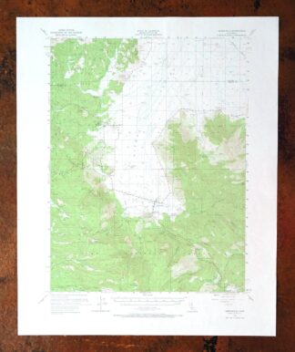
Sierraville California Calpine Loyalton USGS Topo Map 1969
$40
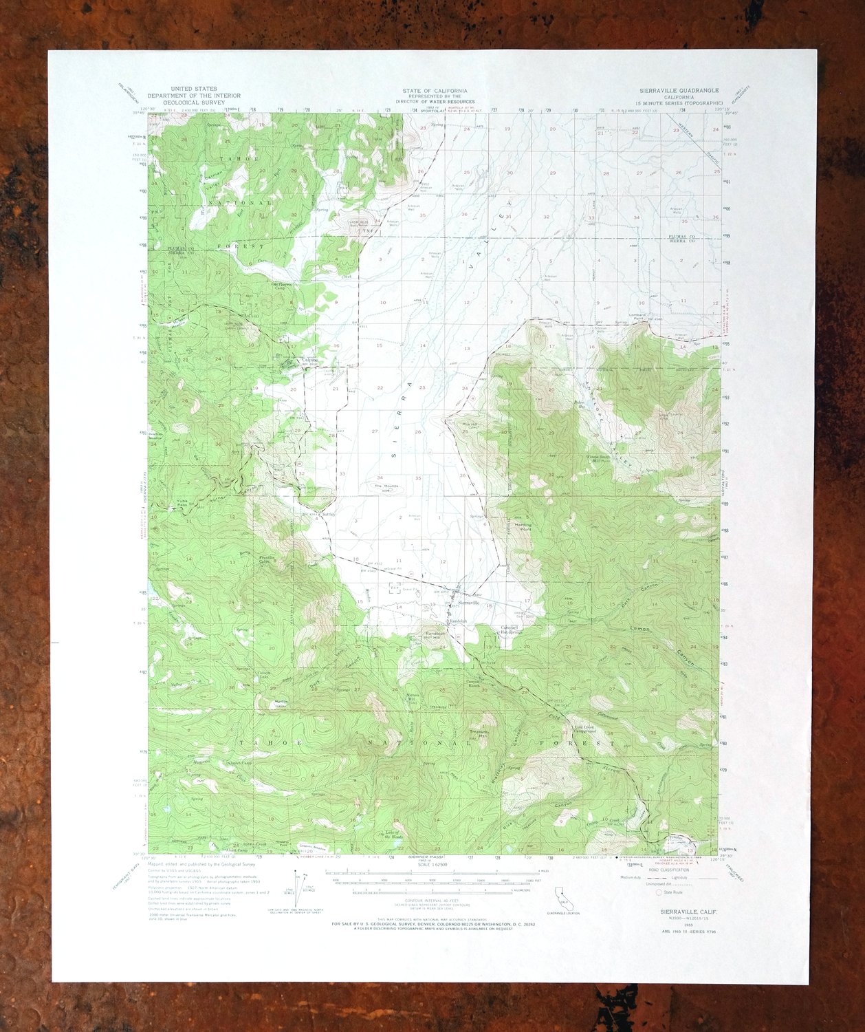
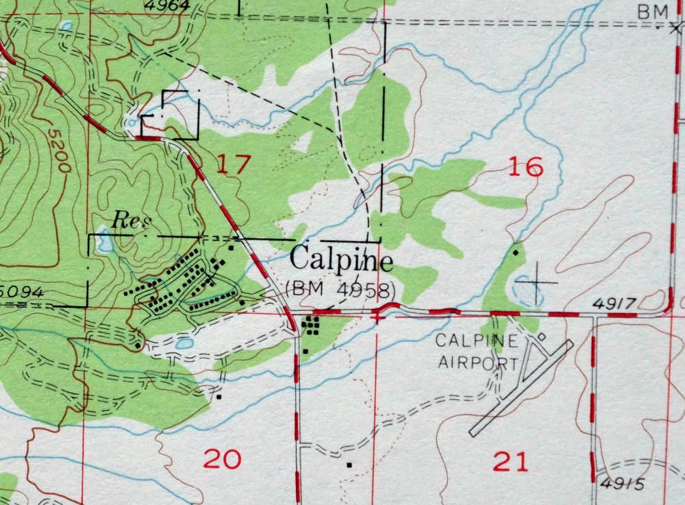
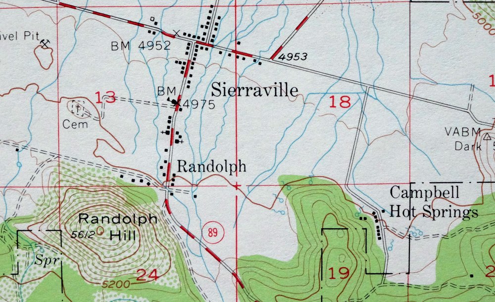
This USGS 15-minute topographic map is a 1955 edition printed in 1969, and the sheet is in excellent condition: never folded, very lightly handled, smooth and flat on thick stock with a flawless map area and a clean collar. Drawn at 1:62,500 from a 1953 and 1955 aerial and field survey, it takes in the country around Sierraville and Loyalton in Sierra and Plumas counties, with Calpine also within the quad boundaries and portions of both Tahoe and Plumas national forests along the way. This is high Sierra Valley terrain on the eastern slope of the range, where the mountain meadows and forested ridges give the map a distinctive northern California high-country character. Because the sheet lies flat and unfolded, it frames well for anyone with a tie to the Sierraville area.
In stock
This vintage sheet is a 1955 edition of the Sierraville California USGS topographic map. It is an original 57-year-old 1969 United States Geological Survey print in excellent condition.
HOW THIS MAP CAN BE USED
In addition to making a fascinating conversation piece, this sheet would look great in a frame or on display, make a unique and prized gift for anyone interested in this area, be perfect as a reference for genealogy studies or general historical research, or fill that missing piece in your collection. Maps of this vintage are printed on durable stock and are well-suited for outdoor activities and recreation of all kinds, including hiking, backpacking, hunting, rafting and kayaking, backcountry skiing, geocaching, general exploration, treasure hunting, etc.
FEATURES SHOWN ON THE MAP
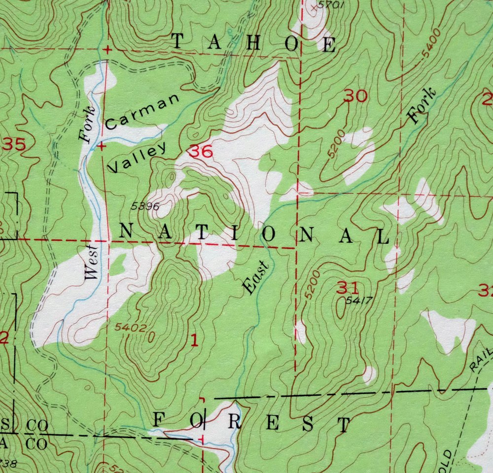
The Sierraville 15-minute map shows cities and towns, roads, railroads, utilities and energy infrastructure, rivers, creeks, elevation contour lines, public land survey lines, county, state, and other administrative boundaries as they existed at the time of the survey in 1953 and 1955. All known structures (houses, businesses, churches, schools, barns, cabins, etc) are also shown.
A VALUABLE HISTORICAL RECORD
Maps from the 15-minute series for the continental United States are no longer produced or printed by the USGS and original prints are becoming increasingly difficult to find. They are a valuable historical record for an area, as they contain many placenames and features that have been dropped from more recent maps.
Nearby maps
-
Milford California USGS 15-Min Topographic Map 1966 Vintage
$40 Add to cart -
Litchfield California Susanville USGS Topo Map 1972 Vintage
$40 Add to cart -
Susanville California Janesville USGS Topo Map 1966 Vintage
$39 Add to cart -
Westwood California USGS 15-Min Topographic Map 1961 Vintage
$38 Add to cart -
Gridley California Oroville Live Oak USGS Topo Map 1959
$37 Add to cart -
Fredonyer Peak California USGS 15-Min Topo Map 1972 Vintage
$40 Add to cart -

Richardson Springs California Chico Nord USGS Topo Map 1966
$35 Add to cart -
Panther Spring California USGS 15-Min Topo Map 1970 Vintage
$36 Add to cart -
Manzanita Lake California Viola USGS Topo Map 1974 Vintage
$39 Add to cart -
Fales Hot Springs California USGS Topo Map 1971 Vintage
$20 Add to cart -
Fruto California Stony Creek Nye Creek USGS Topo Map 1944
$30 Add to cart -
Tower Peak California USGS 15-Min Topo Map 1972 Vintage
$40 Add to cart -
Stonyford California USGS 15-Min Topo Map 1967 Vintage
$39 Add to cart -

Jawbone Ridge California Buck Meadows USGS Topo Map 1949
$27 Add to cart -
Hetch Hetchy Reservoir California USGS Topo Map 1973 Vintage
$39 Add to cart -
Mount Vaca California Fairfield Vacaville USGS Topo Map 1967
$40 Add to cart -
Pittsburg California Concord Fairfield USGS Topo Map 1965
$38 Add to cart -

Kinsley California USGS 7.5-Min Topographic Map 1949 Vintage
$32 Add to cart -
Lamoine California Shasta Lake USGS Topo Map 1974 Vintage
$40 Add to cart -
Lakeport California Lucerne Nice USGS Topo Map 1977 Vintage
$44 Add to cart -
Big Sage Reservoir California Alturas USGS Topo Map 1972
$40 Add to cart -
Port Chicago California Concord Martinez USGS Topo Map 1956
$38 Add to cart -

Cressey California Livingston Delhi USGS Topo Map 1948
$23 Add to cart -
Shasta California McCloud USGS 15-Min Topo Map 1968 Vintage
$40 Add to cart