MAP DETAILS | |
|---|---|
| TITLE | Cecilville |
| STATE | California |
| LOCATION | 55 miles northwest of Redding |
| SERIES | 15-minute |
| SURVEYED | 1951 and 1955 Aerial and Field Survey |
| EDITION | 1955 |
| PRINTED | 1974 |
| PRINT NOTES | Thick paper stock, includes woodland tint (green to indicate vegetated areas) |
| SCALE | 1:62500 |
| CONTOUR INTERVAL | 80 feet |
| SHEET DIMENSIONS | 18 x 22 inches |
| MAP DIMENSIONS | 13 1/8 x 17 1/2 inches |
| COVERAGE AREA | 13 x 17 miles |
| SHEET CONDITION For maps of this vintage, effort is made to note all visible flaws, no matter how minor. | |
| OVERALL CONDITION | Very Good |
| SHEET NOTES | lightly handled, never folded |
| MAP AREA | no markings, no blemishes |
| COLLARS | no markings, no blemishes, no edge tears, minor handling in collars |
| MAP COVERAGE Quadrangle extent overlaid on current basemap. | |
| PLACENAMES Depending on map series and survey date, all of the features listed below may not be shown on this map. This list contains features that currently exist or historically existed within the area covered by the map. The list can be used as a reference to determine if this map covers your area of interest. Placenames are listed alphabetically next to each feature type. | |
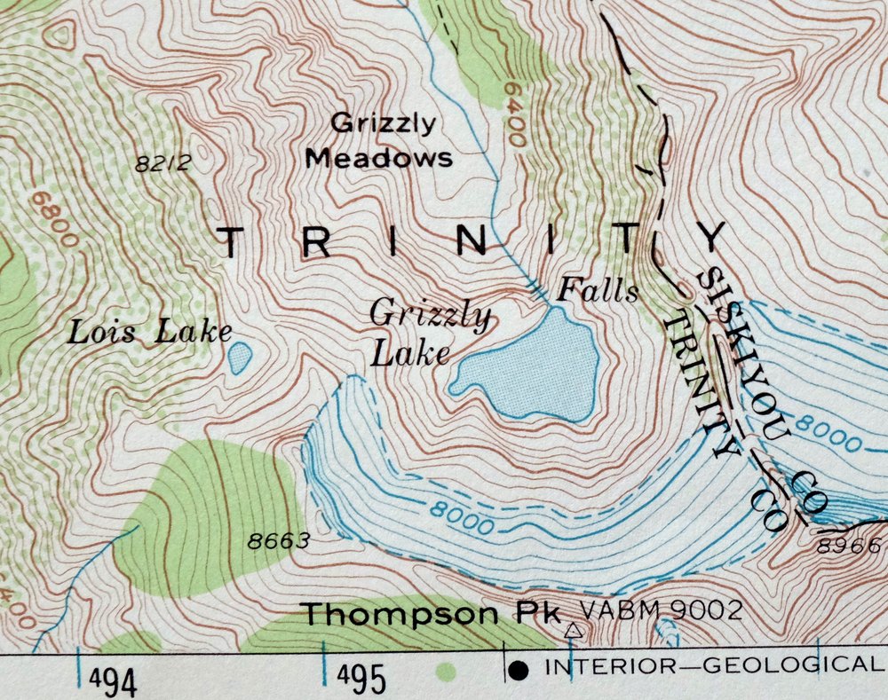
| NOTABLE PLACES | Trinity Alps, Salmon Mountains, and Klamath NF |
| CITIES AND TOWNS (CURRENT) | Cecilville |
| COUNTIES COVERED | Siskiyou and Trinity |
| FEDERAL LAND UNITS | Klamath National Forest, Trinity Alps Wilderness, and Trinity National Forest |
| RIVERS AND STREAMS | Big Bend Creek, Black Bear Creek, Blind Horse Creek, Cabin Creek, Caribou Creek, Cecil Creek, China Creek, Cody Creek, Crawford Creek, East Fork New River, East Fork South Fork Salmon River, French Creek, Grizzly Creek, Indian Creek, Little Grizzly Creek, Little South Fork Salmon River, Matthews Creek, McNeil Creek, Methodist Creek, Middle Fork of Little South Fork, Middle Fork Rattlesnake Creek, Mill Creek, North Fork Trinity River, Plummer Creek, Rattlesnake Creek, Rush Creek, Sainte Claire Creek, Shadow Creek, Sixmile Creek, Smith Creek, South Fork Salmon River, South Fork Taylor Creek, Specimen Creek, Stuart Fork, Taylor Creek, West Fork Crawford Creek, West Fork Plummer Creek, West Fork Shadow Creek, and Whisky Creek |
| WATER BODIES | Emerald Lake, Grizzly Lake, and Sapphire Lake |
| Locations: Bacon Rind Campground, Big Rock, Black Bear, Blue Ridge Ranch, Bobs Farm, Cecil Point Lookout, China Gardens, China Gardens Camp, Crawford Creek Forest Service Station, East Fork Campground, Eddy Gulch Lookout, Election Camp, Five Dollar Camp, Fosters Cabin, Georges Ranch, Glacierview Ranch, Hull Cabin, Hunters Camp, Jorstad Cabin, Last Chance Camp, Lor-o Ranch, Low Gap Campsite, Matthews Creek Campground, McDowell Camp, Moccasin Ranch, Moliter Cabin, Morrison Cabin, Mullane Corral, Pegleg Camp, Petersburg Station, Rattlesnake Camp, Shadow Creek Campground, and Yoakumville. Mountain Ranges: Coast Ranges. Mountains, Peaks, and Summits: Cabin Peak, Caesar Peak, Caeser Peak, Canyon Mountain, Grizzly Butte, Rays Peak, and Thompson Peak. Valleys and Canyons: Ault Gulch, Bear Valley, Black Gulch, Blue Gulch, Boardtree Gulch, Browns Gulch, Butcher Gulch, Callahan Gulch, Devils Gulch, Dry Gulch, Fourth of July Gulch, Garden Gulch, Gibson Gulch, Gooey Gulch, Gould Gulch, Graham Gulch, Hazel Gulch, Henrys Gulch, Indian Gulch, Jennings Gulch, Ketchum Gulch, Limestone Gulch, Long Gulch, Marley Gulch, Mill Gulch, Morrison Gulch, Murphy Gulch, Canyon Number 1, Orton Gulch, Rays Gulch, Specimen Gulch, Spring Gulch, Stage Gulch, Station Gulch, Strause Gulch, Stribling Gulch, and Timber Gulch. Drainages: Bark Shanty Creek, Big Bend Creek, Black Bear Creek, Blind Horse Creek, Cabin Creek, Caribou Creek, Cecil Creek, China Creek, Cody Creek, Crawford Creek, East Fork South Fork Salmon River, French Creek, Grizzly Creek, Horse Creek, Indian Creek, Little Grizzly Creek, Little South Fork Salmon River, Matthews Creek, McNeil Creek, Methodist Creek, Middle Fork Rattlesnake Creek, Middle Fork of Little South Fork, Mill Creek, Plummer Creek, Rush Creek, Sainte Claire Creek, Shadow Creek, Sixmile Creek, Smith Creek, South Fork Taylor Creek, Specimen Creek, Taylor Creek, West Fork Crawford Creek, West Fork Plummer Creek, West Fork Shadow Creek, and Whisky Creek. Capes: Cecil Point, Grouse Point, High Point, and Lafayette Point. Mines: Gunbarrel Mine, King Solomon Mine, Moliter Mine, Starveout Mine, and White Bear Mine. Lakes and Ponds: Cecil Lake, Grizzly Lake, Little South Fork Lake, Lois Lake, Luther Lake, Moraine Lake, Mullane Lake, Pony Lake, Rattlesnake Lake, and Sapphire Lake. Bluffs: Limestone Bluffs. Gaps: Chikoot Pass, Election Gap, Low Gap, and Windy Gap. Bends: Horseshoe Bend. Basins: Yellow Jacket Basin. Bars: Cody Bar. Schools: South Fork School. Ridges: Blue Ridge and Grasshopper Ridge. Flats: Grizzly Meadows, Haypress Meadow, High Prairie, and Schoolhouse Flat. Pillars: Murphy Rock. Springs: Campbell Spring, China Spring, Cold Spring, Last Chance Spring, and Maple Spring. | |
| SHIPPING AND RETURNS | |
 This map sheet will be carefully rolled in a sturdy tube and shipped via the US Postal Service. If you find that the sheet you receive is not as described in the listing, you may ship it back to us for a refund of the purchase price. | |
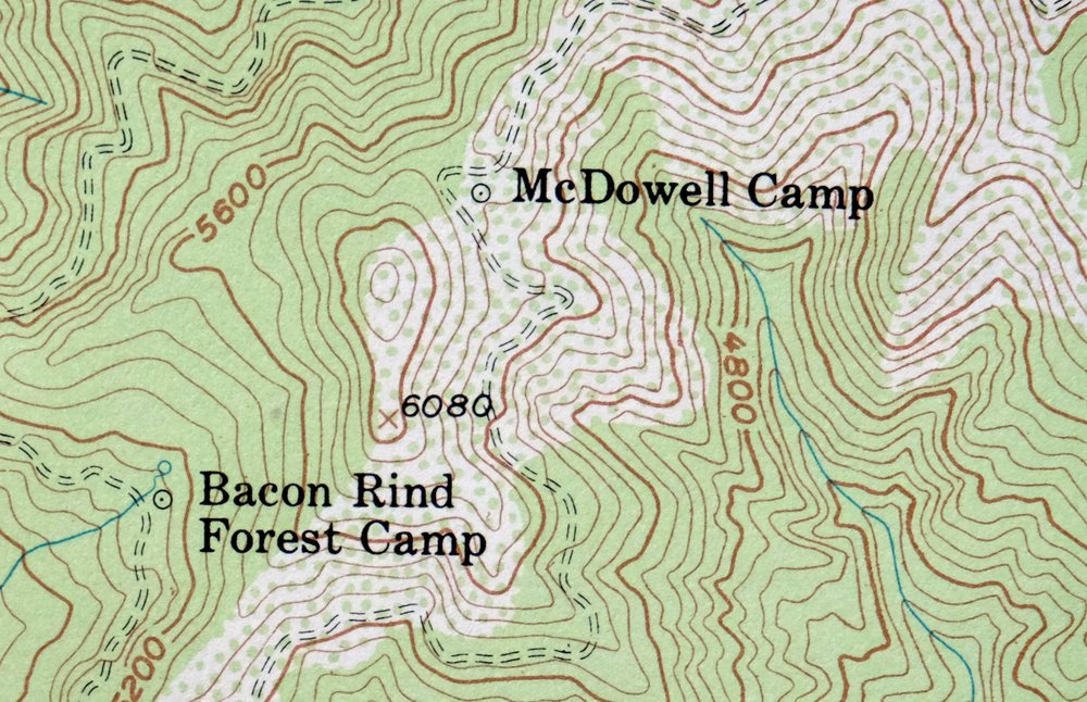
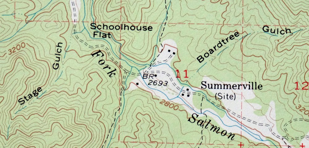
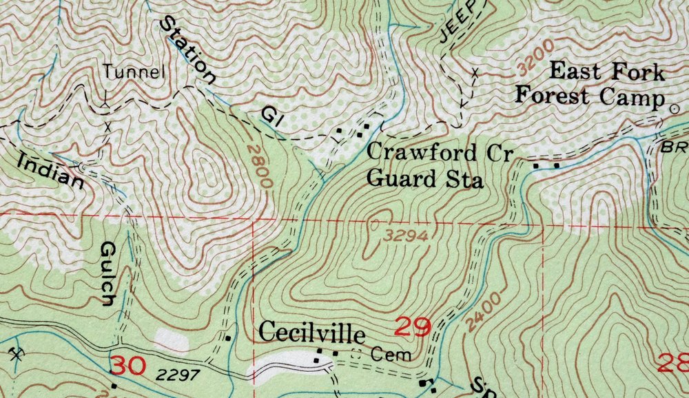
1974 Cecilville California USGS Topo Map: Trinity Alps
$34
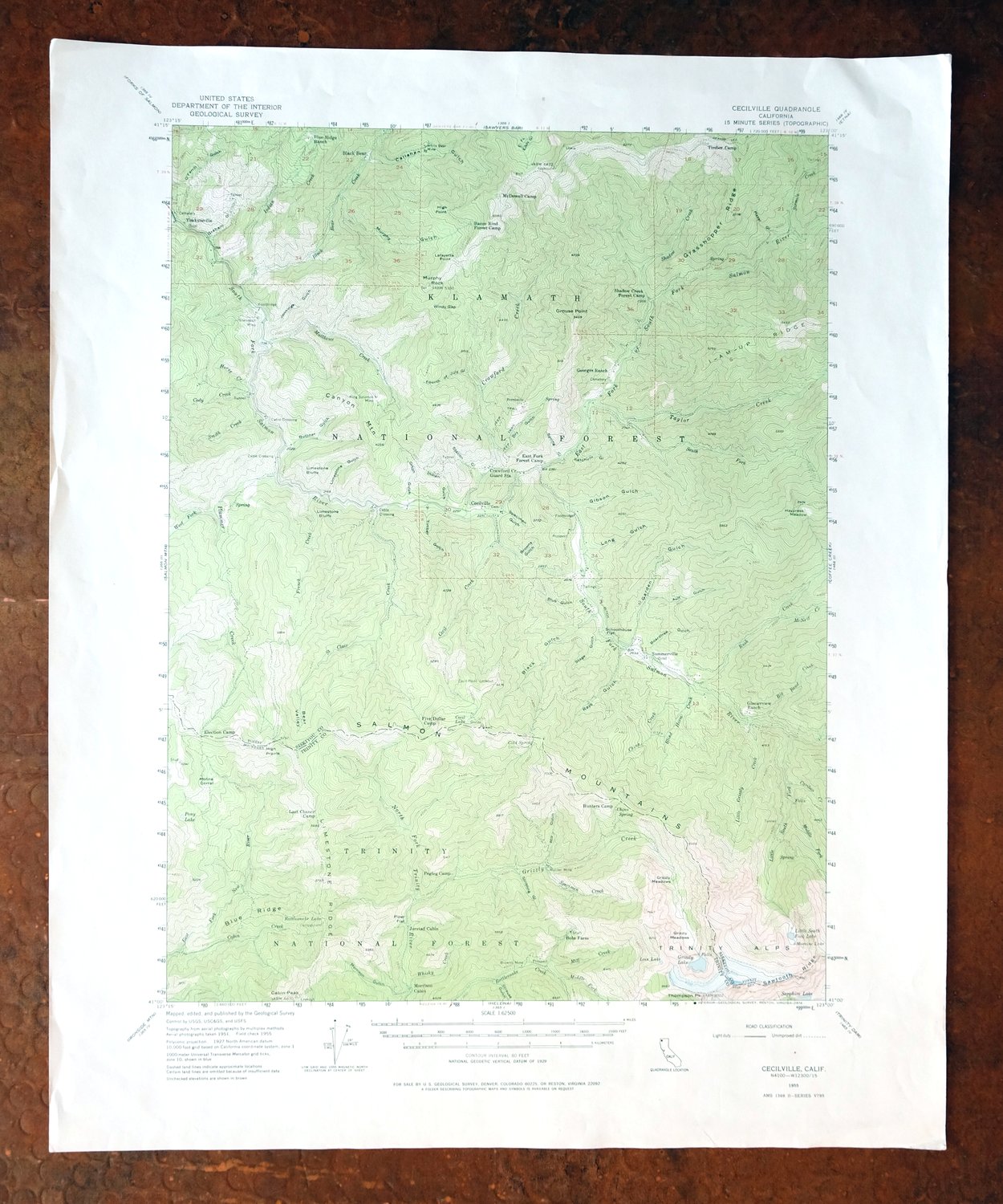
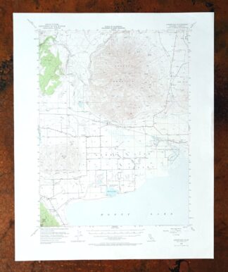
This 15-minute USGS topographic map of Cecilville, California, was first published in 1955 and printed on this thick sheet in 1974, with a green woodland tint marking the forested areas. It covers a rugged stretch of northwestern California about 55 miles northwest of Redding, spanning parts of Siskiyou and Trinity counties and taking in portions of the Klamath and Trinity national forests. The quad reaches into the Trinity Alps Wilderness and the Salmon Mountains – steep, remote country. Never folded and in very good condition, it would frame well.
In stock
This vintage sheet is a 1955 edition of the Cecilville California USGS topographic map. It is an original 52-year-old 1974 United States Geological Survey print in very good condition.
HOW THIS MAP CAN BE USED
In addition to making a fascinating conversation piece, this sheet would look great in a frame or on display, make a unique and prized gift for anyone interested in this area, be perfect as a reference for genealogy studies or general historical research, or fill that missing piece in your collection. Maps of this vintage are printed on durable stock and are well-suited for outdoor activities and recreation of all kinds, including hiking, backpacking, hunting, rafting and kayaking, backcountry skiing, geocaching, general exploration, treasure hunting, etc.
FEATURES SHOWN ON THE MAP
The Cecilville 15-minute map shows cities and towns, roads, railroads, utilities and energy infrastructure, rivers, creeks, elevation contour lines, public land survey lines, county, state, and other administrative boundaries as they existed at the time of the survey in 1951 and 1955. All known structures (houses, businesses, churches, schools, barns, cabins, etc) are also shown.
A VALUABLE HISTORICAL RECORD
Maps from the 15-minute series for the continental United States are no longer produced or printed by the USGS and original prints are becoming increasingly difficult to find. They are a valuable historical record for an area, as they contain many placenames and features that have been dropped from more recent maps.
Nearby maps
-
1953 USGS Topo Map: Helena, California
$34 Add to cart -
Lamoine California Shasta Lake USGS Topo Map 1974 Vintage
$42 Add to cart -
Shasta California McCloud USGS 15-Min Topo Map 1968 Vintage
$40 Add to cart -

Preston Peak California Klamath NF USGS 15-Min Topo Map 1962
$28 Add to cart -
1954 USGS Topo Map: Copco, Agar, California (Original Print)
$40 Add to cart -
1950 Dorris California USGS Topo Map: Somerset
$40 Add to cart -
Manzanita Lake California Viola USGS Topo Map 1974 Vintage
$39 Add to cart -
Piercy California USGS 15-Min Topographic Map 1971 Vintage
$33 Add to cart -
Panther Spring California USGS 15-Min Topo Map 1970 Vintage
$36 Add to cart -
Tulelake California USGS 15-Min Topographic Map 1970 Vintage
$33 Add to cart -
1978 USGS Topo Map: Mount Harkness, California
$36 Add to cart -

Richardson Springs California Chico Nord USGS Topo Map 1966
$35 Add to cart -
Fruto California Stony Creek Nye Creek USGS Topo Map 1944
$30 Add to cart -
1968 Chico California USGS Topo Map: Sacramento River
$41 Add to cart -
Stonyford California USGS 15-Min Topo Map 1967 Vintage
$39 Add to cart -
Glenblair California Comptche USGS Topo Map 1943 Vintage
$38 Add to cart -
Westwood California USGS 15-Min Topographic Map 1961 Vintage
$38 Add to cart -
Big Sage Reservoir California Alturas USGS Topo Map 1972
$40 Add to cart -
Fredonyer Peak California USGS 15-Min Topo Map 1972 Vintage
$32 Add to cart -
Lakeport California Lucerne Nice USGS Topo Map 1977 Vintage
$46 Add to cart -
1967 USGS Topo Map: Clearlake Oaks, California
$40 Add to cart -
Susanville California Janesville USGS Topo Map 1966 Vintage
$39 Add to cart -
Gridley California Oroville Live Oak USGS Topo Map 1959
$37 Add to cart -
Litchfield California Susanville USGS Topo Map 1972 Vintage
$40 Add to cart