MAP DETAILS | |
|---|---|
| TITLE | Rancocas |
| STATE | New Jersey |
| LOCATION | Vicinity of Vineland, 20 miles north of Mays Landing |
| SERIES | 30-minute |
| SURVEYED | 1885 and 1886 Field Survey |
| GEOGRAPHER | Henry Gannett |
| ENGRAVED | 1900 |
| EDITION | 1900 |
| PRINTED | 1913 |
| PRINT NOTES | Thick paper stock |
| SCALE | 1:125000 |
| CONTOUR INTERVAL | 10 feet |
| SHEET DIMENSIONS | 16 1/2 x 20 inches |
| MAP DIMENSIONS | 13 1/2 x 17 1/2 inches |
| COVERAGE AREA | 27 x 35 miles |
| SOURCE | From an uncommonly well-preserved collection |
| MAP NOTES | A fascinating historical snapshot surveyed before the modern highway system, showing historic overland travel routes, rail lines, and early placenames. |
| SHEET CONDITION For maps of this vintage, effort is made to note all visible flaws, no matter how minor. | |
| OVERALL CONDITION | Excellent |
| SHEET NOTES | very lightly handled, never folded, smooth and flat |
| MAP AREA | flawless map area |
| COLLARS | no wear or tears, no markings, minor blemishes, hole punches along left collar |
| MAP COVERAGE Quadrangle extent overlaid on current basemap. | |
| BACKSIDE LEGEND | |
 A map summary is printed on the back side of the Rancocas sheet similar to the one shown in the picture. It outlines the history, purpose, and status of the USGS mapping program at the time of the printing in 1913. It also provides instructions on how to read contour lines and a description of how they are used to depict the terrain. At the bottom of the page is a legend showing all of the symbols used to represent the cultural, relief, and water features found on the map. | |
| PLACENAMES Depending on map series and survey date, all of the features listed below may not be shown on this map. This list contains features that currently exist or historically existed within the area covered by the map. The list can be used as a reference to determine if this map covers your area of interest. Placenames are listed alphabetically next to each feature type. | |
| CITIES AND TOWNS (CURRENT) | Albion, Ashland, Atco, Atsion, Barclay-Kingston, Berlin, Blue Anchor, Braddock, Browns Mills, Buddtown, Buena, Cedar Brook, Chatsworth, Cherry Hill Mall, Chesilhurst, Cinnaminson, Clementon, Collings Lakes, Country Lake Estates, Echelon, Egg Harbor City, Elwood, Elwood-Magnolia, Erlton-Ellisburg, Evesboro, Ewansville, Fairview, Folsom, Fort Dix, Gibbsboro, Greentree, Hainesport, Hammonton, Kresson, Lake Pine, Laurel Springs, Leisuretowne, Lenola, Lindenwold, Lumberton, Magnolia, Maple Shade, Marlton, Masonville, Medford Lakes, Moorestown, Moorestown-Lenola, Mount Holly, Nesco, Pemberton, Pemberton Heights, Pine Hill, Pine Valley, Port Republic, Presidential Lakes Estates, Ramblewood, Rancocas Woods, Red Lion, Sicklerville, Springdale, Stratford, Tabernacle, Tansboro, Victory Lakes, Vincentown, Vineland, Waterford Works, West Berlin, Williamstown, Winslow, and Wrightstown |
| COUNTIES COVERED | Atlantic, Burlington, Camden, Cumberland, Gloucester, and Ocean |
| FEDERAL LAND UNITS | Fort Dix Military Reservation |
| RIVERS AND STREAMS | Albertson Brook, Arnold Branch, Baffin Brook, Bard Branch, Barton Run, Batsto River, Bear Swamp River, Beaver Branch, Beaver Run, Beaverdam Creek, Big Bridge Branch, Big Creek, Bisphams Mill Creek, Black Run, Blackwater Branch, Blue Anchor Brook, Bobbys Run, Bread and Cheese Run, Brockaways Branch, Buck Run, Budd Run, Bull Creek, Cedar Run, Clark Branch, Clarks Mill Stream, Cold Water Run, Cooper Branch, Cooper River, Cranberry Branch, Cropwell Branch, Deep Run, Drivers Branch, Ducks Nest Stream, Elliots Creek, Featherbed Branch, Fence Creek, First Branch, Fourmile Branch, Friendship Creek, Gates Branch, Great Egg Harbor River, Great Swamp Branch, Greenwood Branch, Gum Spring, Gun Branch, Hammonton Creek, Hartshorne Mill Stream, Haynes Creek, Hays Mill Creek, Honey Run Branch, Hospitality Branch, Hospitality Brook, Indian Branch, Indian Cabin Creek, Indian Mills Brook, Jacks Run, Jade Run, Jerry Creek, Kay Branch, Kendles Run, Kettle Run, Landing Creek, Larkins Run, Little Bull Creek, Little Creek, Little Hauken Run, Long Branch, Lucas Branch, Masons Creek, McDonalds Branch, Menantico Creek, Middle Branch Mount Misery Brook, Mile Run, Millard Creek, Morses Mill Stream, Mount Misery Brook, Mullica River, Muskingum Brook, Nacote Creek, Negro Creek, Nescochague Creek, Newbold Run, Nicholson Branch, North Branch Big Timber Creek, North Branch Cooper River, North Branch Mount Misery Brook, North Branch Pennsauken Creek, North Branch Rancocas Creek, Nortons Branch, Ong Run, Ore Spung, Oswego River, Panther Branch, Parkers Creek, Penn Swamp Branch, Penny Pot Stream, Petties Branch, Pine Creek, Pole Branch, Pompeston Creek, Powells Run, Price Branch, Pump Branch, Rancocas Creek, Reeds Branch, Risley Branch, Roberts Branch, Second Branch, Shane Branch, Sharps Branch, Sharps Run, Shinns Branch, Shoal Branch, Skit Branch, Slab Causeway Branch, Sleeper Branch, South Branch Mount Misery Brook, South Branch Rancocas Creek, Southwest Branch South Branch Rancocas Creek, Springers Brook, Squankum Branch, Swede Run, Tarkiln Branch, Teal Creek, Three Pond Branch, Tibbs Branch, Tindale Run, Tinkers Branch, Tub Mill Branch, Tulpehocken Creek, Turtle Creek, Union Creek, Wading River, Watering Race Branch, Wesickaman Creek, West Branch Wading River, Whitehall Branch, and Wildcat Branch |
| WATER BODIES | Amphibious Lake, Anchor Lake One, Anchor Lake Two, Atco Lake, Atsion Lake, Batsto Lake, Bear Swamp, Beaverdam Lake, Big Goose Pond, Big Pine Lake, Birchwood Lake, Blue Lake, Bottom Lake, Braddocks Millpond, Bridgewood Lake, Burrs Mill Brook Reservoir, Camp Inawendiwin Lake, Cedar Lake, Centennial Lake, Chatsworth Lake, Clement Lake, Clementon Lake, Country Lake, Cranes Lake, Diamond Lake, Egg Harbor City Lake, Great Swamp, Hammonton Lake, Hanover Lake, Harmony Lake, Harrisville Pond, Hobb Lake, Indian Mills Lake, Indian Mills Sawmill Pond, Kenilworth Lake, Kirkwood Lake, Kresson Lake, Lake Albert, Lake Lekau, Lake Mishe-Mokwa, Lake Pachoango, Lebanon Lake, Linden Lake, Little Goose Pond, Little Pine Lake, Lost Lake, Makepeace Lake, Marsh Lake, Martha Pond, Mill Pond, Mimosa Lakes, Mirror Lake, Moss Mill Lake, Nescochague Lake, New Brooklyn Lake, Old Forge Lake, Oles Lake, Oliphants Lake, Pakim Pond, Penn Swamp Pond, Pilling Lake, Lake Pine, Rowand Lake, Silver Lake, Smithville Lake, Spruce Lake, Squaw Lake, Strawbridge Lake, Sunset Lake, Sunshine Park Lake, Taunton Lake, Timber Lake, Timber Lakes, Upper Stokes Pond, Victory Lakes, Vincentown Millpond, Virginia Lake, West Jersey Cranberry Meadow, Woodland Lake, and Lake Worth |
| Locations: Amotol Race Track, Atco Dragway, Camp Ha-Lu-Sa, Camp Inawendiwin, Camp Kettle Run, Camp Lenape, Chesterville, Foster Station, Golden Pheasant Country Club, Hadonbrook Country Club, Hampton Station, Hedger House, Jaques Bridge, Kresson Golf Course, Laurel Oak Country Club, Mary Ann Furnace, Paragon Country Club, Pine Hill Camp, Pinecrest Country Club, Ramblewood Country Club, Red Lion Circle, Reeves Station, Seven Causeways, Small, Spring Hill Country Club, Sunny Jim Golf Club, Taggart Siding, Trout Run Station, Wilsons Station, and Woodcrest Country Club. Administrative Boundaries: Borough of Berlin, Township of Berlin, Township of Buena Vista, Borough of Buena, Borough of Chesilhurst, Borough of Clementon, Egg Harbor City, Township of Evesham, Borough of Folsom, Township of Galloway, Borough of Gibbsboro, Township of Hainesport, Town of Hammonton, Borough of Lindenwold, Township of Lumberton, Township of Maple Shade, Borough of Medford Lakes, Township of Medford, Township of Monroe, Township of Moorestown, Township of Mount Laurel, Township of Mullica, Borough of Pemberton, Township of Pemberton, Borough of Pine Hill, Borough of Pine Valley, Township of Shamong, Township of Southampton, Township of Tabernacle, Township of Voorhees, Township of Washington, Township of Waterford, and Township of Winslow. Mountains, Peaks, and Summits: Apple Pie Hill, Big Hill, Huckleberry Hill, Hutton Hill, Jackson Hill, Jemima Mount, Mount Laurel, Pine Hill, Sharps Mountain, Stone Mountain, and Stormy Hill. Woods: Chatsworth Woods and The Pine Barrens. Parks: Berlin Park, Carranza Memorial, Creek Island Park, Goshen Pond Camping Area, Hammonton Lake Park, Iron Works Park, Medford Fish and Wildlife Management Area, Medford Park, Mill Dam Park, Monroe Park, Mount Laurel State Park, New Brooklyn County Park, Rancocas State Park, Swan Bay Fish and Wildlife Management Area, Winslow Fish and Wildlife Management Area, Wood Park, and Woolman Lake Park. Drainages: Albertson Brook, Alquatka Branch, Arnold Branch, Baffin Brook, Bard Branch, Barton Run, Batsto River, Bear Swamp River, Beaver Branch, Beaver Run, Beaverdam Creek, Big Bridge Branch, Bisphams Mill Creek, Black Run, Blue Anchor Brook, Bobbys Run, Bread and Cheese Run, Brockaways Branch, Buck Run, Bucks Cove Run, Budd Run, Bull Creek, Bulls Branch, Burnt Bridge Branch, Burrs Mill Brook, Cedar Brook, Cedar Run, Clark Branch, Clarks Mill Stream, Cold Water Run, Cooper Branch, Cranberry Branch, Cropwell Branch, Deep Run, Drivers Branch, Ducks Nest Stream, Elliots Creek, Faraway Branch, Featherbed Branch, Fence Creek, First Branch, Fourmile Branch, Friendship Creek, Friendship Creek Branch, Gates Branch, Gaunts Brook, Goodwater Run, Great Swamp Branch, Greenwood Branch, Gum Spring, Gun Branch, Hammonton Creek, Hartshorne Mill Stream, Haynes Creek, Hays Mill Creek, Hedges Branch, Honey Run Branch, Hospitality Branch, Hospitality Brook, Indian Branch, Indian Cabin Creek, Indian Mills Brook, Jacks Run, Jade Run, Jerry Creek, Kay Branch, Kettle Run, Landing Creek, Larkins Run, Little Bull Creek, Little Creek, Little Hauken Run, Little Mill Creek, Long Branch, Lucas Branch, Makepeace Stream, Masons Creek, McDonalds Branch, Middle Branch Mount Misery Brook, Mile Run, Millard Creek, Morses Mill Stream, Mount Misery Brook, Muskingum Brook, Negro Creek, Nescochague Creek, New Squankum Branch, Newbold Run, Nicholson Branch, North Branch Mount Misery Brook, North Branch Rancocas Creek, Nortons Branch, Oakland Brook, Ong Run, Ore Spung, Oswego River, Parkers Creek, Penn Swamp Branch, Penny Pot Stream, Petties Branch, Pine Creek, Pole Branch, Pole Bridge Branch, Powells Run, Price Branch, Pump Branch, Reeds Branch, Risley Branch, Roberts Branch, Rubins Run, Second Branch, Shane Branch, Sharps Branch, Sharps Run, Shinns Branch, Shoal Branch, Skit Branch, Slab Causeway Branch, Sleeper Branch, South Branch Burrs Mill Brook, South Branch Mount Misery Brook, South Branch Rancocas Creek, Southwest Branch South Branch Rancocas Creek, Springers Brook, Squankum Branch, Tarkiln Branch, Teal Creek, Three Pond Branch, Tibbs Branch, Tinkers Branch, Trout Run, Tub Mill Branch, Tulpehocken Creek, Turtle Creek, Union Creek, Wesickaman Creek, West Branch Wading River, White Oak Branch, Whitehall Branch, and Wildcat Branch. Islands: Hog Islands, Maple Island, Soldiers Island, and Treasure Island. Capes: Jenkins Neck. Mines: Marl Pit. Churches: Bethel Church, Bethlehem Church, Calvary Church, Cistercian Monastery, Faith Church, First Union Church, Friendship Church, Green Grove Church, Hillman Church, Immaculate Conception Novitiate, Jacobs Chapel, Lower Bank Church, Mount Zion Church, New Covenant Church, Oak Grove Church, Refuge Church, Sacred Heart Church, Saint Andrews Church, Saint James Church, Saint Johns Church, Saint Martins Church, Saint Mary of the Lakes Church, Saint Marys Church, Saint Matthews Church, Saint Michaels Church, Saint Peters Church, Saints Peter and Paul Church, Snyder Church, Trinity Church, and Wiley Mission. Forests: Green Bank State Forest and Wharton State Forest. Hospitals: Ancora State Hospital, Buttonwood Hospital, Deborah Sanatorium, and West Jersey Hospital. Lakes and Ponds: Adams Lake, Big Goose Pond, Big Pine Lake, Blue Hole, Bottom Lake, Buttonwood Lake, Cedar Pond, Clement Lake, Lake Cotoxen, Deep Hollow Pond, Edgewood Lake, Egg Harbor City Lake, Grant Lake, Harmony Lake, Hospitality Lake, Jennings Lake, Kresson Lake, Linden Lake, Lion Lake, Little Goose Pond, Little Pine Lake, Mannis Duck Pond, Manson Lake, Marsh Lake, Martha Pond, Mill Pond, Monroe Lake, Nescochague Lake, Oliphants Lake, Otter Pond, Pakim Pond, Penn Swamp Pond, Pilling Lake, Pine Lake, Lake Pine, Rowand Lake, Silver Lake, Sunshine Park Lake, Upper Lake, Virginia Lake, Watson Lake, Woodland Lake, Woolman Lake, and Lake Worth. Buildings: Evergreen Home for the Aged and Saint Marys Home for the Aged. Dams: Amphibious Lake Dam, Atco Lake Dam, Atsion Lake Dam, Batsto Dam, Beaverdam Lake Dam, Birchwood Lake Dam, Braddock Lake Dam, Braddocks Mill Dam, Breakneck Dam, Cains Mill Pond Dam, Camp Inawendiwin Dam, Cedar Lake Dam, Centennial Lake Dam, Chatsworth Lake Dam, Clementon Lake Dam, Cranes Lake Dam, Cushman Lake Dam, Diamond Lake Dam, Gravelly Run Dam, Hammonton Lake Dam, Hanover Lake Dam, Harrisville Dam, Hobb Lake Dam, Huntington Drive Dam, Indian Mills Dam, Indian Mills Sawmill Dam, Kenilworth Lake Dam, Lake Albert Dam, Lake George Dam, Lebanon Forest Dam Number One, Lebanon Lake Dam, Lisbon Dam, Lower Aetna Lake Dam, Makepeace Lake Dam, Marlton Lakes Upper Dam, Mirror Lake Dam, Mishe-Mokwa Dam, Moss Mill Lake Dam, New Brooklyn Dam, New Camp Site Dam, New Lisbon Mill Dam, Pachoango Dam, Pancoast Mill Pond Dam, Pine Lake Dam, Pleasant Mills Dam, Smithville Dam, Spruce Lake Dam, Strawbridge Lake Upper Dam, Sunset Lake Dam, Timber Lake Dam, Timber Lakes Dam, Tomlinsons Mill Dam, Upper Aetna Lake Dam, Upper Stokes Dam, Victory Lakes Dam Number Two, and Vincentown Mill Dam. Channels: Mathis Thorofare. Canals: Big Ditch. Bayous and Sloughs: Haulover Creek. Bridges: Quaker Bridge. Airports: A M Rodgers Construction Company, AT and T Cedarbrook Heliport, Albion, Als Landing Strip, Atsion Helistop, Bertino Heliport, Burlington County Airpark, Camden County Airport, Camden-Burlington County, Caputo Helistop, Chemical Bank-New Jersey National Heliport, Collins Field, Eayrestown Helistop, Flying W Airport, Folsom Airport, Geiserts Strip, Griffin Associates Heliport, Hammonton Municipal Airport, Ideal Manufacturing Corporation Airport, Indian Mills Heliport, LZ 1 NLDC Heliport, Mount Holly Heliport, Mullica Landing Airport, New Freedom Switching Station Heliport, New Jersey Turnpike Authority Heliport, Our Ladys Heliport, Pacemaker Heliport, Pemberton Airport, Piney Hollow Airfield, Red Lion Airport, Rusnaks Private Strip, S and C Echelon Heliport, Sandor Farms Airstrip, South Jersey Regional Airport, Vineland-Downstown Airport, and Winchelsea Airport. Swamps: Bear Swamp, Friendship Cranberry Bogs, Great Swamp, Hog Wallow Cranberry Bogs, Penn Swamp, and West Jersey Cranberry Meadow. Schools: Albion School, Allen School, Assumption School, Baker School, Barclay School, Bates Mill School, Britt School, Beeler School, Berlin School, Brainerd School, Buffalo Avenue School, Cecil School Number 8, Cherry Hill High School, Cleary School, Eastern High School, Edgewood Regional High School, Evans School, Fleetwood School, Gibbs School, Haines School, Heritage Junior High School, Hillside School, John F Kennedy Memorial School, John H Glen School, Kingston School, Laurel Hill School, Lenape Regional High School, Medford Lakes School Number 2, Miller School, Moorestown High School, Nesco School, New Albany School, Overbrook Regional High School, Phillips School, Richard Stockton State College, Roberts School, Sacred Heart School, Saint Charles School, Saint Edwards School, Saint Joan of Arcs School, Saint Josephs School, Saint Lawrence School, Saint Nicholas School, Saint Peters School, School Number 1, Sharp School, South Valley School, Stanwick School, Strabel School, Tansboro School, Walther School, Westfield School, and Woodcrest School. Ridges: Sandy Ridge. Reservoirs and Tanks: Amphibious Lake, Anchor Lake One, Anchor Lake Two, Atco Lake, Atsion Lake, Batsto Lake, Bridgewood Lake, Beaverdam Lake, Birchwood Lake, Blue Lake, Braddock Lake, Braddocks Millpond, Burrs Mill Brook Reservoir, Cains Mill Lake, Camp Inawendiwin Lake, Cedar Lake, Centennial Lake, Chatsworth Lake, Clementon Lake, Country Lake, Cranes Lake, Cushman Lake, Deverson Lake, Diamond Lake, Gravelly Run Pond, Hammonton Lake, Hanover Lake, Harrisville Pond, Hobb Lake, Indian Mills Lake, Indian Mills Sawmill Pond, Kenilworth Lake, Lake Albert, Lake George, Lake Lekau, Lake Mishe-Mokwa, Lake Norrsken, Lake Pachoango, Lake Pine, Lake Stockwell, Lake Three, Lebanon Lake, Lost Lake, Lower Aetna Lake, Makepeace Lake, Marlton Lakes, McCarthys Lakes, Mimosa Lakes, Mirror Lake, Moss Mill Lake, New Brooklyn Lake, Old Forge Lake, Oles Lake, Pancoast Mill Pond, Papoose Lake, Presidential Lakes, Smithville Lake, Spruce Lake, Squaw Lake, Strawbridge Lake, Sunset Lake, Taunton Lake, Timber Lake, Timber Lakes, Upper Aetna Lake, Upper Marlton Lake, Upper Stokes Pond, Van Dal Lake, Victory Lakes, and Vincentown Millpond. Towers: WEEE-FM (Cherry Hill), WHSP-TV (Vineland), WNJS-TV (Camden), WRDR-FM (Egg Harbor City), WTYO-AM (Hammonton), and WWJZ-AM (Mount Holly). | |
| SHIPPING AND RETURNS | |
 This map sheet will be carefully rolled in a sturdy tube and shipped via the US Postal Service. If you find that the sheet you receive is not as described in the listing, you may ship it back to us for a refund of the purchase price. | |


Rancocas New Jersey Vineland Lindenwold USGS Topo Map 1913
$85
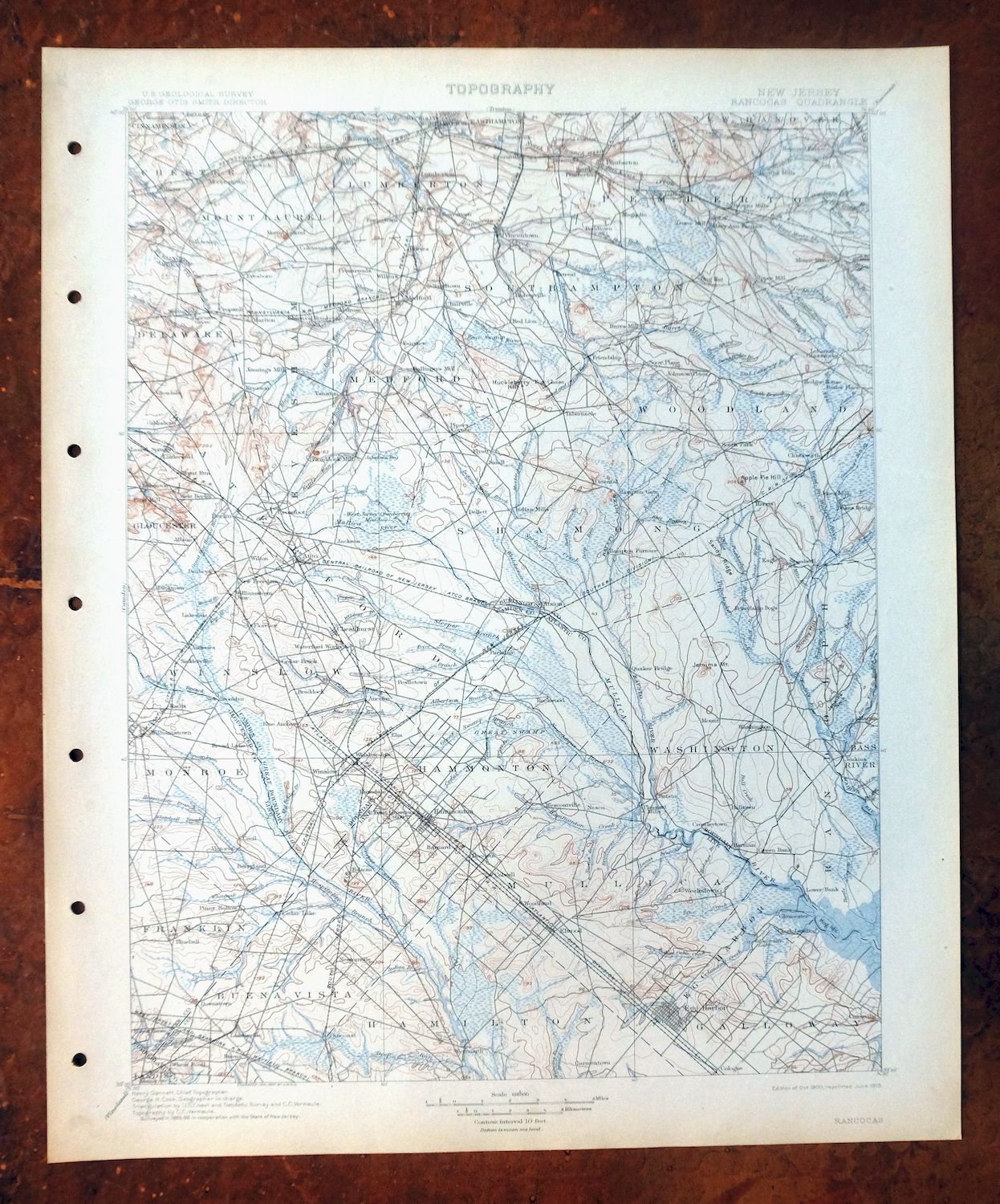
This USGS 30-minute topographic sheet was first published in 1900 and printed in 1913; the sheet has been kept in excellent condition, never folded and smooth and flat on thick stock, with a flawless map area. Drawn from an 1885 and 1886 field survey engraved in 1900 under geographer Henry Gannett, it covers a broad stretch of southern New Jersey across Atlantic, Burlington, Camden, Cumberland, Gloucester, and Ocean counties, with the quad area taking in Vineland, Hammonton, Berlin, Winslow, and Vincentown among others. Surveyed well before the modern highway system, it records the overland travel routes, rail lines, and early placenames of the region as they stood at the turn of the century, and comes from an uncommonly well-preserved collection. The reverse carries printed USGS reference material from the 1913 printing.
In stock
This antique sheet is a 1900 edition of the Rancocas New Jersey USGS topographic map. It is an authentic 113-year-old 1913 United States Geological Survey print in excellent condition.
HOW THIS MAP CAN BE USED
In addition to making a fascinating conversation piece, this sheet would look great in a frame or on display, make a unique and prized gift for anyone interested in this area, be perfect as a reference for genealogy studies or general historical research, or fill that missing piece in your collection.
FEATURES SHOWN ON THE MAP
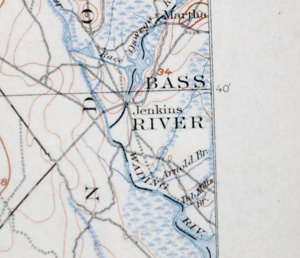
The Rancocas 30-minute map shows cities and towns, roads, railroads, rivers, creeks, elevation contour lines, public land survey lines, county, state, and other administrative boundaries as they existed at the time of the survey in 1885 and 1886.
A VALUABLE HISTORICAL RECORD
Maps from the USGS 30-minute series have been out of print for many years. They have never been common and original prints are increasingly difficult to find. For areas where the 30-minute map was produced, it is usually the first large-scale survey done by the USGS for that area. These are a valuable historical record, as they contain many placenames and features that have been dropped from more recent series’ and editions.
Nearby maps
-

Trenton New Jersey Philadelphia Levittown USGS Topo Map 1907
$150 Add to cart -
Vineland New Jersey Dover Millville USGS Topo Map 1905
$115 Add to cart -
Dover Delaware Bombay Hook NWR Middletown USGS Topo Map 1906
$47 Add to cart -

Tolchester Maryland Dundalk Essex USGS Topo Map 1908 Antique
$145 Add to cart -

Patapsco Maryland Baltimore Jessup USGS Topographic Map 1908
$96 Add to cart -
Patuxent Maryland Washington Bowie USGS 30-Min Topo Map 1907
$65 Add to cart -
Whiting New Jersey Barnegat Toms River USGS Topo Map 1907
$85 Add to cart -

Burlington Pennsylvania Trenton USGS Topographic Map 1958
$49 Add to cart -
Germantown Pennsylvania Horsham USGS Topographic Map 1912
$125 Add to cart -

Dennisville New Jersey Villas Woodbine USGS Topo Map 1910
$90 Add to cart -

New Brunswick New Jersey Spotswood Edison USGS Topo Map 1965
$32 Add to cart -

Quakertown Pennsylvania Lansdale Perkasie USGS Topo Map 1911
$95 Add to cart -

Plainfield New Jersey Edison Somerset USGS Topo Map 1965
$42 Add to cart -

Coatesville Pennsylvania Oxford USGS Topographic Map 1944
$36 Add to cart -

Honey Brook Pennsylvania Thorndale USGS Topographic Map 1962
$49 Add to cart -

Quarryville Pennsylvania Oxford USGS Topographic Map 1944
$53 Add to cart -

New Holland Pennsylvania Ephrata Akron USGS Topo Map 1962
$48 Add to cart -

Wernersville Pennsylvania Mohnton USGS Topographic Map 1963
$45 Add to cart -

Harlem New York New York Yonkers USGS Topo Map 1913 Antique
$250 Add to cart -

Lancaster Pennsylvania Columbia Lititz USGS Topo Map 1943
$58 Add to cart -
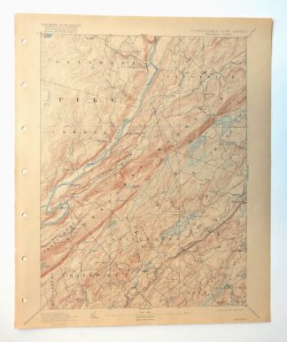
Wallpack New Jersey Newton Crandon Lakes USGS Topo Map 1916
$95 Add to cart -

Park Ridge New Jersey New City Ridgewood USGS Topo Map 1963
$45 Add to cart -

Hazleton Pennsylvania Lansford Tamaqua USGS Topo Map 1956
$48 Add to cart -

Hazleton Pennsylvania McAdoo Jeddo USGS Topographic Map 1962
$47 Add to cart