MAP DETAILS | |
|---|---|
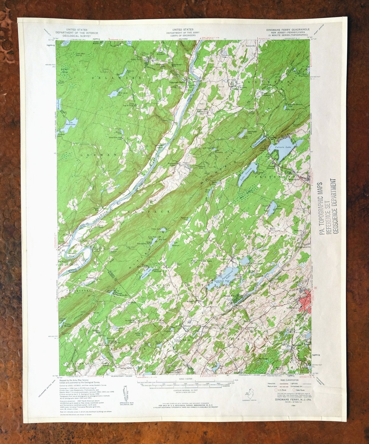
| TITLE | Dingmans Ferry |
| STATE | New Jersey, Pennsylvania |
| LOCATION | Vicinity of Newton |
| SERIES | 15-minute |
| SURVEYED | 1942 through 1954 Aerial and Field Survey |
| EDITION | 1954 |
| PRINTED | 1960 |
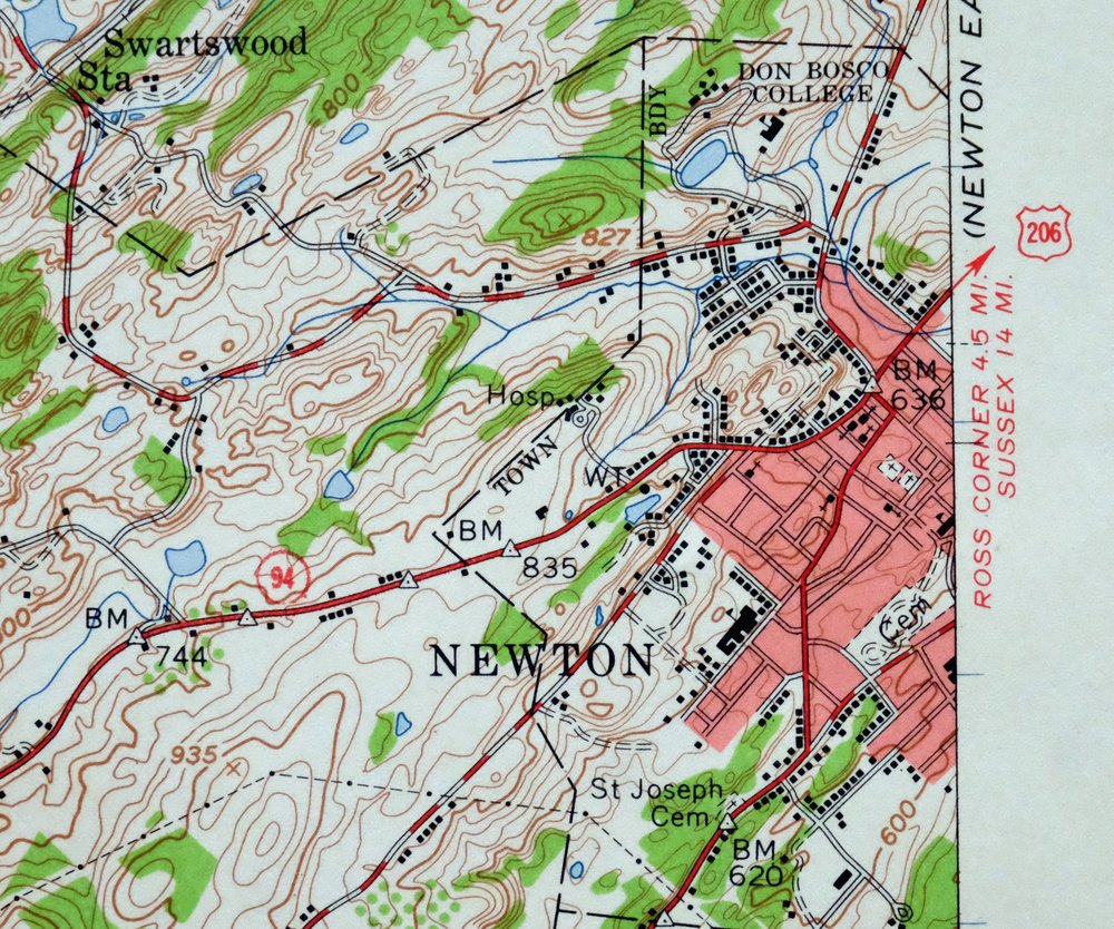
| PRINT NOTES | Includes woodland tint (green to indicate vegetated areas). A reddish tint is used to indicate urban areas where only landmark buildings are shown. |
| SCALE | 1:62500 |
| CONTOUR INTERVAL | 20 feet |
| SHEET DIMENSIONS | 17 x 21 inches |
| MAP DIMENSIONS | 13 1/8 x 17 1/2 inches |
| COVERAGE AREA | 13 x 17 miles |
| SHEET CONDITION For maps of this vintage, effort is made to note all visible flaws, no matter how minor. | |
| OVERALL CONDITION | Very Good |
| SHEET NOTES | lightly handled, never folded |
| MAP AREA | no markings, no blemishes |
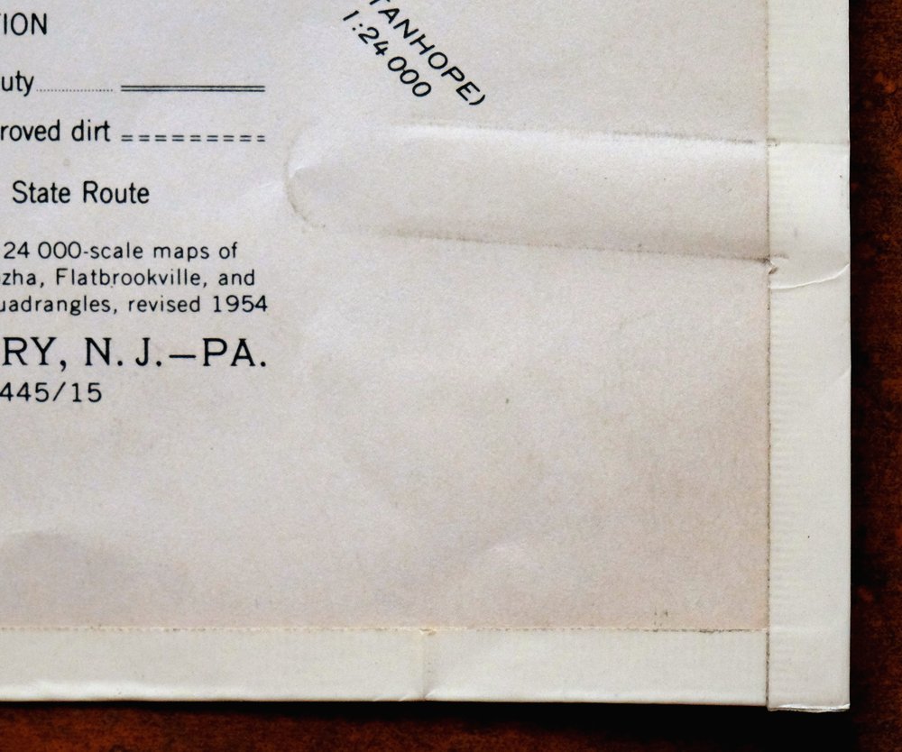
| COLLARS | no markings, no blemishes, edge protectors applied, no edge tears, paper clip indention in lower right collar corner, library stamp in right collar |
 | |
| MAP COVERAGE Quadrangle extent overlaid on current basemap. | |
| PLACENAMES Depending on map series and survey date, all of the features listed below may not be shown on this map. This list contains features that currently exist or historically existed within the area covered by the map. The list can be used as a reference to determine if this map covers your area of interest. Placenames are listed alphabetically next to each feature type. | |
| NOTABLE PLACES | Newton, Hampton Township, and Delaware River |
| CITIES AND TOWNS (CURRENT) | Branchville, Crandon Lakes, and Dingmans Ferry |
| COUNTIES COVERED | Monroe, Pike, Sussex, and Warren |
| FEDERAL LAND UNITS | Delaware Water Gap National Recreation Area |
| RIVERS AND STREAMS | Adams Creek, Bush Kill, Criss Brook, Culvers Creek, Dingmans Creek, Flat Brook, Hornbecks Creek, Kittatinny Creek, Little Bush Kill, Little Flat Brook, Paulins Kill, Pequest River, Spackmans Creek, Stony Brook, Tillman Brook, Toms Creek, Trout Brook, Vancampens Brook, and Yards Creek |
| WATER BODIES | Bass Lake, Bear Swamp, Beaver Pond, Big Bear Swamp, Catfish Pond, Clearview Lake, Crandon Lakes, Crater Lake, Culvers Lake, Duck Pond, Fairview Lake, Hemlock Lake, Hortons Pond, Hunts Pond, Lake Kathryn, Lake Kemadobi, Kiel Lake, Kittatinny Camp Lake, Kittatinny Lake, Lake Anne, Lake Ashroe, Lake Kemah, Lake Maskenozha, Lake Owassa, Lake Plymouth, Lake Robert Rooke, Lake Shawanni, Lake Success, Lake Wapalanne, Landis Lake, Lehman Lake, Little Swartswood Lake, Long Pine Pond, Long Ridge Reservation Reservoir, Lower Birchwood Lake, Lower Crandon Lake, Maple Lake, Meadows Lake, Mecca Lake, Minks Pond, Mountain Ridge Lake, Muckshaw Ponds, Mud Pond, North Lake, Nyce Lake, Lake Owassa, Plymouth Pond, Quick Pond, Richard Lake, Sand Pond, Shuster Pond, Silver Lake, Spring Lake, Spring Valley Lake, Stickle Pond, Stony Lake, Sunny Hill Lake, Sunset Lake, Swartswood Lake, Upper Blue Mountain Lake, White Lake, Whites Pond, Whittakers Pond, Wild Acres Lake, Willow Crest Lake, and Youngs Pond |
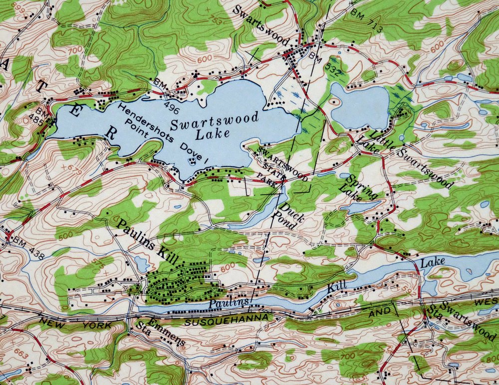
| New Jersey Locations: Camp Columbus, Camp Ken-Etiwa-Pec, Camp Kitta-Tinny, Camp Lincoln Laurel, Camp Minisink, Camp Mohican, Camp No-Be-Bo-Sco, Camp Olympia, Camp Pokano-Rainona, Camp Saint Benedict, County Camp, Dennis Memorial Camp, Dingmans Ferry, Donkeys Corners, Emmens Station, Kittatinny Camp, Madeleine Mulford Girl Scout Camp, Newbakers Corners, Princeton Summer Camp, Sakawawin Boy Scout Camp, Smith Ferry, Stillwater Station, Swartswood Station, and Wintermutes Foundry. Administrative Boundaries: Township of Fredon, Township of Hampton, Township of Hardwick, Town of Newton, Township of Sandyston, Township of Stillwater, and Township of Walpack. Parks: Flatbrook Fish and Wildlife Management Area, Swartswood State Park, Walpack Fish and Wildlife Management Area, and Whittingham Fish and Wildlife Management Area. Drainages: Big Flat Brook, Criss Brook, Flat Brook, Kittatinny Creek, Little Flat Brook, Stony Brook, Tillman Brook, and Trout Brook. Islands: Buck Bar and Dove Island. Capes: Hendershots Point. Churches: Saint Pauls Abbey and Sandystone Church. Forests: Stokes State Forest. Lakes and Ponds: Big Spring, Catfish Pond, Crater Lake, Dry Pond, Duck Pond, Fairview Lake, Hortons Pond, Hunts Pond, Lake Kathryn, Meadows Lake, Mecca Lake, Muckshaw Ponds, Mud Pond, Lake Owassa, Plymouth Pond, Redings Pond, Sand Pond, Shuster Pond, Spring Lake, Turtle Pond, and Whites Pond. Waterfalls: Bass Lake Falls and Tillman Falls. Dams: Balesville Dam, Bass Lake Dam, Clearview Lake Dam, Culvers Lake Dam, Headleys Pond Dam, Hemlock Lake Dam, Kittatinny Camp Lake Dam, Kittatinny Lake Dam, Lake Ashroe Dam, Lake Kathyrn Dam, Lake Ocquittunk Dam, Lake Owassa Dam, Lake Plymouth Dam, Lake Robert Rooke Dam, Lake Success Dam, Little Swartswood Lake Dam, Lower Blue Mountain Lake Dam, Paulins Kill Dam, Quick Pond Dam, Skellinger Dam, Spring Valley Dam, Stickle Pond Dam, Stony Lake Dam, Swartswood Lake Dam, Thomas Rich Dam, Upper Blue Mountain Lake Dam, Willow Crest Dam, and Youngs Pond Dam. Gaps: Culvers Gap. Bends: Wallpack Bend. Airports: Newton Airport and Newton Memorial Hospital Heliport. Swamps: Bear Swamp. Schools: Don Bosco College, Newton High School, and Wallpack Consolidated School. Reservoirs and Tanks: Bales Mill Pond, Bass Lake, Blue Mountain Lakes, Clearview Lake, Crandon Lakes, Culvers Lake, Duck Pond, Headleys Pond, Hemlock Lake, Kittatinny Camp Lake, Kittatinny Lake, Lake Anne, Lake Ashroe, Lake Kemah, Lake Ocquittunk, Lake Plymouth, Lake Robert Rooke, Lake Shawanni, Lake Success, Lake Wapalanne, Little Swartswood Lake, Long Pine Pond, Lower Blue Mountain Lake, Lower Crandon Lake, Mountain Ridge Lake, Paulins Kill Lake, Quick Pond, Spring Valley Lake, Stickle Pond, Stony Lake, Swartswood Lake, Thomas Rich Lake, Upper Blue Mountain Lake, Willow Crest Lake, and Youngs Pond. Towers: Normanook Lookout Tower, WFMV-FM (Blairstown), and WNNJ-FM (Newton). | |
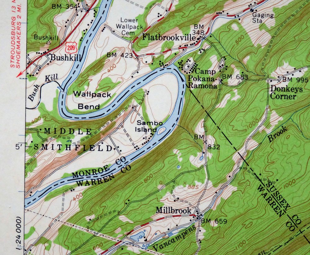
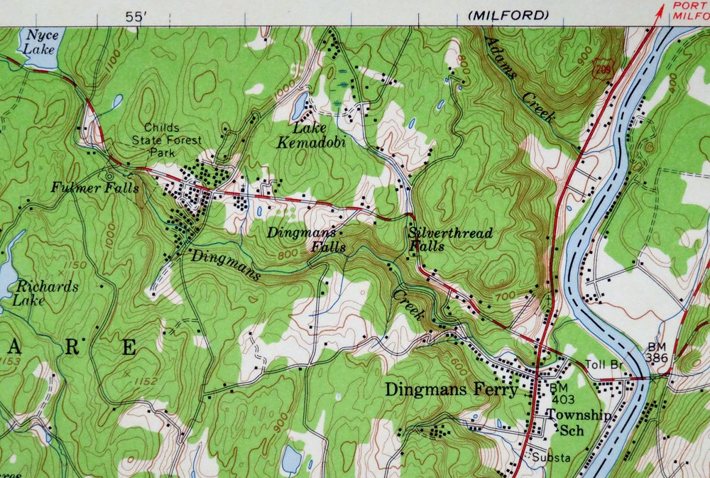
| Pennsylvania Locations: Camp Fire Girls Camp, Camp Log-N-Twig, Camp Massad, and Pocono Mountain Lake Resort. Administrative Boundaries: Township of Middle Smithfield. Parks: Delaware Water Gap National Recreation Area, George W Childs State Park, and Middle Delaware National Scenic and Recreational River. Drainages: Adams Creek, Bush Kill, Dingmans Creek, Hornbecks Creek, Nichecronk Brook, Spackmans Creek, and Toms Creek. Islands: Sambo Island and Shapanack Island. Churches: Holy Trinity Church. Lakes and Ponds: Lake Kemadobi, Sunny Hill Lake, and Whittakers Pond. Waterfalls: Deer Leap Falls, Dingmans Falls, Factory Falls, Fulmer Falls, and Silverthread Falls. Dams: Benewater Dam, Fawn Lake Dam, Gorson Dam, Lake Kernadobi Dam, Lake Latimore Dam, Lake Lattimore Dam, Long Ridge Dam, Lower Birchwood Lake Dam, Lower Rickards Dam, Maple Lake Dam, Minks Dam, North Lake Dam, Olson Dam, Pocono Mountain Lake Dam, Richards Dam, Rickard Dam, Snyder Dam, Trout Dam, Whitesell Dam, Whittaker Dam, and Wild Acres Lake Dam. Bends: Wallpack Bend. Bars: Buck Bar. Swamps: Big Bear Swamp, Little Bear Swamp, and Long Swamp. Schools: Pocono Environmental Education Center. Reservoirs and Tanks: Fawn Lake, Kiel Lake, Lake Log-n-Twig, Lake Maskenozha, Landis Lake, Long Ridge Reservation Reservoir, Lower Birchwood Lake, Maple Lake, Minks Pond, North Lake, Nyce Lake, Pocono Mountain Lake, Richard Lake, Sunset Lake, and Wild Acres Lake. Towers: Dry Meadow Fire Tower. | |
| SHIPPING AND RETURNS | |
 This map sheet will be carefully rolled in a sturdy tube and shipped via the US Postal Service. If you find that the sheet you receive is not as described in the listing, you may ship it back to us for a refund of the purchase price. | |
1960 Dingmans Ferry NJ/PA USGS Army COE Topo Map
$48
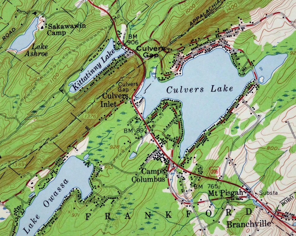
This is a USGS 15-minute topographic sheet of the Dingmans Ferry quadrangle, a 1954 edition printed in 1960, mapped from aerial and field surveys made between 1942 and 1954 and printed with a green woodland tint. It spans the Delaware River where New Jersey meets Pennsylvania, covering parts of Sussex and Warren counties in New Jersey and Monroe and Pike in Pennsylvania, with Branchville, Crandon Lakes, and the community of Dingmans Ferry in the area. This stretch of the Delaware, with its wooded ridges and river crossings, was later folded into the Delaware Water Gap National Recreation Area. The sheet has never been folded and would frame well.
In stock
This vintage sheet is a 1954 edition of the Dingmans Ferry New Jersey USGS topographic map. It is an original 66-year-old 1960 United States Geological Survey print in very good condition.
HOW THIS MAP CAN BE USED
In addition to making a fascinating conversation piece, this sheet would look great in a frame or on display, make a unique and prized gift for anyone interested in this area, be perfect as a reference for genealogy studies or general historical research, or fill that missing piece in your collection. Maps of this vintage are printed on durable stock and are well-suited for outdoor activities and recreation of all kinds, including hiking, backpacking, hunting, rafting and kayaking, backcountry skiing, geocaching, general exploration, treasure hunting, etc.
FEATURES SHOWN ON THE MAP
The Dingmans Ferry 15-minute map shows cities and towns, roads, railroads, utilities and energy infrastructure, rivers, creeks, elevation contour lines, public land survey lines, county, state, and other administrative boundaries as they existed at the time of the survey in 1942 through 1954. A reddish tint is used on this sheet to indicate urban areas where only landmark buildings are depicted. Outside of those areas, all known structures (houses, businesses, churches, schools, barns, cabins, etc) are shown.
A VALUABLE HISTORICAL RECORD
Maps from the 15-minute series for the continental United States are no longer produced or printed by the USGS and original prints are becoming increasingly difficult to find. They are a valuable historical record for an area, as they contain many placenames and features that have been dropped from more recent maps.
Nearby maps
-

Milford Pennsylvania Lackawaxen Pond Eddy USGS Topo Map 1915
$58 Add to cart -
Hawley Pennsylvania Tafton USGS 15-Min Topo Map 1964 Vintage
$44 Add to cart -

Goshen New York Middletown Warwick USGS Topographic Map 1913
$55 Add to cart -

Damascus Pennsylvania Honesdale USGS Topo Map 1964 Vintage
$35 Add to cart -

Schunemunk New York Newburgh Kiryas Joel USGS Topo Map 1915
$65 Add to cart -
Honesdale Pennsylvania Carbondale Waymart USGS Topo Map 1945
$49 Add to cart -

West Point New York Newburgh Peekskill USGS Topo Map 1912
$105 Add to cart -

Harlem New York New York Yonkers USGS Topo Map 1913 Antique
$250 Add to cart -

Hazleton Pennsylvania Lansford Tamaqua USGS Topo Map 1956
$48 Add to cart -
Starrucca Pennsylvania Hancock Lakewood USGS Topo Map 1964
$40 Add to cart -

Quakertown Pennsylvania Lansdale Perkasie USGS Topo Map 1911
$120 Add to cart -

Tunkhannock Pennsylvania Dalton Glenburn USGS Topo Map 1952
$40 Add to cart -
Susquehanna Pennsylvania Hallstead USGS 15-Min Topo Map 1959
$46 Add to cart -
Olyphant Pennsylvania Scranton Dunmore USGS Topo Map 1960
$37 Add to cart -

Park Ridge New Jersey New City Ridgewood USGS Topo Map 1963
$45 Add to cart -

Plainfield New Jersey Edison Somerset USGS Topo Map 1965
$42 Add to cart -

Wilkes-barre East Pennsylvania Laurel Run USGS Topo Map 1959
$36 Add to cart -

New Brunswick New Jersey Spotswood Edison USGS Topo Map 1965
$32 Add to cart -
Wilkes-barre West Pennsylvania Nanticoke USGS Topo Map 1958
$30 Add to cart -

Hazleton Pennsylvania McAdoo Jeddo USGS Topographic Map 1962
$47 Add to cart -
Kingston Pennsylvania Wilkes-Barre USGS Topographic Map 1959
$39 Add to cart -

Trenton New Jersey Philadelphia Levittown USGS Topo Map 1907
$150 Add to cart -

Burlington Pennsylvania Trenton USGS Topographic Map 1958
$49 Add to cart -
Germantown Pennsylvania Horsham USGS Topographic Map 1912
$125 Add to cart