MAP DETAILS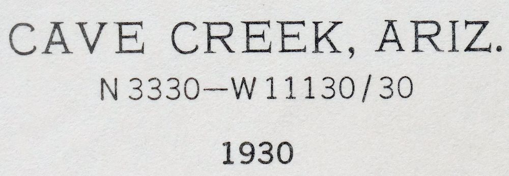 | |
|---|---|
| TITLE | Cave Creek |
| STATE | Arizona |
| LOCATION | Vicinity of Phoenix |
| SERIES | 30-minute |
| SURVEYED | 1929 and 1930 Field Survey |
| GEOGRAPHER | W.G. Carson |
| EDITION | 1930 |
| PRINTED | 1963 |
| PRINT NOTES | Thick paper stock, includes woodland tint (green to indicate vegetated areas) |
| SCALE | 1:125000 |
| CONTOUR INTERVAL | 100 feet |
| SHEET DIMENSIONS | 17 x 21 inches |
| MAP DIMENSIONS | 14 1/2 x 17 1/2 inches |
| COVERAGE AREA | 29 x 35 miles |
| SOURCE | From the vintage map collection of Art Christiansen, Tempe, Arizona |
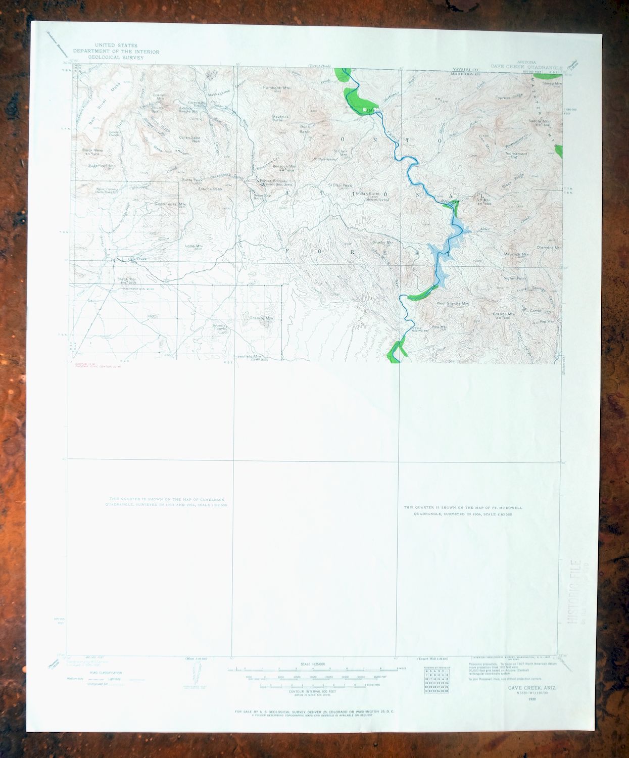
| MAP NOTES | A fascinating historical snapshot of the Verde River through the Tonto National Forest, including the area of present-day Carefree and Horseshoe Dam, surveyed before the modern highway system, showing historic travel routes and placenames; only the north half of this quadrangle was surveyed for this series. |
| SHEET CONDITION For maps of this vintage, effort is made to note all visible flaws, no matter how minor. | |
| OVERALL CONDITION | Excellent |
| SHEET NOTES | lightly handled, never folded |
| MAP AREA | flawless map area |
| COLLARS | no wear or tears, no markings, very light library stamp in lower right collar |
| MAP COVERAGE Quadrangle extent overlaid on current basemap. | |
| PLACENAMES Depending on map series and survey date, all of the features listed below may not be shown on this map. This list contains features that currently exist or historically existed within the area covered by the map. The list can be used as a reference to determine if this map covers your area of interest. Placenames are listed alphabetically next to each feature type. | |
| CITIES AND TOWNS (CURRENT) | Camp Creek, Carefree, Cave Creek, Fountain Hills, Mesa, New River, Paradise Valley, Phoenix, Rio Verde, and Scottsdale |
| COUNTIES COVERED | Maricopa and Yavapai |
| FEDERAL LAND UNITS | Bartlett Reservoir, Fort McDowell Indian Reservation, Horseshoe Reservoir, Mazatzal Wilderness, Saguaro Lake, Salt River Indian Reservation, and Tonto National Forest |
| RIVERS AND STREAMS | Big Maggie May, Blue Wash, Camp Creek, Canyon Creek, Cave Creek, Copper Camp Creek, Cottonwood Creek, Davenport Wash, East Fork Bronco Creek, Flemming Wash, Galloway Wash, Grapevine Wash, Indian Spring Wash, Ironwood Wash, Lime Creek, Little Maggie May, Mattys Fork, Mesquite Wash, New River, Picadilla Creek, Pine Creek, Rodger Creek, Rowe Wash, Salt River, Seven Springs Wash, Sheep Creek, South Fork Sheep Creek, Sycamore Creek, Tournament Creek, Verde River, and Willow Springs Wash |
| WATER BODIES | Bartlett Reservoir, Horseshoe Reservoir, and Saguaro Lake |
| Locations: Arcadia Village Shopping Center, Ashdale Ranger Station, Beeline Dragway, Blue Point Forest Camp, Blue Point Ranger Station, Boulders Golf Course, Box Bar Ranch, Browns Ranch, CCC Recreation Site, Camelback Country Club Golf Course, Camelback Mall, Camelview Plaza Shopping Center, Carefree Ranch, Cartwright Ranch, Cave Creek Guard Station, Cave Creek Ranger Station, Century Country Club, Coon Bluff Forest Camp, Desert Foothills Amphitheater, Desert Forest Golf Course, Desert Mountain Golf Course, Desert Vista Viewpoint, Dos S Ranch, Evergreen Station, Evergreen Substation, Fountain Hills Golf Course, Goldfield Ranch, Goldfield Recreation Site, Granite Reef Forest Camp, Indian Bend Country Club, Ironwood Golf Course, Jojoba Boating Site, Jokaki, Junction Recreation Site, K A Ranch, Lincoln Plaza Shopping Center, Lincoln Village Shopping Center, Liscum, Los Portales Mall, McCormick Ranch Golf Course, Mormon Grove Trailhead, Mummy Mountain Golf Course, Paradise Valley Country Club, Paradise Valley Mall, Paradise Valley Racquet Club, Paradise Valley Substation, Park Scottsdale Shopping Center, Pemberton Ranch, Phoenix Filter Plant, Pinnacle Peak Country Club Golf Course, Pinnacle Peak Substation, Rattle Snake Cove Recreation Site, Rio Verde Country Club Golf Course, Rio Verde Estate, SB Cabin, SB Cove Administrative Site, Saguaro Lake Marina, Saguaro Lake Ranch Resort, Salt River Project Housing, Salt River Project Housing Area, Scottsdale Country Club, Scottsdale Country Club Golf Course, Scottsdale Fashion Square Shopping Center, Scottsdale Shopping Center, Sears Kay Ranch, Sears Trailhead, Shea Scottsdale Shopping Center, Sheep Camp, South Cove Recreation Site, Thunderbird Square Shopping Center, Villa Monterey Golf Course, and Water Users Recreation Site. Mountain Ranges: McDowell Mountains. Reserves: Fort McDowell Indian Reservation and Salt River Indian Reservation. Mountains, Peaks, and Summits: Adams Mesa, Apache Peak, Arizona Dam Butte, Asher Hills, Blue Mountain, Bee Mountain, Black Mesa, Black Mountain, Bronco Butte, Brushy Mountain, Butte Peak, Camelback Mountain, Continental Mountain, Coon Bluff, Cramm Mountain, Dome Mountain, East End, Elephant Mountain, Fraesfield Mountain, Go John Mountain, Gold Hill, Goldfield Mountains, Granite Mountain, Herder Mountain, Humboldt Mountain, Indian Butte, Indian Point, Indian Spring Peak, Kentuck Mountain, Lion Mountain, Little Granite Mountain, Lone Mountain, Lousley Hill, Maverick Butte, Maverick Mountain, McDowell Mountains, McDowell Peak, Mount McDowell, Mesquite Flat, Mummy Mountain, Needle Rock, New River Mesa, One Mountain, Pinnacle Peak, The Praying Monk, Quien Sabe Peak, Red Mountain, Rock Knob, Round Butte, S B Mountain, Saddle Mountain, Saint Clair Mountain, Saint Clair Peak, Sawik Mountain, Schlechts Butte, Sheep Mesa, Sheep Mountain, Skull Mesa, Stewart Mountain, Sugarloaf Mountain, Thompson Peak, Troon Mountain, Usery Mountains, West Granite Mountain, Wildcat Hill, and Willow Spring Mountain. Arroyos and Washes: Ashbrook Wash and Colony Wash. Valleys and Canyons: Bootles Canyon, Brush Corral Canyon, Bulldog Canyon, Chalk Canyon, Echo Canyon, Go John Canyon, Grays Gulch, Indian Springs Canyon, Jones Canyon, Juans Canyon, Little Grapevine Canyon, Little Lo Spring Canyon, Log Corral Canyon, Malpais Canyon, Mashakattee Canyon, Maverick Spring Canyon, Mill Canyon, Otero Canyon, Rackensack Canyon, Ramps Canyon, Robbers Roost Canyon, Round Valley, Skunk Tank Canyon, Sycamore Canyon, Walnut Spring Canyon, and Willow Springs Canyon. Parks: Agua Linda Park, Bartlett Lake Recreation Site, Blue Point Picnic Area, Black Mountain Summit Park, Butcher Jones Picnic Area, Camelback Mountain Park, Camelback Walk, Camp Reno Historical Marker, Carefree Sun Dial, Cave Creek Campground, Cave Creek Recreation Area, Chaparral Park, Chestnutt Park, Comanche Park, Crossed Arrows Park, Echo Canyon Park, Fishermans Point Recreation Area, Gilbert Park, Horseshoe Recreation Area, Indian Bend Wash Greenbelt, McCormick Railroad Park, McDowell Mountain Regional Park, Mesquite Recreation Area, Mountain View Park, Paradise Park, Phon D Sutton Recreation Area, Riverside Recreation Site, Saguaro del Norte Recreation Area, Sahkoo Park, Sandpiper Park, Scottsdale Horsemens Park, Sereno Park, Seven Springs Picnic Grounds, Shoshone Park, Sonrisa Park, Sweetwater Park, and Zuni Park. Drainages: Alder Creek, Blue Wash, Big Maggie May, Bronco Creek, Camp Creek, Canyon Creek, Copper Camp Creek, Cottonwood Creek, Davenport Wash, East Fork Bronco Creek, Flemming Wash, Galloway Wash, Grapevine Wash, Indian Bend Wash, Indian Spring Wash, Ironwood Wash, Lime Creek, Little Maggie May, Log Corral Wash, Mattys Fork, Maverick Mountain Wash, Mesquite Wash, Picadilla Creek, Pine Creek, Quien Sabe Creek, Rock Creek, Rowe Wash, Seven Springs Wash, Sheep Creek, South Fork Sheep Creek, Sycamore Creek, Tournament Creek, Verde River, and Willow Springs Wash. Islands: Hog Island and Panic Rock. Capes: Alder Point. Mines: Grays Gulch Mine, Maricopa Mine, Mormon Girl Mine, Nelson Mine, Phoenix Mine, Quien Sabe Mine, Story Mine, and White Eagle Mine. Lakes and Ponds: Marguerite Lake. Buildings: Goldfield Ranger Station and Mummy Mountain Observatory. Dams: Bartlett Dam, Fountain Hills Dam, Fountain Hills Dam Number Eleven, Fountain Hills Dam Number Four, Fountain Hills Dam Number Nineteen, Fountain Hills Dam Number Seven, Fountain Hills Dam Number Six, Fountain Hills Dam Number Thirty Six, Granite Reef Dam, Horseshoe Dam, and Stewart Mountain Dam. Bluffs: Blue Point. Gaps: McDowell Pass. Canals: Arizona Canal, Indian Bend Wasteway, Jones Ditch, and Old Verde Canal. Bridges: Sheep Bridge. Bays: Cat Bay, Devils Hole, Echo Bay, Jacks Cove, Rattlesnake Cove, and South Cove. Basins: Buck Basin, Cottonwood Basin, Echo Canyon Bowl, and Skunk Basin. Airports: Air Commerce Center Heliport, Bartlett Dam Heliport, Carefree Airport, Carefree Heliport, Fountain Hills Airport, Granite Airport, Horseshoe Dam Heliport, Paradise Valley Hospital Emergency Department Heliport, Scottsdale Airport, Scottsdale Memorial Hospital-North Heliport, Scottsdale Municipal Airport, Sky Ranch Carefree Airport, Stewart Mountain Dam Heliport, Sycamore Creek Airport, The Boulders Heliport, Westcor Heliport, and Westcor Home Office Heliport. Schools: Arizona Job College, Arrowhead School, Cave Creek School, Chaparral High School, Cherokee Elementary School, Cocopah Elementary School, Desert Shadows School, Fountain Hills Elementary and Junior High School, Judson School, Kachina School, Kiva School, Mohave School, Navajo School, Paradise Valley High School, Pueblo Elementary School, Saguaro High School, Scottsdale Community College, and Thunderbird Academy. Ridges: Black Ridge, Cypress Ridge, and Skunk Ridge. Reservoirs and Tanks: Barpit Tank, Bartlett Reservoir, Beeline Tank, Bootlegger Tank, Big Tank, Black Hill Tank, Black Mesa Tanks, Brunson Tank, Buckhorn Tank, CC Tank, Carlock Tank, Chalk Tank, Charlie Tank, Cottonwood Tank, Division Tank, Dry Lake Tank, Flower Tank, Horseshoe Reservoir, Hughes Tank, Humboldt Tank, Indian Springs Tank, Little Grapevine Tank, Lopez Tank, Lost Tank, McCann Spring Tank, McDowell Tank, Mesa Tank, Mesquite Spring Tank, Middle Tank, Midel A Tank, Model A Tank, New River Mesa Tank, Otero Tank, Palo Fiero Tank, Palo Verde Tank, Reed Tank, Rock Tank, Ryan Tank, Saguaro Lake, Skunk Tank, South Deer Flat Tank, Sparks Tank, and Wildcat Tank. Flats: Deer Flat, Potato Patch, Squaw Flat, and Tournament Flat. Towers: KARZ-AM (Phoenix) and KOOL-AM (Phoenix). Wells: Apache Peak Well, Jana Gordo Well, Jim Adams Well, Moore Well, Parrette Well, Rio Verde Well, and Romo Well. Springs: Agua Chiquita Spring, Alder Creek Spring, Alder Spring, Arrastra Spring, Bad Spring, Basin Spring, Blackberry Spring, Blue Mountain Spring, Board Spring, Brush Corral Spring, Brush Spring, Buck Basin Spring, Burro Spring, C P Spring, Canon Spring, Canyon Creek Spring, Cement Spring, Chalk Spring, Chalk Spring Number Two, Chinatown Spring, Cholla Spring, Columbine Spring, Coral Water Spring, Cottonwood Spring, Diamond Spring, Dripping Spring, Dripping Spring Number Two, Duberry Spring, Fig Spring, Flemming Spring, Gold Hill Spring, Grapevine Spring, Head of Cottonwood Spring, Head of Rackensack Springs, Henry Spring, Honeymoon Seep, Indian Spring, J M Spring, Jack Spring, Jack Springs, Kentuck Spring, Lewis Spring, Little Wonder Spring, Lizard Spring, Log Corral Spring, Lopez Spring, Lower Sheep Spring, Maggie May Spring, Marion Spring, Marion Spring Number One, Mashakattee Spring, Maverick Spring, Mesquite Spring, Middle Water, Mormon Grove Spring, Mountain Spring, New Tank Spring, North Bronco Spring, Otero Spring, Pats Shoe Spring, Pipeline Spring, Quien Sabe Spring, Rackensack Spring, Ranger Spring, Robbers Roost Spring, Rock Spring, Saddle Mountain Spring, Saint Clair Spring, Sandstone Spring, Seven Springs, Sheep Creek Seep, Shulte Spring, Squaw Flat Spring, Summit Spring, Sycamore Spring, Trail Springs, Trap Spring, Upper Alder Creek Spring, Upper Sheep Creek Spring, Walnut Spring, Willow Spring, and Yellow Jacket Spring. | |
| SHIPPING AND RETURNS | |
 This map sheet will be carefully rolled in a sturdy tube and shipped via the US Postal Service. If you find that the sheet you receive is not as described in the listing, you may ship it back to us for a refund of the purchase price. | |
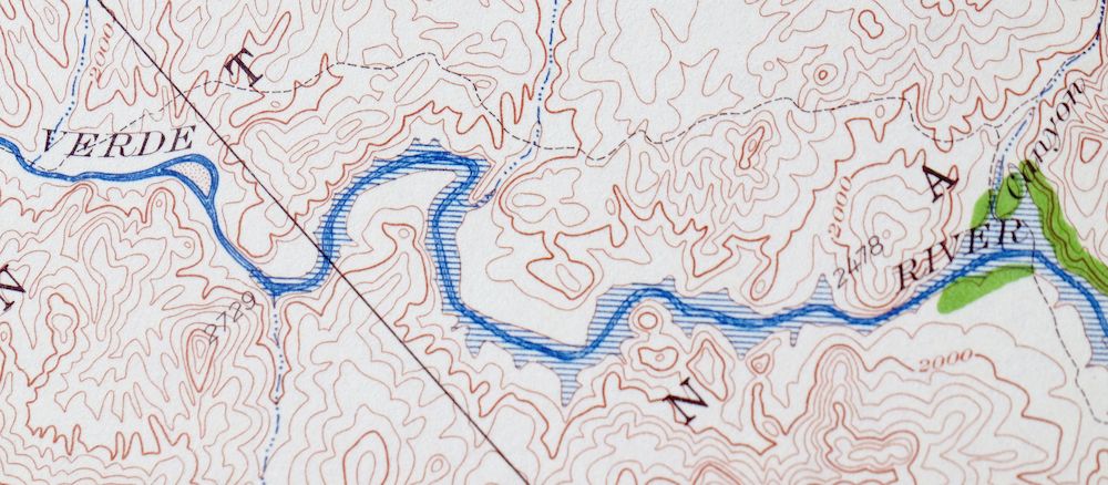
Cave Creek Arizona Phoenix Mesa USGS Topo Map 1963 Vintage
$44
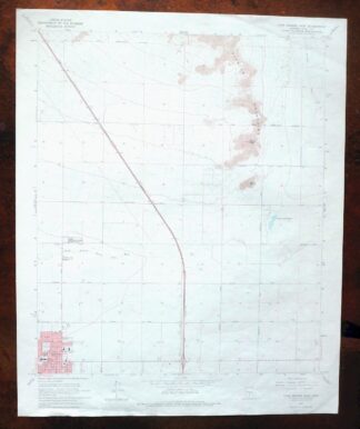
This USGS 30-minute topographic map is a 1930 edition printed in 1963, in excellent condition on thick stock, lightly handled and never folded with a flawless map area and only a very light library stamp in the lower right collar. Covering the country north of Phoenix, the quad takes in the towns of Cave Creek, Carefree, and Rio Verde along with portions of the Tonto National Forest and the Verde River. Drawn from field survey work of 1929 and 1930 by geographer W.G. Carson, it records the Verde River corridor and the Horseshoe Dam area as they were before the modern highway system, preserving historic travel routes and placenames; only the north half of this quadrangle was surveyed for the series. It comes from the vintage map collection of Art Christiansen of Tempe, Arizona.
In stock
This vintage sheet is a 1930 edition of the Cave Creek Arizona USGS topographic map. It is an original 63-year-old 1963 United States Geological Survey print in excellent condition.
HOW THIS MAP CAN BE USED
In addition to making a fascinating conversation piece, this sheet would look great in a frame or on display, make a unique and prized gift for anyone interested in this area, be perfect as a reference for genealogy studies or general historical research, or fill that missing piece in your collection. Maps of this vintage are printed on durable stock and are well-suited for outdoor activities and recreation of all kinds, including hiking, backpacking, hunting, rafting and kayaking, backcountry skiing, geocaching, general exploration, treasure hunting, etc.
FEATURES SHOWN ON THE MAP
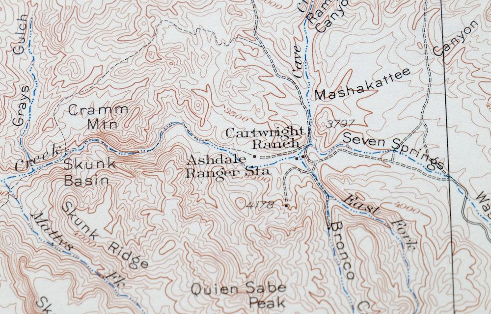
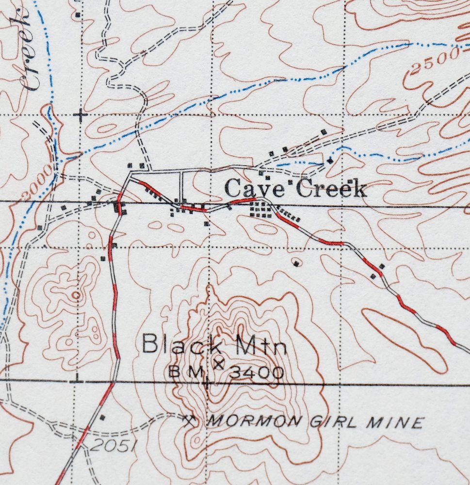
The Cave Creek 30-minute map shows cities and towns, roads, railroads, utilities and energy infrastructure, rivers, creeks, elevation contour lines, public land survey lines, county, state, and other administrative boundaries as they existed at the time of the survey in 1929 and 1930.
A VALUABLE HISTORICAL RECORD
Maps from the USGS 30-minute series have been out of print for many years. They have never been common and original prints are increasingly difficult to find. For areas where the 30-minute map was produced, it is usually the first large-scale survey done by the USGS for that area. These are a valuable historical record, as they contain many placenames and features that have been dropped from more recent series’ and editions.
Nearby maps
-
Roosevelt Arizona Four Peaks Tonto Basin USGS Topo Map 1956
$52 Add to cart -

Florence Arizona Apache Junction Superior USGS Topo Map 1917
$70 Add to cart -

Congress Arizona Yarnell Wilhoit USGS Topo Map 1948 Vintage
$38 Add to cart -

Camp Verde Arizona Cottonwood Sedona USGS Topo Map 1965
$56 Add to cart -

Mcdowell Peak Arizona Scottsdale USGS Topo Map 1967 Vintage
$37 Add to cart -

Camelback Arizona Tonto NF Phoenix USGS 15-Min Topo Map 1948
$55 Add to cart -

Mesa Arizona Gilbert Salt River USGS Topo Map 1965 Vintage
$95 Add to cart -
Apache Junction Arizona Tonto NF Mesa USGS Topo Map 1975
$42 Add to cart -

Desert Well Arizona Apache Junction Mesa USGS Topo Map 1906
$65 Add to cart -
Phoenix Arizona USGS 7.5-Min Topographic Map 1968 Vintage
$32 Add to cart -
Glendale Arizona Phoenix Peoria USGS Topo Map 1975 Vintage
$37 Add to cart -
Guadalupe Arizona Phoenix Mesa USGS Topo Map 1957 Vintage
$49 Add to cart -
Fowler Arizona Phoenix Tolleson USGS Topo Map 1957 Vintage
$41 Add to cart -
Payson Arizona Sun Valley Gisela USGS Topo Map 1965 Vintage
$64 Add to cart -

Gila Butte Arizona Chandler Santan USGS Topographic Map 1966
$37 Add to cart -

Sacaton Arizona Gilbert Coolidge USGS Topographic Map 1948
$45 Add to cart -

Avondale Arizona Phoenix Goodyear USGS Topo Map 1965 Vintage
$55 Add to cart -
Crown King Arizona Prescott NF USGS Topo Map 1955 Vintage
$46 Add to cart -

Superior Arizona Top-of-the-World USGS Topo Map 1957 Vintage
$45 Add to cart -
Maricopa Arizona Ak-Chin Village USGS Topo Map 1967 Vintage
$46 Add to cart -
Pine Arizona Payson Sun Valley USGS Topo Map 1940 Antique
$45 Add to cart -
Maricopa Arizona Ak-Chin Rancho El Dorado USGS Topo Map 1968
$45 Add to cart -

Mobile Arizona Goodyear USGS 15-Min Topo Map 1951 Vintage
$37 Add to cart -
Casa Grande East Arizona USGS 7.5-Min Topo Map 1975 Vintage
$38 Add to cart
