MAP DETAILS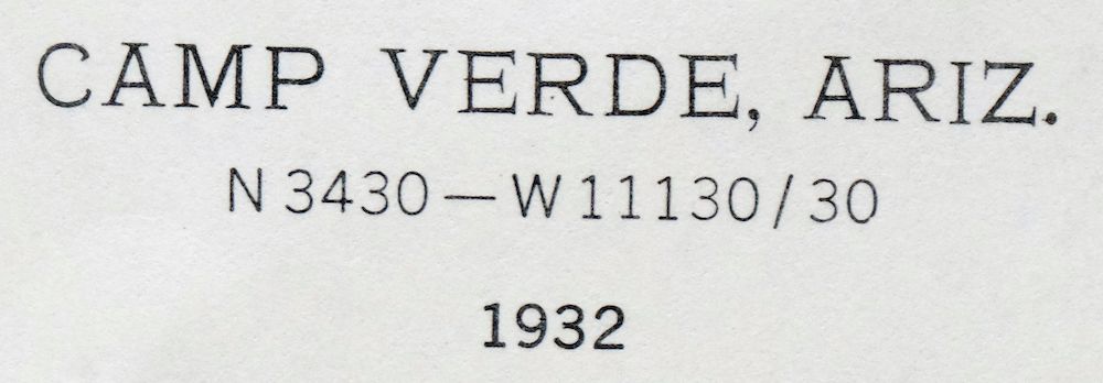 | |
|---|---|
| TITLE | Camp Verde |
| STATE | Arizona |
| LOCATION | 30 miles south of Flagstaff |
| SERIES | 30-minute |
| SURVEYED | 1931 and 1932 Field Survey |
| GEOGRAPHER | W.G. Carson |
| EDITION | 1932 |
| PRINTED | 1965 |
| PRINT NOTES | Thick paper stock |
| SCALE | 1:125000 |
| CONTOUR INTERVAL | 100 feet |
| SHEET DIMENSIONS | 17 x 21 inches |
| MAP DIMENSIONS | 14 3/8 x 17 1/2 inches |
| COVERAGE AREA | 28 x 35 miles |
| SOURCE | From the vintage map collection of Art Christiansen, Tempe, Arizona |
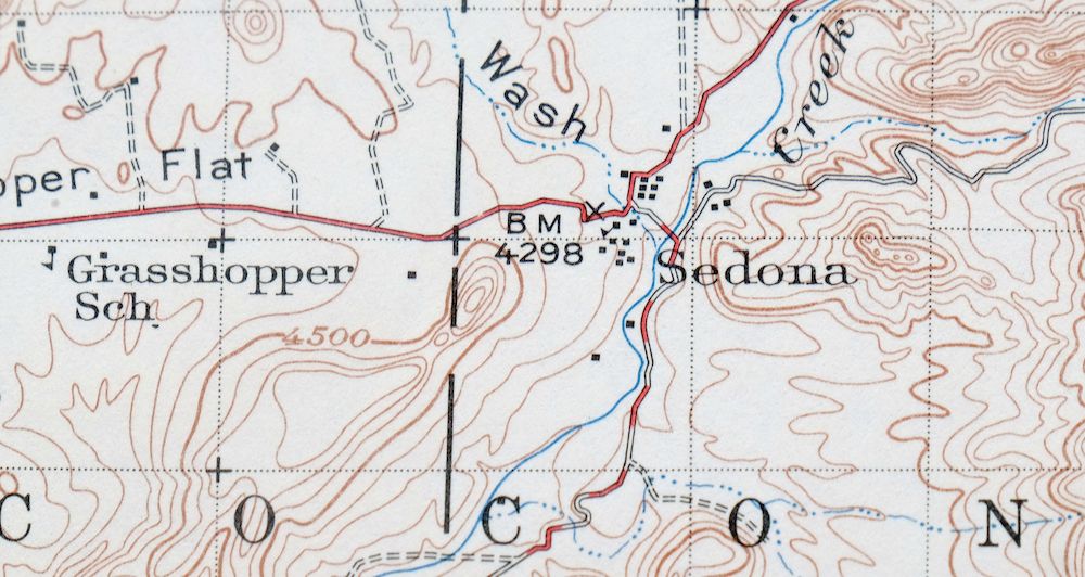
| MAP NOTES | A fascinating snapshot of the present-day I-17 corridor from Camp Verde to Munds Park, surveyed before the modern highway system, including historic travel routes and placenames, and showing Sedona when it was a cluster of 15 houses on Oak Creek. |
| SHEET CONDITION For maps of this vintage, effort is made to note all visible flaws, no matter how minor. | |
| OVERALL CONDITION | Excellent |
| SHEET NOTES | very lightly handled, never folded, smooth and flat |
| MAP AREA | flawless map area |
| COLLARS | no wear or tears, no markings, no blemishes |
| MAP COVERAGE Quadrangle extent overlaid on current basemap. | |
| PLACENAMES Depending on map series and survey date, all of the features listed below may not be shown on this map. This list contains features that currently exist or historically existed within the area covered by the map. The list can be used as a reference to determine if this map covers your area of interest. Placenames are listed alphabetically next to each feature type. | |
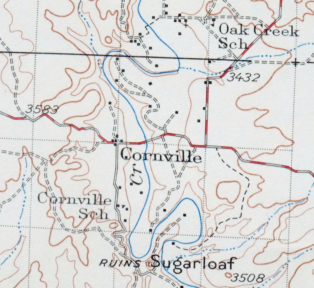
| CITIES AND TOWNS (CURRENT) | Big Park, Camp Verde, Cornville, Cottonwood, Cottonwood-Verde Village, Lake Montezuma, Munds Park, and Sedona |
| COUNTIES COVERED | Coconino and Yavapai |
| FEDERAL LAND UNITS | Camp Verde Indian Reservation, Coconino National Forest, Montezuma Castle National Monument, Munds Mountain Wilderness, Prescott National Forest, Red Rock-Secret Mountain Wilderness, Sycamore Canyon Wilderness, West Clear Creek Wilderness, and Wet Beaver Wilderness |
| RIVERS AND STREAMS | Beaver Creek, Cherry Creek, Cienega Creek, Coffee Creek, Dry Beaver Creek, Dry Creek, Gaddis Wash, Grief Hill Wash, Oak Creek, Oak Wash, Russell Wash, Soldier Wash, Spring Creek, Sycamore Creek, Turkey Creek, Verde River, Walker Creek, West Clear Creek, West Fork Oak Creek, and Wickiup Creek |
| WATER BODIES | Black Tank, Lake Montezuma, New Tank, Nolan Tank, Odell Lake, Salmon Lake, State Land Tank, and Stoneman Lake |
| Locations: Apache Maid Cabin, Apache Maid Ranch, Apache Maid Ranger Station, Arizona Highway Maintenance Yard, Beaver Creek Ranch, Beaver Creek Ranger Station, Buck Ridge Cabin, Buckhorn Ranch, Bull Pen Ranch, Camp Verde Ranger Station, Chavez Crossing Campground, Cloverleaf Ranch, Copper Canyon Substation, Copper Corral, Deer Pass Ranch, Flower Pot Ranch, Foxboro Ranch, Grasshopper Point Campground, Grassy Mountain Windmill, Gray Ranch, Hancock Ranch, Hayfield Draw Windmill, Hidden Cabin, Jawbone Windmill, M Diamond Ranch, Melton Windmill, Mullican Ranch, Munds Park Rest Area, Munds Park Substation, Oakwood Country Club, Page Springs State Fish Cultural Station, Pinewood Country Club, Red Canyon Ranch, Rimrock Ranch, Robbers Roost, Rancho Roco Roja, Schnebly Hill Vista, School House Picnic Ground, Secret Cabin, Sedona Ranger Station, Sedona-Oak Creek Golf Course, Soda Spring Ranch, T-Bar Ranch, Taylor Cabin, V Lazy Y Cabin, Wickiup Windmill, Windmill Ranch, and Woods Ranch. Areas: Barney Pasture, Barney Pasture Burn, Devils Dining Room, Devils Kitchen, Grasshopper Point, and Rattlesnake Burn. Administrative Boundaries: State of Arizona. Reserves: Camp Verde Indian Reservation, Fort Verde Garden Reservation, and Lower Camp Verde Indian Reservation. Mountains, Peaks, and Summits: Anderson Butte, Apache Maid Mountain, Bald Hill, Bell Rock, Bear Mountain, Big Hill, Black Hills, Black Mountain, Brins Mesa, Buckhorn Mountain, Bunker Hill, Cactus Mountain, Capitol Butte, Casner Butte, Casner Mountain, Cathedral Rock, Cedar Mountain, Chimney Rock, The Cockscomb, Coffeepot Rock, Courthouse Butte, Doe Mountain, East Pocket Knob, Fain Mountain, First Bench of Wilson Mountain, Grassy Knolls, Grassy Mountain, Grief Hill, Hog Hill, Hollingshead Point, Horse Knoll, Horse Mesa, House Mountain, Hull Hill, Juniper Hill, Lee Butte, Lee Mountain, Little Round Mountain, Lost Mountain, Lost Wilson Mountain, Loy Butte, Luke Mountain, Maroon Mountain, Maverick Butte, Merry-Go-Round, Mescal Mountain, Middle Schroeder Butte, Milos Butte, Mormon Mountain, Munds Mountain, Mount Nestor, Oak Hill, Rattlesnake Mesa, Red Hill, Robbers Roost, Rock Top, Round Mountain, Round Top Mountain, Russell Hill, Sacred Mountain, Salmon Lake Butte, Scheurman Mountain, Scheurman Mountain Tank, Schnebly Hill, Secret Mountain, Sheepshead Mountain, Steamboat Rock, Sugarloaf, Sugarloaf Mountain, T-Six Mountain, T-Six Point, Table Mountain, Table Top Mountain, Thirteenmile Rock Butte, Tule Butte, Twin Buttes, Walker Mountain, White Hills, White Mesa, Wikiup Mesa, Wilson Mountain, and Windmill Mountain. Arroyos and Washes: Mortgage Draw. Valleys and Canyons: Allen Canyon, Bar M Canyon, Bell Canyon, Black Canyon, Bear Sign Canyon, Bear Wallow Canyon, Bee Canyon, Bias Canyon, Black Mountain Canyon, Boulder Canyon, Boynton Canyon, Brady Canyon, Carroll Canyon, Casner Canyon, Cedar Tank Canyon, Copper Canyon, Crazy Park Canyon, Damfino Canyon, Deadwood Draw, Devils Windpipe, Fay Canyon, Foster Canyon, Gaddis Canyon, Grandpa Wash, H S Canyon, Hart Well Canyon, Hayfield Draw, Hog Canyon, Home Tank Draw, Jacks Canyon, Lincoln Canyon, Long Canyon, Loy Canyon, Lucky Canyon, Margs Draw, Meadow Canyon, Mooney Canyon, Mormon Canyon, Mullican Canyon, Munds Canyon, North Fork Long Canyon, Oak Creek Canyon, Oak Hill Draw, Oxtail Draw, Pine Tank Canyon, Rarick Canyon, Rattlesnake Canyon, Red Canyon, Red Tank Draw, Rocky Gulch, Ryal Canyon, Secret Canyon, Sheepshead Canyon, Squaw Peak Canyon, Sterling Canyon, Surveyor Canyon, T-Six Canyon, Tule Canyon, Upper Tank Draw, West Clear Creek Canyon, Wilbur Canyon, Wilson Canyon, and Woods Canyon. Parks: Banjo Bill Campground, Beaver Creek Campground, Cave Spring Campground, Clear Creek Campground, Encinoso Picnic Area, Halfway Picnic Area, Manzanita Campground, Midgely Bridge Picnic Area, Montezuma Castle National Monument, Munds Mountain Wilderness, Potato Patch Park, Red Rock Campground, Red Rock Secret Mountain Wilderness, Side Rock Campground, Slide Rock Swim Area, West Clear Creek Wilderness, and Wet Beaver Wilderness. Trails: A B Young Trail, Apache Maid Trail, Bell Trail, Bridle Trail, Buckhorn Trail, Casner Canyon Eleven Trail, Casner Mountain Trail Eight, Deadwood Trail, Hot Loop Trail, Jack Canyon-Mund Mountain Fifty Five - Seventy Seven, Long Canyon Trail, Loy Butte Five, Mooney Trail, Thompson Ladder, Thompsons Ladder Fourteen, Vultee Arch Twenty Two, Walker Basin Trail, and Wilson Mountain Trail. Drainages: Beaver Creek, Cherry Creek, Coffee Creek, Dry Beaver Creek, Dry Creek, Gaddis Wash, Grief Hill Wash, Oak Creek, Russell Wash, Soldier Wash, Spring Creek, Turkey Creek, Walker Creek, West Clear Creek, West Fork Oak Creek, Wet Beaver Creek, and Wickiup Creek. Churches: Chapel of the Holy Cross. Lakes and Ponds: Lake Montezuma, Salmon Lake, and Stoneman Lake. Dams: Foxboro Lake Dam, Odell Dam, Tat Momolikot Dam, Weir Number Eight, Weir Number Eleven, Weir Number Nine, Weir Number Seven, Wier Number Five, Wier Number One, Wier Number Six, Wier Number Three, and Wier Number Two. Crossings: Little Antelope Interchange, McGuireville Interchange, Munds Park Interchange, Sedona Interchange, Sheeps Crossing, Stoneman Lake Interchange, and Willard Springs Interchange. Bluffs: Beaverhead, Buckhead Point, Dave Joy Point, Deadwood Point, Indian Point, Jacks Point, Thompsons Point, and View Point. Gaps: Boynton Pass, Fivemile Pass, Soldier Pass, and Sycamore Pass. Canals: Cornville Ditch, Cottonwood Ditch, Eureka Ditch, Oak Creek Ditch, Ok Ditch, Spring Ditch, and Woods Ditch. Bridges: Midgley Bridge and Woods Canyon Bridge. Bends: Bull Hole. Basins: Blodgett Basin, East Pocket, Hidden Valley, Maverick Basin, Rim Tank Basin, Roundup Basin, Salmon Lake Basin, South Pocket, Taylor Basin, and Walker Basin. Natural Arches: Devils Bridge, Fay Canyon Arch, Indian Head Arch, and Vultee Arch. Airports: Camp Verde Airport, Montezuma Airport, Rancho Roca Roja Airport, Rimrock Airport, Sedona Airport, and Solair Estates Airport. Schools: Beaver Creek School, Camp Verde Elementary School, Camp Verde School, Christian Indian School, Oak Creek School, Sedona School, and Verde Valley School. Ridges: Buckhead Ridge and Pinto Mesa. Reservoirs and Tanks: Antelope Park Tank, Antelope Tank, Apache Maid Tanks, Apron Tank, Archies Tank, Arts Tank, Bald Hill Tank Number Five, Bald Hill Tank Number Four, Bald Hill Tank Number One, Bald Hill Tank Number Three, Bald Hill Tank Number Two, Barrow Tank, Basco Tank, Basin Tank, Bell Canyon Tank, Bills Tank, Black Tank, Blackjack Tank, Blodgett Basin Tank, Blodgett Tank, Blowout Tank, Blue Grade Tank, Boiler Tank, Bootlegger Tank, Bear Seep Tank, Beaver Tank, Beaverhead Tank, Beaverhead Tank Number One, Beaverhead Tank Number Two, Bedford Tank, Bert Lee Tank, Bert Tank, Bessie Tank, Black Mesa Tank, Black Mountain Canyon Tank, Black Mountain Tank, Boulder Canyon Tank Number One, Boulder Canyon Tank Number Two, Box Tank, Brady Tank, Bristow Tank, Brockett Tank, Bruce Place Tank, Buckhorn Slope Tank, Buckhorn Tank Number Five, Buckhorn Tank Number Four, Buckhorn Tank Number One, Buckhorn Tank Number Three, Buckhorn Tank Number Two, Bug Tank, Bull Tank, Bums Tank, Burn Tank, Burnt Basin Tank, CF Tank, Cabin Tank, Campbell Draw Tank, Cash Tank, Casner Canyon Tank, Casner Mountain Tank, Casner Park Tank, Cat Tank, Cedar Bench Tank Number One, Cedar Bench Tank Number Two, Cedar Flat Tank, Cedar Mountain Tank, Cedar Tank, Cigarette Tank, Cinder Tank, Cochran Tank, Committee Tank, Concrete Tank, Cons Tank, Corief Hill Water Tank, Corner Tank, Cornville Tank, Corral Tank, Cove Tank, Cowboy Junior Tank, Cowboy Tank, Coyote Park Tank, Coyote Pup Tank, Cracker Box Tank, Crapshooter Tank, Crazy Park Tank, Creosote Flat Tank, Cuter Place Tank, Cuter Tank, Cutter Tank, D A Tank Number One, D A Tank Number Two, Dad Jones Tank, Dad Jones Tank Number Two, Deadwood Draw Tank Number One, Deadwood Draw Tank Number Two, Deadwood Tank, Deep Tank, Devils Jawbone Tank, Diamond M Tank, Division Tank, Doe Tank, Driveway Tank, Drum Tank, Dumas Tank, Durfee Tank, Dutch Kid Tank, Dutchs Tank, Earls Tank, East Pocket Tank, Eaton Tank, Ed Loy Tank, Elk Tank, Elmore Tank Number One, Elmore Tank Number Two, Ernies Tank, Evans Tank, F S Tank, Fern Tank, Fire Tank, Fivemile Pass Tank, Fivemile Pass Tank Number One, Fivemile Pass Tank Number Two, Flowerpot Tank, Fork Tank, Four Wall Tank, Fox Tank, Foxboro Lake, Frank Tank, Franks Tank, Fritz Tank, Frog Tank, Fuller Tank, Geronimo Number Two Tank, Geronimo Tank, Girdner Tank, Gnat Tank, Goswick Lake Tank, Goswick Tank, Grasshopper Flat Tank, Gray Tank, Greasy Spoon Tank, Grindstone Tank, Gyberg Tank, H A Tank, Hance Tank, Harris Tank, Hat Ranch Tank, Hidden Tank, High Pig Tank, Hilltop Tank, Hog Tank, Hollingshead Point Tank, Hollingshead Tank, Home Tank Number One, Home Tank Number Two, Horse Knoll Tank, Horse Mesa Tank, Horse Mountain Trick Tank, Horse Park Tank, Horse Pasture Tank, Horse Tank, Horse Trap Tank, Horsetrap Tank, Hot Loop Tank, House Mountain Tank, Hull Hill Tank, Hunting Tank, Huntley Tank, Indian Flat Tank Number Two, Indian Tank, Iris Tank, Jackass Tank, Jacks Canyon Tank, Jacks Point Tank, Jacobs Tank, Joe Tank, Joes Tank, John Henry Tank, John Lee Tank, Johnnies Tank, Johnson Tank, Jones Tank, Juniper Flat Tank, Juniper Tank, Kelly Tank, Knob Tank, Lake Mountain Tank, Lake Ridge Tank, Last Chance Tank, Last Tank, Lee Tank, Limestone Tank, Limpios Tank, Lincoln Canyon Tank, Little Antelope Tank, Little Daisy Tank, Little Hog Hill Tank, Little Horse Tank, Little Pig Tank, Loco Tank, Loma Tank, Lone Pine Tank, Long Canyon Tank, Lookout Point Tank, Lookout Tank, Lost Lake Tank, Lower Rattlesnake Tank, Luke Mountain Tank, Macks Tank Number One, Macks Tank Number Two, Maid Tank, Malpais Tank, Marshall Tank, Mason Tank, Masonry Tank, Maverick Basin Tank, Maverick Tank, Mayflower Tank, Meadow Canyon Tank, Mesa Blanco Tank, Mesa Tank, Midle Water Tank, Miller Tank, Miller Water Tank, Mistake Tank, Monkey Tank, Monroe Tank, Mormon Mountain Tank, Mud Spring Tank, Mud Tank, Mud Tank Number Two, Mulcarie Tank, Mullican Place Tank, Mullican Tank, Mullican Tank Number One, Munds Tank, Natural Tank, Need Tank, New Tank, Newman Tank, Ninemile Tank, Nira Tank, Nolan Tank, North Rim Tank, OK Tank, Oak Grove Tank, Oak Hill Tank Number One, Oak Tank, Odell Lake, Old Seventynine Tank, Outside Tank, Oxtail Tank, Painted Tank Number One, Painted Tank Number Two, Paqueno Tank, Park Tank, Parsons Tank, Pasture Tank, Pen Tank, Pesthouse Tank, Petes Tank, Pig Trough Tank, Pine Ridge Tank, Pine Tank, Pinto Mesa Tank, Plaza de Toros Tank, Potato Patch Tank, Purgatory Tank, Quail Trick Tank, Quemado Tank, Racetrack Tank, Ralston Tank, Rarick Tank, Rattlesnake Tank, Rays Tank, Red Hill Tank, Red Raspberry Tank, Red Tank, Rim Tank, Ring Tank, Road Tank, Robbers Roost Tank, Robinson Tank, Rock Dike Tank, Rock Hole Tank, Rock Tank, Rocky Park Tank, Round Mountain Tank, Roundup Basin Tank, Roundup Tank, Ruin Tank, Runner Tank, Salmon Lake Tank, Sandrock Draw Tank, Sandrock Tank, Sawlog Tank Number One, Sawlog Tank Number Two, Schnebly Number Two Tank, Schnebly Tank, Schroeder Tank, Sebra Tank, Section Corner Tank, Section Five Tank, Seep Tank, Seventeen Tank, Sheepshead Tank, Sheeptrail Tank, Shipping Tank, Skeleton Bone Tank, Skeleton Park Tank, Skeleton Tank, Slope Tank, Snap Seep Tank, South Pocket Tank, Speeds Tank, Split Tank, Squaw Peak Tank, State Land Tank, Steamboat Tank, Stewards Tank, Stud Horse Tank, Sues Tank, Sugarloaf Tank, Sugarloaf Tank Number One, Sugarloaf Tank Number Two, T-Bar Tank, T-Six Tank, T-bar Tank Number One, T-bar Tank Number Two, Table Mountain Tank, Tank Number Two, Tanque Aloma, Tap Tank, Taylor Basin Tank, Taylor Tank, Telephone Tank, Test Hole Tank, Thicket Tank, Thirteenmile Tank, Thomas Point Tank, Thomas Tank, Three Wall Tank, Three-Jim Tank, Tin Roof Tank, Tinny Tank, Tomkins Tank, Tommies Tank, Trail Tank, Tree Tank, Triangle Tank, Trick Number Two Tank, Trick Tank, Turey Seep Tank, Turkey Creek Tank, Turkey Tank, Turkey Trap Tank, Twin Buttes Tank, Two Holes Tank, Underwood Tank, Upper Rattlesnake Tank, Utopia Tank, V D Tank, Vee Seven Tank, Vernon Tank, Waldroup Place Tank, Waldroup Tank, Walker Basin Tank, Walker Creek Tank, Walker Rim Tank, Watermelon Tank, Weimer Tank, Wheatfield Tank Number One, Wheatfield Tank Number Two, White Flat Tank, White Hill Tank, White Mesa Tank, Wickiup Tank Number One, Wickiup Tank Number Two, Wier Number Eight Tank, Wildhorse Tank, Wilson Tank, Winden Tank, Windmill Tank, Winsor Tank, Winter Cabin Tank, Wire Corral Tank, Woods Tank, and Young Tank. Flats: Antelope Park, Beaverhead Flat, Bert Lee Park, Big Park, Casner Park, Cedar Flat, Clay Park, Crazy Park, Gash Flat, Grasshopper Flat, Horse Park, Indian Flat, Little Horse Park, Little Park, Munds Park, Negro Flat, Roundup Park, Sandrock Pasture, and White Flat. Towers: East Pocket Lookout Tower, KAFF-FM (Flagstaff), KAZM-AM (Sedona), KKTM-TV (Flagstaff), KMGN-FM (Flagstaff), KNAU-FM (Flagstaff), KNAZ-TV (Flagstaff), KQST-FM (Sedona), KSED-FM (Sedona), KSOJ-FM (Flagstaff), KVNA-FM (Flagstaff), KVRD-AM (Cottonwood), and KZJC-TV (Flagstaff). Wells: Bates Well, Cherry Creek Well, Cienega Well, Lucky Canyon Windmill, Montezuma Well, Moore Well, Nichols Well, Wilbur Well, and Wool Growers Windmill. Springs: Barney Spring, Bell Rock Spring, Bill Back Spring, Bootlegger Spring, Beaverhead Spring, Big Spring, Bristow Seep Spring, Bristow Spring, Bunker Hill Spring, Cave Spring, Chalk Point Spring, Clear Creek Number Four Spring, Clear Creek Number One Spring, Clear Creek Number Three Spring, Clear Creek Number Two Spring, Copper Canyon Water, Cottonwood Spring, Dry Beaver Spring, Fain Spring, Foster Spring, Gaddis Canyon Spring, Grief Hills Spring Number One, Grief Hills Spring Number Two, Hance Spring, Howard Spring, Hull Spring, Hull Water, Lander Spring, Lee Mountain Spring, Lee Spring, Mud Spring, Munds Spring, Pinto Mesa Spring, Rock Top Spring, Russell Spring, Ryal Spring, Sheep Spring, Soda Spring, Sycamore Spring, T-Six Spring, Thirteen Mile Spring, Upper Lucky Canyon Spring, Weimer Spring, Willard Spring, Winter Cabin Spring, and Woods Spring. | |
| SHIPPING AND RETURNS | |
 This map sheet will be carefully rolled in a sturdy tube and shipped via the US Postal Service. If you find that the sheet you receive is not as described in the listing, you may ship it back to us for a refund of the purchase price. | |
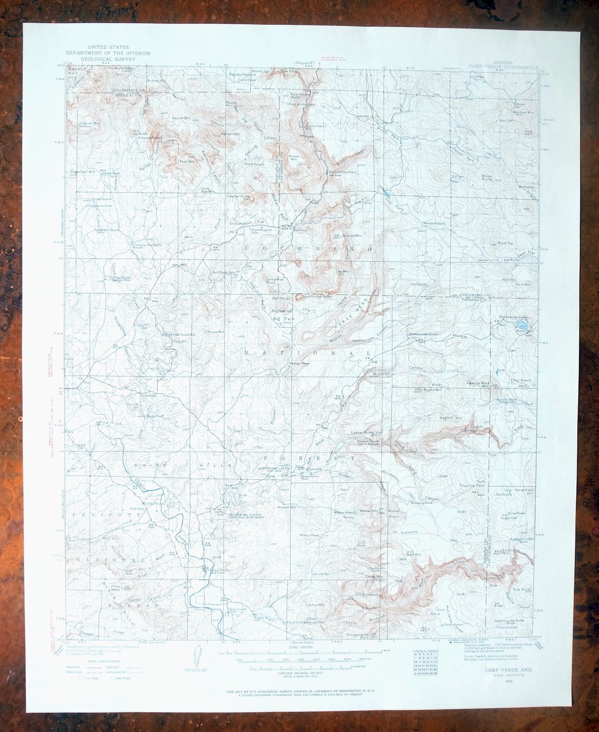
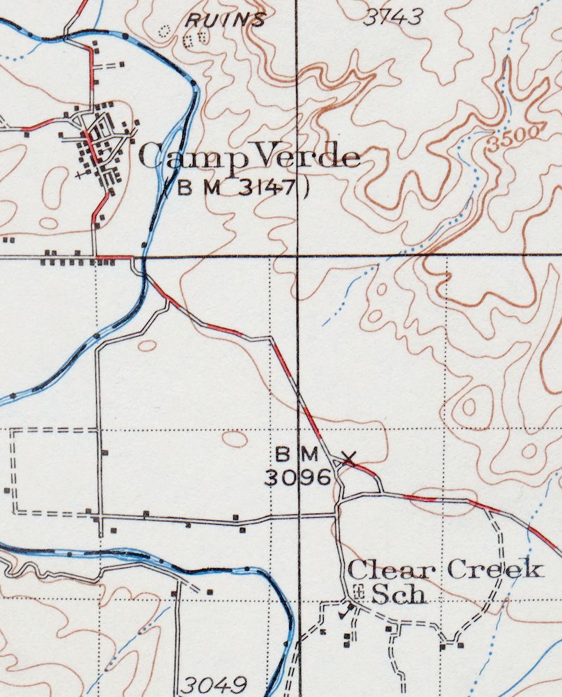
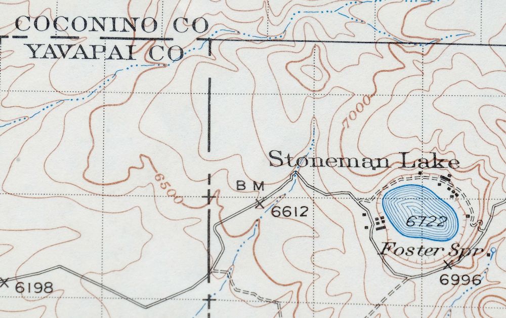
Camp Verde Arizona Cottonwood Sedona USGS Topo Map 1965
$56
First published in 1932, this USGS 30-minute topographic sheet was printed in 1965 on thick stock and is in excellent condition: never folded, smooth and flat, with a flawless map area and a clean collar free of markings or wear. The quad sits about 30 miles south of Flagstaff and takes in Camp Verde, Cottonwood, and Sedona, along with portions of the Coconino and Prescott National Forests, Montezuma Castle National Monument, and the Camp Verde Indian Reservation. Surveyed in 1931 and 1932 by W.G. Carson before the modern highway system, it captures the present-day I-17 corridor from Camp Verde to Munds Park with its older travel routes and placenames, and shows Sedona when it was a cluster of fifteen houses on Oak Creek. This sheet comes from the vintage map collection of Art Christiansen of Tempe, Arizona.
In stock
This vintage sheet is a 1932 edition of the Camp Verde Arizona USGS topographic map. It is an original 61-year-old 1965 United States Geological Survey print in excellent condition.
HOW THIS MAP CAN BE USED
In addition to making a fascinating conversation piece, this sheet would look great in a frame or on display, make a unique and prized gift for anyone interested in this area, be perfect as a reference for genealogy studies or general historical research, or fill that missing piece in your collection. Maps of this vintage are printed on durable stock and are well-suited for outdoor activities and recreation of all kinds, including hiking, backpacking, hunting, rafting and kayaking, backcountry skiing, geocaching, general exploration, treasure hunting, etc.
FEATURES SHOWN ON THE MAP
The Camp Verde 30-minute map shows cities and towns, roads, railroads, utilities and energy infrastructure, rivers, creeks, elevation contour lines, public land survey lines, county, state, and other administrative boundaries as they existed at the time of the survey in 1931 and 1932.
A VALUABLE HISTORICAL RECORD
Maps from the USGS 30-minute series have been out of print for many years. They have never been common and original prints are increasingly difficult to find. For areas where the 30-minute map was produced, it is usually the first large-scale survey done by the USGS for that area. These are a valuable historical record, as they contain many placenames and features that have been dropped from more recent series’ and editions.
Nearby maps
-

Congress Arizona Yarnell Wilhoit USGS Topo Map 1948 Vintage
$38 Add to cart -

Cave Creek Arizona Phoenix Mesa USGS Topo Map 1963 Vintage
$44 Add to cart -
Roosevelt Arizona Four Peaks Tonto Basin USGS Topo Map 1956
$52 Add to cart -

Florence Arizona Apache Junction Superior USGS Topo Map 1917
$70 Add to cart -
Mountainaire Arizona Coconino NF USGS Topo Map 1964 Vintage
$36 Add to cart -
Mingus Mountain Arizona Cottonwood USGS Topographic Map 1970
$51 Add to cart -

Clarkdale Arizona Cottonwood Jerome USGS Topo Map 1948
$44 Add to cart -
Pine Arizona Payson Sun Valley USGS Topo Map 1940 Antique
$45 Add to cart -

Bill Williams Mountain Arizona Williams USGS Topo Map 1983
$40 Add to cart -

Prescott Arizona Chino Valley Williamson USGS Topo Map 1966
$52 Add to cart -

Mount Union Arizona Prescott NF Mayer USGS Topo Map 1949
$34 Add to cart -
Mount Union Arizona Prescott NF Mayer USGS Topo Map 1964
$43 Add to cart -
Ash Fork Arizona Kaibab NF Prescott NF USGS Topo Map 1978
$44 Add to cart -
Promontory Butte Arizona Coconino NF USGS Topo Map 1960
$46 Add to cart -
Payson Arizona Sun Valley Gisela USGS Topo Map 1965 Vintage
$64 Add to cart -

Simmons Arizona Paulden Williamson USGS 15-Min Topo Map 1964
$42 Add to cart -
Crown King Arizona Prescott NF USGS Topo Map 1955 Vintage
$46 Add to cart -
Picacho Butte Arizona Chino Valley USGS 15-Min Topo Map 1950
$24 Add to cart -
Woods Canyon Arizona Sitgreaves NF USGS 15-Min Topo Map 1963
$35 Add to cart -
Ebert Mountain Arizona Red Mountain USGS Topo Map 1969
$36 Add to cart -
S P Mountain Arizona USGS 15-Min Topo Map 1975 Vintage
$34 Add to cart -
Camp Wood Arizona Prescott NF USGS Topographic Map 1949
$32 Add to cart -
Sheridan Mountain Arizona Sycamore Creek USGS Topo Map 1978
$35 Add to cart -
Valle Arizona Kaibab Quivero USGS Topo Map 1964 Vintage
$28 Add to cart
