MAP DETAILS | |
|---|---|
| TITLE | Florence |
| STATE | Arizona |
| LOCATION | 50 miles east of Phoenix |
| SERIES | 30-minute |
| SURVEYED | 1900 Field Survey |
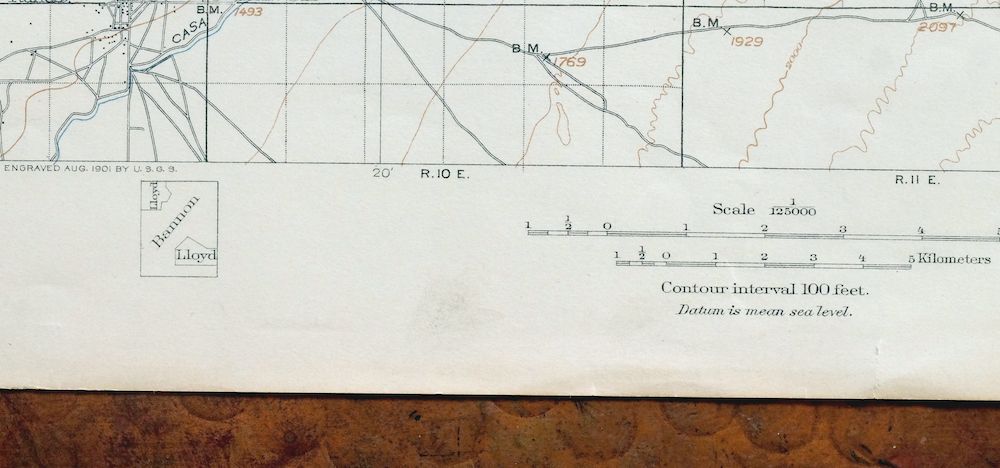
| GEOGRAPHER | E.M. Douglas |
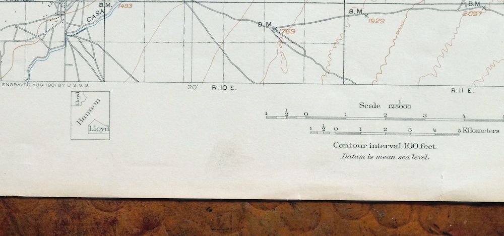
| ENGRAVED | 1901 |
| EDITION | 1902 |
| PRINTED | 1917 |
| PRINT NOTES | Thick paper stock |
| SCALE | 1:125000 |
| CONTOUR INTERVAL | 100 feet |
| SHEET DIMENSIONS | 16 1/2 x 20 inches |
| MAP DIMENSIONS | 14 5/8 x 17 1/2 inches |
| COVERAGE AREA | 29 x 35 miles |
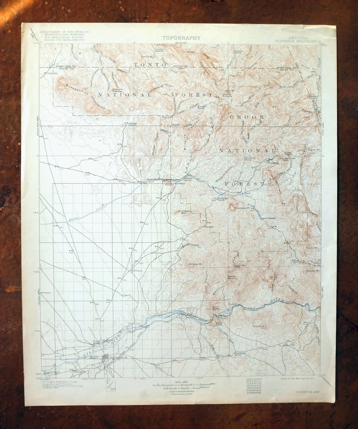
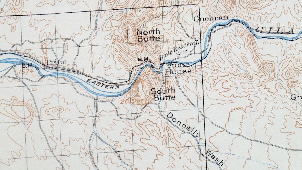
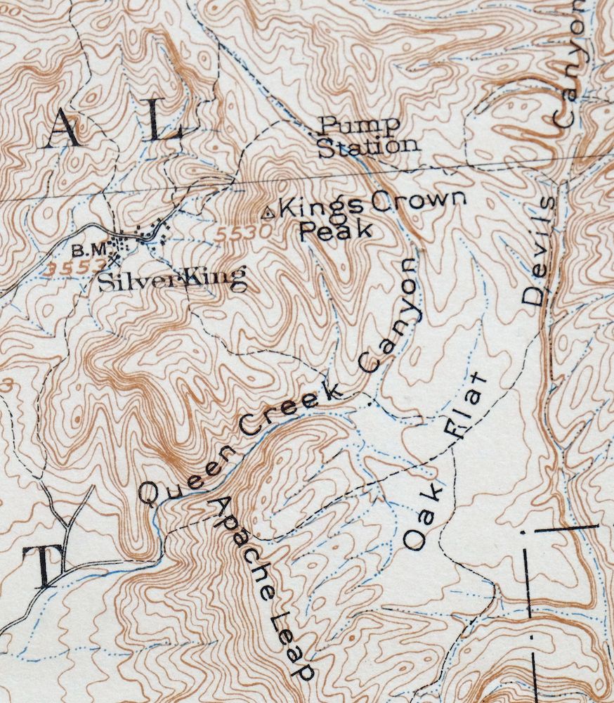
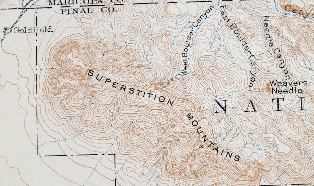
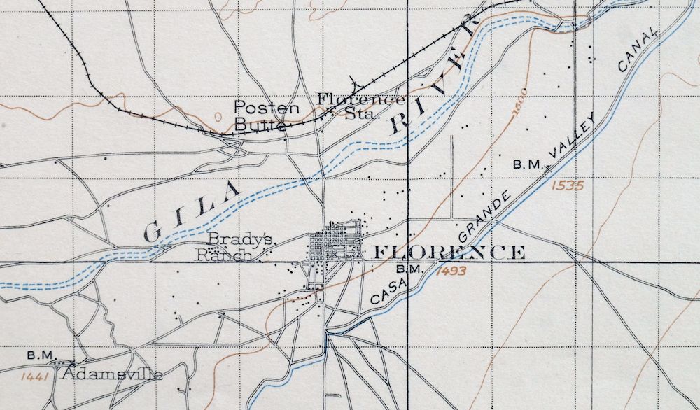
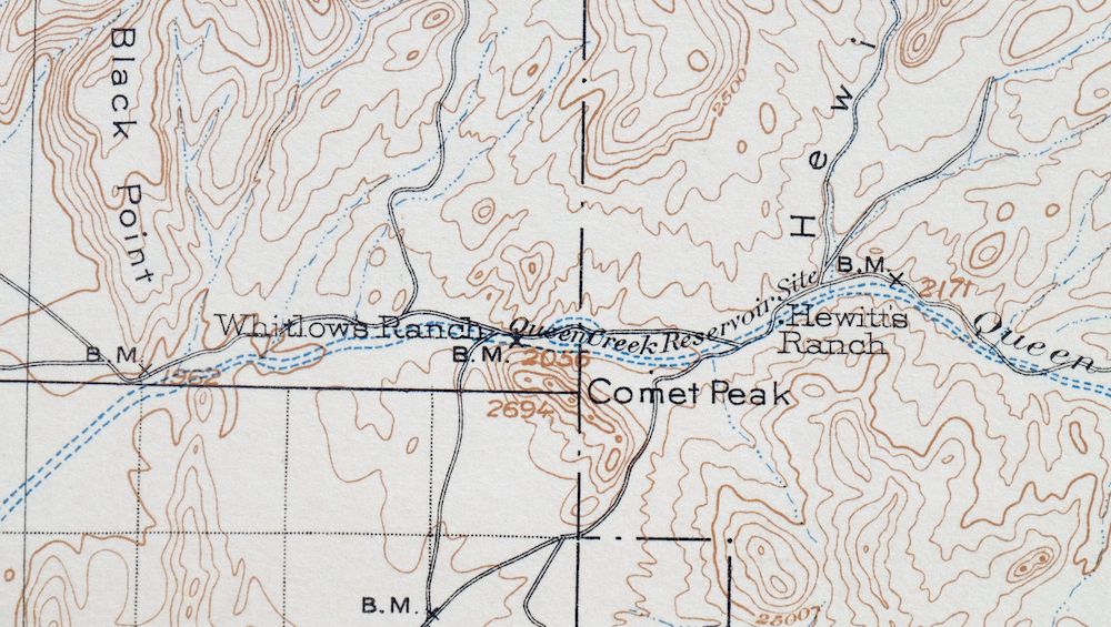
| MAP NOTES | A fascinating historical snapshot of the far east valley from the Superstition Mountains south to the Gila River, surveyed before the modern highway system, showing rail lines, ranches, mining infrastructure, historic overland routes, early placenames, and all known structures. |
| SHEET CONDITION For maps of this vintage, effort is made to note all visible flaws, no matter how minor. | |
| OVERALL CONDITION | Good |
| SHEET NOTES | never folded, lightly age-toned paper |
| MAP AREA | no markings, no blemishes |
| COLLARS | no markings, scattered light blemishes, edge tears in collars discreetly stabilized with transparent archival tape on backside of sheet |
  | |
| MAP COVERAGE Quadrangle extent overlaid on current basemap. | |
| BACKSIDE LEGEND | |
 A map summary is printed on the back side of the Florence sheet similar to the one shown in the picture. It outlines the history, purpose, and status of the USGS mapping program at the time of the printing in 1917. It also provides instructions on how to read contour lines and a description of how they are used to depict the terrain. At the bottom of the page is a legend showing all of the symbols used to represent the cultural, relief, and water features found on the map. | |
| PLACENAMES Depending on map series and survey date, all of the features listed below may not be shown on this map. This list contains features that currently exist or historically existed within the area covered by the map. The list can be used as a reference to determine if this map covers your area of interest. Placenames are listed alphabetically next to each feature type. | |
| CITIES AND TOWNS (CURRENT) | Apache Junction, Florence, Florence Junction, Gold Camp, Price, Queen Valley, Superior, and Top-of-the-World |
| COUNTIES COVERED | Gila, Maricopa, and Pinal |
| FEDERAL LAND UNITS | Florence Military Reservation, Superstition Wilderness, Tonto National Forest, and White Canyon Wilderness |
| RIVERS AND STREAMS | Arnett Creek, Barranca Creek, Bear Thicket Creek, Bogart Wash, Campaign Creek, China Wash, Comstock Wash, Conley Spring Wash, First Water Creek, Fortuna Wash, Gila River, Hackberry Creek, La Barge Creek, Magma Wash, Milk Ranch Creek, Milky Wash, Mineral Creek, Oak Creek, Peachville Wash, Pine Creek, Pinto Creek, Queen Creek, Rancho Rio Creek, Reavis Creek, Reymert Wash, Ripsey Wash, Rock Creek, Silver King Wash, Silverado Wash, Spencer Spring Creek, Tortilla Creek, Weekes Wash, West Fork Pinto Creek, Yellowjack Wash, and Zelleweger Wash |
| WATER BODIES | Black Hills Tank, Upper Tank, and West Pit |
| Locations: A-Diamond Ranch, Arizona Highway Department Devils Canyon Maintenance Camp, Arizona Highway Department Florence Junction Maintenance Camp, Arizona Highway Department Oil Storage Tanks, Arizona State Prison, Aylors Caballo Camp, B Bar B Ranch, Barnett Camp, Burns Ranch, Byous Windmill, Devils Canyon Campground, Donnelly Ranch, Dons Camp, Ellsworth Ranch, First Water Ranch, First Water Trailhead, Florence Station, Gold Canyon Ranch, Happy Camp, Hewitt Station, Ho Ho Kam Country Club, J F Ranch, J I Ranch, Kennedy Ranch, Kings Ranch, Maverick Camp, Miles Ranch Trailhead, Milk Ranch, Navajo Station, Old Pinal Townsite, Peralta Canyon Camp, Picketpost Inn, Pinon Camp, Quarter Circle U Ranch, Queen Valley Estates, Queen Valley Golf Course, Queens Station, RRR Ranch, Reavis Ranch, Reeds Camp, Reevis Ranch, Roblas Windmill, Rogers Trough Trailhead, Rogers Troughs, Saguaro Slope Ranch, San Mateo Castro Ranch, Silver King Substation, Silver Spur Cabin, Superior Dump, Tea Cup Ranch, Tony Ranch, Tortilla Ranch, Tortilla Trailhead, Whitlow Corral, Williams Camp, Woodbury Cabin, and Woodbury Trailhead. Areas: Massacre Grounds. Mountains, Peaks, and Summits: La Barge Mountain, La Barge Mountain, Battleship Mountain, Bell Butte, Black Hill, Black Top Mesa, Bluff Spring Mountain, Black Mesa, Black Mountain, Buzzard Roost, Byous Butte, Cimeron Mountain, Coffee Flat Mountain, Comet Peak, Conley Points, Copper Butte, Dinosaur Mountain, Double Peaks, Dozer Hill, Dromedary Peak, Elephant Butte, The Flatiron, Fortuna Peak, Government Hill, Granite Mountain, Grayback, Hackberry Butte, Hackberry Mesa, Herman Mountain, Iron Mountain, J K Mountain, Kings Crown Peak, Last Turn Hill, Malapais Mountain, Mineral Mountain, Miners Needle, Miners Summit, Montana Mountain, Mound Mountain, Music Mountain, North Butte, Palomino Mountain, Peachville Mountain, Peters Mesa, Picacho Butte, Picketpost Mountain, Picture Rocks, Pinto Peak, Poston Butte, Red Hills, Roblas Butte, Sandow Hill, Sleeping Beauty Mountain, South Butte, Superstition Mountain, Superstition Mountains, Superstition Peak, Teapot Mountain, Tortilla Mountain, White Mountain, and Yellow Peak. Arroyos and Washes: Magma Wash. Valleys and Canyons: Alamo Canyon, Arnett Canyon, Barks Canyon, Belmont Canyon, Bluff Spring Canyon, Bluff Spring Mountain Canyon, Bear Tank Canyon, Benson Spring Canyon, Box Canyon, Brads Canyon, Cedar Basin Canyon, Charlebois Canyon, Coffee Flat Canyon, Copper Canyon, Cottonwood Canyon, Cross Canyon, Donkey Canyon, East Boulder Canyon, East Fork Roblas Canyon, Eastwater Canyon, Elm Canyon, Fraser Canyon, Goat Canyon, Gold Gulch, Gonzales Pass Canyon, Hackberry Canyon, Happy Camp Canyon, Haunted Canyon, Hewitt Canyon, Hieroglyphic Canyon, Hog Canyon, Iron Canyon, Little Boulder Canyon, Little Goat Canyon, Log Trough Canyon, Lost Dutch Canyon, Martinez Canyon, Millsite Canyon, Miners Canyon, Monument Canyon, Music Canyon, Musk Hog Canyon, Needle Canyon, O'Grady Canyon, Old West Boulder Canyon, Pacific Canyon, Paradise Canyon, Peacock Canyon, Peralta Canyon, Potts Canyon, Powers Gulch, Queen Creek Canyon, Randolph Canyon, Rawhide Canyon, Reavis Trail Canyon, Red Tanks Canyon, Rice Water Canyon, Roblas Canyon, Rogers Canyon, Rough Canyon, Second Water Canyon, Squaw Canyon, Telegraph Canyon, Trap Canyon, Tule Canyon, Upper LaBarge Box Canyon, Walnut Canyon, West Boulder Canyon, Whetrock Canyon, Whiskey Spring Canyon, White Canyon, Whitford Canyon, Whitlow Canyon, Wood Camp Canyon, and Wood Canyon. Parks: Black Spring, Carney Springs Campground, Highway Park, Lost Dutchman State Park, Oak Flat Campground, Peralta Canyon Campground, Picketpost Mountain Research Natural Area, Superstition Mountain Monument, and Thompson Arboretum. Trails: Black Mesa Trail, Boulder Trail, Cave Trail, Charlebois Trail, Coffee Flat Trail, Dutchmans Trail, East Boulder Trail, Garden Valley Trail, J F Ranch Trail, Miners Trail, Needle Cutoff Trail, Needle Trail, Peralta Trail, Peters Trail, Quarter Circle U Trail, Red Hills Trail, Red Tanks Trail, Reevis Trail, Second Water Trail, Tortilla Camp Trail, West Boulder Trail, and Whiskey Spring Trail. Drainages: Arnett Creek, Bogart Wash, Bear Thicket Creek, Box O Wash, China Wash, Comstock Wash, Conley Spring Wash, Cottonwood Creek, Donnelly Wash, Fortuna Wash, Hackberry Creek, Horrell Creek, Milk Ranch Creek, Oak Creek, Peachville Wash, Rancho Rio Creek, Reymert Wash, Ripsey Wash, Rock Creek, Silver King Wash, Silverado Wash, Spencer Spring Creek, West Fork Pinto Creek, Willow Creek, Wood Creek, Yellowjack Wash, and Zelleweger Wash. Mines: Ajax Mine, Apache Mine, Apex Mine, Belmont Mine, Bluebird Mine, Bomboy Mine, Black Queen Mine, Columbia Mine, Copper Butte Mine, Dacite Cliffs Mine, Fortuna Mine, Golden Bell Mine, Golden Hillside Mines, Goldfield Mine, Grand Pacific Mine, Herring Mine, Magma Copper Mines, Magma Number Nine Mine, Martinez Mine, Miller Mines, Myres Mine, Oklahoma Mine, Orphan Boy Mine, Palmer Mine, Perlite Mine, Queen Creek Mine, Ray Mine Open Pit, Red Mountain Mine, Reymert Mine, Silver Bell Mine, Silver King Mine, Sunset Mine, Tomahawk Mine, Woodpecker Mine, and Wooley Mine. Hospitals: Magma Hospital and Pinal General Hospital. Lakes and Ponds: West Pit. Buildings: Cochran Railroad Station, Magma Railroad Station, Price Railroad Station, Superior Stadium, and Wooley Railroad Station. Dams: Ashurst Hayden Dam, Florence Diversion Dam, Magma Dam, Magma Retarding Dam, Magma Tailings Dam Number Five, Magma Tailings Dam Number Six, Magma Tailings Dam Numbers One and Two, Magma Tailings Dam Numbers Three and Four, and Whitlow Ranch Dam. Bluffs: Apache Leap and Black Point. Gaps: Bluff Saddle, Bull Pass, Fremont Saddle, Gonzales Pass, Parker Pass, Red Tanks Divide, Terrapin Pass, Tims Saddle, Tortilla Pass, and Upper Black Top Mesa Pass. Canals: North Side Canal. Bridges: Queen Creek Bridge. Basins: Angel Basin, Bull Basin, Burro Basin, Cedar Basin, Horse Camp Basin, Marsh Valley, and The Rincon. Airports: Florence Junction Airport and Superior Municipal Airport. Schools: Florence Elementary School, Florence Union High School, Harding School, J F Kennedy Elementary School, Roosevelt Elementary School, and Superior High School. Ridges: Dacite Cliffs, Hewitt Ridge, Horse Ridge, Sawtooth Ridge, Silverado Ridge, and The Spine. Reservoirs and Tanks: Alamo Number One Tank, Alamo Number Two Tank, Apache Land Tank, Arboretum Tank, Black Hills Tank, Cedar Tank, Crucifixon Tank, Deep Well Tank, Dons Tank, Dry Tank, Dugan Tank, East Fork Tank, Goldwater Tank, Gonzales Tank, Hardt Tank, Headquarters Tank, Highway Tank, Horse Pasture Tank, Javelina Tank, Junction Tank, Lime Tank, Little Cement Tank, Little Rock Tank, Mesa Tank, Middle Tank, Midway Tank, El Molino Tank, Mormon Tank, New Tank, North Fork Tank, Peachville Tank, Pinto Spring Trough, Queen Creek Tank, Rebel Tank, Red Tank, Superior Tank, Superior Water Tank, Talley Tank, Trail Tank, Twin Tanks, Upper Tank, Web Tank, West Tank, Whitlow Ranch Flood Control Basin, and Whitlow Tank. Flats: Coffee Flat, Garden Valley, and Oak Flat. Tunnels: Queen Creek Tunnel. Towers: Goldfield Mine Water Tower, KGUS-AM (Florence), and KVVA-FM (Apache Junction). Wells: Arnett Well, Cottonwood Well, Desert Well Number One, Desert Well Number Two, Government Well, Little Well, Martinez Well, Nobel Well, Peg Leg Well, Picket Mill Well, Preston Well, Reeds Water, Reymert Well, Roblas Well, Silver King Windmill, Tortilla Well, Valles Well, and Vallies Well. Pillars: Weavers Needle. Springs: Angel Spring, Apache Spring, BM Spring, Baldwin Spring, Bath Tub Spring, Bitter Spring, Blue Spring, Bluff Spring, Bluff Spring Mountain Spring, Bootlegger Spring, Bootlegger Trap Spring, Bored Spring, Bear Spring Number One, Benson Spring, Black Jack Spring, Brads Water, Brushy Spring, Burro Spring, Byous Spring, Campsite Spring, Canyon Spring, Carney Spring, Case Knife Spring, Cement Spring, Charlebois Spring, Cherry Spring, Cimeron Spring, Clover Spring, Coon Spring, Crockett Spring, Crystal Spring, Cuff Button Spring, Deer Spring, Dogie Spring, Dripping Spring, Eagle Spring, Fifty Dollar Spring, Fig Spring, Filaria Spring, Flat Rock Spring, Frog Spring, Grapevine Spring, Hackberry Spring, Happy Camp Spring, Haunted Canyon Spring, Hidden Spring, Hieroglyphic Spring, Hole Spring, Holmes Spring, Honeycutt Spring, Horse Camp Spring, House Rock Spring, Indian Spring, Indian Spring Number One, Iron House Spring, Iron Mountain Spring, Jerky Spring, Jones Water Spring, Kane Spring, Kanes Spring, Kennedy Spring, LaBarge Spring, Labarge Spring Number Two, Limestone Spring, Little Hawk Spring, Little Mud Spring, Log Trough Spring, Lost Dutch Spring, Lower Champaign Spring, Lower Railroad Spring, Mac Spring, Maverick Spring, McGinnel Spring, Mesquite Spring, Miller Spring, Miller Tunnel Number One Spring, Millsite Spring, Mormon Corral Spring, Mountain Spring, Mowing Machine Spring, Mullin Spring, Music Canyon Spring, Musk Hog Spring, Negro Head Spring, New Spring, Night Hawk Spring, Ninetysix Spring, Oak Flat Spring, Oak Spring, Paradise Spring, Park Spring, Peacock Spring, Peralta Spring, Perlite Spring, Pinto Spring, Pointer Spring, Pope Spring, Pump Station Spring, Quail Spring, Randolph Spring, Rattlesnake Spring, Reavis Saddle Spring, Red Rock Spring, Red Wood Spring, Rock Spring, Rogers Canyon Spring, Rogers Spring, Second Water Spring, Seep Spring, Sheep Camp Spring, Sheep Mountain Spring, Sherry Spring, Silverrona Spring, Spencer Spring, Sup Hor Spring, Swede Camp Spring, Sycamore Spring, Thompson Spring, Tony Ranch Spring, Trap Canyon Spring, Trough Springs, Tunnel Spring, Turney Spring, Upper Campaign Spring, Upper Haunted Canyon Spring, Upper LaBarge Spring, Walnut Spring, West Spring, Whetstone Spring, Whiskey Spring, White Rock Spring, White Water Spring, Willow Spring, Willow Spring Number Two, Wood Canyon Spring, Wood Creek Spring, and Yellow Jacket Spring. | |
| SHIPPING AND RETURNS | |
 This map sheet will be carefully rolled in a sturdy tube and shipped via the US Postal Service. If you find that the sheet you receive is not as described in the listing, you may ship it back to us for a refund of the purchase price. | |
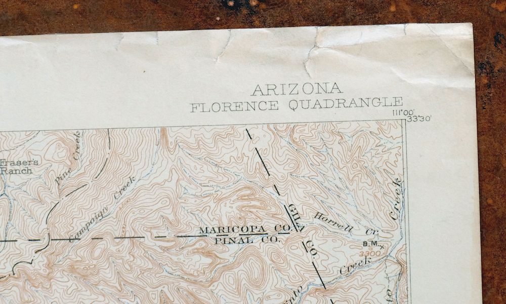
Florence Arizona Apache Junction Superior USGS Topo Map 1917
$73
This is a 1902 edition of the USGS Florence 30-minute topographic quadrangle, printed in 1917 on thick stock and in good condition, never folded with lightly age-toned paper. Sitting about 50 miles east of Phoenix, the quad area takes in Florence and Apache Junction along with Superior, Queen Valley, Florence Junction, and Top-of-the-World, and includes portions of the Tonto National Forest, the Superstition Wilderness, and the White Canyon Wilderness. It captures the far east valley from the Superstition Mountains south to the Gila River as surveyed in 1900, before the modern highway system, with rail lines, ranches, mining infrastructure, and early overland routes still in place. Engraved in 1901 under geographer E.M. Douglas, this antique sheet has scattered light blemishes in the collars, where edge tears have been discreetly stabilized with transparent archival tape on the back, while the map area itself carries no markings or blemishes.
In stock
This antique sheet is a 1902 edition of the Florence Arizona USGS topographic map. It is an authentic 109-year-old 1917 United States Geological Survey print in good condition.
HOW THIS MAP CAN BE USED
In addition to making a fascinating conversation piece, this sheet would look great in a frame or on display, make a unique and prized gift for anyone interested in this area, be perfect as a reference for genealogy studies or general historical research, or fill that missing piece in your collection.
FEATURES SHOWN ON THE MAP
The Florence 30-minute map shows cities and towns, roads, railroads, rivers, creeks, elevation contour lines, public land survey lines, county, state, and other administrative boundaries as they existed at the time of the survey in 1900.
A VALUABLE HISTORICAL RECORD
Maps from the USGS 30-minute series have been out of print for many years. They have never been common and original prints are increasingly difficult to find. For areas where the 30-minute map was produced, it is usually the first large-scale survey done by the USGS for that area. These are a valuable historical record, as they contain many placenames and features that have been dropped from more recent series’ and editions.
Nearby maps
-
Roosevelt Arizona Four Peaks Tonto Basin USGS Topo Map 1956
$52 Add to cart -

Cave Creek Arizona Phoenix Mesa USGS Topo Map 1963 Vintage
$44 Add to cart -

Camp Verde Arizona Cottonwood Sedona USGS Topo Map 1965
$56 Add to cart -

Congress Arizona Yarnell Wilhoit USGS Topo Map 1948 Vintage
$38 Add to cart -

Morenci Arizona Clifton Blue River USGS 30-Min Topo Map 1954
$64 Add to cart -

San Simon Arizona Bowie USGS 30-Min Topo Map 1948 Vintage
$55 Add to cart -
Pearce Arizona McNeal Gleeson USGS Topo Map 1948 Vintage
$55 Add to cart -

Superior Arizona Top-of-the-World USGS Topo Map 1957 Vintage
$45 Add to cart -
Apache Junction Arizona Tonto NF Mesa USGS Topo Map 1975
$42 Add to cart -

Sacaton Arizona Gilbert Coolidge USGS Topographic Map 1948
$45 Add to cart -

Desert Well Arizona Apache Junction Mesa USGS Topo Map 1906
$65 Add to cart -
Globe Arizona Miami Claypool USGS Topo Map 1955 Vintage
$54 Add to cart -
Globe Arizona Miami Claypool USGS Topo Map 1982 Vintage
$28 Add to cart -
Casa Grande East Arizona USGS 7.5-Min Topo Map 1975 Vintage
$38 Add to cart -
Signal Peak Arizona Casa Grande Eloy USGS Topo Map 1960
$45 Add to cart -
Winkelman Arizona Dudleyville Hayden USGS Topo Map 1966
$43 Add to cart -

Mesa Arizona Gilbert Salt River USGS Topo Map 1965 Vintage
$95 Add to cart -

Gila Butte Arizona Chandler Santan USGS Topographic Map 1966
$37 Add to cart -
Christmas Arizona USGS 15-Min Topographic Map 1917 Antique
$57 Add to cart -
Casa Grande West Arizona USGS 7.5-Min Topo Map 1967 Vintage
$32 Add to cart -
Guadalupe Arizona Phoenix Mesa USGS Topo Map 1957 Vintage
$49 Add to cart -
Red Rock Arizona Picacho Peak Marana USGS Topo Map 1965
$46 Add to cart -

Tortolita Mountains Arizona USGS 15-Min Topographic Map 1964
$38 Add to cart -
Casa Grande Arizona Stanfield Bon USGS Topographic Map 1959
$44 Add to cart
