MAP DETAILS | |
|---|---|
| TITLE | Mountain Home |
| STATE | Idaho |
| LOCATION | 35 miles southeast of Boise |
| SERIES | 30-minute |
| SURVEYED | 1889 Field Survey |
| GEOGRAPHER | A.H. Thompson |
| EDITION | 1893 |
| PRINTED | 1916 |
| PRINT NOTES | Thick paper stock |
| SCALE | 1:125000 |
| CONTOUR INTERVAL | 100 feet |
| SHEET DIMENSIONS | 16 1/2 x 20 inches |
| MAP DIMENSIONS | 12 3/4 x 17 1/2 inches |
| COVERAGE AREA | 25 x 35 miles |
| MAP NOTES | Surveyed before the existence of Mountain Home Air Force Base. |
| SHEET CONDITION For maps of this vintage, effort is made to note all visible flaws, no matter how minor. | |
| OVERALL CONDITION | Very Good |
| SHEET NOTES | lightly handled, never folded, lightly age-toned paper |
| MAP AREA | no wear, no markings, no blemishes |
| COLLARS | minor wear or tears, no markings, no blemishes |
| MAP COVERAGE Quadrangle extent overlaid on current basemap. | |
| BACKSIDE LEGEND | |
 A map summary is printed on the back side of the Mountain Home sheet similar to the one shown in the picture. It outlines the history, purpose, and status of the USGS mapping program at the time of the printing in 1916. It also provides instructions on how to read contour lines and a description of how they are used to depict the terrain. At the bottom of the page is a legend showing all of the symbols used to represent the cultural, relief, and water features found on the map. | |
| PLACENAMES Depending on map series and survey date, all of the features listed below may not be shown on this map. This list contains features that currently exist or historically existed within the area covered by the map. The list can be used as a reference to determine if this map covers your area of interest. Placenames are listed alphabetically next to each feature type. | |
| CITIES AND TOWNS (CURRENT) | Mayfield, Mountain Home, and Mountain Home AFB |
| COUNTIES COVERED | Ada, Elmore, and Owyhee |
| FEDERAL LAND UNITS | Boise National Forest, Mountain Home Air Force Base, Mountain Home Small Arms Range Annex, and Snake River Birds of Prey National Conservation Area |
| RIVERS AND STREAMS | Beaver Creek, Bender Creek, Bennett Creek, Big Horse Creek, Blacks Creek, Bock Creek, Bounds Creek, Bowns Creek, Bryans Run, Buffalo Creek, Canyon Creek, Case Creek, Cayuse Creek, Cottonwood Creek, Cow Creek, Crown Creek, Dead Horse Creek, Deer Creek, Devils Hole Creek, Ditto Creek, Dive Creek, Dry Buck Creek, Dry Creek, East Fork Long Tom Creek, East Fork Slater Creek, East Side Canal, Feeder Canal, Flat Creek, Fornham Creek, Granite Creek, Hot Springs Creek, Indian Creek, Jack Creek, John Hoffman Reservoir, Long Tom Creek, Mennecke Creek, Miller Canal, Mountain Home Reservoir, Mud Springs Creek, Old Lamberton Canal (historical), Pierce Creek, Pine Creek, Pony Creek, Rattlesnake Creek, Rock Creek, Salt Creek, Sheep Creek, Slater Creek, Smith Creek, Snake River, South Fork Boise River, Squaw Creek, Syrup Creek, Thorn Creek, Trail Creek, West Fork Long Tom Creek, West Fork Slater Creek, West Side Canal, Williams Creek, and Willow Creek |
| WATER BODIES | C. J. Strike Reservoir, Fraser Reservoir, and Long Tom Reservoir |
| Locations: Bennett Ranch, Cow Creek Forest Camp, Danskin Guard Station, Forest Camp, Granite Spring Campground, Long Tom Ranch, Seven L Ranch, Stardust Plaza, Sunnyside, The Roost, Thomson Ranch, Willow Creek Guard Station, and Willow Ranch. Mountain Ranges: Danskin Mountains. Mountains, Peaks, and Summits: Cinder Cone Butte, Danskin Peak, Little Fiddler, Lockman Butte, Teapot Dome, and Tollgate Hill. Valleys and Canyons: Black Canyon, Caldwell Draw, Cherry Gulch, Dixie Gulch, Emigrant Cove, Long Gulch, McElroy Draw, McIntyre Draw, Pole Gulch, Raspberry Gulch, Smith Draw, Tacket Gulch, Teetors Gulch, and Timber Gulch. Parks: Carl Miller Park, East Side Park, Memorial Park, Oregon Trail Historical Marker, Railroad Park, and Richard Aguirre Park. Drainages: Beaver Creek, Big Horse Creek, Bock Creek, Bounds Creek, Case Creek, Cayuse Creek, Cottonwood Creek, Cove Creek, Cow Creek, Crooked Creek, Crown Creek, Dead Horse Creek, Deer Creek, Devils Hole Creek, Ditto Creek, Dive Creek, Dry Buck Creek, Dry Creek, East Fork Bennett Creek, East Fork Long Tom Creek, East Fork Slater Creek, Echo Creek, Fornham Creek, Granite Creek, Hell Hole Creek, Little Fiddler Creek, Little Horse Creek, Little Pierce Creek, Long Tom Creek, Mennecke Creek, Mud Springs Creek, Packsaddle Creek, Paradise Creek, Pierce Creek, Pine Creek, Pole Creek, Pony Creek, Porcupine Creek, Rattlesnake Creek, Rock Creek, Roost Creek, Rough Creek, Salt Creek, Sheep Creek, Slater Creek, Soles Rest Creek, South Fork Rock Creek, Squaw Creek, Syrup Creek, Thorn Creek, Trail Creek, West Fork Long Tom Creek, West Fork Slater Creek, Williams Creek, and Willowdale Creek. Churches: Mountain Home Christian Center. Hospitals: Elmore Memorial Hospital. Lakes and Ponds: Danskin Lake. Dams: Groefsema Dam, Hoffman And Duffy Dam, Long Tom Dam, and Mountain Home Dam. Bluffs: Big Bluff. Craters: Crater Rings. Canals: East Side Canal, Feeder Canal, Lamberton Canal, Miller Canal, and West Side Canal. Bends: Indian Point. Basins: Devils Hole, Smith Prairie, and Teapot Basin. Airports: Camas County Airport, Mountain Home Municipal Airport, and Smith Prairie Airport. Schools: Incorporated Childrens House Montessori School, East Elementary School, Elmore County Alternative Center, Faith Lutheran School, Mountain Home Air Force Base Intermediate School, Mountain Home Air Force Base Junior High School, Mountain Home Air Force Base Primary School, Mountain Home Junior High School, Mountain Home Senior High School, North Elementary School, and West Elementary School. Reservoirs and Tanks: John Hoffman Reservoir, Keith Reservoir, Lamberton Reservoir, Long Tom Reservoir, and Mountain Home Reservoir. Flats: Ballinger Flat, Clover Hollow, Cougar Flat, Little Fiddler Flat, Little Sage Hen Flat, Sage Hen Flat, Slade Flat, Slaters Flat, and Sproule Flat. Towers: KLVJ-AM (Mountain Home) and KLVJ-FM (Mountain Home). Pillars: Cathedral Rocks. Springs: Berneathy Spring, Cold Spring, Cottonwood Springs, Frenchman Spring, Granite Spring, Hot Springs, Iron Spring, McGuire Spring, Montrose Spring, Mud Spring, Parker Spring, Rattlesnake Spring, Timmons Field Spring, and Tommy Field Spring. | |
| SHIPPING AND RETURNS | |
 This map sheet will be carefully rolled in a sturdy tube and shipped via the US Postal Service. If you find that the sheet you receive is not as described in the listing, you may ship it back to us for a refund of the purchase price. | |
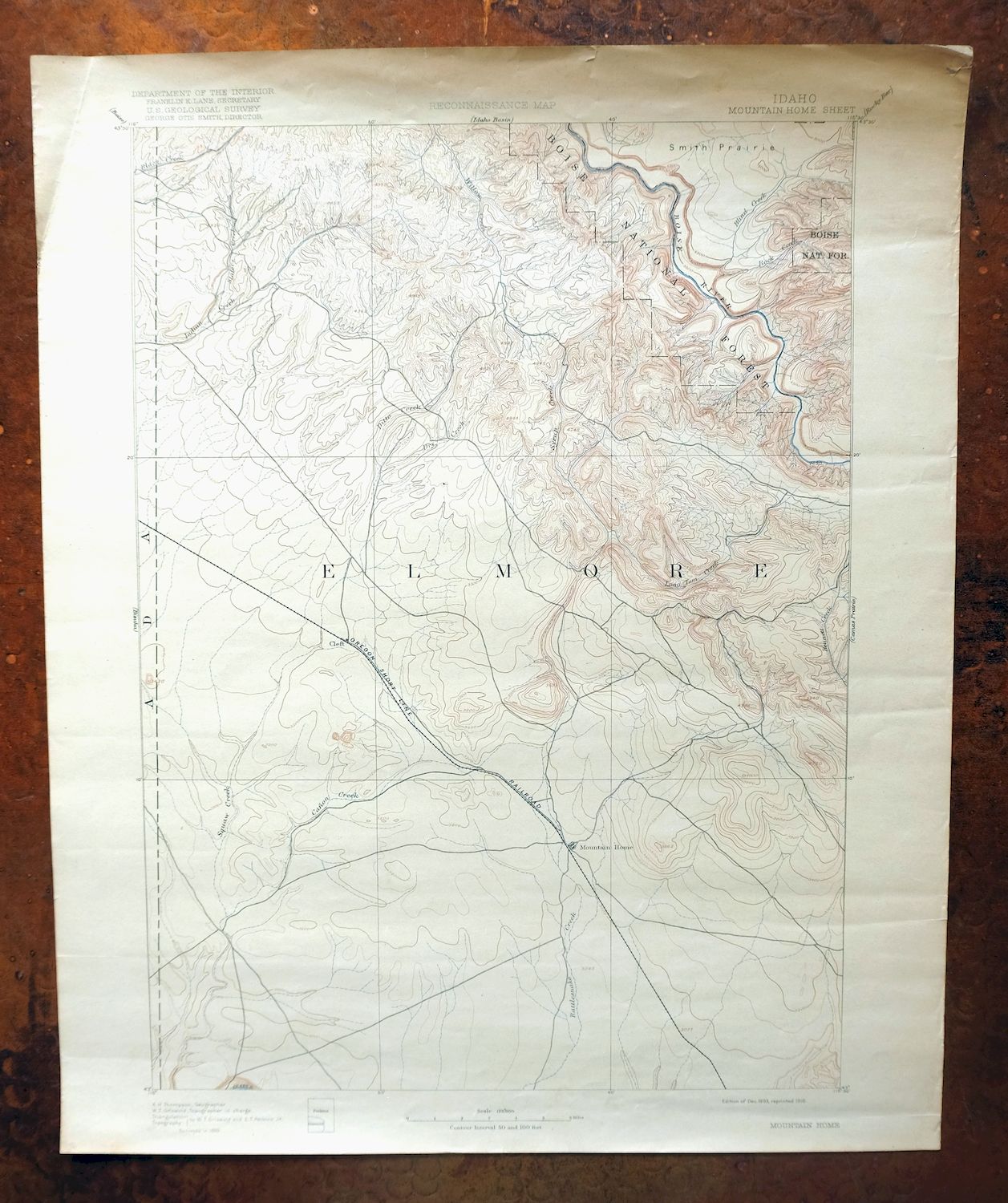
Mountain Home Idaho Cleft Mayfield USGS 30-Min Topo Map 1916
$37
This USGS topographic sheet is an 1893 edition printed in 1916, an antique on thick stock that survives in very good condition with lightly age-toned paper and a sheet that was never folded. On the 30-minute scale it takes in the country around Mountain Home, Idaho, about 35 miles southeast of Boise, with the quad area spanning parts of Ada, Elmore, and Owyhee counties and including Mayfield and part of the Boise National Forest. Drawn from an 1889 field survey under geographer A.H. Thompson, it maps the landscape decades before Mountain Home Air Force Base was established, so the base that now defines the area does not appear. The reverse carries printed reference material from the era.
In stock
This antique sheet is an 1893 edition of the Mountain Home Idaho USGS topographic map. It is an authentic 110-year-old 1916 United States Geological Survey print in very good condition.
HOW THIS MAP CAN BE USED
In addition to making a fascinating conversation piece, this sheet would look great in a frame or on display, make a unique and prized gift for anyone interested in this area, be perfect as a reference for genealogy studies or general historical research, or fill that missing piece in your collection.
FEATURES SHOWN ON THE MAP
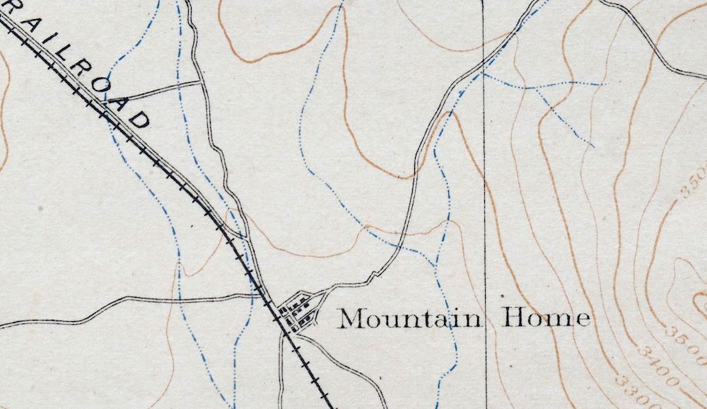
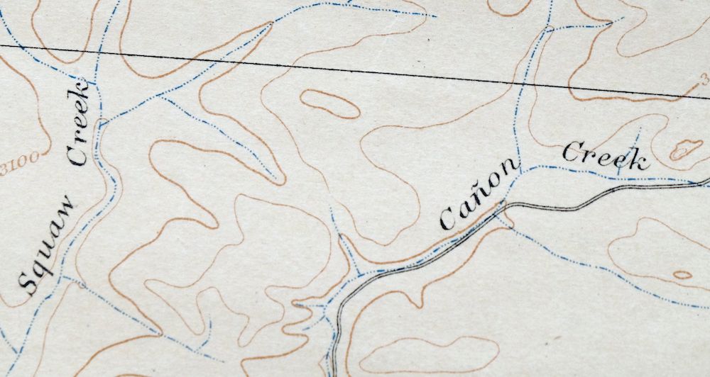
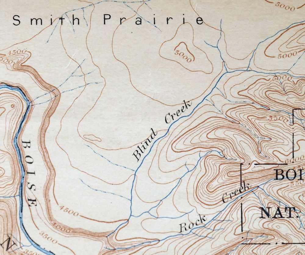
The Mountain Home 30-minute map shows cities and towns, roads, railroads, rivers, creeks, elevation contour lines, public land survey lines, county, state, and other administrative boundaries as they existed at the time of the survey in 1889.
A VALUABLE HISTORICAL RECORD
Maps from the USGS 30-minute series have been out of print for many years. They have never been common and original prints are increasingly difficult to find. For areas where the 30-minute map was produced, it is usually the first large-scale survey done by the USGS for that area. These are a valuable historical record, as they contain many placenames and features that have been dropped from more recent series’ and editions.
Nearby maps
-

Nampa Idaho Caldwell Emmett USGS 30-Min Topographic Map 1948
$37 Add to cart -
Squaw Creek Idaho Alpha Cascade USGS Topo Map 1948 Vintage
$38 Add to cart -

Mountain City Nevada Owyhee River Owyhee USGS Topo Map 1956
$40 Add to cart -
Owyhee Nevada Duck Valley USGS 15-Min Topo Map 1965 Vintage
$40 Add to cart -
Cuprum Idaho USGS 15-Min Topographic Map 1958 Vintage
$31 Add to cart -

Goldstone Mountain Idaho Baker USGS Topo Map 1969 Vintage
$22 Add to cart -
Carlin Nevada Humboldt River Bunker Hill USGS Topo Map 1961
$24 Add to cart -
Disaster Nevada Adler Creek WSA Denio USGS Topo Map 1909
$65 Add to cart -
Limekiln Rapids Idaho USGS 15-Min Topo Map 1946 Vintage
$32 Add to cart -
Soda Springs Idaho Cache NF Grace USGS Topo Map 1951 Vintage
$32 Add to cart -
Monument Ridge Montana USGS 15-Min Topo Map 1975 Vintage
$38 Add to cart -

Walla Walla Washington Langdon Mill Creek USGS Topo Map 1978
$43 Add to cart -

Ennis Montana McAllister Jeffers USGS Topo Map 1969 Vintage
$38 Add to cart -
Sphinx Mountain Montana Big Sky USGS Topo Map 1968 Vintage
$40 Add to cart -

Missoula Montana Stevensville Lolo USGS Topographic Map 1925
$57 Add to cart -
Wallula Washington Finley Burbank USGS Topo Map 1918 Antique
$34 Add to cart -

Tepee Creek Montana Grayling USGS Topo Map 1963 Vintage
$35 Add to cart -

Spanish Peaks Montana Big Sky USGS Topo Map 1973 Vintage
$37 Add to cart -

Crown Butte Montana Yellowstone NP USGS 15-Min Topo Map 1979
$40 Add to cart -
Stockton Utah Tooele Rush Valley USGS Topo Map 1941 Antique
$32 Add to cart -

Mount Holmes Wyoming USGS 15-Min Topo Map 1979 Vintage
$39 Add to cart -

Badger Mountain Washington South Richland USGS Topo Map 1978
$43 Add to cart -

Boulder Montana Butte-Silver Bow Clancy USGS Topo Map 1933
$39 Add to cart -

La Crosse Washington Winona Palouse River USGS Topo Map 1952
$42 Add to cart
