MAP DETAILS | |
|---|---|
| TITLE | Owyhee |
| STATE | Nevada, Idaho |
| LOCATION | 75 miles north of Elko, NV |
| SERIES | 15-minute |
| SURVEYED | 1938 and 1939 Field Survey |
| GEOGRAPHER | R.C. Seitz |
| EDITION | 1939 |
| PRINTED | 1965 |
| PRINT NOTES | Thick paper stock, includes woodland tint (green to indicate vegetated areas) |
| SCALE | 1:62500 |
| CONTOUR INTERVAL | 50 feet |
| SHEET DIMENSIONS | 16 7/8 x 20 7/8 inches |
| MAP DIMENSIONS | 13 x 17 1/2 inches |
| COVERAGE AREA | 13 x 17 miles |
| SHEET CONDITION For maps of this vintage, effort is made to note all visible flaws, no matter how minor. | |
| OVERALL CONDITION | Very Good |
| SHEET NOTES | lightly handled, never folded |
| MAP AREA | flawless map area |
| COLLARS | minor wear or tears, no markings, minor age toning on collar edges |
| MAP COVERAGE Quadrangle extent overlaid on current basemap. | |
| PLACENAMES Depending on map series and survey date, all of the features listed below may not be shown on this map. This list contains features that currently exist or historically existed within the area covered by the map. The list can be used as a reference to determine if this map covers your area of interest. Placenames are listed alphabetically next to each feature type. | |
| CITIES AND TOWNS (CURRENT) | Owyhee |
| COUNTIES COVERED | Elko and Owyhee |
| FEDERAL LAND UNITS | Duck Valley Indian Reservation and Humboldt National Forest |
| RIVERS AND STREAMS | Billy Shaw Slough, Boyle Creek, Breakneck Creek, Dry Creek, East Fork Skull Creek, Fawn Creek, Granite Creek, Indian Creek, Jones Creek, Marys Creek, Mill Creek, Mitchell Creek, North Fork Skull Creek, Owyhee River, Reed Creek, Sheep Creek, Skull Creek, South Fork Boyle Creek, Summit Creek, Thacker Slough, Van Duzer Creek, Wall Creek, and Winters Creek |
| Nevada Administrative Boundaries: Mountain City Township. Mountain Ranges: Bull Run Mountains. Mountains, Peaks, and Summits: Crows Nest, Fly Head, Gondem Bah, Ottawanah, Paisewa Goei, The Point, Prentice Hill, Quarry Hill, Siciegottit, Ungina Wongo, Wonga Douya, and Yellow Rock. Valleys and Canyons: Banty Gulch, Duck Valley, Prentice Canyon, and Wall Canyon. Trails: Cleveland Trail and White Rock Owyhee Mail Trail. Drainages: Fawn Creek, Cobb Creek, Cow Creek, East Fork Skull Creek, Jones Creek, Lime Creek, McCall Creek, Mitchell Creek, North Fork Skull Creek, Reed Creek, Skull Creek, South Fork Boyle Creek, Summit Creek, Wall Creek, and Winters Creek. Capes: Paradise Point and Timber Point. Mines: Blue Ribbon Mine and Idaho Nevada Shaft. Dams: China Dam, Dry Creek Dam, and Nevada Noname Two Dam. Gaps: Crows Nest Gate, Porcupine Pass, and White Gate. Craters: The Crater. Canals: Agency Canal, Duck Valley Canal, Homer Ditch, Main Canal, Sheep Creek Ditch, Thacker Lateral, and White Rock Lateral. Airports: Owyhee Airport. Schools: Owyhee Elementary School and Owyhee High School. Reservoirs and Tanks: Bahm Basa Pond, Coyote Hole, and Dry Creek Reservoir. Flats: Jones Flat, Picnic Flats, and Willis Meadows. Wells: Deep Well and Stateline Well. Springs: Barrel Spring, Cavanaugh Spring, Cold Spring, Granger Spring, Sagebrush Spring, and Thacker Spring. | |
| Idaho Reserves: Duck Valley Indian Reservation. Drainages: South Fork Boyle Creek. | |
| SHIPPING AND RETURNS | |
 This map sheet will be carefully rolled in a sturdy tube and shipped via the US Postal Service. If you find that the sheet you receive is not as described in the listing, you may ship it back to us for a refund of the purchase price. | |
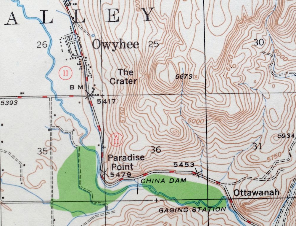
Owyhee Nevada Duck Valley USGS 15-Min Topo Map 1965 Vintage
$40
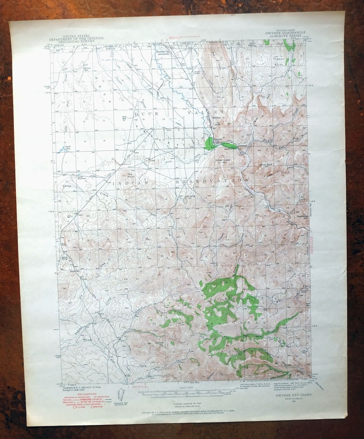
This USGS 15-minute topographic map is a 1939 edition printed in 1965, and the sheet is in very good condition, lightly handled and never folded. Straddling the Nevada-Idaho line about 75 miles north of Elko, the quad takes in the town of Owyhee and the Duck Valley area, with the Duck Valley Indian Reservation and part of the Humboldt National Forest within its boundaries. Printed on thick stock with a flawless map area, it shows the high country of Nevada’s remote northern edge as it was mapped from field surveys in 1938 and 1939.
In stock
This vintage sheet is a 1939 edition of the Owyhee Nevada USGS topographic map. It is an original 61-year-old 1965 United States Geological Survey print in very good condition.
HOW THIS MAP CAN BE USED
In addition to making a fascinating conversation piece, this sheet would look great in a frame or on display, make a unique and prized gift for anyone interested in this area, be perfect as a reference for genealogy studies or general historical research, or fill that missing piece in your collection. Maps of this vintage are printed on durable stock and are well-suited for outdoor activities and recreation of all kinds, including hiking, backpacking, hunting, rafting and kayaking, backcountry skiing, geocaching, general exploration, treasure hunting, etc.
FEATURES SHOWN ON THE MAP
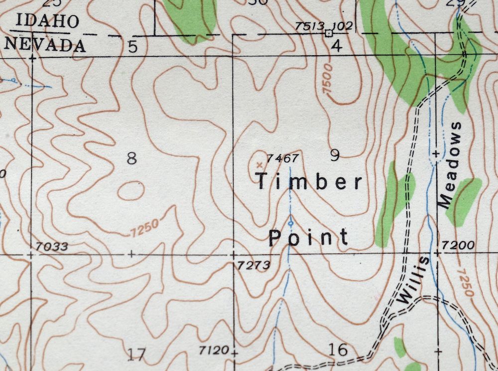
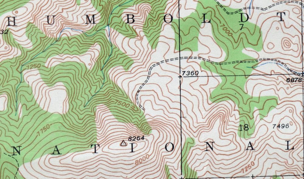
The Owyhee 15-minute map shows cities and towns, roads, railroads, utilities and energy infrastructure, rivers, creeks, elevation contour lines, public land survey lines, county, state, and other administrative boundaries as they existed at the time of the survey in 1938 and 1939. All known structures (houses, businesses, churches, schools, barns, cabins, etc) are also shown, with exceptions in some urban areas, where only landmark buildings may be shown.
A VALUABLE HISTORICAL RECORD
Maps from the 15-minute series for the continental United States are no longer produced or printed by the USGS and original prints are becoming increasingly difficult to find. They are a valuable historical record for an area, as they contain many placenames and features that have been dropped from more recent maps.
Nearby maps
-

Mountain City Nevada Owyhee River Owyhee USGS Topo Map 1956
$40 Add to cart -
Carlin Nevada Humboldt River Bunker Hill USGS Topo Map 1961
$24 Add to cart -

Mountain Home Idaho Cleft Mayfield USGS 30-Min Topo Map 1916
$37 Add to cart -
Disaster Nevada Adler Creek WSA Denio USGS Topo Map 1909
$65 Add to cart -

Nampa Idaho Caldwell Emmett USGS 30-Min Topographic Map 1948
$37 Add to cart -
Squaw Creek Idaho Alpha Cascade USGS Topo Map 1948 Vintage
$38 Add to cart -
Wildcat Peak Nevada Toiyabe NF USGS Topo Map 1962 Vintage
$14 Add to cart -
Stockton Utah Tooele Rush Valley USGS Topo Map 1941 Antique
$32 Add to cart -
Cuprum Idaho USGS 15-Min Topographic Map 1958 Vintage
$31 Add to cart -
Big Sage Reservoir California Alturas USGS Topo Map 1972
$40 Add to cart -
Soda Springs Idaho Cache NF Grace USGS Topo Map 1951 Vintage
$32 Add to cart -
Litchfield California Susanville USGS Topo Map 1972 Vintage
$40 Add to cart -
Fredonyer Peak California USGS 15-Min Topo Map 1972 Vintage
$40 Add to cart -
Milford California USGS 15-Min Topographic Map 1966 Vintage
$40 Add to cart -
Susanville California Janesville USGS Topo Map 1966 Vintage
$39 Add to cart -

Goldstone Mountain Idaho Baker USGS Topo Map 1969 Vintage
$22 Add to cart -
Provo Utah Uinta NF Spanish Fork USGS Topo Map 1959 Vintage
$36 Add to cart -
Westwood California USGS 15-Min Topographic Map 1961 Vintage
$38 Add to cart -
Tulelake California USGS 15-Min Topographic Map 1970 Vintage
$33 Add to cart -
Sierraville California Calpine Loyalton USGS Topo Map 1969
$40 Add to cart -

Moroni Utah Fountain Green USGS 15-Min Topo Map 1968 Vintage
$39 Add to cart -
Fillmore Utah Kanosh Meadow USGS 15-Min Topographic Map 1975
$40 Add to cart -

Hayden Peak Utah Uinta Mountains USGS Topo Map 1946 Vintage
$45 Add to cart -
Dorris California Mount Hebron USGS Topo Map 1965 Vintage
$19 Add to cart