MAP DETAILS | |
|---|---|
| TITLE | Morenci |
| STATE | Arizona, New Mexico |
| LOCATION | 40 miles northeast of Safford |
| SERIES | 30-minute |
| SURVEYED | 1900 through 1913 Field Survey |
| GEOGRAPHER | R.B. Marshall |
| EDITION | 1913 |
| PRINTED | 1954 |
| PRINT NOTES | Thick paper stock, includes woodland tint (green to indicate vegetated areas) |
| SCALE | 1:125000 |
| CONTOUR INTERVAL | 100 feet |
| SHEET DIMENSIONS | 17 x 21 inches |
| MAP DIMENSIONS | 14 5/8 x 17 1/2 inches |
| COVERAGE AREA | 29 x 35 miles |
| SOURCE | From the vintage map collection of Art Christiansen, Tempe, Arizona |
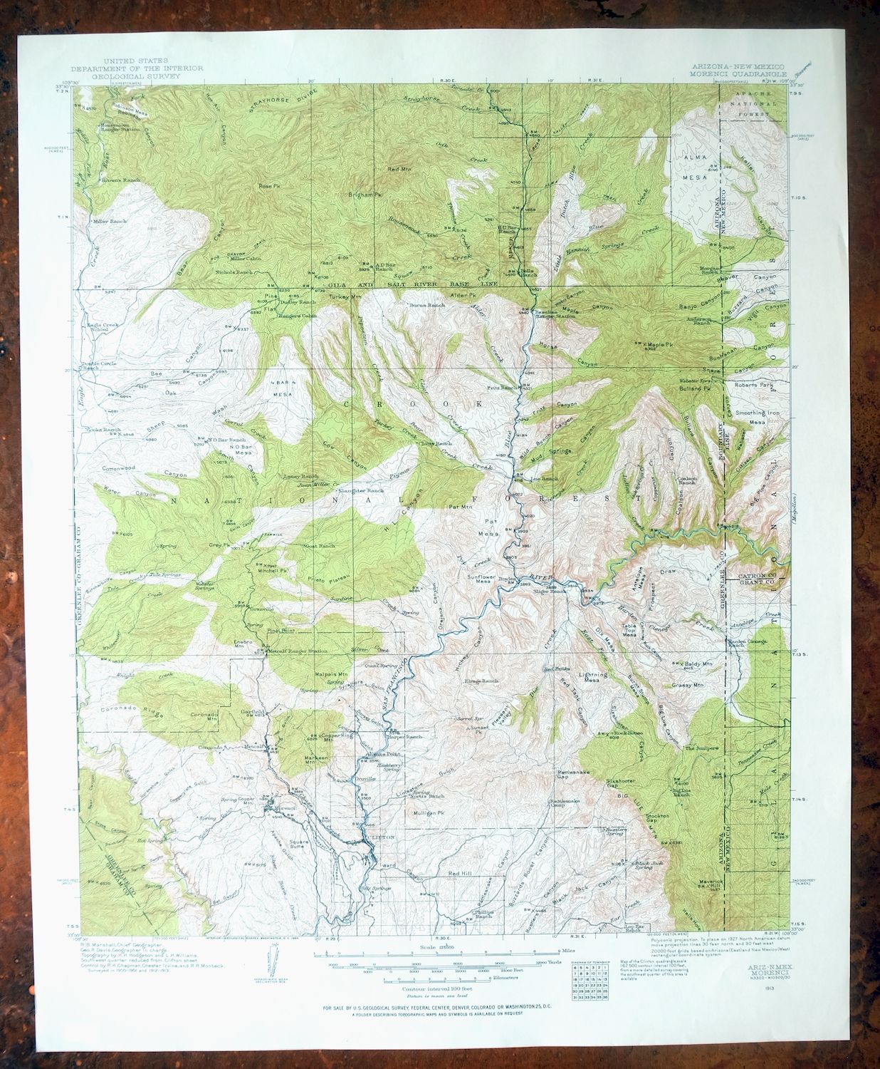
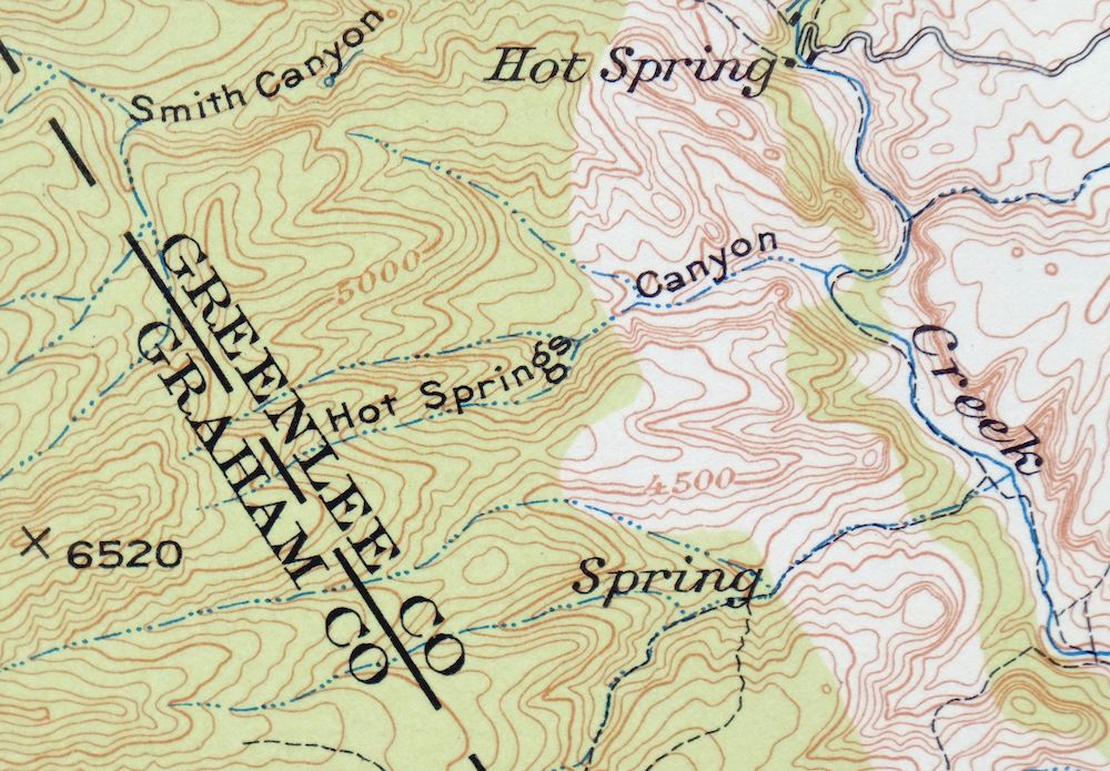
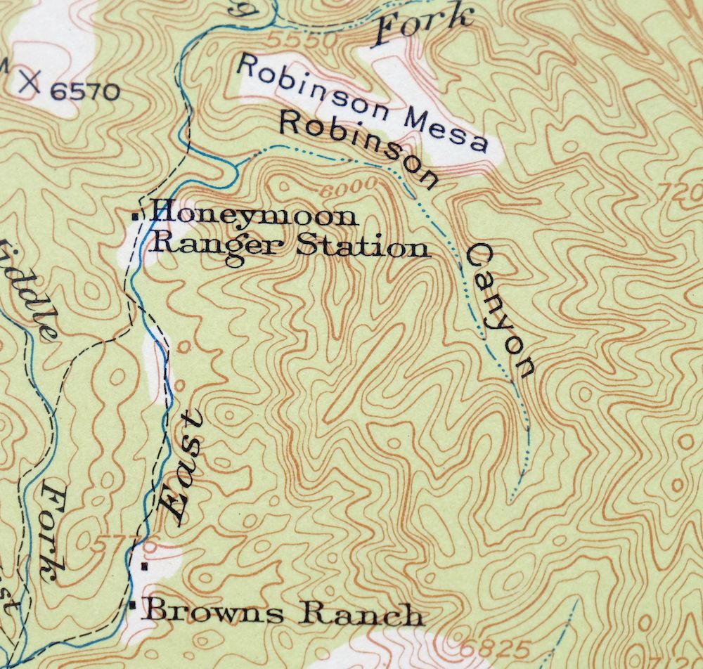
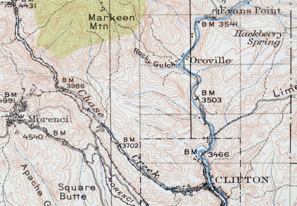
| MAP NOTES | A fascinating snapshot of the Clifton and Morenci region of east-central Arizona from the hot springs on Eagle Creek northeast to Alma Mesa, including Honeymoon Ranger Station on the Upper Eagle, surveyed before the modern highway system, showing historic travel routes, rail lines, ranches, and placenames. |
| SHEET CONDITION For maps of this vintage, effort is made to note all visible flaws, no matter how minor. | |
| OVERALL CONDITION | Excellent |
| SHEET NOTES | very lightly handled, never folded, smooth and flat |
| MAP AREA | flawless map area |
| COLLARS | no wear or tears, no markings, no blemishes |
| MAP COVERAGE Quadrangle extent overlaid on current basemap. | |
| PLACENAMES Depending on map series and survey date, all of the features listed below may not be shown on this map. This list contains features that currently exist or historically existed within the area covered by the map. The list can be used as a reference to determine if this map covers your area of interest. Placenames are listed alphabetically next to each feature type. | |
| CITIES AND TOWNS (CURRENT) | Clifton, Granville, and Morenci |
| COUNTIES COVERED | Catron, Graham, Grant, and Greenlee |
| FEDERAL LAND UNITS | Apache National Forest, Blue Range Wilderness, Gila National Forest, and San Carlos Indian Reservation |
| RIVERS AND STREAMS | Alder Creek, Antelope Creek, Ash Creek, Bear Creek, Beeler Creek, Benton Creek, Blue River, Bull Creek, C A Bar Creek, Cave Creek, Chase Creek, Cienega Creek, Clear Creek, Coal Creek, Cold Creek, Deerhead Creek, Dix Creek, Dry Prong Creek, Dutch Blue Creek, Eagle Creek, Earl Creek, East Eagle Creek, Hannah Springs Creek, Harden Cienega Creek, Indian Creek, Juan Miller Creek, King Creek, Left Prong Dix Creek, Linden Creek, Little Blue Creek, Middle Prong Creek, Mule Creek, North Bull Creek, North Corral Creek, North Fork Tennessee Creek, Oak Creek, Owl Creek, Pat Creek, Pigeon Creek, Pipestem Creek, Pistol Creek, Right Prong Dix Creek, Rousensock Creek, San Francisco River, Sardine Creek, Sheep Wash, Silver Basin Creek, Silver Creek, Squaw Creek, Strayhorse Creek, Tennessee Creek, Thomas Creek, Tule Creek, Turkey Creek, Wet Prong Creek, White Mule Creek, Whitewater Creek, and Willow Creek |
| WATER BODIES | Bluff Tank, Citizen Tank, Forks Tank, Mesa Tank, Moore Tank, Mud Springs Tank Number One, N O Bar Mesa Tank Number Two, Pipestem Mountain Tank, Smoothing Iron Tank, Trail Cabin Tank, and Upper Big Dry Tank |
| Arizona Locations: A D Bar Ranch, Al Creek Corral, Asma Corral, Auger Corral, Beeler Creek Corral, Bedrock Corrall, Big Lue Ranch, Bull Basin Corral, Butcher Knife Corral, Canyon Corral, Cave Creek Corral, Cement Tank Corral, Cherry Lodge Picnic Area, Cienega Corral Cabin, Cienega Creek Number Two Corral, Clear Creek Corral, Coalson Ranch, Cookstove Corral, Coronado, Cottonwood Corral, Deerhead Corral, Dix Creek Corral, Dog Flat Corral, Double Circle Ranch, Dutch Chimney Corral, Eagle Creek Pumping Station, El Paso Corral, Four Bar Mesa Cabin, Four Bar Mesa Corral, Four Drag Ranch, Frank Davis Ranch, Fritz Ranch, G J Filleman Ranch, Gap Holding Corral, Gavilan Corral, Greenwade Ranch, H U Bar Ranch, Hamilton Mesa Corral, Hannah Spring Canyon Corral, Hicks Ranch, Hogtrail Corral, Horse Canyon Cabin, Horse Canyon Corral, Joe Fritz Corral, Juan Miller Corral, Lightening Mesa Corral, Lopez Corral, Lower Cave Creek Spring, Lower Clear Creek Corral, Lower Indian Corral, Lower Oak Creek Corral, Lower Pipestem Corral, Lower Rousensock Corral, Lower Wild Bunch Corral, Mallet Ranch, Malpais Corral, Manning Corral, Maple Corral, Martinez Ranch, Mesa Corral, Metcalf, Moore Ranch, Morris Gap Corral, Mountain Corral, Mud Springs Corral, N O Bar Ranch, N Pat Corral, One Horn Corral, Oroville, Pasture Wells Corral, Pat Corral, Phillips Ranch, Picket Corral, Pine Flat Corral, Pine Flat Cortral, Pinon Mountain Corral, Ranch Corral, Rattlesnake Gap Camp, Red Tank Corral, Robinson Mesa Corral, Rose Peak Lookout, Ru Ranch, Salt Ground Corral, Sandrock Corral, Santa Cruz Corral, Santa Rosa Mine, Sawmill Corral, Seven Cross A Ranch, Shipping Corral, Silver Basin Corral, Smith Cabin, Spur Cross Corral, Stacy Ranch, Stateline Camp, Sunflower Corral, Syeamore Corral, T Links Ranch, Tercer Springs Number One, Tinny Cabin Corral, Tinny Corral, Trail Cabin Forest Service Facility, Trail Corral, Trap Corral, Tule Springs Ranch, Turkey Creek Corral, Upper Cienega Corral, Upper Eagle Creek Corral, Upper Rousensock Corral, VT Ranch, Wagon Corral, Webster Corral, West Coal Creek Corral, White Mule Windmill, White Rocks Cabin, Wild Bunch Corral, Winter Cabin, Wood Spring Corral, and Woolaroc. Mountain Ranges: Blue Range. Mountains, Peaks, and Summits: Alder Peak, Alma Mesa, Antelope Mesa, Baldy Mountain, Bonehead Mesa, Bee Mesa, Big Lue Mountains, Black Mountain, Brigham Peak, Brushy Mountain, Bullard Peak, Burnt Stump Mesa, Burro Mesa, Chalk Peak, Charlie Moore Mountain, Clifton Peak, Coalson Peak, Cold Spring Mountain, Copper King Mountain, Copper Mountain, Coronado Mountain, Dix Mesa, Enebro Mountain, Four Bar Mesa, Gavilan Peak, Government Mesa, Grassy Mountain, Grey Peak, Hamilton Mesa, Harper Mesa, High Mesa, Horse Mesa, Horse Mountain, Layout Mesa, Lightning Mesa, Lone Tree Mesa, Malpais Mountain, Maple Peak, Markeen Mountain, Maverick Hill, Mitchell Peak, Modoc Mountain, Morenci Mountain, Mud Spring Mesa, Mulligan Peak, N O Bar Mesa, Painted Bluffs, Palace Peak, Pat Mesa, Pat Mountain, Pinal Point, Pinyon Knob, Pipestem Mountain, Red Hill, Red Mountain, Robinson Mesa, Rose Peak, Santa Rosa Mountain, Seep Spring Mountain, Shannon Mountain, Smelter Hill, Square Butte, Sunflower Mesa, Sunset Peak, Table Mountain, Table Top, Table Top Mesa, Telephone Mesa, Walker Butte, Webster Mountain, and White Peaks. Valleys and Canyons: Ash Spring Canyon, Auger Canyon, Banjo Canyon, Bar F Canyon, Bat Canyon, Beef Eater Canyon, Bird Canyon, Board Canyon, Bear Canyon, Bee Canyon, Big Dry Canyon, Big Lue Canyon, Black Jack Canyon, Bull Canyon, Bullard Canyon, Butcherknife Canyon, Chesser Canyon, Chimney Rock Canyon, Cistern Canyon, Citizen Canyon, Coalson Canyon, Colorado Gulch, Copperas Canyon, Copperplate Gulch, Coronado Gulch, Cow Canyon, Dark Canyon, Deer Springs Canyon, Devils Canyon, Devils Den Canyon, Do Nothing Canyon, Dorsey Gulch, Drive Canyon, Dry Prong Canyon, Fritz Canyon, Fry Canyon, Garfield Gulch, Gavilan Canyon, Gold Gulch, Guswert Canyon, H L Canyon, Hackberry Canyon, Hackberry Gulch, Hamilton Canyon, Harry Canyon, Hickey Canyon, Hickory Gulch, Hobo Canyon, Hog Canyon, Hogtrail Canyon, Horse Canyon, Horseshoe Canyon, Horseshoe Gulch, Hot Air Canyon, Hot Springs Canyon, La Jolla Canyon, La Jolla Canyon, Kelly Canyon, King Gulch, Knight Canyon, Ladrone Canyon, Lengthy Canyon, Limestone Gulch, Lone Sycamore Gulch, Long Canyon, Maple Canyon, Moonshine Canyon, Morenci Gulch, Mud Spring Canyon, Mud Springs Canyon, Oak Canyon, Oak Springs Canyon, One Horn Canyon, Open Canyon, Orejana Canyon, Palace Canyon, Pine Canyon, Pinkard Gulch, Pinkhead Gulch, Pipestem Canyon, Placer Gulch, Pleasant Valley, Porky Canyon, Post Canyon, Prospect Draw, Rattlesnake Canyon, Red Canyon, Red Tank Canyon, Rincon Canyon, Roan Cow Canyon, Robinson Canyon, Rock House Canyon, Rock Tank Canyon, Rocky Gulch, Rousensock Canyon, Rustlers Canyon, Salt Ground Canyon, Santa Cruz Canyon, Santa Rosa Gulch, Seep Spring Canyon, Sixshooter Canyon, Skeleton Canyon, Smith Canyon, Soapbox Canyon, South Smith Canyon, Spring Canyon, Standard Gulch, Stargo Gulch, Stove Canyon, Suicide Canyon, Sunset Canyon, Sycamore Canyon, Sycamore Gulch, Tornado Canyon, Trail Canyon, Trujillo Canyon, W H Draw, Ward Canyon, Water Canyon, Webster Canyon, West Brushy Canyon, West Fork Copperas Canyon, West Fork Hot Air Canyon, White Rock Canyon, Wild Bunch Canyon, Wood Canyon, Woods Canyon, and Yam Canyon. Woods: The Junipers. Parks: Blackbridge Picnic Area, Granville Campground, Granville Recreation Area, Honeymoon Campground, Lower Juan Miller Campground, Mount Baldy Wilderness, Upper Juan Miller Campground, and Upper Juan Miller Picnic Area. Trails: Adbar Trail Fourteen, Blue River One Hundred One Trail, Bear Canyon Trail, Coronado Trail, East Eagle Trail Thirty-Three, Frye Trail Twelve, H L Canyon Eleven Trail, Horse Canyon Trail Thirty-six, Hot Air Trail Fifteen, Little Blue Creek Forty-one Trail, Mud Springs Trail Forty-nine, Red Mountain Twenty-five Trail, Robinson Mesa Twenty-seven Trail, and Stray Horse Canyon Trail Twenty. Drainages: Alder Creek, Antelope Creek, Ash Creek, Beeler Creek, Blue River, Bear Creek, Benton Creek, Bull Creek, Cave Creek, Chase Creek, Cienega Creek, Clear Creek, Coal Creek, Crabtree Creek, Deerhead Creek, Dix Creek, Dry Prong Creek, Dutch Blue Creek, East Eagle Creek, Hannah Springs Creek, Harden Cienega Creek, Indian Creek, Juan Miller Creek, King Creek, Knight Creek, Left Prong Dix Creek, Little Blue Creek, Lyda Creek, Middle Prong Creek, North Bull Creek, North Corral Creek, Oak Creek, Owl Creek, Pat Creek, Pigeon Creek, Pipestem Creek, Pistol Creek, Right Prong Dix Creek, Rousensock Creek, San Francisco River, Sardine Creek, Sheep Wash, Silver Basin Creek, Silver Creek, Sixshooter Creek, Squaw Creek, Strayhorse Creek, Thomas Creek, Turkey Creek, Wet Prong Creek, White Mule Creek, Whitewater Creek, and Willow Creek. Mines: Coronado Mine, Morenci Open Pit, and Stevens Mine. Buildings: Clifton City Hall and Clifton Railroad Station. Waterfalls: Sardine Falls. Dams: Tailings Water Reclamation Dam. Bluffs: Evans Point and Final Point. Gaps: Bootleg Saddle, Bull Saddle, H L Saddle, Hogtrail Saddle, Morris Gap, Needles Eye, Rattlesnake Gap, Sardine Saddle, Sheep Saddle, Sixshooter Gap, Stockton Gap, and Sunflower Saddle. Basins: Bonehead Basin, H U Bar Box, Little Blue Box, Maverick Basin, Salt Basin, Silver Basin, Yerra Basin, and Zuni Basin. Schools: Clifton High School, Coronado Elementary School, Humboldt Elementary School, Laugharn Elementary School, Liem Primary School, Longfellow Elementary School, Morenci High School, and Murdock Elementary School. Ridges: Coronado Ridge, Snake Ridge, and Strayhorse Divide. Reservoirs and Tanks: Anderson Tank, Assessment Tank, Auger Tank, BUckhorn Tank, Banjo Tank, Baseline Tank, Baseline Tank Number 2, Basin Tank, Beehive Tank, Ben Tank, Bench Tank, Benchmark Tank Number 1, Benchmark Tank Number 2, Bens Tank, Big Tank Series, Big Tank Series Number One, Birkner Tank, Black Tank, Blackwater Pit Tank, Bloody Canyon Tank, Blue Tank, Bluff Tank, Bobby Tank, Bear Tank, Bear Track Tank, Beaver Tank, Beaver Tank Number Two, Bee Springs Tank, Benton Falls Tank, Benton Tank, Big Buckhorn Tank, Big Saddle Tank, Black Jack Tank, Black Mountain Tank, Borrow Tank, Boulder Tank, Brushy Canyon Tank, Brushy Mountain Tank, Brushy Tank, Brushy Tanks Number One, Buchanan Tank, Buck Park Tank, Buck Tank, Buckhorn Canyon Tank, Bull Canyon Tank, Burnt Stump Mesa Tank, Burro Mesa Tank, Butcher Tank, Butte Tank, Butte Tank Number Two, Buzzard Roost Tank, Buzzard Tank, CC Tank, CCC Tank, Caborne Tank, Camp Tank, Camp Tank Number One, Camp Tank Number Two, Cap Tank, Cement Tank, Chichi Tank, Chinaberry Tank, Chuck Box Tank, Circle Canyon Stock Tank, Cistern Tank, Citizen Tank, Clear Creek Ridge Tank, Coalson Tank, Cold Spring Mountain Tank, Cookstove Tank, Copperas Tank, Corner Tank, Cottonwood Spring Trough Tank, Cottonwood Tank, Coyote Tank, Curly Tank, Dam Tank, Deer Tank, Divide Tanks Number One, Divide Tanks Number Two, Division Tank, Dix Mesa Number Two Tank, Dix Mesa Tank, Dix Saddle Number One Tank, Dix Saddle Number Two Tank, Do Nothing Tank, Dog Flat Tank, Double Tank, Draw Tank, Dry Lake Tank, Dry Prong Tank, Dry Tank, East Eagle Tank, Edwards Tank, Fence Tank, Filleman Tank, Forks Tank, Four Bar Mesa Tanks, Four Bar Tank, Garage Tank, Gavilan Tank, Gayle Tank, Gibson Tank, Glenn Tank, Glover Tank, Goodwin Tank, Grass Tank, Grassy Mountain Tank, H L Saddle Tank, H U Bar Tank, Halfmile Tank, Hamilton Tank, Hicks Tank, Hidden Tank, High Mesa Tank, High Tank, Hiway Tank, Hobo Number Four Tanks, Hobo Number Three Tank, Hobo Number Two Tank, Horse Canyon Ridge Tank, Horse Pasture Tank, Hot Air Tank, Javaline Tank, Jeep Tank, Joe Fritz Pasture Tank, Joe Fritz Tank, Joe Tank, Johnnie Tank, Jump Up Tank, Juniper Mesa Tank, Juniper Tank, Lambing Camp Tank, Lee Tank, Lightening Mesa Tank, Lightning Mesa Tank, Line Tank, Little Buzzard Tank, Little Tank, Lone Pine Tank, Low Canyon Tank, Lower Buckhorn Tank, Lower Bull Tank, Lower Hog Canyon Tank, Lower Sanburn Tanks, Lower Tank, Manning Tank, Maple Number One Tank, Maple Peak Tank, Maple Tank, Maverick Hill Tank, Maverick Tank, Mesa Tank, Mesquite Flat Tank, Mesquite Tank, Middle Prong Tank, Middle Tank, Moore Tank, Mud Springs Canyon Tank, Mud Springs Tank Number One, Mud Springs Tank Number Two, Mule Canyon Tank, N O Bar Mesa Tank, N O Bar Mesa Tank Number Two, New Mesa Tank, New Tank, Nine Tank, No Tank, North Bull Creek Tank, North Pat Mesa Tank, North Sixshooter Tank, Number One Tank, Number Two Tank, Oak Tank, Old Callett Tank, Old Collett Tank, Old Tank, One Horn Tank, Open Draw Tank, P Tank, Panther Tank, Park Tank, Pasture Tank, Pat Mesa Tank, Peters Tank, Phillips Tank, Pine Creek Tank, Pine Log Tank, Pine Spring Tank, Pine Tank, Pinon Mountain Tank, Pinon Tank Number One, Pipestem Mountain Tank, Pleasant Valley Tank, Pleasant Valley Tank Number Two, Pot Tank, Prieto Plateau Tank, Prieto Tank, Prospect Tank, Rattlesnake Gap Tank, Rattlesnake Pasture Tank, Rattlesnake Tank, Rattlesnake Tanks Number Two, Red Flats Tank, Red Tank Well, Ridge Tank, Rim Tank, Road Tank, Roan Cow Tank, Robinson Mesa Tank, Rock Tank, Rocky Tank, Rough Ridge Tank, Salt Box Tank, Salt Ground Tank, Saltground Tank, Sandstone Tank, Sandy Tank, Secondary Tank, Seep Tank, Sen Canyon Tank, Sheep Wash Tank, Shipping Tank, Silver Basin Tank, Sixshooter Flat Tank, Sixshooter Tank, Slide-in Tank, Small Tank, Snake Ridge Tank, Snare Tank, South Shooter Flat Tank, Split Ridge Tank, Split Tank, Stateline Number One Tank, Stateline Number Two Tank, Stateline Tank, Steep Canyon Tank, Steep Tank, Stevens Tank, Stock Number Two Tank, Stock Tank Number Three, Stove Tank, Stove Tanks, Suicide Tank, Sunflower Mesa Tank, Sunflower Saddle Tank, Sunflower Tank, Table Top Number Two Tank, Table Top Tank, Tailings Water Reclamation Reservoir, Tinny Tank, Trail Cabin Tank, Trail Tank, Tube Tank, Tule Tank Number Two, Turkey Tank, Upper Big Dry Tank, Upper Hog Canyon Tank, Upper Open Drawer Tank, Upper Salt Ground Tank, Upper Sanburn Tanks, VT Pasture Tank, WJ Tank, Webster Hole Tank, West Brushy Canyon Tank, West Fork Tank, White Basin Tank, White Bluff Tank, White Saddle Tank, White Tank, Wild Bunch Tank, Wild Bunch Trick Tank, Willow Tank, Wing Tank, Winter Camp Tank, Yellowjacket Tank, Yellowstone Tank, and Zumwalt Corner Tank. Flats: Buck Park, Juniper Flat, Mesquite Flat, Paint Rock Prairie, Pine Flat, and Sunset Glade. Towers: KCUZ-AM (Clifton), KJJJ-FM (Clifton), and KLCF-AM (Clifton). Plains and Plateaus: Prieto Plateau. Wells: Bear Canyon Well, ST Well, and White Mule Windmill. Springs: Al Spring, Alder Spring, Apple Orchard Spring, Arizona Spring, Ash Spring, Auger Creek Spring, BS Spring, Bar Springs, Barrel Spring, Bell Springs, Bench Spring, Bend Spring, Black Coffee Spring, Blow Out Spring, Blue Holes Spring, Bonehead Spring, Bear Cub Spring, Bear Paw Spring, Bear Spring, Bear Spring Number One, Bear Trough Spring, Bear Valley Spring, Bee Spring, Benton Creek Spring, Big Bend Spring, Big Horn Spring, Big Lue Spring, Black Jack Spring, Box Spring, Broken Spring, Bull Basin Spring, Bull Spring, Bullard Spring, Burns Spring, Butcher Knife Spring, Butte Spring, Buzzard Roost Spring, Camp Stool Spring, Canyon Spring, Cave Spring, Cement Spring, Chain Springs Number Four, Chain Springs Number One, Chain Springs Number Three, Chain Springs Number Two, Charles Spring, Cienega Spring, Clear Spring, Clifton Hot Springs, Coalson Spring, Cold Spring, Cold Water Spring, Copperas Spring, Coronado Spring, Cottonwood Spring, Cottonwood Spring Number 3, Couple Spring, Cow Spring, Cruz Spring, Crystal Spring, Curve Spring, Dark Spring, Dave Spring, Dead Mule Spring, Deer Spring, Deerhead Spring, Dirty Hannah Creek Spring, Divide Spring, Don Smith Spring, The Door Spring, Drunk Spring, Dry Prong Seep, Dry Spring, Dunigan Spring, East Snare SPring, Elbow Spring, Fish Spring, Flat Spring, Flow Spring, Frisco Bluff Spring, Fritz Spring, Frog Spring, Fry Spring, Gavilan Number One Spring, Gavilan Spring, Glass Spring, Gold Spring, Granville Spring, Grapevine Spring, Grey Peak Spring, Hackberry Spring, Hamilton Spring, Hammerhead Spring, Hannah Canyon Springs, Hannah Hot Spring, Hard Rock Spring, Head of Wild Bunch Spring, Hickey Spring, Highway Camp Spring, Hill Spring, Hobo Spring, Hog Canyon Spring, Hogwallow Spring, Holding Cienega Spring, The Hole, Horse Canyon Ridge Spring, Horse Spring, Horse Springs, Horsehead Spring, Hot Spring, Hot Springs, Hu Bar Spring, Hughes Spring, Indian Cave Spring, Indian Creek Spring, Jack Rabbit Spring, Juniper Spring, Kelly Wells Spring, Knight Spring, Ladron Spring, Latherone Spring, Lefty Spring, Lemonade Spring, Limestone Spring, Line Spring, Little Blue Spring, Little Dutch Spring, Long Ears Spring, Lopez Spring, Lower Butcherknife Spring, Lower Coalson Spring, Lower Cottonwood Spring, Lower Hughes Spring, Lower Juan Miller Springs, Lower Juan Miller Springs Number One, Lower Oak Spring, Lower Sardine Spring, Lower Tube Spring, Maggett Spring, Magnet Spring, Main Spring, Malpais Spring, Mangrum Spring, Maple Spring, Maverick Spring, McBride Spring, Mesa Spring, Mitchell Spring, Moore Spring, Morris Spring, Mountain Lion Spring, Mud Spring, Mud Springs, Narrow Spring, No Name Spring, Oak Spring, Oak Spring Number Two, Onery Spring, Orejana Spring, Ouail Spring, Pen Canyon Springs, Pig Pen Spring, Pigeon Canyon Spring, Pigeon Spring Number One, Pigeon Spring Number Two, Pine Spring, Pinto Spring, Pipestem Spring, Pocket Spring, Podsol Springs, Point Spring, Pop Top Spring, Porky Canyon Spring, Pungent Spring, Quail Spring, Rattlesnake Spring, Red Saddle Spring, Ridge Spring, Rock Basin Spring, Rock Spring, Rock Tank Spring, Roughout Spring, Running Spring, Rustlers Spring, Sardine Saddle Spring, Sardine Spring, Sawmill Spring, Section Twenty-nine Spring, Seep Spring, Shake Spring, Sheep Springs, Shorty Spring, Simmons Spring, Slaughter House Springs, Sleep Spring, Slow Spring, Smith Spring, Sob Spring, Sour Spring, The Spring, Stacy Spring, Strayhorse Spring, Suicide Spring, Sulfur Spring, Summit Spring, Sunset Spring, Sweet Spring, Tea Bag Spirngs Number One, Tea Bag Springs Number Three, Tea Bag Springs Number Two, Tercer Springs Number Three, Tercer Springs Number Two, Thomas Creek Spring, Timing Spring, Tincup Spring, Trail Spring, Tributary Spring, Tule Springs, Turn Springs, Two-Fork Spring, Uee Spring, Unknown Spring, Upper Cienega Spring, Upper Cottonwood Spring, Upper Cove Creek Spring, Upper Distill Spring, Upper Mud Spring, Upper Rattlesnake Spring, Upper Sardine Spring, Upper Spring, Wagon Spring, Walker Butte Spring, Walnut Spring, Washout Spring, Wavy Spring, Webster Spring, Well Spring, West Rustler Spring, West Rustlers Spring, West Yellowjacket Spring, Wet Spring, White Rock Spring, White Yams Spring, Whitethorn Spring, Wild Bear Spring, Wild Bunch Spring, Wildbunch Spring, Winter Cabin Spring, Wood Spring, Woods Spring, Woodsy Spring, Wright Spring, XA Spring, Yam Spring, Yellow Jacket Spring, Yellow Spring, Yellow Springs, Yerra Basin Spring, Yolk Spring, and Zuni Spring. Slopes: Coronado Incline. | |
| New Mexico Locations: Cradle Mesa Corral, Fox Corral, North Side Pine Corral, and Smoothing Iron Camp. Mountains, Peaks, and Summits: McMullen Peak, Mud Spring Mesa, and Smoothing Iron Mesa. Valleys and Canyons: Banjo Canyon, Bull Run Canyon, Bullard Canyon, Citizen Canyon, Devils Den Canyon, Heifers Delight Canyon, Kelly Canyon, Little Lloyd Canyon, Lloyd Canyon, Long Canyon, Mud Spring Canyon, One Horn Canyon, Pothole Canyon, Webster Canyon, and Yam Canyon. Drainages: Antelope Creek and North Fork Tennessee Creek. Reservoirs and Tanks: Angel Tank, Antelope Tank, Basin Tank, Big High Tank, Brand Tree Canyon Tank, Buzzard Branch Tank, Center Tank, Cobblestone Tank, Corner Tank, Cradle Mesa Tank, Day Tank, Deep Tank, Ditch Tank, Dry Tank, Eva Tank, Five Tank, Four Tank, Fox Tank, Hells Hole Tank, Hobbled Steer Tank, Hunter Tank, Jay Tank, Jim Tank, Judy Tank, Little High Tank, Liza Tank, Mesa Tank, Middle Tank, Morgan Tank, New Hobbled Steer Tank, No Permit Tank, North Side Pine Tank, One Tank, Pit Tank, Pot Tank, Powerline Tank, Round Tank, Short Tank, Six Tank, Smoothing Iron Tank, Snare Mesa Tank, Sox Taml, Stateline Water Storage Tank, Sunflower Mesa Tank, Three Tank, Tomcat Tank, Two Tank, Vigil Tank, and White Rocks Tank. Flats: Rincon Flats. Springs: Citizen Spring, Lower Pine Spring, Mud Spring, Rock Spring, and Upper Pine Spring. | |
| SHIPPING AND RETURNS | |
 This map sheet will be carefully rolled in a sturdy tube and shipped via the US Postal Service. If you find that the sheet you receive is not as described in the listing, you may ship it back to us for a refund of the purchase price. | |
Morenci Arizona Clifton Blue River USGS 30-Min Topo Map 1954
$64
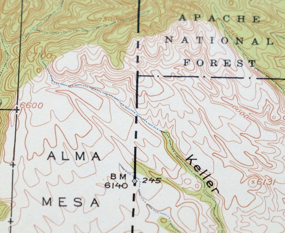
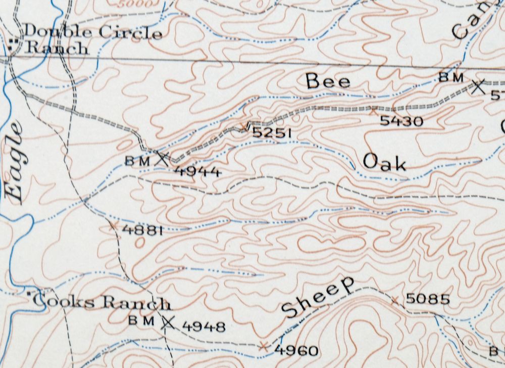
This 30-minute USGS topographic sheet was first published as a 1913 edition and printed in 1954, and it is in excellent condition: never folded, smooth and flat, with a flawless map area and a clean collar showing no wear or markings. Printed on thick stock, the quad takes in the Clifton and Morenci region of east-central Arizona, crossing into New Mexico and including portions of the Apache and Gila National Forests, the San Carlos Indian Reservation, and the Blue Range Wilderness, with the towns of Clifton and Morenci and the community of Granville falling within its boundaries. Surveyed between 1900 and 1913 under geographer R.B. Marshall and long before the modern highway system, it records the historic travel routes, rail lines, and ranches of the country running from the hot springs on Eagle Creek northeast to Alma Mesa, including the Honeymoon Ranger Station on the Upper Eagle. From the vintage map collection of Art Christiansen of Tempe, Arizona.
In stock
This vintage sheet is a 1913 edition of the Morenci Arizona USGS topographic map. It is an original 72-year-old 1954 United States Geological Survey print in excellent condition.
HOW THIS MAP CAN BE USED
In addition to making a fascinating conversation piece, this sheet would look great in a frame or on display, make a unique and prized gift for anyone interested in this area, be perfect as a reference for genealogy studies or general historical research, or fill that missing piece in your collection. Maps of this vintage are printed on durable stock and are well-suited for outdoor activities and recreation of all kinds, including hiking, backpacking, hunting, rafting and kayaking, backcountry skiing, geocaching, general exploration, treasure hunting, etc.
FEATURES SHOWN ON THE MAP
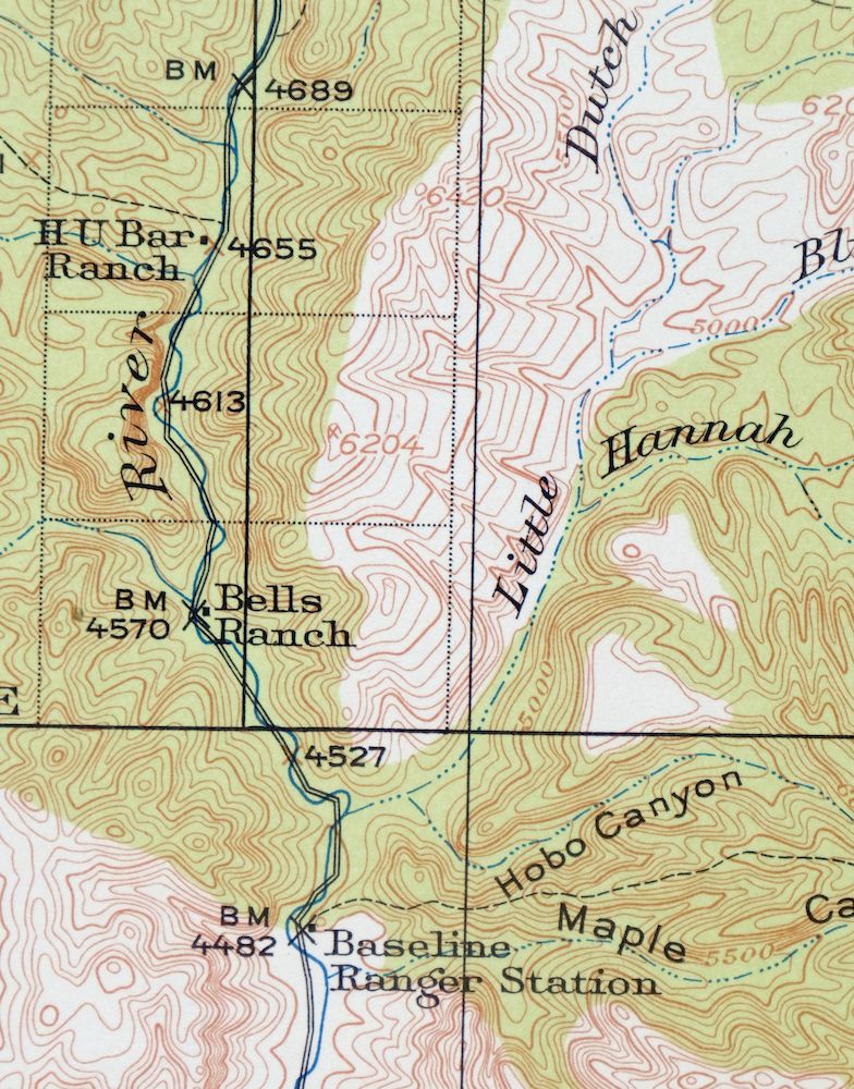
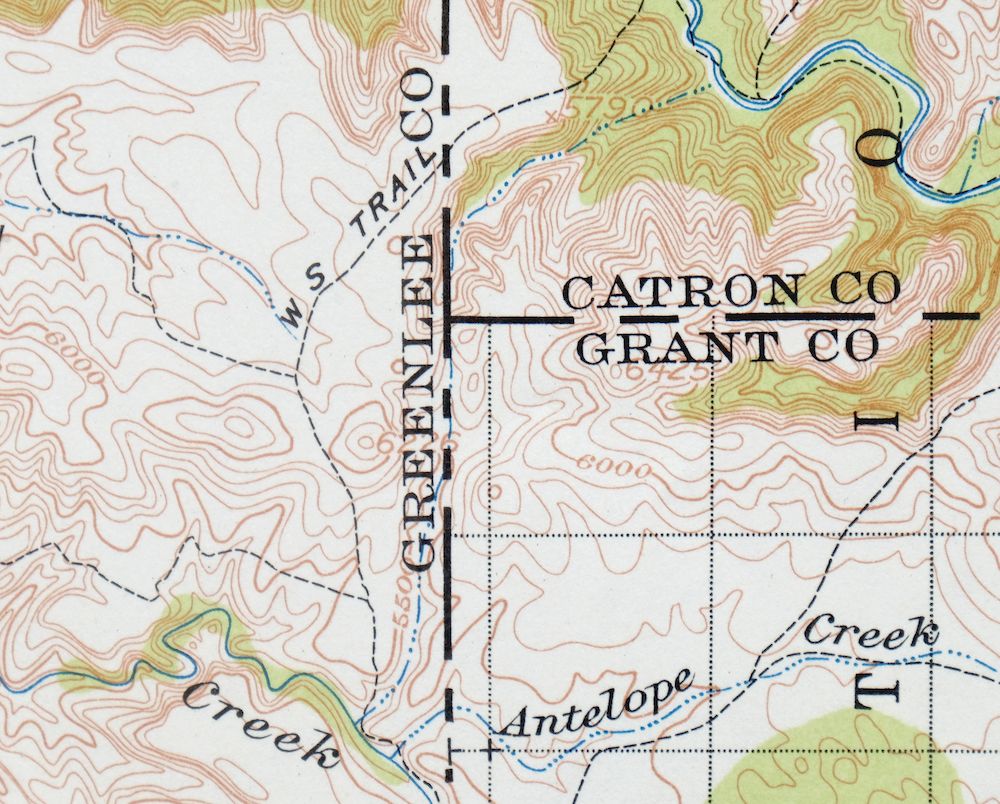
The Morenci 30-minute map shows cities and towns, roads, railroads, utilities and energy infrastructure, rivers, creeks, elevation contour lines, public land survey lines, county, state, and other administrative boundaries as they existed at the time of the survey in 1900 through 1913.
A VALUABLE HISTORICAL RECORD
Maps from the USGS 30-minute series have been out of print for many years. They have never been common and original prints are increasingly difficult to find. For areas where the 30-minute map was produced, it is usually the first large-scale survey done by the USGS for that area. These are a valuable historical record, as they contain many placenames and features that have been dropped from more recent series’ and editions.
Nearby maps
-
Mogollon New Mexico Pleasanton Mule Creek USGS Topo Map 1964
$54 Add to cart -

San Simon Arizona Bowie USGS 30-Min Topo Map 1948 Vintage
$55 Add to cart -
Pearce Arizona McNeal Gleeson USGS Topo Map 1948 Vintage
$55 Add to cart -

Florence Arizona Apache Junction Superior USGS Topo Map 1917
$70 Add to cart -
Roosevelt Arizona Four Peaks Tonto Basin USGS Topo Map 1956
$52 Add to cart -
Hannagan Meadow Arizona Apache NF USGS Topo Map 1960 Vintage
$38 Add to cart -
Blue Arizona Apache NF USGS 15-Min Topo Map 1963 Vintage
$52 Add to cart -

Safford Arizona Thatcher Solomon USGS Topo Map 1980 Vintage
$44 Add to cart -
Bowie Arizona USGS 15-Min Topographic Map 1950 Vintage
$36 Add to cart -

Klondyke Arizona USGS 15-Min Topographic Map 1971 Vintage
$44 Add to cart -
Cochise Head Arizona USGS 15-Min Topo Map 1957 Vintage
$44 Add to cart -

Winchester Mountains Arizona The Mesas USGS Topo Map 1962
$35 Add to cart -
Show Low Arizona Pinetop-Lakeside USGS Topo Map 1972 Vintage
$40 Add to cart -
Christmas Arizona USGS 15-Min Topographic Map 1917 Antique
$57 Add to cart -
Cochise Arizona Willcox USGS 15-Min Topo Map 1963 Vintage
$43 Add to cart -
Cibecue Arizona Sitgreaves NF USGS Topo Map 1963 Vintage
$32 Add to cart -
Globe Arizona Miami Claypool USGS Topo Map 1982 Vintage
$28 Add to cart -
Globe Arizona Miami Claypool USGS Topo Map 1955 Vintage
$54 Add to cart -
Chiricahua Peak Arizona Coronado NF USGS Topo Map 1962
$38 Add to cart -
Portal Arizona Rodeo USGS 15-Min Topo Map 1963 Vintage
$54 Add to cart -
Winkelman Arizona Dudleyville Hayden USGS Topo Map 1966
$43 Add to cart -
Hunt Arizona USGS 15-Min Topographic Map 1974 Vintage
$30 Add to cart -
Chediski Peak Arizona Cibecue USGS Topo Map 1963 Vintage
$32 Add to cart -
Clay Springs Arizona Pinedale Aripine USGS Topo Map 1971
$34 Add to cart
