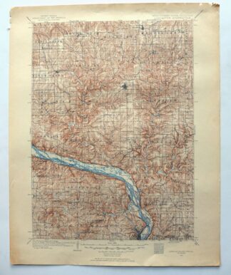
MAP DETAILS | |
|---|---|
| TITLE | Lancaster |
| STATE | Wisconsin, Illinois, Iowa |
| LOCATION | Vicinity of Dubuque, 70 miles west of Madison, WI |
| SERIES | 30-minute |
| SURVEYED | 1897 through 1904 Field Survey |
| GEOGRAPHER | Jno. H. Renshawe |
| EDITION | 1908 |
| PRINTED | 1953 |
| PRINT NOTES | Thick paper stock |
| SCALE | 1:125000 |
| CONTOUR INTERVAL | 20 feet |
| SHEET DIMENSIONS | 16 x 20 inches (approximate) |
| MAP DIMENSIONS | 12 7/8 x 17 1/2 inches |
| COVERAGE AREA | 25 x 35 miles |
| SHEET CONDITION For maps of this vintage, effort is made to note all visible flaws, no matter how minor. | |
| OVERALL CONDITION | Good |
| SHEET NOTES | lightly handled, never folded |
| MAP AREA | no wear, no markings, no blemishes |
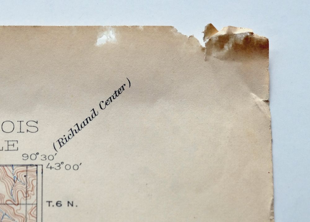
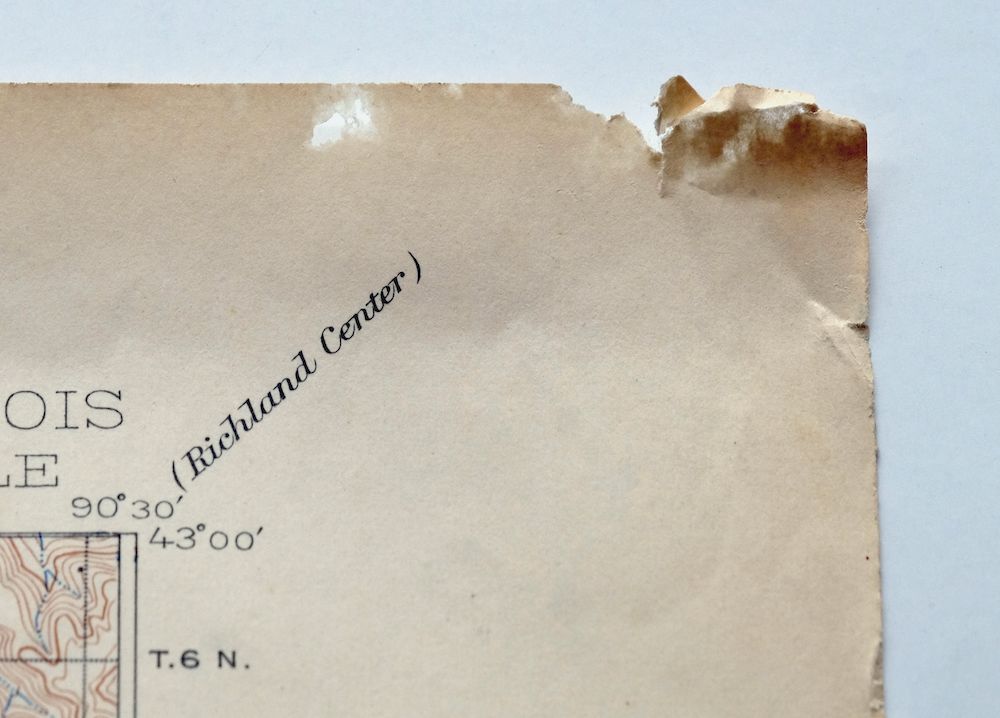
| COLLARS | minor wear or tears, no markings, minor blemishes |
 | |
| MAP COVERAGE Quadrangle extent overlaid on current basemap. | |
| PLACENAMES Depending on map series and survey date, all of the features listed below may not be shown on this map. This list contains features that currently exist or historically existed within the area covered by the map. The list can be used as a reference to determine if this map covers your area of interest. Placenames are listed alphabetically next to each feature type. | |
| CITIES AND TOWNS (CURRENT) | Asbury, Balltown, Bankston, Beetown, Bloomington, Cassville, Dickeyville, Dubuque, Durango, East Dubuque, Fennimore, Holy Cross, Lancaster, Mount Hope, North Buena Vista, Patch Grove, Platteville, Potosi, Rickardsville, Sageville, Sherrill, Stitzer, and Tennyson |
| COUNTIES COVERED | Clayton, Dubuque, Grant, and Jo Daviess |
| FEDERAL LAND UNITS | Upper Mississippi River Wildlife And Fish Refuge |
| RIVERS AND STREAMS | Arrow Branch, Austin Branch, Bacon Branch, Basswood Creek, Bear Branch, Bee Branch, Beetown Branch, Blake Fork, Blakely Branch, Blockhouse Creek, Bloody Run, Boice Creek, Borah Creek, Bull Branch, Cannon Branch, Chase Creek, Cloie Branch, Crow Branch, Culver Branch, Fair Play Creek, Flat Rock Creek, French Creek, Furnace Branch, Grant River, Haberkorn Creek, Hackett Branch, Hickory Creek, Hollow Branch, Indian Creek, Kieler Creek, Kuenster Creek, Lane Creek, Lee Branch, Leggett Creek, Leisure Creek, Little Grant River, Little Green River, Little Maquoketa River, Little Menominee River, Little Platte River, Louisburg Creek, Martin Branch, McAdam Branch, McPherson Branch, Menominee River, Middle Fork Catfish Creek, Middle Fork Little Maquoketa River, Mill Branch, Millville Creek, Mississippi River, Moore Branch, Muddy Creek, Muskellunge Creek, Newell Creek, North Fork Catfish Creek, North Fork Little Maquoketa River, North Fork Maquoketa River, Pigeon Creek, Platte River, Plum Creek, Rattlesnake Creek, Rogers Branch, Sinnipee Creek, Sinsinawa River, Snowden Branch, Warner Creek, West Basswood Creek, Whig Branch, Willow Branch, and Young Branch |
| WATER BODIES | O'Leary Lake |
| Wisconsin Locations: Happy Corners, Lancaster Industrial Park, and Potosi Station. Administrative Boundaries: Village of Bloomington, Town of Beetown, Town of Cassville, Village of Cassville, Village of Dickeyville, Town of Ellenboro, City of Fennimore, Town of Fennimore, Town of Harrison, Town of Jamestown, City of Lancaster, Town of Liberty, Town of Little Grant, Town of Mount Hope, Village of Mount Hope, Town of Mount Ida, Town of North Lancaster, Town of Paris, Town of Patch Grove, Village of Patch Grove, Town of Potosi, Village of Potosi, Town of South Lancaster, Village of Tennyson, and Town of Waterloo. Mountains, Peaks, and Summits: Sinsinawa Mound. Valleys and Canyons: Boatyard Hollow, Bobs Hollow, Betel Hollow, Dark Hollow, Dry Hollow, Fox Hollow, Graham Hollow, Hog Hollow, Long Hollow, Plum Hollow, Rigsby Hollow, and Yankee Hollow. Parks: Grant County Fairgrounds, Grant River Recreation Area, Klondyke Park, Marsden Park, Ryland Park, and Schreiner Park. Drainages: Arrow Branch, Austin Branch, Bacon Branch, Blake Fork, Blakely Branch, Blockhouse Creek, Boice Creek, Beetown Branch, Borah Creek, Bull Branch, Cannon Branch, Crow Branch, Culver Branch, Day Branch, Fair Play Creek, Flat Rock Creek, French Creek, Grant River, Hackett Branch, Heiler Creek, Hollow Branch, Indian Creek, Jack Oak Slough, Kieler Creek, Kuenster Creek, Lee Branch, Leggett Creek, Little Grant River, Little Platte River, Louisburg Creek, Martin Branch, Martinville Creek, McAdam Branch, McCartney Branch, McPherson Branch, Mill Branch, Moore Branch, Muskellunge Creek, Newell Creek, Pigeon Creek, Platte River, Potosi Creek, Rattlesnake Creek, Rogers Branch, Rountree Branch, Sinnipee Creek, Snowden Branch, Whig Branch, Willow Branch, Willow Creek, and Young Branch. Islands: Hurricane Island, Jack Oak Island, Island Number Two Hundred Eleven, Island Number Two Hundred Five, Island Number Two Hundred Nine, Island Number Two Hundred One, Island Number Two Hundred Seven, Island Number Two Hundred Twelve, Rosebrook Island, and Stumpf Island. Mines: Little Grant Mine. Churches: Advent Church, Bethlehem United Church of Christ, Christ Lutheran Church, Davies Memorial United Church of Christ, Faith Lutheran Church, Grant County Christian Center, Lancaster Christian Chapel, Lima-Union Church, Mount Zion Church, Reorganized Church of Jesus Christ of Latter Day S, Saint Andrew Church, Saint Clements Church, Saint Marys Catholic Church, Saint Peter Lutheran Church, Saint Thomas Catholic Church, Trinity Evangelical Free Church, and Whig Church. Hospitals: Grant Community Clinic and Lancaster Memorial Hospital. Lakes and Ponds: Bertom Lake, McCartney Lake, and O'Leary Lake. Buildings: Cunningham Museum, Dwight T Parker Public Library, Fennimore Railroad Historical Society Museum, Grant County Courthouse, Grant County Law Enforcement Center, Lancaster City Hall, and Schreiner Memorial Library. Dams: Koeller and Klein Dam, Lock and Dam Number 11, and Pluemer G8020 Dam. Gaps: Banfield Saddle. Channels: Potosi Canal. Bayous and Sloughs: Coalpit Slough, Crooked Slough, Long Slough, Sand Cut, and Snyder Slough. Bridges: Baker Ford Bridge, Banfield Bridge, Blackburn Bridge, Burton Bridge, Chaffie Hollow Bridge, Eagle Point Bridge, Masseyville Bridge, Pidgeon Bridge, Platte Road Bridge, Porters Bridge, Raiseback Bridge, Steinback Bridge, and Wilcox Bridge. Airports: C Jeidy Farms Airport, Cassville Municipal Airport, Lancaster Municipal Airport, Martin Fierro Airport, and Stupek Farms Airport. Schools: Adrain School, Aupperle School, Badger School, Blue School, Boice Creek School, Burton School, Cement School, Center School, Dickeyville Elementary School, Elwell School, Fairview School, Fennimore Community School, Fennimore Elementary School, Fennimore High School, Flat Rock School, Groom School, Henry School, Hurricane School, Lancaster High School, Lancaster Middle School, Maple Glen School, Oak Ridge School, Pea Ridge School, Peoples School, Potosi Elementary School, Potosi High School, Rigsby School, River Ridge High School, River Ridge Middle School, Rock School, Rogers Hollow School, Rowdon School, Saint Clement School, Saint Joseph School, Sinners Creek School, Sinnipee School, Twin Platte School, Union School, Whitcomb School, White School, and Winskill Elementary School. Ridges: Buckwheat Ridge, Campbell Ridge, Irish Ridge, Liberty Ridge, Little Irish Ridge, and Military Ridge. Reservoirs and Tanks: 0.37 Reservoir. Flats: Blake Prairie and Boice Prairie. Towers: WGLR-AM (Lancaster), WGLR-FM (Lancaster), and WKPL-FM (Platteville). Springs: Klondike Springs. | |
| Illinois | |
| Illinois None | |
| Iowa Locations: Buena Vista School, Camp Burton, Hefel School, Cottage Hill School, Eagle School, Fair Ground, Flanagan School, Mangold School, Pershing School, Saint John School, Spechts Ferry, Tivali, Tivoli School, Town Clock Plaza, and Waupeton School. Administrative Boundaries: Township of Buena Vista, Township of Center, Township of Concord, City of Dubuque, Township of Dubuque, Township of Iowa, Township of Jefferson, and Township of Peru. Mountains, Peaks, and Summits: Balltown Ridge, Hefel Ridge, Sherrill Mound, and Sugar Loaf. Valleys and Canyons: Carney Hollow, Couler Valley, Furnace Hollow, Mangold Hollow, Panther Hollow, Stegar Hollow, and Union Park Hollow. Parks: Burden Field, Henderson Memorial Park, Comiskey Field, Dubuque Greyhound Park, Eagle Point Park, Jackson Park, and Madison Park. Drainages: Basswood Creek, Bee Branch, Bloody Run, Bunker Chute, Haberkorn Creek, Cloie Branch, Leisure Creek, Little Maquoketa River, Middle Fork Little Maquoketa River, North Fork Little Maquoketa River, Picayune Chute, Plum Creek, and West Basswood Creek. Islands: Hamm Island and Sweezy Island. Churches: Saint Francis Convent, Saint Johns Church, Saint Paul Church, and Saint Rose Priory. Hospitals: Saint Marys Home and Sunny Crest Santarium. Lakes and Ponds: Dead Lake, Mud Lake, and Wachendorf Lake. Buildings: Ham House Museum, Five Flags Theater, Riverboat Museum, and Ryan House. Dams: Lock And Dam Number 11 and Mississippi River Lock Dam Number Eleven. Channels: Lake Peosta Channel. Bayous and Sloughs: Wood Duck Slough. Bridges: Eagle Point Bridge and Rodford Bridge. Airports: John Deere Dubuque Works Airport. Schools: Audubon School, Bankston School, Bloody Run School, Central School, Cedar Ridge School, Clarke College, Hempstead High School, Holy Ghost, Holy Trinity School, Hoover School, Derby Grange School, Durango School, East Rickardsville School, East Stone Hill School, Eisenhower School, Floyd School, Fulton School, J F Kennedy School, Jackson School, Jefferson School, Knollville School, Lahey School, Loras College, Marshall School, Mount Saint Bernard Seminary, Nativity School, Plum Creek School, Prescott School, Riverside School, Sacred Heart School, Saint Anthony, Saint Marys School, Saint Patricks School, West Sageville School, West Stone Hill School, and Wilton School. Flats: Peru Bottoms. Towers: KLYV-FM (Dubuque) and WDBQ-AM (Dubuque). Springs: Black Bridge Spring. | |
| SHIPPING AND RETURNS | |
 This map sheet will be carefully rolled in a sturdy tube and shipped via the US Postal Service. If you find that the sheet you receive is not as described in the listing, you may ship it back to us for a refund of the purchase price. | |
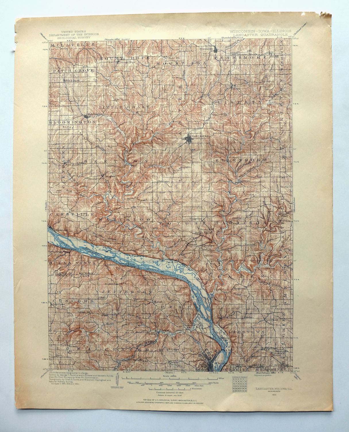
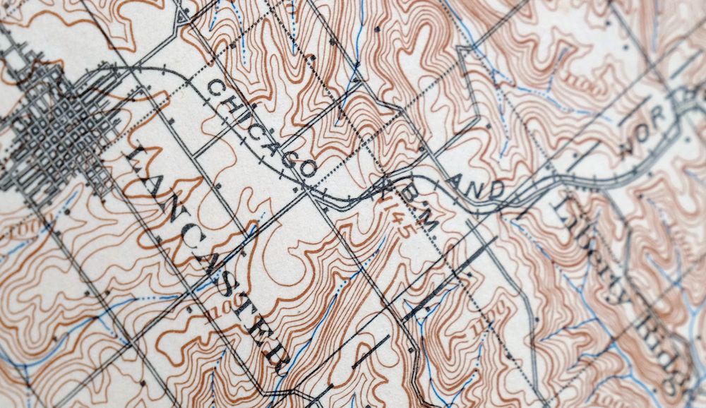
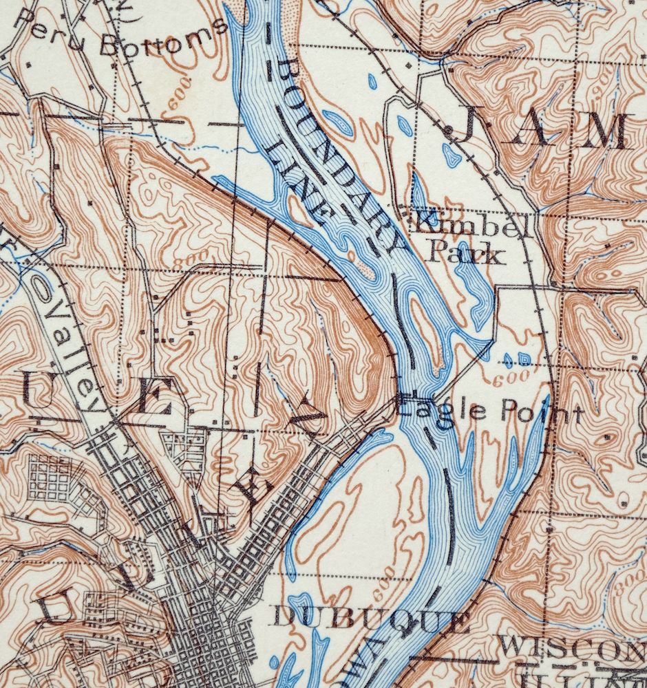
Lancaster Wisconsin Dubuque Asbury USGS Topographic Map 1953
$30
This USGS 30-minute topographic sheet is a 1908 edition printed in 1953, in good condition and, unusually, never folded. Its coverage spans the point where Wisconsin, Illinois, and Iowa meet along the Mississippi River, taking in Dubuque and East Dubuque, Platteville and Lancaster, with smaller communities like Cassville and Fennimore within the quad boundaries. This corner of the upper Mississippi was long tied to lead and zinc mining in the Grant and Jo Daviess county country, and the map’s 20-foot contours trace the bluffs and river valleys that define the area. Printed on thick stock and kept lightly handled with a clean map area, it comes with only minor wear along the collar.
In stock
This vintage sheet is a 1908 edition of the Lancaster Wisconsin USGS topographic map. It is an original 73-year-old 1953 United States Geological Survey print in good condition.
HOW THIS MAP CAN BE USED
In addition to making a fascinating conversation piece, this sheet would look great in a frame or on display, make a unique and prized gift for anyone interested in this area, be perfect as a reference for genealogy studies or general historical research, or fill that missing piece in your collection. Maps of this vintage are printed on durable stock and are well-suited for outdoor activities and recreation of all kinds, including hiking, backpacking, hunting, rafting and kayaking, backcountry skiing, geocaching, general exploration, treasure hunting, etc.
FEATURES SHOWN ON THE MAP
The Lancaster 30-minute map shows cities and towns, roads, railroads, utilities and energy infrastructure, rivers, creeks, elevation contour lines, public land survey lines, county, state, and other administrative boundaries as they existed at the time of the survey in 1897 through 1904.
A VALUABLE HISTORICAL RECORD
Maps from the USGS 30-minute series have been out of print for many years. They have never been common and original prints are increasingly difficult to find. For areas where the 30-minute map was produced, it is usually the first large-scale survey done by the USGS for that area. These are a valuable historical record, as they contain many placenames and features that have been dropped from more recent series’ and editions.
Nearby maps
-
South Wayne Wisconsin Argyle Wiota USGS Topographic Map 1923
$54 Add to cart -

Denzer Wisconsin Baraboo West Baraboo USGS Topo Map 1929
$77 Add to cart -

Cross Plains Wisconsin Madison Middleton USGS Topo Map 1942
$25 Add to cart -
Evansville Wisconsin Madison Fitchburg USGS Topo Map 1925
$43 Add to cart -

Brodhead Wisconsin Orfordville Albany USGS Topo Map 1910
$80 Add to cart -
Forreston Illinois Freeport Shannon USGS Topo Map 1972
$14 Add to cart -

Briggsville Wisconsin Portage Lake Delton USGS Topo Map 1931
$37 Add to cart -

Shopiere Wisconsin Janesville Clinton USGS Topo Map 1910
$85 Add to cart -

Woodhull Illinois Wataga Windsor USGS Topo Map 1947 Vintage
$20 Add to cart -

Whitehall Wisconsin Arcadia Independence USGS Topo Map 1929
$38 Add to cart -
Oconomowoc Wisconsin Waukesha Plat USGS Topographic Map 1947
$26 Add to cart -
La Harpe Illinois Stronghurst Raritan USGS Topo Map 1918
$49 Add to cart -
Evanston Illinois Chicago USGS 7.5-Min Topo Map 1964 Vintage
$31 Add to cart -
Colchester Illinois Plymouth Tennessee USGS Topo Map 1913
$25 Add to cart -
Blue Island Illinois Chicago Posen USGS Topographic Map 1965
$28 Add to cart -
Jackson Park Illinois Chicago USGS Topo Map 1973 Vintage
$36 Add to cart -
Harvey Illinois Chicago Heights Dolton USGS Topo Map 1965
$46 Add to cart -
Lake Calumet Illinois Chicago Hammond USGS Topo Map 1966
$35 Add to cart -
Calumet City Illinois Harvey USGS Topographic Map 1970
$45 Add to cart -

Quincy Illinois Hannibal Payson USGS Topo Map 1962 Vintage
$43 Add to cart -
Springfield East Illinois Sherman USGS Topo Map 1973 Vintage
$32 Add to cart -

Pearl Illinois Kampsville Eldred USGS Topo Map 1956 Vintage
$40 Add to cart -
Raymond Illinois Farmersville Waggoner USGS Topo Map 1925
$46 Add to cart -
1968 Bar Lake Michigan USGS Topo Map: Manistee NF
$25 Add to cart