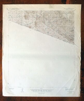
MAP DETAILS | |
|---|---|
| TITLE | Oro Blanco |
| STATE | Arizona |
| LOCATION | 65 miles southwest of Tucson |
| SERIES | 15-minute |
| SURVEYED | 1941 and 1942 Field Survey |
| EDITION | 1944 |
| PRINTED | 1944 |
| PRINT NOTES | Thick paper stock |
| SCALE | 1:62500 |
| CONTOUR INTERVAL | 50 feet |
| SHEET DIMENSIONS | 17 7/8 x 22 inches |
| MAP DIMENSIONS | 15 x 17 1/2 inches |
| COVERAGE AREA | 15 x 17 miles |
| SOURCE | From the vintage map collection of Art Christiansen, Tempe, Arizona |
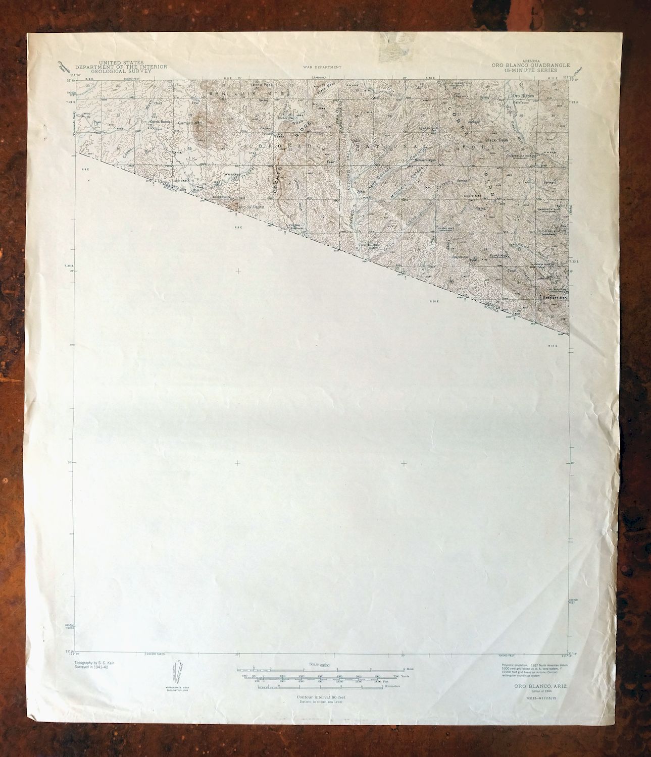
| MAP NOTES | The Mexico side of the border is not surveyed on this sheet. |
| SHEET CONDITION For maps of this vintage, effort is made to note all visible flaws, no matter how minor. | |
| OVERALL CONDITION | Fair |
| SHEET NOTES | never folded, lightly age-toned paper, considerable storage/handling wear on right collar of sheet with a few radiating creases across map area |
| MAP AREA | no markings, no blemishes, some creases |
| COLLARS | no markings, moderate blemishes, considerable collar wear and tear especially in right collar |
| MAP COVERAGE Quadrangle extent overlaid on current basemap. | |
| BACKSIDE LEGEND | |
 A map summary is printed on the back side of the Oro Blanco sheet similar to the one shown in the picture. It outlines the history, purpose, and status of the USGS mapping program at the time of the printing in 1944. It also provides instructions on how to read contour lines and a description of how they are used to depict the terrain. At the bottom of the page is a legend showing all of the symbols used to represent the cultural, relief, and water features found on the map. | |
| PLACENAMES Depending on map series and survey date, all of the features listed below may not be shown on this map. This list contains features that currently exist or historically existed within the area covered by the map. The list can be used as a reference to determine if this map covers your area of interest. Placenames are listed alphabetically next to each feature type. | |
| COUNTIES COVERED | Pima and Santa Cruz |
| FEDERAL LAND UNITS | Buenos Aires National Wildlife Refuge and Coronado National Forest |
| RIVERS AND STREAMS | Alamito Wash, Arrieta Wash, Canoa Wash, Oro Blanco Wash, and Yellow Jacket Wash |
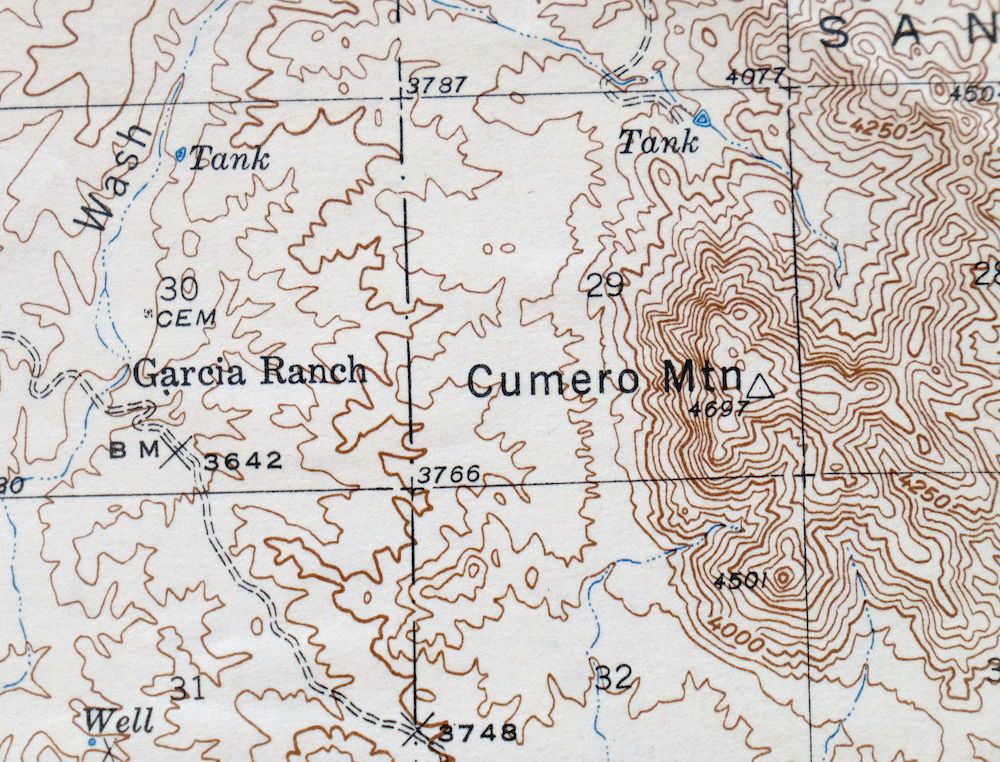
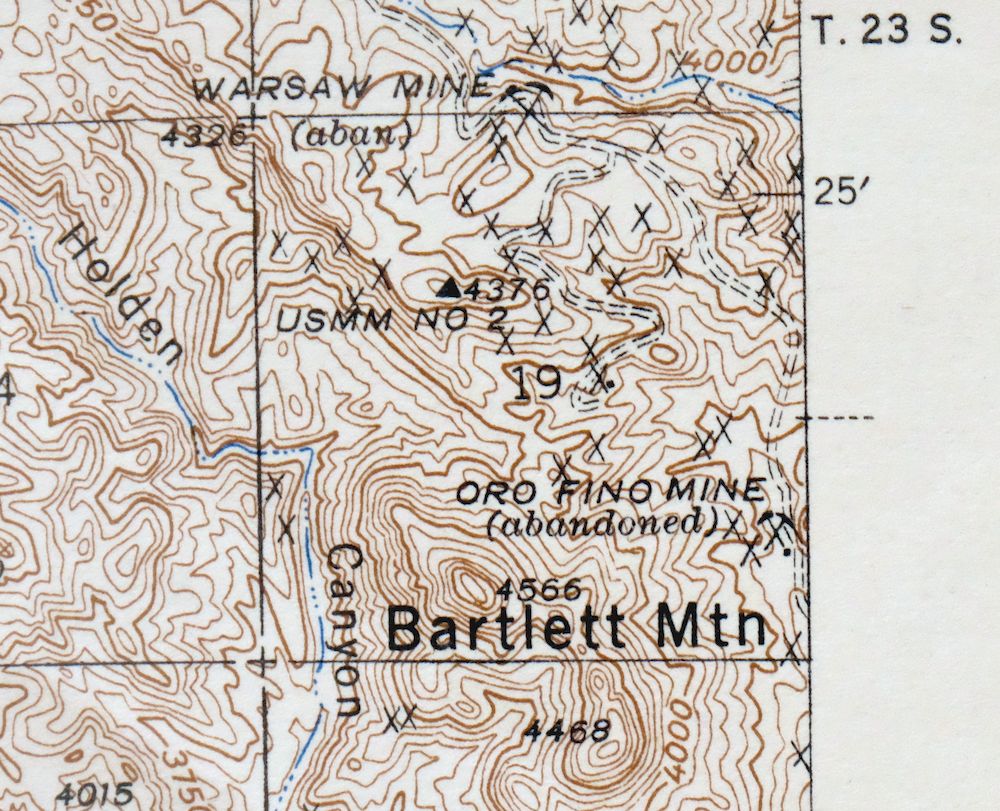
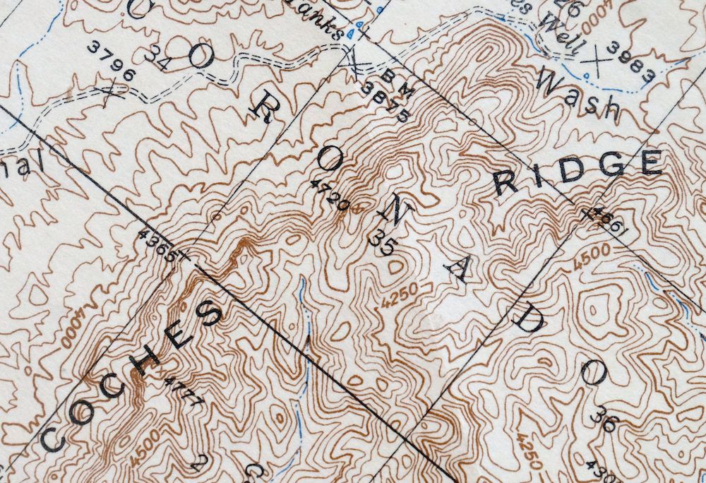
| Locations: Coches Windmill, Garcia Ranch, Oro Blanco Ranch, and Tres Bellotas Ranch. Mountains, Peaks, and Summits: Bartlett Mountain, Black Mesa, Black Peak, Cobre Mountain, Cumero Mountain, Cerro del Fresnal, Lesna Peak, and Sentinel Peak. Valleys and Canyons: Agua Cercada Canyon, Bonita Canyon, California Gulch, Canoncito, Coches Canyon, Holden Canyon, Japanese Valley, Mojonera Canyon, Sierra Canyon, Sycamore Canyon, Tinaja Canyon, and Tres Bellotas Canyon. Drainages: Alamito Wash, Alamo Wash, Arrieta Wash, Cantina Wash, and Yellow Jacket Wash. Mines: Alamo Mine, Austerlitz Mine, Border Mine, Brick Mine, Choctaw Mine, Oro Fino Mine, El Oro Mine, Saint Christopher Mine, and Yellow Jacket Mine. Dams: Dam Number 1, Dam Number 2, Fresnal Dam, and Oro Blanco Dam. Ridges: Cobre Ridge and Coches Ridge. Reservoirs and Tanks: Agua Cercada Tank, Alamito Tank, Bonita Tank, Boundary Tank, Cantina Reservoir, Cave Road Tank, Cemetery Tank, Coche Tank, Coches Tank, Corner Tank, Dart Tank, Gil Water Tank, Holden Tank, Japanese Tank, Land Tank, Margarita Tank, Marijuna Tank, Oak Tank, Oro Blanco Reservoir, Palomas Tank, Pasture Tank, Road Tank, Rock Tank, Saucita Tank, Sierra Tanks, Slick Rock Tank, Turner Tank, Upper Turner Tank, Warsaw Tank, and Yellow Jacket Tank. Wells: Agua Cercada Well, Coches Well, Mojonera Well, Road Canyon Well, Sierra Well, and Tres Bellotas Well. Springs: Agua Cercada Spring, Grapevine Spring, Lesna Spring, Nogalito Spring, Old Glory Spring, Saucito Spring, Sierra Spring, Skunk Spring, Warsaw Spring, and Yanks Spring. | |
| SHIPPING AND RETURNS | |
 This map sheet will be carefully rolled in a sturdy tube and shipped via the US Postal Service. If you find that the sheet you receive is not as described in the listing, you may ship it back to us for a refund of the purchase price. | |
Oro Blanco Arizona USGS 15-Min Topographic Map 1944 Vintage
$22
Printed in its year of first publication, 1944, this USGS 15-minute topographic sheet is a first-year print in fair condition, on thick stock and never folded, with lightly age-toned paper and considerable storage and handling wear on the right collar. Covering country about 65 miles southwest of Tucson along the Mexican border, the quad spans parts of Pima and Santa Cruz counties and takes in portions of the Coronado National Forest and the Buenos Aires National Wildlife Refuge. Surveyed in 1941 and 1942, the sheet maps only the Arizona side—the terrain south of the border is left unsurveyed—a detail that captures how this stretch of borderland was recorded during the war years. From the vintage map collection of Art Christiansen of Tempe, Arizona, and the reverse carries printed USGS reference material.
In stock
This vintage sheet is a 1944 edition of the Oro Blanco Arizona USGS topographic map. It is an original 82-year-old United States Geological Survey print in fair condition.
HOW THIS MAP CAN BE USED
In addition to making a fascinating conversation piece, this sheet would make a unique and prized gift for anyone interested in this area, be perfect as a reference for genealogy studies or general historical research, or fill that missing piece in your collection.
FEATURES SHOWN ON THE MAP
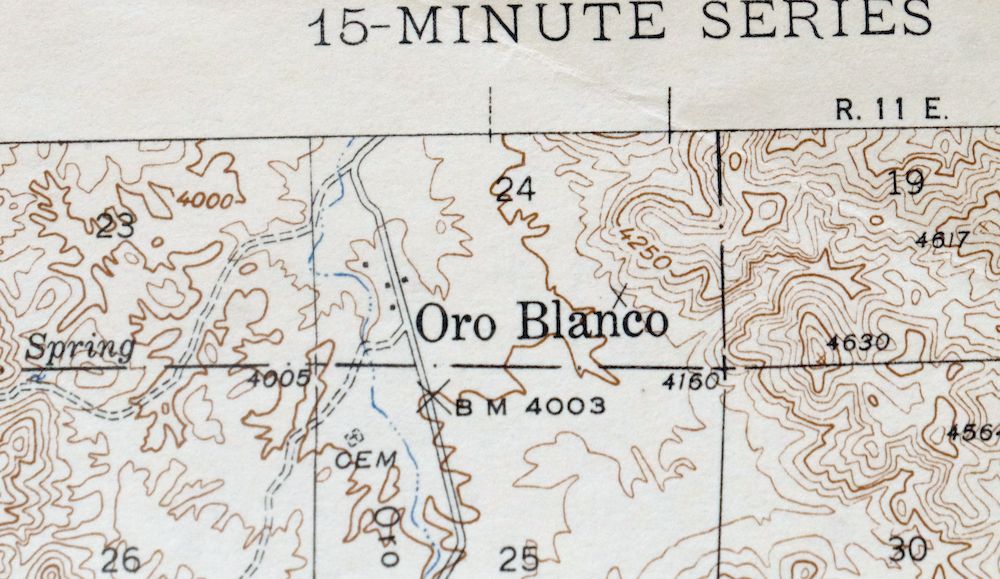
The Oro Blanco 15-minute map shows cities and towns, roads, railroads, rivers, creeks, elevation contour lines, public land survey lines, county, state, and other administrative boundaries as they existed at the time of the survey in 1941 and 1942. All known structures (houses, businesses, churches, schools, barns, cabins, etc) are also shown.
A VALUABLE HISTORICAL RECORD
Maps from the 15-minute series for the continental United States are no longer produced or printed by the USGS and original prints are becoming increasingly difficult to find. They are a valuable historical record for an area, as they contain many placenames and features that have been dropped from more recent maps.
Nearby maps
-
Presumido Peak Arizona USGS 15-Min Topo Map 1960 Vintage
$48 Add to cart -
Nogales Arizona Rio Rico Northeast USGS 15-Min Topo Map 1972
$38 Add to cart -

Vamori Arizona San Miguel USGS 15-Min Topo Map 1958 Vintage
$34 Add to cart -
Baboquivari Peak Arizona USGS 15-Min Topo Map 1967 Vintage
$48 Add to cart -
Lochiel Arizona USGS 15-Min Topographic Map 1965 Vintage
$47 Add to cart -
Sells Arizona Topawa Cowlic USGS 15-Min Topographic Map 1948
$45 Add to cart -

Elgin Arizona Patagonia Sonoita USGS Topo Map 1971 Vintage
$52 Add to cart -
San Xavier Mission Arizona Tucson USGS Topo Map 1961 Vintage
$52 Add to cart -
Empire Mountains Arizona Vail Pantano USGS Topo Map 1961
$47 Add to cart -

Sunnyside Arizona Sierra Vista USGS Topo Map 1965 Vintage
$46 Add to cart -

Tucson Arizona Davis-Monthan Tanque Verde USGS Topo Map 1963
$58 Add to cart -
Benson Arizona Coronado NF St. David USGS Topo Map 1962
$38 Add to cart -
Tucson SW Arizona Summit Sahuarita USGS Topographic Map 1977
$33 Add to cart -

Tucson SE Arizona Rita Ranch Littletown USGS Topo Map 1980
$35 Add to cart -
Hereford Arizona Sierra Vista USGS Topo Map 1946 Vintage
$45 Add to cart -
Tucson North Arizona Casas Adobes USGS Topo Map 1977 Vintage
$46 Add to cart -
Cortaro Arizona Tucson Oro Valley USGS Topographic Map 1947
$58 Add to cart -
Vaca Hills Arizona Papago USGS Topographic Map 1965 Vintage
$32 Add to cart -

Marana Arizona Picture Rocks Rillito USGS Topo Map 1976
$37 Add to cart -

Mount Lemmon Arizona Tucson Casas Adobes USGS Topo Map 1967
$62 Add to cart -
Tombstone Arizona Sierra Vista USGS Topo Map 1959 Vintage
$56 Add to cart -
Tombstone Arizona Walnut Gulch USGS Topo Map 1964 Vintage
$34 Add to cart -
Gu Achi Arizona Santa Rosa Anegam USGS Topo Map 1964 Vintage
$28 Add to cart -
Bisbee Arizona USGS 7.5-Min Topographic Map 1978 Vintage
$40 Add to cart